The Promenade
ONE AND CADOL DEVELOPERS · Sangareddy · RERA P01100003619
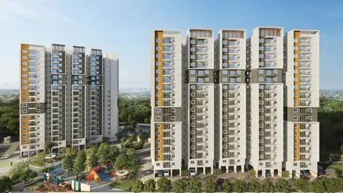
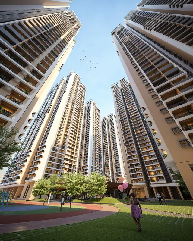
THE PROMENADE is a residential project at Kollur Village, Tellapur Muncipality Mandal, Sangareddy District. It is being developed by One And Cadol Developers, a partnership. The registered land area is 55,545.23 sq.m, with 125 4BHK homes of 355.89 sq.m saleable area per unit listed in the unit record. Its TG-RERA registration is P01100003619, and the proposed completion date in the RERA header is 26/10/2027.
01What we found
Read from TG-RERA filings, approvals, land and registration records and court records. A court case is counted only when the court record states this project's survey number with its village, or names the project.
02Check before you pay
13 items to check before you pay, 4 high - from the title chain, court records and approvals, each with what to ask the builder or your advocate. An item may not be a problem with the project: records can be incomplete.
1. Project at a glance
Project identity
| Item | Record |
|---|---|
| Registered project | THE PROMENADE |
| Project type | Residential; the HMDA document describes a gated-community housing layout, and the registered unit record lists 4BHK homes. |
| Phase / registered portion | Phase not stated in the available registration record. |
| TG-RERA registration | P01100003619, granted under section 5; certificate issued 20/11/2021. |
| Registration validity | 20/11/2021–26/06/2027, subject to any extension by the Authority. This is the registration period, not an occupancy certificate or a statement that construction is complete. |
| Registered promoter | One And Cadol Developers; the RERA record identifies it as a partnership. |
| RERA status | The supplied certificate records registration; no extension is recorded in the supplied certificate. RERA record RERA filing Corporate record |
Land and geographic identity
| Item | Record |
|---|---|
| Locality / site description | Kollur Village, Tellapur Municipality; the RERA certificate locality is “KOLLUR VILLAGE, TELLAPUR MUNCIPALITY.” |
| Revenue village | Kollur Village is stated in the HMDA draft layout document and title records. Revenue-village identity should be confirmed against current revenue records. |
| Mandal | Tellapur Muncipality Mandal appears in the HMDA draft layout extraction. The RERA land record does not disclose a mandal. |
| District / PIN | Sangareddy; 502300. |
| Project survey numbers | 274, 274/AA and 274/EE in the TG-RERA registration certificate and HMDA draft layout record. |
| Registered site extent | The RERA land record gives total area 55,545.23 sq.m, affected area 172.39 sq.m, and net area 55,372.84 sq.m. The HMDA draft layout also records these figures. |
| Boundaries in the RERA record | North: MAIN ROAD; South: LAND OF JANWADA VILLAGE; East: OTHER LAND; West: OTHERS LAND. |
| Location reference | The supplied parcel-centroid geocode is 17.41528, 78.35459; it is a mapped parcel reference, not a surveyed boundary. RERA record RERA filing Land records Location record |
Development identity
| Item | Record |
|---|---|
| Sanctioning authority | Hyderabad Metropolitan Development Authority (HMDA). |
| Principal approval | Layout Permit 000245/LO/Plg/HMDA/2021, approved date 26 June, 2021; the filed document is described as a Draft layout Letter. |
| Application reference | 028922/SKP/LT/U6/HMDA/05102019. |
| Approved built-up area | 47,862.5 sq.m is recorded in the RERA fields. |
| Building / unit counts | RERA fields state 122 total building units and 122 proposed building units (as per agreement). The normalized unit record lists 125 4BHK units plus one clubhouse row; these are separate record fields and are not reconciled here. |
| Floor configuration and parking levels | Basement, stilt, podium, ground/upper-floor configuration, parking levels and per-building arrangement are not disclosed in the supplied extracts. |
| HMDA layout areas | The draft layout document records total site area 55545.23, master-plan road affected area 172.39, net site area 55372.84, plotted area 29860.5, layout road area 14575.71, amenities area 2281.34, and park 8654. Its area schedule also separately lists internal roads, open space, landscape and utility areas. RERA filing RERA filing Approvals record RERA unit table |
Offering and status
| Item | Record |
|---|---|
| RERA-filed homes | 4BHK, filed saleable area 355.89 sq.m per unit. |
| RERA unit counts | The normalized unit record shows 125 4BHK units: 33 booked and 92 available. Counts are portal-read, with no as-of date supplied, and should be treated as indicative. |
| Clubhouse row | The filed unit table also includes one CLUB HOUSE row of 1199.42 sq.m. It is a common facility, not a home for sale. |
| Construction stage | No independently verified site-progress report or construction-stage percentage is supplied. |
| Completion date | The promoter’s Form-B declaration undertakes completion by 26 June 2027; the RERA header separately gives proposed completion 26/10/2027. The supplied record does not explain the difference. |
| Occupancy / completion certificate | No occupancy certificate or completion certificate is identified in the supplied documents. No phase- or building-specific OC status is provided. RERA unit table RERA unit details RERA record RERA filing Document index |
2. The project story
The RERA record describes a residential development at Kollur Village, Tellapur Municipality, on land identified as Survey Nos. 274, 274/AA and 274/EE. The project is registered under P01100003619 and the filed unit schedule identifies 4BHK homes. The HMDA document describes a gated-community housing layout and sets out layout infrastructure and open-space provisions. RERA record RERA filing Land records RERA unit table
The available records do not establish construction progress through an independently verified site inspection. The RERA portal counts show bookings and availability but have no recorded as-of date. The promoter’s Form-B affidavit gives a completion undertaking of 26 June 2027; the header lists a proposed completion date of 26/10/2027. No occupancy or completion certificate is included in the supplied documents, so the reviewed material does not establish that any phase or building is occupancy-certified. RERA unit table RERA record Document index
3. Master plan, architecture & building design
The filed approval record identifies HMDA Layout Permit 000245/LO/Plg/HMDA/2021, dated 26 June 2021. The supplied HMDA document is titled a Draft layout Letter and describes a gated-community housing layout. It covers Survey Nos. 274, 274/AA and 274/EE and records a net site area of 55372.84 sq.m after a 172.39 sq.m master-plan-road-affected area is accounted for. Approvals record
The draft layout schedule records 29860.5 as plotted area, 14575.71 as layout road area, 2281.34 as amenities area and 8654 as park. A further schedule lists 14565.55 sq.m internal roads, 5675.00 sq.m open space, 2275.87 sq.m landscape and 715.59 sq.m utility area. These are figures as recorded in the HMDA document; the supplied material does not reconcile the two area schedules. The document states that 1725.5 sq.m comprising Plot Nos. 28, 29, 30, 31, 32, 33 and 34 is mortgaged to HMDA pending the required layout development and release process.
The document’s conditions describe roads, storm-water drains, underground drainage, internal water-supply lines and an overhead tank, an assured water source, electrical lines and street lighting, transformer provision, avenue planting, park development and rainwater-harvesting pits. It also calls for common septic tank/STP provision, utility ducting, waste-management arrangements, footpaths and cycling tracks. These are conditions and stated provisions in the draft layout record; the supplied documents do not establish their present completion.
Although the RERA fields give approved built-up area 47,862.5 sq.m and unit counts, the supplied material does not provide a verified building-by-building schedule, floor configuration, building footprints, parking levels, or detailed circulation plan. No FSI-counted-area or carpet-area schedule is provided here. RERA filing RERA filing Document index
4. Homes, configurations & floor plans
The TG-RERA normalized unit record lists the following configuration and counts. The counts are portal-read and carry no supplied as-of date. RERA unit details RERA unit table
| Configuration | Units | Booked | Available | RERA saleable area | Measured carpet area | Loading (if supplied) |
|---|---|---|---|---|---|---|
| 4BHK | 125 | 33 | 92 | 355.89 sq.m | Not available | Not supplied |
The unit record also lists one clubhouse row of 1199.42 sq.m; it is recorded as a common-area/not-for-sale row, not an additional home. RERA unit table RERA unit table
The supplied floor-plan measurement output contains no measured 4BHK design or carpet-area figure. The RERA saleable area is a filed figure; no drawing-measured carpet area, room dimensions or balcony/utility measurements are available for this overview. Carpet area, if established from a drawing, would be a different measurement from saleable area, which may include a home’s share of common areas. Floor plans RERA unit details
5. Parking & vehicle circulation
Parking counts, visitor or accessible-space provision, parking levels, ramps, and unit-wise parking allocations are not established in the supplied material. The HMDA draft layout document identifies Plot Nos. 28–34 as seven plots mortgaged to HMDA; it does not establish those plots as resident parking. No parking-space-per-home ratio can be reported. RERA filing Document index
6. Amenities, recreation & open spaces
The RERA amenities record marks the following infrastructure and facilities “YES,” but records 0 progress for each item. This indicates a listed provision, not verified completion. The HMDA draft layout document sets out additional layout conditions and area figures. RERA amenities
| Description / size | RERA unit table includes a CLUB HOUSE row of 1199.42 sq.m. |
|---|---|
| Evidence source | RERA unit table RERA amenities |
| Declared progress / verified status | Listed in the record; no completion percentage or independent verification supplied. |
| Description / size | HMDA draft layout lists 14575.71 as layout road area and separately 14565.55 sq.m as internal roads. |
|---|---|
| Evidence source | RERA amenities |
| Declared progress / verified status | RERA amenities marked “YES,” progress 0; completion not verified. |
| Description / size | HMDA schedule lists park 8654; another schedule lists open space 5675.00 sq.m and landscape 2275.87 sq.m. |
|---|---|
| Evidence source | RERA amenities |
| Declared progress / verified status | Listed as provision/condition; delivery not verified. |
| Description / size | HMDA conditions refer to internal supply lines, overhead tank and an assured supply source. |
|---|---|
| Evidence source | RERA amenities |
| Declared progress / verified status | RERA-listed; progress 0; completion not verified. |
| Description / size | RERA lists sewerage (chambers, lines, septic tank, STP) and treatment/disposal; HMDA conditions call for underground drainage and common septic tank/STP. |
|---|---|
| Evidence source | RERA amenities |
| Declared progress / verified status | RERA-listed; progress 0; completion not verified. |
| Description / size | Storm-water drains are listed in the RERA amenities and HMDA layout conditions. |
|---|---|
| Evidence source | RERA amenities |
| Declared progress / verified status | RERA-listed; progress 0; completion not verified. |
| Description / size | RERA lists street lighting and electrical meter room/sub-station/receiving station; HMDA conditions refer to street lights and transformer provision. |
|---|---|
| Evidence source | RERA amenities |
| Declared progress / verified status | RERA-listed; progress 0; completion not verified. |
| Description / size | RERA lists solid-waste management and disposal; HMDA conditions refer to segregation and disposal arrangements. |
|---|---|
| Evidence source | RERA amenities |
| Declared progress / verified status | RERA-listed; progress 0; completion not verified. |
| Description / size | RERA lists water conservation and rainwater harvesting and energy management; HMDA conditions refer to rainwater-harvesting pits. |
|---|---|
| Evidence source | RERA amenities |
| Declared progress / verified status | RERA-listed; progress 0; completion not verified. |
| Description / size | Listed in the RERA amenities record. |
|---|---|
| Evidence source | RERA amenities |
| Declared progress / verified status | RERA-listed; progress 0; no completion or statutory-clearance evidence supplied. |
| Description / size | Included among HMDA draft-layout conditions. |
|---|---|
| Declared progress / verified status | Condition/provision recorded; completion not verified. |
The supplied vendor brochure lists other recreational and clubhouse features, but its project match is marked unconfirmed in the evidence. Those claims are therefore not presented as established project facilities in this Overview. Promoter website
7. Utilities, building services & safety
The RERA amenities record lists water supply, sewerage, storm-water drainage, solid-waste management, rainwater harvesting, energy management, fire protection, and electrical meter-room/sub-station/receiving-station facilities. It records 0 progress against each listing. RERA amenities
HMDA’s draft layout conditions specify internal water-supply lines, an overhead tank and an assured water source; underground drainage and storm-water drains; common septic tank/STP; electrical supply lines, street lighting and transformer provision; rainwater-harvesting pits; utility ducting; and waste segregation/disposal arrangements. These are requirements or provisions in the draft layout document, not evidence of installed or operating services. The supplied records do not state water-storage or treatment capacities, STP capacity, power-backup capacity, lift numbers or capacities, detailed fire systems, CCTV/security arrangements, or accessibility features.
8. Location, access & connectivity
The registered project location is KOLLUR VILLAGE, TELLAPUR MUNCIPALITY, Sangareddy District, PIN 502300. The RERA land boundaries identify a MAIN ROAD to the north and land of Janwada Village to the south; they do not identify the road by name. The supplied parcel-centroid coordinate is 17.41528, 78.35459. RERA filing Location record
The HMDA layout document refers to a proposed 30.0mts wide road affecting 172.39 sq.m and describes internal roads. No verified public-transport connections or measured distances to landmarks are supplied in the registered-location evidence used here. Location record
9. Developer & development status
The registered promoter is ONE AND CADOL DEVELOPERS, identified in the RERA record as a partnership, with GSTIN 36AAEFO7789A1Z1. The supplied promoter address is KAVURI HILLS, KAVURI HILLS, KOLLUR VILLAGE, TELLAPUR MUNCIPALITY, Sangareddy, 502300. The available records name BOMMIREDDY RAVINDER REDDY as authorized signatory and list RAJI REDDY AAVULA as a partner. Corporate record RERA filing Parties record
The RERA record gives proposed completion 26/10/2027; the promoter’s Form-B affidavit undertakes completion by 26 June 2027. These are reported as separate record entries, not reconciled here. No independently verified construction-progress status or occupancy/completion certificate is supplied. RERA record RERA filing Document index
10. Approvals, official records & documents
| Record | Supplied evidence |
|---|---|
| TG-RERA registration | FORM ‘C’ certificate for THE PROMENADE, registration P01100003619, issued 20/11/2021, valid through 26/06/2027 unless extended by the Authority. |
| Principal HMDA approval | HMDA Layout Permit 000245/LO/Plg/HMDA/2021, approved date 26 June, 2021; filed as a Draft layout Letter. |
| HMDA application reference | 028922/SKP/LT/U6/HMDA/05102019. |
| HMDA mortgage and road-area records | Mortgage document 20501/2021 concerns Plot Nos. 28–34, extent 1725.5 sq.m, in favour of HMDA; document 20500/2021 concerns the 172.39 sq.m master-plan-road-affected area gifted to the local authority, as stated in the HMDA record. |
| Environmental reference in layout record | The HMDA draft layout document records SEIAA order SEIAA/TS/OL/SRD-188/2020, dated 12.02.2021. |
| Promoter declaration | Form-B affidavit by the authorized signatory, dated 08.10.2021, including title, encumbrance and completion declarations. |
| Other completion / occupancy records | No occupancy certificate or completion certificate is identified in the supplied documents. Document index |
| Public layout lookup | The evidence pack reports that the HMDA DPMS approved-layout lookup was not publicly reachable; this describes access to the lookup, not an approval or refusal. HMDA |
1. Project at a glance
Project identity
Registered project: THE PROMENADE
Project type: Residential; the HMDA document describes a gated-community housing layout, and the registered unit record lists 4BHK homes.
Phase / registered portion: Phase not stated in the available registration record.
TG-RERA registration: P01100003619, granted under section 5; certificate issued 20/11/2021.
Registration validity: 20/11/2021–26/06/2027, subject to any extension by the Authority. This is the registration period, not an occupancy certificate or a statement that construction is complete.
Registered promoter: One And Cadol Developers; the RERA record identifies it as a partnership.
RERA status: The supplied certificate records registration; no extension is recorded in the supplied certificate.
Land and geographic identity
Locality / site description: Kollur Village, Tellapur Municipality; the RERA certificate locality is “KOLLUR VILLAGE, TELLAPUR MUNCIPALITY.”
Revenue village: Kollur Village is stated in the HMDA draft layout document and title records. Revenue-village identity should be confirmed against current revenue records.
Mandal: Tellapur Muncipality Mandal appears in the HMDA draft layout extraction. The RERA land record does not disclose a mandal.
District / PIN: Sangareddy; 502300.
Project survey numbers: 274, 274/AA and 274/EE in the TG-RERA registration certificate and HMDA draft layout record.
Registered site extent: The RERA land record gives total area 55,545.23 sq.m, affected area 172.39 sq.m, and net area 55,372.84 sq.m. The HMDA draft layout also records these figures.
Boundaries in the RERA record: North: MAIN ROAD; South: LAND OF JANWADA VILLAGE; East: OTHER LAND; West: OTHERS LAND.
Location reference: The supplied parcel-centroid geocode is 17.41528, 78.35459; it is a mapped parcel reference, not a surveyed boundary.
Development identity
Sanctioning authority: Hyderabad Metropolitan Development Authority (HMDA).
Principal approval: Layout Permit 000245/LO/Plg/HMDA/2021, approved date 26 June, 2021; the filed document is described as a Draft layout Letter.
Application reference: 028922/SKP/LT/U6/HMDA/05102019.
Approved built-up area: 47,862.5 sq.m is recorded in the RERA fields.
Building / unit counts: RERA fields state 122 total building units and 122 proposed building units (as per agreement). The normalized unit record lists 125 4BHK units plus one clubhouse row; these are separate record fields and are not reconciled here.
Floor configuration and parking levels: Basement, stilt, podium, ground/upper-floor configuration, parking levels and per-building arrangement are not disclosed in the supplied extracts.
HMDA layout areas: The draft layout document records total site area 55545.23, master-plan road affected area 172.39, net site area 55372.84, plotted area 29860.5, layout road area 14575.71, amenities area 2281.34, and park 8654. Its area schedule also separately lists internal roads, open space, landscape and utility areas.
Offering and status
RERA-filed homes: 4BHK, filed saleable area 355.89 sq.m per unit.
RERA unit counts: The normalized unit record shows 125 4BHK units: 33 booked and 92 available. Counts are portal-read, with no as-of date supplied, and should be treated as indicative.
Clubhouse row: The filed unit table also includes one CLUB HOUSE row of 1199.42 sq.m. It is a common facility, not a home for sale.
Construction stage: No independently verified site-progress report or construction-stage percentage is supplied.
Completion date: The promoter’s Form-B declaration undertakes completion by 26 June 2027; the RERA header separately gives proposed completion 26/10/2027. The supplied record does not explain the difference.
Occupancy / completion certificate: No occupancy certificate or completion certificate is identified in the supplied documents. No phase- or building-specific OC status is provided.
2. The project story
The RERA record describes a residential development at Kollur Village, Tellapur Municipality, on land identified as Survey Nos. 274, 274/AA and 274/EE. The project is registered under P01100003619 and the filed unit schedule identifies 4BHK homes. The HMDA document describes a gated-community housing layout and sets out layout infrastructure and open-space provisions.
The available records do not establish construction progress through an independently verified site inspection. The RERA portal counts show bookings and availability but have no recorded as-of date. The promoter’s Form-B affidavit gives a completion undertaking of 26 June 2027; the header lists a proposed completion date of 26/10/2027. No occupancy or completion certificate is included in the supplied documents, so the reviewed material does not establish that any phase or building is occupancy-certified.
3. Master plan, architecture & building design
The filed approval record identifies HMDA Layout Permit 000245/LO/Plg/HMDA/2021, dated 26 June 2021. The supplied HMDA document is titled a Draft layout Letter and describes a gated-community housing layout. It covers Survey Nos. 274, 274/AA and 274/EE and records a net site area of 55372.84 sq.m after a 172.39 sq.m master-plan-road-affected area is accounted for.
The draft layout schedule records 29860.5 as plotted area, 14575.71 as layout road area, 2281.34 as amenities area and 8654 as park. A further schedule lists 14565.55 sq.m internal roads, 5675.00 sq.m open space, 2275.87 sq.m landscape and 715.59 sq.m utility area. These are figures as recorded in the HMDA document; the supplied material does not reconcile the two area schedules. The document states that 1725.5 sq.m comprising Plot Nos. 28, 29, 30, 31, 32, 33 and 34 is mortgaged to HMDA pending the required layout development and release process.
The document’s conditions describe roads, storm-water drains, underground drainage, internal water-supply lines and an overhead tank, an assured water source, electrical lines and street lighting, transformer provision, avenue planting, park development and rainwater-harvesting pits. It also calls for common septic tank/STP provision, utility ducting, waste-management arrangements, footpaths and cycling tracks. These are conditions and stated provisions in the draft layout record; the supplied documents do not establish their present completion.
Although the RERA fields give approved built-up area 47,862.5 sq.m and unit counts, the supplied material does not provide a verified building-by-building schedule, floor configuration, building footprints, parking levels, or detailed circulation plan. No FSI-counted-area or carpet-area schedule is provided here.
4. Homes, configurations & floor plans
The TG-RERA normalized unit record lists the following configuration and counts. The counts are portal-read and carry no supplied as-of date.
| Configuration | Units | Booked | Available | RERA saleable area | Measured carpet area | Loading (if supplied) |
|---|---|---|---|---|---|---|
| 4BHK | 125 | 33 | 92 | 355.89 sq.m | Not available | Not supplied |
The unit record also lists one clubhouse row of 1199.42 sq.m; it is recorded as a common-area/not-for-sale row, not an additional home.
The supplied floor-plan measurement output contains no measured 4BHK design or carpet-area figure. The RERA saleable area is a filed figure; no drawing-measured carpet area, room dimensions or balcony/utility measurements are available for this overview. Carpet area, if established from a drawing, would be a different measurement from saleable area, which may include a home’s share of common areas.
5. Parking & vehicle circulation
Parking counts, visitor or accessible-space provision, parking levels, ramps, and unit-wise parking allocations are not established in the supplied material. The HMDA draft layout document identifies Plot Nos. 28–34 as seven plots mortgaged to HMDA; it does not establish those plots as resident parking. No parking-space-per-home ratio can be reported.
6. Amenities, recreation & open spaces
The RERA amenities record marks the following infrastructure and facilities “YES,” but records 0 progress for each item. This indicates a listed provision, not verified completion. The HMDA draft layout document sets out additional layout conditions and area figures.
| Description / size | RERA unit table includes a CLUB HOUSE row of 1199.42 sq.m. |
|---|---|
| Declared progress / verified status | Listed in the record; no completion percentage or independent verification supplied. |
| Description / size | HMDA draft layout lists 14575.71 as layout road area and separately 14565.55 sq.m as internal roads. |
|---|---|
| Declared progress / verified status | RERA amenities marked “YES,” progress 0; completion not verified. |
| Description / size | HMDA schedule lists park 8654; another schedule lists open space 5675.00 sq.m and landscape 2275.87 sq.m. |
|---|---|
| Declared progress / verified status | Listed as provision/condition; delivery not verified. |
| Description / size | HMDA conditions refer to internal supply lines, overhead tank and an assured supply source. |
|---|---|
| Declared progress / verified status | RERA-listed; progress 0; completion not verified. |
| Description / size | RERA lists sewerage (chambers, lines, septic tank, STP) and treatment/disposal; HMDA conditions call for underground drainage and common septic tank/STP. |
|---|---|
| Declared progress / verified status | RERA-listed; progress 0; completion not verified. |
| Description / size | Storm-water drains are listed in the RERA amenities and HMDA layout conditions. |
|---|---|
| Declared progress / verified status | RERA-listed; progress 0; completion not verified. |
| Description / size | RERA lists street lighting and electrical meter room/sub-station/receiving station; HMDA conditions refer to street lights and transformer provision. |
|---|---|
| Declared progress / verified status | RERA-listed; progress 0; completion not verified. |
| Description / size | RERA lists solid-waste management and disposal; HMDA conditions refer to segregation and disposal arrangements. |
|---|---|
| Declared progress / verified status | RERA-listed; progress 0; completion not verified. |
| Description / size | RERA lists water conservation and rainwater harvesting and energy management; HMDA conditions refer to rainwater-harvesting pits. |
|---|---|
| Declared progress / verified status | RERA-listed; progress 0; completion not verified. |
| Description / size | Listed in the RERA amenities record. |
|---|---|
| Declared progress / verified status | RERA-listed; progress 0; no completion or statutory-clearance evidence supplied. |
| Description / size | Included among HMDA draft-layout conditions. |
|---|---|
| Declared progress / verified status | Condition/provision recorded; completion not verified. |
The supplied vendor brochure lists other recreational and clubhouse features, but its project match is marked unconfirmed in the evidence. Those claims are therefore not presented as established project facilities in this Overview.
7. Utilities, building services & safety
The RERA amenities record lists water supply, sewerage, storm-water drainage, solid-waste management, rainwater harvesting, energy management, fire protection, and electrical meter-room/sub-station/receiving-station facilities. It records 0 progress against each listing.
HMDA’s draft layout conditions specify internal water-supply lines, an overhead tank and an assured water source; underground drainage and storm-water drains; common septic tank/STP; electrical supply lines, street lighting and transformer provision; rainwater-harvesting pits; utility ducting; and waste segregation/disposal arrangements. These are requirements or provisions in the draft layout document, not evidence of installed or operating services. The supplied records do not state water-storage or treatment capacities, STP capacity, power-backup capacity, lift numbers or capacities, detailed fire systems, CCTV/security arrangements, or accessibility features.
8. Location, access & connectivity
The registered project location is KOLLUR VILLAGE, TELLAPUR MUNCIPALITY, Sangareddy District, PIN 502300. The RERA land boundaries identify a MAIN ROAD to the north and land of Janwada Village to the south; they do not identify the road by name. The supplied parcel-centroid coordinate is 17.41528, 78.35459.
The HMDA layout document refers to a proposed 30.0mts wide road affecting 172.39 sq.m and describes internal roads. No verified public-transport connections or measured distances to landmarks are supplied in the registered-location evidence used here.
9. Developer & development status
The registered promoter is ONE AND CADOL DEVELOPERS, identified in the RERA record as a partnership, with GSTIN 36AAEFO7789A1Z1. The supplied promoter address is KAVURI HILLS, KAVURI HILLS, KOLLUR VILLAGE, TELLAPUR MUNCIPALITY, Sangareddy, 502300. The available records name BOMMIREDDY RAVINDER REDDY as authorized signatory and list RAJI REDDY AAVULA as a partner.
The RERA record gives proposed completion 26/10/2027; the promoter’s Form-B affidavit undertakes completion by 26 June 2027. These are reported as separate record entries, not reconciled here. No independently verified construction-progress status or occupancy/completion certificate is supplied.
10. Approvals, official records & documents
TG-RERA registration: FORM ‘C’ certificate for THE PROMENADE, registration P01100003619, issued 20/11/2021, valid through 26/06/2027 unless extended by the Authority.
Principal HMDA approval: HMDA Layout Permit 000245/LO/Plg/HMDA/2021, approved date 26 June, 2021; filed as a Draft layout Letter.
HMDA application reference: 028922/SKP/LT/U6/HMDA/05102019.
HMDA mortgage and road-area records: Mortgage document 20501/2021 concerns Plot Nos. 28–34, extent 1725.5 sq.m, in favour of HMDA; document 20500/2021 concerns the 172.39 sq.m master-plan-road-affected area gifted to the local authority, as stated in the HMDA record.
Environmental reference in layout record: The HMDA draft layout document records SEIAA order SEIAA/TS/OL/SRD-188/2020, dated 12.02.2021.
Promoter declaration: Form-B affidavit by the authorized signatory, dated 08.10.2021, including title, encumbrance and completion declarations.
Other completion / occupancy records: No occupancy certificate or completion certificate is identified in the supplied documents.
Public layout lookup: The evidence pack reports that the HMDA DPMS approved-layout lookup was not publicly reachable; this describes access to the lookup, not an approval or refusal.
Frequently asked questions
Is THE PROMENADE registered with Telangana RERA?
Yes. THE PROMENADE is registered with the Telangana Real Estate Regulatory Authority as P01100003619; the registration status is New Project.
Who is the developer of THE PROMENADE?
The promoter named in the RERA registration is ONE AND CADOL DEVELOPERS.
Where is THE PROMENADE located?
THE PROMENADE is in TELLAPUR MUNCIPALITY, Sangareddy, Telangana (502300).
When will THE PROMENADE be completed?
The promoter's proposed date of completion filed with RERA is 26/10/2027. This is the promoter's declaration, not a guarantee.
More projects in Sangareddy