SURABHIs SIGNATURE VILLAS EXTENSION
SURABHI ESTATES PRIVATE LIMITED · Sangareddy · RERA P01100007763
SURABHIs SIGNATURE VILLAS EXTENSION is a residential villa project in Tellapur, Ramachandrapuram Mandal, Sangareddy district. The registered promoter is SURABHI ESTATES PRIVATE LIMITED, and the RERA land details record a total and net area of 4,653.91 sq. m. The HMDA drawing records 18 plots, 54 dwelling units and Ground + 2 floors; the RERA record lists 18 proposed building units, while the filed unit labels do not state standard bedroom configurations. The project is registered with TG-RERA as P01100007763, and the promoter’s Form B declaration undertakes completion by 09/11/2029.
01What we found
Read from TG-RERA filings, approvals, land and registration records and court records. A court case is counted only when the court record states this project's survey number with its village, or names the project.
02Check before you pay
10 items to check before you pay, 5 high - from the title chain, court records and approvals, each with what to ask the builder or your advocate. An item may not be a problem with the project: records can be incomplete.
1. Project at a glance
Project identity
| Item | Record |
|---|---|
| Registered project name | SURABHIs SIGNATURE VILLAS EXTENSION RERA record |
| Project type | Residential; the RERA record describes a villa project and the HMDA filing describes a gated-community layout with housing. RERA record |
| Phase / registered portion | “Extension”; the RERA record identifies 18 proposed building units. The supplied records do not separately define a phase boundary. RERA record RERA filing |
| TG-RERA registration | P01100007763; registered 27 February 2024, valid through 9 November 2029. This is registration validity, not a construction or occupancy certificate. RERA record |
| Registered promoter | SURABHI ESTATES PRIVATE LIMITED RERA record Corporate record |
| RERA status | Registration is recorded. The supplied registration record does not establish completion or occupancy certification. |
Land and geographic identity
| Item | Record |
|---|---|
| Locality | Tellapur / Tellapur Municipal limits RERA record |
| Revenue village | Osman Nagar Village is named in the approval and title records; the RERA project record also identifies Tellapur. |
| Mandal | Ramachandrapuram Mandal is stated in the architect’s certificate and title report; the HMDA approval extraction also refers to Tellapur Municipality Mandal. The exact mandal for the registered parcel is not consistently specified in the supplied records. |
| District / PIN | Sangareddy; PIN 500036 RERA record RERA filing |
| Survey numbers / subdivisions | Survey No. 19 is the project survey number in the RERA record. An HMDA title-report document also refers to Sy. No. 19/P and 19; the supplied project record does not establish that “19/P” is the registered subdivision for the project parcel. RERA filing |
| Registered extent | 4,653.91 sq. m. total and net area, as recorded in the RERA land details. RERA filing |
| Boundaries, as filed | North: land in Survey No. 19 part belonging to Gandaiah; south: land in Survey No. 18 of Muppa Homes; east: land in Survey No. 19 of Surabhi Estates Pvt Ltd; west: BATA and land belonging to P. Mallesh. RERA filing |
Development identity
| Item | Record |
|---|---|
| Sanctioning authority | Hyderabad Metropolitan Development Authority (HMDA) Approvals record |
| Principal approval | HMDA approval no. 000208/LO/Plg/HMDA/2023, dated 9 November 2023; described in the filed document as a draft layout letter for layout with housing. Approvals record |
| Other plan reference | 102839/LO/PLG/HMDA/2013 appears on the filed building/layout drawing. Approvals record |
| Approved built-up area | The HMDA drawing extraction records “Grand Total Built Up Area 4571.48”; it separately records “Grand Total Proposed Net BUA Area 4519.54” and “Grand Total Total Net BUA Area 4545.51.” These are distinct drawing labels. |
| Buildings / units | RERA land details state 18 proposed building units; the HMDA drawing records 18 plots and 54 dwelling units. RERA filing |
| Sanctioned floors / height | The drawing lists Ground + 2 floors and building heights of 9.60 MT. and 9.90 MT. It does not provide a single unambiguous floor/height schedule for every home in the extracted record. |
| Parking levels / provision | No parking count, parking-level schedule or allocation is established by the supplied project records. |
Offering and status
| Item | Record |
|---|---|
| RERA-filed unit labels and counts | The filing lists 38 units under unclassified labels: DRAWING BEDROOMS (1), DRAWING KITCHEN (8), LIVING BEDROOMS (17), LIVING KITCHEN (10), LIVING OPENTERRACE (2). It also lists 16 units as common-area rows: GARDEN SITOUT (1), GYM GARDEN (7), GYM SITOUT (8); these are not treated here as homes for sale. RERA unit table RERA unit details |
| RERA-filed saleable area | The 38 unclassified home rows range from 55.92 to 90.33 sq. m. saleable area. RERA unit details |
| Bookings / availability | Portal-derived counts show 0 booked and 38 available for the unclassified home rows, and 0 booked for the common-area rows; the portal data has no supplied as-of date, so these counts are indicative. RERA unit table |
| Construction stage | The architect’s Form–1A records 0% for the listed construction and internal/external development items. This is a filed certificate, not an independent site inspection. |
| Completion deadline | The promoter’s Form B declaration undertakes completion by 09/11/2029. |
| Occupancy / completion certificate | No occupancy or completion certificate is evidenced in the supplied project documents. Document index |
2. The project story
This is a residential villa development registered with TG-RERA as SURABHIs SIGNATURE VILLAS EXTENSION, on Survey No. 19 at Osman Nagar Village, within the Tellapur area of Sangareddy district. Its filed land extent is 4,653.91 sq. m. RERA record RERA filing
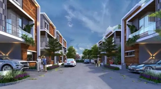
The project is described in the HMDA material as a gated-community layout with housing. The HMDA drawing records 18 plots and 54 dwelling units; the RERA land details separately state 18 proposed building units. The RERA unit table’s 38 home rows use unclassified labels rather than standard configuration names, while 16 additional rows are gym/garden sitouts identified as common-area entries. RERA filing RERA unit details
The architect’s filed Form–1A reports 0% for the listed construction and development items. Accordingly, the available evidence describes a proposed development rather than a completed or occupancy-certified project; the progress figure is the architect’s filing, not an independent verification of the site.
3. Master plan, architecture & building design
The filed HMDA drawing describes a residential gated-community layout on 4,653.91 sq. m. It records 2,489.73 sq. m. as plotted area, 1,662.56 sq. m. as road area and 385.30 sq. m. as organized open-space/park/utility area. The approval letter separately identifies 385.30 sq. m. of park/open space and requires the designated open-space and road areas to be handed over to the local body by registered gift deed before final layout approval.
The drawing records 18 plots, 54 dwelling units and Ground + 2 floors. It lists 9.14 m. road widths, including the main road, and records building heights of 9.60 MT. and 9.90 MT. The supplied extraction does not provide a complete, unit-by-unit drawing schedule for building footprints, entries, stairs, lifts or villa-to-plot assignments.
The drawing extraction gives three separate overall area labels: “Grand Total Built Up Area 4571.48,” “Grand Total Proposed Net BUA Area 4519.54,” and “Grand Total Total Net BUA Area 4545.51.” They are reproduced as labelled; the supplied material does not identify a separate FSI-counted area or carpet-area total.
4. Homes, configurations & floor plans
The RERA filing does not provide recognisable bedroom-based configurations for its home rows. It records 38 homes using the labels below; these are quoted as filed rather than reclassified. Saleable area is the RERA-filed figure. No RERA-filed carpet area or loading is supplied for these rows. RERA unit details RERA unit table
| Units | 38 |
|---|---|
| Booked | 0 |
| Available | 38 |
| RERA saleable area | 55.92–90.33 sq. m. |
| Measured carpet area | Not established for these filed rows |
| Loading (if supplied) | Not supplied |
Separately, software measurements from the approved floor-plan drawing identify one 1BHK design at 72.0 sq. m. (775 sq. ft.) carpet area and one 2BHK design at 91.1 sq. m. (980 sq. ft.) carpet area. These are drawing-geometry measurements, not RERA-filed configurations or area disclosures, and require checking against the drawing. The supplied data does not match these measurements to the RERA-filed home rows. Floor plans RERA unit details
The drawing-derived room schedule includes a 2BHK example with living, dining, kitchen, two bedrooms and two toilets; the 1BHK example lists a bedroom and an attached toilet. The figures are software-measured from the plan and are not independently verified. RERA unit details
5. Parking & vehicle circulation
The supplied project records do not establish a sanctioned parking count, visitor or accessible parking provision, parking levels, ramps, vehicle entry/exit arrangements, EV charging, or unit-specific parking allocations. The HMDA drawing shows internal roads, including 9.14 m. wide roads, but this does not itself establish parking provision or exclusive parking rights.
6. Amenities, recreation & open spaces
The HMDA approval and RERA amenity filing identify proposed project infrastructure and open-space facilities. The filed architect’s certificate reports 0% for listed development items; the supplied records do not verify any facility as completed. RERA amenities
| Description / size | 385.30 sq. m.; the HMDA approval describes this as parks/utility open space |
|---|---|
| Declared progress / verified status | Approved-design provision; filed certificate records 0% for listed development items; not independently verified complete |
| Description / size | Road area 1,662.56 sq. m.; drawing lists 9.14 m. road widths |
|---|---|
| Evidence source | RERA amenities |
| Declared progress / verified status | RERA amenity entry says “YES”; filed progress is 0%; not independently verified complete |
| Description / size | No size or capacity supplied |
|---|---|
| Evidence source | RERA amenities |
| Declared progress / verified status | Listed in RERA amenity table; progress 0%; not independently verified complete |
| Description / size | No separate size supplied beyond the recorded open-space area |
|---|---|
| Evidence source | RERA amenities |
| Declared progress / verified status | RERA amenity entry says “YES”; progress 0%; not independently verified complete |
No project-specific RERA or HMDA evidence supplied here establishes a clubhouse, pool, sports court, gym or other indoor recreation facility as sanctioned or delivered.
7. Utilities, building services & safety
The HMDA approval lists STP, a common septic tank, internal water-supply pipelines, a hydro-pneumatic water-supply system, electrical supply lines, street lights, a transformer, avenue plantation, park development, rainwater-harvesting pits, storm-water drains and underground drainage lines as required/proposed works. The approval directs construction of the STP to the stated Indian standard and certification by a licensed structural engineer. These are approval conditions or provisions, not evidence of completed services.
The RERA amenity record marks water supply, sewerage, rainwater harvesting and the electrical meter room/sub-station/receiving station “YES”; it records 0% progress for the listed items. It also lists storm-water drains, sewage treatment/disposal, solid-waste management, energy management and fire protection/safety requirements, without supplied capacities or completion evidence. RERA amenities
No project-specific records supplied here establish water-source capacity, storage volume, backup-power capacity, lift numbers or capacities, fire-system specifications, CCTV/access arrangements, waste segregation arrangements or accessible routes. Document index RERA amenities
8. Location, access & connectivity
The registered project location is Tellapur, Sangareddy district, PIN 500036. Project documents identify the site as Survey No. 19 in Osman Nagar Village; the supplied records do not establish a complete approach-road description beyond the HMDA drawing’s 9.14 m. road references. RERA record RERA filing
The supplied location data places the cadastral parcel centroid at 17.41528, 78.35459 and records the Financial District (Nanakramguda) at 1.2 km. The supplied record does not provide a measurement method or route for that distance. Location record
9. Developer & development status
The registered legal promoter is SURABHI ESTATES PRIVATE LIMITED, a private limited company, GSTIN 36AAXCS2415F1Z5. The supplied promoter address is MINERVA COMPLEX, S D ROAD, SECUNDERABAD, OSMAN NAGAR, TELLAPUR, Sangareddy, 500036. Corporate record Parties record
The promoter’s Form B affidavit, dated 7 February 2024, declares legal title to the project land, states that the land is free from encumbrances and undertakes completion by 09/11/2029. These are promoter declarations in the filed document.
The architect’s Form–1A reports 0% progress for the listed works. No occupancy or completion certificate is included in the supplied documents. Document index
10. Approvals, official records & documents
| Record | Supplied evidence |
|---|---|
| TG-RERA registration | Form C certificate for SURABHIs SIGNATURE VILLAS EXTENSION, registration P01100007763; validity 27/02/2024–09/11/2029. |
| HMDA principal approval | Approval no. 000208/LO/Plg/HMDA/2023, dated 9 November 2023; filed as a draft layout letter for a layout with housing in Survey No. 19. |
| Building/layout drawing | Drawing extraction bears reference 102839/LO/PLG/HMDA/2013 and records 18 plots, 54 dwelling units, Ground + 2 floors and the stated built-up-area labels. |
| Title-related documents | Filed title report and supporting records include a 21 April 2022 deed of exchange and revenue-related documents; the title report identifies the site as Survey No. 19, Osman Nagar Village. |
| Encumbrance record | Filed Telangana Registration and Stamps Department statement, Application No. 708989 / Statement No. 152499797, searched 01-01-1995 to 04-02-2024. |
| Construction progress | Architect’s Form–1A certificate for Survey No. 19 reports 0% for the listed construction and development items. |
| Completion / occupancy certificate | Not evidenced in the supplied documents. Document index |
1. Project at a glance
Project identity
Registered project name: SURABHIs SIGNATURE VILLAS EXTENSION
Project type: Residential; the RERA record describes a villa project and the HMDA filing describes a gated-community layout with housing.
Phase / registered portion: “Extension”; the RERA record identifies 18 proposed building units. The supplied records do not separately define a phase boundary.
TG-RERA registration: P01100007763; registered 27 February 2024, valid through 9 November 2029. This is registration validity, not a construction or occupancy certificate.
Registered promoter: SURABHI ESTATES PRIVATE LIMITED
RERA status: Registration is recorded. The supplied registration record does not establish completion or occupancy certification.
Land and geographic identity
Locality: Tellapur / Tellapur Municipal limits
Revenue village: Osman Nagar Village is named in the approval and title records; the RERA project record also identifies Tellapur.
Mandal: Ramachandrapuram Mandal is stated in the architect’s certificate and title report; the HMDA approval extraction also refers to Tellapur Municipality Mandal. The exact mandal for the registered parcel is not consistently specified in the supplied records.
District / PIN: Sangareddy; PIN 500036
Survey numbers / subdivisions: Survey No. 19 is the project survey number in the RERA record. An HMDA title-report document also refers to Sy. No. 19/P and 19; the supplied project record does not establish that “19/P” is the registered subdivision for the project parcel.
Registered extent: 4,653.91 sq. m. total and net area, as recorded in the RERA land details.
Boundaries, as filed: North: land in Survey No. 19 part belonging to Gandaiah; south: land in Survey No. 18 of Muppa Homes; east: land in Survey No. 19 of Surabhi Estates Pvt Ltd; west: BATA and land belonging to P. Mallesh.
Development identity
Sanctioning authority: Hyderabad Metropolitan Development Authority (HMDA)
Principal approval: HMDA approval no. 000208/LO/Plg/HMDA/2023, dated 9 November 2023; described in the filed document as a draft layout letter for layout with housing.
Other plan reference: 102839/LO/PLG/HMDA/2013 appears on the filed building/layout drawing.
Approved built-up area: The HMDA drawing extraction records “Grand Total Built Up Area 4571.48”; it separately records “Grand Total Proposed Net BUA Area 4519.54” and “Grand Total Total Net BUA Area 4545.51.” These are distinct drawing labels.
Buildings / units: RERA land details state 18 proposed building units; the HMDA drawing records 18 plots and 54 dwelling units.
Sanctioned floors / height: The drawing lists Ground + 2 floors and building heights of 9.60 MT. and 9.90 MT. It does not provide a single unambiguous floor/height schedule for every home in the extracted record.
Parking levels / provision: No parking count, parking-level schedule or allocation is established by the supplied project records.
Offering and status
RERA-filed unit labels and counts: The filing lists 38 units under unclassified labels: DRAWING BEDROOMS (1), DRAWING KITCHEN (8), LIVING BEDROOMS (17), LIVING KITCHEN (10), LIVING OPENTERRACE (2). It also lists 16 units as common-area rows: GARDEN SITOUT (1), GYM GARDEN (7), GYM SITOUT (8); these are not treated here as homes for sale.
RERA-filed saleable area: The 38 unclassified home rows range from 55.92 to 90.33 sq. m. saleable area.
Bookings / availability: Portal-derived counts show 0 booked and 38 available for the unclassified home rows, and 0 booked for the common-area rows; the portal data has no supplied as-of date, so these counts are indicative.
Construction stage: The architect’s Form–1A records 0% for the listed construction and internal/external development items. This is a filed certificate, not an independent site inspection.
Completion deadline: The promoter’s Form B declaration undertakes completion by 09/11/2029.
Occupancy / completion certificate: No occupancy or completion certificate is evidenced in the supplied project documents.
2. The project story
This is a residential villa development registered with TG-RERA as SURABHIs SIGNATURE VILLAS EXTENSION, on Survey No. 19 at Osman Nagar Village, within the Tellapur area of Sangareddy district. Its filed land extent is 4,653.91 sq. m.
The project is described in the HMDA material as a gated-community layout with housing. The HMDA drawing records 18 plots and 54 dwelling units; the RERA land details separately state 18 proposed building units. The RERA unit table’s 38 home rows use unclassified labels rather than standard configuration names, while 16 additional rows are gym/garden sitouts identified as common-area entries.
The architect’s filed Form–1A reports 0% for the listed construction and development items. Accordingly, the available evidence describes a proposed development rather than a completed or occupancy-certified project; the progress figure is the architect’s filing, not an independent verification of the site.
3. Master plan, architecture & building design
The filed HMDA drawing describes a residential gated-community layout on 4,653.91 sq. m. It records 2,489.73 sq. m. as plotted area, 1,662.56 sq. m. as road area and 385.30 sq. m. as organized open-space/park/utility area. The approval letter separately identifies 385.30 sq. m. of park/open space and requires the designated open-space and road areas to be handed over to the local body by registered gift deed before final layout approval.
The drawing records 18 plots, 54 dwelling units and Ground + 2 floors. It lists 9.14 m. road widths, including the main road, and records building heights of 9.60 MT. and 9.90 MT. The supplied extraction does not provide a complete, unit-by-unit drawing schedule for building footprints, entries, stairs, lifts or villa-to-plot assignments.
The drawing extraction gives three separate overall area labels: “Grand Total Built Up Area 4571.48,” “Grand Total Proposed Net BUA Area 4519.54,” and “Grand Total Total Net BUA Area 4545.51.” They are reproduced as labelled; the supplied material does not identify a separate FSI-counted area or carpet-area total.
4. Homes, configurations & floor plans
The RERA filing does not provide recognisable bedroom-based configurations for its home rows. It records 38 homes using the labels below; these are quoted as filed rather than reclassified. Saleable area is the RERA-filed figure. No RERA-filed carpet area or loading is supplied for these rows.
| Units | 38 |
|---|---|
| Booked | 0 |
| Available | 38 |
| RERA saleable area | 55.92–90.33 sq. m. |
| Measured carpet area | Not established for these filed rows |
| Loading (if supplied) | Not supplied |
Separately, software measurements from the approved floor-plan drawing identify one 1BHK design at 72.0 sq. m. (775 sq. ft.) carpet area and one 2BHK design at 91.1 sq. m. (980 sq. ft.) carpet area. These are drawing-geometry measurements, not RERA-filed configurations or area disclosures, and require checking against the drawing. The supplied data does not match these measurements to the RERA-filed home rows.
The drawing-derived room schedule includes a 2BHK example with living, dining, kitchen, two bedrooms and two toilets; the 1BHK example lists a bedroom and an attached toilet. The figures are software-measured from the plan and are not independently verified.
5. Parking & vehicle circulation
The supplied project records do not establish a sanctioned parking count, visitor or accessible parking provision, parking levels, ramps, vehicle entry/exit arrangements, EV charging, or unit-specific parking allocations. The HMDA drawing shows internal roads, including 9.14 m. wide roads, but this does not itself establish parking provision or exclusive parking rights.
6. Amenities, recreation & open spaces
The HMDA approval and RERA amenity filing identify proposed project infrastructure and open-space facilities. The filed architect’s certificate reports 0% for listed development items; the supplied records do not verify any facility as completed.
| Description / size | 385.30 sq. m.; the HMDA approval describes this as parks/utility open space |
|---|---|
| Declared progress / verified status | Approved-design provision; filed certificate records 0% for listed development items; not independently verified complete |
| Description / size | Road area 1,662.56 sq. m.; drawing lists 9.14 m. road widths |
|---|---|
| Declared progress / verified status | RERA amenity entry says “YES”; filed progress is 0%; not independently verified complete |
| Description / size | No size or capacity supplied |
|---|---|
| Declared progress / verified status | Listed in RERA amenity table; progress 0%; not independently verified complete |
| Description / size | No separate size supplied beyond the recorded open-space area |
|---|---|
| Declared progress / verified status | RERA amenity entry says “YES”; progress 0%; not independently verified complete |
No project-specific RERA or HMDA evidence supplied here establishes a clubhouse, pool, sports court, gym or other indoor recreation facility as sanctioned or delivered.
7. Utilities, building services & safety
The HMDA approval lists STP, a common septic tank, internal water-supply pipelines, a hydro-pneumatic water-supply system, electrical supply lines, street lights, a transformer, avenue plantation, park development, rainwater-harvesting pits, storm-water drains and underground drainage lines as required/proposed works. The approval directs construction of the STP to the stated Indian standard and certification by a licensed structural engineer. These are approval conditions or provisions, not evidence of completed services.
The RERA amenity record marks water supply, sewerage, rainwater harvesting and the electrical meter room/sub-station/receiving station “YES”; it records 0% progress for the listed items. It also lists storm-water drains, sewage treatment/disposal, solid-waste management, energy management and fire protection/safety requirements, without supplied capacities or completion evidence.
No project-specific records supplied here establish water-source capacity, storage volume, backup-power capacity, lift numbers or capacities, fire-system specifications, CCTV/access arrangements, waste segregation arrangements or accessible routes.
8. Location, access & connectivity
The registered project location is Tellapur, Sangareddy district, PIN 500036. Project documents identify the site as Survey No. 19 in Osman Nagar Village; the supplied records do not establish a complete approach-road description beyond the HMDA drawing’s 9.14 m. road references.
The supplied location data places the cadastral parcel centroid at 17.41528, 78.35459 and records the Financial District (Nanakramguda) at 1.2 km. The supplied record does not provide a measurement method or route for that distance.
9. Developer & development status
The registered legal promoter is SURABHI ESTATES PRIVATE LIMITED, a private limited company, GSTIN 36AAXCS2415F1Z5. The supplied promoter address is MINERVA COMPLEX, S D ROAD, SECUNDERABAD, OSMAN NAGAR, TELLAPUR, Sangareddy, 500036.
The promoter’s Form B affidavit, dated 7 February 2024, declares legal title to the project land, states that the land is free from encumbrances and undertakes completion by 09/11/2029. These are promoter declarations in the filed document.
The architect’s Form–1A reports 0% progress for the listed works. No occupancy or completion certificate is included in the supplied documents.
10. Approvals, official records & documents
TG-RERA registration: Form C certificate for SURABHIs SIGNATURE VILLAS EXTENSION, registration P01100007763; validity 27/02/2024–09/11/2029.
HMDA principal approval: Approval no. 000208/LO/Plg/HMDA/2023, dated 9 November 2023; filed as a draft layout letter for a layout with housing in Survey No. 19.
Building/layout drawing: Drawing extraction bears reference 102839/LO/PLG/HMDA/2013 and records 18 plots, 54 dwelling units, Ground + 2 floors and the stated built-up-area labels.
Title-related documents: Filed title report and supporting records include a 21 April 2022 deed of exchange and revenue-related documents; the title report identifies the site as Survey No. 19, Osman Nagar Village.
Encumbrance record: Filed Telangana Registration and Stamps Department statement, Application No. 708989 / Statement No. 152499797, searched 01-01-1995 to 04-02-2024.
Construction progress: Architect’s Form–1A certificate for Survey No. 19 reports 0% for the listed construction and development items.
Completion / occupancy certificate: Not evidenced in the supplied documents.
Frequently asked questions
Is SURABHIs SIGNATURE VILLAS EXTENSION registered with Telangana RERA?
Yes. SURABHIs SIGNATURE VILLAS EXTENSION is registered with the Telangana Real Estate Regulatory Authority as P01100007763; the registration status is New Project.
Who is the developer of SURABHIs SIGNATURE VILLAS EXTENSION?
The promoter named in the RERA registration is SURABHI ESTATES PRIVATE LIMITED.
Where is SURABHIs SIGNATURE VILLAS EXTENSION located?
SURABHIs SIGNATURE VILLAS EXTENSION is in TELLAPUR, Sangareddy, Telangana (500036).
When will SURABHIs SIGNATURE VILLAS EXTENSION be completed?
The promoter's proposed date of completion filed with RERA is 09/11/2029. This is the promoter's declaration, not a guarantee.
More projects in Sangareddy