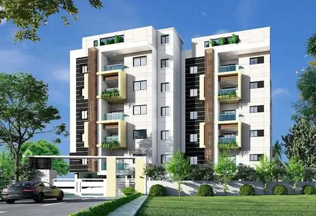
Makanas Enclave
MAKANA · Medchal-Malkajgiri · RERA P02200008968
MAKANAS ENCLAVE is a plotted development in TELANGANA SPORTS VILLAGE, Thumkunta, Shamirpet mandal, Medchal-Malkajgiri district, developed by registered promoter Makana Vinod Kumar Jain. The site area is 24280.91 sq.mt, and the layout shows 96 residential plots, with plot sizes of 81.27–361.23 sq.m (97.2–432.0 sq.yd). TG-RERA registration number P02200008968 runs from 12/10/2023 to 12/10/2026, with proposed completion on 12/10/2026.
01What we found
Read from TG-RERA filings, approvals, land and registration records and court records. A court case is counted only when the court record states this project's survey number with its village, or names the project.
02Check before you pay
7 items to check before you pay, 4 high - from the title chain, court records and approvals, each with what to ask the builder or your advocate. An item may not be a problem with the project: records can be incomplete.
1. Project at a glance
Project identity
| Field | Project record |
|---|---|
| Registered name | MAKANAS ENCLAVE RERA record |
| Project type | Plotted development / open-plot layout RERA record RERA filing |
| Phase / registered portion | The TG-RERA record identifies registration P02200008968. A separate phase description is not disclosed. RERA record |
| TG-RERA registration | P02200008968; registered from 12/10/2023 to 12/10/2026. This is the registration period, not a completion or occupancy certificate. RERA record |
| Registered promoter | Makana Vinod Kumar Jain (also identified in project records as MAKANA VINOD KUMAR JAIN). Legal entity type is not disclosed. |
| RERA status | Registration certificate issued under section 5; the certificate says validity is subject to its stated conditions. |
Land and geographic identity
| Field | Project record |
|---|---|
| Locality | TELANGANA SPORTS VILLAGE RERA record RERA filing |
| Revenue village | Thumkunta (also rendered THUMKUNTA in the layout records) RERA record Land records |
| Mandal | Shamirpet RERA record Land records |
| District | Medchal-Malkajgiri RERA record Land records |
| PIN | 500078 RERA filing |
| Project survey identifiers | RERA identifies 360 P. Project documents also refer to Survey No. 360, 360/P, and 361; the latter appears among the survey identifiers on the layout-plan extraction. The RERA land record does not specify further subdivisions. RERA record Land records |
| Site extent | 24280.91 sq.mt total site area; 342.91 sq.mt road-affected area; 23938.00 sq.mt net site area in the RERA land record and approval extraction. Land records |
| Boundaries | East: Survey No. 361; west: Karimnagar Highway; north: Survey No. 360 P; south: Survey No. 361 P. RERA filing |
Development identity
| Field | Project record |
|---|---|
| Sanctioning authority | Hyderabad Metropolitan Development Authority (HMDA); the project records also identify Thumkunta Municipality as the authority for a later project document. Approvals record |
| Principal layout approval | 008960/LO/HMDA/1955/MED/2023, dated 12 October, 2023, for an open plotted layout. Approvals record |
| Layout plan identifiers | The layout records show application TS/052907/2023 and LTP licence 68/str/engg/TP10/ghmc. Approvals record |
| Approved built-up area | 0.00 proposed built-up area, both excluding and including parking, in the layout-plan parameters. This is a plotted layout; building-level floor configuration is not disclosed. |
| Plots shown | 96 individual sub-plots in the layout drawing. Layout record |
| Mortgage shown in approval record | Nine plots—85, 94, 93, 92, 91, 90, 89, 96 and 95—with a stated area of 2281.32 Sq.mt. |
| Roads and open-space allocations | The layout record identifies 7119.98 sq.m roads, 1795.47 sq.m organized open space/park, 607.14 sq.m social infrastructure and 138.54 sq.m utilities. Layout record |
Offering and status
| Field | Project record |
|---|---|
| Unit type | Residential plots; plot sizes are derived from the layout drawing, not listed here as RERA-filed saleable areas. RERA record Layout record |
| Plot count | 96, as stated in the layout schedule. Layout record |
| Plot-size range | Software-measured from the drawing: 81.27–361.23 sq.m (97.2–432.0 sq.yd); verify against the drawing. Layout record |
| Booked / available counts | Not disclosed in the supplied project record. |
| Construction stage | No independently verified site-progress assessment is supplied. The registration record gives a proposed completion date of 12/10/2026. RERA record |
| Completion undertaking | Promoter’s Form-B declaration undertakes completion in 3 YEARS. (12-10-2026). |
| Occupancy / completion certificate status | Not established for this project in the supplied records. A project-filed architect’s Form–1A certificate is described as certifying completion of development work and carries the date 02.01.2025; the supplied extract does not provide the certificate’s detailed scope or establish the status of each plot or common work. |
2. The project story
MAKANAS ENCLAVE is registered as a plotted residential development in Thumkunta, Shamirpet mandal, Medchal-Malkajgiri district. The RERA record identifies Survey No. 360 P; project documents additionally refer to Survey No. 360, 360/P and 361. The registered site is recorded as 24280.91 sq.mt, with 23938.00 sq.mt stated as net site area after a 342.91 sq.mt road-affected area. RERA record Land records
The layout drawing shows 96 individual plots arranged with internal roads, open space/park, social-infrastructure land and a utility area. No apartments, building blocks or building-level floor plans are established by the supplied records. The plotted-area schedule reports 14276.16 sq.m for plots; roads occupy 7119.98 sq.m, open space/park 1795.47 sq.m, social infrastructure 607.14 sq.m and utilities 138.54 sq.m. Layout record
The registration record and Form-B declaration set 12/10/2026 as the proposed completion date. The Form-B is the promoter’s declaration, not an independent construction-progress assessment. Although the project file includes a Form–1A architect’s certificate described as certifying completion of development work, the supplied extract does not state the detailed works covered; this overview therefore does not infer that every layout facility or each plot is complete or occupancy-certified. RERA record
3. Master plan, architecture & building design
The filed development is a plotted layout rather than a building scheme. The layout drawing identifies 96 plots and records 24280.91 sq.mt total site area, 342.91 sq.mt road-affected area and 23938.00 sq.mt net site area. It records no proposed built-up area: 0.00 excluding parking and 0.00 including parking. Building footprints, floors, heights, apartment layouts and phase-by-tower organization are not applicable or not disclosed in the supplied material.
The drawing’s area statement allocates 14276.16 sq.m to plotted area (59.64% as printed), 7119.98 sq.m to roads (29.74%), 1795.47 sq.m to organized open space/park (7.50%), 607.14 sq.m to social infrastructure (2.54%) and 138.54 sq.m to utilities (0.58%). The area statement also prints a total net layout of 23937.29 sq.mt; the project’s land record and approval extraction state net area as 23938.00 sq.mt.
Road widths shown in the layout-plan extraction are 9.14M, 12.14M, 30.00 MT and 60.00 MT. The approval record identifies 60mtrs road as the road-affected area context and records transfer of that affected area by gift deed.
4. Homes, configurations & floor plans
This is a plotted project, not an apartment configuration. The layout drawing shows 96 plots; the individual plot areas below are software-measured from the drawing and should be checked against the approved drawing. Plot areas are not RERA-filed carpet or apartment saleable areas. Layout record
| Plot-size band | Plots |
|---|---|
| 0–100 sq.yd | 1 |
| 100–150 sq.yd | 18 |
| 150–200 sq.yd | 57 |
| 200–250 sq.yd | 14 |
| 250–300 sq.yd | 2 |
| 300–400 sq.yd | 3 |
| 400–500 sq.yd | 1 |
The software-measured range is 81.27–361.23 sq.m (97.2–432.0 sq.yd), with a median of 132.39 sq.m (158.3 sq.yd). The layout data reports 96 plots with sizes and states that their summed area matches the drawing’s plotted-area statement. No RERA-filed plot-wise saleable-area schedule, booked/available inventory counts, or plot-specific floor plans are supplied. Layout record
5. Parking & vehicle circulation
The layout plan reports 0.00 common-parking area and does not provide a parking-space count, parking allocation, visitor or accessible parking provision, EV charging, or an allocation of parking rights to individual plots.
Internal roads are shown in the layout, with listed widths of 9.14M, 12.14M, 30.00 MT and 60.00 MT. The supplied records do not specify vehicle entry/exit arrangements, turning areas, pedestrian separation or plot-specific driveway arrangements.
6. Amenities, recreation & open spaces
The records show layout-level open space and utility/site features. A 100% figure in the RERA amenity fields is a filed availability/status value, not independent verification that the feature has been completed. The supplied material does not provide independent site verification of these items. RERA amenities
| Facility | Description / size | Evidence source | Declared progress / verified status |
|---|---|---|---|
| Organized open space / park | 1795.47 sq.m; 7.50% in the layout area statement | Layout record | Layout allocation shown; completion not independently verified |
| Tot-lot / green strip / park | Tot-lot is named in layout utilities/amenities; “Green Strip/TOT LOT/Park” is marked available at 100% in the RERA amenity record | RERA amenities | Filed status; completion not independently verified |
| Internal roads and footpaths | 7119.98 sq.m road area; widths shown as 9.14M, 12.14M, 30.00 MT and 60.00 MT | Layout provision recorded; completion not independently verified | |
| Social infrastructure land | 607.14 sq.m; 2.54% | Layout record | Land allocation shown; specific facility or delivery status not disclosed |
| Utility land | 138.54 sq.m; 0.58% | Layout record | Land allocation shown; installed facilities not independently verified |
The promoter-marketed amenities in the supplied vendor record include kids’ play areas, sand pits, yoga areas, 24 × 7 security, a large green area and 24 × 7 water supply. These are marketing claims and are not treated here as sanctioned or delivered facilities. Promoter website
7. Utilities, building services & safety
The RERA amenity record marks water supply, sewerage (chamber, lines, septic tank, STP), storm-water drains, rainwater harvesting, street lighting and internal roads/footpaths as available at 100%. These are filed status entries; the supplied material does not independently verify their installation, operation or capacity. The same record lists 0% for treatment and disposal of sewage and sullage water, solid-waste management and disposal, energy management, fire protection/fire-safety requirements, and electrical meter room/sub-station/receiving station. RERA amenities
The layout extraction names a SEPTIC TANK, Sump, Distribution transformer, Garbage Pit, DUSTBIN and bio-compost pit. The approval extraction separately lists common septic tank/STP, overhead tank, transformer and transformer yard. The supplied records do not state water-source or storage capacities, STP capacity, electrical load, backup arrangements, fire systems, security equipment, or accessibility provisions.
8. Location, access & connectivity
The registered location is TELANGANA SPORTS VILLAGE, Thumkunta, Shamirpet mandal, Medchal-Malkajgiri district, Telangana 500078. The project record gives Karimnagar Highway as the western boundary; the layout identifies a 60mtrs road affecting 342.91 sq.m. RERA record RERA filing RERA filing
A supplied location record gives the nearest sampled Outer Ring Road interchange at 2.8 km; the location extract describes this as approximate. Location record Vendor-provided connectivity information lists St Alphonsa Grammar School at 3.0 km, Jawahar Deer Park at 4.9 km, Nisa Hospital at 1.9 km, Wellington Road at approximately 0.1 km, and Nehru Outer Ring Road Hyderabad at approximately 3.5 km. These are vendor-supplied claims, not independently verified travel distances. Promoter website
9. Developer & development status
The TG-RERA certificate names Makana Vinod Kumar Jain as promoter; the Form-B declaration is made by Mr. Vinod Kumar Jain Makana. The registered entity type, company or LLP identifier, registered office and official promoter contact details are not disclosed in the supplied evidence. Corporate record
The RERA record sets the proposed completion date at 12/10/2026; the Form-B declaration undertakes completion in 3 YEARS. (12-10-2026). A Form–1A architect’s certificate dated 02.01.2025 is described in the supplied extraction as certifying completion of development work. Its detailed scope is not provided here, and no independent current site-progress report or plot-wise completion/occupancy status is supplied. RERA record
10. Approvals, official records & documents
| Record | What the supplied evidence identifies |
|---|---|
| TG-RERA registration certificate | Form ‘C’, registration P02200008968, for MAKANAS ENCLAVE; valid 12/10/2023–12/10/2026. |
| HMDA layout approval | 008960/LO/HMDA/1955/MED/2023, dated 12 October, 2023, identified as approval for layout permission. |
| Layout-plan records | Layout-plan extractions show application TS/052907/2023, LTP licence 68/str/engg/TP10/ghmc, 96 plots, area distribution and nine plots identified for HMDA mortgage. |
| HMDA mortgage and road-area records | The approval extraction identifies mortgage deed 6791/2023 and gift deed 6790/2023, both dated 30 September, 2023; the latter concerns the 342.91 sq.m road-affected area. |
| Architect’s Form–1A | Extraction identifies O08563/FLT/HMDA/2146/MED/2024, dated 02.01.2025, and describes an architect’s certificate for overall completion of registered-project development work. Detailed certificate scope is not available in the supplied extraction. |
| Promoter Form-B declaration | Dated 8" day of October,2024; declares title and nil encumbrances and gives the promoter’s completion undertaking. These are promoter declarations. |
| RERA-filed allotment and agreement documents | The supplied RERA file includes a partially completed plot allotment letter and a partially filled agreement-for-sale template; the supplied evidence does not identify a particular buyer’s completed agreement or plot transfer. |
1. Project at a glance
Project identity
Registered name: MAKANAS ENCLAVE
Project type: Plotted development / open-plot layout
Phase / registered portion: The TG-RERA record identifies registration P02200008968. A separate phase description is not disclosed.
TG-RERA registration: P02200008968; registered from 12/10/2023 to 12/10/2026. This is the registration period, not a completion or occupancy certificate.
Registered promoter: Makana Vinod Kumar Jain (also identified in project records as MAKANA VINOD KUMAR JAIN). Legal entity type is not disclosed.
RERA status: Registration certificate issued under section 5; the certificate says validity is subject to its stated conditions.
Land and geographic identity
Locality: TELANGANA SPORTS VILLAGE
Revenue village: Thumkunta (also rendered THUMKUNTA in the layout records)
Mandal: Shamirpet
District: Medchal-Malkajgiri
PIN: 500078
Project survey identifiers: RERA identifies 360 P. Project documents also refer to Survey No. 360, 360/P, and 361; the latter appears among the survey identifiers on the layout-plan extraction. The RERA land record does not specify further subdivisions.
Site extent: 24280.91 sq.mt total site area; 342.91 sq.mt road-affected area; 23938.00 sq.mt net site area in the RERA land record and approval extraction.
Boundaries: East: Survey No. 361; west: Karimnagar Highway; north: Survey No. 360 P; south: Survey No. 361 P.
Development identity
Sanctioning authority: Hyderabad Metropolitan Development Authority (HMDA); the project records also identify Thumkunta Municipality as the authority for a later project document.
Principal layout approval: 008960/LO/HMDA/1955/MED/2023, dated 12 October, 2023, for an open plotted layout.
Layout plan identifiers: The layout records show application TS/052907/2023 and LTP licence 68/str/engg/TP10/ghmc.
Approved built-up area: 0.00 proposed built-up area, both excluding and including parking, in the layout-plan parameters. This is a plotted layout; building-level floor configuration is not disclosed.
Plots shown: 96 individual sub-plots in the layout drawing.
Mortgage shown in approval record: Nine plots—85, 94, 93, 92, 91, 90, 89, 96 and 95—with a stated area of 2281.32 Sq.mt.
Roads and open-space allocations: The layout record identifies 7119.98 sq.m roads, 1795.47 sq.m organized open space/park, 607.14 sq.m social infrastructure and 138.54 sq.m utilities.
Offering and status
Unit type: Residential plots; plot sizes are derived from the layout drawing, not listed here as RERA-filed saleable areas.
Plot count: 96, as stated in the layout schedule.
Plot-size range: Software-measured from the drawing: 81.27–361.23 sq.m (97.2–432.0 sq.yd); verify against the drawing.
Booked / available counts: Not disclosed in the supplied project record.
Construction stage: No independently verified site-progress assessment is supplied. The registration record gives a proposed completion date of 12/10/2026.
Completion undertaking: Promoter’s Form-B declaration undertakes completion in 3 YEARS. (12-10-2026).
Occupancy / completion certificate status: Not established for this project in the supplied records. A project-filed architect’s Form–1A certificate is described as certifying completion of development work and carries the date 02.01.2025; the supplied extract does not provide the certificate’s detailed scope or establish the status of each plot or common work.
2. The project story
MAKANAS ENCLAVE is registered as a plotted residential development in Thumkunta, Shamirpet mandal, Medchal-Malkajgiri district. The RERA record identifies Survey No. 360 P; project documents additionally refer to Survey No. 360, 360/P and 361. The registered site is recorded as 24280.91 sq.mt, with 23938.00 sq.mt stated as net site area after a 342.91 sq.mt road-affected area.
The layout drawing shows 96 individual plots arranged with internal roads, open space/park, social-infrastructure land and a utility area. No apartments, building blocks or building-level floor plans are established by the supplied records. The plotted-area schedule reports 14276.16 sq.m for plots; roads occupy 7119.98 sq.m, open space/park 1795.47 sq.m, social infrastructure 607.14 sq.m and utilities 138.54 sq.m.
The registration record and Form-B declaration set 12/10/2026 as the proposed completion date. The Form-B is the promoter’s declaration, not an independent construction-progress assessment. Although the project file includes a Form–1A architect’s certificate described as certifying completion of development work, the supplied extract does not state the detailed works covered; this overview therefore does not infer that every layout facility or each plot is complete or occupancy-certified.
3. Master plan, architecture & building design
The filed development is a plotted layout rather than a building scheme. The layout drawing identifies 96 plots and records 24280.91 sq.mt total site area, 342.91 sq.mt road-affected area and 23938.00 sq.mt net site area. It records no proposed built-up area: 0.00 excluding parking and 0.00 including parking. Building footprints, floors, heights, apartment layouts and phase-by-tower organization are not applicable or not disclosed in the supplied material.
The drawing’s area statement allocates 14276.16 sq.m to plotted area (59.64% as printed), 7119.98 sq.m to roads (29.74%), 1795.47 sq.m to organized open space/park (7.50%), 607.14 sq.m to social infrastructure (2.54%) and 138.54 sq.m to utilities (0.58%). The area statement also prints a total net layout of 23937.29 sq.mt; the project’s land record and approval extraction state net area as 23938.00 sq.mt.
Road widths shown in the layout-plan extraction are 9.14M, 12.14M, 30.00 MT and 60.00 MT. The approval record identifies 60mtrs road as the road-affected area context and records transfer of that affected area by gift deed.
4. Homes, configurations & floor plans
This is a plotted project, not an apartment configuration. The layout drawing shows 96 plots; the individual plot areas below are software-measured from the drawing and should be checked against the approved drawing. Plot areas are not RERA-filed carpet or apartment saleable areas.
0–100 sq.yd: 1
100–150 sq.yd: 18
150–200 sq.yd: 57
200–250 sq.yd: 14
250–300 sq.yd: 2
300–400 sq.yd: 3
400–500 sq.yd: 1
The software-measured range is 81.27–361.23 sq.m (97.2–432.0 sq.yd), with a median of 132.39 sq.m (158.3 sq.yd). The layout data reports 96 plots with sizes and states that their summed area matches the drawing’s plotted-area statement. No RERA-filed plot-wise saleable-area schedule, booked/available inventory counts, or plot-specific floor plans are supplied.
5. Parking & vehicle circulation
The layout plan reports 0.00 common-parking area and does not provide a parking-space count, parking allocation, visitor or accessible parking provision, EV charging, or an allocation of parking rights to individual plots.
Internal roads are shown in the layout, with listed widths of 9.14M, 12.14M, 30.00 MT and 60.00 MT. The supplied records do not specify vehicle entry/exit arrangements, turning areas, pedestrian separation or plot-specific driveway arrangements.
6. Amenities, recreation & open spaces
The records show layout-level open space and utility/site features. A 100% figure in the RERA amenity fields is a filed availability/status value, not independent verification that the feature has been completed. The supplied material does not provide independent site verification of these items.
| Facility | Description / size | Evidence source | Declared progress / verified status |
|---|---|---|---|
| Organized open space / park | 1795.47 sq.m; 7.50% in the layout area statement | Layout allocation shown; completion not independently verified | |
| Tot-lot / green strip / park | Tot-lot is named in layout utilities/amenities; “Green Strip/TOT LOT/Park” is marked available at 100% in the RERA amenity record | Filed status; completion not independently verified | |
| Internal roads and footpaths | 7119.98 sq.m road area; widths shown as 9.14M, 12.14M, 30.00 MT and 60.00 MT | Layout provision recorded; completion not independently verified | |
| Social infrastructure land | 607.14 sq.m; 2.54% | Land allocation shown; specific facility or delivery status not disclosed | |
| Utility land | 138.54 sq.m; 0.58% | Land allocation shown; installed facilities not independently verified |
The promoter-marketed amenities in the supplied vendor record include kids’ play areas, sand pits, yoga areas, 24 × 7 security, a large green area and 24 × 7 water supply. These are marketing claims and are not treated here as sanctioned or delivered facilities.
7. Utilities, building services & safety
The RERA amenity record marks water supply, sewerage (chamber, lines, septic tank, STP), storm-water drains, rainwater harvesting, street lighting and internal roads/footpaths as available at 100%. These are filed status entries; the supplied material does not independently verify their installation, operation or capacity. The same record lists 0% for treatment and disposal of sewage and sullage water, solid-waste management and disposal, energy management, fire protection/fire-safety requirements, and electrical meter room/sub-station/receiving station.
The layout extraction names a SEPTIC TANK, Sump, Distribution transformer, Garbage Pit, DUSTBIN and bio-compost pit. The approval extraction separately lists common septic tank/STP, overhead tank, transformer and transformer yard. The supplied records do not state water-source or storage capacities, STP capacity, electrical load, backup arrangements, fire systems, security equipment, or accessibility provisions.
8. Location, access & connectivity
The registered location is TELANGANA SPORTS VILLAGE, Thumkunta, Shamirpet mandal, Medchal-Malkajgiri district, Telangana 500078. The project record gives Karimnagar Highway as the western boundary; the layout identifies a 60mtrs road affecting 342.91 sq.m.
A supplied location record gives the nearest sampled Outer Ring Road interchange at 2.8 km; the location extract describes this as approximate. Vendor-provided connectivity information lists St Alphonsa Grammar School at 3.0 km, Jawahar Deer Park at 4.9 km, Nisa Hospital at 1.9 km, Wellington Road at approximately 0.1 km, and Nehru Outer Ring Road Hyderabad at approximately 3.5 km. These are vendor-supplied claims, not independently verified travel distances.
9. Developer & development status
The TG-RERA certificate names Makana Vinod Kumar Jain as promoter; the Form-B declaration is made by Mr. Vinod Kumar Jain Makana. The registered entity type, company or LLP identifier, registered office and official promoter contact details are not disclosed in the supplied evidence.
The RERA record sets the proposed completion date at 12/10/2026; the Form-B declaration undertakes completion in 3 YEARS. (12-10-2026). A Form–1A architect’s certificate dated 02.01.2025 is described in the supplied extraction as certifying completion of development work. Its detailed scope is not provided here, and no independent current site-progress report or plot-wise completion/occupancy status is supplied.
10. Approvals, official records & documents
TG-RERA registration certificate: Form ‘C’, registration P02200008968, for MAKANAS ENCLAVE; valid 12/10/2023–12/10/2026.
HMDA layout approval: 008960/LO/HMDA/1955/MED/2023, dated 12 October, 2023, identified as approval for layout permission.
Layout-plan records: Layout-plan extractions show application TS/052907/2023, LTP licence 68/str/engg/TP10/ghmc, 96 plots, area distribution and nine plots identified for HMDA mortgage.
HMDA mortgage and road-area records: The approval extraction identifies mortgage deed 6791/2023 and gift deed 6790/2023, both dated 30 September, 2023; the latter concerns the 342.91 sq.m road-affected area.
Architect’s Form–1A: Extraction identifies O08563/FLT/HMDA/2146/MED/2024, dated 02.01.2025, and describes an architect’s certificate for overall completion of registered-project development work. Detailed certificate scope is not available in the supplied extraction.
Promoter Form-B declaration: Dated 8" day of October,2024; declares title and nil encumbrances and gives the promoter’s completion undertaking. These are promoter declarations.
RERA-filed allotment and agreement documents: The supplied RERA file includes a partially completed plot allotment letter and a partially filled agreement-for-sale template; the supplied evidence does not identify a particular buyer’s completed agreement or plot transfer.
Frequently asked questions
Is MAKANAS ENCLAVE registered with Telangana RERA?
Yes. MAKANAS ENCLAVE is registered with the Telangana Real Estate Regulatory Authority as P02200008968; the registration status is New Project.
Who is the developer of MAKANAS ENCLAVE?
The promoter named in the RERA registration is MAKANA.
Where is MAKANAS ENCLAVE located?
MAKANAS ENCLAVE is in TELANGANA SPORTS VILLAGE, Thumkunta, Shamirpet, Medchal-Malkajgiri, Telangana (500078).
When will MAKANAS ENCLAVE be completed?
The promoter's proposed date of completion filed with RERA is 12/10/2026. This is the promoter's declaration, not a guarantee.
More projects in Thumkunta