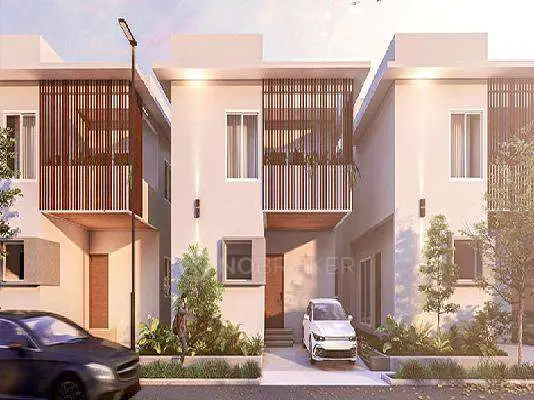
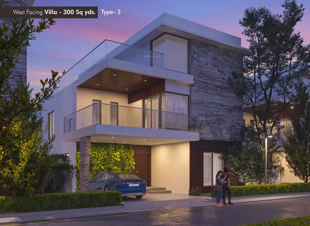
Lahari Ameya
LAHARI INFRASTRUCTURE PRIVATE LIMITED · Rangareddy · RERA P02400008951
LAHARI AMEYA is a residential plotted development at Kondakal, Shankarpalle Mandal, Ranga Reddy District, developed by registered promoter LAHARI INFRASTRUCTURE PRIVATE LIMITED. The RERA-filed site area is 22069.93 sq.m, and HMDA’s final layout letter records 83 residential plots; no plot configurations or sizes are stated. The project is registered under TG-RERA number P02400008951, with completion proposed by 3rd October 2027.
More from Lahari Infrastructure Pvt Ltd · 5 projects →
01What we found
Read from TG-RERA filings, approvals, land and registration records and court records. A court case is counted only when the court record states this project's survey number with its village, or names the project.
02Check before you pay
6 items to check before you pay, 3 high - from the title chain, court records and approvals, each with what to ask the builder or your advocate. An item may not be a problem with the project: records can be incomplete.
1. Project at a glance
Project identity
| Item | Record |
|---|---|
| Registered project name | LAHARI AMEYA RERA record |
| Project type | Plotted development / open layout; residential plot use RERA record |
| Phase / registered portion | No separate phase is identified. The registration concerns the plotted project on SY NO. 474/P. |
| TG-RERA registration | P02400008951 RERA record |
| Registration validity | 04/10/2024 to 03/10/2027, unless extended by the Authority. This is the registration period, not a statement that construction or possession is complete. |
| Registered promoter | LAHARI INFRASTRUCTURE PRIVATE LIMITED RERA record Corporate record |
| RERA status | New Project; registered RERA record Approvals record |
Land and geographic identity
| Item | Record |
|---|---|
| Locality / revenue village | Kondakal / Kondakal RERA record RERA filing |
| Mandal | Shankarpalle RERA record RERA filing |
| District | Ranga Reddy RERA record RERA filing |
| PIN | 501203 RERA record RERA filing |
| Project survey number and subdivision | SY NO. 474/P RERA record RERA filing |
| RERA-filed site area | Total area 22069.93 sq.m; affected area 0; net area 22069.93 sq.m RERA filing |
| Boundaries as filed | North: ROAD WIDTH-18; south, east and west: VACANT LAND RERA filing |
| Cadastral record scope | The cadastral extract is for whole survey 474/P, not a project-parcel-specific measurement; it reports an extent of 71806.77 sqm for the whole survey. Cadastral map |
Development identity
| Item | Record |
|---|---|
| Sanctioning authority | Hyderabad Metropolitan Development Authority (HMDA) Approvals record |
| Draft layout permit | 000051/LO/Plg/HMDA/2024, dated 04 October, 2024 Approvals record |
| Final layout permit | 1210/HMDA/SWFL/2025, dated 11/12/2025 Approvals record |
| Approved built-up area / building count / floors | Not applicable or not disclosed in the supplied records for this plotted layout; no building configuration is provided. RERA filing |
| Layout land-use areas in final layout letter | Plotted area 14765.07; road area 4672.92; open space area 1676.25; social infrastructure area 669.17; utilities area 286.52; total net layout 22069.93. The letter lists common parking area and amenities area as 0.0. |
| Layout plot count | 83 plots in the final layout letter. |
Offering and status
| Item | Record |
|---|---|
| Unit type | Residential plots; plot-by-plot sizes and RERA-filed saleable-area schedule are not available in the supplied data. |
| Booked / available counts | Not disclosed in the supplied project evidence. |
| Construction / development stage | The supplied final layout letter records completion certification and says roads, open spaces, social infrastructure and utilities have been taken over by the local authority; this is not an individual plot’s building completion or occupancy certificate. |
| Completion date | Promoter’s Form-B declaration undertakes completion by 3rd October 2027; the RERA certificate validity also ends on 03/10/2027. |
| Occupancy certificate status | No project or plot-level occupancy certificate is identified in the supplied records. The final layout letter is a layout approval/release record, not an occupancy certificate for a dwelling. |
2. The project story
LAHARI AMEYA is a proposed residential plotted layout at Kondakal, Shankarpalle Mandal, Ranga Reddy District, on SY NO. 474/P. The RERA-filed site area is 22069.93 sq.m, with 83 plots recorded in HMDA’s final layout letter. The layout also provides for roads, open space, social infrastructure and utilities; it is not a multi-storey apartment or villa development in the supplied approvals. RERA record RERA filing
HMDA issued a draft layout permit on 04 October, 2024, followed by the final layout letter under 1210/HMDA/SWFL/2025 dated 11/12/2025. The final letter records takeover of roads, open spaces, social infrastructure and utilities by the local authority and states that relinquishment documentation was executed for the mortgaged plots. The promoter’s Form-B declaration states a completion undertaking of 3rd October 2027. These records describe layout approval and development obligations; they do not establish construction or occupancy certification for homes on individual plots.
3. Master plan, architecture & building design
This is an open residential layout, not a building project in the supplied plans. The final layout letter records a total net layout area of 22069.93, of which 14765.07 is plotted area, 4672.92 roads, 1676.25 open space, 669.17 social infrastructure and 286.52 utilities. It lists 0.0 for common parking area and amenities area.
The layout drawing records 83 plots and road widths including 30.00, 18 and 40'-0" wide road. The draft permit specifies residential plot use and records a mortgage over Plot Nos. 67 to 76, stated as 2250.70 sq.m in the RERA land details and final-layout relinquishment record. No building footprints, building heights, floors, apartment arrangements or building-level design are supplied. RERA filing
4. Homes, configurations & floor plans
The RERA project is a plotted development. The supplied HMDA final layout letter records 83 plots, but the evidence does not provide a plot-by-plot area schedule or booked/available inventory.
| Configuration | Units | Booked | Available | RERA saleable area | Measured carpet area | Loading (if supplied) |
|---|---|---|---|---|---|---|
| Residential plots | 83 (final layout letter) | Not disclosed | Not disclosed | Not disclosed | Not measured | Not supplied |
The available drawing set contains two layout sheets, with no measured floor-plan areas. A vendor record mentions a “PLOT” size of 1364 sqft, but this is a vendor/marketing claim, not a RERA-filed plot schedule; it is not used here as the project’s registered size range. Floor plans Promoter website
5. Parking & vehicle circulation
The final layout letter lists common parking area as 0.0. The supplied material does not establish a sanctioned count of resident or visitor parking spaces, plot-specific parking allocation, or a dedicated parking facility. The approved layout includes internal roads, but the available evidence does not specify vehicle-entry/exit arrangements, ramps, pedestrian separation or EV charging.
6. Amenities, recreation & open spaces
The approval records layout-level open space, social infrastructure and utilities. The RERA amenity schedule marks some infrastructure as available, but these filed percentages are not independent site verification. The vendor’s recreational-feature list is marketing material and is not treated as an approved or delivered facility list. RERA amenities
| Description / size | Final layout letter: open space area 1676.25; layout drawing also records organized open space/park area/utility area 1962.78 sq.m. |
|---|---|
| Declared progress / verified status | Final letter records takeover of open spaces by the local authority; independent on-site condition not supplied. |
| Description / size | 669.17 |
|---|---|
| Declared progress / verified status | Final letter records takeover by the local authority; specific facility fit-out or operating status not supplied. |
| Description / size | No area or facility disclosed; RERA amenity schedule shows 0%. |
|---|---|
| Evidence source | RERA amenities |
| Declared progress / verified status | Not reported as provided. |
| Description / size | Cricket pitch, children’s play area and swimming pool; no dimensions supplied. |
|---|---|
| Evidence source | Promoter website |
| Declared progress / verified status | Vendor/marketing claims; no approval or completion evidence supplied. |
7. Utilities, building services & safety
HMDA’s final layout letter identifies water supply, sewerage and drainage-disposal systems, street lighting and rainwater-harvesting structure among the layout provisions. The RERA amenity schedule marks water supply, sewerage, storm-water drains, street lighting, water conservation/rainwater harvesting and an electrical meter room/sub-station/receiving station as available. These are filed status entries, not independent verification of operation or capacity. RERA amenities
The draft layout letter lists common septic tank/STP, internal water-supply pipelines, overhead tank, transformer, park development, rainwater-harvesting pits, storm-water drains and underground drainage lines. No capacities, water source, treatment specifications, backup-power details, waste-management arrangements, security systems, fire-safety provisions or accessibility details are established in the supplied approval records. RERA amenities
8. Location, access & connectivity
The registered location is Kondakal, Shankarpalle Mandal, Ranga Reddy District, Telangana 501203, on SY NO. 474/P. The site boundaries filed with RERA describe an 18-wide road to the north and vacant land on the other three sides. RERA record RERA filing RERA filing
The supplied location data gives an approximate distance of 10.7 km to the nearest sampled Outer Ring Road interchange. The record does not provide public-transport details or other verified landmark distances. Location record
9. Developer & development status
The registered promoter is LAHARI INFRASTRUCTURE PRIVATE LIMITED, a company, with GSTIN 36AABCL3204B2Z8. The supplied RERA address record is LAHARI, ROAD NO.34, KONDAKAL, KONDAKAL, Shankarpalle, Ranga Reddy, 501203. Corporate record RERA filing RERA filing
The promoter’s authorised signatory, S Satyanarayana, submitted a Form-B declaration dated 14-10-2024 stating that the project would be completed by 3rd October 2027 and making the stated project-fund, audit and approval undertakings. These are promoter declarations. The available records do not supply booked/available plot counts or an independently verified construction-progress percentage.
10. Approvals, official records & documents
| Identifier / date | P02400008951; valid 04/10/2024–03/10/2027 |
|---|---|
| What it establishes | Registration of LAHARI AMEYA and its identified land at SY NO. 474/P. |
| Identifier / date | 000051/LO/Plg/HMDA/2024, 04 October, 2024 |
|---|---|
| What it establishes | Draft open-layout approval for the site and its stated conditions, including mortgage of Plot Nos. 67–76. |
| Identifier / date | 1210/HMDA/SWFL/2025, 11/12/2025 |
|---|---|
| What it establishes | Final layout approval/release record for 83 plots, with land-use areas and stated takeover/relinquishment records. |
| Identifier / date | HMDA layout drawing; reference final layout number 059874/LT/SKP/FLT/U6/HMDA/02032023 |
|---|---|
| What it establishes | Layout plan for residential plotted development on SY.NOS.474/P; records plot count, roads and land-use schedule. |
| Identifier / date | 14-10-2024 |
|---|---|
| What it establishes | Promoter’s declarations and completion undertaking; not an independent title or completion verification. |
| Identifier / date | No dwelling-level completion or occupancy certificate supplied |
|---|---|
| What it establishes | The HMDA final layout letter concerns the layout; it does not certify occupancy of homes on the plots. |
1. Project at a glance
Project identity
Registered project name: LAHARI AMEYA
Project type: Plotted development / open layout; residential plot use
Phase / registered portion: No separate phase is identified. The registration concerns the plotted project on SY NO. 474/P.
TG-RERA registration: P02400008951
Registration validity: 04/10/2024 to 03/10/2027, unless extended by the Authority. This is the registration period, not a statement that construction or possession is complete.
Registered promoter: LAHARI INFRASTRUCTURE PRIVATE LIMITED
RERA status: New Project; registered
Land and geographic identity
Locality / revenue village: Kondakal / Kondakal
Mandal: Shankarpalle
District: Ranga Reddy
PIN: 501203
Project survey number and subdivision: SY NO. 474/P
RERA-filed site area: Total area 22069.93 sq.m; affected area 0; net area 22069.93 sq.m
Boundaries as filed: North: ROAD WIDTH-18; south, east and west: VACANT LAND
Cadastral record scope: The cadastral extract is for whole survey 474/P, not a project-parcel-specific measurement; it reports an extent of 71806.77 sqm for the whole survey.
Development identity
Sanctioning authority: Hyderabad Metropolitan Development Authority (HMDA)
Draft layout permit: 000051/LO/Plg/HMDA/2024, dated 04 October, 2024
Final layout permit: 1210/HMDA/SWFL/2025, dated 11/12/2025
Approved built-up area / building count / floors: Not applicable or not disclosed in the supplied records for this plotted layout; no building configuration is provided.
Layout land-use areas in final layout letter: Plotted area 14765.07; road area 4672.92; open space area 1676.25; social infrastructure area 669.17; utilities area 286.52; total net layout 22069.93. The letter lists common parking area and amenities area as 0.0.
Layout plot count: 83 plots in the final layout letter.
Offering and status
Unit type: Residential plots; plot-by-plot sizes and RERA-filed saleable-area schedule are not available in the supplied data.
Booked / available counts: Not disclosed in the supplied project evidence.
Construction / development stage: The supplied final layout letter records completion certification and says roads, open spaces, social infrastructure and utilities have been taken over by the local authority; this is not an individual plot’s building completion or occupancy certificate.
Completion date: Promoter’s Form-B declaration undertakes completion by 3rd October 2027; the RERA certificate validity also ends on 03/10/2027.
Occupancy certificate status: No project or plot-level occupancy certificate is identified in the supplied records. The final layout letter is a layout approval/release record, not an occupancy certificate for a dwelling.
2. The project story
LAHARI AMEYA is a proposed residential plotted layout at Kondakal, Shankarpalle Mandal, Ranga Reddy District, on SY NO. 474/P. The RERA-filed site area is 22069.93 sq.m, with 83 plots recorded in HMDA’s final layout letter. The layout also provides for roads, open space, social infrastructure and utilities; it is not a multi-storey apartment or villa development in the supplied approvals.
HMDA issued a draft layout permit on 04 October, 2024, followed by the final layout letter under 1210/HMDA/SWFL/2025 dated 11/12/2025. The final letter records takeover of roads, open spaces, social infrastructure and utilities by the local authority and states that relinquishment documentation was executed for the mortgaged plots. The promoter’s Form-B declaration states a completion undertaking of 3rd October 2027. These records describe layout approval and development obligations; they do not establish construction or occupancy certification for homes on individual plots.
3. Master plan, architecture & building design
This is an open residential layout, not a building project in the supplied plans. The final layout letter records a total net layout area of 22069.93, of which 14765.07 is plotted area, 4672.92 roads, 1676.25 open space, 669.17 social infrastructure and 286.52 utilities. It lists 0.0 for common parking area and amenities area.
The layout drawing records 83 plots and road widths including 30.00, 18 and 40'-0" wide road. The draft permit specifies residential plot use and records a mortgage over Plot Nos. 67 to 76, stated as 2250.70 sq.m in the RERA land details and final-layout relinquishment record. No building footprints, building heights, floors, apartment arrangements or building-level design are supplied.
4. Homes, configurations & floor plans
The RERA project is a plotted development. The supplied HMDA final layout letter records 83 plots, but the evidence does not provide a plot-by-plot area schedule or booked/available inventory.
| Configuration | Units | Booked | Available | RERA saleable area | Measured carpet area | Loading (if supplied) |
|---|---|---|---|---|---|---|
| Residential plots | 83 (final layout letter) | Not disclosed | Not disclosed | Not disclosed | Not measured | Not supplied |
The available drawing set contains two layout sheets, with no measured floor-plan areas. A vendor record mentions a “PLOT” size of 1364 sqft, but this is a vendor/marketing claim, not a RERA-filed plot schedule; it is not used here as the project’s registered size range.
5. Parking & vehicle circulation
The final layout letter lists common parking area as 0.0. The supplied material does not establish a sanctioned count of resident or visitor parking spaces, plot-specific parking allocation, or a dedicated parking facility. The approved layout includes internal roads, but the available evidence does not specify vehicle-entry/exit arrangements, ramps, pedestrian separation or EV charging.
6. Amenities, recreation & open spaces
The approval records layout-level open space, social infrastructure and utilities. The RERA amenity schedule marks some infrastructure as available, but these filed percentages are not independent site verification. The vendor’s recreational-feature list is marketing material and is not treated as an approved or delivered facility list.
| Description / size | Final layout letter: open space area 1676.25; layout drawing also records organized open space/park area/utility area 1962.78 sq.m. |
|---|---|
| Declared progress / verified status | Final letter records takeover of open spaces by the local authority; independent on-site condition not supplied. |
| Description / size | 669.17 |
|---|---|
| Declared progress / verified status | Final letter records takeover by the local authority; specific facility fit-out or operating status not supplied. |
| Description / size | No area or facility disclosed; RERA amenity schedule shows 0%. |
|---|---|
| Declared progress / verified status | Not reported as provided. |
| Description / size | Cricket pitch, children’s play area and swimming pool; no dimensions supplied. |
|---|---|
| Declared progress / verified status | Vendor/marketing claims; no approval or completion evidence supplied. |
7. Utilities, building services & safety
HMDA’s final layout letter identifies water supply, sewerage and drainage-disposal systems, street lighting and rainwater-harvesting structure among the layout provisions. The RERA amenity schedule marks water supply, sewerage, storm-water drains, street lighting, water conservation/rainwater harvesting and an electrical meter room/sub-station/receiving station as available. These are filed status entries, not independent verification of operation or capacity.
The draft layout letter lists common septic tank/STP, internal water-supply pipelines, overhead tank, transformer, park development, rainwater-harvesting pits, storm-water drains and underground drainage lines. No capacities, water source, treatment specifications, backup-power details, waste-management arrangements, security systems, fire-safety provisions or accessibility details are established in the supplied approval records.
8. Location, access & connectivity
The registered location is Kondakal, Shankarpalle Mandal, Ranga Reddy District, Telangana 501203, on SY NO. 474/P. The site boundaries filed with RERA describe an 18-wide road to the north and vacant land on the other three sides.
The supplied location data gives an approximate distance of 10.7 km to the nearest sampled Outer Ring Road interchange. The record does not provide public-transport details or other verified landmark distances.
9. Developer & development status
The registered promoter is LAHARI INFRASTRUCTURE PRIVATE LIMITED, a company, with GSTIN 36AABCL3204B2Z8. The supplied RERA address record is LAHARI, ROAD NO.34, KONDAKAL, KONDAKAL, Shankarpalle, Ranga Reddy, 501203.
The promoter’s authorised signatory, S Satyanarayana, submitted a Form-B declaration dated 14-10-2024 stating that the project would be completed by 3rd October 2027 and making the stated project-fund, audit and approval undertakings. These are promoter declarations. The available records do not supply booked/available plot counts or an independently verified construction-progress percentage.
10. Approvals, official records & documents
| Identifier / date | P02400008951; valid 04/10/2024–03/10/2027 |
|---|---|
| What it establishes | Registration of LAHARI AMEYA and its identified land at SY NO. 474/P. |
| Identifier / date | 000051/LO/Plg/HMDA/2024, 04 October, 2024 |
|---|---|
| What it establishes | Draft open-layout approval for the site and its stated conditions, including mortgage of Plot Nos. 67–76. |
| Identifier / date | 1210/HMDA/SWFL/2025, 11/12/2025 |
|---|---|
| What it establishes | Final layout approval/release record for 83 plots, with land-use areas and stated takeover/relinquishment records. |
| Identifier / date | HMDA layout drawing; reference final layout number 059874/LT/SKP/FLT/U6/HMDA/02032023 |
|---|---|
| What it establishes | Layout plan for residential plotted development on SY.NOS.474/P; records plot count, roads and land-use schedule. |
| Identifier / date | 14-10-2024 |
|---|---|
| What it establishes | Promoter’s declarations and completion undertaking; not an independent title or completion verification. |
| Identifier / date | No dwelling-level completion or occupancy certificate supplied |
|---|---|
| What it establishes | The HMDA final layout letter concerns the layout; it does not certify occupancy of homes on the plots. |
Frequently asked questions
Is LAHARI AMEYA registered with Telangana RERA?
Yes. LAHARI AMEYA is registered with the Telangana Real Estate Regulatory Authority as P02400008951; the registration status is New Project.
Who is the developer of LAHARI AMEYA?
The promoter named in the RERA registration is LAHARI INFRASTRUCTURE PRIVATE LIMITED.
Where is LAHARI AMEYA located?
LAHARI AMEYA is in KONDAKAL, Shankarpalle, Rangareddy, Telangana (501203).
When will LAHARI AMEYA be completed?
The promoter's proposed date of completion filed with RERA is 03/10/2027. This is the promoter's declaration, not a guarantee.
More projects in Kondakal