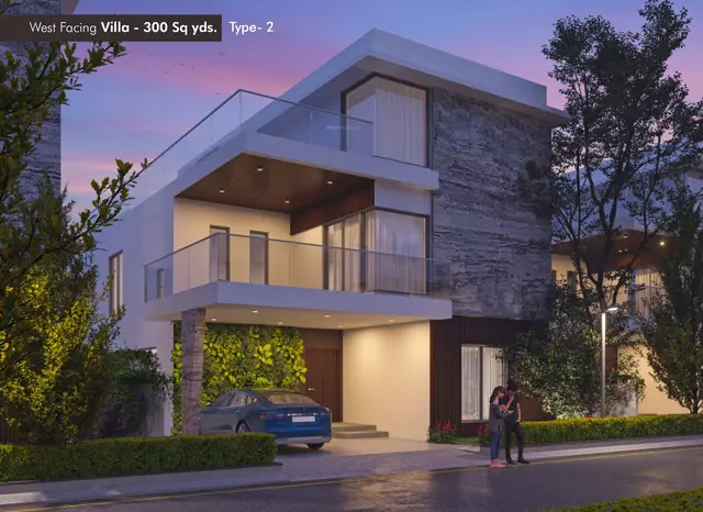
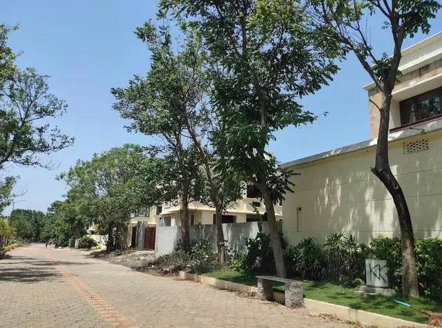
Kumbhasthala Dukes County Phase-4
KUMBHASTHALA GLOBAL SPACES PRIVATE LIMITED · Rangareddy · RERA P02400010711
KUMBHASTHALA DUKES COUNTY PHASE-4 is a plotted development of open plots in HARIPRIYA DUKES COUNTY, Kondakal village, Shankarpalle mandal, Ranga Reddy district. It is being developed by the registered promoter, KUMBHASTHALA GLOBAL SPACES PRIVATE LIMITED. The project covers 12,278.01 sq.m and the layout drawing shows 26 plots, with plot sizes ranging from 166.79–742.4 sq.m; the record does not state towers, floors or building configurations. Its TG-RERA registration is P02400010711, and the proposed completion date is 05-02-2029.
01What we found
Read from TG-RERA filings, approvals, land and registration records and court records. A court case is counted only when the court record states this project's survey number with its village, or names the project.
02Check before you pay
8 items to check before you pay, 5 high - from the title chain, court records and approvals, each with what to ask the builder or your advocate. An item may not be a problem with the project: records can be incomplete.
1. Project at a glance
Project identity
| Item | Record |
|---|---|
| Registered project name | KUMBHASTHALA DUKES COUNTY PHASE-4 RERA record |
| Project type | Plotted development; the registration certificate describes the offering as open plots. RERA record |
| Phase / registered portion | Phase-4; the registration covers the plotted project on the land identified below. RERA record |
| TG-RERA registration | P02400010711; registered 5 February 2026 and valid through 5 February 2029, subject to any extension by the Authority. Registration validity is separate from the project completion deadline. RERA record Approvals record |
| Registered promoter | KUMBHASTHALA GLOBAL SPACES PRIVATE LIMITED, a private limited company. RERA record Corporate record |
| RERA status | New project; registration certificate supplied. RERA record |
Land and geographic identity
| Item | Record |
|---|---|
| Locality / site description | HARIPRIYA DUKES COUNTY; the filed land details also identify OPEN PLOT / PLOT NO 393/P. RERA record RERA filing |
| Revenue village | Kondakal. RERA record Land records |
| Mandal | Shankarpalle. RERA record Land records |
| District | Ranga Reddy. RERA record Land records |
| PIN | 501203. RERA record |
| Project survey numbers and subdivisions | 158/P, 159/P, 163/P, 164/1/1, 164/1/2, 164/1/3. RERA record Land records |
| Registered site extent | 12,278.01 sq.m in the RERA land details. RERA filing |
| Total / net layout area | 12,278.01 sq.m in the layout drawing. Layout record |
| Boundaries | Not stated in the supplied project land details. Land records |
Development identity
| Item | Record |
|---|---|
| Sanctioning authority | Hyderabad Metropolitan Development Authority (HMDA); the draft layout permission records delegation to Kondakal Gram Panchayat. Approvals record |
| Principal layout approval | 1635/HMDA/SWDL/2026, dated 05/02/2026; the filed approval is identified as a draft layout permission. Approvals record |
| Application / file number | 010707/HMDA/03133/SWDL/SKP2/2025. Approvals record |
| Approved built-up area | Not applicable as a building-area figure to this plotted-layout record; no building construction area is supplied. RERA filing |
| Plots shown | 26 in the layout drawing; plot count and sizes are drawing-derived. Layout record |
| Buildings, floors and parking levels | Not disclosed for this plotted development. Document index Layout record |
Offering and status
| Item | Record |
|---|---|
| Offering | Open plots; the registration certificate identifies OPEN PLOT / PLOT NO 393/P in its unit field. |
| Plot schedule | The drawing-derived record reports 26 plots with sizes for all 26; size range is 166.79–742.4 sq.m (software-measured from the drawing). Layout record |
| Booked / available count | Not supplied in the available RERA project data. RERA filing |
| Construction / development stage | The HMDA document is a draft layout permission and requires development works before final layout release. No independently verified site-progress record is supplied. |
| Completion deadline | The promoter’s Form-B declaration undertakes completion by 05-02-2029. |
| Occupancy / completion certificate | No occupancy or completion certificate is supplied; the record concerns a plotted layout, not completed buildings. Document index Approvals record |
2. The project story
This is a registered plotted development, rather than an apartment or villa scheme in the supplied project record. It is located at Kondakal village, Shankarpalle mandal, Ranga Reddy district, on the registered survey land 158/P, 159/P, 163/P, 164/1/1, 164/1/2 and 164/1/3. The RERA filing identifies the project as Phase-4 and records a site extent of 12,278.01 sq.m. RERA record Land records
The layout drawing shows 26 plots and sets out roads, open space, social infrastructure and utility land. HMDA’s supplied draft layout letter identifies the plan as technically approved and forwarded to Kondakal Gram Panchayat for release of proceedings and plans; the evidence does not establish that those proceedings or final layout plans have been released. The letter requires infrastructure works and handover of specified areas before final layout release. Layout record
The promoter’s Form-B affidavit undertakes completion by 05-02-2029. That is a promoter declaration, not an independent finding of site progress. No verified construction-progress assessment or occupancy/completion certificate is supplied. Document index
3. Master plan, architecture & building design
The submitted layout drawing shows a 12,278.01 sq.m total/net layout area. Its land-use schedule is: 8,036.06 sq.m plotted area (65.45%), 2,899.76 sq.m roads (23.62%), 925.53 sq.m open space (7.54%), 335.55 sq.m social infrastructure (2.73%) and 81.10 sq.m utility area (0.66%). The drawing records zero area for buffer, common parking, facilities and green belt. These are layout-drawing figures, not building-area or saleable-area measurements. Layout record
The drawing identifies 26 plots. Its plotted-area schedule and extracted plot-size bands are drawing-derived and should be checked against the plan: 1 plot in the 150–200 sq.yd band, 14 in 200–250, 3 in 300–400, 2 in 400–500 and 6 in 500–1,000 sq.yd bands. The recorded size range is 166.79–742.4 sq.m; the median is 186.05 sq.m. Layout record
This is a plotted layout, so building count, floor configuration, tower arrangement, building footprint and residential/commercial building distribution are not disclosed. The layout plan records road widths including 9.14/9.15 m, 12/12.2 m, 18/18.28 m and 30.0 m; HMDA’s draft letter separately specifies roads of 18 m and above.
4. Homes, configurations & floor plans
The RERA record is for open plots, not apartment configurations. The submitted registration certificate’s unit field identifies OPEN PLOT / PLOT NO 393/P; it does not establish a complete plot-by-plot booked or available inventory in the supplied data.
| Configuration | Units | Booked | Available | RERA saleable area | Measured carpet area | Loading (if supplied) |
|---|---|---|---|---|---|---|
| Open plots | 26 shown in layout drawing | Not supplied | Not supplied | Not supplied as a plot-by-plot schedule in the available RERA data | Not applicable | Not supplied |
The 26-plot count and drawing-derived plot sizes are not RERA-filed booking or availability figures. The extracted size range is 166.79–742.4 sq.m; plot areas and individual allocations should be checked against the layout drawing. Layout record
5. Parking & vehicle circulation
The layout schedule records 0.00 sq.m of common parking area; no sanctioned count of parking spaces, visitor spaces, accessible spaces, vehicle-allocation arrangement, EV charging provision or parking-level plan is supplied. Layout record
The draft layout letter records that plots 24 and 25, with a stated extent of 1,377.56 sq.m, are mortgaged to the Metropolitan Commissioner, HMDA. This is a mortgage for the layout; the available record does not describe it as a buyer parking allocation.
6. Amenities, recreation & open spaces
The layout plan allocates land to open space, social infrastructure and utilities. The evidence does not establish delivery or independent completion of these facilities.
| Facility | Description / size | Evidence source | Declared progress / verified status |
|---|---|---|---|
| Park / open space | Open Space Area 925.53 sq.m (7.54%). | Layout record | Shown in layout; no completion verification supplied. |
| Social infrastructure | 335.55 sq.m (2.73%). | Layout record | Allocated in layout; specific facility and completion status not supplied. |
| Utility land | 81.10 sq.m (0.66%). | Layout record | Allocated in layout; specific utility installations and completion status not verified. |
No project-specific RERA evidence in the supplied data confirms a clubhouse, gym, swimming pool or other indoor/community recreation facility. RERA amenities Document index
7. Utilities, building services & safety
The layout approval records utility-related provisions including a common septic tank / STP, overhead tank, transformer, rainwater-harvesting pits, solid waste and bio-compost unit. The supplied evidence does not state their capacities or establish that they have been installed or commissioned.
The RERA amenities list marks internal roads and footpaths, water supply, sewerage (chambers, lines, septic tank/STP), storm-water drains, green strip/tot-lot/park and street lighting as available in the project disclosure, with progress shown as 0% for each listed item. “Available: YES” is therefore a filed availability entry, not evidence of completed delivery. RERA amenities
The supplied records do not establish project-specific water source or storage capacity, treatment and reuse arrangements, electrical backup, fire-safety installations, security systems, accessibility works or completion of utility connections. RERA amenities Document index
8. Location, access & connectivity
The registered revenue location is Kondakal village, Shankarpalle mandal, Ranga Reddy district, Telangana 501203. The project land is identified across 158/P, 159/P, 163/P, 164/1/1, 164/1/2 and 164/1/3. RERA record Land records
The supplied location data gives a cadastral parcel centroid of 17.48937, 78.20335, an approximate sampled distance of 7.5 km to the nearest sampled Outer Ring Road interchange, and 2.4 km to an unnamed park. These are mapped-location outputs; no travel-time figures or named public-transport links are supplied. Location record Cadastral map
9. Developer & development status
The registered promoter is KUMBHASTHALA GLOBAL SPACES PRIVATE LIMITED, identified as a company/private limited entity. The project record identifies VELAGA NARESH as an authorized signatory; the Form-B affidavit names NARESH VELAGA as declarant. Corporate record Parties record
The promoter address in the project record is SILICON TOWERS, MADHAPUR, VELIMELA ROAD, HARIPRIYA DUKES COUNTY, Shankarpalle, Ranga Reddy, 501203. The supplied promoter website is https://www.kumbhasthala.com/. No corporate identification number or promoter contact details are provided in the available data. Parties record Corporate record
The RERA registration certificate is for Phase-4 and is valid from 05/02/2026 to 05/02/2029; the promoter’s Form-B declaration separately undertakes completion by 05-02-2029. No independently verified site progress or occupancy/completion certificate is supplied. Approvals record
10. Approvals, official records & documents
| Identifier / date | P02400010711; issued for a three-year period from 05/02/2026 to 05/02/2029. |
|---|---|
| What the supplied evidence establishes | Registration of KUMBHASTHALA DUKES COUNTY PHASE-4 as an open-plots project at Kondakal. |
| Identifier / date | 010707/HMDA/03133/SWDL/SKP2/2025. |
|---|---|
| What the supplied evidence establishes | Application/file reference in the HMDA layout documents. |
| Identifier / date | 1635/HMDA/SWDL/2026, dated 05/02/2026. |
|---|---|
| What the supplied evidence establishes | Draft layout permission for the listed Kondakal survey land; letter states that specified development works and handovers are required before final layout release. |
| Identifier / date | Application ID dc8ff0cb-82dd-4f4b-9d7e-d1850692cf27. |
|---|---|
| What the supplied evidence establishes | Drawing records 26 plots and the layout land-use schedule. |
| Identifier / date | 202/2026, dated 13/01/2026. |
|---|---|
| What the supplied evidence establishes | Mortgage of plots 24 and 25, stated extent 1,377.56 sq.m, in favour of the Metropolitan Commissioner, HMDA. |
| Identifier / date | Registered as 1370/2026. |
|---|---|
| What the supplied evidence establishes | Agreement between Shradha Developers and Kumbhasthala Global Spaces Private Limited for development of the land into open plots; the supplied document summary describes development rights and a 90% owner / 10% developer plot-sharing arrangement. |
| Identifier / date | Completion undertaking: 05-02-2029. |
|---|---|
| What the supplied evidence establishes | Promoter declaration concerning completion and project obligations. |
| Identifier / date | Not supplied. |
|---|---|
| What the supplied evidence establishes | No such certificate is established by the available project records. Document index |
1. Project at a glance
Project identity
Registered project name: KUMBHASTHALA DUKES COUNTY PHASE-4
Project type: Plotted development; the registration certificate describes the offering as open plots.
Phase / registered portion: Phase-4; the registration covers the plotted project on the land identified below.
TG-RERA registration: P02400010711; registered 5 February 2026 and valid through 5 February 2029, subject to any extension by the Authority. Registration validity is separate from the project completion deadline.
Registered promoter: KUMBHASTHALA GLOBAL SPACES PRIVATE LIMITED, a private limited company.
RERA status: New project; registration certificate supplied.
Land and geographic identity
Locality / site description: HARIPRIYA DUKES COUNTY; the filed land details also identify OPEN PLOT / PLOT NO 393/P.
Revenue village: Kondakal.
Mandal: Shankarpalle.
District: Ranga Reddy.
PIN: 501203.
Project survey numbers and subdivisions: 158/P, 159/P, 163/P, 164/1/1, 164/1/2, 164/1/3.
Registered site extent: 12,278.01 sq.m in the RERA land details.
Total / net layout area: 12,278.01 sq.m in the layout drawing.
Boundaries: Not stated in the supplied project land details.
Development identity
Sanctioning authority: Hyderabad Metropolitan Development Authority (HMDA); the draft layout permission records delegation to Kondakal Gram Panchayat.
Principal layout approval: 1635/HMDA/SWDL/2026, dated 05/02/2026; the filed approval is identified as a draft layout permission.
Application / file number: 010707/HMDA/03133/SWDL/SKP2/2025.
Approved built-up area: Not applicable as a building-area figure to this plotted-layout record; no building construction area is supplied.
Plots shown: 26 in the layout drawing; plot count and sizes are drawing-derived.
Buildings, floors and parking levels: Not disclosed for this plotted development.
Offering and status
Offering: Open plots; the registration certificate identifies OPEN PLOT / PLOT NO 393/P in its unit field.
Plot schedule: The drawing-derived record reports 26 plots with sizes for all 26; size range is 166.79–742.4 sq.m (software-measured from the drawing).
Booked / available count: Not supplied in the available RERA project data.
Construction / development stage: The HMDA document is a draft layout permission and requires development works before final layout release. No independently verified site-progress record is supplied.
Completion deadline: The promoter’s Form-B declaration undertakes completion by 05-02-2029.
Occupancy / completion certificate: No occupancy or completion certificate is supplied; the record concerns a plotted layout, not completed buildings.
2. The project story
This is a registered plotted development, rather than an apartment or villa scheme in the supplied project record. It is located at Kondakal village, Shankarpalle mandal, Ranga Reddy district, on the registered survey land 158/P, 159/P, 163/P, 164/1/1, 164/1/2 and 164/1/3. The RERA filing identifies the project as Phase-4 and records a site extent of 12,278.01 sq.m.
The layout drawing shows 26 plots and sets out roads, open space, social infrastructure and utility land. HMDA’s supplied draft layout letter identifies the plan as technically approved and forwarded to Kondakal Gram Panchayat for release of proceedings and plans; the evidence does not establish that those proceedings or final layout plans have been released. The letter requires infrastructure works and handover of specified areas before final layout release.
The promoter’s Form-B affidavit undertakes completion by 05-02-2029. That is a promoter declaration, not an independent finding of site progress. No verified construction-progress assessment or occupancy/completion certificate is supplied.
3. Master plan, architecture & building design
The submitted layout drawing shows a 12,278.01 sq.m total/net layout area. Its land-use schedule is: 8,036.06 sq.m plotted area (65.45%), 2,899.76 sq.m roads (23.62%), 925.53 sq.m open space (7.54%), 335.55 sq.m social infrastructure (2.73%) and 81.10 sq.m utility area (0.66%). The drawing records zero area for buffer, common parking, facilities and green belt. These are layout-drawing figures, not building-area or saleable-area measurements.
The drawing identifies 26 plots. Its plotted-area schedule and extracted plot-size bands are drawing-derived and should be checked against the plan: 1 plot in the 150–200 sq.yd band, 14 in 200–250, 3 in 300–400, 2 in 400–500 and 6 in 500–1,000 sq.yd bands. The recorded size range is 166.79–742.4 sq.m; the median is 186.05 sq.m.
This is a plotted layout, so building count, floor configuration, tower arrangement, building footprint and residential/commercial building distribution are not disclosed. The layout plan records road widths including 9.14/9.15 m, 12/12.2 m, 18/18.28 m and 30.0 m; HMDA’s draft letter separately specifies roads of 18 m and above.
4. Homes, configurations & floor plans
The RERA record is for open plots, not apartment configurations. The submitted registration certificate’s unit field identifies OPEN PLOT / PLOT NO 393/P; it does not establish a complete plot-by-plot booked or available inventory in the supplied data.
| Configuration | Units | Booked | Available | RERA saleable area | Measured carpet area | Loading (if supplied) |
|---|---|---|---|---|---|---|
| Open plots | 26 shown in layout drawing | Not supplied | Not supplied | Not supplied as a plot-by-plot schedule in the available RERA data | Not applicable | Not supplied |
The 26-plot count and drawing-derived plot sizes are not RERA-filed booking or availability figures. The extracted size range is 166.79–742.4 sq.m; plot areas and individual allocations should be checked against the layout drawing.
5. Parking & vehicle circulation
The layout schedule records 0.00 sq.m of common parking area; no sanctioned count of parking spaces, visitor spaces, accessible spaces, vehicle-allocation arrangement, EV charging provision or parking-level plan is supplied.
The draft layout letter records that plots 24 and 25, with a stated extent of 1,377.56 sq.m, are mortgaged to the Metropolitan Commissioner, HMDA. This is a mortgage for the layout; the available record does not describe it as a buyer parking allocation.
6. Amenities, recreation & open spaces
The layout plan allocates land to open space, social infrastructure and utilities. The evidence does not establish delivery or independent completion of these facilities.
| Facility | Description / size | Evidence source | Declared progress / verified status |
|---|---|---|---|
| Park / open space | Open Space Area 925.53 sq.m (7.54%). | Shown in layout; no completion verification supplied. | |
| Social infrastructure | 335.55 sq.m (2.73%). | Allocated in layout; specific facility and completion status not supplied. | |
| Utility land | 81.10 sq.m (0.66%). | Allocated in layout; specific utility installations and completion status not verified. |
No project-specific RERA evidence in the supplied data confirms a clubhouse, gym, swimming pool or other indoor/community recreation facility.
7. Utilities, building services & safety
The layout approval records utility-related provisions including a common septic tank / STP, overhead tank, transformer, rainwater-harvesting pits, solid waste and bio-compost unit. The supplied evidence does not state their capacities or establish that they have been installed or commissioned.
The RERA amenities list marks internal roads and footpaths, water supply, sewerage (chambers, lines, septic tank/STP), storm-water drains, green strip/tot-lot/park and street lighting as available in the project disclosure, with progress shown as 0% for each listed item. “Available: YES” is therefore a filed availability entry, not evidence of completed delivery.
The supplied records do not establish project-specific water source or storage capacity, treatment and reuse arrangements, electrical backup, fire-safety installations, security systems, accessibility works or completion of utility connections.
8. Location, access & connectivity
The registered revenue location is Kondakal village, Shankarpalle mandal, Ranga Reddy district, Telangana 501203. The project land is identified across 158/P, 159/P, 163/P, 164/1/1, 164/1/2 and 164/1/3.
The supplied location data gives a cadastral parcel centroid of 17.48937, 78.20335, an approximate sampled distance of 7.5 km to the nearest sampled Outer Ring Road interchange, and 2.4 km to an unnamed park. These are mapped-location outputs; no travel-time figures or named public-transport links are supplied.
9. Developer & development status
The registered promoter is KUMBHASTHALA GLOBAL SPACES PRIVATE LIMITED, identified as a company/private limited entity. The project record identifies VELAGA NARESH as an authorized signatory; the Form-B affidavit names NARESH VELAGA as declarant.
The promoter address in the project record is SILICON TOWERS, MADHAPUR, VELIMELA ROAD, HARIPRIYA DUKES COUNTY, Shankarpalle, Ranga Reddy, 501203. The supplied promoter website is https://www.kumbhasthala.com/. No corporate identification number or promoter contact details are provided in the available data.
The RERA registration certificate is for Phase-4 and is valid from 05/02/2026 to 05/02/2029; the promoter’s Form-B declaration separately undertakes completion by 05-02-2029. No independently verified site progress or occupancy/completion certificate is supplied.
10. Approvals, official records & documents
| Identifier / date | P02400010711; issued for a three-year period from 05/02/2026 to 05/02/2029. |
|---|---|
| What the supplied evidence establishes | Registration of KUMBHASTHALA DUKES COUNTY PHASE-4 as an open-plots project at Kondakal. |
| Identifier / date | 010707/HMDA/03133/SWDL/SKP2/2025. |
|---|---|
| What the supplied evidence establishes | Application/file reference in the HMDA layout documents. |
| Identifier / date | 1635/HMDA/SWDL/2026, dated 05/02/2026. |
|---|---|
| What the supplied evidence establishes | Draft layout permission for the listed Kondakal survey land; letter states that specified development works and handovers are required before final layout release. |
| Identifier / date | Application ID dc8ff0cb-82dd-4f4b-9d7e-d1850692cf27. |
|---|---|
| What the supplied evidence establishes | Drawing records 26 plots and the layout land-use schedule. |
| Identifier / date | 202/2026, dated 13/01/2026. |
|---|---|
| What the supplied evidence establishes | Mortgage of plots 24 and 25, stated extent 1,377.56 sq.m, in favour of the Metropolitan Commissioner, HMDA. |
| Identifier / date | Registered as 1370/2026. |
|---|---|
| What the supplied evidence establishes | Agreement between Shradha Developers and Kumbhasthala Global Spaces Private Limited for development of the land into open plots; the supplied document summary describes development rights and a 90% owner / 10% developer plot-sharing arrangement. |
| Identifier / date | Completion undertaking: 05-02-2029. |
|---|---|
| What the supplied evidence establishes | Promoter declaration concerning completion and project obligations. |
| Identifier / date | Not supplied. |
|---|---|
| What the supplied evidence establishes | No such certificate is established by the available project records. |
Frequently asked questions
Is KUMBHASTHALA DUKES COUNTY PHASE-4 registered with Telangana RERA?
Yes. KUMBHASTHALA DUKES COUNTY PHASE-4 is registered with the Telangana Real Estate Regulatory Authority as P02400010711; the registration status is New Project.
Who is the developer of KUMBHASTHALA DUKES COUNTY PHASE-4?
The promoter named in the RERA registration is KUMBHASTHALA GLOBAL SPACES PRIVATE LIMITED.
Where is KUMBHASTHALA DUKES COUNTY PHASE-4 located?
KUMBHASTHALA DUKES COUNTY PHASE-4 is in HARIPRIYA DUKES COUNTY, Kondakal, Shankarpalle, Rangareddy, Telangana (501203).
When will KUMBHASTHALA DUKES COUNTY PHASE-4 be completed?
The promoter's proposed date of completion filed with RERA is 05/06/2029. This is the promoter's declaration, not a guarantee.
More projects in Kondakal