Som Boulevard
SSI-KC DEVELOPERS · Rangareddy · RERA P02400003701
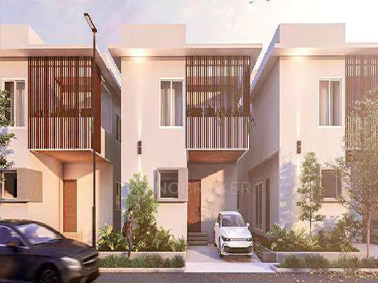
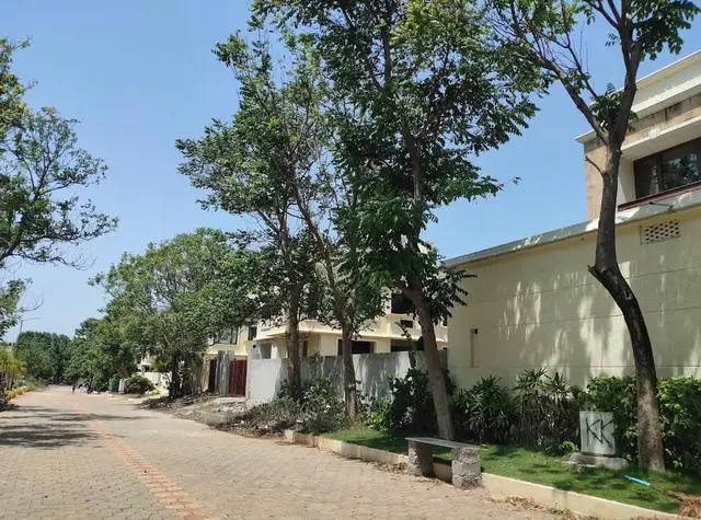
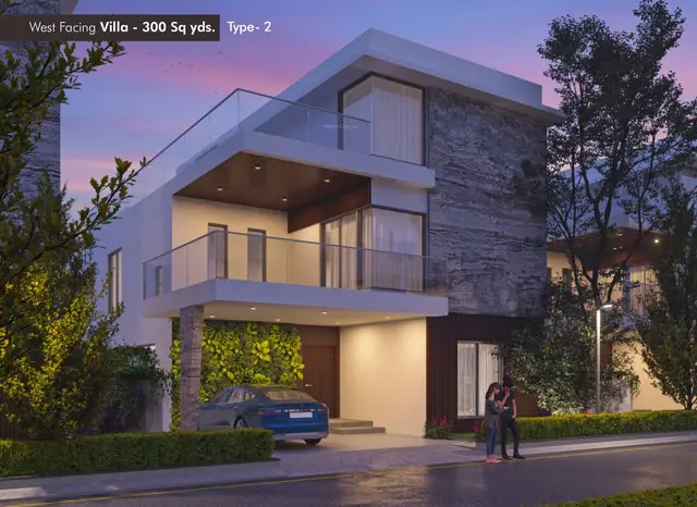
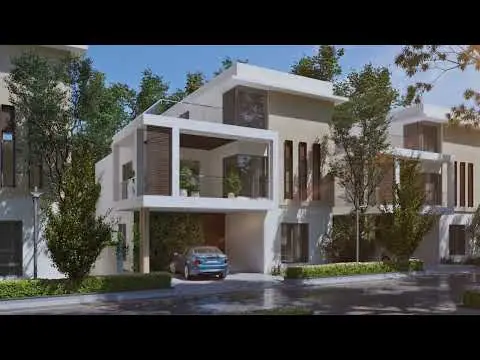
SOM BOULEVARD is a residential villa project in Kondakal, Shankarpalle mandal, Ranga Reddy district. The registered promoter is Ssi-Kc Developers. The project covers 168157.388 sqmts and comprises 267 building units: 266 TRIPLEX VILLA units and one DUPLEX VILLA unit. It is registered under TG-RERA number P02400003701, with proposed completion on 03/01/2028.
📘 Project brochure from the promoter’s website ↗01What we found
Read from TG-RERA filings, approvals, land and registration records and court records. A court case is counted only when the court record states this project's survey number with its village, or names the project.
02Check before you pay
6 items to check before you pay, 4 high - from the title chain, court records and approvals, each with what to ask the builder or your advocate. An item may not be a problem with the project: records can be incomplete.
Project at a glance
Project identity
| Item | Project record |
|---|---|
| Registered name | SOM BOULEVARD RERA record |
| Project type | Residential villa project; the HMDA document describes a residential gated-community draft layout. RERA record |
| Phase / registered portion | No separate phase name or phase identifier is disclosed. Registration is for the project under P02400003701. RERA record |
| TG-RERA registration | P02400003701, granted under section 5; certificate issued 03/12/2021. RERA record |
| Registration validity | 03/12/2021–03/09/2027, unless extended by the Authority. The supplied certificate records no extension. This is the registration-validity period, not the project completion deadline. |
| Registered promoter | Ssi-Kc Developers (also written in the project filing as SSI-KC DEVELOPERS). RERA record |
| RERA status in supplied record | New Project; registration certificate on file. RERA record |
Land and geographic identity
| Item | Project record |
|---|---|
| Locality / revenue village | Kondakal; the supplied project records identify the revenue village as Kondakal. RERA record RERA filing |
| Mandal / district / PIN | Shankarpalle / Ranga Reddy / 501203. RERA record |
| Project survey numbers | 397, 398, 399, 400, 401, 402, 403 and 404; the RERA registration record also states “397 TO 404.” No project-specific subdivision numbers are disclosed in the registration identity. RERA record RERA filing |
| Site extent | RERA land details state 168157.388 sqmts total area, 19027.411 sqmts affected by road widening/FTL/nala widening, and 149129.98 sqmts net area. The HMDA permit and Gram Panchayat letter state 168157.388 Sq.Mtrs or Ac. 41.55. RERA filing |
| Boundaries (as filed) | North: part of Survey Nos. 403, 404 and 407; South: part of Survey Nos. 397 and 401; East: part of Survey Nos. 401 and 402; West: part of Survey No. 398. RERA filing |
Development identity
| Item | Project record |
|---|---|
| Sanctioning authority / principal approval | Hyderabad Metropolitan Development Authority (HMDA); Draft Layout Permit 18/LO/Plg/HMDA/2021, approved 03-09-2021. The associated Gram Panchayat release letter is GP/30/2021-22, dated 20.10.2021. Approvals record |
| Approved built-up area | 124826.11 sqmts in the project filing. RERA filing |
| Buildings / blocks | The RERA filing lists 267 total building units and names the units as villas. It does not provide a separately verified building/block arrangement. RERA filing RERA unit table |
| Floor configuration / height | No sanctioned floor-by-floor configuration or height is established by the supplied approval extracts. Document index |
| Parking levels / count | No project-wide sanctioned parking count, parking-level plan or RERA-filed unit allocation is established in the supplied records. Document index |
| Approved versus filed units | The RERA land record states 267 total building units as per approved plan and 267 proposed building units as per agreement. The filed unit schedule lists 267 units. RERA filing RERA unit table |
Offering and status
| Item | Project record |
|---|---|
| RERA-filed configurations | TRIPLEX VILLA: 266 units; DUPLEX VILLA: 1 unit. RERA unit table RERA unit details |
| RERA-filed saleable area | Triplex Villa: 2528.39 sq.m per unit; Duplex Villa: 5200.0 sq.m per unit. These are the filing’s saleable-area figures, not carpet-area measurements. RERA unit table RERA unit details |
| Booked / available | Triplex Villa: 147 booked / 119 available; Duplex Villa: 1 booked / 0 available; total: 148 booked / 119 available. Counts are from the TG-RERA portal record, with no as-of date supplied; treat them as indicative. RERA unit table |
| Declared completion dates | The Form-B undertaking states completion by 03.09.2027; the project header states proposed completion 03/01/2028. RERA record |
| Construction stage | TG-RERA progress fields report infrastructure and community-building progress; these are portal-declared percentages, not independent site verification. See “Developer & development status.” RERA amenities |
| Occupancy / completion certificate | No occupancy certificate or completion certificate is supplied for the project or any phase/tower. Document index |
The project story
SOM BOULEVARD is registered as a residential villa development on land in Kondakal village, Shankarpalle mandal, Ranga Reddy district. Its RERA filing describes 267 homes, with the unit schedule comprising 266 “TRIPLEX VILLA” units and one “DUPLEX VILLA.” The HMDA permit describes a residential gated-community draft layout and sets out development conditions and infrastructure provisions. RERA record RERA unit table
The project’s main approval in the supplied record is HMDA Draft Layout Permit 18/LO/Plg/HMDA/2021, dated 03-09-2021, followed by a Kondakal Gram Panchayat release letter dated 20.10.2021. The records identify the land as Survey Nos. 397–404. They do not establish a completed project or an issued occupancy/completion certificate. Document index
The portal progress entries indicate differing reported stages across infrastructure and community facilities, rather than a single overall completion figure. Those entries are filed progress declarations; the supplied material does not independently verify construction at the site. RERA amenities
Master plan, architecture & building design
The RERA land record gives a total site area of 168157.388 sqmts, an affected area of 19027.411 sqmts, and a net area of 149129.98 sqmts. It records approved built-up area of 124826.11 sqmts and 267 total building units as per the approved plan. RERA filing RERA filing
The HMDA Draft Layout Permit describes a residential gated-community layout, gives road widths of 18 mts and above and 40'-0", and records a mortgage over 15 specified plots. It requires the applicant to complete development works within SIX (6) YEARS and to develop amenities before release of the final layout. The supplied material does not include readable sanctioned architectural drawings sufficient to establish villa footprints, sanctioned floor configuration, height, internal circulation, or the arrangement of individual buildings.
No sanctioned floor-by-floor configuration, parking-level plan, or verified count of parking spaces is available in the supplied evidence. The portal lists an “AMENITIES CELLAR GROUND AND TWO UPPER FLOORS” item but reports 0% progress; this entry alone does not establish a sanctioned building configuration. RERA amenities
Homes, configurations & floor plans
The TG-RERA unit schedule lists the following configurations and saleable areas. The portal booking counts have no supplied as-of date and are indicative. RERA unit table RERA unit details
| Configuration | Units | Booked | Available | RERA saleable area | Measured carpet area | Loading (if supplied) |
|---|---|---|---|---|---|---|
| TRIPLEX VILLA | 266 | 147 | 119 | 2528.39 sq.m per unit | Not measured from drawings | Not supplied |
| DUPLEX VILLA | 1 | 1 | 0 | 5200.0 sq.m per unit | Not measured from drawings | Not supplied |
The supplied floor-plan record contains 48 drawings, all 48 marked as scans pending; none has been software-measured. Accordingly, no drawing-based carpet area, room dimensions or floor-plan comparison can be reported. Saleable area is the TG-RERA-filed measure; it should not be treated as carpet area. Floor plans RERA unit details
The project’s Form-B declaration identifies the development basis as Development Agreement-cum-General Power of Attorney 6717/2021 and names the land owners in the filing. The supplied blank sale-agreement and allotment-letter templates do not establish the details of any particular villa sale.
Parking & vehicle circulation
The supplied project records do not establish a sanctioned project-wide number of car or two-wheeler spaces, visitor or accessible parking, parking levels, ramp arrangement, or unit-specific parking allocations. A RERA-filed unit is identified as mortgaged in the project unit schedule, but that does not provide an individual buyer’s parking entitlement. RERA unit table Document index
The HMDA permit identifies internal road-width requirements of 18 mts and above and 40'-0". The permit’s listed widths do not, by themselves, establish the detailed driveway, pedestrian-separation, entry/exit or parking layout.
Amenities, recreation & open spaces
The TG-RERA progress record lists community and site facilities with declared progress percentages. These are portal entries; they are not independent verification of completion. RERA amenities
| Facility | Description / size | Evidence source | Declared progress / verified status |
|---|---|---|---|
| Internal Roads & Footpaths | No area or length supplied | TG-RERA progress record | 60% declared; not independently verified |
| Water Supply | No source, storage capacity or treatment capacity supplied here | TG-RERA progress record | 75% declared; not independently verified |
| Sewerage (Chamber, Lines, Septic Tank, STP) | No capacity supplied | TG-RERA progress record | 75% declared; not independently verified |
| Storm Water Drains | No length or capacity supplied | TG-RERA progress record | 75% declared; not independently verified |
| Green Strip/TOT LOT/Park | No area supplied | TG-RERA progress record | 75% declared; not independently verified |
| Street Lighting | No quantity supplied | TG-RERA progress record | 25% declared; not independently verified |
| Community Buildings | No size or capacity supplied | TG-RERA progress record | 90% declared; not independently verified |
| Treatment and disposal of sewage and sullage water | No capacity supplied | TG-RERA progress record | 55% declared; not independently verified |
| Solid waste management and disposal | No capacity or system detail supplied | TG-RERA progress record | 55% declared; not independently verified |
| Water conservation / rainwater harvesting | No number or capacity supplied | TG-RERA progress record | 55% declared; not independently verified |
| Energy management | No system or capacity supplied | TG-RERA progress record | 20% declared; not independently verified |
| Fire protection and fire safety requirements | No systems or clearance details supplied | TG-RERA progress record | 0% declared; not independently verified |
| Electrical meter room, sub-station, receiving station | No capacity supplied | TG-RERA progress record | 65% declared; not independently verified |
| Aggregate recreational open space | Area not supplied | TG-RERA progress record | 55% declared; not independently verified |
| “AMENITIES CELLAR GROUND AND TWO UPPER FLOORS” | No size or facility schedule supplied | TG-RERA progress record | 0% declared; not independently verified |
The HMDA permit lists a common septic tank / STP, internal water-supply pipelines and overhead tank, transformer, avenue plantation, park development and rainwater-harvesting pits as development provisions. The permit records these as required/proposed works; the supplied material does not verify their completion.
Utilities, building services & safety
The HMDA permit lists internal water-supply pipelines and an overhead tank, common septic tank / STP, transformer and rainwater-harvesting pits. The RERA progress record separately reports water supply at 75%, sewerage at 75%, sewage and sullage treatment/disposal at 55%, water conservation/rainwater harvesting at 55%, and electrical meter room/sub-station/receiving station at 65%. These are reported progress figures; capacities, commissioning and independent completion verification are not supplied. RERA amenities
The TG-RERA record reports fire protection and fire-safety requirements at 0%. The supplied evidence does not detail fire systems, escape routes, fire access, clearances, lifts, backup power, waste segregation, access control, CCTV or accessibility provisions. RERA amenities Document index
Location, access & connectivity
The registered project location is Kondakal, Shankarpalle mandal, Ranga Reddy district, PIN 501203. The supplied cadastral record gives a parcel-centroid coordinate of 17.447754411601107, 78.19477459807536; this is a software/cadastral location reference, not a site-surveyed entrance coordinate. RERA record Cadastral map Location record
The nearest sampled Outer Ring Road interchange is listed at 11.5 km (approx.). No other independently measured road, public-transport or landmark distances are supplied in the location record. Location record
Developer & development status
The registered promoter is SSI-KC DEVELOPERS, described in the filing as an “Others” organization and as an AOP - JOINT VENTURE. Its GSTIN is 36ABNAS5084P1ZH. The legal-entity type beyond the filing’s description is not independently established in the supplied material. RERA record RERA filing Corporate record
The registration certificate gives the promoter office as Village: Madhapur, Mandal: Serilingampally, District: Ranga Reddy, Pin: 500081. A project filing separately lists an address at Flat No 201, Plot No 901, Sy No. 11/1, DSR Tranquil, Ayyappa Society Main Road, Kondakal. No official project contact details are supplied. RERA filing
The Form-B declaration by authorized signatory M. Rohan, dated 01-11-2021, undertakes completion by 03.09.2027. The project header gives proposed completion as 03/01/2028. Neither date is an occupancy certificate; no OC or completion certificate is supplied. RERA record Document index
Approvals, official records & documents
| Record | Supplied evidence |
|---|---|
| TG-RERA registration | Form “C” certificate for SOM BOULEVARD, registration P02400003701, issued 03/12/2021, valid to 03/09/2027 unless extended. |
| Principal layout approval | HMDA Draft Layout Permit 18/LO/Plg/HMDA/2021, dated 03-09-2021, for the residential gated-community layout in Survey Nos. 397–404. |
| Gram Panchayat record | Kondakal Gram Panchayat letter GP/30/2021-22, dated 20.10.2021, releasing draft-layout GP approvals and referring to the HMDA layout permit. |
| Promoter declaration | Form-B affidavit-cum-declaration by M. Rohan as authorized signatory for SSI-KC DEVELOPERS, dated 01-11-2021; identifies the development agreement-cum-GPA as the project basis and includes the completion undertaking. |
| Approved layout / building drawings | The supplied record identifies the HMDA permit, but the material provided here does not include readable sanctioned drawings adequate to describe individual villa plans, floor configurations or parking plans. Document index |
| Commencement and occupancy/completion certificates | The filed records are titled as commencement-certificate items, but the supplied extracts describe the HMDA draft layout permit and Gram Panchayat release letter. No occupancy or completion certificate is supplied. Document index |
| Project-account details | The registration certificate requires 70% of amounts realized to be deposited in a separate scheduled-bank account. The project record lists Union Bank of India, Jubilee Hills, with account number masked as \*0025. Parties record |
The HMDA permit also records mortgage deed 5351 of 2021, dated 23-08-2021, over Plot Nos. 3, 10, 51, 76, 198, 199, 205, 206, 207, 210, 239, 240, 244, 245 and 249, measuring 7106.11Sq.Mtrs, in favour of the Metropolitan Commissioner, HMDA.
Project at a glance
Project identity
Registered name: SOM BOULEVARD
Project type: Residential villa project; the HMDA document describes a residential gated-community draft layout.
Phase / registered portion: No separate phase name or phase identifier is disclosed. Registration is for the project under P02400003701.
TG-RERA registration: P02400003701, granted under section 5; certificate issued 03/12/2021.
Registration validity: 03/12/2021–03/09/2027, unless extended by the Authority. The supplied certificate records no extension. This is the registration-validity period, not the project completion deadline.
Registered promoter: Ssi-Kc Developers (also written in the project filing as SSI-KC DEVELOPERS).
RERA status in supplied record: New Project; registration certificate on file.
Land and geographic identity
Locality / revenue village: Kondakal; the supplied project records identify the revenue village as Kondakal.
Mandal / district / PIN: Shankarpalle / Ranga Reddy / 501203.
Project survey numbers: 397, 398, 399, 400, 401, 402, 403 and 404; the RERA registration record also states “397 TO 404.” No project-specific subdivision numbers are disclosed in the registration identity.
Site extent: RERA land details state 168157.388 sqmts total area, 19027.411 sqmts affected by road widening/FTL/nala widening, and 149129.98 sqmts net area. The HMDA permit and Gram Panchayat letter state 168157.388 Sq.Mtrs or Ac. 41.55.
Boundaries (as filed): North: part of Survey Nos. 403, 404 and 407; South: part of Survey Nos. 397 and 401; East: part of Survey Nos. 401 and 402; West: part of Survey No. 398.
Development identity
Sanctioning authority / principal approval: Hyderabad Metropolitan Development Authority (HMDA); Draft Layout Permit 18/LO/Plg/HMDA/2021, approved 03-09-2021. The associated Gram Panchayat release letter is GP/30/2021-22, dated 20.10.2021.
Approved built-up area: 124826.11 sqmts in the project filing.
Buildings / blocks: The RERA filing lists 267 total building units and names the units as villas. It does not provide a separately verified building/block arrangement.
Floor configuration / height: No sanctioned floor-by-floor configuration or height is established by the supplied approval extracts.
Parking levels / count: No project-wide sanctioned parking count, parking-level plan or RERA-filed unit allocation is established in the supplied records.
Approved versus filed units: The RERA land record states 267 total building units as per approved plan and 267 proposed building units as per agreement. The filed unit schedule lists 267 units.
Offering and status
RERA-filed configurations: TRIPLEX VILLA: 266 units; DUPLEX VILLA: 1 unit.
RERA-filed saleable area: Triplex Villa: 2528.39 sq.m per unit; Duplex Villa: 5200.0 sq.m per unit. These are the filing’s saleable-area figures, not carpet-area measurements.
Booked / available: Triplex Villa: 147 booked / 119 available; Duplex Villa: 1 booked / 0 available; total: 148 booked / 119 available. Counts are from the TG-RERA portal record, with no as-of date supplied; treat them as indicative.
Declared completion dates: The Form-B undertaking states completion by 03.09.2027; the project header states proposed completion 03/01/2028.
Construction stage: TG-RERA progress fields report infrastructure and community-building progress; these are portal-declared percentages, not independent site verification. See “Developer & development status.”
Occupancy / completion certificate: No occupancy certificate or completion certificate is supplied for the project or any phase/tower.
The project story
SOM BOULEVARD is registered as a residential villa development on land in Kondakal village, Shankarpalle mandal, Ranga Reddy district. Its RERA filing describes 267 homes, with the unit schedule comprising 266 “TRIPLEX VILLA” units and one “DUPLEX VILLA.” The HMDA permit describes a residential gated-community draft layout and sets out development conditions and infrastructure provisions.
The project’s main approval in the supplied record is HMDA Draft Layout Permit 18/LO/Plg/HMDA/2021, dated 03-09-2021, followed by a Kondakal Gram Panchayat release letter dated 20.10.2021. The records identify the land as Survey Nos. 397–404. They do not establish a completed project or an issued occupancy/completion certificate.
The portal progress entries indicate differing reported stages across infrastructure and community facilities, rather than a single overall completion figure. Those entries are filed progress declarations; the supplied material does not independently verify construction at the site.
Master plan, architecture & building design
The RERA land record gives a total site area of 168157.388 sqmts, an affected area of 19027.411 sqmts, and a net area of 149129.98 sqmts. It records approved built-up area of 124826.11 sqmts and 267 total building units as per the approved plan.
The HMDA Draft Layout Permit describes a residential gated-community layout, gives road widths of 18 mts and above and 40'-0", and records a mortgage over 15 specified plots. It requires the applicant to complete development works within SIX (6) YEARS and to develop amenities before release of the final layout. The supplied material does not include readable sanctioned architectural drawings sufficient to establish villa footprints, sanctioned floor configuration, height, internal circulation, or the arrangement of individual buildings.
No sanctioned floor-by-floor configuration, parking-level plan, or verified count of parking spaces is available in the supplied evidence. The portal lists an “AMENITIES CELLAR GROUND AND TWO UPPER FLOORS” item but reports 0% progress; this entry alone does not establish a sanctioned building configuration.
Homes, configurations & floor plans
The TG-RERA unit schedule lists the following configurations and saleable areas. The portal booking counts have no supplied as-of date and are indicative.
| Configuration | Units | Booked | Available | RERA saleable area | Measured carpet area | Loading (if supplied) |
|---|---|---|---|---|---|---|
| TRIPLEX VILLA | 266 | 147 | 119 | 2528.39 sq.m per unit | Not measured from drawings | Not supplied |
| DUPLEX VILLA | 1 | 1 | 0 | 5200.0 sq.m per unit | Not measured from drawings | Not supplied |
The supplied floor-plan record contains 48 drawings, all 48 marked as scans pending; none has been software-measured. Accordingly, no drawing-based carpet area, room dimensions or floor-plan comparison can be reported. Saleable area is the TG-RERA-filed measure; it should not be treated as carpet area.
The project’s Form-B declaration identifies the development basis as Development Agreement-cum-General Power of Attorney 6717/2021 and names the land owners in the filing. The supplied blank sale-agreement and allotment-letter templates do not establish the details of any particular villa sale.
Parking & vehicle circulation
The supplied project records do not establish a sanctioned project-wide number of car or two-wheeler spaces, visitor or accessible parking, parking levels, ramp arrangement, or unit-specific parking allocations. A RERA-filed unit is identified as mortgaged in the project unit schedule, but that does not provide an individual buyer’s parking entitlement.
The HMDA permit identifies internal road-width requirements of 18 mts and above and 40'-0". The permit’s listed widths do not, by themselves, establish the detailed driveway, pedestrian-separation, entry/exit or parking layout.
Amenities, recreation & open spaces
The TG-RERA progress record lists community and site facilities with declared progress percentages. These are portal entries; they are not independent verification of completion.
| Facility | Description / size | Evidence source | Declared progress / verified status |
|---|---|---|---|
| Internal Roads & Footpaths | No area or length supplied | TG-RERA progress record | 60% declared; not independently verified |
| Water Supply | No source, storage capacity or treatment capacity supplied here | TG-RERA progress record | 75% declared; not independently verified |
| Sewerage (Chamber, Lines, Septic Tank, STP) | No capacity supplied | TG-RERA progress record | 75% declared; not independently verified |
| Storm Water Drains | No length or capacity supplied | TG-RERA progress record | 75% declared; not independently verified |
| Green Strip/TOT LOT/Park | No area supplied | TG-RERA progress record | 75% declared; not independently verified |
| Street Lighting | No quantity supplied | TG-RERA progress record | 25% declared; not independently verified |
| Community Buildings | No size or capacity supplied | TG-RERA progress record | 90% declared; not independently verified |
| Treatment and disposal of sewage and sullage water | No capacity supplied | TG-RERA progress record | 55% declared; not independently verified |
| Solid waste management and disposal | No capacity or system detail supplied | TG-RERA progress record | 55% declared; not independently verified |
| Water conservation / rainwater harvesting | No number or capacity supplied | TG-RERA progress record | 55% declared; not independently verified |
| Energy management | No system or capacity supplied | TG-RERA progress record | 20% declared; not independently verified |
| Fire protection and fire safety requirements | No systems or clearance details supplied | TG-RERA progress record | 0% declared; not independently verified |
| Electrical meter room, sub-station, receiving station | No capacity supplied | TG-RERA progress record | 65% declared; not independently verified |
| Aggregate recreational open space | Area not supplied | TG-RERA progress record | 55% declared; not independently verified |
| “AMENITIES CELLAR GROUND AND TWO UPPER FLOORS” | No size or facility schedule supplied | TG-RERA progress record | 0% declared; not independently verified |
The HMDA permit lists a common septic tank / STP, internal water-supply pipelines and overhead tank, transformer, avenue plantation, park development and rainwater-harvesting pits as development provisions. The permit records these as required/proposed works; the supplied material does not verify their completion.
Utilities, building services & safety
The HMDA permit lists internal water-supply pipelines and an overhead tank, common septic tank / STP, transformer and rainwater-harvesting pits. The RERA progress record separately reports water supply at 75%, sewerage at 75%, sewage and sullage treatment/disposal at 55%, water conservation/rainwater harvesting at 55%, and electrical meter room/sub-station/receiving station at 65%. These are reported progress figures; capacities, commissioning and independent completion verification are not supplied.
The TG-RERA record reports fire protection and fire-safety requirements at 0%. The supplied evidence does not detail fire systems, escape routes, fire access, clearances, lifts, backup power, waste segregation, access control, CCTV or accessibility provisions.
Location, access & connectivity
The registered project location is Kondakal, Shankarpalle mandal, Ranga Reddy district, PIN 501203. The supplied cadastral record gives a parcel-centroid coordinate of 17.447754411601107, 78.19477459807536; this is a software/cadastral location reference, not a site-surveyed entrance coordinate.
The nearest sampled Outer Ring Road interchange is listed at 11.5 km (approx.). No other independently measured road, public-transport or landmark distances are supplied in the location record.
Developer & development status
The registered promoter is SSI-KC DEVELOPERS, described in the filing as an “Others” organization and as an AOP - JOINT VENTURE. Its GSTIN is 36ABNAS5084P1ZH. The legal-entity type beyond the filing’s description is not independently established in the supplied material.
The registration certificate gives the promoter office as Village: Madhapur, Mandal: Serilingampally, District: Ranga Reddy, Pin: 500081. A project filing separately lists an address at Flat No 201, Plot No 901, Sy No. 11/1, DSR Tranquil, Ayyappa Society Main Road, Kondakal. No official project contact details are supplied.
The Form-B declaration by authorized signatory M. Rohan, dated 01-11-2021, undertakes completion by 03.09.2027. The project header gives proposed completion as 03/01/2028. Neither date is an occupancy certificate; no OC or completion certificate is supplied.
Approvals, official records & documents
TG-RERA registration: Form “C” certificate for SOM BOULEVARD, registration P02400003701, issued 03/12/2021, valid to 03/09/2027 unless extended.
Principal layout approval: HMDA Draft Layout Permit 18/LO/Plg/HMDA/2021, dated 03-09-2021, for the residential gated-community layout in Survey Nos. 397–404.
Gram Panchayat record: Kondakal Gram Panchayat letter GP/30/2021-22, dated 20.10.2021, releasing draft-layout GP approvals and referring to the HMDA layout permit.
Promoter declaration: Form-B affidavit-cum-declaration by M. Rohan as authorized signatory for SSI-KC DEVELOPERS, dated 01-11-2021; identifies the development agreement-cum-GPA as the project basis and includes the completion undertaking.
Approved layout / building drawings: The supplied record identifies the HMDA permit, but the material provided here does not include readable sanctioned drawings adequate to describe individual villa plans, floor configurations or parking plans.
Commencement and occupancy/completion certificates: The filed records are titled as commencement-certificate items, but the supplied extracts describe the HMDA draft layout permit and Gram Panchayat release letter. No occupancy or completion certificate is supplied.
Project-account details: The registration certificate requires 70% of amounts realized to be deposited in a separate scheduled-bank account. The project record lists Union Bank of India, Jubilee Hills, with account number masked as \*0025.
The HMDA permit also records mortgage deed 5351 of 2021, dated 23-08-2021, over Plot Nos. 3, 10, 51, 76, 198, 199, 205, 206, 207, 210, 239, 240, 244, 245 and 249, measuring 7106.11Sq.Mtrs, in favour of the Metropolitan Commissioner, HMDA.
Frequently asked questions
Is SOM BOULEVARD registered with Telangana RERA?
Yes. SOM BOULEVARD is registered with the Telangana Real Estate Regulatory Authority as P02400003701; the registration status is New Project.
Who is the developer of SOM BOULEVARD?
The promoter named in the RERA registration is SSI-KC DEVELOPERS.
Where is SOM BOULEVARD located?
SOM BOULEVARD is in Kondakal, Shankarpalle, Rangareddy, Telangana (501203).
When will SOM BOULEVARD be completed?
The promoter's proposed date of completion filed with RERA is 03/01/2028. This is the promoter's declaration, not a guarantee.
More projects in Kondakal