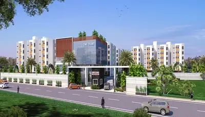
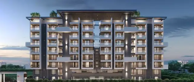
Bhagavati Green Meadows
Bhagavati Infrastructures · Medchal-Malkajgiri · RERA P02200000104
Bhagavati Green Meadows is a residential plotted development in KANDLAKOI, Medchal Mandal, Medchal-Malkajgiri district, developed by registered promoter Bhagavati Infrastructures. The layout covers 38,024.16 sq. m and depicts 116 residential plots, with plot areas ranging from 139.63–1,001.68 sq. m. It is registered under TG-RERA P02200000104, with a proposed completion date of 21/04/2020.
More from Bhagavati Infrastructures · 3 projects →
01What we found
Read from TG-RERA filings, approvals, land and registration records and court records. A court case is counted only when the court record states this project's survey number with its village, or names the project.
02Check before you pay
11 items to check before you pay, 4 high - from the title chain, court records and approvals, each with what to ask the builder or your advocate. An item may not be a problem with the project: records can be incomplete.
1. Project at a glance
Project identity
| Field | Project record |
|---|---|
| Registered name | Bhagavati Green Meadows RERA record |
| Project type | Plotted development / residential open-plot layout RERA record RERA filing |
| Phase / registered portion | No separate phase designation is disclosed; the registration is for the project. RERA record |
| TG-RERA registration | P02200000104 RERA record |
| Registration validity | 31/12/2018 to 21/04/2020; the certificate says validity may be extended by the Authority. No extension is recorded in the supplied certificate. This is registration validity, not an occupancy certificate or proof of present completion. RERA record |
| Registered promoter | Bhagavati Infrastructures RERA record RERA filing |
| RERA status in supplied record | Registration certificate issued; current registration status is not separately stated in the supplied evidence. |
Land and geographic identity
| Field | Project record |
|---|---|
| Locality | KANDLAKOI RERA filing |
| Revenue village | Kandlakoi RERA record Land records |
| Mandal / district / PIN | Medchal / Medchal-Malkajgiri / 501401 RERA record |
| Project survey numbers and subdivisions | 196 Past (also printed as 196 PART), 199/A, 200/A, 201/A, 201/C, 202 RERA record Land records |
| Site area | 38,024.16 sq. m; the layout plan states both total and net layout area as 38,024.16 sq. m. Land records Layout record |
| Boundaries recorded in the RERA project data | North: neighboring land in Sy. Nos. 193 and 194; South: land of Sachdev Sports; East: neighboring land in Sy. No. 203; West: 100-feet-wide road. Land records |
| Area measurement | The approved layout drawing’s area statement is the source for the 38,024.16 sq. m layout figure. Layout record |
Development identity
| Field | Project record |
|---|---|
| Sanctioning authority | Hyderabad Metropolitan Development Authority (HMDA) Approvals record |
| Principal final-layout approval | HMDA Permit No. 000190/LO/Plg/HMDA/2018, dated 26.11.2019 Approvals record |
| Earlier draft-layout record | HMDA draft-layout record No. 000190/LO/Pig/HMDA/2018, dated 14 September 2018 Approvals record |
| Development form | Residential layout of open plots; the supplied approvals do not describe apartment towers or dwelling-building construction. |
| Approved built-up area / buildings and floors | Not disclosed as a project building schedule in the supplied evidence; individual residential building permissions are addressed separately under the final-layout conditions. |
| Approved layout plot count | 116 plots, as read from the approved layout drawing. Layout record |
| Plot-area range and distribution | Software-measured from the approved drawing: 139.63–1,001.68 sq. m; 116 plot areas were read, and the sum matches the drawing’s plotted-area statement. Layout record |
| HMDA-mortgaged plots shown in the RERA project data | Plots 43–51, nine plots, area 3,407.31 sq. m; the evidence describes this as an approval-related mortgage for completion of layout works. Layout record Land records |
| Other mortgage details in draft-plan record | The draft-plan extraction also lists plots 103–107, 110 and 111 (seven plots), stated as 1,271.17 sq. m. |
Offering and status
| Field | Project record |
|---|---|
| Offering | Residential plots; unit-by-unit prices, saleable areas, bookings and availability are not supplied. RERA filing Layout record |
| Original promoter-declared completion undertaking | On or before 10-04-2020 in the Form B declaration dated 24 December 2018. |
| RERA-recorded proposed completion date | 21/04/2020. RERA record RERA filing |
| Construction / development stage | The supplied materials do not provide a current, independently verified site-progress assessment. Document index RERA amenities |
| Occupancy / completion certificate | No occupancy or completion certificate is included in the supplied evidence; this is a plotted layout, and no phase- or plot-specific building OC status is provided. Document index |
| Layout infrastructure status | The RERA amenity record marks internal roads and footpaths, water supply, sewerage, green strip/park, street lighting, rainwater harvesting and recreational open space at 100%; these are recorded percentages, not an independent site inspection. RERA amenities |
2. The project story
Bhagavati Green Meadows is registered as a residential plotted development in Kandlakoi village, Medchal Mandal, Medchal-Malkajgiri district. The approved layout covers 38,024.16 sq. m across the stated survey parcels and depicts 116 residential plots, an internal road network, open space and utility land. It is a land-layout project, not a tower or apartment scheme in the supplied approvals. RERA record Land records Layout record
HMDA’s final-layout letter records approval under Permit No. 000190/LO/Plg/HMDA/2018, subject to conditions. It states that roads and open spaces were taken over by the local authority under registered gift deed 12813/2019 dated 29.08.2019, and refers to relinquishment deed 16336/2019 dated 13/11/2019 concerning mortgaged plots. The final-layout conditions also provide for residential use of building sites and separate consideration of individual building permissions.
The RERA record includes a 100% entry for several layout infrastructure items, but the supplied evidence does not establish their present on-site condition through an independent inspection. Nor does it establish current plot-by-plot construction, sales, possession or occupancy status. RERA amenities Document index
3. Master plan, architecture & building design
The approved drawing describes a residential open-plot layout on 38,024.16 sq. m. Its land-use statement allocates 22,620.74 sq. m to plots, 11,347.70 sq. m to roads, 3,101.35 sq. m to organized open space/park, and 954.36 sq. m to utility area. These are layout-area categories, not building or apartment areas. Layout record
The software-read drawing inventory contains 116 plots. Reported plot sizes range from 139.63 sq. m to 1,001.68 sq. m, with a median of 153.01 sq. m. The drawing-derived count and measurements are software-measured and should be checked against the stamped plan before relying on a particular plot’s dimensions. Layout record
The supplied plan records road widths of 30.00 and 12.19m [40'-0"]. It identifies utility features including transformer, overhead tank and septic tank; the final-layout letter also refers to water supply, sewerage and drainage disposal systems, street lighting and rainwater-harvesting structure. No residential building count, floor configuration, building footprint, apartment mix or phase-wise tower arrangement is evidenced in the supplied project documents.
The RERA project data states 3,407.31 sq. m as mortgage area, corresponding to plots 43–51 in the supplied layout data. The draft-plan material also refers to a separate group of mortgaged plots (103–107, 110 and 111); the approvals and conditions for the layout are indexed in section 10. Land records Layout record
4. Homes, configurations & floor plans
This project is a plotted layout. The supplied RERA data does not include plot-wise RERA saleable area, booking status or available inventory, so the apartment configuration table is not applicable. RERA record RERA filing
| Plot information | Supplied evidence |
|---|---|
| Layout plot count | 116; software-read from the approved layout drawing. Layout record |
| Plot-size range | 139.63–1,001.68 sq. m; software-measured from the drawing. Layout record |
| Median plot size | 153.01 sq. m; software-measured from the drawing. Layout record |
| RERA plot-wise saleable area / booked / available | Not supplied. RERA filing |
| Floor plans / measured carpet area | No dwelling floor plans or software-measured carpet areas are available; the supplied drawing set is layout-sheet material. Floor plans |
Plot area is the area shown for a plot in the layout drawing; it is not an apartment carpet or saleable-area measure. The evidence does not provide plot-specific dimensions, orientation, booking status or allocation to an individual buyer. Layout record
5. Parking & vehicle circulation
The layout plan records roads and internal access, including the road widths 30.00 and 12.19m [40'-0"]. The final-layout conditions require roads to remain open for public access and prohibit a compound wall that would obstruct access to neighboring lands.
No project-level parking count, dedicated resident or visitor parking schedule, accessible parking provision, parking structure, EV charging provision, or plot-specific parking allocation is established in the supplied evidence. A separate building permission may address parking for a house constructed on an individual plot; no such individual permission is included here.
6. Amenities, recreation & open spaces
Landscape / open space
| Description / size | 3,101.35 sq. m in the layout land-use statement. Layout record |
|---|---|
| Evidence source | Approved layout drawing. |
| Declared progress / verified status | RERA amenity record marks green strip/park and aggregate recreational open space at 100%; not independently site-verified. RERA amenities |
| Description / size | Listed among the draft-layout infrastructure items. |
|---|---|
| Evidence source | Draft-layout record. |
| Declared progress / verified status | Proposed/required in the supplied approval material; current completion is not independently established. |
| Description / size | Road area 11,347.70 sq. m in the layout land-use statement. Layout record |
|---|---|
| Evidence source | Approved layout drawing. |
| Declared progress / verified status | RERA amenity record marks internal roads and footpaths at 100%; not independently site-verified. RERA amenities |
Convenience / community and layout support
| Description / size | 954.36 sq. m in the layout land-use statement. Layout record |
|---|---|
| Evidence source | Approved layout drawing. |
| Declared progress / verified status | Shown in the layout; current condition not independently verified. |
| Description / size | No area or facility is shown in the supplied RERA amenity record; the record gives 0%. RERA amenities |
|---|---|
| Evidence source | RERA amenity record. RERA amenities |
| Declared progress / verified status | Not shown as provided in that record. |
| Description / size | The drawing-derived layout data records 954.36 sq. m as social infrastructure; the approved layout extraction labels the same stated area as utility area. Layout record |
|---|---|
| Evidence source | Drawing extraction. |
| Declared progress / verified status | The supplied evidence does not establish a completed community building or specify a particular facility. |
No clubhouse, swimming pool, gym or children’s play area is established as an approved or delivered facility in the RERA-filed layout evidence. RERA amenities Document index
7. Utilities, building services & safety
The final-layout letter states that the layout has been provided with water supply, sewerage and drainage-disposal systems, street lighting and a rainwater-harvesting structure. The drawing extraction identifies utility features including transformer, overhead tank, septic tank, water and drainage pipe lines, electrical poles and panel board. The draft-layout record also lists storm-water drains, underground drainage lines, common septic tank/STP, internal water-supply pipes, street lights, avenue planting and rainwater-harvesting pits. These are approval/drawing descriptions; the supplied evidence does not independently verify current operation or capacity.
The RERA amenity record marks water supply, sewerage (chambers, lines, septic tank, STP), street lighting and rainwater harvesting at 100%. It records 0% for storm-water drains, treatment and disposal of sewage and sullage water, solid-waste management, energy management, fire protection, and electrical meter room/sub-station/receiving station. Those entries are reported records, not an independent inspection. RERA amenities
No system capacities, water source, treatment specification, backup-power capacity, fire-system design, CCTV/security arrangement, waste-segregation plan or accessibility details are provided in the supplied project-specific approval and RERA records. RERA amenities Document index
8. Location, access & connectivity
The registered project location is KANDLAKOI, Kandlakoi village, Medchal Mandal, Medchal-Malkajgiri district, PIN 501401. The RERA project boundaries identify a 100-feet-wide road on the west; the approved layout drawing also shows internal roads with recorded widths of 30.00 and 12.19m [40'-0"]. RERA record Land records
A location record supplies a geocoded cadastral-parcel centroid at 17.415275719570207, 78.35458902767974 and lists Financial District (Nanakramguda) at 1.2 km. These are the supplied location-record values; no travel time or route measurement is provided. Location record
9. Developer & development status
The registered promoter is Bhagavati Infrastructures, recorded as a partnership in the RERA project data. The project record names Ravikanth Goud Teegala as an authorized signatory; the registration certificate lists the promoter office as Village: Olb Bowenpally, Mandal: Balanagar, District: Medchal-Malkajgiri, PIN: 500011. The project data also supplies an address at Plot no. 14, Shankar Enclave, HAL Colony Road, KANDLAKOI, Medchal, PIN 501401. The evidence does not provide a company registration number or official promoter website/contact details. Corporate record RERA filing
The Form B declaration dated 24 December 2018 states that the promoter undertook to complete the project on or before 10-04-2020. The RERA project header separately records 21/04/2020 as the proposed completion date. The supplied evidence does not establish a later revised completion date or independently verified current construction progress. RERA record
The RERA amenity record contains progress percentages for layout infrastructure, but no site inspection report is supplied. No occupancy or completion certificate is included in the evidence. RERA amenities Document index
10. Approvals, official records & documents
| Identifier / date | P02200000104, issued 31/12/2018; valid through 21/04/2020 as stated in the certificate. |
|---|---|
| What the supplied evidence records | Form C records Bhagavati Green Meadows as registered under section 5 and includes project conditions, including a separate-account requirement. |
| Identifier / date | 000190/LO/Pig/HMDA/2018, dated 14 September 2018. |
|---|---|
| What the supplied evidence records | Draft open-plot layout record for the stated survey parcels, subject to development, access, gift and mortgage conditions. |
| Identifier / date | 000190/LO/Plg/HMDA/2018, dated 26.11.2019; application/file 028242/LT/MED/FLT/U6/HMDA/18092019. |
|---|---|
| What the supplied evidence records | Final-layout letter for the residential open-plot layout, with stated conditions and references to roads/open spaces handed to the local authority and relinquishment concerning mortgaged plots. |
| Identifier / date | HMDA permit 000190/LO/Plg/HMDA/2018. |
|---|---|
| What the supplied evidence records | Drawing-derived layout inventory and land-use figures used in this Overview. |
| Identifier / date | Application/file 028242/LT/MED/FLT/U6/HMDA/18092019; dated 02 November 2019. |
|---|---|
| What the supplied evidence records | Refers to plots 43–51, stated as 3,407.31 sq. m, and a separate 0 sq. yd relinquishment reference. |
| Identifier / date | 24 December 2018. |
|---|---|
| What the supplied evidence records | Promoter declaration including a completion undertaking, title/encumbrance statements and project-fund commitments. |
| Identifier / date | Not supplied. Document index |
|---|---|
| What the supplied evidence records | The available evidence does not establish an occupancy/completion certificate or current certificate status. |
No individual residential building permission, building-floor schedule, or plot-wise occupancy certificate is supplied. The HMDA final-layout letter states that individual building permission is to be considered separately under the applicable building rules.
1. Project at a glance
Project identity
Registered name: Bhagavati Green Meadows
Project type: Plotted development / residential open-plot layout
Phase / registered portion: No separate phase designation is disclosed; the registration is for the project.
TG-RERA registration: P02200000104
Registration validity: 31/12/2018 to 21/04/2020; the certificate says validity may be extended by the Authority. No extension is recorded in the supplied certificate. This is registration validity, not an occupancy certificate or proof of present completion.
Registered promoter: Bhagavati Infrastructures
RERA status in supplied record: Registration certificate issued; current registration status is not separately stated in the supplied evidence.
Land and geographic identity
Locality: KANDLAKOI
Revenue village: Kandlakoi
Mandal / district / PIN: Medchal / Medchal-Malkajgiri / 501401
Project survey numbers and subdivisions: 196 Past (also printed as 196 PART), 199/A, 200/A, 201/A, 201/C, 202
Site area: 38,024.16 sq. m; the layout plan states both total and net layout area as 38,024.16 sq. m.
Boundaries recorded in the RERA project data: North: neighboring land in Sy. Nos. 193 and 194; South: land of Sachdev Sports; East: neighboring land in Sy. No. 203; West: 100-feet-wide road.
Area measurement: The approved layout drawing’s area statement is the source for the 38,024.16 sq. m layout figure.
Development identity
Sanctioning authority: Hyderabad Metropolitan Development Authority (HMDA)
Principal final-layout approval: HMDA Permit No. 000190/LO/Plg/HMDA/2018, dated 26.11.2019
Earlier draft-layout record: HMDA draft-layout record No. 000190/LO/Pig/HMDA/2018, dated 14 September 2018
Development form: Residential layout of open plots; the supplied approvals do not describe apartment towers or dwelling-building construction.
Approved built-up area / buildings and floors: Not disclosed as a project building schedule in the supplied evidence; individual residential building permissions are addressed separately under the final-layout conditions.
Approved layout plot count: 116 plots, as read from the approved layout drawing.
Plot-area range and distribution: Software-measured from the approved drawing: 139.63–1,001.68 sq. m; 116 plot areas were read, and the sum matches the drawing’s plotted-area statement.
HMDA-mortgaged plots shown in the RERA project data: Plots 43–51, nine plots, area 3,407.31 sq. m; the evidence describes this as an approval-related mortgage for completion of layout works.
Other mortgage details in draft-plan record: The draft-plan extraction also lists plots 103–107, 110 and 111 (seven plots), stated as 1,271.17 sq. m.
Offering and status
Offering: Residential plots; unit-by-unit prices, saleable areas, bookings and availability are not supplied.
Original promoter-declared completion undertaking: On or before 10-04-2020 in the Form B declaration dated 24 December 2018.
RERA-recorded proposed completion date: 21/04/2020.
Construction / development stage: The supplied materials do not provide a current, independently verified site-progress assessment.
Occupancy / completion certificate: No occupancy or completion certificate is included in the supplied evidence; this is a plotted layout, and no phase- or plot-specific building OC status is provided.
Layout infrastructure status: The RERA amenity record marks internal roads and footpaths, water supply, sewerage, green strip/park, street lighting, rainwater harvesting and recreational open space at 100%; these are recorded percentages, not an independent site inspection.
2. The project story
Bhagavati Green Meadows is registered as a residential plotted development in Kandlakoi village, Medchal Mandal, Medchal-Malkajgiri district. The approved layout covers 38,024.16 sq. m across the stated survey parcels and depicts 116 residential plots, an internal road network, open space and utility land. It is a land-layout project, not a tower or apartment scheme in the supplied approvals.
HMDA’s final-layout letter records approval under Permit No. 000190/LO/Plg/HMDA/2018, subject to conditions. It states that roads and open spaces were taken over by the local authority under registered gift deed 12813/2019 dated 29.08.2019, and refers to relinquishment deed 16336/2019 dated 13/11/2019 concerning mortgaged plots. The final-layout conditions also provide for residential use of building sites and separate consideration of individual building permissions.
The RERA record includes a 100% entry for several layout infrastructure items, but the supplied evidence does not establish their present on-site condition through an independent inspection. Nor does it establish current plot-by-plot construction, sales, possession or occupancy status.
3. Master plan, architecture & building design
The approved drawing describes a residential open-plot layout on 38,024.16 sq. m. Its land-use statement allocates 22,620.74 sq. m to plots, 11,347.70 sq. m to roads, 3,101.35 sq. m to organized open space/park, and 954.36 sq. m to utility area. These are layout-area categories, not building or apartment areas.
The software-read drawing inventory contains 116 plots. Reported plot sizes range from 139.63 sq. m to 1,001.68 sq. m, with a median of 153.01 sq. m. The drawing-derived count and measurements are software-measured and should be checked against the stamped plan before relying on a particular plot’s dimensions.
The supplied plan records road widths of 30.00 and 12.19m [40'-0"]. It identifies utility features including transformer, overhead tank and septic tank; the final-layout letter also refers to water supply, sewerage and drainage disposal systems, street lighting and rainwater-harvesting structure. No residential building count, floor configuration, building footprint, apartment mix or phase-wise tower arrangement is evidenced in the supplied project documents.
The RERA project data states 3,407.31 sq. m as mortgage area, corresponding to plots 43–51 in the supplied layout data. The draft-plan material also refers to a separate group of mortgaged plots (103–107, 110 and 111); the approvals and conditions for the layout are indexed in section 10.
4. Homes, configurations & floor plans
This project is a plotted layout. The supplied RERA data does not include plot-wise RERA saleable area, booking status or available inventory, so the apartment configuration table is not applicable.
Layout plot count: 116; software-read from the approved layout drawing.
Plot-size range: 139.63–1,001.68 sq. m; software-measured from the drawing.
Median plot size: 153.01 sq. m; software-measured from the drawing.
RERA plot-wise saleable area / booked / available: Not supplied.
Floor plans / measured carpet area: No dwelling floor plans or software-measured carpet areas are available; the supplied drawing set is layout-sheet material.
Plot area is the area shown for a plot in the layout drawing; it is not an apartment carpet or saleable-area measure. The evidence does not provide plot-specific dimensions, orientation, booking status or allocation to an individual buyer.
5. Parking & vehicle circulation
The layout plan records roads and internal access, including the road widths 30.00 and 12.19m [40'-0"]. The final-layout conditions require roads to remain open for public access and prohibit a compound wall that would obstruct access to neighboring lands.
No project-level parking count, dedicated resident or visitor parking schedule, accessible parking provision, parking structure, EV charging provision, or plot-specific parking allocation is established in the supplied evidence. A separate building permission may address parking for a house constructed on an individual plot; no such individual permission is included here.
6. Amenities, recreation & open spaces
Landscape / open space
| Description / size | 3,101.35 sq. m in the layout land-use statement. |
|---|---|
| Evidence source | Approved layout drawing. |
| Declared progress / verified status | RERA amenity record marks green strip/park and aggregate recreational open space at 100%; not independently site-verified. |
| Description / size | Listed among the draft-layout infrastructure items. |
|---|---|
| Evidence source | Draft-layout record. |
| Declared progress / verified status | Proposed/required in the supplied approval material; current completion is not independently established. |
| Description / size | Road area 11,347.70 sq. m in the layout land-use statement. |
|---|---|
| Evidence source | Approved layout drawing. |
| Declared progress / verified status | RERA amenity record marks internal roads and footpaths at 100%; not independently site-verified. |
Convenience / community and layout support
| Description / size | 954.36 sq. m in the layout land-use statement. |
|---|---|
| Evidence source | Approved layout drawing. |
| Declared progress / verified status | Shown in the layout; current condition not independently verified. |
| Description / size | No area or facility is shown in the supplied RERA amenity record; the record gives 0%. |
|---|---|
| Evidence source | RERA amenity record. |
| Declared progress / verified status | Not shown as provided in that record. |
| Description / size | The drawing-derived layout data records 954.36 sq. m as social infrastructure; the approved layout extraction labels the same stated area as utility area. |
|---|---|
| Evidence source | Drawing extraction. |
| Declared progress / verified status | The supplied evidence does not establish a completed community building or specify a particular facility. |
No clubhouse, swimming pool, gym or children’s play area is established as an approved or delivered facility in the RERA-filed layout evidence.
7. Utilities, building services & safety
The final-layout letter states that the layout has been provided with water supply, sewerage and drainage-disposal systems, street lighting and a rainwater-harvesting structure. The drawing extraction identifies utility features including transformer, overhead tank, septic tank, water and drainage pipe lines, electrical poles and panel board. The draft-layout record also lists storm-water drains, underground drainage lines, common septic tank/STP, internal water-supply pipes, street lights, avenue planting and rainwater-harvesting pits. These are approval/drawing descriptions; the supplied evidence does not independently verify current operation or capacity.
The RERA amenity record marks water supply, sewerage (chambers, lines, septic tank, STP), street lighting and rainwater harvesting at 100%. It records 0% for storm-water drains, treatment and disposal of sewage and sullage water, solid-waste management, energy management, fire protection, and electrical meter room/sub-station/receiving station. Those entries are reported records, not an independent inspection.
No system capacities, water source, treatment specification, backup-power capacity, fire-system design, CCTV/security arrangement, waste-segregation plan or accessibility details are provided in the supplied project-specific approval and RERA records.
8. Location, access & connectivity
The registered project location is KANDLAKOI, Kandlakoi village, Medchal Mandal, Medchal-Malkajgiri district, PIN 501401. The RERA project boundaries identify a 100-feet-wide road on the west; the approved layout drawing also shows internal roads with recorded widths of 30.00 and 12.19m [40'-0"].
A location record supplies a geocoded cadastral-parcel centroid at 17.415275719570207, 78.35458902767974 and lists Financial District (Nanakramguda) at 1.2 km. These are the supplied location-record values; no travel time or route measurement is provided.
9. Developer & development status
The registered promoter is Bhagavati Infrastructures, recorded as a partnership in the RERA project data. The project record names Ravikanth Goud Teegala as an authorized signatory; the registration certificate lists the promoter office as Village: Olb Bowenpally, Mandal: Balanagar, District: Medchal-Malkajgiri, PIN: 500011. The project data also supplies an address at Plot no. 14, Shankar Enclave, HAL Colony Road, KANDLAKOI, Medchal, PIN 501401. The evidence does not provide a company registration number or official promoter website/contact details.
The Form B declaration dated 24 December 2018 states that the promoter undertook to complete the project on or before 10-04-2020. The RERA project header separately records 21/04/2020 as the proposed completion date. The supplied evidence does not establish a later revised completion date or independently verified current construction progress.
The RERA amenity record contains progress percentages for layout infrastructure, but no site inspection report is supplied. No occupancy or completion certificate is included in the evidence.
10. Approvals, official records & documents
| Identifier / date | P02200000104, issued 31/12/2018; valid through 21/04/2020 as stated in the certificate. |
|---|---|
| What the supplied evidence records | Form C records Bhagavati Green Meadows as registered under section 5 and includes project conditions, including a separate-account requirement. |
| Identifier / date | 000190/LO/Pig/HMDA/2018, dated 14 September 2018. |
|---|---|
| What the supplied evidence records | Draft open-plot layout record for the stated survey parcels, subject to development, access, gift and mortgage conditions. |
| Identifier / date | 000190/LO/Plg/HMDA/2018, dated 26.11.2019; application/file 028242/LT/MED/FLT/U6/HMDA/18092019. |
|---|---|
| What the supplied evidence records | Final-layout letter for the residential open-plot layout, with stated conditions and references to roads/open spaces handed to the local authority and relinquishment concerning mortgaged plots. |
| Identifier / date | HMDA permit 000190/LO/Plg/HMDA/2018. |
|---|---|
| What the supplied evidence records | Drawing-derived layout inventory and land-use figures used in this Overview. |
| Identifier / date | Application/file 028242/LT/MED/FLT/U6/HMDA/18092019; dated 02 November 2019. |
|---|---|
| What the supplied evidence records | Refers to plots 43–51, stated as 3,407.31 sq. m, and a separate 0 sq. yd relinquishment reference. |
| Identifier / date | 24 December 2018. |
|---|---|
| What the supplied evidence records | Promoter declaration including a completion undertaking, title/encumbrance statements and project-fund commitments. |
| Identifier / date | Not supplied. |
|---|---|
| What the supplied evidence records | The available evidence does not establish an occupancy/completion certificate or current certificate status. |
No individual residential building permission, building-floor schedule, or plot-wise occupancy certificate is supplied. The HMDA final-layout letter states that individual building permission is to be considered separately under the applicable building rules.
Frequently asked questions
Is Bhagavati Green Meadows registered with Telangana RERA?
Yes. Bhagavati Green Meadows is registered with the Telangana Real Estate Regulatory Authority as P02200000104; the registration status is New Project.
Who is the developer of Bhagavati Green Meadows?
The promoter named in the RERA registration is Bhagavati Infrastructures.
Where is Bhagavati Green Meadows located?
Bhagavati Green Meadows is in KANDLAKOI, Medchal, Medchal-Malkajgiri, Telangana (501401).
When will Bhagavati Green Meadows be completed?
The promoter's proposed date of completion filed with RERA is 21/04/2020. This is the promoter's declaration, not a guarantee.
More projects in Kandlakoi