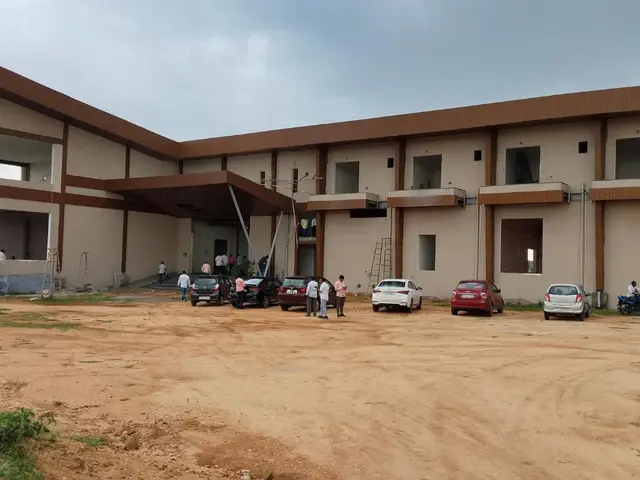
JBs NATURE VALLEY PHASE-4
MG & JP INFRA PROJECTS · Nalgonda · RERA P01800004114
JBs NATURE VALLEY PHASE-4 is a plotted development at Gundrampally Gram Panchayat, Chityal Mandal, Nalgonda District, developed by registered promoter MG & JP INFRA PROJECTS. The registered land area is 354047.32 sq. m., and the approved layout comprises 729 plots; towers, floors and plot configurations are not disclosed in the supplied record. The project is registered under TG-RERA registration number P01800004114. The promoter’s proposed completion date is 08-06-2023.
More from Mg & Jp Infra Projects · 2 projects →
01What we found
Read from TG-RERA filings, approvals, land and registration records and court records. A court case is counted only when the court record states this project's survey number with its village, or names the project.
02Check before you pay
9 items to check before you pay, 3 high - from the title chain, court records and approvals, each with what to ask the builder or your advocate. An item may not be a problem with the project: records can be incomplete.
1. Project at a glance
Project identity
| Field | Record |
|---|---|
| Registered project | JBs NATURE VALLEY PHASE-4 RERA record |
| Project type | Plotted development / plotted layout RERA record RERA filing |
| Registered portion | Phase-4 RERA record |
| TG-RERA registration | P01800004114, Form C; issued 15/02/2022; registration period stated as 15/02/2022 to 08/06/2023; no extension is recorded in the supplied certificate Approvals record |
| Registered promoter | MG & JP INFRA PROJECTS; partnership RERA filing Corporate record |
| RERA status in supplied record | New Project; registration validity has ended. The filed architect’s completion certificate and DTCP occupancy-certificate reference are listed below; registration validity, completion certification and occupancy certification are separate records RERA record Approvals record |
Land and geographic identity
| Field | Record |
|---|---|
| Locality / panchayat | Gundrampally Gram Panchayat RERA record RERA filing |
| Revenue village | Gundrampally (also stated as Gundrampally village / Gundrampally Gram Panchayat in the filed records) RERA filing |
| Mandal | Chityal RERA record |
| District | Nalgonda RERA record |
| PIN | 508114 RERA record |
| Project survey numbers | 177, 178, 179, 188, 186, 192, 202 and 203; no project subdivisions are specified in the filed survey-number list RERA filing |
| Registered site extent | RERA land details: 354047.32 sq. m. RERA filing |
| Layout area and land-use schedule | DTCP layout documents state Ac. 87.487 cts; 423437.08 Syds total layout area. The component schedule is summarised under “Master plan, architecture & building design” |
| Net / total area | RERA filing states total area and net area as 354047.32 sq. m., with affected road-widening/FTL/nala area recorded as 00 RERA filing |
| Boundaries | East, West, North and South are each entered as “CTS NO-”; boundary details are not supplied RERA filing |
Development identity
| Field | Record |
|---|---|
| Sanctioning authority | Director of Town and Country Planning (DTCP); permission delegated to Gundrampally Gram Panchayat |
| Principal layout approval | Draft Technical Layout Pattern 175/2021/H, approved 8-06-2021, over the eight survey numbers listed above |
| Further layout / OC reference | DTCP record identifies occupancy-certificate number 10421/1775/2020/H, dated 29-06-2022, and a final technical layout approval; the filed extract also refers to layout pattern numbers 175/2020/H, 105/2018/H and proceedings TLP.No. 175/2018/H |
| Approved layout scale | 729 plots |
| Approved built-up area | 201897.66 sq. m. recorded in the RERA filing; the supplied material does not explain how this figure applies to a plotted layout RERA filing |
| Towers / buildings and floors | Not disclosed in the supplied project record. The approval is for a plotted layout, not a tower schedule |
| Parking | No project-wide parking count or parking arrangement is established in the supplied filed layout extracts |
Offering and status
| Field | Record |
|---|---|
| Offering | Plots; approved layout count is 729 |
| Plot-size range / plot-wise inventory | Not available in the supplied evidence |
| Booked / available counts | Not supplied RERA record Document index |
| RERA-promoter completion undertaking | 08-06-2023 |
| Occupancy certificate | DTCP occupancy-certificate number 10421/1775/2020/H, dated 29-06-2022, is identified in the filed architect’s certificate |
| Completion certification | The filed architect’s Form 1A states the project is complete in all aspects; the certificate records completion date 16-01-2025 |
2. The project story
JBs NATURE VALLEY PHASE-4 is registered as a plotted development at Gundrampally Gram Panchayat in Chityal Mandal, Nalgonda District. Its registered land schedule names Survey Nos. 177, 178, 179, 188, 186, 192, 202 and 203. The DTCP layout material describes a 729-plot layout, with residential plots alongside designated roads, open space, school sites and convenient-shopping land. RERA record
The filed Form 1A is an architect’s certification of completion and identifies a DTCP occupancy certificate dated 29-06-2022. The certificate separately records a completion date of 16-01-2025. These are documentary certifications; no independent site inspection or plot-by-plot completion verification is provided here.
3. Master plan, architecture & building design
This is a plotted layout rather than a multi-storey residential building scheme in the supplied approval record. The draft layout approval lists 729 plots and specifies plot numbers 528 to 575 and 600 to 729 in its sanctioned parameters. The supplied material does not include a legible layout drawing from which individual plot dimensions, road widths, plot arrangement or circulation can be described.
The DTCP land-use schedule records:
| Layout component | Area / share in filed layout record |
|---|---|
| Total Layout Area | Ac. 87.487 cts; 423437.08 Syds |
| Buffer Area | Ac. 1.69 cts; 8179.60 Syds |
| Existing Road Area | Ac. 6.83 cts; 33057.20 Syds |
| Owners Land for Future Extension | Ac. 3.197 cts; 15473.48 Syds |
| Net Plot Area | Ac. 75.77 cts; 366726.80 syds |
| Open Space (Park) | Ac. 7.58 cts; 36687.20 Syds; 10% |
| Roads area | Ac. 18.30 cts; 88572.00 Syds; 24.89% |
| Plotted area | Ac. 49.89 cts; 241467.60 Syds; 65.11% |
| Primary School | Ac. 1.40 cts; 6776.00 Syds |
| Nursery School | Ac.0.25 cts; 1210.00 Syds |
| Convenient Shopping | Ac. 1.36 cts; 6582.40 Syds |
| Mortgage area | Ac. 7.62 cts; 36880.20 Syds; 15.27% |
The RERA filing separately records total and net land area of 354047.32 sq. m. and approved built-up area of 201897.66 sq. m. The supplied records do not define the built-up-area figure further or provide building drawings, floor configurations or individual plot sizes. RERA filing RERA filing
4. Homes, configurations & floor plans
The registered offering is plots, with 729 plots stated in the DTCP layout material. Plot-size bands, plot-wise dimensions, booked and available inventory, and plot-wise RERA saleable areas are not supplied.
The supplied drawing set contains two drawings, with 0 measured, 2 scans pending, and no measured carpet-area results. The drawing-measurement workflow is therefore not a basis for reporting plot areas. Floor plans
5. Parking & vehicle circulation
The supplied layout extracts do not establish a project-wide parking count, dedicated visitor parking, parking allocation for individual plots, or vehicle-entry and exit arrangements. The layout approval states that roads are to remain open for neighbouring-site access and that the owner/developer is not to construct a compound wall or fencing around the site.
6. Amenities, recreation & open spaces
The DTCP layout records the following designated facilities and open-space provisions. These are recorded allocations or approval descriptions; the supplied evidence does not independently verify current condition or operation.
| Facility | Description / size | Evidence source | Declared progress / verified status |
|---|---|---|---|
| Park / open space | Ac. 7.58 cts; 36687.20 Syds; 10% | Allocated in layout record; completion not independently verified | |
| Primary School | Ac. 1.40 cts; 6776.00 Syds | Designated land; facility delivery not independently verified | |
| Nursery School | Ac.0.25 cts; 1210.00 Syds | Designated land; facility delivery not independently verified | |
| Convenient Shopping | Ac. 1.36 cts; 6582.40 Syds | Designated land; facility delivery not independently verified | |
| Roads | Ac. 18.30 cts; 88572.00 Syds; 24.89% | Layout allocation; current completion not independently verified |
The filed approval also lists street lighting, electricity facilities, sewerage disposal, protected water supply and rainwater-harvesting pits as layout amenities/utilities; these are covered under utilities below.
7. Utilities, building services & safety
The layout approval lists street lighting and Electricity facilities, a sewerage disposal system, a protected water supply system, and rain water harvesting pits. The later DTCP material refers to water supply, sewerage and drainage disposal systems, street lighting, rainwater-harvesting structure and other civic amenities. These are approval-record descriptions; detailed capacities, network specifications and independent commissioning or operating evidence are not supplied.
The RERA amenities record marks water supply, sewerage, energy management, fire protection and electrical meter room/sub-station/receiving station as “YES,” but gives 0% progress for each listed amenity. It does not provide specifications or capacities. RERA amenities
8. Location, access & connectivity
The official project identity places the development in Gundrampally village, Chityal Mandal, Nalgonda District, at Gundrampally Gram Panchayat, PIN 508114. The DTCP layout approval identifies the same village and panchayat. RERA record RERA filing
No verified project approach-road description, public-transport information or nearby-landmark distances are supplied. The location record contains a Financial District (Nanakramguda) anchor at 1.2 km, but its supplied cadastral parcel-centroid coordinates do not establish that it is a verified distance from this project; it is not used here as project connectivity evidence. Location record
9. Developer & development status
The TG-RERA filing identifies MG & JP INFRA PROJECTS as the promoter and records the organisation type as Partnership. The GSTIN is 36ABMFM6043N1ZP. The RERA registration certificate lists the promoter office as Village: PEDDAAMBERPET, Mandal: Abdullapurmet, District: Ranga Reddy, PIN 501505. The project’s named authorized signatory is S ANIL REDDY. Corporate record RERA filing Parties record
In Form B dated 19-11-2021, the promoter declared that the project would be completed by 08-06-2023. The filed architect’s Form 1A later records completion certification and a completion date of 16-01-2025; it identifies DTCP occupancy certificate 10421/1775/2020/H, dated 29-06-2022. These are filed declarations and certifications, not an independent inspection finding.
10. Approvals, official records & documents
| Record | Supplied evidence |
|---|---|
| TG-RERA registration | Form C for JBs NATURE VALLEY PHASE-4, registration P01800004114, issued 15/02/2022; valid to 08/06/2023 |
| Draft layout approval | DTCP Draft Technical Layout Pattern 175/2021/H, dated 8-06-2021; 729 plots over Survey Nos. 177, 178, 179, 188, 186, 192, 202 and 203 |
| Further DTCP layout / OC record | File DTCP-HT3/OTH/22/2022-HYD Sec-DTCP; occupancy-certificate number 10421/1775/2020/H, dated 29-06-2022; layout material includes pattern references 175/2020/H and 105/2018/H, and proceedings TLP.No. 175/2018/H |
| Architect’s completion certificate | Form 1A for the registered project; records completion certification, completion date 16-01-2025 and the DTCP OC reference |
| Promoter declaration | Form B by S ANIL REDDY for MG & JP INFRA PROJECTS, dated 19-11-2021; includes a completion undertaking of 08-06-2023 |
| RERA-filed title report | Advocate Jillella Rajeshwar Rao’s land title search report dated 18-11-2021 |
| RERA-filed title document | Legal title report containing a sale deed and earlier title instruments |
The supplied layout drawing identified as a layout-plan filing is not extracted, so this overview cannot describe plot dimensions, detailed road geometry or individual plot arrangement from that drawing.
1. Project at a glance
Project identity
Registered project: JBs NATURE VALLEY PHASE-4
Project type: Plotted development / plotted layout
Registered portion: Phase-4
TG-RERA registration: P01800004114, Form C; issued 15/02/2022; registration period stated as 15/02/2022 to 08/06/2023; no extension is recorded in the supplied certificate
Registered promoter: MG & JP INFRA PROJECTS; partnership
RERA status in supplied record: New Project; registration validity has ended. The filed architect’s completion certificate and DTCP occupancy-certificate reference are listed below; registration validity, completion certification and occupancy certification are separate records
Land and geographic identity
Locality / panchayat: Gundrampally Gram Panchayat
Revenue village: Gundrampally (also stated as Gundrampally village / Gundrampally Gram Panchayat in the filed records)
Mandal: Chityal
District: Nalgonda
PIN: 508114
Project survey numbers: 177, 178, 179, 188, 186, 192, 202 and 203; no project subdivisions are specified in the filed survey-number list
Registered site extent: RERA land details: 354047.32 sq. m.
Layout area and land-use schedule: DTCP layout documents state Ac. 87.487 cts; 423437.08 Syds total layout area. The component schedule is summarised under “Master plan, architecture & building design”
Net / total area: RERA filing states total area and net area as 354047.32 sq. m., with affected road-widening/FTL/nala area recorded as 00
Boundaries: East, West, North and South are each entered as “CTS NO-”; boundary details are not supplied
Development identity
Sanctioning authority: Director of Town and Country Planning (DTCP); permission delegated to Gundrampally Gram Panchayat
Principal layout approval: Draft Technical Layout Pattern 175/2021/H, approved 8-06-2021, over the eight survey numbers listed above
Further layout / OC reference: DTCP record identifies occupancy-certificate number 10421/1775/2020/H, dated 29-06-2022, and a final technical layout approval; the filed extract also refers to layout pattern numbers 175/2020/H, 105/2018/H and proceedings TLP.No. 175/2018/H
Approved layout scale: 729 plots
Approved built-up area: 201897.66 sq. m. recorded in the RERA filing; the supplied material does not explain how this figure applies to a plotted layout
Towers / buildings and floors: Not disclosed in the supplied project record. The approval is for a plotted layout, not a tower schedule
Parking: No project-wide parking count or parking arrangement is established in the supplied filed layout extracts
Offering and status
Offering: Plots; approved layout count is 729
Plot-size range / plot-wise inventory: Not available in the supplied evidence
Booked / available counts: Not supplied
RERA-promoter completion undertaking: 08-06-2023
Occupancy certificate: DTCP occupancy-certificate number 10421/1775/2020/H, dated 29-06-2022, is identified in the filed architect’s certificate
Completion certification: The filed architect’s Form 1A states the project is complete in all aspects; the certificate records completion date 16-01-2025
2. The project story
JBs NATURE VALLEY PHASE-4 is registered as a plotted development at Gundrampally Gram Panchayat in Chityal Mandal, Nalgonda District. Its registered land schedule names Survey Nos. 177, 178, 179, 188, 186, 192, 202 and 203. The DTCP layout material describes a 729-plot layout, with residential plots alongside designated roads, open space, school sites and convenient-shopping land.
The filed Form 1A is an architect’s certification of completion and identifies a DTCP occupancy certificate dated 29-06-2022. The certificate separately records a completion date of 16-01-2025. These are documentary certifications; no independent site inspection or plot-by-plot completion verification is provided here.
3. Master plan, architecture & building design
This is a plotted layout rather than a multi-storey residential building scheme in the supplied approval record. The draft layout approval lists 729 plots and specifies plot numbers 528 to 575 and 600 to 729 in its sanctioned parameters. The supplied material does not include a legible layout drawing from which individual plot dimensions, road widths, plot arrangement or circulation can be described.
The DTCP land-use schedule records:
Total Layout Area: Ac. 87.487 cts; 423437.08 Syds
Buffer Area: Ac. 1.69 cts; 8179.60 Syds
Existing Road Area: Ac. 6.83 cts; 33057.20 Syds
Owners Land for Future Extension: Ac. 3.197 cts; 15473.48 Syds
Net Plot Area: Ac. 75.77 cts; 366726.80 syds
Open Space (Park): Ac. 7.58 cts; 36687.20 Syds; 10%
Roads area: Ac. 18.30 cts; 88572.00 Syds; 24.89%
Plotted area: Ac. 49.89 cts; 241467.60 Syds; 65.11%
Primary School: Ac. 1.40 cts; 6776.00 Syds
Nursery School: Ac.0.25 cts; 1210.00 Syds
Convenient Shopping: Ac. 1.36 cts; 6582.40 Syds
Mortgage area: Ac. 7.62 cts; 36880.20 Syds; 15.27%
The RERA filing separately records total and net land area of 354047.32 sq. m. and approved built-up area of 201897.66 sq. m. The supplied records do not define the built-up-area figure further or provide building drawings, floor configurations or individual plot sizes.
4. Homes, configurations & floor plans
The registered offering is plots, with 729 plots stated in the DTCP layout material. Plot-size bands, plot-wise dimensions, booked and available inventory, and plot-wise RERA saleable areas are not supplied.
The supplied drawing set contains two drawings, with 0 measured, 2 scans pending, and no measured carpet-area results. The drawing-measurement workflow is therefore not a basis for reporting plot areas.
5. Parking & vehicle circulation
The supplied layout extracts do not establish a project-wide parking count, dedicated visitor parking, parking allocation for individual plots, or vehicle-entry and exit arrangements. The layout approval states that roads are to remain open for neighbouring-site access and that the owner/developer is not to construct a compound wall or fencing around the site.
6. Amenities, recreation & open spaces
The DTCP layout records the following designated facilities and open-space provisions. These are recorded allocations or approval descriptions; the supplied evidence does not independently verify current condition or operation.
| Facility | Description / size | Evidence source | Declared progress / verified status |
|---|---|---|---|
| Park / open space | Ac. 7.58 cts; 36687.20 Syds; 10% | Allocated in layout record; completion not independently verified | |
| Primary School | Ac. 1.40 cts; 6776.00 Syds | Designated land; facility delivery not independently verified | |
| Nursery School | Ac.0.25 cts; 1210.00 Syds | Designated land; facility delivery not independently verified | |
| Convenient Shopping | Ac. 1.36 cts; 6582.40 Syds | Designated land; facility delivery not independently verified | |
| Roads | Ac. 18.30 cts; 88572.00 Syds; 24.89% | Layout allocation; current completion not independently verified |
The filed approval also lists street lighting, electricity facilities, sewerage disposal, protected water supply and rainwater-harvesting pits as layout amenities/utilities; these are covered under utilities below.
7. Utilities, building services & safety
The layout approval lists street lighting and Electricity facilities, a sewerage disposal system, a protected water supply system, and rain water harvesting pits. The later DTCP material refers to water supply, sewerage and drainage disposal systems, street lighting, rainwater-harvesting structure and other civic amenities. These are approval-record descriptions; detailed capacities, network specifications and independent commissioning or operating evidence are not supplied.
The RERA amenities record marks water supply, sewerage, energy management, fire protection and electrical meter room/sub-station/receiving station as “YES,” but gives 0% progress for each listed amenity. It does not provide specifications or capacities.
8. Location, access & connectivity
The official project identity places the development in Gundrampally village, Chityal Mandal, Nalgonda District, at Gundrampally Gram Panchayat, PIN 508114. The DTCP layout approval identifies the same village and panchayat.
No verified project approach-road description, public-transport information or nearby-landmark distances are supplied. The location record contains a Financial District (Nanakramguda) anchor at 1.2 km, but its supplied cadastral parcel-centroid coordinates do not establish that it is a verified distance from this project; it is not used here as project connectivity evidence.
9. Developer & development status
The TG-RERA filing identifies MG & JP INFRA PROJECTS as the promoter and records the organisation type as Partnership. The GSTIN is 36ABMFM6043N1ZP. The RERA registration certificate lists the promoter office as Village: PEDDAAMBERPET, Mandal: Abdullapurmet, District: Ranga Reddy, PIN 501505. The project’s named authorized signatory is S ANIL REDDY.
In Form B dated 19-11-2021, the promoter declared that the project would be completed by 08-06-2023. The filed architect’s Form 1A later records completion certification and a completion date of 16-01-2025; it identifies DTCP occupancy certificate 10421/1775/2020/H, dated 29-06-2022. These are filed declarations and certifications, not an independent inspection finding.
10. Approvals, official records & documents
TG-RERA registration: Form C for JBs NATURE VALLEY PHASE-4, registration P01800004114, issued 15/02/2022; valid to 08/06/2023
Draft layout approval: DTCP Draft Technical Layout Pattern 175/2021/H, dated 8-06-2021; 729 plots over Survey Nos. 177, 178, 179, 188, 186, 192, 202 and 203
Further DTCP layout / OC record: File DTCP-HT3/OTH/22/2022-HYD Sec-DTCP; occupancy-certificate number 10421/1775/2020/H, dated 29-06-2022; layout material includes pattern references 175/2020/H and 105/2018/H, and proceedings TLP.No. 175/2018/H
Architect’s completion certificate: Form 1A for the registered project; records completion certification, completion date 16-01-2025 and the DTCP OC reference
Promoter declaration: Form B by S ANIL REDDY for MG & JP INFRA PROJECTS, dated 19-11-2021; includes a completion undertaking of 08-06-2023
RERA-filed title report: Advocate Jillella Rajeshwar Rao’s land title search report dated 18-11-2021
RERA-filed title document: Legal title report containing a sale deed and earlier title instruments
The supplied layout drawing identified as a layout-plan filing is not extracted, so this overview cannot describe plot dimensions, detailed road geometry or individual plot arrangement from that drawing.
Frequently asked questions
Is JBs NATURE VALLEY PHASE-4 registered with Telangana RERA?
Yes. JBs NATURE VALLEY PHASE-4 is registered with the Telangana Real Estate Regulatory Authority as P01800004114; the registration status is New Project.
Who is the developer of JBs NATURE VALLEY PHASE-4?
The promoter named in the RERA registration is MG & JP INFRA PROJECTS.
Where is JBs NATURE VALLEY PHASE-4 located?
JBs NATURE VALLEY PHASE-4 is in GUNDRAMPALLY GRAM PANCHAYAT, Chityal, Nalgonda, Telangana (508114).
When will JBs NATURE VALLEY PHASE-4 be completed?
The promoter's proposed date of completion filed with RERA is 08/06/2023. This is the promoter's declaration, not a guarantee.
More projects in Gundram Palle