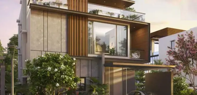
Dhatri County - II
TRIDHATRI INFRA DEVELOPERS · Medchal-Malkajgiri · RERA P02200010715
DHATRI COUNTY - II is a plotted development in Railapur Village, Medchal Mandal, Medchal-Malkajgiri District, developed by registered promoter TRIDHATRI INFRA DEVELOPERS. The layout covers a total area of 70,890.18 sq.m and a net layout area of 70,668.46 sq.m; the site-plan extraction identifies 272 plots, with sizes from 125.11–257.15 sq.m. It is registered with TG-RERA under P02200010715, and the promoter’s Form B declares completion by 31/10/2028.
📘 Project brochure from the promoter’s website ↗01What we found
Read from TG-RERA filings, approvals, land and registration records and court records. A court case is counted only when the court record states this project's survey number with its village, or names the project.
02Check before you pay
8 items to check before you pay, 3 high - from the title chain, court records and approvals, each with what to ask the builder or your advocate. An item may not be a problem with the project: records can be incomplete.
1. Project at a glance
Project identity
| Field | Project record |
|---|---|
| Registered project name | DHATRI COUNTY - II. [REGCERT-75683 p1] |
| Project type | Plotted development / open-plot layout. |
| Phase / registered portion | New-project registration for the layout on the listed survey parcels; a separate phase name or phase number is not disclosed. RERA record |
| TG-RERA registration | P02200010715. [REGCERT-75683 p1] |
| Registration validity | 01/11/2025–31/10/2028, unless extended by the Authority. This is registration validity, not a statement that the project has an occupancy certificate. [REGCERT-75683 p1] |
| Registered promoter | TRIDHATRI INFRA DEVELOPERS. [REGCERT-75683 p1] |
| RERA status | Registered; the supplied certificate is Form C. [REGCERT-75683 p1] |
Land and geographic identity
| Field | Project record |
|---|---|
| Locality / revenue village | Railapur Village. [REGCERT-75683 p1] |
| Mandal | Medchal Mandal. [REGCERT-75683 p1] |
| District | Medchal-Malkajgiri District. [REGCERT-75683 p1] |
| PIN | 501401. [REGCERT-75683 p1] |
| Survey numbers | 141, 142, 143, 144 and 145. [REGCERT-75683 p1] |
| Subdivisions identified in the filed site plan | 143/1, 141/D, 144/A/1, 141/A, 144/C/1, 144/B/A/3/2, 144/C/AA, 144/B/AA, 144/B/A, 141/C, 141/B/A, 144/A/2, 145/F/A, 145/E/AA, 143/H/A /2/2, 142/A/AA/2, 142/A/A /2, 141/B, 144/B/A /1, 141/B/E, 144/C/2 and 141/B/AA. |
| Site extent | Total layout area 70,890.18 sq.m; net layout area 70,668.46 sq.m. |
| Road-affected area | 221.72 sq.m. |
| Boundaries | East: 12 19 M MAIN INTERNAL APPROACH ROAD; west: OTHERS LAND; north: 9 M WIDE BUFFER LINE; south: OTHERS LAND. RERA filing |
Development identity
| Field | Project record |
|---|---|
| Sanctioning authority | Hyderabad Metropolitan Development Authority (HMDA); the filed draft layout letter records delegation to Medchal Municipality. |
| Principal layout reference | File/application 006722/HMDA/02019/SWDL/MDL1/2025; draft layout approval number 0922/HMDA/SWDL/2025, dated 01/11/2025. |
| Development form | Plotted layout. No building/tower count or floor configuration is disclosed for the registered offering. |
| Approved built-up area | Not stated as a project-wide building area in the supplied records. The layout letter identifies 6,347.62 Sq.mtrs of built-up area mortgaged in favour of HMDA. |
| Roads and access widths shown in the site-plan extraction | 3.00M WIDE PATH WAY, 9.00M WIDE BUFFER LINE, 9m Main Internal Approach Road, 10.07m Existing Road Width, 45m Proposed Road Width, 12.19m Main Internal Approach Road, 12m Main Internal Approach Road and 11.99m Main Internal Approach Road. |
Offering and status
| Field | Project record |
|---|---|
| Offering | Plots in a plotted layout. RERA-filed plot-by-plot inventory, plot count and saleable-size schedule are not supplied in the available records. |
| RERA booked / available counts | Not disclosed in the supplied project evidence. |
| Construction / development stage | The approval record describes a draft layout and requires the applicant to complete layout development works within THREE (3) YEARS; no independently verified site-progress report is supplied. |
| Completion commitment | The promoter’s Form B declares completion by 31/10/2028. |
| Registration validity end | 31/10/2028; distinct from the completion commitment above. [REGCERT-75683 p1] |
| Occupancy / completion certificate | No occupancy or completion certificate is identified in the supplied project records. The cited approval is a draft layout permission, not an OC. |
2. The project story
DHATRI COUNTY - II is registered as an open-plot layout in Railapur Village, Medchal Mandal, over Survey Nos. 141, 142, 143, 144 and 145. The filed site-plan extraction names multiple subdivisions within those surveys; those identifiers are set out in the identity table above. The project record describes a total layout area of 70,890.18 sq.m, with a net layout area of 70,668.46 sq.m after a road-affected area of 221.72 sq.m. [REGCERT-75683 p1]
The layout approval material provides for plot parcels, internal roads, open spaces, social-infrastructure land and utility land. The draft layout letter requires roads and specified common areas to be developed and handed over to the local body by registered gift deed before release of the final layout. It also requires layout infrastructure works to be completed within three years. These are approval conditions, not evidence that the works are complete.
The promoter’s Form B is a declaration undertaking completion by 31/10/2028. No project-specific construction-progress figures or independent site verification are provided here. No occupancy or completion certificate is identified in the supplied evidence.
3. Master plan, architecture & building design
The filed layout drawing and draft layout letter describe a plotted development rather than a residential building scheme. The layout’s net area is 70,668.46 sq.m. Its recorded land-use schedule is: 42,109.87 sq.m plotted area (59.59%); 21,332.44 sq.m road area (30.19%); 5,331.17 sq.m organized open-space/park area (7.54%); 1,782.63 sq.m social-infrastructure area (2.52%); and 112.08 sq.m utilities area (0.16%). The draft-layout extraction separately identifies 221.72 sq.m as road-affected area.
The site-plan extraction identifies 272 plots, with sizes read by software from the drawing’s plot schedule; the software-derived size range is 125.11–257.15 sq.m. The drawing-derived count and sizes should be checked against the plan itself. Layout record
Road information in the plan extraction includes a 10.07m Existing Road Width, 45m Proposed Road Width, 9m Main Internal Approach Road, 12.19m Main Internal Approach Road, 12m Main Internal Approach Road, 11.99m Main Internal Approach Road, 3.00M WIDE PATH WAY and 9.00M WIDE BUFFER LINE.
The approval record identifies STP/common septic-tank provision, water-supply infrastructure, overhead tank, electrical lines, street lights, transformer, avenue plantation, park development and rainwater-harvesting pits as layout development works. The draft approval requires the applicant to implement infrastructure and develop open spaces; the supplied evidence does not independently establish completion.
4. Homes, configurations & floor plans
This is a plotted layout, so the relevant offering is plots rather than apartment configurations. The RERA-filed unit schedule and booked/available plot inventory are not present in the supplied evidence. The layout drawing extraction reports 272 plots and software-measured plot sizes from 125.11 sq.m to 257.15 sq.m; both are drawing-derived and should be verified against the plan. Layout record
The filed floor-plan set contains two drawings, neither identified as a flat plan; no carpet-area measurements are available. Carpet area, balcony/utility area and apartment common-area loading therefore do not apply to this plotted offering. Floor plans
5. Parking & vehicle circulation
The layout land-use schedule records 0.00 sq.m of common parking area. The supplied records do not establish a count of vehicle spaces, visitor or accessible parking, plot-specific parking allocation, or dedicated EV-charging locations.
The approval material identifies internal roads and footpaths and requires road formation, drainage and utility works. It does not provide a quantified parking-space schedule. A plot or road drawing alone does not establish exclusive parking rights for an allottee.
6. Amenities, recreation & open spaces
| Facility | Description / size | Evidence source | Declared progress / verified status |
|---|---|---|---|
| Organized open space / parks | 5,331.17 sq.m (7.54%) of net layout area; the drawing extraction lists open-space areas of 874.96 sq.m, 584.05 sq.m, 3,162.06 sq.m, 372.05 sq.m, 205.67 sq.m and 132.39 sq.m. | Included in draft-layout plan; development and handover are required before final layout release. Completion not independently verified. | |
| Social infrastructure | 1,782.63 sq.m (2.52%) of net layout area. | Land-use allocation in the draft layout; facility type and completion status not specified. | |
| Walking track | No size supplied. | Promoter website | Promoter-marketed claim only; no completion evidence supplied. |
| Clubhouse | No size or capacity supplied. | Promoter website | Promoter-marketed claim only; not identified as an allocated facility in the draft-layout land-use schedule. |
| Children’s playground | No size supplied. | Promoter website | Promoter-marketed claim only; no completion evidence supplied. |
| Indoor games / indoor sports | No size supplied. | Promoter website | Promoter-marketed claim only; no completion evidence supplied. |
| Gymnasium | No size supplied. | Promoter website | Promoter-marketed claim only; no completion evidence supplied. |
| Swimming pool | No size supplied. | Promoter website | Promoter-marketed claim only; no completion evidence supplied. |
| Meditation centre | No size supplied. | Promoter website | Promoter-marketed claim only; no completion evidence supplied. |
| Bonfire area | No size supplied. | Promoter website | Promoter-marketed claim only; no completion evidence supplied. |
7. Utilities, building services & safety
The draft layout letter requires layout infrastructure including internal water-supply pipelines, an overhead tank, an assured water-supply source, underground drainage and storm-water drainage, a common septic tank/STP, electrical supply lines, street lighting, a transformer, rainwater-harvesting pits, avenue planting and park development. It also calls for underground ducting of utilities, solid-waste disposal space and source segregation. These are approval requirements or proposed layout works; the supplied evidence does not establish that they are completed or operational.
The site-plan extraction also lists STP, RHW, DT sump, OHT, social infrastructure and public utility. No capacities, water-source details, treatment specifications, electrical backup, security-system details or measured service-performance data are supplied.
The layout approval conditions include requirements relating to safe construction, road and utility works, tree planting, rainwater harvesting and garbage facilities. The supplied project records do not establish installed fire-safety systems or project-specific fire clearances; the building-related safety clauses in the approval extract do not by themselves establish that a building facility is part of this plotted project.
8. Location, access & connectivity
The registered location is Railapur, Medchal, Medchal-Malkajgiri, 501401, in Railapur Village, Medchal Mandal. [REGCERT-75683 p1]
The site-plan extraction identifies an existing road width of 10.07m, a proposed road width of 45m, internal approach roads of 9m, 12.19m, 12m and 11.99m, and a 3.00M WIDE PATH WAY. These are drawing-record descriptions, not measured travel distances.
A supplied location record gives the nearest sampled Outer Ring Road interchange at approximately 1.1 km. Promoter-provided connectivity descriptions refer to NH-44, Medchal Highway and MMTS stations; no measured distances to those locations are supplied here. Location record Promoter website
9. Developer & development status
The registered legal promoter is TRIDHATRI INFRA DEVELOPERS, identified in the project record as a partnership. Its RERA registration certificate identifies the project as DHATRI COUNTY - II, registration P02200010715. RERA filing [REGCERT-75683 p1]
The promoter’s Form B is signed by authorized signatory VENKAMMA GARI HANMANTH REDDY and declares completion by 31/10/2028. The RERA certificate records registration validity through 31/10/2028; the two dates are separately stated in the source documents and are not evidence of completed development. [REGCERT-75683 p1]
No independently verified progress percentage or completion certificate is supplied. The available approval material is for a draft layout and states that development works are to be completed within three years.
10. Approvals, official records & documents
| Identifier / date | P02200010715; valid 01/11/2025–31/10/2028 |
|---|---|
| What the supplied record establishes | Registration of DHATRI COUNTY - II under the registered promoter TRIDHATRI INFRA DEVELOPERS, with certificate conditions. [REGCERT-75683 p1] |
| Identifier / date | File/application 006722/HMDA/02019/SWDL/MDL1/2025; approved date 01/11/2025 |
|---|---|
| What the supplied record establishes | Draft layout permission for the plotted project over Survey Nos. 141, 142, 143, 144 and 145 at Railapur; the document states the permission is not proof of title. |
| Identifier / date | 0922/HMDA/SWDL/2025 |
|---|---|
| What the supplied record establishes | Approval number recorded in the draft layout letter. |
| Identifier / date | 13280/2025 and 13281/2025, dated 24/10/2025 in the letter’s references |
|---|---|
| What the supplied record establishes | The draft-layout material records mortgage security in favour of the Metropolitan Commissioner, HMDA, including specified plot and built-up areas. |
| Identifier / date | 13285/2025, dated 28/10/2025 in the layout letter |
|---|---|
| What the supplied record establishes | The letter records the road-affected area of 221.72 sq.m as handed over to the local body. |
| Identifier / date | 02/12/2025 |
|---|---|
| What the supplied record establishes | Promoter declaration of title, encumbrance position, project-fund commitments and completion by 31/10/2028. |
| Identifier / date | Not identified in the supplied documents |
|---|---|
| What the supplied record establishes | No OC or completion certificate is evidenced in this review. |
| Identifier / date | Document 629236 |
|---|---|
| What the supplied record establishes | Site layout, land-use schedule, road widths and subdivision identifiers; the extracted drawing details are software-read and should be checked against the source drawing. |
1. Project at a glance
Project identity
Registered project name: DHATRI COUNTY - II. [REGCERT-75683 p1]
Project type: Plotted development / open-plot layout.
Phase / registered portion: New-project registration for the layout on the listed survey parcels; a separate phase name or phase number is not disclosed.
TG-RERA registration: P02200010715. [REGCERT-75683 p1]
Registration validity: 01/11/2025–31/10/2028, unless extended by the Authority. This is registration validity, not a statement that the project has an occupancy certificate. [REGCERT-75683 p1]
Registered promoter: TRIDHATRI INFRA DEVELOPERS. [REGCERT-75683 p1]
RERA status: Registered; the supplied certificate is Form C. [REGCERT-75683 p1]
Land and geographic identity
Locality / revenue village: Railapur Village. [REGCERT-75683 p1]
Mandal: Medchal Mandal. [REGCERT-75683 p1]
District: Medchal-Malkajgiri District. [REGCERT-75683 p1]
PIN: 501401. [REGCERT-75683 p1]
Survey numbers: 141, 142, 143, 144 and 145. [REGCERT-75683 p1]
Subdivisions identified in the filed site plan: 143/1, 141/D, 144/A/1, 141/A, 144/C/1, 144/B/A/3/2, 144/C/AA, 144/B/AA, 144/B/A, 141/C, 141/B/A, 144/A/2, 145/F/A, 145/E/AA, 143/H/A /2/2, 142/A/AA/2, 142/A/A /2, 141/B, 144/B/A /1, 141/B/E, 144/C/2 and 141/B/AA.
Site extent: Total layout area 70,890.18 sq.m; net layout area 70,668.46 sq.m.
Road-affected area: 221.72 sq.m.
Boundaries: East: 12 19 M MAIN INTERNAL APPROACH ROAD; west: OTHERS LAND; north: 9 M WIDE BUFFER LINE; south: OTHERS LAND.
Development identity
Sanctioning authority: Hyderabad Metropolitan Development Authority (HMDA); the filed draft layout letter records delegation to Medchal Municipality.
Principal layout reference: File/application 006722/HMDA/02019/SWDL/MDL1/2025; draft layout approval number 0922/HMDA/SWDL/2025, dated 01/11/2025.
Development form: Plotted layout. No building/tower count or floor configuration is disclosed for the registered offering.
Approved built-up area: Not stated as a project-wide building area in the supplied records. The layout letter identifies 6,347.62 Sq.mtrs of built-up area mortgaged in favour of HMDA.
Roads and access widths shown in the site-plan extraction: 3.00M WIDE PATH WAY, 9.00M WIDE BUFFER LINE, 9m Main Internal Approach Road, 10.07m Existing Road Width, 45m Proposed Road Width, 12.19m Main Internal Approach Road, 12m Main Internal Approach Road and 11.99m Main Internal Approach Road.
Offering and status
Offering: Plots in a plotted layout. RERA-filed plot-by-plot inventory, plot count and saleable-size schedule are not supplied in the available records.
RERA booked / available counts: Not disclosed in the supplied project evidence.
Construction / development stage: The approval record describes a draft layout and requires the applicant to complete layout development works within THREE (3) YEARS; no independently verified site-progress report is supplied.
Completion commitment: The promoter’s Form B declares completion by 31/10/2028.
Registration validity end: 31/10/2028; distinct from the completion commitment above. [REGCERT-75683 p1]
Occupancy / completion certificate: No occupancy or completion certificate is identified in the supplied project records. The cited approval is a draft layout permission, not an OC.
2. The project story
DHATRI COUNTY - II is registered as an open-plot layout in Railapur Village, Medchal Mandal, over Survey Nos. 141, 142, 143, 144 and 145. The filed site-plan extraction names multiple subdivisions within those surveys; those identifiers are set out in the identity table above. The project record describes a total layout area of 70,890.18 sq.m, with a net layout area of 70,668.46 sq.m after a road-affected area of 221.72 sq.m. [REGCERT-75683 p1]
The layout approval material provides for plot parcels, internal roads, open spaces, social-infrastructure land and utility land. The draft layout letter requires roads and specified common areas to be developed and handed over to the local body by registered gift deed before release of the final layout. It also requires layout infrastructure works to be completed within three years. These are approval conditions, not evidence that the works are complete.
The promoter’s Form B is a declaration undertaking completion by 31/10/2028. No project-specific construction-progress figures or independent site verification are provided here. No occupancy or completion certificate is identified in the supplied evidence.
3. Master plan, architecture & building design
The filed layout drawing and draft layout letter describe a plotted development rather than a residential building scheme. The layout’s net area is 70,668.46 sq.m. Its recorded land-use schedule is: 42,109.87 sq.m plotted area (59.59%); 21,332.44 sq.m road area (30.19%); 5,331.17 sq.m organized open-space/park area (7.54%); 1,782.63 sq.m social-infrastructure area (2.52%); and 112.08 sq.m utilities area (0.16%). The draft-layout extraction separately identifies 221.72 sq.m as road-affected area.
The site-plan extraction identifies 272 plots, with sizes read by software from the drawing’s plot schedule; the software-derived size range is 125.11–257.15 sq.m. The drawing-derived count and sizes should be checked against the plan itself.
Road information in the plan extraction includes a 10.07m Existing Road Width, 45m Proposed Road Width, 9m Main Internal Approach Road, 12.19m Main Internal Approach Road, 12m Main Internal Approach Road, 11.99m Main Internal Approach Road, 3.00M WIDE PATH WAY and 9.00M WIDE BUFFER LINE.
The approval record identifies STP/common septic-tank provision, water-supply infrastructure, overhead tank, electrical lines, street lights, transformer, avenue plantation, park development and rainwater-harvesting pits as layout development works. The draft approval requires the applicant to implement infrastructure and develop open spaces; the supplied evidence does not independently establish completion.
4. Homes, configurations & floor plans
This is a plotted layout, so the relevant offering is plots rather than apartment configurations. The RERA-filed unit schedule and booked/available plot inventory are not present in the supplied evidence. The layout drawing extraction reports 272 plots and software-measured plot sizes from 125.11 sq.m to 257.15 sq.m; both are drawing-derived and should be verified against the plan.
The filed floor-plan set contains two drawings, neither identified as a flat plan; no carpet-area measurements are available. Carpet area, balcony/utility area and apartment common-area loading therefore do not apply to this plotted offering.
5. Parking & vehicle circulation
The layout land-use schedule records 0.00 sq.m of common parking area. The supplied records do not establish a count of vehicle spaces, visitor or accessible parking, plot-specific parking allocation, or dedicated EV-charging locations.
The approval material identifies internal roads and footpaths and requires road formation, drainage and utility works. It does not provide a quantified parking-space schedule. A plot or road drawing alone does not establish exclusive parking rights for an allottee.
6. Amenities, recreation & open spaces
| Facility | Description / size | Evidence source | Declared progress / verified status |
|---|---|---|---|
| Organized open space / parks | 5,331.17 sq.m (7.54%) of net layout area; the drawing extraction lists open-space areas of 874.96 sq.m, 584.05 sq.m, 3,162.06 sq.m, 372.05 sq.m, 205.67 sq.m and 132.39 sq.m. | Included in draft-layout plan; development and handover are required before final layout release. Completion not independently verified. | |
| Social infrastructure | 1,782.63 sq.m (2.52%) of net layout area. | Land-use allocation in the draft layout; facility type and completion status not specified. | |
| Walking track | No size supplied. | Promoter-marketed claim only; no completion evidence supplied. | |
| Clubhouse | No size or capacity supplied. | Promoter-marketed claim only; not identified as an allocated facility in the draft-layout land-use schedule. | |
| Children’s playground | No size supplied. | Promoter-marketed claim only; no completion evidence supplied. | |
| Indoor games / indoor sports | No size supplied. | Promoter-marketed claim only; no completion evidence supplied. | |
| Gymnasium | No size supplied. | Promoter-marketed claim only; no completion evidence supplied. | |
| Swimming pool | No size supplied. | Promoter-marketed claim only; no completion evidence supplied. | |
| Meditation centre | No size supplied. | Promoter-marketed claim only; no completion evidence supplied. | |
| Bonfire area | No size supplied. | Promoter-marketed claim only; no completion evidence supplied. |
7. Utilities, building services & safety
The draft layout letter requires layout infrastructure including internal water-supply pipelines, an overhead tank, an assured water-supply source, underground drainage and storm-water drainage, a common septic tank/STP, electrical supply lines, street lighting, a transformer, rainwater-harvesting pits, avenue planting and park development. It also calls for underground ducting of utilities, solid-waste disposal space and source segregation. These are approval requirements or proposed layout works; the supplied evidence does not establish that they are completed or operational.
The site-plan extraction also lists STP, RHW, DT sump, OHT, social infrastructure and public utility. No capacities, water-source details, treatment specifications, electrical backup, security-system details or measured service-performance data are supplied.
The layout approval conditions include requirements relating to safe construction, road and utility works, tree planting, rainwater harvesting and garbage facilities. The supplied project records do not establish installed fire-safety systems or project-specific fire clearances; the building-related safety clauses in the approval extract do not by themselves establish that a building facility is part of this plotted project.
8. Location, access & connectivity
The registered location is Railapur, Medchal, Medchal-Malkajgiri, 501401, in Railapur Village, Medchal Mandal. [REGCERT-75683 p1]
The site-plan extraction identifies an existing road width of 10.07m, a proposed road width of 45m, internal approach roads of 9m, 12.19m, 12m and 11.99m, and a 3.00M WIDE PATH WAY. These are drawing-record descriptions, not measured travel distances.
A supplied location record gives the nearest sampled Outer Ring Road interchange at approximately 1.1 km. Promoter-provided connectivity descriptions refer to NH-44, Medchal Highway and MMTS stations; no measured distances to those locations are supplied here.
9. Developer & development status
The registered legal promoter is TRIDHATRI INFRA DEVELOPERS, identified in the project record as a partnership. Its RERA registration certificate identifies the project as DHATRI COUNTY - II, registration P02200010715. [REGCERT-75683 p1]
The promoter’s Form B is signed by authorized signatory VENKAMMA GARI HANMANTH REDDY and declares completion by 31/10/2028. The RERA certificate records registration validity through 31/10/2028; the two dates are separately stated in the source documents and are not evidence of completed development. [REGCERT-75683 p1]
No independently verified progress percentage or completion certificate is supplied. The available approval material is for a draft layout and states that development works are to be completed within three years.
10. Approvals, official records & documents
| Identifier / date | P02200010715; valid 01/11/2025–31/10/2028 |
|---|---|
| What the supplied record establishes | Registration of DHATRI COUNTY - II under the registered promoter TRIDHATRI INFRA DEVELOPERS, with certificate conditions. [REGCERT-75683 p1] |
| Identifier / date | File/application 006722/HMDA/02019/SWDL/MDL1/2025; approved date 01/11/2025 |
|---|---|
| What the supplied record establishes | Draft layout permission for the plotted project over Survey Nos. 141, 142, 143, 144 and 145 at Railapur; the document states the permission is not proof of title. |
| Identifier / date | 0922/HMDA/SWDL/2025 |
|---|---|
| What the supplied record establishes | Approval number recorded in the draft layout letter. |
| Identifier / date | 13280/2025 and 13281/2025, dated 24/10/2025 in the letter’s references |
|---|---|
| What the supplied record establishes | The draft-layout material records mortgage security in favour of the Metropolitan Commissioner, HMDA, including specified plot and built-up areas. |
| Identifier / date | 13285/2025, dated 28/10/2025 in the layout letter |
|---|---|
| What the supplied record establishes | The letter records the road-affected area of 221.72 sq.m as handed over to the local body. |
| Identifier / date | 02/12/2025 |
|---|---|
| What the supplied record establishes | Promoter declaration of title, encumbrance position, project-fund commitments and completion by 31/10/2028. |
| Identifier / date | Not identified in the supplied documents |
|---|---|
| What the supplied record establishes | No OC or completion certificate is evidenced in this review. |
| Identifier / date | Document 629236 |
|---|---|
| What the supplied record establishes | Site layout, land-use schedule, road widths and subdivision identifiers; the extracted drawing details are software-read and should be checked against the source drawing. |
Frequently asked questions
Is DHATRI COUNTY - II registered with Telangana RERA?
Yes. DHATRI COUNTY - II is registered with the Telangana Real Estate Regulatory Authority as P02200010715; the registration status is New Project.
Who is the developer of DHATRI COUNTY - II?
The promoter named in the RERA registration is TRIDHATRI INFRA DEVELOPERS.
Where is DHATRI COUNTY - II located?
DHATRI COUNTY - II is in MEDCHAL MANDAL, Railapur, Medchal, Medchal-Malkajgiri, Telangana (501401).
When will DHATRI COUNTY - II be completed?
The promoter's proposed date of completion filed with RERA is 28/02/2029. This is the promoter's declaration, not a guarantee.
More projects in Medchal