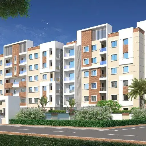
Prakruti Homes
CHAKKA SAI LAXMAN RAO AND OTHERS · Bhadradri Kothagudem · RERA P00900011047
PRAKRUTI HOMES is a proposed residential open-plot layout in Palwancha, Palwancha Mandal, Bhadradri Kothagudem District. The registered promoter is CHAKKA SAI LAXMAN RAO AND OTHERS. The layout drawing states a total net layout area of 13149.78 sq.m and 36 plots, with drawing-measured plot sizes of 153.04–242.54 sq.m; no project buildings or floor configuration are identified. The project is registered under TG-RERA registration P00900011047, with a proposed completion date of 06/03/2027.
01What we found
Read from TG-RERA filings, approvals, land and registration records and court records. A court case is counted only when the court record states this project's survey number with its village, or names the project.
02Check before you pay
7 items to check before you pay, 3 high - from the title chain, court records and approvals, each with what to ask the builder or your advocate. An item may not be a problem with the project: records can be incomplete.
1. Project at a glance
Project identity
| Field | Project record |
|---|---|
| Registered project name | PRAKRUTI HOMES RERA record |
| Project type | Plotted development; proposed residential open-plot layout RERA record |
| Phase / registered portion | Not separately identified; the registration is for the project as recorded RERA record |
| TG-RERA registration | P00900011047 RERA record |
| Registration validity | 7 November 2024–6 November 2026 RERA record |
| Registered promoter | CHAKKA SAI LAXMAN RAO AND OTHERS RERA record |
| RERA status | New Project; registration recorded as valid through 6 November 2026 in the supplied record RERA record Approvals record |
Land and geographic identity
| Field | Project record |
|---|---|
| Locality | Palwancha / Palwancha Mandal RERA record |
| Revenue village | Palwancha Revenue Village |
| Mandal | Palwancha Mandal RERA record |
| District | Bhadradri Kothagudem RERA record |
| PIN | 507115 RERA record |
| Survey numbers and subdivisions | 421/1/1/1/1/1/2; 421/1/1/2; 421/1/1/1/1/1/1/2/1/1/1; 421/1/1/1/2; 421/1/1/1/1/2 RERA record |
| Registered site extent | Not stated as a separate RERA registration figure in the supplied record. The filed layout drawing states 13149.77 sq.mt RERA record |
| Net / total layout area | Drawing area statement: total net layout 13149.78 sq.m; layout-plan facts also state a net site area of 13149.77 sq.mt |
| Boundaries in RERA project fields | North: land of others; South: defined boundary of canal of width up to 10 m; East: land of others; West: existing and proposed 12.19 m wide road RERA filing |
Development identity
| Field | Project record |
|---|---|
| Sanctioning authority | TS-DTCP; the layout approval is delegated to Palwancha Municipality |
| Principal approval | Tentative Layout Plan No. 0012/LO/3022/2024, approved 7 November 2024; application No. 003857/LO/DTCP/3022/0007/2024 |
| Approved layout drawing reference | File No. G/LS/625/2021-22; LTP licence No. TS/049627/2024 |
| Approved built-up area | Not applicable to plotted lots; the layout plan states proposed built-up area of 0.00 both excluding and including parking |
| Plots | 36 plots stated in the layout-plan schedule and tentative approval |
| Buildings / floors | No project buildings or floor configuration are identified in the supplied layout record. The tentative conditions refer to detached single-family dwelling houses on individual sites |
| Parking | Common parking area is recorded as 0.00 in the layout land-use table; no individual parking allocation or sanctioned parking-space count is supplied |
Offering and status
| Field | Project record |
|---|---|
| Offered unit type | Residential plots; plot-wise count and sizes are read from the layout drawing Layout record |
| Plot count / size range | 36 plots; software-measured from the drawing: 153.04–242.54 sq.m (183.0–290.1 sq.yd); verify against the drawing Layout record |
| Booked / available | Not disclosed in the supplied data RERA record |
| Construction stage | No independently verified site-progress information supplied. The RERA record reports completeness of 70%, but the nature and measurement basis of that figure are not identified in the supplied evidence RERA record |
| Completion dates | Form-B promoter declaration: 06/11/2026; RERA header proposed completion: 06/03/2027 RERA record |
| Occupancy / completion certificate | No occupancy or completion certificate is identified in the supplied documents. The approval provided is for a tentative layout |
Registration validity, the promoter’s completion undertaking, the RERA-recorded proposed completion date and certificate status are distinct items; none should be read as proof that the layout infrastructure has been completed.
2. The project story
- PRAKRUTI HOMES is registered as a plotted residential development in Palwancha, with a tentative layout approval covering 36 plots across the five recorded survey subdivisions. The layout plan allocates land to plots, internal roads, park/open space, social infrastructure, utilities and a water-bodies buffer; it does not describe an apartment or villa-building scheme. RERA record
- The municipal approval describes a tentative layout and places responsibility for layout development on the applicant. It requires infrastructure and amenities to be completed within two years of the 7 November 2024 approval date, with a stated deadline of 7 November 2026, and describes the possibility of a further one-year extension on specified terms. This is an approval condition, not evidence that works have been completed.
- The RERA record gives a 70% completeness figure, but the supplied evidence does not specify its measurement basis or independently verify physical progress at the site. The approval and project documents supplied do not establish completed works or an occupancy/completion certificate. RERA record
3. Master plan, architecture & building design
- The filed layout drawing records a total net layout area of 13149.78 sq.m and a plotted area of 6595.21 sq.m. Its land-use table also records 4694.30 sq.m for roads, 1188.97 sq.m for organized open space/park, 329.33 sq.m for social infrastructure, 132.10 sq.m for utilities and 209.87 sq.m for buffer zone. The drawing states 0.00 for amenity area and common parking area. These are layout land-use figures, not building or carpet-area measurements.
- The drawing identifies road widths of 9.14 m, 18.29 m and 12.19 m and states a total of 36 individual sub-plots. The software-derived plot schedule reports 36 plots with sizes from 153.04 sq.m to 242.54 sq.m; these measurements are drawing-based and should be checked against the plan. Layout record
- No building footprints, towers, building floor plans, apartment arrangements or built-up building area are supplied. The tentative approval states that only a detached dwelling house designed for occupation by a single family may be built on a site; it does not provide a dwelling design or specify building height or floors.
4. Homes, configurations & floor plans
This is a plotted layout, not an apartment configuration schedule. The layout drawing states 36 plots. The plot counts and sizes below are software-measured from the drawing’s plot schedule, not RERA-filed carpet or saleable areas. The supplied floor-plan record contains two layout sheets and no dwelling floor plans from which carpet areas or room measurements can be established. Layout record Floor plans
| Plot-size band (sq.yd) | Plots | Drawing-measured equivalent band (sq.m) |
|---|---|---|
| 150–200 | 1 | 125–167 |
| 200–250 | 33 | 167–209 |
| 250–300 | 2 | 209–251 |
- The measured smallest, median and largest plot areas are 153.04 sq.m (183.0 sq.yd), 182.62 sq.m (218.4 sq.yd) and 242.54 sq.m (290.1 sq.yd) respectively. The drawing’s four most common printed areas are 183.95 sq.m (12 plots), 180.11 sq.m (6 plots), 167.23 sq.m (6 plots) and 199.88 sq.m (2 plots). Verify the plotted schedule against the drawing before relying on an individual plot measurement. Layout record
- The supplied RERA allotment-letter and agreement-for-sale forms are partially completed templates; they do not identify a particular allottee, plot, price or completed sale.
5. Parking & vehicle circulation
- The layout land-use table records 0.00 for common parking area, and the supplied documents do not state a sanctioned number of parking spaces or a plot-specific parking allocation. No parking levels, ramps, mechanical parking, visitor or accessible parking, EV charging or pedestrian/vehicle separation arrangements are identified.
- The tentative approval requires roads to remain open for access to neighbouring sites and prohibits a compound wall or fencing around the site. The approval describes road widths of 9.14 m, 18.29 m and 12.19 m; these are layout roads, not evidence of completed road works.
6. Amenities, recreation & open spaces
The layout drawing and tentative approval describe land reservations and proposed layout infrastructure. The supplied amenity-status record lists 14 categories, with several marked 100%; those percentages are recorded status fields and do not independently establish physical completion. RERA amenities
| Description / size | 1188.97 sq.m; 9.04% in the layout area statement |
|---|---|
| Evidence source | Drawing and tentative approval |
| Declared progress / verified status | Park development is a stated approval condition; completion not independently verified |
| Description / size | 329.33 sq.m; 2.50% |
|---|---|
| Evidence source | Drawing and tentative approval |
| Declared progress / verified status | Land reservation recorded; no specific facility or completed building identified |
| Description / size | 132.10 sq.m; 1.00% |
|---|---|
| Evidence source | Drawing and tentative approval |
| Declared progress / verified status | Reserved land recorded; utility installations not independently verified |
| Description / size | 209.87 sq.m; 1.60% in the layout drawing |
|---|---|
| Evidence source | Layout drawing |
| Declared progress / verified status | Area recorded in drawing; physical condition not independently verified |
| Description / size | 4694.30 sq.m; 35.70%; drawing records widths of 9.14 m, 18.29 m and 12.19 m |
|---|---|
| Evidence source | Drawing and tentative approval |
| Declared progress / verified status | Road formation and black-topping are specified works; completion not independently verified |
| Description / size | No area or quantity stated |
|---|---|
| Evidence source | Tentative approval |
| Declared progress / verified status | Specified as a layout work; completion not independently verified |
| Description / size | No specific facility or size supplied; amenity record shows community buildings at 0% RERA amenities |
|---|---|
| Evidence source | RERA amenity-status record RERA amenities |
| Declared progress / verified status | Not shown as provided in the supplied status data RERA amenities |
- The tentative approval directs the applicant to hand over open space, utility land and road area to the municipality by registered gift deed before release of the tentative layout. The supplied record does not establish that this handover or the listed development works has occurred.
7. Utilities, building services & safety
The tentative approval describes the following proposed layout works: internal water-supply pipelines, an assured water-supply source, overhead tank/sump, storm-water drains, underground drainage lines, a common septic tank or STP, electrical supply lines, street lights, transformer, solid-waste management, rainwater-harvesting pits and park development. It does not supply capacities or confirm installation or commissioning.
| Evidence in the project record | Internal water-supply pipelines, assured source and overhead tank/sump specified in approval conditions |
|---|---|
| Status limitation | Source, storage capacity and completion not independently verified |
| Evidence in the project record | Underground drainage, common septic tank/STP and storm-water drains specified |
|---|---|
| Status limitation | Capacity, treatment process, reuse and completion not supplied |
| Evidence in the project record | Electrical supply lines, street lights and transformer specified |
|---|---|
| Status limitation | Capacity, backup and completion not supplied |
| Evidence in the project record | Solid-waste management identified in the approval conditions |
|---|---|
| Status limitation | System details and implementation not supplied |
| Evidence in the project record | Rainwater-harvesting pits specified |
|---|---|
| Status limitation | Number, capacity and completion not supplied |
| Evidence in the project record | The supplied project documents do not describe a fire system, fire clearance, accessible circulation or building escape arrangements |
|---|---|
| Status limitation | Not established by the supplied record; no building-services design is provided |
8. Location, access & connectivity
- The registered location is Palwancha, Palwancha Mandal, Bhadradri Kothagudem District, Telangana, PIN 507115. The site’s RERA-filed boundaries describe land of others to the north and east, a canal boundary to the south, and an existing/proposed 12.19 m road to the west. RERA record RERA filing
- The layout drawing records internal road widths of 9.14 m, 18.29 m and 12.19 m. A location record identifies a sampled Outer Ring Road interchange at 215.2 km; the supplied information does not provide a route or travel-time estimate. Location record
9. Developer & development status
- The registered promoter is CHAKKA SAI LAXMAN RAO AND OTHERS. The RERA record describes the organization type as “Others”; the specific legal-entity form, corporate identifier, registered office and official contact details are not established in the supplied evidence. RERA record RERA filing Corporate record
- The Form-B declaration is made by CHAKKA SAI LAXMAN RAO and records a promoter undertaking to complete by 06/11/2026. The RERA header separately records a proposed completion date of 06/03/2027; the supplied data does not explain the basis of the 70% completeness figure or independently verify construction progress. RERA record
- The tentative approval makes the applicant responsible for layout development and specifies a two-year period from 7 November 2024 to complete infrastructure and amenities. No completion or occupancy certificate is identified in the supplied documents.
10. Approvals, official records & documents
| Identifier / date | P00900011047; valid 7 November 2024–6 November 2026 |
|---|---|
| What the supplied evidence establishes | Form-C registration record for PRAKRUTI HOMES and registered promoter CHAKKA SAI LAXMAN RAO AND OTHERS. |
| Identifier / date | 0012/LO/3022/2024, 7 November 2024; application 003857/LO/DTCP/3022/0007/2024 |
|---|---|
| What the supplied evidence establishes | Tentative layout plan issued by Palwancha Municipality / Municipal Corporation; includes conditions for infrastructure, amenities and reserved-land handover. |
| Identifier / date | File No. G/LS/625/2021-22; LTP licence TS/049627/2024 |
|---|---|
| What the supplied evidence establishes | Layout drawing showing 36 plots, land-use areas, road widths and reserved plots. |
| Identifier / date | 4188/2024, 28 October 2024 |
|---|---|
| What the supplied evidence establishes | Approval identifies Plots 7, 8, 9, 10, 11 and 12 as mortgaged to the municipality; the supplied mortgage document is described as a simple mortgage deed. |
| Identifier / date | Completion undertaking 06/11/2026 |
|---|---|
| What the supplied evidence establishes | Promoter declaration concerning title basis, encumbrances, completion and RERA obligations. |
| Identifier / date | Not identified in supplied documents |
|---|---|
| What the supplied evidence establishes | No such certificate is established by the supplied evidence. Document index |
The approval itself states that tentative layout approval is not proof of land title. This overview reports the approval and filed records; it does not determine title or whether approval conditions have been fulfilled.
1. Project at a glance
Project identity
Registered project name: PRAKRUTI HOMES
Project type: Plotted development; proposed residential open-plot layout
Phase / registered portion: Not separately identified; the registration is for the project as recorded
TG-RERA registration: P00900011047
Registration validity: 7 November 2024–6 November 2026
Registered promoter: CHAKKA SAI LAXMAN RAO AND OTHERS
RERA status: New Project; registration recorded as valid through 6 November 2026 in the supplied record
Land and geographic identity
Locality: Palwancha / Palwancha Mandal
Revenue village: Palwancha Revenue Village
Mandal: Palwancha Mandal
District: Bhadradri Kothagudem
PIN: 507115
Survey numbers and subdivisions: 421/1/1/1/1/1/2; 421/1/1/2; 421/1/1/1/1/1/1/2/1/1/1; 421/1/1/1/2; 421/1/1/1/1/2
Registered site extent: Not stated as a separate RERA registration figure in the supplied record. The filed layout drawing states 13149.77 sq.mt
Net / total layout area: Drawing area statement: total net layout 13149.78 sq.m; layout-plan facts also state a net site area of 13149.77 sq.mt
Boundaries in RERA project fields: North: land of others; South: defined boundary of canal of width up to 10 m; East: land of others; West: existing and proposed 12.19 m wide road
Development identity
Sanctioning authority: TS-DTCP; the layout approval is delegated to Palwancha Municipality
Principal approval: Tentative Layout Plan No. 0012/LO/3022/2024, approved 7 November 2024; application No. 003857/LO/DTCP/3022/0007/2024
Approved layout drawing reference: File No. G/LS/625/2021-22; LTP licence No. TS/049627/2024
Approved built-up area: Not applicable to plotted lots; the layout plan states proposed built-up area of 0.00 both excluding and including parking
Plots: 36 plots stated in the layout-plan schedule and tentative approval
Buildings / floors: No project buildings or floor configuration are identified in the supplied layout record. The tentative conditions refer to detached single-family dwelling houses on individual sites
Parking: Common parking area is recorded as 0.00 in the layout land-use table; no individual parking allocation or sanctioned parking-space count is supplied
Offering and status
Offered unit type: Residential plots; plot-wise count and sizes are read from the layout drawing
Plot count / size range: 36 plots; software-measured from the drawing: 153.04–242.54 sq.m (183.0–290.1 sq.yd); verify against the drawing
Booked / available: Not disclosed in the supplied data
Construction stage: No independently verified site-progress information supplied. The RERA record reports completeness of 70%, but the nature and measurement basis of that figure are not identified in the supplied evidence
Completion dates: Form-B promoter declaration: 06/11/2026; RERA header proposed completion: 06/03/2027
Occupancy / completion certificate: No occupancy or completion certificate is identified in the supplied documents. The approval provided is for a tentative layout
Registration validity, the promoter’s completion undertaking, the RERA-recorded proposed completion date and certificate status are distinct items; none should be read as proof that the layout infrastructure has been completed.
2. The project story
- PRAKRUTI HOMES is registered as a plotted residential development in Palwancha, with a tentative layout approval covering 36 plots across the five recorded survey subdivisions. The layout plan allocates land to plots, internal roads, park/open space, social infrastructure, utilities and a water-bodies buffer; it does not describe an apartment or villa-building scheme.
- The municipal approval describes a tentative layout and places responsibility for layout development on the applicant. It requires infrastructure and amenities to be completed within two years of the 7 November 2024 approval date, with a stated deadline of 7 November 2026, and describes the possibility of a further one-year extension on specified terms. This is an approval condition, not evidence that works have been completed.
- The RERA record gives a 70% completeness figure, but the supplied evidence does not specify its measurement basis or independently verify physical progress at the site. The approval and project documents supplied do not establish completed works or an occupancy/completion certificate.
3. Master plan, architecture & building design
- The filed layout drawing records a total net layout area of 13149.78 sq.m and a plotted area of 6595.21 sq.m. Its land-use table also records 4694.30 sq.m for roads, 1188.97 sq.m for organized open space/park, 329.33 sq.m for social infrastructure, 132.10 sq.m for utilities and 209.87 sq.m for buffer zone. The drawing states 0.00 for amenity area and common parking area. These are layout land-use figures, not building or carpet-area measurements.
- The drawing identifies road widths of 9.14 m, 18.29 m and 12.19 m and states a total of 36 individual sub-plots. The software-derived plot schedule reports 36 plots with sizes from 153.04 sq.m to 242.54 sq.m; these measurements are drawing-based and should be checked against the plan.
- No building footprints, towers, building floor plans, apartment arrangements or built-up building area are supplied. The tentative approval states that only a detached dwelling house designed for occupation by a single family may be built on a site; it does not provide a dwelling design or specify building height or floors.
4. Homes, configurations & floor plans
This is a plotted layout, not an apartment configuration schedule. The layout drawing states 36 plots. The plot counts and sizes below are software-measured from the drawing’s plot schedule, not RERA-filed carpet or saleable areas. The supplied floor-plan record contains two layout sheets and no dwelling floor plans from which carpet areas or room measurements can be established.
| Plot-size band (sq.yd) | Plots | Drawing-measured equivalent band (sq.m) |
|---|---|---|
| 150–200 | 1 | 125–167 |
| 200–250 | 33 | 167–209 |
| 250–300 | 2 | 209–251 |
- The measured smallest, median and largest plot areas are 153.04 sq.m (183.0 sq.yd), 182.62 sq.m (218.4 sq.yd) and 242.54 sq.m (290.1 sq.yd) respectively. The drawing’s four most common printed areas are 183.95 sq.m (12 plots), 180.11 sq.m (6 plots), 167.23 sq.m (6 plots) and 199.88 sq.m (2 plots). Verify the plotted schedule against the drawing before relying on an individual plot measurement.
- The supplied RERA allotment-letter and agreement-for-sale forms are partially completed templates; they do not identify a particular allottee, plot, price or completed sale.
5. Parking & vehicle circulation
- The layout land-use table records 0.00 for common parking area, and the supplied documents do not state a sanctioned number of parking spaces or a plot-specific parking allocation. No parking levels, ramps, mechanical parking, visitor or accessible parking, EV charging or pedestrian/vehicle separation arrangements are identified.
- The tentative approval requires roads to remain open for access to neighbouring sites and prohibits a compound wall or fencing around the site. The approval describes road widths of 9.14 m, 18.29 m and 12.19 m; these are layout roads, not evidence of completed road works.
6. Amenities, recreation & open spaces
The layout drawing and tentative approval describe land reservations and proposed layout infrastructure. The supplied amenity-status record lists 14 categories, with several marked 100%; those percentages are recorded status fields and do not independently establish physical completion.
| Description / size | 1188.97 sq.m; 9.04% in the layout area statement |
|---|---|
| Evidence source | Drawing and tentative approval |
| Declared progress / verified status | Park development is a stated approval condition; completion not independently verified |
| Description / size | 329.33 sq.m; 2.50% |
|---|---|
| Evidence source | Drawing and tentative approval |
| Declared progress / verified status | Land reservation recorded; no specific facility or completed building identified |
| Description / size | 132.10 sq.m; 1.00% |
|---|---|
| Evidence source | Drawing and tentative approval |
| Declared progress / verified status | Reserved land recorded; utility installations not independently verified |
| Description / size | 209.87 sq.m; 1.60% in the layout drawing |
|---|---|
| Evidence source | Layout drawing |
| Declared progress / verified status | Area recorded in drawing; physical condition not independently verified |
| Description / size | 4694.30 sq.m; 35.70%; drawing records widths of 9.14 m, 18.29 m and 12.19 m |
|---|---|
| Evidence source | Drawing and tentative approval |
| Declared progress / verified status | Road formation and black-topping are specified works; completion not independently verified |
| Description / size | No area or quantity stated |
|---|---|
| Evidence source | Tentative approval |
| Declared progress / verified status | Specified as a layout work; completion not independently verified |
| Description / size | No specific facility or size supplied; amenity record shows community buildings at 0% |
|---|---|
| Evidence source | RERA amenity-status record |
| Declared progress / verified status | Not shown as provided in the supplied status data |
- The tentative approval directs the applicant to hand over open space, utility land and road area to the municipality by registered gift deed before release of the tentative layout. The supplied record does not establish that this handover or the listed development works has occurred.
7. Utilities, building services & safety
The tentative approval describes the following proposed layout works: internal water-supply pipelines, an assured water-supply source, overhead tank/sump, storm-water drains, underground drainage lines, a common septic tank or STP, electrical supply lines, street lights, transformer, solid-waste management, rainwater-harvesting pits and park development. It does not supply capacities or confirm installation or commissioning.
| Evidence in the project record | Internal water-supply pipelines, assured source and overhead tank/sump specified in approval conditions |
|---|---|
| Status limitation | Source, storage capacity and completion not independently verified |
| Evidence in the project record | Underground drainage, common septic tank/STP and storm-water drains specified |
|---|---|
| Status limitation | Capacity, treatment process, reuse and completion not supplied |
| Evidence in the project record | Electrical supply lines, street lights and transformer specified |
|---|---|
| Status limitation | Capacity, backup and completion not supplied |
| Evidence in the project record | Solid-waste management identified in the approval conditions |
|---|---|
| Status limitation | System details and implementation not supplied |
| Evidence in the project record | Rainwater-harvesting pits specified |
|---|---|
| Status limitation | Number, capacity and completion not supplied |
| Evidence in the project record | The supplied project documents do not describe a fire system, fire clearance, accessible circulation or building escape arrangements |
|---|---|
| Status limitation | Not established by the supplied record; no building-services design is provided |
8. Location, access & connectivity
- The registered location is Palwancha, Palwancha Mandal, Bhadradri Kothagudem District, Telangana, PIN 507115. The site’s RERA-filed boundaries describe land of others to the north and east, a canal boundary to the south, and an existing/proposed 12.19 m road to the west.
- The layout drawing records internal road widths of 9.14 m, 18.29 m and 12.19 m. A location record identifies a sampled Outer Ring Road interchange at 215.2 km; the supplied information does not provide a route or travel-time estimate.
9. Developer & development status
- The registered promoter is CHAKKA SAI LAXMAN RAO AND OTHERS. The RERA record describes the organization type as “Others”; the specific legal-entity form, corporate identifier, registered office and official contact details are not established in the supplied evidence.
- The Form-B declaration is made by CHAKKA SAI LAXMAN RAO and records a promoter undertaking to complete by 06/11/2026. The RERA header separately records a proposed completion date of 06/03/2027; the supplied data does not explain the basis of the 70% completeness figure or independently verify construction progress.
- The tentative approval makes the applicant responsible for layout development and specifies a two-year period from 7 November 2024 to complete infrastructure and amenities. No completion or occupancy certificate is identified in the supplied documents.
10. Approvals, official records & documents
| Identifier / date | P00900011047; valid 7 November 2024–6 November 2026 |
|---|---|
| What the supplied evidence establishes | Form-C registration record for PRAKRUTI HOMES and registered promoter CHAKKA SAI LAXMAN RAO AND OTHERS. |
| Identifier / date | 0012/LO/3022/2024, 7 November 2024; application 003857/LO/DTCP/3022/0007/2024 |
|---|---|
| What the supplied evidence establishes | Tentative layout plan issued by Palwancha Municipality / Municipal Corporation; includes conditions for infrastructure, amenities and reserved-land handover. |
| Identifier / date | File No. G/LS/625/2021-22; LTP licence TS/049627/2024 |
|---|---|
| What the supplied evidence establishes | Layout drawing showing 36 plots, land-use areas, road widths and reserved plots. |
| Identifier / date | 4188/2024, 28 October 2024 |
|---|---|
| What the supplied evidence establishes | Approval identifies Plots 7, 8, 9, 10, 11 and 12 as mortgaged to the municipality; the supplied mortgage document is described as a simple mortgage deed. |
| Identifier / date | Completion undertaking 06/11/2026 |
|---|---|
| What the supplied evidence establishes | Promoter declaration concerning title basis, encumbrances, completion and RERA obligations. |
| Identifier / date | Not identified in supplied documents |
|---|---|
| What the supplied evidence establishes | No such certificate is established by the supplied evidence. |
The approval itself states that tentative layout approval is not proof of land title. This overview reports the approval and filed records; it does not determine title or whether approval conditions have been fulfilled.
Frequently asked questions
Is PRAKRUTI HOMES registered with Telangana RERA?
Yes. PRAKRUTI HOMES is registered with the Telangana Real Estate Regulatory Authority as P00900011047; the registration status is New Project.
Who is the developer of PRAKRUTI HOMES?
The promoter named in the RERA registration is CHAKKA SAI LAXMAN RAO AND OTHERS.
Where is PRAKRUTI HOMES located?
PRAKRUTI HOMES is in PALWANCHA MANDAL, Palwancha, Bhadradri Kothagudem, Telangana (507115).
When will PRAKRUTI HOMES be completed?
The promoter's proposed date of completion filed with RERA is 06/03/2027. This is the promoter's declaration, not a guarantee.
More projects in Palwancha