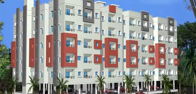
Magnus Smart City
M/s MUGDHA REALTORS AND OTHERS · Rangareddy · RERA P02400010251
MAGNUS SMART CITY is a new plotted development with open plots in Annaram, Farooqnagar Mandal, Ranga Reddy District. The registered promoter is MUGDHA REALTORS. The layout covers 67,879.71 sq.m of total site area and lists 215 plots; towers, blocks, floors and plot configurations are not stated in the TG-RERA record. Its TG-RERA registration number is P02400010251, and the header records a proposed completion date of 10/01/2031.
01What we found
Read from TG-RERA filings, approvals, land and registration records and court records. A court case is counted only when the court record states this project's survey number with its village, or names the project.
02Check before you pay
7 items to check before you pay, 3 high - from the title chain, court records and approvals, each with what to ask the builder or your advocate. An item may not be a problem with the project: records can be incomplete.
1. Project at a glance
Project identity
| Item | Project record |
|---|---|
| Registered name | MAGNUS SMART CITY RERA record |
| Project type | New plotted development / layout with open plots RERA record RERA filing |
| Phase / registered portion | The registration record identifies this as a new project; a separately named phase is not disclosed. The registered layout is in Survey No. 172Part, Annaram. RERA record |
| TG-RERA registration | P02400010251 RERA record |
| Registration validity | 10 September 2025 to 10 September 2030. This is the registration period, not the completion deadline. RERA record |
| Registered promoter | MUGDHA REALTORS; the certificate names MUGDHA REALTORS AND OTHERS. RERA record Corporate record |
| RERA status | Registered; the supplied certificate records the validity period and ongoing conditions. Approvals record |
Land and geographic identity
| Item | Project record |
|---|---|
| Locality / revenue village | Annaram; the layout plan names ANNARAM / Annaram Village. RERA record RERA filing |
| Mandal / district / PIN | Farooqnagar Mandal, Ranga Reddy District, 509202. RERA record RERA filing |
| Project survey number as registered and shown on the layout | Sy. No. 172Part (also recorded as 172PART). RERA record |
| Registered site area | 67,879.71 sq.m total site area; 66,191.12 sq.m net layout area. RERA filing Layout record |
| Road-affected area | 1,688.59 sq.m. RERA filing |
| Boundaries in RERA filing | East: Land of Mugdha Realtors; West: Road; North: Annaram Road; South: Land of Mugdha Realtors. RERA filing |
| Cadastral context | Bhu Bharati’s survey-level record describes 172PART as a whole-survey match with extent 83,912.06 sq.m; it is not the registered project-area figure. Cadastral map |
Development identity
| Item | Project record |
|---|---|
| Sanctioning authority / principal layout approval | Hyderabad Metropolitan Development Authority (HMDA); Layout Permit No. 0546/HMDA/SWDL/2025, approved 14/06/2025. The filed layout plan also carries file No. 002620/HMDA/00778/SWDL/SKP1/2025, dated 10/09/2025. Approvals record |
| Other filed approval reference | Document 612053 records No.002620/HMDA/00778/SWDI/SKPI/2025, dated 28/07/2025; the supplied extract is a fragment and does not show a heading or further layout particulars. |
| Approved development | Open-plot layout; the layout schedule records 215 plots. Layout record |
| Approved built-up area | 41,470.47 sq.m is recorded in the filing as approved built-up area; the layout schedule labels the same figure “Plotted Area.” RERA filing |
| Buildings / floors | Not disclosed as a building project. The supplied approval is for an open-plot layout; no tower, building-floor or parking-level count is established. |
| Layout land-use allocation | Plotted area 41,470.47 sq.m (62.65%); roads 17,229.54 sq.m (26.03%); open space/park 5,063.22 sq.m (7.65%); social infrastructure 1,719.84 sq.m (2.60%); utility area 706.48 sq.m (1.07%). |
Offering and status
| Item | Project record |
|---|---|
| Offered unit type | Residential plots; the filed layout schedule lists 215 plots. Layout record |
| Plot size range / booked and available | No RERA unit-type schedule, booked/available counts or RERA-filed plot-size range is supplied. Drawing-derived plot-size information is described in section 4. RERA unit table Layout record |
| Construction / development stage | The supplied RERA information identifies a new project but provides no independently verified site-progress report. The amenities record shows 0% progress for its listed items. RERA record RERA amenities |
| Completion dates | RERA Form B undertaking: 10 September 2030; header proposed completion: 10/01/2031. These are recorded separately in the supplied evidence. RERA record |
| Occupancy / completion certificate | No occupancy or completion certificate is supplied. This is a plotted layout; the filed draft-layout letter states that final layout release is subject to specified development and handover conditions. |
2. The project story
MAGNUS SMART CITY is registered as a residential plotted development in Annaram, Farooqnagar Mandal, Ranga Reddy District. Its filed layout covers 67,879.71 sq.m of total site area, of which 66,191.12 sq.m is stated as net layout area, and lists 215 open plots. RERA record
The layout plan allocates land to plots, internal roads, open space/park, social infrastructure and utilities. It shows internal road widths including 9.14m, 10.06m and 18.29m, and identifies a 2.00M wide cycle track. The plan also records an existing road width of 12.0m and proposed road width of 30.0m. These are plan details, not confirmation of completed works.
The filed draft-layout letter calls for roads, storm-water drains, underground drainage lines and a common septic tank/STP, internal water-supply lines and an overhead tank, electrical lines and street lights, avenue planting, park development and rainwater-harvesting pits. The filing records these as development requirements; the supplied amenity progress entries show 0%, and no independent site inspection or completion evidence is provided. RERA amenities
The layout letter states that development works are to be completed within three years and that the applicant must hand over layout roads, open space, social infrastructure and utility areas to the local body by registered gift deed before HMDA releases final layout plans. It also states that construction in plots is not to be allowed until final layout plans are issued.
3. Master plan, architecture & building design
This is an open-plot layout rather than a tower or apartment scheme. The filed layout schedule lists 215 plots and divides the net layout area of 66,191.12 sq.m as follows:
| Layout component | Area | Share of net layout area |
|---|---|---|
| Plotted area | 41,470.47 sq.m | 62.65% |
| Road area | 17,229.54 sq.m | 26.03% |
| Open space / park | 5,063.22 sq.m | 7.65% |
| Social infrastructure | 1,719.84 sq.m | 2.60% |
| Utility area | 706.48 sq.m | 1.07% |
| Total net layout area | 66,191.12 sq.m | 100% |
The plan also records 1,688.59 sq.m as road-widening / road-affected area. It identifies internal approach-road widths of 9.14m, 10.06m and 18.29m, as well as a 2.00M wide cycle track.
The filed layout indicates land reserved for social infrastructure and public utility, but does not establish a detailed architectural programme or completed buildings in those areas. No building count, floor configuration, tower height, dwelling configuration, FSI-counted area or carpet area is provided for this plotted layout. The 41,470.47 sq.m figure is the layout’s plotted-area allocation and is also recorded in the RERA fields as approved built-up area; it should not be read as an individual plot’s saleable or carpet area. RERA filing
4. Homes, configurations & floor plans
The RERA registration evidence supplied does not include a plot-by-plot unit schedule with booked/available status or RERA-filed plot areas. The layout drawing’s plot schedule was software-read: it reports 215 plots with sizes available for 215 entries. The source itself says the drawing-derived values should be checked against the drawing. Layout record RERA unit table
| Units | 215 (layout schedule) |
|---|---|
| Booked | Not supplied |
| Available | Not supplied |
| RERA saleable area | Not supplied |
| Drawing-derived size information | Software-measured from the layout drawing: 148.64–441.03 sq.m; median 183.95 sq.m. Layout record |
The drawing-derived size bands are: 15 plots at 150–200 sq.yd; 181 at 200–250 sq.yd; 1 at 250–300 sq.yd; 6 at 300–400 sq.yd; 11 at 400–500 sq.yd; and 1 at 500–1000 sq.yd. These bands and measurements are software-read from the layout drawing, not RERA-filed unit areas. Layout record
The floor-plan record contains two layout sheets and reports no measured floor plans. Carpet-area, room-dimension and apartment-configuration data therefore do not apply on the evidence supplied for this plotted layout. Floor plans
5. Parking & vehicle circulation
The filed layout allocates 0.00 sq.m to a common parking area. It shows internal roads and a 2.00M wide cycle track, but the supplied evidence does not give a sanctioned parking-space count, visitor or accessible parking provision, parking allocation to individual plots, or a vehicle-entry/exit arrangement.
The draft-layout letter lists roads, drainage and other layout infrastructure but does not establish parking bays or exclusive parking rights for plot purchasers. Any plot-specific parking entitlement should be confirmed in the registered buyer documents.
6. Amenities, recreation & open spaces
The table below separates layout-plan allocations and filed development requirements from progress evidence. The RERA amenity record reports 0% progress for its listed items; it does not verify that any facility is complete. RERA amenities
| Description / size | 5,063.22 sq.m (7.65%) of net layout area; park development is specified in the draft-layout conditions. |
|---|---|
| Declared progress / verified status | RERA amenity record: 0% for Green Strip/TOT LOT/Park; completion not independently verified. RERA amenities |
| Description / size | 1,719.84 sq.m (2.60%) allocated. Specific built facilities are not detailed in the layout extract. |
|---|---|
| Declared progress / verified status | No completed facility verified. |
| Description / size | Road area 17,229.54 sq.m (26.03%); drawing lists road widths of 9.14m, 10.06m and 18.29m, and a 2.00M wide cycle track. |
|---|---|
| Declared progress / verified status | RERA amenity record: 0%; completion not independently verified. RERA amenities |
| Description / size | Listed in the RERA amenity record without a supplied description or size. |
|---|---|
| Evidence source | RERA amenities |
| Declared progress / verified status | Progress recorded as 0%; no completion evidence supplied. |
| Description / size | Vendor lists facilities including a clubhouse, gym, swimming pool, sports facilities, children’s play area, jogging tracks, temple and amphitheatre. |
|---|---|
| Evidence source | Promoter website |
| Declared progress / verified status | Promoter-marketed claims only; not established as sanctioned or delivered by the supplied project documents. |
7. Utilities, building services & safety
The filed draft-layout letter specifies development of a common septic tank/STP, underground drainage lines, storm-water drains, internal water-supply pipes, an overhead tank, an assured water-supply source, electrical supply lines, street lighting, a transformer, avenue planting, park development and rainwater-harvesting pits. These are approval conditions or proposed layout works; no capacity data or independently verified completion evidence is supplied.
The layout drawing labels a SEPTIC TANK, GARBAGE BIN, TRANSFORMER, WATER TANK and BELOW SUMP. The RERA amenity record lists water supply, sewerage, storm-water drainage, sewage treatment/disposal, solid-waste management, rainwater harvesting and electrical meter/substation/receiving-station provision, each with 0% progress where a percentage is recorded. RERA amenities
The supplied evidence does not establish completed utility connections, water-source capacity, treatment capacity, electrical backup, EV charging installation, security systems or accessibility works. The layout approval document includes conditions concerning services, transformer space and rainwater harvesting, but those conditions are not evidence that the works have been completed.
8. Location, access & connectivity
The registered project location is Annaram, Farooqnagar Mandal, Ranga Reddy District, PIN 509202, in Sy. No. 172Part. The filed site boundaries identify Annaram Road to the north, a road to the west, and land of Mugdha Realtors to the east and south. RERA record RERA filing
The layout drawing records an existing 12.0m road width and a proposed 30.0m road width, and shows internal road widths of 9.14m, 10.06m and 18.29m. The location record gives the nearest sampled Outer Ring Road interchange as approximately 36.0 km away. Location record
No public-transport details or independently measured distances to neighbourhood services are supplied in the project evidence. The location record places the cadastral parcel centroid at 17.02169, 78.17020. Location record Cadastral map
9. Developer & development status
The registered promoter is MUGDHA REALTORS, identified in the RERA filing as a partnership. Its GSTIN is 36ACBFM2676D1ZC. The supplied address is Jayabheri Enclave, Gachibowli, Phase-II, Annaram, Farooqnagar, Ranga Reddy, 509202; the registration certificate also lists the promoter address as Village Gachi Bowli, Mandal Serilingampally, District Ranga Reddy, PIN 500032. Corporate record Parties record
The RERA filing names SURESH NAMALA as authorized signatory and SAIKUMAR YATA, SOUMITH REDDY JAKKA and SATYANARAYANA CHITTI as partners. The Form B declaration, made by authorized signatory Sri Namala Suresh, undertakes completion by 10 September 2030. Parties record
The header separately records a proposed completion date of 10/01/2031. The supplied evidence does not include a site-verified construction-progress report or an occupancy/completion certificate. RERA record
10. Approvals, official records & documents
| Record | Supplied evidence |
|---|---|
| TG-RERA registration | Form C certificate for MAGNUS SMART CITY, registration P02400010251, valid 10/09/2025–10/09/2030. |
| Principal layout approval | HMDA Draft Layout Letter under Layout Permit No. 0546/HMDA/SWDL/2025, dated 14/06/2025, for an open-plot layout in Sy. No. 172Part, Annaram. |
| Filed layout drawing | Layout plan/file No. 002620/HMDA/00778/SWDL/SKP1/2025, dated 10/09/2025; records 215 plots, land-use allocation and plan conditions. |
| Additional approval fragment | Document 612053 records No.002620/HMDA/00778/SWDI/SKPI/2025, dated 28/07/2025, and an extent of 66,191.12 sq.m; its extract does not provide a heading or further particulars. |
| HMDA mortgage / road-affected land records referenced in draft letter | Mortgage of 6,346.37 sq.m in favour of the Metropolitan Commissioner, HMDA, under document No. 6788/2025; road-affected area 1,688.59 sq.m recorded as gifted under deed No. 6789/2025, dated 29.08.2025. |
| Promoter Form B declaration | October 2025 declaration by authorized signatory Sri Namala Suresh; includes the promoter’s stated completion undertaking and land/title and project-account declarations. |
| Occupancy / completion certificate | None supplied. The draft-layout letter says final layout release follows the specified development and handover conditions. |
| Public layout-portal lookup | The HMDA DPMS approved-layout lookup is reported as not publicly reachable in the supplied evidence; this is a limitation of access, not a determination about approval status. HMDA |
1. Project at a glance
Project identity
Registered name: MAGNUS SMART CITY
Project type: New plotted development / layout with open plots
Phase / registered portion: The registration record identifies this as a new project; a separately named phase is not disclosed. The registered layout is in Survey No. 172Part, Annaram.
TG-RERA registration: P02400010251
Registration validity: 10 September 2025 to 10 September 2030. This is the registration period, not the completion deadline.
Registered promoter: MUGDHA REALTORS; the certificate names MUGDHA REALTORS AND OTHERS.
RERA status: Registered; the supplied certificate records the validity period and ongoing conditions.
Land and geographic identity
Locality / revenue village: Annaram; the layout plan names ANNARAM / Annaram Village.
Mandal / district / PIN: Farooqnagar Mandal, Ranga Reddy District, 509202.
Project survey number as registered and shown on the layout: Sy. No. 172Part (also recorded as 172PART).
Registered site area: 67,879.71 sq.m total site area; 66,191.12 sq.m net layout area.
Road-affected area: 1,688.59 sq.m.
Boundaries in RERA filing: East: Land of Mugdha Realtors; West: Road; North: Annaram Road; South: Land of Mugdha Realtors.
Cadastral context: Bhu Bharati’s survey-level record describes 172PART as a whole-survey match with extent 83,912.06 sq.m; it is not the registered project-area figure.
Development identity
Sanctioning authority / principal layout approval: Hyderabad Metropolitan Development Authority (HMDA); Layout Permit No. 0546/HMDA/SWDL/2025, approved 14/06/2025. The filed layout plan also carries file No. 002620/HMDA/00778/SWDL/SKP1/2025, dated 10/09/2025.
Other filed approval reference: Document 612053 records No.002620/HMDA/00778/SWDI/SKPI/2025, dated 28/07/2025; the supplied extract is a fragment and does not show a heading or further layout particulars.
Approved development: Open-plot layout; the layout schedule records 215 plots.
Approved built-up area: 41,470.47 sq.m is recorded in the filing as approved built-up area; the layout schedule labels the same figure “Plotted Area.”
Buildings / floors: Not disclosed as a building project. The supplied approval is for an open-plot layout; no tower, building-floor or parking-level count is established.
Layout land-use allocation: Plotted area 41,470.47 sq.m (62.65%); roads 17,229.54 sq.m (26.03%); open space/park 5,063.22 sq.m (7.65%); social infrastructure 1,719.84 sq.m (2.60%); utility area 706.48 sq.m (1.07%).
Offering and status
Offered unit type: Residential plots; the filed layout schedule lists 215 plots.
Plot size range / booked and available: No RERA unit-type schedule, booked/available counts or RERA-filed plot-size range is supplied. Drawing-derived plot-size information is described in section 4.
Construction / development stage: The supplied RERA information identifies a new project but provides no independently verified site-progress report. The amenities record shows 0% progress for its listed items.
Completion dates: RERA Form B undertaking: 10 September 2030; header proposed completion: 10/01/2031. These are recorded separately in the supplied evidence.
Occupancy / completion certificate: No occupancy or completion certificate is supplied. This is a plotted layout; the filed draft-layout letter states that final layout release is subject to specified development and handover conditions.
2. The project story
MAGNUS SMART CITY is registered as a residential plotted development in Annaram, Farooqnagar Mandal, Ranga Reddy District. Its filed layout covers 67,879.71 sq.m of total site area, of which 66,191.12 sq.m is stated as net layout area, and lists 215 open plots.
The layout plan allocates land to plots, internal roads, open space/park, social infrastructure and utilities. It shows internal road widths including 9.14m, 10.06m and 18.29m, and identifies a 2.00M wide cycle track. The plan also records an existing road width of 12.0m and proposed road width of 30.0m. These are plan details, not confirmation of completed works.
The filed draft-layout letter calls for roads, storm-water drains, underground drainage lines and a common septic tank/STP, internal water-supply lines and an overhead tank, electrical lines and street lights, avenue planting, park development and rainwater-harvesting pits. The filing records these as development requirements; the supplied amenity progress entries show 0%, and no independent site inspection or completion evidence is provided.
The layout letter states that development works are to be completed within three years and that the applicant must hand over layout roads, open space, social infrastructure and utility areas to the local body by registered gift deed before HMDA releases final layout plans. It also states that construction in plots is not to be allowed until final layout plans are issued.
3. Master plan, architecture & building design
This is an open-plot layout rather than a tower or apartment scheme. The filed layout schedule lists 215 plots and divides the net layout area of 66,191.12 sq.m as follows:
| Layout component | Area | Share of net layout area |
|---|---|---|
| Plotted area | 41,470.47 sq.m | 62.65% |
| Road area | 17,229.54 sq.m | 26.03% |
| Open space / park | 5,063.22 sq.m | 7.65% |
| Social infrastructure | 1,719.84 sq.m | 2.60% |
| Utility area | 706.48 sq.m | 1.07% |
| Total net layout area | 66,191.12 sq.m | 100% |
The plan also records 1,688.59 sq.m as road-widening / road-affected area. It identifies internal approach-road widths of 9.14m, 10.06m and 18.29m, as well as a 2.00M wide cycle track.
The filed layout indicates land reserved for social infrastructure and public utility, but does not establish a detailed architectural programme or completed buildings in those areas. No building count, floor configuration, tower height, dwelling configuration, FSI-counted area or carpet area is provided for this plotted layout. The 41,470.47 sq.m figure is the layout’s plotted-area allocation and is also recorded in the RERA fields as approved built-up area; it should not be read as an individual plot’s saleable or carpet area.
4. Homes, configurations & floor plans
The RERA registration evidence supplied does not include a plot-by-plot unit schedule with booked/available status or RERA-filed plot areas. The layout drawing’s plot schedule was software-read: it reports 215 plots with sizes available for 215 entries. The source itself says the drawing-derived values should be checked against the drawing.
| Units | 215 (layout schedule) |
|---|---|
| Booked | Not supplied |
| Available | Not supplied |
| RERA saleable area | Not supplied |
| Drawing-derived size information | Software-measured from the layout drawing: 148.64–441.03 sq.m; median 183.95 sq.m. |
The drawing-derived size bands are: 15 plots at 150–200 sq.yd; 181 at 200–250 sq.yd; 1 at 250–300 sq.yd; 6 at 300–400 sq.yd; 11 at 400–500 sq.yd; and 1 at 500–1000 sq.yd. These bands and measurements are software-read from the layout drawing, not RERA-filed unit areas.
The floor-plan record contains two layout sheets and reports no measured floor plans. Carpet-area, room-dimension and apartment-configuration data therefore do not apply on the evidence supplied for this plotted layout.
5. Parking & vehicle circulation
The filed layout allocates 0.00 sq.m to a common parking area. It shows internal roads and a 2.00M wide cycle track, but the supplied evidence does not give a sanctioned parking-space count, visitor or accessible parking provision, parking allocation to individual plots, or a vehicle-entry/exit arrangement.
The draft-layout letter lists roads, drainage and other layout infrastructure but does not establish parking bays or exclusive parking rights for plot purchasers. Any plot-specific parking entitlement should be confirmed in the registered buyer documents.
6. Amenities, recreation & open spaces
The table below separates layout-plan allocations and filed development requirements from progress evidence. The RERA amenity record reports 0% progress for its listed items; it does not verify that any facility is complete.
| Description / size | 5,063.22 sq.m (7.65%) of net layout area; park development is specified in the draft-layout conditions. |
|---|---|
| Declared progress / verified status | RERA amenity record: 0% for Green Strip/TOT LOT/Park; completion not independently verified. |
| Description / size | 1,719.84 sq.m (2.60%) allocated. Specific built facilities are not detailed in the layout extract. |
|---|---|
| Declared progress / verified status | No completed facility verified. |
| Description / size | Road area 17,229.54 sq.m (26.03%); drawing lists road widths of 9.14m, 10.06m and 18.29m, and a 2.00M wide cycle track. |
|---|---|
| Declared progress / verified status | RERA amenity record: 0%; completion not independently verified. |
| Description / size | Listed in the RERA amenity record without a supplied description or size. |
|---|---|
| Declared progress / verified status | Progress recorded as 0%; no completion evidence supplied. |
| Description / size | Vendor lists facilities including a clubhouse, gym, swimming pool, sports facilities, children’s play area, jogging tracks, temple and amphitheatre. |
|---|---|
| Declared progress / verified status | Promoter-marketed claims only; not established as sanctioned or delivered by the supplied project documents. |
7. Utilities, building services & safety
The filed draft-layout letter specifies development of a common septic tank/STP, underground drainage lines, storm-water drains, internal water-supply pipes, an overhead tank, an assured water-supply source, electrical supply lines, street lighting, a transformer, avenue planting, park development and rainwater-harvesting pits. These are approval conditions or proposed layout works; no capacity data or independently verified completion evidence is supplied.
The layout drawing labels a SEPTIC TANK, GARBAGE BIN, TRANSFORMER, WATER TANK and BELOW SUMP. The RERA amenity record lists water supply, sewerage, storm-water drainage, sewage treatment/disposal, solid-waste management, rainwater harvesting and electrical meter/substation/receiving-station provision, each with 0% progress where a percentage is recorded.
The supplied evidence does not establish completed utility connections, water-source capacity, treatment capacity, electrical backup, EV charging installation, security systems or accessibility works. The layout approval document includes conditions concerning services, transformer space and rainwater harvesting, but those conditions are not evidence that the works have been completed.
8. Location, access & connectivity
The registered project location is Annaram, Farooqnagar Mandal, Ranga Reddy District, PIN 509202, in Sy. No. 172Part. The filed site boundaries identify Annaram Road to the north, a road to the west, and land of Mugdha Realtors to the east and south.
The layout drawing records an existing 12.0m road width and a proposed 30.0m road width, and shows internal road widths of 9.14m, 10.06m and 18.29m. The location record gives the nearest sampled Outer Ring Road interchange as approximately 36.0 km away.
No public-transport details or independently measured distances to neighbourhood services are supplied in the project evidence. The location record places the cadastral parcel centroid at 17.02169, 78.17020.
9. Developer & development status
The registered promoter is MUGDHA REALTORS, identified in the RERA filing as a partnership. Its GSTIN is 36ACBFM2676D1ZC. The supplied address is Jayabheri Enclave, Gachibowli, Phase-II, Annaram, Farooqnagar, Ranga Reddy, 509202; the registration certificate also lists the promoter address as Village Gachi Bowli, Mandal Serilingampally, District Ranga Reddy, PIN 500032.
The RERA filing names SURESH NAMALA as authorized signatory and SAIKUMAR YATA, SOUMITH REDDY JAKKA and SATYANARAYANA CHITTI as partners. The Form B declaration, made by authorized signatory Sri Namala Suresh, undertakes completion by 10 September 2030.
The header separately records a proposed completion date of 10/01/2031. The supplied evidence does not include a site-verified construction-progress report or an occupancy/completion certificate.
10. Approvals, official records & documents
TG-RERA registration: Form C certificate for MAGNUS SMART CITY, registration P02400010251, valid 10/09/2025–10/09/2030.
Principal layout approval: HMDA Draft Layout Letter under Layout Permit No. 0546/HMDA/SWDL/2025, dated 14/06/2025, for an open-plot layout in Sy. No. 172Part, Annaram.
Filed layout drawing: Layout plan/file No. 002620/HMDA/00778/SWDL/SKP1/2025, dated 10/09/2025; records 215 plots, land-use allocation and plan conditions.
Additional approval fragment: Document 612053 records No.002620/HMDA/00778/SWDI/SKPI/2025, dated 28/07/2025, and an extent of 66,191.12 sq.m; its extract does not provide a heading or further particulars.
HMDA mortgage / road-affected land records referenced in draft letter: Mortgage of 6,346.37 sq.m in favour of the Metropolitan Commissioner, HMDA, under document No. 6788/2025; road-affected area 1,688.59 sq.m recorded as gifted under deed No. 6789/2025, dated 29.08.2025.
Promoter Form B declaration: October 2025 declaration by authorized signatory Sri Namala Suresh; includes the promoter’s stated completion undertaking and land/title and project-account declarations.
Occupancy / completion certificate: None supplied. The draft-layout letter says final layout release follows the specified development and handover conditions.
Public layout-portal lookup: The HMDA DPMS approved-layout lookup is reported as not publicly reachable in the supplied evidence; this is a limitation of access, not a determination about approval status.
Frequently asked questions
Is MAGNUS SMART CITY registered with Telangana RERA?
Yes. MAGNUS SMART CITY is registered with the Telangana Real Estate Regulatory Authority as P02400010251; the registration status is New Project.
Who is the developer of MAGNUS SMART CITY?
The promoter named in the RERA registration is M/s MUGDHA REALTORS AND OTHERS.
Where is MAGNUS SMART CITY located?
MAGNUS SMART CITY is in Annaram, Farooqnagar, Rangareddy, Telangana (509202).
When will MAGNUS SMART CITY be completed?
The promoter's proposed date of completion filed with RERA is 10/01/2031. This is the promoter's declaration, not a guarantee.
More projects in Annaram