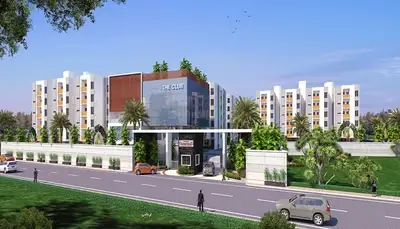
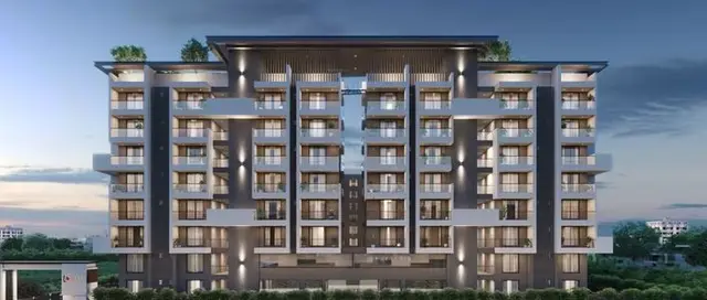
Bhagavati Green Meadows Annexe
Bhagavati Infrastructures · Medchal-Malkajgiri · RERA P02200002039
BHAGAVATI GREEN MEADOWS ANNEXE is a residential plotted development in Kandlakoi, Medchal Mandal, Medchal-Malkajgiri District. It is being developed by registered promoter Bhagavati Infrastructures, a partnership. The site area is 42530.63 sq.m, with a net site area of 30660.12 sq.m; the layout records 122 plots, and no plot configurations are supplied. The project is registered under TG-RERA P02200002039, and the promoter-declared completion date is 01/07/2022.
More from Bhagavati Infrastructures · 3 projects →
01What we found
Read from TG-RERA filings, approvals, land and registration records and court records. A court case is counted only when the court record states this project's survey number with its village, or names the project.
02Check before you pay
9 items to check before you pay, 4 high - from the title chain, court records and approvals, each with what to ask the builder or your advocate. An item may not be a problem with the project: records can be incomplete.
1. Project at a glance
Project identity
| Item | Record |
|---|---|
| Registered project name | BHAGAVATI GREEN MEADOWS ANNEXE RERA record |
| Project type | Plotted development / open residential layout RERA record |
| Phase / registered portion | Not separately identified in the supplied registration record. RERA record |
| TG-RERA registration | P02200002039; issued 24/08/2020; stated validity 24/08/2020–31/07/2022. No extension is recorded in the supplied certificate. Registration validity is distinct from the completion undertaking and from any completion or occupancy certification. Approvals record |
| Registered promoter | Bhagavati Infrastructures; entity type disclosed as partnership. Corporate record RERA filing |
| RERA status | New project in the supplied project record. The registration certificate’s stated validity ended on 31/07/2022; current registration status is not established by the supplied material. RERA record |
Land and geographic identity
| Item | Record |
|---|---|
| Locality | KANDLAKOI / Kandlakoi RERA record RERA filing |
| Revenue village | Kandlakoi; the layout documents also describe the site as Kandlakoya-ORRGC Village. RERA record |
| Mandal | Medchal RERA record |
| District | Medchal-Malkajgiri RERA record |
| PIN | 501401 RERA record |
| Project survey numbers | 192, 193/A, 194, 194/A as recorded in the TG-RERA identity and registration certificate. The layout drawing identifies 192/P, 193/A and 194/A. RERA record RERA filing |
| Registered site area | Total site area 42530.63 sq.m; net site area 30660.12 sq.m; road-widening / master-plan road affected area 11870.51 sq.m. RERA filing |
| Boundaries (RERA filing) | East: ROAD AND GNANASHRAMAM; west: NEIGHBOURS LAND SY NO 194; north: NEIGHBOURS LAND; south: BHAGAVATI INFRASTRUCTURES LAND. RERA filing |
Development identity
| Item | Record |
|---|---|
| Sanctioning authority | Hyderabad Metropolitan Development Authority (HMDA); the layout record also refers to delegation to Gundlapochampally Municipality. Approvals record |
| Principal layout approval | Layout Permit No. 000047/LO/Plg/HMDA/2020, dated 28 May, 2020; application/file No. 032525/ZOC/LO/U6/HMDA/03012020. The RERA filing also lists 000047/LO/Plg/HMDA/2. Approvals record |
| Approved built-up area | 21669.96 sq.m is recorded in the RERA filing as “Approved Built up Area”; the layout area statement labels the same figure “Plotted Area.” No building or apartment built-up area is supplied. RERA filing Layout record |
| Buildings / floors | Not applicable to the supplied open plotted-layout record; no building count, floor configuration or parking levels are disclosed. |
| Layout arrangement | The layout drawing identifies plot numbers 1–25 and states a total of 122 plots; mortgage conditions cover plots 1–25. The supplied material does not establish that all plots are currently saleable. Layout record |
Offering and status
| Item | Record |
|---|---|
| Offered type | Residential plots; RERA unit-level plot count, plot-size schedule and inventory availability are not supplied. RERA record |
| RERA-filed sizes / booked and available counts | Not disclosed in the supplied records. RERA record RERA unit table |
| Construction / development stage | The filing records 80% completeness; this is a recorded progress figure, not an independent site inspection. RERA record |
| Promoter-declared completion | Form B states 01/07/2022. The registration certificate states validity through 31/07/2022; these are separate recorded dates. |
| Occupancy / completion certificate | No completion certificate or occupancy certificate is included in the supplied material. The supplied approval is described as a draft layout letter. Document index |
2. The project story
BHAGAVATI GREEN MEADOWS ANNEXE is registered as a residential plotted development at Kandlakoi, Medchal Mandal, Medchal-Malkajgiri District. Its layout record describes an open plotted layout in the Outer Ring Road Growth Corridor and identifies residential plot use. RERA record RERA filing
The HMDA layout record gives a total site area of 42530.63 sq.m, including 11870.51 sq.m affected by the master-plan road, and a net site area of 30660.12 sq.m. The layout drawing identifies plot numbers 1–25 and records a total of 122 plots. That number is a drawing-extracted figure; a complete plot-by-plot size or current saleable-inventory schedule is not supplied. Layout record RERA unit table
The project filing records 80% completeness, while the promoter’s Form B records a completion undertaking of 01/07/2022. Neither figure establishes independently verified present-day completion. No completion or occupancy certificate is available in the supplied evidence. RERA record Document index
3. Master plan, architecture & building design
The supplied HMDA drawing is for an open plotted layout, not a building plan. It records a total site area of 42530.63 sq.m, net site area of 30660.12 sq.m, and road-widening area of 11870.51 sq.m. Its area statement allocates 21669.96 sq.m to plotted area, 5546.05 sq.m to roads, 2677.06 sq.m to organised open space / utility area, and 767.03 sq.m to social infrastructure.
The drawing identifies residential plot use and road widths including 12.00, 12, and 40' in the plan extraction; the approval letter also specifies roads of 18 mts and above and 60 feet and above. The supplied data does not provide a complete road-by-road layout schedule or plot-size schedule.
The RERA filing records 21669.96 sq.m as approved built-up area, while the layout drawing labels that quantity as plotted area. No building footprint, tower/block configuration, floor count, FSI-counted area or apartment design information is supplied. RERA filing Layout record
4. Homes, configurations & floor plans
This is a plotted development. A RERA-filed plot inventory table with plot-wise areas, booked counts and available counts is not supplied, so no RERA configuration table can be completed. RERA record RERA unit table
The layout drawing identifies plot numbers 1–25 and records 122 plots overall, but the supplied extracted layout data is incomplete for plot-by-plot sizes. Layout record
A third-party vendor record lists plot-size claims, including “saleable 1815 - 3906 sq.ft” and several individual values; these are not TG-RERA-filed measurements and are not used here as the project’s recorded offer. Promoter website
The drawing-measurement record states that 0 of 3 drawings were measured and that the drawings contain no flats. Therefore, no software-measured carpet-area or room-dimension figures are available. Floor plans
5. Parking & vehicle circulation
The project is a plotted layout, and the supplied material does not state sanctioned resident, visitor, accessible or two-wheeler parking counts, nor does it establish plot-wise parking allocation.
The layout approval requires roads to be opened for accessibility to neighbouring sites and includes internal roads and footpaths in its infrastructure schedule. The supplied documents do not specify vehicle entry/exit locations, pedestrian-vehicle separation details or EV charging provision.
6. Amenities, recreation & open spaces
The layout approval records open-space, road, social-infrastructure and utility-area allocations. The project filing’s amenity checklist records declarations for internal roads and footpaths, water supply, sewerage, storm-water drains, street lighting and rainwater harvesting; those checklist entries do not establish independent completion. RERA amenities
| Description / size | 2677.06 sq.m |
|---|---|
| Evidence source | HMDA layout area statement |
| Declared progress / verified status | Shown in the approved layout record; delivered condition not independently verified. |
| Description / size | 767.03 sq.m |
|---|---|
| Evidence source | HMDA layout area statement |
| Declared progress / verified status | Shown in the approved layout record; facility/building and delivery details are not supplied. |
| Description / size | 5546.05 sq.m roads area; approval extraction also identifies road widths 18 mts and above and 60 feet and above |
|---|---|
| Evidence source | HMDA layout records |
| Declared progress / verified status | Required/provided for in the layout record; completion not independently verified. |
| Description / size | No size supplied |
|---|---|
| Evidence source | Layout approval / utility list |
| Declared progress / verified status | Listed as a layout requirement; completion not independently verified. |
| Description / size | No quantity or size beyond the open-space area above |
|---|---|
| Evidence source | Layout approval |
| Declared progress / verified status | Required by the approval record; completion not independently verified. |
| Description / size | No sanctioned size or capacity supplied |
|---|---|
| Evidence source | Vendor marketing record Promoter website |
| Declared progress / verified status | Marketing claims only; not established as sanctioned or delivered. |
| Description / size | No size or quantity supplied |
|---|---|
| Evidence source | Vendor marketing record Promoter website |
| Declared progress / verified status | Marketing claims only; not independently verified. |
7. Utilities, building services & safety
The HMDA approval record requires or lists potable-water connectivity, internal water-supply pipelines, an overhead tank, underground storm-water drainage, underground drainage lines, street lighting, electrical supply lines and a transformer yard. It also lists rainwater-harvesting pits, a common septic tank / STP, a bio-compost unit and source segregation of garbage. These are approval-record provisions; the supplied evidence does not verify installation, capacity or operation.
| What the supplied record says | Internal water-supply pipelines and an overhead tank are listed; the approval requires arrangements to connect to a potable-water supply pipeline. |
|---|---|
| Status evidence | Required/listed in the approval record; no capacity or independent completion evidence supplied. |
| What the supplied record says | Common septic tank / STP, underground drainage lines and storm-water drains are listed. |
|---|---|
| Status evidence | Required/listed in the approval record; no capacity or independent completion evidence supplied. |
| What the supplied record says | Rainwater-harvesting pits are listed; the RERA amenity checklist records water conservation / rainwater harvesting as “YES.” |
|---|---|
| Status evidence | RERA checklist declaration and approval listing; installation not independently verified. RERA amenities |
| What the supplied record says | Electrical supply lines, transformer yard and LED street lighting are listed. |
|---|---|
| Status evidence | Required/listed in the approval record; no capacity or completion evidence supplied. |
| What the supplied record says | Solid-waste space, a bio-compost unit and source segregation are specified in the approval conditions. |
|---|---|
| Status evidence | Approval requirements; implementation not independently verified. |
| What the supplied record says | The supplied layout records do not provide a fire-system design, fire clearance, accessible-circulation plan or facility capacities. |
|---|---|
| Status evidence | Not established by the supplied evidence. RERA amenities Document index |
8. Location, access & connectivity
The registered project location is Kandlakoi, Medchal Mandal, Medchal-Malkajgiri District, Telangana 501401. The layout documents describe the site as Kandlakoya-ORRGC Village in the Outer Ring Road Growth Corridor. RERA record
Supplied location data lists the following approximate measured distances: Location record
| Destination / feature | Supplied distance |
|---|---|
| Outer Ring Road (nearest sampled interchange, approx.) | 0.6 km |
| TGSRTC Bus Station, Medchal | 0.2 km |
| Community Health Centre, Ghatkesar | 0.4 km |
| Kandlakoya Oxygen Park | 3.4 km |
| Medchal railway station | 1.2 km |
These are location-record measurements; no travel times are supplied. A vendor record describes the location as near schools, hospitals and supermarkets, but gives no measured distances, so that description is not treated as a verified connectivity detail. Location record Promoter website
9. Developer & development status
The registered promoter is Bhagavati Infrastructures, disclosed as a partnership. The RERA filing identifies its project address as Shankar Enclave, HAL Colony Road, Kandlakoi, Medchal, Medchal-Malkajgiri, 501401. The registration certificate separately records the promoter office as Village: Olb Bowenpally, Mandal: Balanagar, District: Medchal-Malkajgiri, Pin: 500011. Corporate record RERA filing
The filing identifies Ravikanth Goud Teegala as authorised signatory and lists partners including Bhoomlingam Goud Teegala, Vijayalakshmi Teegala, Srilatha Padala, Shashikanth Goud Teegala, Prabhakar Goud Vuppunuthula, Shiva Kumar Padakanti and Nagaraju Thodupunuri. Parties record
The project record reports 80% completeness, and Form B gives a promoter-declared completion date of 01/07/2022. The TG-RERA certificate states registration validity through 31/07/2022. These are distinct recorded measures; the supplied evidence does not independently establish current construction status or a completion/occupancy certificate. RERA record Document index
10. Approvals, official records & documents
| Record | Supplied evidence |
|---|---|
| TG-RERA registration | Form C registration certificate for BHAGAVATI GREEN MEADOWS ANNEXE, registration no. P02200002039, issued 24/08/2020; stated validity through 31/07/2022. |
| Principal layout approval | HMDA layout permit 000047/LO/Plg/HMDA/2020, dated 28 May, 2020; application/file No. 032525/ZOC/LO/U6/HMDA/03012020. The drawing is described as a proposed draft open plotted layout. |
| RERA-filed plan identifier | 000047/LO/Plg/HMDA/2. Approvals record RERA record |
| Layout plan | HMDA plan for survey numbers 192/P, 193/A and 194/A, with area statement, road and open-space allocations and conditions. The approval record states that layout permission is not proof of land title. |
| RERA promoter declaration | Form B affidavit dated 13* Day of July 2020; includes the promoter’s completion undertaking of 01/07/2022. |
| Completion / occupancy certificate | Not included in the supplied documents. Document index |
| Other approval-document status | The HMDA DPMS approved-layout lookup is reported unavailable through the public internet; this is a source-access limitation, not evidence of refusal. HMDA |
1. Project at a glance
Project identity
Registered project name: BHAGAVATI GREEN MEADOWS ANNEXE
Project type: Plotted development / open residential layout
Phase / registered portion: Not separately identified in the supplied registration record.
TG-RERA registration: P02200002039; issued 24/08/2020; stated validity 24/08/2020–31/07/2022. No extension is recorded in the supplied certificate. Registration validity is distinct from the completion undertaking and from any completion or occupancy certification.
Registered promoter: Bhagavati Infrastructures; entity type disclosed as partnership.
RERA status: New project in the supplied project record. The registration certificate’s stated validity ended on 31/07/2022; current registration status is not established by the supplied material.
Land and geographic identity
Locality: KANDLAKOI / Kandlakoi
Revenue village: Kandlakoi; the layout documents also describe the site as Kandlakoya-ORRGC Village.
Mandal: Medchal
District: Medchal-Malkajgiri
PIN: 501401
Project survey numbers: 192, 193/A, 194, 194/A as recorded in the TG-RERA identity and registration certificate. The layout drawing identifies 192/P, 193/A and 194/A.
Registered site area: Total site area 42530.63 sq.m; net site area 30660.12 sq.m; road-widening / master-plan road affected area 11870.51 sq.m.
Boundaries (RERA filing): East: ROAD AND GNANASHRAMAM; west: NEIGHBOURS LAND SY NO 194; north: NEIGHBOURS LAND; south: BHAGAVATI INFRASTRUCTURES LAND.
Development identity
Sanctioning authority: Hyderabad Metropolitan Development Authority (HMDA); the layout record also refers to delegation to Gundlapochampally Municipality.
Principal layout approval: Layout Permit No. 000047/LO/Plg/HMDA/2020, dated 28 May, 2020; application/file No. 032525/ZOC/LO/U6/HMDA/03012020. The RERA filing also lists 000047/LO/Plg/HMDA/2.
Approved built-up area: 21669.96 sq.m is recorded in the RERA filing as “Approved Built up Area”; the layout area statement labels the same figure “Plotted Area.” No building or apartment built-up area is supplied.
Buildings / floors: Not applicable to the supplied open plotted-layout record; no building count, floor configuration or parking levels are disclosed.
Layout arrangement: The layout drawing identifies plot numbers 1–25 and states a total of 122 plots; mortgage conditions cover plots 1–25. The supplied material does not establish that all plots are currently saleable.
Offering and status
Offered type: Residential plots; RERA unit-level plot count, plot-size schedule and inventory availability are not supplied.
RERA-filed sizes / booked and available counts: Not disclosed in the supplied records.
Construction / development stage: The filing records 80% completeness; this is a recorded progress figure, not an independent site inspection.
Promoter-declared completion: Form B states 01/07/2022. The registration certificate states validity through 31/07/2022; these are separate recorded dates.
Occupancy / completion certificate: No completion certificate or occupancy certificate is included in the supplied material. The supplied approval is described as a draft layout letter.
2. The project story
BHAGAVATI GREEN MEADOWS ANNEXE is registered as a residential plotted development at Kandlakoi, Medchal Mandal, Medchal-Malkajgiri District. Its layout record describes an open plotted layout in the Outer Ring Road Growth Corridor and identifies residential plot use.
The HMDA layout record gives a total site area of 42530.63 sq.m, including 11870.51 sq.m affected by the master-plan road, and a net site area of 30660.12 sq.m. The layout drawing identifies plot numbers 1–25 and records a total of 122 plots. That number is a drawing-extracted figure; a complete plot-by-plot size or current saleable-inventory schedule is not supplied.
The project filing records 80% completeness, while the promoter’s Form B records a completion undertaking of 01/07/2022. Neither figure establishes independently verified present-day completion. No completion or occupancy certificate is available in the supplied evidence.
3. Master plan, architecture & building design
The supplied HMDA drawing is for an open plotted layout, not a building plan. It records a total site area of 42530.63 sq.m, net site area of 30660.12 sq.m, and road-widening area of 11870.51 sq.m. Its area statement allocates 21669.96 sq.m to plotted area, 5546.05 sq.m to roads, 2677.06 sq.m to organised open space / utility area, and 767.03 sq.m to social infrastructure.
The drawing identifies residential plot use and road widths including 12.00, 12, and 40' in the plan extraction; the approval letter also specifies roads of 18 mts and above and 60 feet and above. The supplied data does not provide a complete road-by-road layout schedule or plot-size schedule.
The RERA filing records 21669.96 sq.m as approved built-up area, while the layout drawing labels that quantity as plotted area. No building footprint, tower/block configuration, floor count, FSI-counted area or apartment design information is supplied.
4. Homes, configurations & floor plans
This is a plotted development. A RERA-filed plot inventory table with plot-wise areas, booked counts and available counts is not supplied, so no RERA configuration table can be completed.
The layout drawing identifies plot numbers 1–25 and records 122 plots overall, but the supplied extracted layout data is incomplete for plot-by-plot sizes.
A third-party vendor record lists plot-size claims, including “saleable 1815 - 3906 sq.ft” and several individual values; these are not TG-RERA-filed measurements and are not used here as the project’s recorded offer.
The drawing-measurement record states that 0 of 3 drawings were measured and that the drawings contain no flats. Therefore, no software-measured carpet-area or room-dimension figures are available.
5. Parking & vehicle circulation
The project is a plotted layout, and the supplied material does not state sanctioned resident, visitor, accessible or two-wheeler parking counts, nor does it establish plot-wise parking allocation.
The layout approval requires roads to be opened for accessibility to neighbouring sites and includes internal roads and footpaths in its infrastructure schedule. The supplied documents do not specify vehicle entry/exit locations, pedestrian-vehicle separation details or EV charging provision.
6. Amenities, recreation & open spaces
The layout approval records open-space, road, social-infrastructure and utility-area allocations. The project filing’s amenity checklist records declarations for internal roads and footpaths, water supply, sewerage, storm-water drains, street lighting and rainwater harvesting; those checklist entries do not establish independent completion.
| Description / size | 2677.06 sq.m |
|---|---|
| Evidence source | HMDA layout area statement |
| Declared progress / verified status | Shown in the approved layout record; delivered condition not independently verified. |
| Description / size | 767.03 sq.m |
|---|---|
| Evidence source | HMDA layout area statement |
| Declared progress / verified status | Shown in the approved layout record; facility/building and delivery details are not supplied. |
| Description / size | 5546.05 sq.m roads area; approval extraction also identifies road widths 18 mts and above and 60 feet and above |
|---|---|
| Evidence source | HMDA layout records |
| Declared progress / verified status | Required/provided for in the layout record; completion not independently verified. |
| Description / size | No size supplied |
|---|---|
| Evidence source | Layout approval / utility list |
| Declared progress / verified status | Listed as a layout requirement; completion not independently verified. |
| Description / size | No quantity or size beyond the open-space area above |
|---|---|
| Evidence source | Layout approval |
| Declared progress / verified status | Required by the approval record; completion not independently verified. |
| Description / size | No sanctioned size or capacity supplied |
|---|---|
| Evidence source | Vendor marketing record |
| Declared progress / verified status | Marketing claims only; not established as sanctioned or delivered. |
| Description / size | No size or quantity supplied |
|---|---|
| Evidence source | Vendor marketing record |
| Declared progress / verified status | Marketing claims only; not independently verified. |
7. Utilities, building services & safety
The HMDA approval record requires or lists potable-water connectivity, internal water-supply pipelines, an overhead tank, underground storm-water drainage, underground drainage lines, street lighting, electrical supply lines and a transformer yard. It also lists rainwater-harvesting pits, a common septic tank / STP, a bio-compost unit and source segregation of garbage. These are approval-record provisions; the supplied evidence does not verify installation, capacity or operation.
| What the supplied record says | Internal water-supply pipelines and an overhead tank are listed; the approval requires arrangements to connect to a potable-water supply pipeline. |
|---|---|
| Status evidence | Required/listed in the approval record; no capacity or independent completion evidence supplied. |
| What the supplied record says | Common septic tank / STP, underground drainage lines and storm-water drains are listed. |
|---|---|
| Status evidence | Required/listed in the approval record; no capacity or independent completion evidence supplied. |
| What the supplied record says | Rainwater-harvesting pits are listed; the RERA amenity checklist records water conservation / rainwater harvesting as “YES.” |
|---|---|
| Status evidence | RERA checklist declaration and approval listing; installation not independently verified. |
| What the supplied record says | Electrical supply lines, transformer yard and LED street lighting are listed. |
|---|---|
| Status evidence | Required/listed in the approval record; no capacity or completion evidence supplied. |
| What the supplied record says | Solid-waste space, a bio-compost unit and source segregation are specified in the approval conditions. |
|---|---|
| Status evidence | Approval requirements; implementation not independently verified. |
| What the supplied record says | The supplied layout records do not provide a fire-system design, fire clearance, accessible-circulation plan or facility capacities. |
|---|---|
| Status evidence | Not established by the supplied evidence. |
8. Location, access & connectivity
The registered project location is Kandlakoi, Medchal Mandal, Medchal-Malkajgiri District, Telangana 501401. The layout documents describe the site as Kandlakoya-ORRGC Village in the Outer Ring Road Growth Corridor.
Supplied location data lists the following approximate measured distances:
Outer Ring Road (nearest sampled interchange, approx.): 0.6 km
TGSRTC Bus Station, Medchal: 0.2 km
Community Health Centre, Ghatkesar: 0.4 km
Kandlakoya Oxygen Park: 3.4 km
Medchal railway station: 1.2 km
These are location-record measurements; no travel times are supplied. A vendor record describes the location as near schools, hospitals and supermarkets, but gives no measured distances, so that description is not treated as a verified connectivity detail.
9. Developer & development status
The registered promoter is Bhagavati Infrastructures, disclosed as a partnership. The RERA filing identifies its project address as Shankar Enclave, HAL Colony Road, Kandlakoi, Medchal, Medchal-Malkajgiri, 501401. The registration certificate separately records the promoter office as Village: Olb Bowenpally, Mandal: Balanagar, District: Medchal-Malkajgiri, Pin: 500011.
The filing identifies Ravikanth Goud Teegala as authorised signatory and lists partners including Bhoomlingam Goud Teegala, Vijayalakshmi Teegala, Srilatha Padala, Shashikanth Goud Teegala, Prabhakar Goud Vuppunuthula, Shiva Kumar Padakanti and Nagaraju Thodupunuri.
The project record reports 80% completeness, and Form B gives a promoter-declared completion date of 01/07/2022. The TG-RERA certificate states registration validity through 31/07/2022. These are distinct recorded measures; the supplied evidence does not independently establish current construction status or a completion/occupancy certificate.
10. Approvals, official records & documents
TG-RERA registration: Form C registration certificate for BHAGAVATI GREEN MEADOWS ANNEXE, registration no. P02200002039, issued 24/08/2020; stated validity through 31/07/2022.
Principal layout approval: HMDA layout permit 000047/LO/Plg/HMDA/2020, dated 28 May, 2020; application/file No. 032525/ZOC/LO/U6/HMDA/03012020. The drawing is described as a proposed draft open plotted layout.
RERA-filed plan identifier: 000047/LO/Plg/HMDA/2.
Layout plan: HMDA plan for survey numbers 192/P, 193/A and 194/A, with area statement, road and open-space allocations and conditions. The approval record states that layout permission is not proof of land title.
RERA promoter declaration: Form B affidavit dated 13* Day of July 2020; includes the promoter’s completion undertaking of 01/07/2022.
Completion / occupancy certificate: Not included in the supplied documents.
Other approval-document status: The HMDA DPMS approved-layout lookup is reported unavailable through the public internet; this is a source-access limitation, not evidence of refusal.
Frequently asked questions
Is BHAGAVATI GREEN MEADOWS ANNEXE registered with Telangana RERA?
Yes. BHAGAVATI GREEN MEADOWS ANNEXE is registered with the Telangana Real Estate Regulatory Authority as P02200002039; the registration status is New Project.
Who is the developer of BHAGAVATI GREEN MEADOWS ANNEXE?
The promoter named in the RERA registration is Bhagavati Infrastructures.
Where is BHAGAVATI GREEN MEADOWS ANNEXE located?
BHAGAVATI GREEN MEADOWS ANNEXE is in KANDLAKOI, Medchal, Medchal-Malkajgiri, Telangana (501401).
When will BHAGAVATI GREEN MEADOWS ANNEXE be completed?
The promoter's proposed date of completion filed with RERA is 31/07/2022. This is the promoter's declaration, not a guarantee.
More projects in Kandlakoi