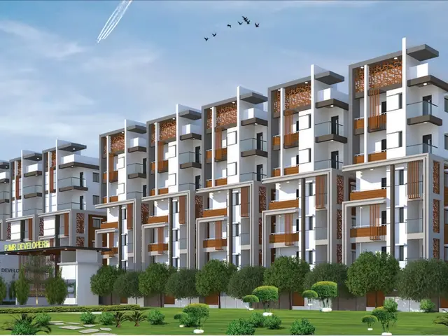
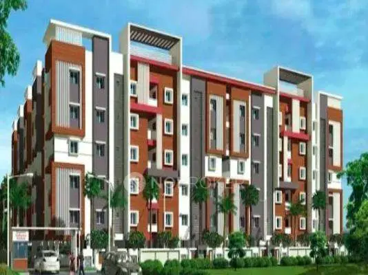
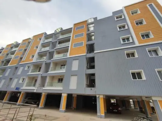
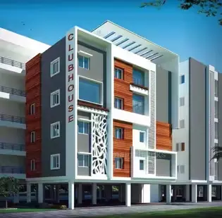
Ybr Infras Avasa East
YBR INFRA DEVELOPERS · Rangareddy · RERA P02400002963
YBR INFRAS AVASA EAST is a plotted development in Adibatla, Ibrahimpatnam mandal, Ranga Reddy district, developed by the registered promoter YBR INFRA DEVELOPERS. The layout covers 16186.9 Sq.m and offers residential plots; the supplied records do not disclose a total plot count or plot-size range. No towers, blocks or floors are disclosed. Its TG-RERA registration is P02400002963, and the promoter’s completion undertaking states 20th September 2022.
More from Ybr Infra Developers · 4 projects →
01What we found
Read from TG-RERA filings, approvals, land and registration records and court records. A court case is counted only when the court record states this project's survey number with its village, or names the project.
02Check before you pay
7 items to check before you pay, 4 high - from the title chain, court records and approvals, each with what to ask the builder or your advocate. An item may not be a problem with the project: records can be incomplete.
1. Project at a glance
Project identity
| Field | Project record |
|---|---|
| Registered project name | YBR INFRAS AVASA EAST RERA record |
| Project type | Plotted development RERA record RERA filing |
| Phase / registered portion | Not disclosed as a phase. The RERA certificate identifies this registration; the HMDA records describe the plotted layout. |
| TG-RERA registration | P02400002963; issued 20/05/2021 and stated valid through 20/09/2022. No extension is recorded in the supplied certificate. Registration validity is separate from the completion undertaking and the layout’s occupancy certificate. |
| Registered promoter | YBR INFRA DEVELOPERS; entity type recorded as Partnership. RERA record RERA filing Corporate record |
| RERA status | The project evidence labels it “New Project.” The supplied registration certificate gives the validity dates above; its current registration status is not established by that certificate. RERA filing |
Land and geographic identity
| Field | Project record |
|---|---|
| Locality | Adibatla RERA record RERA filing |
| Revenue village in RERA fields | Adibatla RERA record RERA filing |
| Village in HMDA layout documents | Ramdaspalle |
| Mandal | Ibrahimpatnam RERA record RERA filing |
| District | Ranga Reddy RERA record RERA filing |
| PIN | 501510 RERA record RERA filing |
| Project survey numbers / subdivisions | 41/7E/2 and 41/7E/3 RERA record |
| Site extent | 16,186.9 Sq.m stated for the layout in the HMDA records; the RERA land details state total area and net area as 16186.9 sqmts and 16186.90 sqmts, respectively. RERA filing |
| Boundaries recorded in RERA land fields | East: LAND OF AKKALI JAGAL REDDY; West: LAND OF GURUVAIAH CHOWDHARY; North: PART OF ANIL JAIN; South: PART OF P BAL REDDY. RERA filing |
Development identity
| Field | Project record |
|---|---|
| Sanctioning authority | Hyderabad Metropolitan Development Authority (HMDA) Approvals record |
| Principal layout approval | 000282/LO/Plg/HMDA/2019, dated 20 September, 2019; the supplied record first describes approval for a draft open-plot layout. Approvals record |
| Final layout record | HMDA Final Layout Letter dated 20 January, 2021, identifying the same permit number and the same survey numbers. |
| Approved built-up area | 10391.74 Sqmts is recorded in the RERA fields; its measurement basis is not specified there. No separate building count or building-floor configuration is disclosed in the supplied project records. RERA filing |
| Plot layout scale | The draft approval identifies plots 43 TO 52 in its sanctioned parameters and specifies road, open-space and social-infrastructure handovers; a complete plot schedule is not supplied here. |
| Buildings / floors / parking levels | Not disclosed in the supplied RERA and approval records. This is a plotted layout, and the final layout states that individual building permission is considered separately. |
Offering and status
| Field | Project record |
|---|---|
| Offering | Residential plots; plot count and plot-size range are not established by the supplied records. |
| Booked / available plots | Not disclosed in the supplied evidence. Document index |
| Completion undertaking | Promoter’s Form B declares completion by 20th September 2022. This is a promoter declaration, not independent verification of completion. |
| Occupancy certificate | The architect’s completion certificate records an HMDAR occupancy certificate, No. 037932/LT/SMD/FLT/U6/HMDA/06082020, dated 20-01-2021. It is presented in connection with the registered plotted project/layout; no individual plot or building OC scope is provided. |
| Construction stage | No current, independently verified site-progress record is supplied. Document index |
2. The project story
YBR INFRAS AVASA EAST is registered as a plotted development at Adibatla, Ibrahimpatnam, Ranga Reddy District, under TG-RERA registration P02400002963. The HMDA layout documents identify the land as Sy.Nos. 41/7E/2 and 41/7E/3 and describe a residential open-plot layout. They record a draft layout approval in 2019 and a final-layout letter in 2021. The final-layout conditions state that building permission for individual sites is to be considered separately; the supplied documents therefore do not establish a common building programme or apartment configuration for the layout. RERA record
The RERA-filed Form B contains the promoter’s undertaking to complete by 20th September 2022. Separately, an architect’s certificate records an HMDAR occupancy certificate dated 20-01-2021 and certifies completion of the project. These records establish what was declared and certified in the submitted documents, but the evidence pack contains no current independent site inspection or plot-by-plot status.
3. Master plan, architecture & building design
This is a plotted layout, not a documented apartment or multi-storey building scheme. The HMDA draft-approval record states a site extent of 16186.9 Sq.Mt and identifies plots 43 TO 52 in its sanctioned parameters. It requires transfer by registered gift deed, free of cost, of layout roads measuring 3986.16 Sq.mtrs (24.63 %), open space measuring 1401.92 Sq.mtrs (8.66 %), and social infrastructure measuring 406.35.mtrs (2.51 %). The final-layout letter records that roads, open spaces and social-infrastructure land were taken over by the Local Authority by registered gift deed Doc. No. 11001/2020, dt.13-08-2020.
The final-layout letter specifies residential use for the building sites and says individual building permissions are to be considered under the applicable building rules. No building footprints, floor configuration, tower heights, plot-size schedule, or approved building plans are included in the supplied evidence. A location-plan excerpt shows an EXT. 40' WIDE ROAD and a 167.24Sq.Mts Utility area, but is marked “NOT TO SCALE” and does not provide a full layout drawing.
4. Homes, configurations & floor plans
The registered offering is plotted development. The supplied material does not provide a complete RERA plot inventory, plot-size bands, booked or available counts, or individual plot saleable areas.
| Configuration | Units | Booked | Available | RERA saleable area | Measured carpet area | Loading (if supplied) |
|---|---|---|---|---|---|---|
| Residential plots | Not disclosed | Not disclosed | Not disclosed | Not disclosed | Not applicable / not supplied | Not supplied |
Two drawing files are recorded in the floor-plan evidence, but none is a measured home floor plan; the supplied floor-plan record reports no_flats: 2 and no measured drawings. Floor plans The HMDA draft approval’s plot reference 43 TO 52 is not a complete plot schedule and should not be treated as the total project inventory.
5. Parking & vehicle circulation
The supplied layout approval identifies layout roads and their required handover, including 3986.16 Sq.mtrs (24.63 %) of layout road area. A location-plan excerpt marks an EXT. 40' WIDE ROAD; another HMDA approval condition refers to roads of 18 mts and above and 60 feet and above. The evidence does not establish parking-space counts, visitor or accessible parking, parking allocation to individual plots, vehicle-entry arrangements, ramps, or EV charging.
6. Amenities, recreation & open spaces
The RERA amenity schedule records several layout facilities as “YES” with 100% shown in the supplied schedule. These are filing-record entries, not an independent verification of present condition. HMDA’s final-layout letter also describes civic services and states that the Local Authority is responsible for maintenance of roads and open spaces taken over by it. RERA amenities
| Description / size | No separate size in the RERA amenity schedule; layout road area recorded as 3986.16 Sq.mtrs (24.63 %) in the HMDA draft approval. |
|---|---|
| Evidence source | RERA amenities |
| Declared progress / verified status | RERA schedule: YES, 100%; HMDA final-layout letter records Local Authority takeover of roads. No independent current-condition verification supplied. |
| Description / size | Open-space area 1401.92 Sq.mtrs (8.66 %) in the draft approval. |
|---|---|
| Evidence source | RERA amenities |
| Declared progress / verified status | RERA schedule records Green Strip/TOT LOT/Park: YES, 100%; final-layout letter records open-space takeover. No independent current-condition verification supplied. |
| Description / size | 406.35.mtrs (2.51 %) in the draft approval. |
|---|---|
| Evidence source | RERA amenities |
| Declared progress / verified status | HMDA record requires handover; final-layout letter records takeover of social-infrastructure area. No facility schedule or current-condition verification supplied. |
| Description / size | No size or facility detail supplied. |
|---|---|
| Evidence source | RERA amenities |
| Declared progress / verified status | Schedule shows 0%; no completed or delivered status established. |
| Description / size | No RERA-filed size or layout detail supplied. |
|---|---|
| Evidence source | Promoter website |
| Declared progress / verified status | Listed on a vendor page only; not established as sanctioned or delivered. |
7. Utilities, building services & safety
The HMDA final-layout letter describes the layout as provided with water supply, sewerage and drainage disposal systems, street lighting, rain-water-harvesting structure and other civic amenities. It assigns maintenance of those services to the Local Authority and notes that it may impose further conditions for their use and maintenance. The RERA amenity schedule separately marks Water Supply, Sewerage, Storm Water Drains, Street Lighting, Water Conservation/Rain Water Harvesting, and Electrical Meter Room/Sub-Station/Receiving Station as “YES” with 100% shown. These are documentary and filed-status statements; no independent operational verification or service capacities are supplied. RERA amenities
The draft approval lists a common septic tank / STP, over head tank, and transformer among the amenities/utilities. No capacities, water source, sewage-treatment specification, power-backup details, fire-safety system, CCTV/access-control plan, accessibility design, or waste-management arrangements are established in the supplied RERA project records. The RERA amenity schedule records Solid Waste Management and Disposal and Fire Protection and Fire Safety Requirements at 0%; no further project-specific detail is supplied. RERA amenities
8. Location, access & connectivity
The registered project location is Adibatla, Ibrahimpatnam Mandal, Ranga Reddy District, Telangana, PIN 501510. The HMDA layout documents describe the site as being in Ramdaspalle village, while the RERA identity fields record Adibatla as the village; both location descriptions are retained here for identification. RERA record RERA filing
The supplied location record gives a cadastral parcel-centroid coordinate of 17.41528, 78.35459. The only measured connectivity entry supplied is Financial District (Nanakramguda) — 1.2 km; no approach-route basis or travel time is provided. Location record Vendor-page statements mention Adibatla as a nearby landmark and refer generally to schools, airports, restaurants, bus stops and railway stations, but provide no distances and are not RERA-filed location measurements. Promoter website
9. Developer & development status
The registered promoter is YBR INFRA DEVELOPERS, recorded as a partnership. The RERA fields identify Y. BAKTHAVATHSAL REDDY as the authorized signatory; Form B identifies him as Managing Partner and records the promoter’s completion undertaking of 20th September 2022. Corporate record RERA filing
The RERA registration certificate records registration P02400002963 from 20/05/2021 to 20/09/2022 and states that it was not extended in the supplied certificate. The architect’s certificate records an HMDAR occupancy certificate dated 20-01-2021 and certifies project completion; the evidence does not provide a current independent site assessment or a plot-by-plot status. The promoter’s listed website is associated with Avasa North; no official project contact details beyond the supplied promoter record are established here. Corporate record
10. Approvals, official records & documents
| Identifier / date | P02400002963; issued 20/05/2021; valid through 20/09/2022 |
|---|---|
| What the supplied record establishes | Form C registration for YBR INFRAS AVASA EAST. |
| Identifier / date | 000282/LO/Plg/HMDA/2019; 20 September, 2019 |
|---|---|
| What the supplied record establishes | Draft open-plot layout approval for Sy.Nos. 41/7E/2 and 41/7E/3; includes layout-area, handover and mortgage conditions. |
| Identifier / date | 000282/LO/Plg/HMDA/2019; 20 January, 2021 |
|---|---|
| What the supplied record establishes | Final residential-layout record for the same survey numbers; records Local Authority gift deed 11001/2020 and relinquishment deed 12574/2020 in relation to the layout. |
| Identifier / date | 037932/LT/SMD/FLT/U6/HMDA/06082020; dated 20-01-2021 |
|---|---|
| What the supplied record establishes | Architect’s certificate identifies the HMDAR occupancy certificate and certifies completion of the project. |
| Identifier / date | 1 November 2019 |
|---|---|
| What the supplied record establishes | Promoter declaration concerning title, encumbrances, RERA obligations and completion by 20th September 2022. |
| Identifier / date | Date 01-Oct-2019 on one excerpt; another excerpt undated in supplied facts |
|---|---|
| What the supplied record establishes | “NOT TO SCALE” plan excerpts showing an EXT. 40' WIDE ROAD and 167.24Sq.Mts Utility; they do not provide a complete sanctioned layout drawing. |
1. Project at a glance
Project identity
Registered project name: YBR INFRAS AVASA EAST
Project type: Plotted development
Phase / registered portion: Not disclosed as a phase. The RERA certificate identifies this registration; the HMDA records describe the plotted layout.
TG-RERA registration: P02400002963; issued 20/05/2021 and stated valid through 20/09/2022. No extension is recorded in the supplied certificate. Registration validity is separate from the completion undertaking and the layout’s occupancy certificate.
Registered promoter: YBR INFRA DEVELOPERS; entity type recorded as Partnership.
RERA status: The project evidence labels it “New Project.” The supplied registration certificate gives the validity dates above; its current registration status is not established by that certificate.
Land and geographic identity
Locality: Adibatla
Revenue village in RERA fields: Adibatla
Village in HMDA layout documents: Ramdaspalle
Mandal: Ibrahimpatnam
District: Ranga Reddy
PIN: 501510
Project survey numbers / subdivisions: 41/7E/2 and 41/7E/3
Site extent: 16,186.9 Sq.m stated for the layout in the HMDA records; the RERA land details state total area and net area as 16186.9 sqmts and 16186.90 sqmts, respectively.
Boundaries recorded in RERA land fields: East: LAND OF AKKALI JAGAL REDDY; West: LAND OF GURUVAIAH CHOWDHARY; North: PART OF ANIL JAIN; South: PART OF P BAL REDDY.
Development identity
Sanctioning authority: Hyderabad Metropolitan Development Authority (HMDA)
Principal layout approval: 000282/LO/Plg/HMDA/2019, dated 20 September, 2019; the supplied record first describes approval for a draft open-plot layout.
Final layout record: HMDA Final Layout Letter dated 20 January, 2021, identifying the same permit number and the same survey numbers.
Approved built-up area: 10391.74 Sqmts is recorded in the RERA fields; its measurement basis is not specified there. No separate building count or building-floor configuration is disclosed in the supplied project records.
Plot layout scale: The draft approval identifies plots 43 TO 52 in its sanctioned parameters and specifies road, open-space and social-infrastructure handovers; a complete plot schedule is not supplied here.
Buildings / floors / parking levels: Not disclosed in the supplied RERA and approval records. This is a plotted layout, and the final layout states that individual building permission is considered separately.
Offering and status
Offering: Residential plots; plot count and plot-size range are not established by the supplied records.
Booked / available plots: Not disclosed in the supplied evidence.
Completion undertaking: Promoter’s Form B declares completion by 20th September 2022. This is a promoter declaration, not independent verification of completion.
Occupancy certificate: The architect’s completion certificate records an HMDAR occupancy certificate, No. 037932/LT/SMD/FLT/U6/HMDA/06082020, dated 20-01-2021. It is presented in connection with the registered plotted project/layout; no individual plot or building OC scope is provided.
Construction stage: No current, independently verified site-progress record is supplied.
2. The project story
YBR INFRAS AVASA EAST is registered as a plotted development at Adibatla, Ibrahimpatnam, Ranga Reddy District, under TG-RERA registration P02400002963. The HMDA layout documents identify the land as Sy.Nos. 41/7E/2 and 41/7E/3 and describe a residential open-plot layout. They record a draft layout approval in 2019 and a final-layout letter in 2021. The final-layout conditions state that building permission for individual sites is to be considered separately; the supplied documents therefore do not establish a common building programme or apartment configuration for the layout.
The RERA-filed Form B contains the promoter’s undertaking to complete by 20th September 2022. Separately, an architect’s certificate records an HMDAR occupancy certificate dated 20-01-2021 and certifies completion of the project. These records establish what was declared and certified in the submitted documents, but the evidence pack contains no current independent site inspection or plot-by-plot status.
3. Master plan, architecture & building design
This is a plotted layout, not a documented apartment or multi-storey building scheme. The HMDA draft-approval record states a site extent of 16186.9 Sq.Mt and identifies plots 43 TO 52 in its sanctioned parameters. It requires transfer by registered gift deed, free of cost, of layout roads measuring 3986.16 Sq.mtrs (24.63 %), open space measuring 1401.92 Sq.mtrs (8.66 %), and social infrastructure measuring 406.35.mtrs (2.51 %). The final-layout letter records that roads, open spaces and social-infrastructure land were taken over by the Local Authority by registered gift deed Doc. No. 11001/2020, dt.13-08-2020.
The final-layout letter specifies residential use for the building sites and says individual building permissions are to be considered under the applicable building rules. No building footprints, floor configuration, tower heights, plot-size schedule, or approved building plans are included in the supplied evidence. A location-plan excerpt shows an EXT. 40' WIDE ROAD and a 167.24Sq.Mts Utility area, but is marked “NOT TO SCALE” and does not provide a full layout drawing.
4. Homes, configurations & floor plans
The registered offering is plotted development. The supplied material does not provide a complete RERA plot inventory, plot-size bands, booked or available counts, or individual plot saleable areas.
| Configuration | Units | Booked | Available | RERA saleable area | Measured carpet area | Loading (if supplied) |
|---|---|---|---|---|---|---|
| Residential plots | Not disclosed | Not disclosed | Not disclosed | Not disclosed | Not applicable / not supplied | Not supplied |
Two drawing files are recorded in the floor-plan evidence, but none is a measured home floor plan; the supplied floor-plan record reports no_flats: 2 and no measured drawings. The HMDA draft approval’s plot reference 43 TO 52 is not a complete plot schedule and should not be treated as the total project inventory.
5. Parking & vehicle circulation
The supplied layout approval identifies layout roads and their required handover, including 3986.16 Sq.mtrs (24.63 %) of layout road area. A location-plan excerpt marks an EXT. 40' WIDE ROAD; another HMDA approval condition refers to roads of 18 mts and above and 60 feet and above. The evidence does not establish parking-space counts, visitor or accessible parking, parking allocation to individual plots, vehicle-entry arrangements, ramps, or EV charging.
6. Amenities, recreation & open spaces
The RERA amenity schedule records several layout facilities as “YES” with 100% shown in the supplied schedule. These are filing-record entries, not an independent verification of present condition. HMDA’s final-layout letter also describes civic services and states that the Local Authority is responsible for maintenance of roads and open spaces taken over by it.
| Description / size | No separate size in the RERA amenity schedule; layout road area recorded as 3986.16 Sq.mtrs (24.63 %) in the HMDA draft approval. |
|---|---|
| Declared progress / verified status | RERA schedule: YES, 100%; HMDA final-layout letter records Local Authority takeover of roads. No independent current-condition verification supplied. |
| Description / size | Open-space area 1401.92 Sq.mtrs (8.66 %) in the draft approval. |
|---|---|
| Declared progress / verified status | RERA schedule records Green Strip/TOT LOT/Park: YES, 100%; final-layout letter records open-space takeover. No independent current-condition verification supplied. |
| Description / size | 406.35.mtrs (2.51 %) in the draft approval. |
|---|---|
| Declared progress / verified status | HMDA record requires handover; final-layout letter records takeover of social-infrastructure area. No facility schedule or current-condition verification supplied. |
| Description / size | No size or facility detail supplied. |
|---|---|
| Declared progress / verified status | Schedule shows 0%; no completed or delivered status established. |
| Description / size | No RERA-filed size or layout detail supplied. |
|---|---|
| Declared progress / verified status | Listed on a vendor page only; not established as sanctioned or delivered. |
7. Utilities, building services & safety
The HMDA final-layout letter describes the layout as provided with water supply, sewerage and drainage disposal systems, street lighting, rain-water-harvesting structure and other civic amenities. It assigns maintenance of those services to the Local Authority and notes that it may impose further conditions for their use and maintenance. The RERA amenity schedule separately marks Water Supply, Sewerage, Storm Water Drains, Street Lighting, Water Conservation/Rain Water Harvesting, and Electrical Meter Room/Sub-Station/Receiving Station as “YES” with 100% shown. These are documentary and filed-status statements; no independent operational verification or service capacities are supplied.
The draft approval lists a common septic tank / STP, over head tank, and transformer among the amenities/utilities. No capacities, water source, sewage-treatment specification, power-backup details, fire-safety system, CCTV/access-control plan, accessibility design, or waste-management arrangements are established in the supplied RERA project records. The RERA amenity schedule records Solid Waste Management and Disposal and Fire Protection and Fire Safety Requirements at 0%; no further project-specific detail is supplied.
8. Location, access & connectivity
The registered project location is Adibatla, Ibrahimpatnam Mandal, Ranga Reddy District, Telangana, PIN 501510. The HMDA layout documents describe the site as being in Ramdaspalle village, while the RERA identity fields record Adibatla as the village; both location descriptions are retained here for identification.
The supplied location record gives a cadastral parcel-centroid coordinate of 17.41528, 78.35459. The only measured connectivity entry supplied is Financial District (Nanakramguda) — 1.2 km; no approach-route basis or travel time is provided. Vendor-page statements mention Adibatla as a nearby landmark and refer generally to schools, airports, restaurants, bus stops and railway stations, but provide no distances and are not RERA-filed location measurements.
9. Developer & development status
The registered promoter is YBR INFRA DEVELOPERS, recorded as a partnership. The RERA fields identify Y. BAKTHAVATHSAL REDDY as the authorized signatory; Form B identifies him as Managing Partner and records the promoter’s completion undertaking of 20th September 2022.
The RERA registration certificate records registration P02400002963 from 20/05/2021 to 20/09/2022 and states that it was not extended in the supplied certificate. The architect’s certificate records an HMDAR occupancy certificate dated 20-01-2021 and certifies project completion; the evidence does not provide a current independent site assessment or a plot-by-plot status. The promoter’s listed website is associated with Avasa North; no official project contact details beyond the supplied promoter record are established here.
10. Approvals, official records & documents
| Identifier / date | P02400002963; issued 20/05/2021; valid through 20/09/2022 |
|---|---|
| What the supplied record establishes | Form C registration for YBR INFRAS AVASA EAST. |
| Identifier / date | 000282/LO/Plg/HMDA/2019; 20 September, 2019 |
|---|---|
| What the supplied record establishes | Draft open-plot layout approval for Sy.Nos. 41/7E/2 and 41/7E/3; includes layout-area, handover and mortgage conditions. |
| Identifier / date | 000282/LO/Plg/HMDA/2019; 20 January, 2021 |
|---|---|
| What the supplied record establishes | Final residential-layout record for the same survey numbers; records Local Authority gift deed 11001/2020 and relinquishment deed 12574/2020 in relation to the layout. |
| Identifier / date | 037932/LT/SMD/FLT/U6/HMDA/06082020; dated 20-01-2021 |
|---|---|
| What the supplied record establishes | Architect’s certificate identifies the HMDAR occupancy certificate and certifies completion of the project. |
| Identifier / date | 1 November 2019 |
|---|---|
| What the supplied record establishes | Promoter declaration concerning title, encumbrances, RERA obligations and completion by 20th September 2022. |
| Identifier / date | Date 01-Oct-2019 on one excerpt; another excerpt undated in supplied facts |
|---|---|
| What the supplied record establishes | “NOT TO SCALE” plan excerpts showing an EXT. 40' WIDE ROAD and 167.24Sq.Mts Utility; they do not provide a complete sanctioned layout drawing. |
Frequently asked questions
Is YBR INFRAS AVASA EAST registered with Telangana RERA?
Yes. YBR INFRAS AVASA EAST is registered with the Telangana Real Estate Regulatory Authority as P02400002963; the registration status is New Project.
Who is the developer of YBR INFRAS AVASA EAST?
The promoter named in the RERA registration is YBR INFRA DEVELOPERS.
Where is YBR INFRAS AVASA EAST located?
YBR INFRAS AVASA EAST is in ADIBATLA, Ibrahimpatnam, Rangareddy, Telangana (501510).
When will YBR INFRAS AVASA EAST be completed?
The promoter's proposed date of completion filed with RERA is 20/09/2022. This is the promoter's declaration, not a guarantee.
More projects in Adibatla