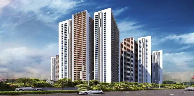
Vasudaika Whistling Woods
VASUDAIKA VENTURES LLP · Rangareddy · RERA P02400005800
VASUDAIKA WHISTLING WOODS is a plotted development in Harshaguda, Maheshwaram Mandal, Ranga Reddy District. It is being developed by the registered promoter VASUDAIKA VENTURES LLP. The project covers **21,194.8 sq. mts** and the HMDA draft layout records **45 plots**; the offering is open plots, with no plot-size configurations stated. Its TG-RERA registration is **P02400005800**, and the promoter’s Form B undertakes completion by **20 APRIL 2025**.
01What we found
Read from TG-RERA filings, approvals, land and registration records and court records. A court case is counted only when the court record states this project's survey number with its village, or names the project.
02Check before you pay
9 items to check before you pay, 4 high - from the title chain, court records and approvals, each with what to ask the builder or your advocate. An item may not be a problem with the project: records can be incomplete.
1. Project at a glance
Project identity
| Item | Project record |
|---|---|
| Registered name | VASUDAIKA WHISTLING WOODS RERA record |
| Project type | Plotted development / open-plots layout RERA record RERA filing |
| Phase / registered portion | No separate phase is identified in the supplied record; the registration covers the project identified in the certificate. |
| TG-RERA registration | P02400005800 |
| Registration validity | Certificate states valid from 15/03/2023 to 20/04/2025; the supplied certificate records no extension. Registration validity is distinct from the project completion date and occupancy/completion record. |
| Registered promoter | VASUDAIKA VENTURES LLP, an LLP RERA record Corporate record |
| RERA status in supplied record | Registered; certificate validity ended 20/04/2025, with extension recorded as false. Current registration status beyond the supplied record is not independently verified. |
Land and geographic identity
| Item | Project record |
|---|---|
| Locality / revenue village | Harshaguda; the layout approval describes Harshaguda Village and also refers to Mankhal Revenue Village. The supplied project identity records Harshaguda; the relationship between locality and revenue-village naming is not independently verified here. RERA record |
| Mandal / district / PIN | Maheshwaram, Ranga Reddy (approval also says R.R. District), 501359 RERA record |
| Project survey numbers | 665/P and 679/P |
| Total site area | 21,194.8 sq. mts |
| Area affected by Master Plan road | 703.21 sq. mts |
| Net site area | 20,491.59 sq. mts |
| Boundaries in RERA project record | East: 33 FT WIDE ROAD; west, north and south: NEIGHBOURS LAND RERA filing |
Development identity
| Item | Project record |
|---|---|
| Sanctioning authority | Hyderabad Metropolitan Development Authority (HMDA) |
| Principal approval | Draft Layout Permit 003719/LO/HMDA/0452/SMD/2021, dated 20.04.2022 |
| Final layout release | HMDA Final Layout with open plots, approval 003719/LO/HMDA/0452/SMD/2021, dated 14.06.2023 |
| Approved built-up area | 2,049.59 sq. mts is recorded in the project fields. The supplied layout approvals describe an open-plots development and do not provide a building schedule or building count. RERA filing |
| Layout scale and land allocation | Draft approval records 45 plots. It lists plotted area 12,779.69 sq. mts, park 1,539.72 sq. mts, social infrastructure 514.38 sq. mts, layout roads 5,360.60 sq. mts, amenities area 297.19 sq. mts, and utilities area 0 sq. mts. |
| Buildings / floors / parking levels | No tower or block count, floor configuration, parking level schedule, or building parking count is supplied for this plotted layout. |
Offering and status
| Item | Project record |
|---|---|
| Offered product | Open plots; the supplied vendor record labels the configuration “Villa Plots,” but RERA approval describes open plots. Promoter website |
| Plot count | 45 plots in the HMDA draft layout approval. Plot-size bands, plot-wise dimensions, and booked/available counts are not supplied. |
| Construction stage | Architect’s Form–1A certifies the project completed in all aspects and records completion as 14/6/2023. This is a filed architect’s certificate; no independent site inspection evidence is supplied. |
| Completion / registration dates | Promoter’s Form B undertakes completion by 20 APRIL 2025; the RERA certificate also ends on 20/04/2025. These are distinct from the architect’s recorded completion date of 14/6/2023. |
| Occupancy / completion record | The architect’s certificate records HMDA occupancy certificate number 003719/LO/HMDA/0452/SMD/2021, dated 14/6/2023, and certifies overall project completion. The HMDA final-layout document is dated 14.06.2023; these records concern the open-plots layout, not residential buildings or individual houses. |
2. The project story
VASUDAIKA WHISTLING WOODS is a plotted residential layout in Harshaguda, Maheshwaram Mandal, Ranga Reddy District, on project land identified as survey numbers 665/P and 679/P. HMDA’s draft permit describes an open-plots layout with 45 plots; the later HMDA record is a final layout release with open plots. The supplied records do not establish that houses or villas have been constructed, or provide plot-wise sizes, booking status, or availability. RERA record
The draft permit reports a total site area of 21,194.8 sq. mts, including 703.21 sq. mts affected by a Master Plan road, and a net area of 20,491.59 sq. mts. HMDA’s final-layout record states that the identified roads, open-space/park, utilities and social-infrastructure land were handed over to the local body by registered Gift Deed 12003/2022. The architect’s Form–1A records completion on 14/6/2023; this is a filed professional certification, not an independent site inspection.
3. Master plan, architecture & building design
This is a plotted layout, not a multi-storey apartment or villa-building scheme in the supplied approvals. HMDA’s draft permit records 45 plots and the following land allocation: 12,779.69 sq. mts plotted area; 1,539.72 sq. mts park; 514.38 sq. mts social infrastructure; 5,360.60 sq. mts layout roads; 297.19 sq. mts amenities area; and 0 sq. mts utilities area. The final-layout record separately lists 297.19 sq. mts of utilities and 615.19 sq. mts of social infrastructure handed over to the local body. These are the figures stated in the respective filed approval records; no reconciliation is made here.
The supplied approved-layout record identifies internal roads and open-space land, but does not provide plot-size bands, a plot-by-plot schedule, building footprints, building heights, floor configurations, or architectural plans for houses. The 2,049.59 sq. mts approved built-up-area figure appears in the project fields; the supplied approval documents do not explain its scope or provide a building schedule. No FSI-counted area, carpet area, or saleable area is supplied for individual plots. RERA filing
4. Homes, configurations & floor plans
The registered offering is plotted development. The HMDA draft permit records 45 plots, but the supplied data does not include RERA configuration counts by plot size, plot-wise saleable areas, booking or availability figures, or measured plot areas.
| Configuration | Units | Booked | Available | RERA saleable area | Measured carpet area | Loading |
|---|---|---|---|---|---|---|
| Open plots (layout approval records 45 plots) | 45 | Not supplied | Not supplied | Not supplied | Not applicable / not supplied | Not supplied |
Two drawing sheets are recorded, but neither has been measured; both are pending scan review. The floor-plan data describes any future drawing-based carpet-area measurement as software-measured rather than RERA-filed; no measured result is available. Floor plans
5. Parking & vehicle circulation
The supplied project evidence does not establish a sanctioned parking count, visitor or accessible parking, parking locations, parking allocation to individual plots, or any parking levels. The HMDA draft permit refers to roads within the layout and requires roads to remain open for access to neighbouring sites, but the supplied information does not specify a complete internal vehicle-circulation plan or parking arrangements.
6. Amenities, recreation & open spaces
HMDA’s draft permit and final-layout record describe layout infrastructure and land allocations. The RERA amenity register marks several infrastructure categories “YES” but reports 0% progress for the listed items; this records the filed status, not independently verified completion. RERA amenities
| Description / size | Draft layout: 1,539.72 sq. mts; final-layout record: 1,539.72 sq. mts open-space/park land |
|---|---|
| Evidence source | HMDA draft permit and final-layout record |
| Declared progress / verified status | Final-layout record states land was handed over to the local body by registered Gift Deed 12003/2022; independent inspection of park development is not supplied. |
| Description / size | Draft layout: 514.38 sq. mts; final-layout record: 615.19 sq. mts |
|---|---|
| Evidence source | HMDA draft permit and final-layout record |
| Declared progress / verified status | Final-layout record states land was handed over to the local body by registered Gift Deed 12003/2022; facility details and delivery status are not supplied. |
| Description / size | 297.19 sq. mts in the draft layout record |
|---|---|
| Evidence source | HMDA draft permit |
| Declared progress / verified status | Land allocation recorded; facility inventory and completion status not supplied. |
| Description / size | Roads: 5,360.60 sq. mts in the draft layout; final-layout record also lists 5,360.60 sq. mts |
|---|---|
| Evidence source | HMDA draft permit and final-layout record |
| Declared progress / verified status | Final-layout record states road land was handed over to the local body; independent condition verification is not supplied. |
| Description / size | Draft permit calls for protected water supply, overhead tank, sumps and internal pipelines |
|---|---|
| Evidence source | HMDA draft permit |
| Declared progress / verified status | Approval-condition / proposed infrastructure description; independently verified completion is not supplied. |
| Description / size | Draft permit lists underground drainage, storm-water drains, rainwater-harvesting pits and an independent sewerage-disposal system |
|---|---|
| Evidence source | HMDA draft permit |
| Declared progress / verified status | Approval-condition / proposed infrastructure description; independently verified completion is not supplied. |
| Description / size | LED street lights and avenue plantation are specified in the draft permit |
|---|---|
| Evidence source | HMDA draft permit |
| Declared progress / verified status | Approval-condition / proposed infrastructure description; independently verified completion is not supplied. |
| Description / size | Vendor lists a swimming pool, kids’ play area, walking and cycling tracks, gated entrance, security and compound wall |
|---|---|
| Evidence source | Vendor Promoter website |
| Declared progress / verified status | Promoter-marketed claims; no supplied approval or completion evidence establishes delivery. |
7. Utilities, building services & safety
HMDA’s draft permit specifies protected water supply, an overhead tank and sumps, internal water-supply pipelines, underground storm-water drainage, underground drainage lines, independent sewerage disposal, rainwater-harvesting pits, electrical supply lines, a transformer, street lighting, solid-waste disposal and a bio-compost unit. It also calls for source segregation of garbage. These are approval-condition descriptions; the supplied evidence does not independently verify installation, operation, capacities, or current service levels.
The final-layout record lists water supply, sewerage and drainage disposal, street lighting, rainwater-harvesting structure and civic amenities. The supplied records do not specify water source or storage capacity, treatment capacity, electrical backup, EV charging, fire systems, security-system specifications, accessibility provisions, or utility capacities. RERA amenities
8. Location, access & connectivity
The registered project location is Harshaguda, Maheshwaram Mandal, Ranga Reddy District, Telangana 501359. The project boundary information records a 33 FT WIDE ROAD to the east. A supplied location record gives the nearest sampled Outer Ring Road interchange as approximately 4.9 km away. RERA record RERA filing Location record
The project data does not provide verified public-transport details, measured distances to other landmarks, or travel times. The vendor record includes travel-time claims, but these are not treated as verified connectivity measurements. Location record Promoter website
9. Developer & development status
The registered legal promoter is VASUDAIKA VENTURES LLP, an LLP. The supplied corporate identifier is GSTIN 36AATFV4950F1ZO. The registered-office address is not fully established by the supplied record: the project promoter information gives PLOT NO 163/2, PATRIKA NAGAR, while the RERA certificate’s promoter-office field is incomplete. RERA record Corporate record RERA filing
J. Venkat Ram is identified as the promoter’s authorized signatory in the Form B declaration, dated 02/11/2022; that declaration undertakes completion by 20 APRIL 2025. The architect’s Form–1A records completion on 14/6/2023 and certifies the project complete in all aspects. No independent site-progress inspection or plot-wise sold/unsold schedule is supplied.
10. Approvals, official records & documents
| Identifier / date | P02400005800, issued 15/03/2023; valid through 20/04/2025 as stated in the certificate |
|---|---|
| What it establishes | Registration of VASUDAIKA WHISTLING WOODS and the certificate’s validity and conditions. |
| Identifier / date | 003719/LO/HMDA/0452/SMD/2021, 20.04.2022 |
|---|---|
| What it establishes | Draft open-plots layout approval for 45 plots on survey numbers 665/P and 679/P. |
| Identifier / date | 003719/LO/HMDA/0452/SMD/2021, 14.06.2023 |
|---|---|
| What it establishes | Final layout record for survey numbers 665/P and 679/P; records handover of identified roads, open-space/park, utilities and social-infrastructure land by Gift Deed 12003/2022, and refers to Relinquishment Deed 8115/2023 for mortgaged plots. |
| Identifier / date | Occupancy certificate number 003719/LO/HMDA/0452/SMD/2021, dated 14/6/2023 |
|---|---|
| What it establishes | Architect’s certification that the registered project was completed in all aspects. |
| Identifier / date | Dated 02/11/2022 |
|---|---|
| What it establishes | Promoter declaration concerning title documentation, encumbrances, separate-account obligations and the 20 APRIL 2025 completion undertaking. |
1. Project at a glance
Project identity
Registered name: VASUDAIKA WHISTLING WOODS
Project type: Plotted development / open-plots layout
Phase / registered portion: No separate phase is identified in the supplied record; the registration covers the project identified in the certificate.
TG-RERA registration: P02400005800
Registration validity: Certificate states valid from 15/03/2023 to 20/04/2025; the supplied certificate records no extension. Registration validity is distinct from the project completion date and occupancy/completion record.
Registered promoter: VASUDAIKA VENTURES LLP, an LLP
RERA status in supplied record: Registered; certificate validity ended 20/04/2025, with extension recorded as false. Current registration status beyond the supplied record is not independently verified.
Land and geographic identity
Locality / revenue village: Harshaguda; the layout approval describes Harshaguda Village and also refers to Mankhal Revenue Village. The supplied project identity records Harshaguda; the relationship between locality and revenue-village naming is not independently verified here.
Mandal / district / PIN: Maheshwaram, Ranga Reddy (approval also says R.R. District), 501359
Project survey numbers: 665/P and 679/P
Total site area: 21,194.8 sq. mts
Area affected by Master Plan road: 703.21 sq. mts
Net site area: 20,491.59 sq. mts
Boundaries in RERA project record: East: 33 FT WIDE ROAD; west, north and south: NEIGHBOURS LAND
Development identity
Sanctioning authority: Hyderabad Metropolitan Development Authority (HMDA)
Principal approval: Draft Layout Permit 003719/LO/HMDA/0452/SMD/2021, dated 20.04.2022
Final layout release: HMDA Final Layout with open plots, approval 003719/LO/HMDA/0452/SMD/2021, dated 14.06.2023
Approved built-up area: 2,049.59 sq. mts is recorded in the project fields. The supplied layout approvals describe an open-plots development and do not provide a building schedule or building count.
Layout scale and land allocation: Draft approval records 45 plots. It lists plotted area 12,779.69 sq. mts, park 1,539.72 sq. mts, social infrastructure 514.38 sq. mts, layout roads 5,360.60 sq. mts, amenities area 297.19 sq. mts, and utilities area 0 sq. mts.
Buildings / floors / parking levels: No tower or block count, floor configuration, parking level schedule, or building parking count is supplied for this plotted layout.
Offering and status
Offered product: Open plots; the supplied vendor record labels the configuration “Villa Plots,” but RERA approval describes open plots.
Plot count: 45 plots in the HMDA draft layout approval. Plot-size bands, plot-wise dimensions, and booked/available counts are not supplied.
Construction stage: Architect’s Form–1A certifies the project completed in all aspects and records completion as 14/6/2023. This is a filed architect’s certificate; no independent site inspection evidence is supplied.
Completion / registration dates: Promoter’s Form B undertakes completion by 20 APRIL 2025; the RERA certificate also ends on 20/04/2025. These are distinct from the architect’s recorded completion date of 14/6/2023.
Occupancy / completion record: The architect’s certificate records HMDA occupancy certificate number 003719/LO/HMDA/0452/SMD/2021, dated 14/6/2023, and certifies overall project completion. The HMDA final-layout document is dated 14.06.2023; these records concern the open-plots layout, not residential buildings or individual houses.
2. The project story
VASUDAIKA WHISTLING WOODS is a plotted residential layout in Harshaguda, Maheshwaram Mandal, Ranga Reddy District, on project land identified as survey numbers 665/P and 679/P. HMDA’s draft permit describes an open-plots layout with 45 plots; the later HMDA record is a final layout release with open plots. The supplied records do not establish that houses or villas have been constructed, or provide plot-wise sizes, booking status, or availability.
The draft permit reports a total site area of 21,194.8 sq. mts, including 703.21 sq. mts affected by a Master Plan road, and a net area of 20,491.59 sq. mts. HMDA’s final-layout record states that the identified roads, open-space/park, utilities and social-infrastructure land were handed over to the local body by registered Gift Deed 12003/2022. The architect’s Form–1A records completion on 14/6/2023; this is a filed professional certification, not an independent site inspection.
3. Master plan, architecture & building design
This is a plotted layout, not a multi-storey apartment or villa-building scheme in the supplied approvals. HMDA’s draft permit records 45 plots and the following land allocation: 12,779.69 sq. mts plotted area; 1,539.72 sq. mts park; 514.38 sq. mts social infrastructure; 5,360.60 sq. mts layout roads; 297.19 sq. mts amenities area; and 0 sq. mts utilities area. The final-layout record separately lists 297.19 sq. mts of utilities and 615.19 sq. mts of social infrastructure handed over to the local body. These are the figures stated in the respective filed approval records; no reconciliation is made here.
The supplied approved-layout record identifies internal roads and open-space land, but does not provide plot-size bands, a plot-by-plot schedule, building footprints, building heights, floor configurations, or architectural plans for houses. The 2,049.59 sq. mts approved built-up-area figure appears in the project fields; the supplied approval documents do not explain its scope or provide a building schedule. No FSI-counted area, carpet area, or saleable area is supplied for individual plots.
4. Homes, configurations & floor plans
The registered offering is plotted development. The HMDA draft permit records 45 plots, but the supplied data does not include RERA configuration counts by plot size, plot-wise saleable areas, booking or availability figures, or measured plot areas.
| Configuration | Units | Booked | Available | RERA saleable area | Measured carpet area | Loading |
|---|---|---|---|---|---|---|
| Open plots (layout approval records 45 plots) | 45 | Not supplied | Not supplied | Not supplied | Not applicable / not supplied | Not supplied |
Two drawing sheets are recorded, but neither has been measured; both are pending scan review. The floor-plan data describes any future drawing-based carpet-area measurement as software-measured rather than RERA-filed; no measured result is available.
5. Parking & vehicle circulation
The supplied project evidence does not establish a sanctioned parking count, visitor or accessible parking, parking locations, parking allocation to individual plots, or any parking levels. The HMDA draft permit refers to roads within the layout and requires roads to remain open for access to neighbouring sites, but the supplied information does not specify a complete internal vehicle-circulation plan or parking arrangements.
6. Amenities, recreation & open spaces
HMDA’s draft permit and final-layout record describe layout infrastructure and land allocations. The RERA amenity register marks several infrastructure categories “YES” but reports 0% progress for the listed items; this records the filed status, not independently verified completion.
| Description / size | Draft layout: 1,539.72 sq. mts; final-layout record: 1,539.72 sq. mts open-space/park land |
|---|---|
| Evidence source | HMDA draft permit and final-layout record |
| Declared progress / verified status | Final-layout record states land was handed over to the local body by registered Gift Deed 12003/2022; independent inspection of park development is not supplied. |
| Description / size | Draft layout: 514.38 sq. mts; final-layout record: 615.19 sq. mts |
|---|---|
| Evidence source | HMDA draft permit and final-layout record |
| Declared progress / verified status | Final-layout record states land was handed over to the local body by registered Gift Deed 12003/2022; facility details and delivery status are not supplied. |
| Description / size | 297.19 sq. mts in the draft layout record |
|---|---|
| Evidence source | HMDA draft permit |
| Declared progress / verified status | Land allocation recorded; facility inventory and completion status not supplied. |
| Description / size | Roads: 5,360.60 sq. mts in the draft layout; final-layout record also lists 5,360.60 sq. mts |
|---|---|
| Evidence source | HMDA draft permit and final-layout record |
| Declared progress / verified status | Final-layout record states road land was handed over to the local body; independent condition verification is not supplied. |
| Description / size | Draft permit calls for protected water supply, overhead tank, sumps and internal pipelines |
|---|---|
| Evidence source | HMDA draft permit |
| Declared progress / verified status | Approval-condition / proposed infrastructure description; independently verified completion is not supplied. |
| Description / size | Draft permit lists underground drainage, storm-water drains, rainwater-harvesting pits and an independent sewerage-disposal system |
|---|---|
| Evidence source | HMDA draft permit |
| Declared progress / verified status | Approval-condition / proposed infrastructure description; independently verified completion is not supplied. |
| Description / size | LED street lights and avenue plantation are specified in the draft permit |
|---|---|
| Evidence source | HMDA draft permit |
| Declared progress / verified status | Approval-condition / proposed infrastructure description; independently verified completion is not supplied. |
| Description / size | Vendor lists a swimming pool, kids’ play area, walking and cycling tracks, gated entrance, security and compound wall |
|---|---|
| Evidence source | Vendor |
| Declared progress / verified status | Promoter-marketed claims; no supplied approval or completion evidence establishes delivery. |
7. Utilities, building services & safety
HMDA’s draft permit specifies protected water supply, an overhead tank and sumps, internal water-supply pipelines, underground storm-water drainage, underground drainage lines, independent sewerage disposal, rainwater-harvesting pits, electrical supply lines, a transformer, street lighting, solid-waste disposal and a bio-compost unit. It also calls for source segregation of garbage. These are approval-condition descriptions; the supplied evidence does not independently verify installation, operation, capacities, or current service levels.
The final-layout record lists water supply, sewerage and drainage disposal, street lighting, rainwater-harvesting structure and civic amenities. The supplied records do not specify water source or storage capacity, treatment capacity, electrical backup, EV charging, fire systems, security-system specifications, accessibility provisions, or utility capacities.
8. Location, access & connectivity
The registered project location is Harshaguda, Maheshwaram Mandal, Ranga Reddy District, Telangana 501359. The project boundary information records a 33 FT WIDE ROAD to the east. A supplied location record gives the nearest sampled Outer Ring Road interchange as approximately 4.9 km away.
The project data does not provide verified public-transport details, measured distances to other landmarks, or travel times. The vendor record includes travel-time claims, but these are not treated as verified connectivity measurements.
9. Developer & development status
The registered legal promoter is VASUDAIKA VENTURES LLP, an LLP. The supplied corporate identifier is GSTIN 36AATFV4950F1ZO. The registered-office address is not fully established by the supplied record: the project promoter information gives PLOT NO 163/2, PATRIKA NAGAR, while the RERA certificate’s promoter-office field is incomplete.
J. Venkat Ram is identified as the promoter’s authorized signatory in the Form B declaration, dated 02/11/2022; that declaration undertakes completion by 20 APRIL 2025. The architect’s Form–1A records completion on 14/6/2023 and certifies the project complete in all aspects. No independent site-progress inspection or plot-wise sold/unsold schedule is supplied.
10. Approvals, official records & documents
| Identifier / date | P02400005800, issued 15/03/2023; valid through 20/04/2025 as stated in the certificate |
|---|---|
| What it establishes | Registration of VASUDAIKA WHISTLING WOODS and the certificate’s validity and conditions. |
| Identifier / date | 003719/LO/HMDA/0452/SMD/2021, 20.04.2022 |
|---|---|
| What it establishes | Draft open-plots layout approval for 45 plots on survey numbers 665/P and 679/P. |
| Identifier / date | 003719/LO/HMDA/0452/SMD/2021, 14.06.2023 |
|---|---|
| What it establishes | Final layout record for survey numbers 665/P and 679/P; records handover of identified roads, open-space/park, utilities and social-infrastructure land by Gift Deed 12003/2022, and refers to Relinquishment Deed 8115/2023 for mortgaged plots. |
| Identifier / date | Occupancy certificate number 003719/LO/HMDA/0452/SMD/2021, dated 14/6/2023 |
|---|---|
| What it establishes | Architect’s certification that the registered project was completed in all aspects. |
| Identifier / date | Dated 02/11/2022 |
|---|---|
| What it establishes | Promoter declaration concerning title documentation, encumbrances, separate-account obligations and the 20 APRIL 2025 completion undertaking. |
Frequently asked questions
Is VASUDAIKA WHISTLING WOODS registered with Telangana RERA?
Yes. VASUDAIKA WHISTLING WOODS is registered with the Telangana Real Estate Regulatory Authority as P02400005800; the registration status is New Project.
Who is the developer of VASUDAIKA WHISTLING WOODS?
The promoter named in the RERA registration is VASUDAIKA VENTURES LLP.
Where is VASUDAIKA WHISTLING WOODS located?
VASUDAIKA WHISTLING WOODS is in HARSHAGUDA, Maheshwaram, Rangareddy, Telangana (501359).
When will VASUDAIKA WHISTLING WOODS be completed?
The promoter's proposed date of completion filed with RERA is 20/04/2025. This is the promoter's declaration, not a guarantee.
More projects in Harshaguda