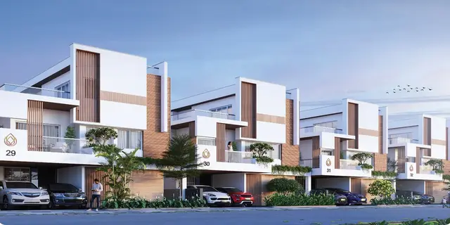
Amulya Greenlands
M/S KAMALA BUILDERS AND DEVELOPERS · Rangareddy · RERA P02400003835
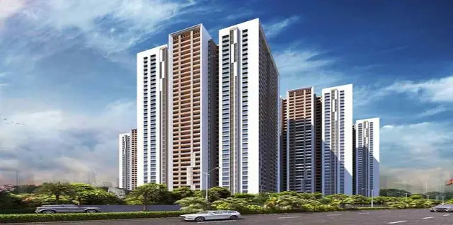
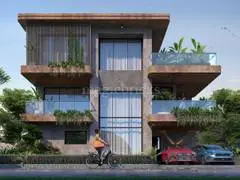
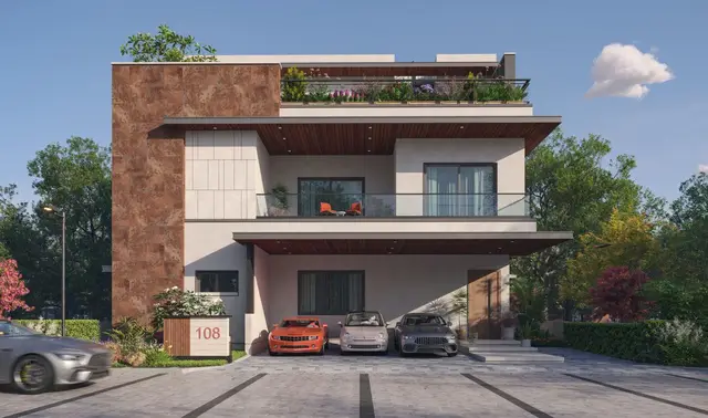
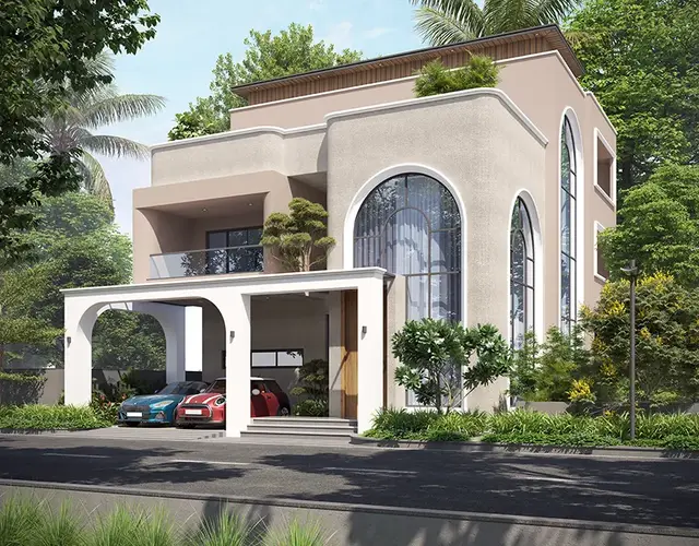
AMULYA GREENLANDS is a residential project at Mankal, Maheshwaram, Ranga Reddy, developed by M/S KAMALA BUILDERS AND DEVELOPERS. The registered site area is 59083.61 sq.m, and the records describe 14 building units, including residential, amenities and EWS/LIG buildings, with listed configurations ranging from Ground+2 upper floors to Stilt+5 upper floors. TG-RERA registration number P02400003835 records 153 villas and 20 2BHK units. The project header gives a proposed completion date of 14/06/2027.
More from Kamala Builders & Developers · 3 projects →
01What we found
Read from TG-RERA filings, approvals, land and registration records and court records. A court case is counted only when the court record states this project's survey number with its village, or names the project.
02Check before you pay
7 items to check before you pay, 3 high - from the title chain, court records and approvals, each with what to ask the builder or your advocate. An item may not be a problem with the project: records can be incomplete.
Project at a glance
Project identity
| Item | Project record |
|---|---|
| Registered project name | AMULYA GREENLANDS RERA record |
| Project type | Registered as a residential project; the filed development documents describe a gated-community scheme comprising villas, apartments, EWS/LIG housing and an amenities building. RERA record RERA filing |
| Phase / registered portion | The record identifies the project as New Project; a separate phase name or phase number is not disclosed. RERA record |
| TG-RERA registration number | P02400003835 RERA record |
| Registration validity | Form ‘C’ states validity from 03/01/2022 to 14/02/2027. This is registration validity, not a statement of construction completion or occupancy certification. |
| Registered promoter | M/S KAMALA BUILDERS AND DEVELOPERS RERA record |
| RERA status | The supplied portal record identifies the project as “New Project.” Registration was captured on 2026-09-10; no extension is recorded in the supplied certificate. RERA record Approvals record |
Land and geographic identity
| Item | Project record |
|---|---|
| Locality / revenue village | Mankal (also written “Mankhal” in filed approval/title documents); the records identify Mankal/Mankhal Village. RERA record Land records |
| Mandal | Maheshwaram RERA record Land records |
| District | Ranga Reddy RERA record Land records |
| PIN | 501359 RERA record |
| Survey numbers and subdivisions | 346 P, 348 P, 349 P, 356 P, 357 P, 359, 360, 361, 362, 363, 364, 365 P AND 366 P RERA record Land records |
| Registered site extent | 59083.61 sq.m total site area; 58530.61 sq.m net area after 553.00 sq.m road-affected area, as recorded in the municipal proceedings. The HMDA layout record separately states a balance area of 55540.61 Sq.mts. RERA filing |
| Boundaries | North: OTHERS LAND; South: OTHERS LAND; East: OTHERS LAND; West: OTHERS LAND. RERA filing |
| Site area in HMDA layout record | 55540.61 Sq.mts/ 66426.57 Sq.yds; the approval record also lists 59083.61/70664.00 Sq.yds as total site area. |
Development identity
| Item | Project record |
|---|---|
| Principal building-permit authority and reference | Thukkuguda Municipality, Proc.No.G1/967/TGMC/RR/2021, dated 15.02.2021. The proceedings describe conditional building sanction for the site and listed buildings. |
| Layout approval reference | HMDA, LP. No. 05/GHSLO/ORRGC/Plg/HMDA/2015, dated 11.03.2016. |
| Approved built-up area | 51529 smts (as stated in the municipal proceedings). |
| Buildings / blocks | RERA’s land details state 14 approved building units and 14 proposed building units. The municipal proceedings list residential and amenities buildings; the HMDA layout record additionally identifies 153 residential villas, a 20-unit apartment, and EWS/LIG buildings. RERA filing |
| Sanctioned floor configurations available in extracts | Municipal proceedings: Residential Building Stilt+5 upper floors; Amenities Building Ground+2 upper floors; EWS/LIG building Stilt+4 Upper floors; Blocks A–H, 1, J and K Ground+2 upper floors. HMDA record: Residential Apartment Stilt + 5 upper floors; EWS and LIG Stilt + 4 Upper floors. |
| Parking levels / sanctioned parking count | Not established in the supplied extracts. Document index |
| Approved versus RERA-declared home counts | HMDA layout record: 153 No's of Housing units, comprising Residential Villas - 153 Nó's, Residential Apartment - 20 Units, EWS - 28 Units and LIG - 26 Units. RERA unit table: 153 villas and 20 2BHK units; EWS LIG is filed as a label with 0 interpretable units in that table. RERA unit table RERA unit details |
Offering and status
| Item | Project record |
|---|---|
| RERA-filed configurations | Villa and 2BHK; the RERA unit table also contains EWS LIG as an unclassified entry. RERA unit table RERA unit details |
| RERA-filed saleable area | Villas: 25.61–440.4 sq.m; 2BHK: 84.81 sq.m. RERA unit table |
| Booked / available | Portal-derived counts show 0 booked / 153 available villas and 0 booked / 20 available 2BHK units. These counts are indicative; the supplied unit record has no as-of date. RERA unit table |
| Construction stage | No independently verified site-progress report or physical construction-stage assessment is supplied. The project is described in vendor-provided text as under construction; that is a vendor description, not a verified site inspection. Promoter website |
| Completion dates | The municipal proceedings state construction to be completed before 14.02.2027; the Form B promoter declaration also undertakes completion by 14-02-2027. The project header separately gives proposed completion as 14/06/2027. RERA record |
| Occupancy / completion certificate | No occupancy certificate or completion certificate is included in the supplied project documents. The records do not establish OC status by tower or building. Document index |
The project story
AMULYA GREENLANDS is registered with TG-RERA as a residential project at Mankal/Mankhal Village, Maheshwaram Mandal, Ranga Reddy District. Its filed design and approval records describe a gated-community development with villas, a residential apartment building, EWS/LIG housing and an amenities building. The recorded land covers survey numbers 346 P, 348 P, 349 P, 356 P, 357 P, 359, 360, 361, 362, 363, 364, 365 P and 366 P. RERA record Land records
The HMDA layout record describes 153 villas, a 20-unit residential apartment, and EWS and LIG buildings with 28 and 26 units respectively. The TG-RERA unit table, however, provides identifiable sale configurations and counts for 153 villas and 20 2BHK homes; its “EWS LIG” entry is not interpretable as a unit count. RERA unit table RERA unit details
Municipal proceedings dated 15.02.2021 describe the site and a set of residential, EWS/LIG, amenities and individual buildings, while the HMDA layout approval is dated 11.03.2016. These are approval records, not evidence that all buildings have been completed. No site inspection, tower-by-tower progress certificate, or occupancy certificate is provided here. The vendor characterizes the development as under construction, but physical progress is not independently verified in the supplied evidence. Promoter website Document index
Master plan, architecture & building design
The municipal proceedings record a total site area of 59083.61 smts, a road-affected area of 553.00 smts, a net area of 58530.61 smts, a 2990.00 smts peripheral-road deduction and a net plot area of 55540.61 smts. The HMDA layout record gives 55540.61 Sq.mts/ 66426.57 Sq.yds as the balance area.
The HMDA layout record describes a land-use allocation of 30,279.55 Sq.mts plotted area (54.52%), 1,300.00 Sg.mtrs LIG & EWS area (2.34 %), 2,297.00 Sq.mts amenities area (4.14%), 14,153.06 Sq.mts road area (25.48%), 5,605.00 Sq.mts open area (10.09%), 384.12 Sq.mts utility area (services) (2.80%) and 1,906.00 Sq.mts buffer area (3.43%).
The available extracts identify the following building forms:
- Municipal proceedings list a Residential Building at Stilt+5 upper floors, an Amenities Building at Ground+2 upper floors, an EWS/LIG building at Stilt+4 Upper floors, and Blocks A–H, 1, J and K at Ground+2 upper floors. The proceedings state a floor height of 14.90 Smt.
- The HMDA layout record identifies a Residential Apartment of 20 Units (Stilt + 5 upper floors), EWS of 28 Units (Stilt + 4 Upper floors) and LIG of 26 Units (Stilt + 4 Upper floors), alongside 153 villas. It records an amenities built-up area of 916.80 Sq.mts.
- The approved-plan extracts do not establish flats per floor, building footprints, lift or stair provision, parking levels, or detailed internal circulation. The floor-plan drawing set contains 14 drawings, with 0 measured and 14 scans pending; no drawing-based room or carpet measurements can therefore be reported. Floor plans
The HMDA record also allocates 5,605.00 Sq.mts to open area and identifies roads and utility land. It does not, in the supplied extracts, provide a detailed site plan sufficient to describe the arrangement of individual villas, road widths by internal segment, or landscape design beyond the named open-space components.
Homes, configurations & floor plans
The table below presents the TG-RERA unit classifications and filed saleable areas. The portal-derived booking/availability counts are indicative because no as-of date is supplied. The EWS/LIG filing label is retained but cannot be counted as a configuration from the supplied RERA unit table. RERA unit table RERA unit details
| Configuration | Units | Booked | Available | RERA saleable area | Measured carpet area | Loading (if supplied) |
|---|---|---|---|---|---|---|
| Villa | 153 | 0 | 153 | 25.61–440.4 sq.m | Not measured; drawings are scans pending | Not supplied |
| 2BHK | 20 | 0 | 20 | 84.81 sq.m | Not measured; drawings are scans pending | Not supplied |
| EWS LIG (filed label; configuration not interpretable in unit table) | 0 interpretable units | 0 | 0 | Not stated | Not measured | Not supplied |
The approved drawings have not been software-measured in the supplied record. Accordingly, no drawing-based carpet area, room dimensions, orientation, balcony or utility-area details are available. Saleable area is the RERA-filed figure; it is not a carpet-area measurement. The separate vendor material contains area labels, but those are marketing/vendor claims and are not used as RERA-filed unit measurements here. Floor plans RERA unit table Promoter website
Parking & vehicle circulation
A sanctioned parking count, parking type or allocation by home is not established by the supplied extracts. They do not specify basement, stilt, podium, surface or mechanical parking; resident or visitor parking; accessible spaces; EV charging; or parking ramps and vehicle-entry arrangements. The HMDA approval identifies certain units/plots as mortgaged to HMDA, but that does not establish parking provision or an allottee’s exclusive parking rights. Document index RERA unit table
The HMDA layout record refers to road areas and states road widths of 30.0mts, 12 mts, and 18mts and above. It does not provide enough detail in the available extract to describe the complete internal vehicle-circulation layout or pedestrian separation.
Amenities, recreation & open spaces
The HMDA layout record specifies an amenities area of 2,297.00 Sq.mts and an amenities built-up area of 916.80 Sq.mts. It also identifies open area, park development and utility-related facilities in the approval extract. The portal amenity list shows declared availability and percentage completion as follows; these are portal-reported percentages, not independent site verification. RERA amenities
| Description / size | Amenities area 2,297.00 Sq.mts; amenities built-up area 916.80 Sq.mts |
|---|---|
| Evidence source | RERA amenities |
| Declared progress / verified status | Portal list: available “YES”, 0%; not independently verified complete |
| Description / size | HMDA record allocates 5,605.00 Sq.mts to open area and lists park development |
|---|---|
| Evidence source | RERA amenities |
| Declared progress / verified status | Portal list: available “YES”, 15%; not independently verified complete |
| Description / size | Size not supplied |
|---|---|
| Evidence source | RERA amenities |
| Declared progress / verified status | Portal list: available “YES”, 50%; not independently verified complete |
| Description / size | No further facility or size details supplied |
|---|---|
| Evidence source | RERA amenities |
| Declared progress / verified status | Portal list: available “YES”, 0%; not independently verified complete |
The amenity list also records sewerage, storm-water drains, sewage/sullage treatment, solid-waste management, rainwater harvesting, energy management, fire protection, an electrical meter room/sub-station/receiving station and recreational open space as available “YES”; each is shown at 0% in that list. Their descriptions and progress should be read as portal declarations, not as confirmation of completion or operational status. RERA amenities
Utilities, building services & safety
The filed HMDA extract lists a common septic tank / STP, transformer, rain-water-harvesting pits, overhead tank and street lights. The portal amenity list separately records water supply at 50%, and sewerage, storm-water drains, sewage/sullage treatment, water conservation/rainwater harvesting, energy management, fire protection and electrical meter room/sub-station/receiving station at 0%. These are declared progress figures; no independent commissioning or site verification is supplied. RERA amenities
The available records do not specify water sources or storage capacities, STP capacity or reuse arrangements, storm-water design, electrical or backup capacity, lifts, fire-system specifications, escape-stair details, security/CCTV, waste segregation facilities or accessible circulation. The municipal proceedings include a condition requiring an occupancy certificate before occupation of buildings above 100 sq.mts plot area, but no occupancy certificate is supplied for the project. Document index
Location, access & connectivity
The registered project location is Mankal/Mankhal Village, Maheshwaram Mandal, Ranga Reddy District, PIN 501359. The supplied location record provides a cadastral parcel-centroid coordinate of 17.41528, 78.35459 and lists Financial District (Nanakramguda) at 1.2 km as an anchor. No travel time or public-transport detail is supplied. RERA record Land records Location record
Developer & development status
The registered legal promoter is M/S KAMALA BUILDERS AND DEVELOPERS, recorded as a Partnership. The supplied corporate identifier is GSTIN 36AAFHK9581B1Z6. The project record lists the promoter address as SUSHMA SAI NAGAR, MANKAL, MANKAL, Maheshwaram, Ranga Reddy, 501359; the registration certificate gives the promoter office as Village: Mandal: District: Ranga Reddy, Pin: 500070. No official project contact details or promoter website are provided in the supplied record. RERA record RERA filing Corporate record Parties record
The promoter’s Form B declaration undertakes completion by 14-02-2027. The municipal proceedings also state completion before 14.02.2027, while the project header lists proposed completion as 14/06/2027. No construction-progress certification, completion certificate or OC is supplied, and the records do not establish completion status by building or phase. RERA record Document index
Approvals, official records & documents
| Record | Details |
|---|---|
| TG-RERA registration | Form ‘C’ registration certificate for AMULYA GREENLANDS, registration no. P02400003835, granted under section 5; valid from 03/01/2022 to 14/02/2027. |
| Municipal building proceedings | Thukkuguda Municipality, Proc.No.G1/967/TGMC/RR/2021, dated 15.02.2021; proceedings describe the site and residential, EWS/LIG, amenities and individual buildings. |
| HMDA layout approval | HMDA LP. No. 05/GHSLO/ORRGC/Plg/HMDA/2015, dated 11.03.2016; the filed extract describes the gated-community layout and its land-use components. |
| Related HMDA letter | HMDA 6465/GHSLO/ORRGC/Plg/HMDA/2012, dated 11.03.2016; the supplied extract concerns draft layout technical approval and identifies mortgage-related restrictions on specified units/plots. |
| HMDA application/forwarding letter | HMDA letter dated 11.03.2016 concerning draft layout/building-plan applications and forwarding to the Executive Authority, Mankal Gram Panchayath, for further action. |
| Promoter declaration | Form B affidavit-cum-declaration by the promoter, including the declared completion date of 14-02-2027. |
| Occupancy/completion records | No occupancy or completion certificate is included in the supplied documents. Document index |
The approval extracts state that construction is to follow sanctioned plans and list further conditions, including road and open-space handover and development works. This overview indexes the documents; the detailed approval conditions are not reproduced here.
Project at a glance
Project identity
Registered project name: AMULYA GREENLANDS
Project type: Registered as a residential project; the filed development documents describe a gated-community scheme comprising villas, apartments, EWS/LIG housing and an amenities building.
Phase / registered portion: The record identifies the project as New Project; a separate phase name or phase number is not disclosed.
TG-RERA registration number: P02400003835
Registration validity: Form ‘C’ states validity from 03/01/2022 to 14/02/2027. This is registration validity, not a statement of construction completion or occupancy certification.
Registered promoter: M/S KAMALA BUILDERS AND DEVELOPERS
RERA status: The supplied portal record identifies the project as “New Project.” Registration was captured on 2026-09-10; no extension is recorded in the supplied certificate.
Land and geographic identity
Locality / revenue village: Mankal (also written “Mankhal” in filed approval/title documents); the records identify Mankal/Mankhal Village.
Mandal: Maheshwaram
District: Ranga Reddy
PIN: 501359
Survey numbers and subdivisions: 346 P, 348 P, 349 P, 356 P, 357 P, 359, 360, 361, 362, 363, 364, 365 P AND 366 P
Registered site extent: 59083.61 sq.m total site area; 58530.61 sq.m net area after 553.00 sq.m road-affected area, as recorded in the municipal proceedings. The HMDA layout record separately states a balance area of 55540.61 Sq.mts.
Boundaries: North: OTHERS LAND; South: OTHERS LAND; East: OTHERS LAND; West: OTHERS LAND.
Site area in HMDA layout record: 55540.61 Sq.mts/ 66426.57 Sq.yds; the approval record also lists 59083.61/70664.00 Sq.yds as total site area.
Development identity
Principal building-permit authority and reference: Thukkuguda Municipality, Proc.No.G1/967/TGMC/RR/2021, dated 15.02.2021. The proceedings describe conditional building sanction for the site and listed buildings.
Layout approval reference: HMDA, LP. No. 05/GHSLO/ORRGC/Plg/HMDA/2015, dated 11.03.2016.
Approved built-up area: 51529 smts (as stated in the municipal proceedings).
Buildings / blocks: RERA’s land details state 14 approved building units and 14 proposed building units. The municipal proceedings list residential and amenities buildings; the HMDA layout record additionally identifies 153 residential villas, a 20-unit apartment, and EWS/LIG buildings.
Sanctioned floor configurations available in extracts: Municipal proceedings: Residential Building Stilt+5 upper floors; Amenities Building Ground+2 upper floors; EWS/LIG building Stilt+4 Upper floors; Blocks A–H, 1, J and K Ground+2 upper floors. HMDA record: Residential Apartment Stilt + 5 upper floors; EWS and LIG Stilt + 4 Upper floors.
Parking levels / sanctioned parking count: Not established in the supplied extracts.
Approved versus RERA-declared home counts: HMDA layout record: 153 No's of Housing units, comprising Residential Villas - 153 Nó's, Residential Apartment - 20 Units, EWS - 28 Units and LIG - 26 Units. RERA unit table: 153 villas and 20 2BHK units; EWS LIG is filed as a label with 0 interpretable units in that table.
Offering and status
RERA-filed configurations: Villa and 2BHK; the RERA unit table also contains EWS LIG as an unclassified entry.
RERA-filed saleable area: Villas: 25.61–440.4 sq.m; 2BHK: 84.81 sq.m.
Booked / available: Portal-derived counts show 0 booked / 153 available villas and 0 booked / 20 available 2BHK units. These counts are indicative; the supplied unit record has no as-of date.
Construction stage: No independently verified site-progress report or physical construction-stage assessment is supplied. The project is described in vendor-provided text as under construction; that is a vendor description, not a verified site inspection.
Completion dates: The municipal proceedings state construction to be completed before 14.02.2027; the Form B promoter declaration also undertakes completion by 14-02-2027. The project header separately gives proposed completion as 14/06/2027.
Occupancy / completion certificate: No occupancy certificate or completion certificate is included in the supplied project documents. The records do not establish OC status by tower or building.
The project story
AMULYA GREENLANDS is registered with TG-RERA as a residential project at Mankal/Mankhal Village, Maheshwaram Mandal, Ranga Reddy District. Its filed design and approval records describe a gated-community development with villas, a residential apartment building, EWS/LIG housing and an amenities building. The recorded land covers survey numbers 346 P, 348 P, 349 P, 356 P, 357 P, 359, 360, 361, 362, 363, 364, 365 P and 366 P.
The HMDA layout record describes 153 villas, a 20-unit residential apartment, and EWS and LIG buildings with 28 and 26 units respectively. The TG-RERA unit table, however, provides identifiable sale configurations and counts for 153 villas and 20 2BHK homes; its “EWS LIG” entry is not interpretable as a unit count.
Municipal proceedings dated 15.02.2021 describe the site and a set of residential, EWS/LIG, amenities and individual buildings, while the HMDA layout approval is dated 11.03.2016. These are approval records, not evidence that all buildings have been completed. No site inspection, tower-by-tower progress certificate, or occupancy certificate is provided here. The vendor characterizes the development as under construction, but physical progress is not independently verified in the supplied evidence.
Master plan, architecture & building design
The municipal proceedings record a total site area of 59083.61 smts, a road-affected area of 553.00 smts, a net area of 58530.61 smts, a 2990.00 smts peripheral-road deduction and a net plot area of 55540.61 smts. The HMDA layout record gives 55540.61 Sq.mts/ 66426.57 Sq.yds as the balance area.
The HMDA layout record describes a land-use allocation of 30,279.55 Sq.mts plotted area (54.52%), 1,300.00 Sg.mtrs LIG & EWS area (2.34 %), 2,297.00 Sq.mts amenities area (4.14%), 14,153.06 Sq.mts road area (25.48%), 5,605.00 Sq.mts open area (10.09%), 384.12 Sq.mts utility area (services) (2.80%) and 1,906.00 Sq.mts buffer area (3.43%).
The available extracts identify the following building forms:
- Municipal proceedings list a Residential Building at Stilt+5 upper floors, an Amenities Building at Ground+2 upper floors, an EWS/LIG building at Stilt+4 Upper floors, and Blocks A–H, 1, J and K at Ground+2 upper floors. The proceedings state a floor height of 14.90 Smt.
- The HMDA layout record identifies a Residential Apartment of 20 Units (Stilt + 5 upper floors), EWS of 28 Units (Stilt + 4 Upper floors) and LIG of 26 Units (Stilt + 4 Upper floors), alongside 153 villas. It records an amenities built-up area of 916.80 Sq.mts.
- The approved-plan extracts do not establish flats per floor, building footprints, lift or stair provision, parking levels, or detailed internal circulation. The floor-plan drawing set contains 14 drawings, with 0 measured and 14 scans pending; no drawing-based room or carpet measurements can therefore be reported.
The HMDA record also allocates 5,605.00 Sq.mts to open area and identifies roads and utility land. It does not, in the supplied extracts, provide a detailed site plan sufficient to describe the arrangement of individual villas, road widths by internal segment, or landscape design beyond the named open-space components.
Homes, configurations & floor plans
The table below presents the TG-RERA unit classifications and filed saleable areas. The portal-derived booking/availability counts are indicative because no as-of date is supplied. The EWS/LIG filing label is retained but cannot be counted as a configuration from the supplied RERA unit table.
| Configuration | Units | Booked | Available | RERA saleable area | Measured carpet area | Loading (if supplied) |
|---|---|---|---|---|---|---|
| Villa | 153 | 0 | 153 | 25.61–440.4 sq.m | Not measured; drawings are scans pending | Not supplied |
| 2BHK | 20 | 0 | 20 | 84.81 sq.m | Not measured; drawings are scans pending | Not supplied |
| EWS LIG (filed label; configuration not interpretable in unit table) | 0 interpretable units | 0 | 0 | Not stated | Not measured | Not supplied |
The approved drawings have not been software-measured in the supplied record. Accordingly, no drawing-based carpet area, room dimensions, orientation, balcony or utility-area details are available. Saleable area is the RERA-filed figure; it is not a carpet-area measurement. The separate vendor material contains area labels, but those are marketing/vendor claims and are not used as RERA-filed unit measurements here.
Parking & vehicle circulation
A sanctioned parking count, parking type or allocation by home is not established by the supplied extracts. They do not specify basement, stilt, podium, surface or mechanical parking; resident or visitor parking; accessible spaces; EV charging; or parking ramps and vehicle-entry arrangements. The HMDA approval identifies certain units/plots as mortgaged to HMDA, but that does not establish parking provision or an allottee’s exclusive parking rights.
The HMDA layout record refers to road areas and states road widths of 30.0mts, 12 mts, and 18mts and above. It does not provide enough detail in the available extract to describe the complete internal vehicle-circulation layout or pedestrian separation.
Amenities, recreation & open spaces
The HMDA layout record specifies an amenities area of 2,297.00 Sq.mts and an amenities built-up area of 916.80 Sq.mts. It also identifies open area, park development and utility-related facilities in the approval extract. The portal amenity list shows declared availability and percentage completion as follows; these are portal-reported percentages, not independent site verification.
| Facility | Description / size | Evidence source | Declared progress / verified status |
|---|---|---|---|
| Amenities building / community buildings | Amenities area 2,297.00 Sq.mts; amenities built-up area 916.80 Sq.mts | Portal list: available “YES”, 0%; not independently verified complete | |
| Green strip / tot lot / park | HMDA record allocates 5,605.00 Sq.mts to open area and lists park development | Portal list: available “YES”, 15%; not independently verified complete | |
| Internal roads and footpaths | Size not supplied | Portal list: available “YES”, 50%; not independently verified complete | |
| Community buildings | No further facility or size details supplied | Portal list: available “YES”, 0%; not independently verified complete |
The amenity list also records sewerage, storm-water drains, sewage/sullage treatment, solid-waste management, rainwater harvesting, energy management, fire protection, an electrical meter room/sub-station/receiving station and recreational open space as available “YES”; each is shown at 0% in that list. Their descriptions and progress should be read as portal declarations, not as confirmation of completion or operational status.
Utilities, building services & safety
The filed HMDA extract lists a common septic tank / STP, transformer, rain-water-harvesting pits, overhead tank and street lights. The portal amenity list separately records water supply at 50%, and sewerage, storm-water drains, sewage/sullage treatment, water conservation/rainwater harvesting, energy management, fire protection and electrical meter room/sub-station/receiving station at 0%. These are declared progress figures; no independent commissioning or site verification is supplied.
The available records do not specify water sources or storage capacities, STP capacity or reuse arrangements, storm-water design, electrical or backup capacity, lifts, fire-system specifications, escape-stair details, security/CCTV, waste segregation facilities or accessible circulation. The municipal proceedings include a condition requiring an occupancy certificate before occupation of buildings above 100 sq.mts plot area, but no occupancy certificate is supplied for the project.
Location, access & connectivity
The registered project location is Mankal/Mankhal Village, Maheshwaram Mandal, Ranga Reddy District, PIN 501359. The supplied location record provides a cadastral parcel-centroid coordinate of 17.41528, 78.35459 and lists Financial District (Nanakramguda) at 1.2 km as an anchor. No travel time or public-transport detail is supplied.
Developer & development status
The registered legal promoter is M/S KAMALA BUILDERS AND DEVELOPERS, recorded as a Partnership. The supplied corporate identifier is GSTIN 36AAFHK9581B1Z6. The project record lists the promoter address as SUSHMA SAI NAGAR, MANKAL, MANKAL, Maheshwaram, Ranga Reddy, 501359; the registration certificate gives the promoter office as Village: Mandal: District: Ranga Reddy, Pin: 500070. No official project contact details or promoter website are provided in the supplied record.
The promoter’s Form B declaration undertakes completion by 14-02-2027. The municipal proceedings also state completion before 14.02.2027, while the project header lists proposed completion as 14/06/2027. No construction-progress certification, completion certificate or OC is supplied, and the records do not establish completion status by building or phase.
Approvals, official records & documents
TG-RERA registration: Form ‘C’ registration certificate for AMULYA GREENLANDS, registration no. P02400003835, granted under section 5; valid from 03/01/2022 to 14/02/2027.
Municipal building proceedings: Thukkuguda Municipality, Proc.No.G1/967/TGMC/RR/2021, dated 15.02.2021; proceedings describe the site and residential, EWS/LIG, amenities and individual buildings.
HMDA layout approval: HMDA LP. No. 05/GHSLO/ORRGC/Plg/HMDA/2015, dated 11.03.2016; the filed extract describes the gated-community layout and its land-use components.
Related HMDA letter: HMDA 6465/GHSLO/ORRGC/Plg/HMDA/2012, dated 11.03.2016; the supplied extract concerns draft layout technical approval and identifies mortgage-related restrictions on specified units/plots.
HMDA application/forwarding letter: HMDA letter dated 11.03.2016 concerning draft layout/building-plan applications and forwarding to the Executive Authority, Mankal Gram Panchayath, for further action.
Promoter declaration: Form B affidavit-cum-declaration by the promoter, including the declared completion date of 14-02-2027.
Occupancy/completion records: No occupancy or completion certificate is included in the supplied documents.
The approval extracts state that construction is to follow sanctioned plans and list further conditions, including road and open-space handover and development works. This overview indexes the documents; the detailed approval conditions are not reproduced here.
Frequently asked questions
Is AMULYA GREENLANDS registered with Telangana RERA?
Yes. AMULYA GREENLANDS is registered with the Telangana Real Estate Regulatory Authority as P02400003835; the registration status is New Project.
Who is the developer of AMULYA GREENLANDS?
The promoter named in the RERA registration is M/S KAMALA BUILDERS AND DEVELOPERS.
Where is AMULYA GREENLANDS located?
AMULYA GREENLANDS is in MANKAL, Maheshwaram, Rangareddy, Telangana (501359).
When will AMULYA GREENLANDS be completed?
The promoter's proposed date of completion filed with RERA is 14/06/2027. This is the promoter's declaration, not a guarantee.
More projects in Mankal