The Patio
PRANEETA DEVELOPERS AND OTHERS · Rangareddy · RERA P02400009076
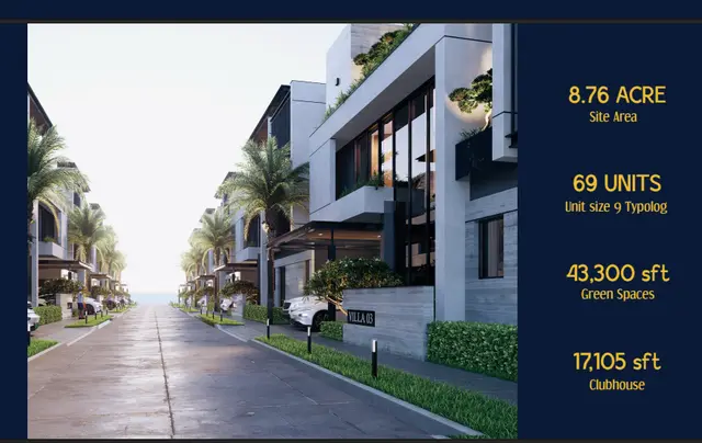
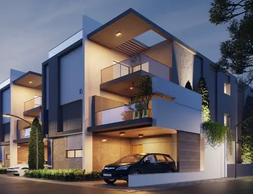
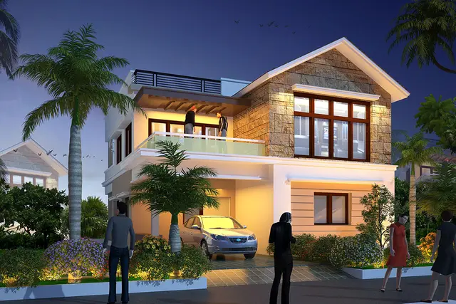
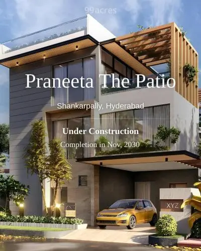
THE PATIO is a TG-RERA-registered new residential project in Mokila, Shankarpalle mandal, Ranga Reddy district, developed by PRANEETA DEVELOPERS AND OTHERS. The site area is 82,919.07 sq.m., and the project is a villa layout with 175 building units listed in the approved plan; the RERA unit record reports 161 total units, including 159 villas and two additional homes filed under the labels “TRIPLEX VILLAS” and “TRIPLEX VILLLA.” Filed villa drawings describe Ground Floor, First Floor and Second Floor, with Terrace Floor also shown. Its TG-RERA registration number is P02400009076, valid 7 November 2024 to 7 November 2030, and the RERA header gives a proposed completion date of 07/03/2031.
01What we found
Read from TG-RERA filings, approvals, land and registration records and court records. A court case is counted only when the court record states this project's survey number with its village, or names the project.
02Check before you pay
7 items to check before you pay, 3 high - from the title chain, court records and approvals, each with what to ask the builder or your advocate. An item may not be a problem with the project: records can be incomplete.
1. Project at a glance
Project identity
| Item | Record |
|---|---|
| Registered project name | THE PATIO RERA record |
| Project type / phase | RERA describes a residential New Project. The filed HMDA material describes a residential layout with housing / villa development. A separate phase designation is not disclosed. RERA record RERA filing |
| TG-RERA registration | P02400009076; valid 7 November 2024 to 7 November 2030. This is the registration-validity period, not the stated project-completion date. RERA record Approvals record |
| Registered promoter | PRANEETA DEVELOPERS AND OTHERS. The RERA record gives organisation type as “Others” and describes the arrangement as “JOINT DEVELOPMENT”; the legal entity form is not specified. RERA record RERA filing Corporate record |
| RERA status | The supplied record identifies the registration as valid through 7 November 2030; no later extension is recorded in the supplied material. Approvals record |
Land and geographic identity
| Item | Record |
|---|---|
| Revenue village / locality | Mokila (also rendered “MOKILA” in filed records); mandal Shankarpalle; district Ranga Reddy; PIN 501203. The registration certificate’s location field says “Shankarpalle, Ranga Reddy, 501203,” while the filed sanction and land records identify Mokila village. RERA record RERA filing |
| Project survey numbers | Survey Nos. 81P, 85P and 87P. The supplied RERA and HMDA project records do not list further subdivisions for the registered project. RERA record RERA filing |
| Registered/site extent | 82,919.07 sq.m. total site area; 82,223.30 sq.m. net area. The filed layout records 695.77 sq.m. as road-widening/road-affected area. RERA filing |
| Boundaries in RERA filing | East: 60 FEET WIDE ROAD; west: NEIGHBOURS LAND SY No 83 AND 84; north: LAND IN SY No 85 PART SY No 86 PART; south: LAND IN SY No 82 PART AND SY No 84 PART. RERA filing |
| Cadastral record | Bhu Bharati records a survey-level match under 81P85P87P, with one row, a whole-survey extent of 77,562.05 sq.m. and a centroid at 17.44157239665733, 78.19450190419852; this is a cadastral record, not a project-boundary survey. Cadastral map |
Development identity
| Item | Record |
|---|---|
| Sanctioning authority / principal permission | Hyderabad Metropolitan Development Authority (HMDA); Draft Layout Permit No. 000062/LO/Plg/HMDA/2024, dated 07 November 2024. The filed letter describes draft layout approval for layout with housing and records that plans are released through Mokila Grampanchayath. Approvals record |
| Application / file reference | Application No. 061622/SKP/LT/U6/HMDA/01082023; the filed plan set also carries HMDA file-number variants, including 061622/SK.P/LT/U6/HMDA/01082023. Approvals record |
| Approved built-up area | The supplied RERA fields state 47,626.01 sq.m. “Approved Built up Area.” The drawings also show a Total proposed net BUA area of 72,751.69 sq.m.; these are differently labelled figures and are not interchangeable. RERA filing |
| Buildings / units | RERA lists 175 total building units as per approved plan and 175 proposed building units as per agreement. The RERA unit record separately reports 161 total units; the project is not described as a conventional tower scheme. RERA filing RERA unit table |
| Floors / height | Filed villa drawings describe villas with Ground Floor, First Floor, Second Floor and Terrace Floor, and also use G+2 / three-floor descriptions. The drawings state villa building heights of 9.75 MT. and 9.65 MT. A proposed clubhouse drawing shows 1 Cellar + 1 Ground + 2 upper floors. |
| Parking | A drawing records Required Parking Area: 1271.17 Sq.mt. and Total proposed parking area: 0.00 Sq.mt. No parking-space count or unit-specific parking allocation is supplied. |
Offering and status
| Item | Record |
|---|---|
| RERA-filed offering | The RERA unit record classifies the main offering as villas. It records 159 units in its normalised “Villa” category and two further filed homes under the labels “TRIPLEX VILLAS” and “TRIPLEX VILLLA.” RERA unit table RERA unit details |
| Filed saleable area | Main villa category: 388.0–446.6 sq.m.; the two additional filed homes: 389.0–515.0 sq.m. These are RERA-filed saleable-area figures. RERA unit table RERA unit details |
| Booked / available | Portal-extracted counts show 0 booked and 161 available across the supplied unit record. The portal record has no stated as-of date, so these counts are indicative. RERA unit table RERA unit details |
| Construction stage | No independently verified site-progress evidence is supplied. The RERA record is a new project; filed drawings are proposed plans, not evidence of completion. RERA record Document index |
| Completion date | RERA header: proposed completion 07/03/2031. Form B declares completion by 7 November 2030. These dates are presented as recorded in their respective documents; the supplied material does not establish a revised completion date. RERA record |
| Occupancy / completion certificate | No occupancy certificate or completion certificate is supplied for the project or any villa, clubhouse or phase. Document index |
2. The project story
THE PATIO is registered with TG-RERA as a new residential project in Mokila village, Shankarpalle mandal, Ranga Reddy district. Its filed HMDA material describes a large layout-with-housing development comprising villas, internal roads, open-space/park and utility land, amenity land, and a clubhouse. The project parcel is identified in the registration and approval records as Survey Nos. 81P, 85P and 87P. RERA record
The RERA filing lists 175 building units, while the portal’s unit data records 161 total units, including 159 villas and two additional homes filed under unclassified villa labels. The HMDA plan drawings describe villas as proposed, generally with ground and two upper floors. No supplied evidence establishes that construction has reached a particular stage or that any part has received an occupancy certificate; therefore, the drawings and promoter completion undertaking should not be read as proof of completed or occupied homes. RERA filing RERA unit table RERA unit details
The project is registered through 7 November 2030, while the RERA header gives a proposed completion date of 7 March 2031. Registration validity and the stated completion timeline are separate record items. Approvals record RERA record
3. Master plan, architecture & building design
The filed land-use schedule identifies a total site area of 82,919.07 sq.m. and a net site area of 82,223.30 sq.m., with 695.77 sq.m. recorded as road widening/road-affected area. The layout drawing’s land-use figures are 47,626.01 sq.m. plotted area, 22,742.58 sq.m. roads, 9,374.79 sq.m. organized open space/park/utility area, and 2,478.08 sq.m. amenity area. These are drawing or approval-record land-use figures, not carpet or saleable areas.
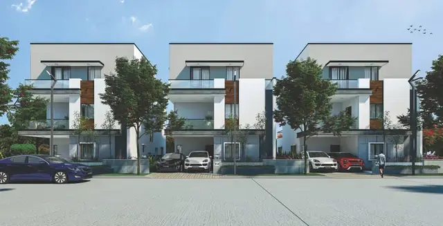
The development is laid out as villa plots rather than residential towers. The drawing set labels villas by plot/unit numbers and shows a residential configuration of ground floor, first floor and second floor, with terrace shown on individual plan sheets; the filed plan data gives heights of 9.75 MT. and 9.65 MT. A separate proposed clubhouse drawing shows a cellar, ground floor and two upper floors.
HMDA’s draft layout letter identifies Plot Nos. 9 TO 19 and 20 TO 29 as mortgaged to HMDA, with a recorded mortgage area of 7,469.95 Sq.m in the plan extraction. The plan also records internal roads, including 15.00 and 12.00 mt. Wide InternalRoad on drawing extracts; the HMDA letter specifies road widths of 18 mts and above.
The supplied drawings include a proposed net BUA figure of 72,751.69 sq.m. and, on an individual-villa plan extraction, Total Built Up Area: 73,538.95 Sq.mt. The registration fields separately state approved built-up area of 47,626.01 sq.m. The records use different area labels; no FSI-counted area or carpet-area total for the project is supplied. RERA filing
4. Homes, configurations & floor plans
The TG-RERA unit record reports villa saleable areas and counts. Its filed labels include spelling variants; the table preserves the supplied normalised categories and calls out the additional entries that could not be classified by the normaliser. Booked and available numbers are portal-extracted without an as-of date. RERA unit table RERA unit details
| Configuration | Units | Booked | Available | RERA saleable area | Measured carpet area | Loading (if supplied) |
|---|---|---|---|---|---|---|
| Villa (RERA filed as “TRILPEX VILLA”, “TRIPLEX VILLA”, “TRIPOLEX VILLA”) | 159 | 0 | 159 | 388.0–446.6 sq.m. | Not supplied | Not supplied |
| Homes (configuration not filed; RERA labels “TRIPLEX VILLAS” and “TRIPLEX VILLLA”) | 2 | 0 | 2 | 389.0–515.0 sq.m. | Not supplied | Not supplied |
A separate software measurement from two supplied drawing designs identifies a 1BHK arrangement with measured carpet area of 199.9–211.6 sq.m. (median 205.8 sq.m., or 2,215 sq.ft. median). The drawing-based measurement is not a TG-RERA configuration or disclosure and should be checked against the drawings. The supplied room list for one measured plan includes kitchen, living, dining, guest bedroom, store and toilet. The supplied data does not establish that this 1BHK drawing corresponds to a RERA-filed villa configuration. RERA unit details Floor plans
Carpet area measures the home’s internal area as interpreted from drawing geometry; saleable area is the RERA-filed figure and is not a substitute for carpet area. The supplied data does not provide a loading figure or a project-specific breakdown of balcony, utility or common-area components. RERA unit details Floor plans
5. Parking & vehicle circulation
The drawing extraction states Required Parking Area: 1271.17 Sq.mt. and Total proposed parking area: 0.00 Sq.mt. The supplied documents do not establish the number of parking spaces, visitor or accessible parking provision, parking levels, EV charging, or an allocation of parking to individual villas. A parking bay or area on a drawing would not, by itself, establish exclusive allotment. RERA amenities
The layout drawings refer to internal roads, including 15.00 and 12.00 mt. Wide InternalRoad; the HMDA draft letter records road widths of 18 mts and above and 60 feet and above. The supplied material does not specify vehicle-entry/exit arrangements, ramps, pedestrian separation or a parking circulation plan.
6. Amenities, recreation & open spaces
The RERA amenity schedule marks the listed infrastructure and facilities “YES,” but records 0% progress for each. Those entries evidence filed declarations, not independently verified completion. The HMDA letter and plan extracts also identify layout-level areas and proposed facilities. RERA amenities
| Description / size | Proposed clubhouse; drawing shows Cellar Floor, Ground Floor, First Floor, Second Floor. No area or capacity supplied. |
|---|---|
| Declared progress / verified status | Proposed in drawing; completion not verified. |
| Description / size | 9,374.79 sq.m. identified as organized open space/park/utility area; HMDA letter describes parks/utility area to be handed to the local body. |
|---|---|
| Declared progress / verified status | RERA amenity schedule marks aggregate recreational open space “YES,” 0%; delivery/handover not independently verified. |
| Description / size | 2,478.08 sq.m. in the filed layout area statement. |
|---|---|
| Declared progress / verified status | Area appears in filed plan; facility delivery not verified. |
| Description / size | 852.937 SQ.MTS shown in drawing extracts. |
|---|---|
| Declared progress / verified status | Shown in filed drawing; completion not verified. |
| Description / size | RERA amenity schedule lists “Green Strip/TOT LOT/Park” as available “YES.” |
|---|---|
| Evidence source | RERA amenities |
| Declared progress / verified status | Declared 0%; not independently verified complete. |
| Description / size | Listed in RERA amenity schedule as “YES”; layout drawing shows road area of 22,742.58 sq.m. |
|---|---|
| Evidence source | RERA amenities |
| Declared progress / verified status | Declared 0%; not independently verified complete. |
| Description / size | Listed as “YES” in RERA amenity schedule. |
|---|---|
| Evidence source | RERA amenities |
| Declared progress / verified status | Declared 0%; not independently verified complete. |
7. Utilities, building services & safety
The RERA amenity schedule marks water supply, sewerage, storm-water drains, sewage/sullage treatment and disposal, solid-waste management, rainwater harvesting, energy management, fire protection, and electrical meter room/sub-station/receiving station as “YES”; each is recorded at 0% progress. These are filed declarations, not evidence of completed installation or statutory clearance. RERA amenities
The HMDA approval letter identifies the following as project requirements or facilities in its filed material: STP, common septic tank, internal water-supply pipelines, hydro-pneumatic system, transformer/transformer yard, rainwater-harvesting pits and bio-compost unit. It specifically states that the applicant shall construct the STP to the stated standard and certify it through a licensed structural engineer. The supplied evidence does not give capacities, completion status or operating details.
The supplied records do not establish water-source details or storage capacity, lift provision or capacity, backup-power capacity, CCTV/access-control arrangements, waste-segregation operations, accessible routes, or completed fire-safety systems. RERA amenities Document index
8. Location, access & connectivity
The registered project location is Mokila village, Shankarpalle mandal, Ranga Reddy district, Telangana, PIN 501203. The filed RERA site boundaries identify a 60-foot-wide road to the east. HMDA’s drawing material refers to internal roads, including 15.00 and 12.00 mt. Wide InternalRoad. RERA record RERA filing
A parcel-centroid geocode is supplied at 17.44157239665733, 78.19450190419852. The nearest sampled Outer Ring Road interchange is recorded at approximately 12.0 km; no travel time is supplied. The evidence does not provide verified public-transport routes or measured distances to other landmarks. Cadastral map Location record
9. Developer & development status
The registered promoter is PRANEETA DEVELOPERS AND OTHERS, recorded as organisation type “Others” and described in the RERA fields as a joint development. The promoter GSTIN is 36AAWFP7202M1ZL. The filed Form B names M/s. PRANEETA DEVELOPERS and identifies Mr. VARTHYA DEVULA NAIK as authorized signatory; the RERA registration certificate names Praneeta Developers And Others as promoter. The supplied record does not identify the complete legal entity form or provide an official contact telephone or email. Corporate record RERA filing
The RERA header gives a proposed completion date of 07/03/2031; the Form B undertaking says completion by 7th November 2030. Neither should be read as verified construction progress. No site-progress evidence or occupancy/completion certificate is supplied. RERA record Document index
10. Approvals, official records & documents
| Record | What the supplied evidence shows |
|---|---|
| TG-RERA registration | Form C certificate for THE PATIO, registration P02400009076, valid 07/11/2024–07/11/2030. |
| HMDA layout permission | HMDA Draft Layout Letter, Permit No. 000062/LO/Plg/HMDA/2024, dated 07 November 2024, for Survey Nos. 81P, 85P and 87P, Mokila. The letter describes draft layout approval and records development and handover conditions. |
| Project drawings | HMDA-filed layout-with-housing plan sheets include villa and clubhouse drawings; the supplied sheets are described as proposed/draft plans. |
| Promoter declaration | Form B affidavit-cum-declaration by authorized signatory VARTHYA DEVULA NAIK, dated November 2024 (day not stated), including the promoter’s completion undertaking. |
| Commencement certificates | No separate building-wise commencement certificate is established in the supplied evidence; documents bearing this filing category include HMDA layout material. Document index |
| Occupancy/completion certificates | None supplied for the project or any phase, villa or clubhouse. Document index |
| Other official lookup | HMDA DPMS approved-layout lookup was unavailable through the public route described in the supplied record; this does not establish refusal or non-approval. HMDA |
1. Project at a glance
Project identity
Registered project name: THE PATIO
Project type / phase: RERA describes a residential New Project. The filed HMDA material describes a residential layout with housing / villa development. A separate phase designation is not disclosed.
TG-RERA registration: P02400009076; valid 7 November 2024 to 7 November 2030. This is the registration-validity period, not the stated project-completion date.
Registered promoter: PRANEETA DEVELOPERS AND OTHERS. The RERA record gives organisation type as “Others” and describes the arrangement as “JOINT DEVELOPMENT”; the legal entity form is not specified.
RERA status: The supplied record identifies the registration as valid through 7 November 2030; no later extension is recorded in the supplied material.
Land and geographic identity
Revenue village / locality: Mokila (also rendered “MOKILA” in filed records); mandal Shankarpalle; district Ranga Reddy; PIN 501203. The registration certificate’s location field says “Shankarpalle, Ranga Reddy, 501203,” while the filed sanction and land records identify Mokila village.
Project survey numbers: Survey Nos. 81P, 85P and 87P. The supplied RERA and HMDA project records do not list further subdivisions for the registered project.
Registered/site extent: 82,919.07 sq.m. total site area; 82,223.30 sq.m. net area. The filed layout records 695.77 sq.m. as road-widening/road-affected area.
Boundaries in RERA filing: East: 60 FEET WIDE ROAD; west: NEIGHBOURS LAND SY No 83 AND 84; north: LAND IN SY No 85 PART SY No 86 PART; south: LAND IN SY No 82 PART AND SY No 84 PART.
Cadastral record: Bhu Bharati records a survey-level match under 81P85P87P, with one row, a whole-survey extent of 77,562.05 sq.m. and a centroid at 17.44157239665733, 78.19450190419852; this is a cadastral record, not a project-boundary survey.
Development identity
Sanctioning authority / principal permission: Hyderabad Metropolitan Development Authority (HMDA); Draft Layout Permit No. 000062/LO/Plg/HMDA/2024, dated 07 November 2024. The filed letter describes draft layout approval for layout with housing and records that plans are released through Mokila Grampanchayath.
Application / file reference: Application No. 061622/SKP/LT/U6/HMDA/01082023; the filed plan set also carries HMDA file-number variants, including 061622/SK.P/LT/U6/HMDA/01082023.
Approved built-up area: The supplied RERA fields state 47,626.01 sq.m. “Approved Built up Area.” The drawings also show a Total proposed net BUA area of 72,751.69 sq.m.; these are differently labelled figures and are not interchangeable.
Buildings / units: RERA lists 175 total building units as per approved plan and 175 proposed building units as per agreement. The RERA unit record separately reports 161 total units; the project is not described as a conventional tower scheme.
Floors / height: Filed villa drawings describe villas with Ground Floor, First Floor, Second Floor and Terrace Floor, and also use G+2 / three-floor descriptions. The drawings state villa building heights of 9.75 MT. and 9.65 MT. A proposed clubhouse drawing shows 1 Cellar + 1 Ground + 2 upper floors.
Parking: A drawing records Required Parking Area: 1271.17 Sq.mt. and Total proposed parking area: 0.00 Sq.mt. No parking-space count or unit-specific parking allocation is supplied.
Offering and status
RERA-filed offering: The RERA unit record classifies the main offering as villas. It records 159 units in its normalised “Villa” category and two further filed homes under the labels “TRIPLEX VILLAS” and “TRIPLEX VILLLA.”
Filed saleable area: Main villa category: 388.0–446.6 sq.m.; the two additional filed homes: 389.0–515.0 sq.m. These are RERA-filed saleable-area figures.
Booked / available: Portal-extracted counts show 0 booked and 161 available across the supplied unit record. The portal record has no stated as-of date, so these counts are indicative.
Construction stage: No independently verified site-progress evidence is supplied. The RERA record is a new project; filed drawings are proposed plans, not evidence of completion.
Completion date: RERA header: proposed completion 07/03/2031. Form B declares completion by 7 November 2030. These dates are presented as recorded in their respective documents; the supplied material does not establish a revised completion date.
Occupancy / completion certificate: No occupancy certificate or completion certificate is supplied for the project or any villa, clubhouse or phase.
2. The project story
THE PATIO is registered with TG-RERA as a new residential project in Mokila village, Shankarpalle mandal, Ranga Reddy district. Its filed HMDA material describes a large layout-with-housing development comprising villas, internal roads, open-space/park and utility land, amenity land, and a clubhouse. The project parcel is identified in the registration and approval records as Survey Nos. 81P, 85P and 87P.
The RERA filing lists 175 building units, while the portal’s unit data records 161 total units, including 159 villas and two additional homes filed under unclassified villa labels. The HMDA plan drawings describe villas as proposed, generally with ground and two upper floors. No supplied evidence establishes that construction has reached a particular stage or that any part has received an occupancy certificate; therefore, the drawings and promoter completion undertaking should not be read as proof of completed or occupied homes.
The project is registered through 7 November 2030, while the RERA header gives a proposed completion date of 7 March 2031. Registration validity and the stated completion timeline are separate record items.
3. Master plan, architecture & building design
The filed land-use schedule identifies a total site area of 82,919.07 sq.m. and a net site area of 82,223.30 sq.m., with 695.77 sq.m. recorded as road widening/road-affected area. The layout drawing’s land-use figures are 47,626.01 sq.m. plotted area, 22,742.58 sq.m. roads, 9,374.79 sq.m. organized open space/park/utility area, and 2,478.08 sq.m. amenity area. These are drawing or approval-record land-use figures, not carpet or saleable areas.
The development is laid out as villa plots rather than residential towers. The drawing set labels villas by plot/unit numbers and shows a residential configuration of ground floor, first floor and second floor, with terrace shown on individual plan sheets; the filed plan data gives heights of 9.75 MT. and 9.65 MT. A separate proposed clubhouse drawing shows a cellar, ground floor and two upper floors.
HMDA’s draft layout letter identifies Plot Nos. 9 TO 19 and 20 TO 29 as mortgaged to HMDA, with a recorded mortgage area of 7,469.95 Sq.m in the plan extraction. The plan also records internal roads, including 15.00 and 12.00 mt. Wide InternalRoad on drawing extracts; the HMDA letter specifies road widths of 18 mts and above.
The supplied drawings include a proposed net BUA figure of 72,751.69 sq.m. and, on an individual-villa plan extraction, Total Built Up Area: 73,538.95 Sq.mt. The registration fields separately state approved built-up area of 47,626.01 sq.m. The records use different area labels; no FSI-counted area or carpet-area total for the project is supplied.
4. Homes, configurations & floor plans
The TG-RERA unit record reports villa saleable areas and counts. Its filed labels include spelling variants; the table preserves the supplied normalised categories and calls out the additional entries that could not be classified by the normaliser. Booked and available numbers are portal-extracted without an as-of date.
| Configuration | Units | Booked | Available | RERA saleable area | Measured carpet area | Loading (if supplied) |
|---|---|---|---|---|---|---|
| Villa (RERA filed as “TRILPEX VILLA”, “TRIPLEX VILLA”, “TRIPOLEX VILLA”) | 159 | 0 | 159 | 388.0–446.6 sq.m. | Not supplied | Not supplied |
| Homes (configuration not filed; RERA labels “TRIPLEX VILLAS” and “TRIPLEX VILLLA”) | 2 | 0 | 2 | 389.0–515.0 sq.m. | Not supplied | Not supplied |
A separate software measurement from two supplied drawing designs identifies a 1BHK arrangement with measured carpet area of 199.9–211.6 sq.m. (median 205.8 sq.m., or 2,215 sq.ft. median). The drawing-based measurement is not a TG-RERA configuration or disclosure and should be checked against the drawings. The supplied room list for one measured plan includes kitchen, living, dining, guest bedroom, store and toilet. The supplied data does not establish that this 1BHK drawing corresponds to a RERA-filed villa configuration.
Carpet area measures the home’s internal area as interpreted from drawing geometry; saleable area is the RERA-filed figure and is not a substitute for carpet area. The supplied data does not provide a loading figure or a project-specific breakdown of balcony, utility or common-area components.
5. Parking & vehicle circulation
The drawing extraction states Required Parking Area: 1271.17 Sq.mt. and Total proposed parking area: 0.00 Sq.mt. The supplied documents do not establish the number of parking spaces, visitor or accessible parking provision, parking levels, EV charging, or an allocation of parking to individual villas. A parking bay or area on a drawing would not, by itself, establish exclusive allotment.
The layout drawings refer to internal roads, including 15.00 and 12.00 mt. Wide InternalRoad; the HMDA draft letter records road widths of 18 mts and above and 60 feet and above. The supplied material does not specify vehicle-entry/exit arrangements, ramps, pedestrian separation or a parking circulation plan.
6. Amenities, recreation & open spaces
The RERA amenity schedule marks the listed infrastructure and facilities “YES,” but records 0% progress for each. Those entries evidence filed declarations, not independently verified completion. The HMDA letter and plan extracts also identify layout-level areas and proposed facilities.
| Facility | Description / size | Evidence source | Declared progress / verified status |
|---|---|---|---|
| Clubhouse | Proposed clubhouse; drawing shows Cellar Floor, Ground Floor, First Floor, Second Floor. No area or capacity supplied. | Proposed in drawing; completion not verified. | |
| Park / organized open space | 9,374.79 sq.m. identified as organized open space/park/utility area; HMDA letter describes parks/utility area to be handed to the local body. | RERA amenity schedule marks aggregate recreational open space “YES,” 0%; delivery/handover not independently verified. | |
| Civic amenity area | 2,478.08 sq.m. in the filed layout area statement. | Area appears in filed plan; facility delivery not verified. | |
| Utility area | 852.937 SQ.MTS shown in drawing extracts. | Shown in filed drawing; completion not verified. | |
| Green strip / tot lot / park | RERA amenity schedule lists “Green Strip/TOT LOT/Park” as available “YES.” | Declared 0%; not independently verified complete. | |
| Internal roads and footpaths | Listed in RERA amenity schedule as “YES”; layout drawing shows road area of 22,742.58 sq.m. | Declared 0%; not independently verified complete. | |
| Community buildings | Listed as “YES” in RERA amenity schedule. | Declared 0%; not independently verified complete. |
7. Utilities, building services & safety
The RERA amenity schedule marks water supply, sewerage, storm-water drains, sewage/sullage treatment and disposal, solid-waste management, rainwater harvesting, energy management, fire protection, and electrical meter room/sub-station/receiving station as “YES”; each is recorded at 0% progress. These are filed declarations, not evidence of completed installation or statutory clearance.
The HMDA approval letter identifies the following as project requirements or facilities in its filed material: STP, common septic tank, internal water-supply pipelines, hydro-pneumatic system, transformer/transformer yard, rainwater-harvesting pits and bio-compost unit. It specifically states that the applicant shall construct the STP to the stated standard and certify it through a licensed structural engineer. The supplied evidence does not give capacities, completion status or operating details.
The supplied records do not establish water-source details or storage capacity, lift provision or capacity, backup-power capacity, CCTV/access-control arrangements, waste-segregation operations, accessible routes, or completed fire-safety systems.
8. Location, access & connectivity
The registered project location is Mokila village, Shankarpalle mandal, Ranga Reddy district, Telangana, PIN 501203. The filed RERA site boundaries identify a 60-foot-wide road to the east. HMDA’s drawing material refers to internal roads, including 15.00 and 12.00 mt. Wide InternalRoad.
A parcel-centroid geocode is supplied at 17.44157239665733, 78.19450190419852. The nearest sampled Outer Ring Road interchange is recorded at approximately 12.0 km; no travel time is supplied. The evidence does not provide verified public-transport routes or measured distances to other landmarks.
9. Developer & development status
The registered promoter is PRANEETA DEVELOPERS AND OTHERS, recorded as organisation type “Others” and described in the RERA fields as a joint development. The promoter GSTIN is 36AAWFP7202M1ZL. The filed Form B names M/s. PRANEETA DEVELOPERS and identifies Mr. VARTHYA DEVULA NAIK as authorized signatory; the RERA registration certificate names Praneeta Developers And Others as promoter. The supplied record does not identify the complete legal entity form or provide an official contact telephone or email.
The RERA header gives a proposed completion date of 07/03/2031; the Form B undertaking says completion by 7th November 2030. Neither should be read as verified construction progress. No site-progress evidence or occupancy/completion certificate is supplied.
10. Approvals, official records & documents
TG-RERA registration: Form C certificate for THE PATIO, registration P02400009076, valid 07/11/2024–07/11/2030.
HMDA layout permission: HMDA Draft Layout Letter, Permit No. 000062/LO/Plg/HMDA/2024, dated 07 November 2024, for Survey Nos. 81P, 85P and 87P, Mokila. The letter describes draft layout approval and records development and handover conditions.
Project drawings: HMDA-filed layout-with-housing plan sheets include villa and clubhouse drawings; the supplied sheets are described as proposed/draft plans.
Promoter declaration: Form B affidavit-cum-declaration by authorized signatory VARTHYA DEVULA NAIK, dated November 2024 (day not stated), including the promoter’s completion undertaking.
Commencement certificates: No separate building-wise commencement certificate is established in the supplied evidence; documents bearing this filing category include HMDA layout material.
Occupancy/completion certificates: None supplied for the project or any phase, villa or clubhouse.
Other official lookup: HMDA DPMS approved-layout lookup was unavailable through the public route described in the supplied record; this does not establish refusal or non-approval.
Frequently asked questions
Is THE PATIO registered with Telangana RERA?
Yes. THE PATIO is registered with the Telangana Real Estate Regulatory Authority as P02400009076; the registration status is New Project.
Who is the developer of THE PATIO?
The promoter named in the RERA registration is PRANEETA DEVELOPERS AND OTHERS.
Where is THE PATIO located?
THE PATIO is in MOKILA, Shankarpalle, Rangareddy, Telangana (501203).
When will THE PATIO be completed?
The promoter's proposed date of completion filed with RERA is 07/03/2031. This is the promoter's declaration, not a guarantee.
More projects in Mokila