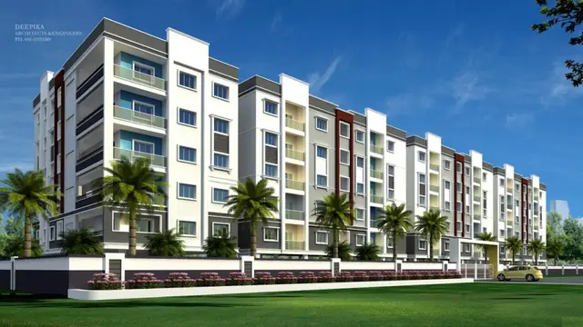
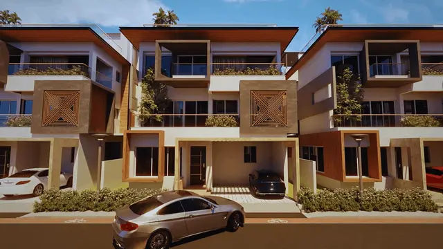
Sree Balaji County - I
MALLEBOINA UDAYA BHASKER AND OTHERS · Rangareddy · RERA P02400006048
SREE BALAJI COUNTY - I is a plotted development in MASANPALLY, Maheshwaram mandal, Ranga Reddy district, developed by the registered promoter MALLEBOINA UDAYA BHASKER AND OTHERS. The registered site area is 10,228.00 sq. m, and the offering is plots; the supplied records do not disclose a plot count or plot-size range, and no towers or floors are stated. The project is registered under TG-RERA registration P02400006048, with a proposed completion date of 24/12/2025.
01What we found
Read from TG-RERA filings, approvals, land and registration records and court records. A court case is counted only when the court record states this project's survey number with its village, or names the project.
02Check before you pay
7 items to check before you pay, 4 high - from the title chain, court records and approvals, each with what to ask the builder or your advocate. An item may not be a problem with the project: records can be incomplete.
1. Project at a glance
Project identity
| Item | Project record |
|---|---|
| Registered project name | SREE BALAJI COUNTY - I RERA record |
| Project type | Plotted development / open-plotted layout RERA record RERA filing |
| Phase or registered portion | “- I” appears in the registered name; a separate phase description is not disclosed RERA record |
| TG-RERA registration | P02400006048 RERA record |
| Registration validity | 18/04/2023 to 24/12/2025; the certificate states that extension would be by Authority action under the Act and Rules |
| Registered promoter | MALLEBOINA UDAYA BHASKER AND OTHERS RERA record RERA filing |
| RERA status | The supplied certificate records registration; the supplied registration record lists the project as “New Project.” Current registration status is not established by these records. RERA record |
Land and geographic identity
| Item | Project record |
|---|---|
| Locality | MASANPALLY RERA record RERA filing |
| Revenue village | Mansanpally (also written “Mansanpalle” in the filed approval documents) RERA record |
| Mandal | Maheshwaram RERA record |
| District | Ranga Reddy RERA record |
| PIN | 501359 RERA record |
| Project survey numbers / subdivisions, as recorded | 290A, 290/E3, 290/E, 290/EE, 290/AA, 290/E2 RERA record |
| Registered site extent | 10,228 sq. m total site area; 10,228.00 sq. m net area in the RERA land record RERA filing Land records |
| Filed draft-layout area statement | Net site area 7892.52 Sq.m; the filed draft-layout record also lists plotted area 5282.45, layout road area 1747.48, park 664.42, and social infrastructure 198.17 (areas are stated in sq. m in the document). |
| Boundaries | East: land in Sy. No. 291; West: land in Sy. No. 258; North: 70 feet wide road; South: land in Sy. Nos. 259 and 289. RERA filing |
Development identity
| Item | Project record |
|---|---|
| Sanctioning authority | Hyderabad Metropolitan Development Authority (HMDA); the filed proceeding identifies Mansanpalle Gram Panchayat as the delegated local body. Approvals record |
| Principal layout approval | 000256/LO/Plg/HMDA/2022, dated 24 December, 2022; application 057103/SMD/LT/U6/HMDA/30092022 Approvals record |
| Local-body proceeding | Proc. No. 01/2023, dated 02/01/2023, for release of a residential draft open-plotted layout |
| Approved built-up area | 7892.52 sq. m is recorded as “Approved Built up Area” in the RERA fields; the HMDA draft-layout record separately describes 7892.52 Sq.m as its net site area. RERA filing |
| Buildings / floors | Not applicable to the plotted-layout offering as described in the supplied records; no tower or building configuration is disclosed. RERA record |
| Parking | No parking-space count or parking-level arrangement is established in the supplied project records. Document index |
| Mortgaged area | 1231.63 Sq.m, comprising Plot Nos. 17–22, recorded in favour of HMDA. RERA filing |
Offering and status
| Item | Project record |
|---|---|
| Unit type | Plots RERA filing |
| RERA-filed plot counts and size range | Not established in the supplied RERA unit/layout records. |
| Booked / available counts | Not disclosed in the supplied project records. |
| Construction / development stage | No independently verified site progress is supplied. The HMDA document describes a draft layout and sets out development works and conditions. |
| Completion date | The promoter’s Form B declaration undertakes completion by 24/12/2025. |
| Occupancy / completion certificate | No occupancy or completion certificate is supplied. For a plotted layout, the available records instead identify a draft-layout process and conditions before final layout release. |
| Registration validity versus completion | The certificate’s registration-validity end date is 24/12/2025; the Form B completion undertaking is also 24/12/2025. These are separate recorded particulars. |
2. The project story
- SREE BALAJI COUNTY - I is registered as a plotted development in Mansanpally village, Maheshwaram mandal, Ranga Reddy district. Its RERA identity lists survey numbers 290A, 290/E3, 290/E, 290/EE, 290/AA and 290/E2. The RERA land record gives a total and net area of 10,228.00 sq. m. RERA record Land records
- The filed HMDA material describes a residential open-plotted layout proposal. It records a draft-layout area statement and requires development works including internal water-supply pipelines, underground storm-water drainage, road and footpath works, street lighting, a transformer yard, rainwater-harvesting pits and park development. These are documented requirements or proposed works, not evidence that they have been completed.
- The promoter’s Form B declaration states a completion undertaking of 24/12/2025. The supplied evidence does not establish current on-site progress, plot-level availability, or that a final layout release or completion certificate has been issued. Document index
3. Master plan, architecture & building design
- This is a plotted layout, not a multi-storey building project in the supplied records. No tower, floor, apartment, building-footprint or building-circulation information is provided. RERA record
- The HMDA draft-layout record states a net site area of 7892.52 Sq.m and lists the following land-use components: plotted area 5282.45, layout road area 1747.48, park 664.42, and social infrastructure 198.17. It also states that the road, organised open-space and social-infrastructure areas are to be handed over to the local body through registered gift deed before release of final layout plans.
- The record specifies roads of 18 mts and above and 60 feet and above; the accompanying draft plan also labels 12.0M WIDE ROAD and 9.14 M WIDE ROAD. The filed conditions call for roads to remain accessible to neighbouring sites and prohibit a compound wall or fencing around the site.
- The filed plan and conditions also identify park development, a social-infrastructure area, a utilities area and cycling tracks. The supplied record does not provide plot-by-plot dimensions or a complete plot schedule for this overview.
4. Homes, configurations & floor plans
- The project is recorded as a plotted development, but the supplied RERA evidence does not provide a verified plot count, plot-size schedule, booked/available inventory, or a RERA-filed saleable-area range. RERA record Document index
- Two drawing records are noted, but both are scans pending measurement; no software-measured plot or floor-plan areas are available. The vendor material is not used to establish RERA plot configurations or areas. Floor plans Promoter website
5. Parking & vehicle circulation
- The supplied project records do not establish a parking-space count, visitor or accessible parking provision, parking allocation to individual plots, or a parking-level arrangement. Document index
- For circulation, the HMDA draft-layout conditions refer to internal roads and require road access to neighbouring sites; the filed plan labels 12.0M WIDE ROAD and 9.14 M WIDE ROAD. No separate pedestrian-access design, vehicle-entry arrangement or EV charging provision is established by the supplied project-specific records.
6. Amenities, recreation & open spaces
The filed HMDA document identifies layout infrastructure and amenities as follows. The supplied records do not independently verify completion.
| Facility | Description / size | Evidence source | Declared progress / verified status |
|---|---|---|---|
| Park / organised open space | 664.42 Sq. m; the draft-layout record states 8.42% | HMDA draft-layout record | Required/recorded in the draft-layout material; completion not verified |
| Social infrastructure | 198.17 sq. m; the draft-layout record states 2.51% | HMDA draft-layout record; draft plan labels “SOCIAL INFRA” | Area shown in filed material; delivered facility or use not established |
| Cycling tracks | Required within the layout | HMDA draft-layout conditions | Required; progress not verified |
| Tot-lot | Labelled “TOT-LOT” on the draft plan; no size supplied | Draft layout plan | Shown on draft plan; completion not verified |
- The RERA amenities record lists 14 categories, including internal roads and footpaths, water supply, sewerage, storm-water drains, green strip/tot-lot/park, street lighting, community buildings, sewage and sullage treatment/disposal, solid-waste management, rainwater harvesting, energy management, fire protection, electrical meter room/sub-station/receiving station, and recreational open space. Each is recorded at 0% in that data. RERA amenities
7. Utilities, building services & safety
- The HMDA draft-layout conditions call for potable/drinking-water connectivity, underground storm-water drainage, paved footpaths, a transformer yard in the utilities area, and LED street lighting. The listed amenities/utilities also include a common septic tank / STP, internal water-supply pipelines, an overhead tank, rainwater-harvesting pits and a bio-compost unit. These are filed provisions or requirements; the supplied material does not verify installation, capacity, or operation.
- See RERA amenities record above for the listed utility and safety categories and their recorded 0% status. No capacity, operating status, fire-clearance evidence, backup-power specification, CCTV/security system, accessibility design or EV provision is established in the supplied project records. RERA amenities
8. Location, access & connectivity
- The registered location is Mansanpally, Maheshwaram mandal, Ranga Reddy district, PIN 501359. The RERA land record gives the site boundaries as Sy. No. 291 to the east, Sy. No. 258 to the west, a 70-feet-wide road to the north, and Sy. Nos. 259 and 289 to the south. RERA record RERA filing
- A cadastral parcel-centroid record places the location at 17.141998116894072, 78.38552295158871. The nearest sampled Outer Ring Road interchange is listed at 10.9 km; this is a measured location-data distance, not a travel-time claim. Cadastral map Location record
- See circulation above for the HMDA layout’s internal-road details and neighbouring-site access requirement. No public-transport distances or other measured landmark distances are supplied.
9. Developer & development status
- The registered promoter is MALLEBOINA UDAYA BHASKER AND OTHERS. The RERA record describes the organisation type as “Others” and its description as “INDIVIDUALS”; no corporate entity type or company registration identifier is established in the supplied evidence. RERA record RERA filing Corporate record
- The promoter’s Form B affidavit, dated 06-01-2023, states that the project would be completed by 24/12/2025 and that pending approvals would be obtained on time. These are promoter declarations. The supplied records do not establish current construction or development progress, final layout release, or occupancy/completion certification. Document index
10. Approvals, official records & documents
| Record | Supplied evidence |
|---|---|
| TG-RERA registration | Form C for SREE BALAJI COUNTY - I, registration P02400006048, issued 18/04/2023, valid through 24/12/2025 |
| HMDA principal layout record | Draft layout letter 000256/LO/Plg/HMDA/2022, dated 24 December, 2022, for survey numbers 290A, 290/E3, 290/E, 290/EE, 290/AA and 290/E2 |
| Local-body proceeding | Mansanpalle Gram Panchayat proceeding Proc. No. 01/2023, dated 02/01/2023, concerning release of a residential draft open-plotted layout |
| Draft layout plan | HMDA draft plan showing road widths and social-infrastructure area; it also refers to gift deed 16162/2022 for land left for a 70-foot-wide road |
| Promoter declaration | Form B affidavit-cum-declaration, dated 06-01-2023, including the promoter’s title, encumbrance and completion declarations |
| Commencement / completion / occupancy evidence | No separate commencement certificate for buildings, final layout release, completion certificate, or occupancy certificate is supplied. The project is described in the supplied approval documents as a plotted layout. Document index |
1. Project at a glance
Project identity
Registered project name: SREE BALAJI COUNTY - I
Project type: Plotted development / open-plotted layout
Phase or registered portion: “- I” appears in the registered name; a separate phase description is not disclosed
TG-RERA registration: P02400006048
Registration validity: 18/04/2023 to 24/12/2025; the certificate states that extension would be by Authority action under the Act and Rules
Registered promoter: MALLEBOINA UDAYA BHASKER AND OTHERS
RERA status: The supplied certificate records registration; the supplied registration record lists the project as “New Project.” Current registration status is not established by these records.
Land and geographic identity
Locality: MASANPALLY
Revenue village: Mansanpally (also written “Mansanpalle” in the filed approval documents)
Mandal: Maheshwaram
District: Ranga Reddy
PIN: 501359
Project survey numbers / subdivisions, as recorded: 290A, 290/E3, 290/E, 290/EE, 290/AA, 290/E2
Registered site extent: 10,228 sq. m total site area; 10,228.00 sq. m net area in the RERA land record
Filed draft-layout area statement: Net site area 7892.52 Sq.m; the filed draft-layout record also lists plotted area 5282.45, layout road area 1747.48, park 664.42, and social infrastructure 198.17 (areas are stated in sq. m in the document).
Boundaries: East: land in Sy. No. 291; West: land in Sy. No. 258; North: 70 feet wide road; South: land in Sy. Nos. 259 and 289.
Development identity
Sanctioning authority: Hyderabad Metropolitan Development Authority (HMDA); the filed proceeding identifies Mansanpalle Gram Panchayat as the delegated local body.
Principal layout approval: 000256/LO/Plg/HMDA/2022, dated 24 December, 2022; application 057103/SMD/LT/U6/HMDA/30092022
Local-body proceeding: Proc. No. 01/2023, dated 02/01/2023, for release of a residential draft open-plotted layout
Approved built-up area: 7892.52 sq. m is recorded as “Approved Built up Area” in the RERA fields; the HMDA draft-layout record separately describes 7892.52 Sq.m as its net site area.
Buildings / floors: Not applicable to the plotted-layout offering as described in the supplied records; no tower or building configuration is disclosed.
Parking: No parking-space count or parking-level arrangement is established in the supplied project records.
Mortgaged area: 1231.63 Sq.m, comprising Plot Nos. 17–22, recorded in favour of HMDA.
Offering and status
Unit type: Plots
RERA-filed plot counts and size range: Not established in the supplied RERA unit/layout records.
Booked / available counts: Not disclosed in the supplied project records.
Construction / development stage: No independently verified site progress is supplied. The HMDA document describes a draft layout and sets out development works and conditions.
Completion date: The promoter’s Form B declaration undertakes completion by 24/12/2025.
Occupancy / completion certificate: No occupancy or completion certificate is supplied. For a plotted layout, the available records instead identify a draft-layout process and conditions before final layout release.
Registration validity versus completion: The certificate’s registration-validity end date is 24/12/2025; the Form B completion undertaking is also 24/12/2025. These are separate recorded particulars.
2. The project story
- SREE BALAJI COUNTY - I is registered as a plotted development in Mansanpally village, Maheshwaram mandal, Ranga Reddy district. Its RERA identity lists survey numbers 290A, 290/E3, 290/E, 290/EE, 290/AA and 290/E2. The RERA land record gives a total and net area of 10,228.00 sq. m.
- The filed HMDA material describes a residential open-plotted layout proposal. It records a draft-layout area statement and requires development works including internal water-supply pipelines, underground storm-water drainage, road and footpath works, street lighting, a transformer yard, rainwater-harvesting pits and park development. These are documented requirements or proposed works, not evidence that they have been completed.
- The promoter’s Form B declaration states a completion undertaking of 24/12/2025. The supplied evidence does not establish current on-site progress, plot-level availability, or that a final layout release or completion certificate has been issued.
3. Master plan, architecture & building design
- This is a plotted layout, not a multi-storey building project in the supplied records. No tower, floor, apartment, building-footprint or building-circulation information is provided.
- The HMDA draft-layout record states a net site area of 7892.52 Sq.m and lists the following land-use components: plotted area 5282.45, layout road area 1747.48, park 664.42, and social infrastructure 198.17. It also states that the road, organised open-space and social-infrastructure areas are to be handed over to the local body through registered gift deed before release of final layout plans.
- The record specifies roads of 18 mts and above and 60 feet and above; the accompanying draft plan also labels 12.0M WIDE ROAD and 9.14 M WIDE ROAD. The filed conditions call for roads to remain accessible to neighbouring sites and prohibit a compound wall or fencing around the site.
- The filed plan and conditions also identify park development, a social-infrastructure area, a utilities area and cycling tracks. The supplied record does not provide plot-by-plot dimensions or a complete plot schedule for this overview.
4. Homes, configurations & floor plans
- The project is recorded as a plotted development, but the supplied RERA evidence does not provide a verified plot count, plot-size schedule, booked/available inventory, or a RERA-filed saleable-area range.
- Two drawing records are noted, but both are scans pending measurement; no software-measured plot or floor-plan areas are available. The vendor material is not used to establish RERA plot configurations or areas.
5. Parking & vehicle circulation
- The supplied project records do not establish a parking-space count, visitor or accessible parking provision, parking allocation to individual plots, or a parking-level arrangement.
- For circulation, the HMDA draft-layout conditions refer to internal roads and require road access to neighbouring sites; the filed plan labels 12.0M WIDE ROAD and 9.14 M WIDE ROAD. No separate pedestrian-access design, vehicle-entry arrangement or EV charging provision is established by the supplied project-specific records.
6. Amenities, recreation & open spaces
The filed HMDA document identifies layout infrastructure and amenities as follows. The supplied records do not independently verify completion.
| Facility | Description / size | Evidence source | Declared progress / verified status |
|---|---|---|---|
| Park / organised open space | 664.42 Sq. m; the draft-layout record states 8.42% | HMDA draft-layout record | Required/recorded in the draft-layout material; completion not verified |
| Social infrastructure | 198.17 sq. m; the draft-layout record states 2.51% | HMDA draft-layout record; draft plan labels “SOCIAL INFRA” | Area shown in filed material; delivered facility or use not established |
| Cycling tracks | Required within the layout | HMDA draft-layout conditions | Required; progress not verified |
| Tot-lot | Labelled “TOT-LOT” on the draft plan; no size supplied | Draft layout plan | Shown on draft plan; completion not verified |
- The RERA amenities record lists 14 categories, including internal roads and footpaths, water supply, sewerage, storm-water drains, green strip/tot-lot/park, street lighting, community buildings, sewage and sullage treatment/disposal, solid-waste management, rainwater harvesting, energy management, fire protection, electrical meter room/sub-station/receiving station, and recreational open space. Each is recorded at 0% in that data.
7. Utilities, building services & safety
- The HMDA draft-layout conditions call for potable/drinking-water connectivity, underground storm-water drainage, paved footpaths, a transformer yard in the utilities area, and LED street lighting. The listed amenities/utilities also include a common septic tank / STP, internal water-supply pipelines, an overhead tank, rainwater-harvesting pits and a bio-compost unit. These are filed provisions or requirements; the supplied material does not verify installation, capacity, or operation.
- See RERA amenities record above for the listed utility and safety categories and their recorded 0% status. No capacity, operating status, fire-clearance evidence, backup-power specification, CCTV/security system, accessibility design or EV provision is established in the supplied project records.
8. Location, access & connectivity
- The registered location is Mansanpally, Maheshwaram mandal, Ranga Reddy district, PIN 501359. The RERA land record gives the site boundaries as Sy. No. 291 to the east, Sy. No. 258 to the west, a 70-feet-wide road to the north, and Sy. Nos. 259 and 289 to the south.
- A cadastral parcel-centroid record places the location at 17.141998116894072, 78.38552295158871. The nearest sampled Outer Ring Road interchange is listed at 10.9 km; this is a measured location-data distance, not a travel-time claim.
- See circulation above for the HMDA layout’s internal-road details and neighbouring-site access requirement. No public-transport distances or other measured landmark distances are supplied.
9. Developer & development status
- The registered promoter is MALLEBOINA UDAYA BHASKER AND OTHERS. The RERA record describes the organisation type as “Others” and its description as “INDIVIDUALS”; no corporate entity type or company registration identifier is established in the supplied evidence.
- The promoter’s Form B affidavit, dated 06-01-2023, states that the project would be completed by 24/12/2025 and that pending approvals would be obtained on time. These are promoter declarations. The supplied records do not establish current construction or development progress, final layout release, or occupancy/completion certification.
10. Approvals, official records & documents
TG-RERA registration: Form C for SREE BALAJI COUNTY - I, registration P02400006048, issued 18/04/2023, valid through 24/12/2025
HMDA principal layout record: Draft layout letter 000256/LO/Plg/HMDA/2022, dated 24 December, 2022, for survey numbers 290A, 290/E3, 290/E, 290/EE, 290/AA and 290/E2
Local-body proceeding: Mansanpalle Gram Panchayat proceeding Proc. No. 01/2023, dated 02/01/2023, concerning release of a residential draft open-plotted layout
Draft layout plan: HMDA draft plan showing road widths and social-infrastructure area; it also refers to gift deed 16162/2022 for land left for a 70-foot-wide road
Promoter declaration: Form B affidavit-cum-declaration, dated 06-01-2023, including the promoter’s title, encumbrance and completion declarations
Commencement / completion / occupancy evidence: No separate commencement certificate for buildings, final layout release, completion certificate, or occupancy certificate is supplied. The project is described in the supplied approval documents as a plotted layout.
Frequently asked questions
Is SREE BALAJI COUNTY - I registered with Telangana RERA?
Yes. SREE BALAJI COUNTY - I is registered with the Telangana Real Estate Regulatory Authority as P02400006048; the registration status is New Project.
Who is the developer of SREE BALAJI COUNTY - I?
The promoter named in the RERA registration is MALLEBOINA UDAYA BHASKER AND OTHERS.
Where is SREE BALAJI COUNTY - I located?
SREE BALAJI COUNTY - I is in MASANPALLY, Mansanpally, Maheshwaram, Rangareddy, Telangana (501359).
When will SREE BALAJI COUNTY - I be completed?
The promoter's proposed date of completion filed with RERA is 24/12/2025. This is the promoter's declaration, not a guarantee.
More projects in Mansanpally