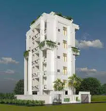
Padmavathi Meadows
P ANIL KUMAR · Medchal-Malkajgiri · RERA P02200007691
PADMAVATHI MEADOWS is a plotted development at Rampally, Keesara Mandal, Medchal-Malkajgiri District, developed by registered promoter P Anil Kumar. The draft plotted layout covers a net site area of 48,649.72 sq.m and comprises 197 plots, with plot-size bands of 150–200, 200–250, 250–300 and 300–400 sq yd; no towers, blocks or floors are stated. Its TG-RERA registration is P02200007691, and the promoter-declared completion date is August 2026.
01What we found
Read from TG-RERA filings, approvals, land and registration records and court records. A court case is counted only when the court record states this project's survey number with its village, or names the project.
02Check before you pay
8 items to check before you pay, 4 high - from the title chain, court records and approvals, each with what to ask the builder or your advocate. An item may not be a problem with the project: records can be incomplete.
1. Project at a glance
Project identity
| Item | Record |
|---|---|
| Registered project name | PADMAVATHI MEADOWS RERA record |
| Project type | Plotted development / draft plotted layout RERA record |
| Phase or registered portion | No separate phase name or phase-wise scope disclosed; the RERA record identifies Survey No. 225 |
| TG-RERA registration | P02200007691; certificate states validity from 06/02/2024 to 09/08/2026, unless extended by the Authority. The registration record was captured on 10 September 2026; a later extension is not supplied here. RERA record |
| Registered promoter | P Anil Kumar; Form B is signed by PURUSHOTHAM ANIL KUMAR. RERA record |
| RERA status | The supplied record labels this a “New Project.” It does not establish a current post-expiry registration status or extension. RERA record |
Land and geographic identity
| Item | Record |
|---|---|
| Locality / revenue village | Rampally / Rampally (also written “Rampalle” in the HMDA approval); the approval identifies Nagaram Municipality. RERA record |
| Mandal | Keesara RERA record |
| District | Medchal-Malkajgiri RERA record |
| PIN | 500083 RERA record |
| Project survey numbers / subdivisions | Survey No. 225; the HMDA approval also describes Survey No. 225 Part. No project-specific subdivision is identified in the supplied project filing. RERA record |
| Site extent | Total site area 48,967.57 sq.m; road-affected area 317.85 sq.m; net site area 48,649.72 sq.m. RERA filing |
| Boundaries in RERA filing | East: “PLOTTD AREA”; west: “PROPOSED 200 FEET ROAD”; north: “PROPOSED 40 FEET ROAD”; south: “PROPOSED 40 EET ROAD.” RERA filing |
Development identity
| Item | Record |
|---|---|
| Sanctioning authority | Hyderabad Metropolitan Development Authority (HMDA) Approvals record |
| Principal layout approval | 007684/LO/HMDA/1665/GHT/2023, dated 10 August 2023; the filed drawing also bears File No. TS/047613/2023. Approvals record |
| Development approved | Draft plotted layout comprising 197 individual plots, according to the approval and plot schedule. Layout record |
| Approved built-up area | 0.00 proposed built-up area, both excluding and including parking, in the filed layout-plan extraction. This is a plotted-layout record, not a building-floor schedule. |
| Buildings, floors and parking levels | Not disclosed as an apartment or building scheme; no building count, floor configuration, parking level or sanctioned parking count is supplied. |
| Area-use schedule | Plotted area 30,097.19 sq.m; layout roads 13,141.27 sq.m; organized open space/park 3,835.58 sq.m; social infrastructure 1,220.28 sq.m; utility area 354.79 sq.m; amenity area 0.00 sq.m. |
Offering and status
| Item | Record |
|---|---|
| Registered offering | Plots; the layout drawing’s schedule contains 197 plots. Plot-size bands and measurements are detailed below as drawing-derived readings. Layout record |
| RERA unit counts, bookings and availability | No unit-type inventory or booked/available plot counts are supplied in the provided RERA data. RERA record |
| Construction / infrastructure stage | The approval sets conditions for the applicant to develop layout infrastructure. No verified site-progress assessment or completed-works status is supplied. |
| Promoter-declared completion | Form B states a completion date of August 2026. |
| Registration validity | 06/02/2024–09/08/2026, unless extended by the Authority; this is the registration period, not a completion or occupancy certificate. |
| Completion certificate / occupancy certificate | No completion certificate or occupancy certificate is supplied. No building or tower-specific OC scope is identified. Document index |
2. The project story
PADMAVATHI MEADOWS is filed as a plotted layout in Survey No. 225 at Rampally, Keesara Mandal, Medchal-Malkajgiri District. HMDA’s draft layout approval describes a net site area of 48,649.72 sq.m and a schedule of 197 plots. The plan allocates land to plots, internal roads, organized open space, social infrastructure and utilities. RERA record Layout record
The approval is for a draft layout and includes conditions concerning infrastructure works and transfer of specified roads, open space and social-infrastructure areas to the local body before final layout-plan release. The supplied evidence does not establish that those works are complete, that final layout plans have been released, or that any part has received completion or occupancy certification. The promoter’s Form B states an August 2026 completion date; that is a promoter declaration, not independent progress verification.
3. Master plan, architecture & building design
The available approved drawing is a plotted-layout plan, not a residential building design. It shows 197 individual plots and road widths including 12M WIDE INTERNAL ROAD, 9.14M WIDE INTERNAL ROAD, 10.00 MT WIDE EXISTING, 60.00 MT WIDE PROPOSED ROAD, and a 2M WIDE CYCLE/WALKING TRACK. The plan’s land-use schedule identifies 30,097.19 sq.m as plotted area, 13,141.27 sq.m as road area, 3,835.58 sq.m as organized open space/park, 1,220.28 sq.m as social infrastructure and 354.79 sq.m as utility area; amenity area is recorded as 0.00 sq.m.
The approval records proposed built-up area as 0.00, both excluding and including parking. No tower/block arrangement, building footprint, floor configuration, building height, flats per floor, lifts, stairs or building-phase plan is supplied. Plot and land-use measurements read by software from the drawing should be checked against the stamped drawing. Layout record Floor plans
4. Homes, configurations & floor plans
This is a plotted offering in the RERA-filed record; no apartment configuration or apartment saleable-area schedule is supplied. The layout drawing’s plot schedule provides a software-read count and area distribution. These figures are drawing-derived, not a RERA unit-inventory disclosure. RERA record Layout record
| Plot size band (sq yd; supplied sq.m band) | Plots |
|---|---|
| 150–200; 125–167 sq.m | 163 |
| 200–250; 167–209 sq.m | 26 |
| 250–300; 209–251 sq.m | 6 |
| 300–400; 251–334 sq.m | 2 |
The software-read plot areas range from 132.59 sq.m (158.6 sq yd) to 276.76 sq.m (331.0 sq yd); the median is 139.35 sq.m (166.7 sq yd). The drawing records the plot schedule as totaling 197 plots, and the sum of plot areas matches the plotted area in the drawing’s area statement. Plot area is not apartment carpet area or apartment saleable area. Layout record
No booked/available counts, plot-specific allotments, house plans, room dimensions or plot-to-house configurations are supplied. The two supplied drawing sheets are layout sheets and contain no measured apartment floor plans. Floor plans Document index
5. Parking & vehicle circulation
The layout-plan extraction records 0.00 common parking area and does not provide a sanctioned number of resident, visitor, accessible or two-wheeler spaces. It also does not establish any exclusive parking allocation to a plot buyer. The drawing identifies internal road widths and a cycle/walking track, but the supplied data does not describe vehicle entry/exit points, ramps, pedestrian segregation, EV charging or parking arrangements beyond those layout features.
6. Amenities, recreation & open spaces
| Description / size | 3,835.58 sq.m (7.88%) in the HMDA approval; the layout data labels this as parks/open space. |
|---|---|
| Evidence source | Approved layout record |
| Declared progress / verified status | Approval requires development of the open space; completion is not evidenced. |
| Description / size | Labelled “Tot-lot” in the layout-plan extraction; no area or capacity supplied. |
|---|---|
| Evidence source | Layout drawing extraction |
| Declared progress / verified status | Drawing label only; completed status not supplied. |
| Description / size | 1,220.28 sq.m (2.51%). |
|---|---|
| Evidence source | Approved layout record |
| Declared progress / verified status | Approval requires handover to the local body before final layout-plan release; completion/handover is not evidenced. |
| Description / size | Listed as available in the RERA amenity data; no building description, area or capacity supplied. RERA amenities |
|---|---|
| Evidence source | RERA amenity data |
| Declared progress / verified status | Listed; progress percentage is 0 in the supplied record. RERA amenities |
| Description / size | Layout road area 13,141.27 sq.m (27.01%); plan also identifies internal road widths and a cycle/walking track. |
|---|---|
| Evidence source | Approved layout record and RERA amenity data |
| Declared progress / verified status | Required layout works; completed status not supplied. RERA amenities |
The supplied vendor record lists a clubhouse, swimming pool, gym, children’s play area and community hall, among other facilities. These are vendor-listed claims, not established here as HMDA-sanctioned or delivered facilities; the approved layout extraction records amenity area as 0.00 sq.m. Promoter website
7. Utilities, building services & safety
The RERA amenity data lists water supply, sewerage (including chambers, lines, septic tank and STP), storm-water drains, street lighting, water conservation/rainwater harvesting, and an electrical meter room/sub-station/receiving station. The layout-plan extraction also names a septic tank, STP, WTP, overhead tank, electrical transformer, rainwater-harvesting pits, solid-waste dumping space and bio-compost. These are disclosed plan/amenity items; the supplied evidence does not establish capacities, commissioning or completed operation. RERA amenities
The approval’s listed conditions refer to development of infrastructure and handover of specified layout areas before final release. No project-specific details are supplied for water sources or storage capacity, sewage-treatment capacity or reuse, electrical backup, fire systems, CCTV, security staffing, accessibility features or completed utility services. The amenity data marks fire-protection and fire-safety requirements without a supplied progress figure; no conclusion on implementation can be drawn from that entry alone. RERA amenities
8. Location, access & connectivity
The registered location is Rampally, Keesara Mandal, Medchal-Malkajgiri District, Telangana 500083; the HMDA approval also uses “Rampalle” and identifies Nagaram Municipality. The cadastral parcel centroid is 17.456895799647853, 78.62937410048433. RERA record Cadastral map
The layout drawing identifies internal roads, an existing 10.00 MT road, a proposed 60.00 MT road, and a proposed road-widening area. These are plan labels and do not establish the present delivery or opening of those roads. The supplied location record lists the nearest sampled Outer Ring Road interchange at approximately 5.4 km. No public-transport details or other verified landmark distances are supplied. Location record
9. Developer & development status
The registered promoter is P Anil Kumar; the RERA record identifies the organization type as “Others,” with the specific entity type otherwise unknown. Form B is made by PURUSHOTHAM ANIL KUMAR, who states he is the promoter. The registration certificate gives a promoter address in Secunderabad, Hyderabad, PIN 500009; the project filing separately gives an address at Madupala Encave, Akbar Road, Survey No. 225, Rampally, Keesara, Medchal-Malkajgiri, PIN 500083. No official project website or contact details are supplied. RERA record Corporate record
The RERA filing names four landowners with area-share agreements: P ASHWIN KUMAR, P HARISH KUMAR, P NAVEEN KUMAR, and KOLA RAM PRASAD. The supplied registration record identifies P Anil Kumar as promoter; it does not state that the landowners are separate registered promoters. Parties record RERA record
Form B records the promoter’s declared completion date as August 2026. The HMDA approval calls for development of layout infrastructure, but no independent site inspection, current progress certificate, final layout release, or completion/occupancy certificate is supplied.
10. Approvals, official records & documents
| Record | Supplied evidence |
|---|---|
| TG-RERA registration | Form C for PADMAVATHI MEADOWS, registration P02200007691, promoter P Anil Kumar; stated validity 06/02/2024–09/08/2026, unless extended. |
| HMDA layout approval | Approval for layout permission No. 007684/LO/HMDA/1665/GHT/2023, dated 10 August 2023; filed as approval for a draft plotted layout. |
| Layout drawing / file reference | Technical approval of draft layout; File No. TS/047613/2023. |
| Mortgage recorded in approval | Mortgage deed 8254/2023, dated 26 July 2023; approval identifies 27 plots, listed by plot numbers, covering 4,605.59 sq.m, in favour of the Metropolitan Commissioner, HMDA. |
| Public-utility gift deed recorded in approval | Gift deed 8255/2023, dated 26 July 2023; approval describes 317.86 sq.m of road-affected land gifted to the local body. |
| Promoter declaration | Form B affidavit by PURUSHOTHAM ANIL KUMAR, verified at Hyderabad on 25 August 2023; includes a declared August 2026 completion date. |
| Title-search report | Advocate’s land title search report dated 13 September 2023 is listed in the project documents. |
| Other filed material | Encumbrance statement (search period 01-01-1995 to 31-10-2020), draft allotment-letter form and partially filled agreement-for-sale material are listed; they do not establish a buyer-specific allotment or completed sale. |
The supplied record does not include a final layout-release confirmation or a completion/occupancy certificate. The approval’s conditions and the status of the land and project are treated in the relevant approvals and land/title sections.
1. Project at a glance
Project identity
Registered project name: PADMAVATHI MEADOWS
Project type: Plotted development / draft plotted layout
Phase or registered portion: No separate phase name or phase-wise scope disclosed; the RERA record identifies Survey No. 225
TG-RERA registration: P02200007691; certificate states validity from 06/02/2024 to 09/08/2026, unless extended by the Authority. The registration record was captured on 10 September 2026; a later extension is not supplied here.
Registered promoter: P Anil Kumar; Form B is signed by PURUSHOTHAM ANIL KUMAR.
RERA status: The supplied record labels this a “New Project.” It does not establish a current post-expiry registration status or extension.
Land and geographic identity
Locality / revenue village: Rampally / Rampally (also written “Rampalle” in the HMDA approval); the approval identifies Nagaram Municipality.
Mandal: Keesara
District: Medchal-Malkajgiri
PIN: 500083
Project survey numbers / subdivisions: Survey No. 225; the HMDA approval also describes Survey No. 225 Part. No project-specific subdivision is identified in the supplied project filing.
Site extent: Total site area 48,967.57 sq.m; road-affected area 317.85 sq.m; net site area 48,649.72 sq.m.
Boundaries in RERA filing: East: “PLOTTD AREA”; west: “PROPOSED 200 FEET ROAD”; north: “PROPOSED 40 FEET ROAD”; south: “PROPOSED 40 EET ROAD.”
Development identity
Sanctioning authority: Hyderabad Metropolitan Development Authority (HMDA)
Principal layout approval: 007684/LO/HMDA/1665/GHT/2023, dated 10 August 2023; the filed drawing also bears File No. TS/047613/2023.
Development approved: Draft plotted layout comprising 197 individual plots, according to the approval and plot schedule.
Approved built-up area: 0.00 proposed built-up area, both excluding and including parking, in the filed layout-plan extraction. This is a plotted-layout record, not a building-floor schedule.
Buildings, floors and parking levels: Not disclosed as an apartment or building scheme; no building count, floor configuration, parking level or sanctioned parking count is supplied.
Area-use schedule: Plotted area 30,097.19 sq.m; layout roads 13,141.27 sq.m; organized open space/park 3,835.58 sq.m; social infrastructure 1,220.28 sq.m; utility area 354.79 sq.m; amenity area 0.00 sq.m.
Offering and status
Registered offering: Plots; the layout drawing’s schedule contains 197 plots. Plot-size bands and measurements are detailed below as drawing-derived readings.
RERA unit counts, bookings and availability: No unit-type inventory or booked/available plot counts are supplied in the provided RERA data.
Construction / infrastructure stage: The approval sets conditions for the applicant to develop layout infrastructure. No verified site-progress assessment or completed-works status is supplied.
Promoter-declared completion: Form B states a completion date of August 2026.
Registration validity: 06/02/2024–09/08/2026, unless extended by the Authority; this is the registration period, not a completion or occupancy certificate.
Completion certificate / occupancy certificate: No completion certificate or occupancy certificate is supplied. No building or tower-specific OC scope is identified.
2. The project story
PADMAVATHI MEADOWS is filed as a plotted layout in Survey No. 225 at Rampally, Keesara Mandal, Medchal-Malkajgiri District. HMDA’s draft layout approval describes a net site area of 48,649.72 sq.m and a schedule of 197 plots. The plan allocates land to plots, internal roads, organized open space, social infrastructure and utilities.
The approval is for a draft layout and includes conditions concerning infrastructure works and transfer of specified roads, open space and social-infrastructure areas to the local body before final layout-plan release. The supplied evidence does not establish that those works are complete, that final layout plans have been released, or that any part has received completion or occupancy certification. The promoter’s Form B states an August 2026 completion date; that is a promoter declaration, not independent progress verification.
3. Master plan, architecture & building design
The available approved drawing is a plotted-layout plan, not a residential building design. It shows 197 individual plots and road widths including 12M WIDE INTERNAL ROAD, 9.14M WIDE INTERNAL ROAD, 10.00 MT WIDE EXISTING, 60.00 MT WIDE PROPOSED ROAD, and a 2M WIDE CYCLE/WALKING TRACK. The plan’s land-use schedule identifies 30,097.19 sq.m as plotted area, 13,141.27 sq.m as road area, 3,835.58 sq.m as organized open space/park, 1,220.28 sq.m as social infrastructure and 354.79 sq.m as utility area; amenity area is recorded as 0.00 sq.m.
The approval records proposed built-up area as 0.00, both excluding and including parking. No tower/block arrangement, building footprint, floor configuration, building height, flats per floor, lifts, stairs or building-phase plan is supplied. Plot and land-use measurements read by software from the drawing should be checked against the stamped drawing.
4. Homes, configurations & floor plans
This is a plotted offering in the RERA-filed record; no apartment configuration or apartment saleable-area schedule is supplied. The layout drawing’s plot schedule provides a software-read count and area distribution. These figures are drawing-derived, not a RERA unit-inventory disclosure.
150–200; 125–167 sq.m: 163
200–250; 167–209 sq.m: 26
250–300; 209–251 sq.m: 6
300–400; 251–334 sq.m: 2
The software-read plot areas range from 132.59 sq.m (158.6 sq yd) to 276.76 sq.m (331.0 sq yd); the median is 139.35 sq.m (166.7 sq yd). The drawing records the plot schedule as totaling 197 plots, and the sum of plot areas matches the plotted area in the drawing’s area statement. Plot area is not apartment carpet area or apartment saleable area.
No booked/available counts, plot-specific allotments, house plans, room dimensions or plot-to-house configurations are supplied. The two supplied drawing sheets are layout sheets and contain no measured apartment floor plans.
5. Parking & vehicle circulation
The layout-plan extraction records 0.00 common parking area and does not provide a sanctioned number of resident, visitor, accessible or two-wheeler spaces. It also does not establish any exclusive parking allocation to a plot buyer. The drawing identifies internal road widths and a cycle/walking track, but the supplied data does not describe vehicle entry/exit points, ramps, pedestrian segregation, EV charging or parking arrangements beyond those layout features.
6. Amenities, recreation & open spaces
| Description / size | 3,835.58 sq.m (7.88%) in the HMDA approval; the layout data labels this as parks/open space. |
|---|---|
| Evidence source | Approved layout record |
| Declared progress / verified status | Approval requires development of the open space; completion is not evidenced. |
| Description / size | Labelled “Tot-lot” in the layout-plan extraction; no area or capacity supplied. |
|---|---|
| Evidence source | Layout drawing extraction |
| Declared progress / verified status | Drawing label only; completed status not supplied. |
| Description / size | 1,220.28 sq.m (2.51%). |
|---|---|
| Evidence source | Approved layout record |
| Declared progress / verified status | Approval requires handover to the local body before final layout-plan release; completion/handover is not evidenced. |
| Description / size | Listed as available in the RERA amenity data; no building description, area or capacity supplied. |
|---|---|
| Evidence source | RERA amenity data |
| Declared progress / verified status | Listed; progress percentage is 0 in the supplied record. |
| Description / size | Layout road area 13,141.27 sq.m (27.01%); plan also identifies internal road widths and a cycle/walking track. |
|---|---|
| Evidence source | Approved layout record and RERA amenity data |
| Declared progress / verified status | Required layout works; completed status not supplied. |
The supplied vendor record lists a clubhouse, swimming pool, gym, children’s play area and community hall, among other facilities. These are vendor-listed claims, not established here as HMDA-sanctioned or delivered facilities; the approved layout extraction records amenity area as 0.00 sq.m.
7. Utilities, building services & safety
The RERA amenity data lists water supply, sewerage (including chambers, lines, septic tank and STP), storm-water drains, street lighting, water conservation/rainwater harvesting, and an electrical meter room/sub-station/receiving station. The layout-plan extraction also names a septic tank, STP, WTP, overhead tank, electrical transformer, rainwater-harvesting pits, solid-waste dumping space and bio-compost. These are disclosed plan/amenity items; the supplied evidence does not establish capacities, commissioning or completed operation.
The approval’s listed conditions refer to development of infrastructure and handover of specified layout areas before final release. No project-specific details are supplied for water sources or storage capacity, sewage-treatment capacity or reuse, electrical backup, fire systems, CCTV, security staffing, accessibility features or completed utility services. The amenity data marks fire-protection and fire-safety requirements without a supplied progress figure; no conclusion on implementation can be drawn from that entry alone.
8. Location, access & connectivity
The registered location is Rampally, Keesara Mandal, Medchal-Malkajgiri District, Telangana 500083; the HMDA approval also uses “Rampalle” and identifies Nagaram Municipality. The cadastral parcel centroid is 17.456895799647853, 78.62937410048433.
The layout drawing identifies internal roads, an existing 10.00 MT road, a proposed 60.00 MT road, and a proposed road-widening area. These are plan labels and do not establish the present delivery or opening of those roads. The supplied location record lists the nearest sampled Outer Ring Road interchange at approximately 5.4 km. No public-transport details or other verified landmark distances are supplied.
9. Developer & development status
The registered promoter is P Anil Kumar; the RERA record identifies the organization type as “Others,” with the specific entity type otherwise unknown. Form B is made by PURUSHOTHAM ANIL KUMAR, who states he is the promoter. The registration certificate gives a promoter address in Secunderabad, Hyderabad, PIN 500009; the project filing separately gives an address at Madupala Encave, Akbar Road, Survey No. 225, Rampally, Keesara, Medchal-Malkajgiri, PIN 500083. No official project website or contact details are supplied.
The RERA filing names four landowners with area-share agreements: P ASHWIN KUMAR, P HARISH KUMAR, P NAVEEN KUMAR, and KOLA RAM PRASAD. The supplied registration record identifies P Anil Kumar as promoter; it does not state that the landowners are separate registered promoters.
Form B records the promoter’s declared completion date as August 2026. The HMDA approval calls for development of layout infrastructure, but no independent site inspection, current progress certificate, final layout release, or completion/occupancy certificate is supplied.
10. Approvals, official records & documents
TG-RERA registration: Form C for PADMAVATHI MEADOWS, registration P02200007691, promoter P Anil Kumar; stated validity 06/02/2024–09/08/2026, unless extended.
HMDA layout approval: Approval for layout permission No. 007684/LO/HMDA/1665/GHT/2023, dated 10 August 2023; filed as approval for a draft plotted layout.
Layout drawing / file reference: Technical approval of draft layout; File No. TS/047613/2023.
Mortgage recorded in approval: Mortgage deed 8254/2023, dated 26 July 2023; approval identifies 27 plots, listed by plot numbers, covering 4,605.59 sq.m, in favour of the Metropolitan Commissioner, HMDA.
Public-utility gift deed recorded in approval: Gift deed 8255/2023, dated 26 July 2023; approval describes 317.86 sq.m of road-affected land gifted to the local body.
Promoter declaration: Form B affidavit by PURUSHOTHAM ANIL KUMAR, verified at Hyderabad on 25 August 2023; includes a declared August 2026 completion date.
Title-search report: Advocate’s land title search report dated 13 September 2023 is listed in the project documents.
Other filed material: Encumbrance statement (search period 01-01-1995 to 31-10-2020), draft allotment-letter form and partially filled agreement-for-sale material are listed; they do not establish a buyer-specific allotment or completed sale.
The supplied record does not include a final layout-release confirmation or a completion/occupancy certificate. The approval’s conditions and the status of the land and project are treated in the relevant approvals and land/title sections.
Frequently asked questions
Is PADMAVATHI MEADOWS registered with Telangana RERA?
Yes. PADMAVATHI MEADOWS is registered with the Telangana Real Estate Regulatory Authority as P02200007691; the registration status is New Project.
Who is the developer of PADMAVATHI MEADOWS?
The promoter named in the RERA registration is P ANIL KUMAR.
Where is PADMAVATHI MEADOWS located?
PADMAVATHI MEADOWS is in RAMPALLY, Keesara, Medchal-Malkajgiri, Telangana (500083).
When will PADMAVATHI MEADOWS be completed?
The promoter's proposed date of completion filed with RERA is 09/12/2026. This is the promoter's declaration, not a guarantee.
More projects in Rampally