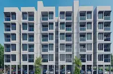
Nasa Valley
PRAVEEN · Rangareddy · RERA P02400006050
NASA VALLEY is a plotted development in Penjerla Village, Kothur, Ranga Reddy. The registered promoter is Mr./Ms. Praveen Surya. The registered land extent is 24,177.21 Sq. Mt. on Survey No. 347/PART; the supplied record does not state a plot count or plot configurations. It is registered under TG-RERA number P02400006050, with a promoter-declared completion date of 08/11/2025.
01What we found
Read from TG-RERA filings, approvals, land and registration records and court records. A court case is counted only when the court record states this project's survey number with its village, or names the project.
02Check before you pay
8 items to check before you pay, 5 high - from the title chain, court records and approvals, each with what to ask the builder or your advocate. An item may not be a problem with the project: records can be incomplete.
1. Project at a glance
Project identity
| Item | Record |
|---|---|
| Registered project | NASA VALLEY RERA record |
| Project type | Plotted development / residential open-plotted layout RERA filing |
| Phase or registered portion | Registered portion is identified as Survey No. 347/PART; a separate phase name or phase number is not disclosed |
| TG-RERA registration | P02400006050 RERA record |
| Registration validity | Certificate states 18/04/2023 to 08/11/2025; extension is recorded as not extended in the supplied certificate |
| Registered promoter | Certificate names Mr./Ms. Praveen Surya; the project header’s promoter field says PRAVEEN RERA record |
| RERA status | The supplied certificate records the registration period above. A current TG-RERA status beyond that period is not established by the supplied record. Approvals record |
Land and geographic identity
| Item | Record |
|---|---|
| Locality / revenue village | Penjerla Village; locality is also recorded as PENJERLA VILLAGE RERA record RERA filing |
| Mandal / district / PIN | Kothur / Ranga Reddy / 509228 RERA record RERA filing |
| Project survey number and subdivision | 347/PART RERA record Land records |
| Registered site extent | 24,177.21 Sq. Mt. in the HMDA intimation and RERA land details RERA filing |
| Net / total area | RERA land details give total area 24177.21 sqmts, affected area 0, and net area 24177.21 sqmts RERA filing |
| Parcel boundary descriptions | East: OTHERS LAND; West: OTHERS LAND; North: OTHERS LAND; South: ROAD AND OTHERS LAND RERA filing |
Development identity
| Item | Record |
|---|---|
| Planning authority | Hyderabad Metropolitan Development Authority (HMDA) Approvals record |
| Principal record | Application 056133/SMD/LT/U6/HMDA/04082022, dated 04/08/2022; HMDA intimation approved/issued 09/11/2022 Approvals record |
| What that record says | Intimation to pay charges and fulfil precedent conditions for further processing; it expressly says it is not approval of the proposal or permission for development |
| Approved built-up area | RERA record lists 14593 sqmts as “Approved Built up Area”; the supplied HMDA intimation does not establish a final released layout plan RERA filing |
| Layout / plot count and plot schedule | Not established by the supplied RERA unit data or extracted layout drawing; a final layout plan is not supplied Document index |
| Building / floor configuration | Not applicable to the recorded plotted offering; no building or floor configuration is disclosed RERA filing |
| Parking | No parking count or parking layout is established in the supplied records Document index |
| Mortgage area | RERA fields state 2286.67 sqmts; HMDA’s intimation identifies plots 72, 74, 75, 85–93 for mortgage to HMDA RERA filing |
Offering and status
| Item | Record |
|---|---|
| Offering | Plots; RERA unit-count, plot-size schedule, booked count and available count are not supplied RERA filing Document index |
| RERA-filed saleable area | No plot-wise or range of saleable area is available in the supplied RERA unit data Document index |
| Promoter-declared completion deadline | 08/11/2025, as stated in the Form B declaration and RERA certificate |
| Registration expiry | 08/11/2025; this is the registration end date, distinct from the completion undertaking |
| Construction / development stage | No independently verified site progress or current construction stage is supplied. The HMDA record is a preliminary intimation, not development permission. |
| OC / completion-certificate status | Not disclosed in the supplied project documents; no phase- or parcel-specific occupancy/completion certificate is supplied Document index |
2. The project story
- NASA VALLEY is registered as a plotted residential development in Penjerla Village, Kothur Mandal, Ranga Reddy District, on Survey No. 347/PART. The registered land extent is 24,177.21 Sq. Mt. RERA record Land records
- The supplied HMDA document concerns a draft open-plotted layout application and sets out charges and conditions for processing. It explicitly states that the intimation is not approval of the proposal or permission to develop. It calls for, among other matters, a mortgage of specified plots to HMDA and transfer of open-space, utility, social-infrastructure and road areas to the Local Body by registered gift deed before release of the final layout plan. The record supplied here does not establish that these later steps or final-plan release occurred.
- The promoter’s Form B declares a completion date of 08/11/2025. That is a promoter declaration, not evidence of completion at the site. No independently verified construction progress, plot handover status or occupancy/completion certificate is provided. Document index
3. Master plan, architecture & building design
- This is a plotted-layout project, not a disclosed apartment or villa development. The RERA land details record a site area of 24177.21 sqmts, net area 24177.21 sqmts, and affected area 0. The RERA fields separately state an “Approved Built up Area” of 14593 sqmts; the supplied documents do not define the calculation or establish this as a final HMDA-released layout figure. RERA filing RERA filing
- The HMDA intimation identifies a draft open-plotted layout on Survey No. 347/PART. Its stated conditions include mortgage of plots 72, 74, 75, 85–93, totalling 2286.67 Sq.mts, in favour of HMDA, and a registered gift deed to the Local Body for open-space, utility, social-infrastructure and road areas before release of the final layout plan. The actual final plot arrangement, plot count, road widths, park/open-space schedule and utility-land schedule cannot be described from the supplied extracted plan data.
- No architectural floor plans or building-design information is supplied. The drawing review records two drawings, with 0 measured and 2 scans pending; there are no drawing-based carpet measurements available. Floor plans
4. Homes, configurations & floor plans
- This project is recorded as plotted development, so apartment configurations and apartment carpet-area comparisons do not apply. The supplied RERA unit data does not provide plot counts, plot-wise RERA saleable areas, booked/available plot counts or a plot-size schedule. RERA filing Document index
- Third-party/vendor data lists a plot saleable-size range of 1582 - 3714 sq.ft and gives individual plot figures, but these are not RERA-filed plot areas and are not used here as the project’s registered offering. Promoter website
- The drawing review has two scans pending and no measured drawings; therefore no software-measured plot or building areas can be reported. Floor plans
5. Parking & vehicle circulation
The supplied records do not establish parking counts, visitor or accessible parking, parking allocation, parking levels, ramps, or EV charging. HMDA’s intimation requires the applicant to form a BT approach road before applying for the final layout and states that roads should be opened for access to neighbouring sites; these are stated conditions, not confirmation that the works have been completed.
6. Amenities, recreation & open spaces
The RERA amenity record lists several facilities, with 0% progress shown for each supplied entry. A “YES” availability entry is not, by itself, evidence that a facility is completed or independently verified. RERA amenities
| Facility | Description / size | Evidence source | Declared progress / verified status |
|---|---|---|---|
| Internal roads & footpaths | Size not stated | RERA amenity record | Listed as available “YES”; 0% progress; completion not independently verified RERA amenities |
| Water supply | Size/capacity not stated | RERA amenity record | Listed as available “YES”; 0% progress; completion not independently verified RERA amenities |
| Sewerage (chamber, lines, septic tank, STP) | Size/capacity not stated | RERA amenity record | Listed; 0% progress; completion not independently verified RERA amenities |
| Storm-water drains | Size/capacity not stated | RERA amenity record | Listed as available “YES”; 0% progress; completion not independently verified RERA amenities |
| Green strip / tot lot / park | Area not stated | RERA amenity record | Listed as available “YES”; 0% progress; completion not independently verified RERA amenities |
| Street lighting | Quantity/specification not stated | RERA amenity record | Listed as available “YES”; 0% progress; completion not independently verified RERA amenities |
| Community buildings | Size/capacity not stated | RERA amenity record | Listed; 0% progress; completion not independently verified RERA amenities |
| Treatment and disposal of sewage and sullage water | Capacity not stated | RERA amenity record | Listed; 0% progress; completion not independently verified RERA amenities |
| Solid-waste management and disposal | Details not stated | RERA amenity record | Listed; 0% progress; completion not independently verified RERA amenities |
| Water conservation / rainwater harvesting | Capacity/details not stated | RERA amenity record | Listed; 0% progress; completion not independently verified RERA amenities |
| Energy management | Details not stated | RERA amenity record | Listed; 0% progress; completion not independently verified RERA amenities |
| Fire protection and fire-safety requirements | Systems/details not stated | RERA amenity record | Listed; 0% progress; completion not independently verified RERA amenities |
| Electrical meter room, sub-station, receiving station | Capacity/details not stated | RERA amenity record | Listed; 0% progress; completion not independently verified RERA amenities |
| Aggregate recreational open space | Area not stated | RERA amenity record | Listed as available “YES”; 0% progress; completion not independently verified RERA amenities |
The HMDA intimation refers to open space, utility area, social-infrastructure area and roads as areas to be handed over to the Local Body by registered gift deed before final layout-plan release. It supplies no individual area figures.
7. Utilities, building services & safety
The RERA amenity record lists water supply, sewerage and sewage treatment/disposal, storm-water drains, rainwater harvesting, solid-waste management, energy management, fire protection, and electrical meter-room/sub-station/receiving-station provisions. It provides no capacities or technical specifications and records 0% progress for the listed entries; completion is not independently verified. RERA amenities
The HMDA intimation identifies utility and social-infrastructure areas among the areas to be gifted to the Local Body before final layout-plan release. The supplied evidence does not specify water sources or storage, treatment capacity, reuse arrangements, electrical supply or backup, security systems, accessibility provisions, or detailed fire/life-safety design.
8. Location, access & connectivity
- The recorded revenue location is Penjerla Village, Kothur Mandal, Ranga Reddy District, Telangana 509228. The supplied cadastral parcel centroid is 17.11258, 78.31384; this is a parcel-centroid location, not a verified project entrance. RERA record RERA filing Location record
- The location data records the nearest sampled Outer Ring Road interchange at approximately 18.0 km. Location record
- No project-specific approach-road map, public-transport information or measured distances to other landmarks is supplied. The HMDA intimation requires formation of a BT approach road before application for the final layout; this is a condition in the intimation, not evidence of a completed road.
9. Developer & development status
- The TG-RERA certificate identifies Mr./Ms. Praveen Surya as promoter; the header lists the promoter as PRAVEEN. The legal-entity type and corporate identifier are not established in the supplied records. RERA record Corporate record
- In Form B dated 22 February 2023, Praveen Surya declares title to the project land, states that the land is free from encumbrances, and undertakes completion by 08/11/2025. These are promoter declarations. The supplied project evidence does not establish current development progress or confirm completion.
- The registration certificate records validity from 18/04/2023 to 08/11/2025 and is marked not extended in the supplied record. Registration validity and the promoter’s completion undertaking are distinct dates/status matters; no current registration status beyond the certificate information is established here.
10. Approvals, official records & documents
| Record | What it establishes in the supplied material |
|---|---|
| TG-RERA Registration Certificate, REGCERT-44853 | Form C registration for NASA VALLEY, P02400006050, under section 5; names Praveen Surya, identifies Survey No. 347/PART, and states validity from 18/04/2023 to 08/11/2025. |
| HMDA intimation, doc 294927 | Intimation dated 09/11/2022 concerning application 056133/SMD/LT/U6/HMDA/04082022 for a draft open-plotted layout on Survey No. 347/PART. It states that it is not approval of the proposal or permission for development and lists precedent conditions for further processing. |
| Layout-plan filing reference, doc 294925 | RERA filing field requests a layout approval letter or stamped layout plan, or a declaration/equivalent document; the supplied item is not an extracted final layout approval. |
| Form B declaration, doc 294932 | Promoter declaration dated 22 February 2023, including the declared completion date 08/11/2025 and statements concerning title, encumbrances and RERA obligations. |
| Occupancy/completion certificate | Not supplied or established in the project records reviewed here. Document index |
1. Project at a glance
Project identity
Registered project: NASA VALLEY
Project type: Plotted development / residential open-plotted layout
Phase or registered portion: Registered portion is identified as Survey No. 347/PART; a separate phase name or phase number is not disclosed
TG-RERA registration: P02400006050
Registration validity: Certificate states 18/04/2023 to 08/11/2025; extension is recorded as not extended in the supplied certificate
Registered promoter: Certificate names Mr./Ms. Praveen Surya; the project header’s promoter field says PRAVEEN
RERA status: The supplied certificate records the registration period above. A current TG-RERA status beyond that period is not established by the supplied record.
Land and geographic identity
Locality / revenue village: Penjerla Village; locality is also recorded as PENJERLA VILLAGE
Mandal / district / PIN: Kothur / Ranga Reddy / 509228
Project survey number and subdivision: 347/PART
Registered site extent: 24,177.21 Sq. Mt. in the HMDA intimation and RERA land details
Net / total area: RERA land details give total area 24177.21 sqmts, affected area 0, and net area 24177.21 sqmts
Parcel boundary descriptions: East: OTHERS LAND; West: OTHERS LAND; North: OTHERS LAND; South: ROAD AND OTHERS LAND
Development identity
Planning authority: Hyderabad Metropolitan Development Authority (HMDA)
Principal record: Application 056133/SMD/LT/U6/HMDA/04082022, dated 04/08/2022; HMDA intimation approved/issued 09/11/2022
What that record says: Intimation to pay charges and fulfil precedent conditions for further processing; it expressly says it is not approval of the proposal or permission for development
Approved built-up area: RERA record lists 14593 sqmts as “Approved Built up Area”; the supplied HMDA intimation does not establish a final released layout plan
Layout / plot count and plot schedule: Not established by the supplied RERA unit data or extracted layout drawing; a final layout plan is not supplied
Building / floor configuration: Not applicable to the recorded plotted offering; no building or floor configuration is disclosed
Parking: No parking count or parking layout is established in the supplied records
Mortgage area: RERA fields state 2286.67 sqmts; HMDA’s intimation identifies plots 72, 74, 75, 85–93 for mortgage to HMDA
Offering and status
Offering: Plots; RERA unit-count, plot-size schedule, booked count and available count are not supplied
RERA-filed saleable area: No plot-wise or range of saleable area is available in the supplied RERA unit data
Promoter-declared completion deadline: 08/11/2025, as stated in the Form B declaration and RERA certificate
Registration expiry: 08/11/2025; this is the registration end date, distinct from the completion undertaking
Construction / development stage: No independently verified site progress or current construction stage is supplied. The HMDA record is a preliminary intimation, not development permission.
OC / completion-certificate status: Not disclosed in the supplied project documents; no phase- or parcel-specific occupancy/completion certificate is supplied
2. The project story
- NASA VALLEY is registered as a plotted residential development in Penjerla Village, Kothur Mandal, Ranga Reddy District, on Survey No. 347/PART. The registered land extent is 24,177.21 Sq. Mt.
- The supplied HMDA document concerns a draft open-plotted layout application and sets out charges and conditions for processing. It explicitly states that the intimation is not approval of the proposal or permission to develop. It calls for, among other matters, a mortgage of specified plots to HMDA and transfer of open-space, utility, social-infrastructure and road areas to the Local Body by registered gift deed before release of the final layout plan. The record supplied here does not establish that these later steps or final-plan release occurred.
- The promoter’s Form B declares a completion date of 08/11/2025. That is a promoter declaration, not evidence of completion at the site. No independently verified construction progress, plot handover status or occupancy/completion certificate is provided.
3. Master plan, architecture & building design
- This is a plotted-layout project, not a disclosed apartment or villa development. The RERA land details record a site area of 24177.21 sqmts, net area 24177.21 sqmts, and affected area 0. The RERA fields separately state an “Approved Built up Area” of 14593 sqmts; the supplied documents do not define the calculation or establish this as a final HMDA-released layout figure.
- The HMDA intimation identifies a draft open-plotted layout on Survey No. 347/PART. Its stated conditions include mortgage of plots 72, 74, 75, 85–93, totalling 2286.67 Sq.mts, in favour of HMDA, and a registered gift deed to the Local Body for open-space, utility, social-infrastructure and road areas before release of the final layout plan. The actual final plot arrangement, plot count, road widths, park/open-space schedule and utility-land schedule cannot be described from the supplied extracted plan data.
- No architectural floor plans or building-design information is supplied. The drawing review records two drawings, with 0 measured and 2 scans pending; there are no drawing-based carpet measurements available.
4. Homes, configurations & floor plans
- This project is recorded as plotted development, so apartment configurations and apartment carpet-area comparisons do not apply. The supplied RERA unit data does not provide plot counts, plot-wise RERA saleable areas, booked/available plot counts or a plot-size schedule.
- Third-party/vendor data lists a plot saleable-size range of 1582 - 3714 sq.ft and gives individual plot figures, but these are not RERA-filed plot areas and are not used here as the project’s registered offering.
- The drawing review has two scans pending and no measured drawings; therefore no software-measured plot or building areas can be reported.
5. Parking & vehicle circulation
The supplied records do not establish parking counts, visitor or accessible parking, parking allocation, parking levels, ramps, or EV charging. HMDA’s intimation requires the applicant to form a BT approach road before applying for the final layout and states that roads should be opened for access to neighbouring sites; these are stated conditions, not confirmation that the works have been completed.
6. Amenities, recreation & open spaces
The RERA amenity record lists several facilities, with 0% progress shown for each supplied entry. A “YES” availability entry is not, by itself, evidence that a facility is completed or independently verified.
| Facility | Description / size | Evidence source | Declared progress / verified status |
|---|---|---|---|
| Internal roads & footpaths | Size not stated | RERA amenity record | Listed as available “YES”; 0% progress; completion not independently verified |
| Water supply | Size/capacity not stated | RERA amenity record | Listed as available “YES”; 0% progress; completion not independently verified |
| Sewerage (chamber, lines, septic tank, STP) | Size/capacity not stated | RERA amenity record | Listed; 0% progress; completion not independently verified |
| Storm-water drains | Size/capacity not stated | RERA amenity record | Listed as available “YES”; 0% progress; completion not independently verified |
| Green strip / tot lot / park | Area not stated | RERA amenity record | Listed as available “YES”; 0% progress; completion not independently verified |
| Street lighting | Quantity/specification not stated | RERA amenity record | Listed as available “YES”; 0% progress; completion not independently verified |
| Community buildings | Size/capacity not stated | RERA amenity record | Listed; 0% progress; completion not independently verified |
| Treatment and disposal of sewage and sullage water | Capacity not stated | RERA amenity record | Listed; 0% progress; completion not independently verified |
| Solid-waste management and disposal | Details not stated | RERA amenity record | Listed; 0% progress; completion not independently verified |
| Water conservation / rainwater harvesting | Capacity/details not stated | RERA amenity record | Listed; 0% progress; completion not independently verified |
| Energy management | Details not stated | RERA amenity record | Listed; 0% progress; completion not independently verified |
| Fire protection and fire-safety requirements | Systems/details not stated | RERA amenity record | Listed; 0% progress; completion not independently verified |
| Electrical meter room, sub-station, receiving station | Capacity/details not stated | RERA amenity record | Listed; 0% progress; completion not independently verified |
| Aggregate recreational open space | Area not stated | RERA amenity record | Listed as available “YES”; 0% progress; completion not independently verified |
The HMDA intimation refers to open space, utility area, social-infrastructure area and roads as areas to be handed over to the Local Body by registered gift deed before final layout-plan release. It supplies no individual area figures.
7. Utilities, building services & safety
The RERA amenity record lists water supply, sewerage and sewage treatment/disposal, storm-water drains, rainwater harvesting, solid-waste management, energy management, fire protection, and electrical meter-room/sub-station/receiving-station provisions. It provides no capacities or technical specifications and records 0% progress for the listed entries; completion is not independently verified.
The HMDA intimation identifies utility and social-infrastructure areas among the areas to be gifted to the Local Body before final layout-plan release. The supplied evidence does not specify water sources or storage, treatment capacity, reuse arrangements, electrical supply or backup, security systems, accessibility provisions, or detailed fire/life-safety design.
8. Location, access & connectivity
- The recorded revenue location is Penjerla Village, Kothur Mandal, Ranga Reddy District, Telangana 509228. The supplied cadastral parcel centroid is 17.11258, 78.31384; this is a parcel-centroid location, not a verified project entrance.
- The location data records the nearest sampled Outer Ring Road interchange at approximately 18.0 km.
- No project-specific approach-road map, public-transport information or measured distances to other landmarks is supplied. The HMDA intimation requires formation of a BT approach road before application for the final layout; this is a condition in the intimation, not evidence of a completed road.
9. Developer & development status
- The TG-RERA certificate identifies Mr./Ms. Praveen Surya as promoter; the header lists the promoter as PRAVEEN. The legal-entity type and corporate identifier are not established in the supplied records.
- In Form B dated 22 February 2023, Praveen Surya declares title to the project land, states that the land is free from encumbrances, and undertakes completion by 08/11/2025. These are promoter declarations. The supplied project evidence does not establish current development progress or confirm completion.
- The registration certificate records validity from 18/04/2023 to 08/11/2025 and is marked not extended in the supplied record. Registration validity and the promoter’s completion undertaking are distinct dates/status matters; no current registration status beyond the certificate information is established here.
10. Approvals, official records & documents
TG-RERA Registration Certificate, REGCERT-44853: Form C registration for NASA VALLEY, P02400006050, under section 5; names Praveen Surya, identifies Survey No. 347/PART, and states validity from 18/04/2023 to 08/11/2025.
HMDA intimation, doc 294927: Intimation dated 09/11/2022 concerning application 056133/SMD/LT/U6/HMDA/04082022 for a draft open-plotted layout on Survey No. 347/PART. It states that it is not approval of the proposal or permission for development and lists precedent conditions for further processing.
Layout-plan filing reference, doc 294925: RERA filing field requests a layout approval letter or stamped layout plan, or a declaration/equivalent document; the supplied item is not an extracted final layout approval.
Form B declaration, doc 294932: Promoter declaration dated 22 February 2023, including the declared completion date 08/11/2025 and statements concerning title, encumbrances and RERA obligations.
Occupancy/completion certificate: Not supplied or established in the project records reviewed here.
Frequently asked questions
Is NASA VALLEY registered with Telangana RERA?
Yes. NASA VALLEY is registered with the Telangana Real Estate Regulatory Authority as P02400006050; the registration status is New Project.
Who is the developer of NASA VALLEY?
The promoter named in the RERA registration is PRAVEEN.
Where is NASA VALLEY located?
NASA VALLEY is in PENJERLA VILLAGE, Penjerla, Kothur, Rangareddy, Telangana (509228).
When will NASA VALLEY be completed?
The promoter's proposed date of completion filed with RERA is 08/11/2025. This is the promoter's declaration, not a guarantee.
More projects in Penjerla