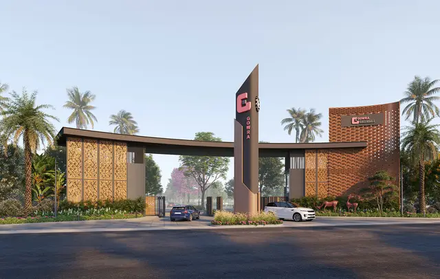
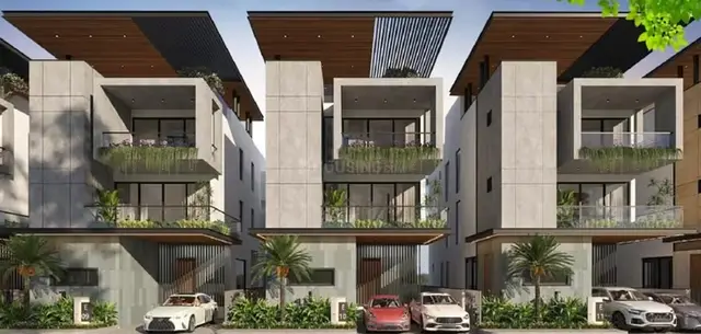
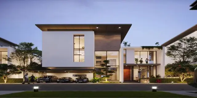
Mypi Farms
MYPI FARMS · Medchal-Malkajgiri · RERA P02200008382
MYPI FARMS is a plotted development at Pudoor Village, Medchal Mandal, Medchal-Malkajgiri District, developed by the registered promoter MYPI FARMS. The project covers a total site area of 24300.73 sq.m, with a net site area of 20242.86 sq.m, and offers plots; the supplied RERA record does not disclose a plot count or plot sizes. The project is registered under TG-RERA registration P02200008382, and the promoter’s Form B states completion on or before 31-12-2027.
01What we found
Read from TG-RERA filings, approvals, land and registration records and court records. A court case is counted only when the court record states this project's survey number with its village, or names the project.
02Check before you pay
7 items to check before you pay, 4 high - from the title chain, court records and approvals, each with what to ask the builder or your advocate. An item may not be a problem with the project: records can be incomplete.
1. Project at a glance
Project identity
| Item | Project record |
|---|---|
| Registered project name | MYPI FARMS RERA record |
| Project type | Plotted development / open-plot layout RERA record |
| Phase or registered portion | Phase not separately identified; registration covers the plotted project on Survey Nos. 489/EE and 500/E at Pudoor Village |
| TG-RERA registration | P02200008382 |
| Registration validity | Certificate states validity from 22/06/2024 to 13/03/2027, unless extended by the Authority. This is the registration-validity period, not the project completion deadline. |
| Registered promoter | MYPI FARMS, stated as a partnership in the RERA project record RERA record RERA filing |
| RERA project status | New Project in the project record RERA record |
Land and geographic identity
| Item | Project record |
|---|---|
| Locality and revenue village | PUDOOR VILLAGE / Pudoor Village RERA record |
| Mandal | Medchal RERA record |
| District | Medchal-Malkajgiri RERA record |
| PIN | 501401 RERA record |
| Project survey numbers and subdivisions | Survey No. 489/EE and Survey No. 500/E RERA record |
| Site area | Total site area 24300.73 sq.m; master-plan road-affected area 4057.87 sq.m; net site area 20242.86 sq.m RERA filing |
| Boundaries | East: 66 FEET WIDE ROAD LEADINGS TO DEVERA YAMJAL; West: AGRL LAND BELONGS TO Y YADAMMA; North: AGRL LAND BELONGS TO Y VENKATESHAM REDDY; South: AGRL LAND BELONGS TO P UDAYASHREE RERA filing |
Development identity
| Item | Project record |
|---|---|
| Sanctioning authority | Hyderabad Metropolitan Development Authority (HMDA) |
| Principal layout approval | Draft layout Letter 000016/LO/Plg/HMDA/2024, approved 13 March, 2024 |
| Related approval reference | LP No. 12345/P4/Plg/HMDA/2023 appears in a separate filed layout-plan item; its extracted particulars name M/s. Green Valley Developers, Puppalguda, and GHMC. The MYPI FARMS draft-layout letter is separately identified above. |
| Net site-area allocation in draft-layout letter | Plotted area 14823.54 sq.m; layout road area 3137.4 sq.m; open space 578.74 sq.m; park 1703.17 sq.m; social infrastructure 578.74 sq.m; amenities area 0 |
| Approved built-up area | Not disclosed for this plotted layout; the filed record gives site and land-use areas instead RERA filing |
| Buildings, floors and parking levels | Not disclosed; the project is filed as a plotted development, not a building configuration RERA record |
| Plot count and sizes | RERA plot count and plot-size schedule are not available in the supplied project record. Promoter website contains third-party configuration entries, not RERA-filed plot inventory. |
Offering and status
| Item | Project record |
|---|---|
| Offered product | Plots in an open-plot layout RERA record |
| Booked / available counts | Not available in the supplied RERA inventory data. |
| Declared construction stage | The project record labels the status “New Project”; no independently verified site-progress measurement is supplied RERA record. |
| Promoter-declared completion undertaking | Form B states completion on or before 31-12-2027. |
| RERA registration validity | 22/06/2024–13/03/2027, subject to extension. |
| Occupancy/completion certificate | No occupancy or completion certificate is identified in the supplied records. For this plotted layout, the HMDA document is a Draft layout Letter, and it states that final layout release follows completion of specified conditions and development works. |
2. The project story
- MYPI FARMS is registered as a plotted development at Pudoor Village, Medchal Mandal, Medchal-Malkajgiri District, on Survey Nos. 489/EE and 500/E. The project’s filed site area is 24300.73 sq.m, including 4057.87 sq.m affected by the master-plan road, leaving a stated net site area of 20242.86 sq.m. The HMDA draft-layout letter describes an open-plot layout and allocates land among plotted area, roads, open space, park and social infrastructure. RERA record RERA filing
- The available HMDA record is a draft layout approval, not evidence that all layout works are complete or that a final layout has been released. Its conditions include forming a 40 ft wide B.T. approach, completing internal roads and other developmental works, and handing over specified road, open-space/park/utility and social-infrastructure areas by registered gift deed before release of the final layout. The letter states a THREE (3) YEARS period for completing the developmental works.
- The project is listed as a “New Project” in the RERA record. The promoter’s Form B declares a completion undertaking of 31-12-2027; the supplied evidence does not independently establish on-site progress or completion of any portion. No occupancy or completion certificate is included in the supplied records. RERA record
3. Master plan, architecture & building design
This is a plotted layout; the supplied project-specific approval material does not establish a tower, block, building-floor, building-height or apartment design. The HMDA draft-layout letter records a net site area of 20242.86 sq.m and the following layout allocation:
| Layout component | Area recorded |
|---|---|
| Plotted area | 14823.54 sq.m |
| Layout road area | 3137.4 sq.m |
| Open space | 578.74 sq.m |
| Park | 1703.17 sq.m |
| Amenities area | 0 |
| Any other | 0 |
| Social infrastructure area | 578.74 sq.m |
- The draft-layout letter specifies internal roads of 3137.40 sq.m (15.50%), open-space/park/utility area of 1703.17 sq.m (8.41%), and social-infrastructure area of 578.74 sq.m (2.86%), to be handed over to the local body by registered gift deed before release of the final layout. It separately identifies 4057.87 sq.m as master-plan road-affected area.
- The approval identifies 14 mortgaged plots—Plot Nos. 1 to 5, 6, 36 to 42 and 49—with a combined stated extent of 2540.13 Sq.Mt. in favour of HMDA. The letter breaks these out as Plot Nos. 6, 36 to 42 and 49, measuring 1628.76 Sq.mtrs, under mortgage document 546/2024, and Plot Nos. 1 to 5, measuring 911.37 Sq.mtrs, under mortgage document 2692/2024. It also records a gift deed for the master-plan road-affected area of 4057.87 Sq.mts.
- The HMDA letter names utilities and layout infrastructure including a transformer yard, STP, common septic tank, overhead tank, rainwater-harvesting pits and park development. These are approval-document provisions; supplied records do not establish that they have been completed.
4. Homes, configurations & floor plans
- The registered offering is plots. The supplied project evidence does not include RERA-filed plot inventory, plot-by-plot sizes, booking counts or availability counts, so a RERA inventory table cannot be populated. RERA record
- Two plan drawings are recorded, but both are classified as having no flats; no software-measured carpet areas are supplied. The floor-plan dataset says its measurements, where present, are software measurements from drawing geometry rather than RERA-filed values; that limitation does not provide plot dimensions for this project. Floor plans
- Third-party vendor data lists plot configurations of “saleable 1944 Sq. Ft” and “saleable 7650 Sq. Ft”; these are not presented as RERA-filed plot sizes or as the registered plot schedule. Promoter website
| Configuration | Units | Booked | Available | RERA saleable area | Measured carpet area | Loading (if supplied) |
|---|---|---|---|---|---|---|
| Plots | Not disclosed | Not disclosed | Not disclosed | Not disclosed | Not applicable | Not disclosed |
5. Parking & vehicle circulation
- The supplied RERA and approval records do not state a parking-space count, parking allocation by plot, visitor or accessible parking, or any mechanical or covered parking provision. The HMDA draft-layout letter requires roads to be opened for access to neighbouring sites and identifies a 40 ft wide B.T. approach and internal roads; the supplied information does not detail vehicle entry/exit arrangements, pedestrian separation or EV charging.
- A third-party vendor listing refers to a “Dedicated parking area for bike,” but no quantity or project-specific RERA or sanction particulars for that feature are supplied. Promoter website
6. Amenities, recreation & open spaces
The HMDA draft-layout letter provides for park and open-space areas, social infrastructure and several layout utilities. The RERA amenities record marks some infrastructure categories as available, but gives 0 declared progress for each listed item; it does not establish completion. RERA amenities
| Facility | Description / size | Evidence source | Declared progress / verified status |
|---|---|---|---|
| Park | 1703.17 sq.m in the layout-area schedule; park development also named as an infrastructure item | HMDA draft-layout letter | Required/provided for in the draft-layout record; completion not verified |
| Open space | 578.74 sq.m in the layout-area schedule | HMDA draft-layout letter | Completion not verified |
| Social infrastructure | 578.74 sq.m; the letter also states 2.86% | HMDA draft-layout letter | Completion not verified |
| Internal roads and footpaths | Internal roads recorded as 3137.40 sq.m (15.50%) | HMDA draft-layout letter; RERA amenities record RERA amenities | RERA progress recorded as 0; completion not verified |
| Community buildings | No size or specific facility disclosed | RERA amenities record RERA amenities | Progress recorded as 0 |
| Rainwater harvesting | Rain water harvesting pits named in the draft-layout letter | HMDA draft-layout letter; RERA amenities record RERA amenities | RERA progress recorded as 0; completion not verified |
- The amenity schedule contains 14 infrastructure categories, including water supply, sewerage, storm-water drains, green strip/park, street lighting, community buildings, sewage treatment/disposal, solid-waste management, energy management, fire protection, electrical meter room/sub-station/receiving station, and recreational open space. The supplied schedule does not provide dimensions or completion evidence for most categories. RERA amenities
- Third-party listings additionally name rainwater harvesting, power backup, fire safety, sewage treatment plant, CCTV camera security, security, CCTV camera and dedicated bike parking. These are vendor-reported features, not evidence of sanctioned or delivered amenities. Promoter website
7. Utilities, building services & safety
- The HMDA draft-layout letter names a transformer yard, STP, common septic tank, overhead tank and rainwater-harvesting pits. The RERA amenities schedule also includes water supply, sewerage, storm-water drains, sewage and sullage treatment/disposal, solid-waste management, energy management, fire protection, electrical meter room/sub-station/receiving station and street lighting. These records establish listed or planned infrastructure, not capacities or completion. RERA amenities
- The vendor separately lists borewell water supply and power backup, but no capacity or corresponding project-specific RERA particulars are supplied. Promoter website
| Evidence in the supplied project record | Water supply appears in the RERA amenities schedule; an overhead tank is named in the HMDA draft-layout letter RERA amenities |
|---|---|
| Status limitation | Source, storage capacity and treatment details are not disclosed. |
| Evidence in the supplied project record | STP, common septic tank, sewerage and storm-water-drain categories are recorded RERA amenities |
|---|---|
| Status limitation | Capacity, reuse arrangements and completion status are not disclosed; RERA progress is recorded as 0. |
| Evidence in the supplied project record | Rainwater-harvesting pits are named in the HMDA draft-layout letter; water conservation/rainwater harvesting is listed in the amenities schedule RERA amenities |
|---|---|
| Status limitation | Capacity and completion are not established. |
| Evidence in the supplied project record | Transformer yard and electrical meter room/sub-station/receiving station are listed RERA amenities |
|---|---|
| Status limitation | Supply capacity and backup arrangements are not disclosed in the project RERA record. |
| Evidence in the supplied project record | Fire-protection/fire-safety requirements appear in the amenities schedule RERA amenities |
|---|---|
| Status limitation | Specific systems, clearances and completion are not disclosed. |
| Evidence in the supplied project record | Solid-waste management and disposal appears in the amenities schedule RERA amenities |
|---|---|
| Status limitation | Method and completion are not disclosed. |
| Evidence in the supplied project record | No project-specific RERA details supplied for CCTV, access control, ramps or accessible circulation |
|---|---|
| Status limitation | Not disclosed. |
| Evidence in the supplied project record | No building or lift configuration is supplied for this plotted layout |
|---|---|
| Status limitation | Not applicable as a documented building feature in the supplied record. |
8. Location, access & connectivity
- The registered project location is PUDOOR VILLAGE, Medchal Mandal, Medchal-Malkajgiri District, PIN 501401, on Survey Nos. 489/EE and 500/E. The recorded site boundary on the east is “66 FEET WIDE ROAD LEADINGS TO DEVERA YAMJAL.” RERA record RERA filing
- The HMDA draft-layout letter requires a 40 ft wide B.T. approach and internal roads, and states that roads are to be opened for access to neighbouring sites. The supplied location data gives the nearest sampled Outer Ring Road interchange at approximately 5.2 km; the point used is a cadastral parcel centroid at 17.60716, 78.52252. Location record Cadastral map
- No public-transport routes or travel times are documented in the supplied project evidence. A vendor listing makes general connectivity statements but does not provide measured distances or named destinations. Promoter website
9. Developer & development status
- The registered promoter is MYPI FARMS, identified in the project record as a partnership. Its GSTIN is 36ABGFM9464P1ZC; the supplied record also contains masked identifier xxxxxx464P. The filed Register of Firms acknowledgment states that MYPI FARMS was entered in the Register of Firms as No: 4470 of 2017 at Medchal–Malkajgiri. RERA record RERA filing Corporate record
- The RERA certificate gives the promoter’s registered-office address as Village: Gundlapochampally, Mandal: Medchal, District: Medchal-Malkajgiri, PIN 500014. The project address is separately recorded as Pudoor Village, Medchal, Medchal-Malkajgiri, 501401. RERA record
- MYPI FARMS’ Form B, signed by SRI.B.RAJA SRINIVAS REDDY as authorised signatory, declares developmental rights in the project land and undertakes completion on or before 31-12-2027. The supplied evidence does not independently verify construction progress or completion.
10. Approvals, official records & documents
| Record | Supplied evidence and scope |
|---|---|
| TG-RERA registration | Form C certificate for MYPI FARMS, registration P02200008382, project land Survey Nos. 489/EE and 500/E, PUDOOR VILLAGE; validity stated as 22/06/2024 to 13/03/2027 unless extended |
| HMDA layout approval record | Draft layout Letter 000016/LO/Plg/HMDA/2024, approved 13 March, 2024, for an open-plot layout by M/s. MYPI FARMS on Survey Nos. 489/EE and 500/E, Pudoor Village |
| Related layout-plan filing | Filing LP No. 12345/P4/Plg/HMDA/2023 contains extracted particulars naming M/s. Green Valley Developers, Puppalguda, and GHMC; the supplied extract does not identify it as the MYPI FARMS draft-layout letter |
| Layout drawing / plan | A layout-plan document is filed in the RERA record; the available extracted MYPI FARMS approval material describes a draft layout and its land allocation and conditions |
| Promoter declaration | Form B affidavit-cum-declaration dated “21th” May 2024, with promoter declarations concerning development rights, encumbrances, project accounts and the completion undertaking |
| Entity record | Register of Firms acknowledgment recording MYPI FARMS as No. 4470 of 2017 |
| Completion / occupancy certificate | None identified in the supplied documents. The supplied MYPI FARMS approval is a draft layout letter, with final-layout release subject to stated conditions |
The HMDA draft-layout letter records conditions relating to roads, open-space and social-infrastructure handover, mortgaged plots, and completion of development works. This overview identifies the record; the full conditions and their status require review in the approvals and risk sections.
1. Project at a glance
Project identity
Registered project name: MYPI FARMS
Project type: Plotted development / open-plot layout
Phase or registered portion: Phase not separately identified; registration covers the plotted project on Survey Nos. 489/EE and 500/E at Pudoor Village
TG-RERA registration: P02200008382
Registration validity: Certificate states validity from 22/06/2024 to 13/03/2027, unless extended by the Authority. This is the registration-validity period, not the project completion deadline.
Registered promoter: MYPI FARMS, stated as a partnership in the RERA project record
RERA project status: New Project in the project record
Land and geographic identity
Locality and revenue village: PUDOOR VILLAGE / Pudoor Village
Mandal: Medchal
District: Medchal-Malkajgiri
PIN: 501401
Project survey numbers and subdivisions: Survey No. 489/EE and Survey No. 500/E
Site area: Total site area 24300.73 sq.m; master-plan road-affected area 4057.87 sq.m; net site area 20242.86 sq.m
Boundaries: East: 66 FEET WIDE ROAD LEADINGS TO DEVERA YAMJAL; West: AGRL LAND BELONGS TO Y YADAMMA; North: AGRL LAND BELONGS TO Y VENKATESHAM REDDY; South: AGRL LAND BELONGS TO P UDAYASHREE
Development identity
Sanctioning authority: Hyderabad Metropolitan Development Authority (HMDA)
Principal layout approval: Draft layout Letter 000016/LO/Plg/HMDA/2024, approved 13 March, 2024
Related approval reference: LP No. 12345/P4/Plg/HMDA/2023 appears in a separate filed layout-plan item; its extracted particulars name M/s. Green Valley Developers, Puppalguda, and GHMC. The MYPI FARMS draft-layout letter is separately identified above.
Net site-area allocation in draft-layout letter: Plotted area 14823.54 sq.m; layout road area 3137.4 sq.m; open space 578.74 sq.m; park 1703.17 sq.m; social infrastructure 578.74 sq.m; amenities area 0
Approved built-up area: Not disclosed for this plotted layout; the filed record gives site and land-use areas instead
Buildings, floors and parking levels: Not disclosed; the project is filed as a plotted development, not a building configuration
Plot count and sizes: RERA plot count and plot-size schedule are not available in the supplied project record. contains third-party configuration entries, not RERA-filed plot inventory.
Offering and status
Offered product: Plots in an open-plot layout
Booked / available counts: Not available in the supplied RERA inventory data.
Declared construction stage: The project record labels the status “New Project”; no independently verified site-progress measurement is supplied.
Promoter-declared completion undertaking: Form B states completion on or before 31-12-2027.
RERA registration validity: 22/06/2024–13/03/2027, subject to extension.
Occupancy/completion certificate: No occupancy or completion certificate is identified in the supplied records. For this plotted layout, the HMDA document is a Draft layout Letter, and it states that final layout release follows completion of specified conditions and development works.
2. The project story
- MYPI FARMS is registered as a plotted development at Pudoor Village, Medchal Mandal, Medchal-Malkajgiri District, on Survey Nos. 489/EE and 500/E. The project’s filed site area is 24300.73 sq.m, including 4057.87 sq.m affected by the master-plan road, leaving a stated net site area of 20242.86 sq.m. The HMDA draft-layout letter describes an open-plot layout and allocates land among plotted area, roads, open space, park and social infrastructure.
- The available HMDA record is a draft layout approval, not evidence that all layout works are complete or that a final layout has been released. Its conditions include forming a 40 ft wide B.T. approach, completing internal roads and other developmental works, and handing over specified road, open-space/park/utility and social-infrastructure areas by registered gift deed before release of the final layout. The letter states a THREE (3) YEARS period for completing the developmental works.
- The project is listed as a “New Project” in the RERA record. The promoter’s Form B declares a completion undertaking of 31-12-2027; the supplied evidence does not independently establish on-site progress or completion of any portion. No occupancy or completion certificate is included in the supplied records.
3. Master plan, architecture & building design
This is a plotted layout; the supplied project-specific approval material does not establish a tower, block, building-floor, building-height or apartment design. The HMDA draft-layout letter records a net site area of 20242.86 sq.m and the following layout allocation:
Plotted area: 14823.54 sq.m
Layout road area: 3137.4 sq.m
Open space: 578.74 sq.m
Park: 1703.17 sq.m
Amenities area: 0
Any other: 0
Social infrastructure area: 578.74 sq.m
- The draft-layout letter specifies internal roads of 3137.40 sq.m (15.50%), open-space/park/utility area of 1703.17 sq.m (8.41%), and social-infrastructure area of 578.74 sq.m (2.86%), to be handed over to the local body by registered gift deed before release of the final layout. It separately identifies 4057.87 sq.m as master-plan road-affected area.
- The approval identifies 14 mortgaged plots—Plot Nos. 1 to 5, 6, 36 to 42 and 49—with a combined stated extent of 2540.13 Sq.Mt. in favour of HMDA. The letter breaks these out as Plot Nos. 6, 36 to 42 and 49, measuring 1628.76 Sq.mtrs, under mortgage document 546/2024, and Plot Nos. 1 to 5, measuring 911.37 Sq.mtrs, under mortgage document 2692/2024. It also records a gift deed for the master-plan road-affected area of 4057.87 Sq.mts.
- The HMDA letter names utilities and layout infrastructure including a transformer yard, STP, common septic tank, overhead tank, rainwater-harvesting pits and park development. These are approval-document provisions; supplied records do not establish that they have been completed.
4. Homes, configurations & floor plans
- The registered offering is plots. The supplied project evidence does not include RERA-filed plot inventory, plot-by-plot sizes, booking counts or availability counts, so a RERA inventory table cannot be populated.
- Two plan drawings are recorded, but both are classified as having no flats; no software-measured carpet areas are supplied. The floor-plan dataset says its measurements, where present, are software measurements from drawing geometry rather than RERA-filed values; that limitation does not provide plot dimensions for this project.
- Third-party vendor data lists plot configurations of “saleable 1944 Sq. Ft” and “saleable 7650 Sq. Ft”; these are not presented as RERA-filed plot sizes or as the registered plot schedule.
| Configuration | Units | Booked | Available | RERA saleable area | Measured carpet area | Loading (if supplied) |
|---|---|---|---|---|---|---|
| Plots | Not disclosed | Not disclosed | Not disclosed | Not disclosed | Not applicable | Not disclosed |
5. Parking & vehicle circulation
- The supplied RERA and approval records do not state a parking-space count, parking allocation by plot, visitor or accessible parking, or any mechanical or covered parking provision. The HMDA draft-layout letter requires roads to be opened for access to neighbouring sites and identifies a 40 ft wide B.T. approach and internal roads; the supplied information does not detail vehicle entry/exit arrangements, pedestrian separation or EV charging.
- A third-party vendor listing refers to a “Dedicated parking area for bike,” but no quantity or project-specific RERA or sanction particulars for that feature are supplied.
6. Amenities, recreation & open spaces
The HMDA draft-layout letter provides for park and open-space areas, social infrastructure and several layout utilities. The RERA amenities record marks some infrastructure categories as available, but gives 0 declared progress for each listed item; it does not establish completion.
| Facility | Description / size | Evidence source | Declared progress / verified status |
|---|---|---|---|
| Park | 1703.17 sq.m in the layout-area schedule; park development also named as an infrastructure item | HMDA draft-layout letter | Required/provided for in the draft-layout record; completion not verified |
| Open space | 578.74 sq.m in the layout-area schedule | HMDA draft-layout letter | Completion not verified |
| Social infrastructure | 578.74 sq.m; the letter also states 2.86% | HMDA draft-layout letter | Completion not verified |
| Internal roads and footpaths | Internal roads recorded as 3137.40 sq.m (15.50%) | HMDA draft-layout letter; RERA amenities record | RERA progress recorded as 0; completion not verified |
| Community buildings | No size or specific facility disclosed | RERA amenities record | Progress recorded as 0 |
| Rainwater harvesting | Rain water harvesting pits named in the draft-layout letter | HMDA draft-layout letter; RERA amenities record | RERA progress recorded as 0; completion not verified |
- The amenity schedule contains 14 infrastructure categories, including water supply, sewerage, storm-water drains, green strip/park, street lighting, community buildings, sewage treatment/disposal, solid-waste management, energy management, fire protection, electrical meter room/sub-station/receiving station, and recreational open space. The supplied schedule does not provide dimensions or completion evidence for most categories.
- Third-party listings additionally name rainwater harvesting, power backup, fire safety, sewage treatment plant, CCTV camera security, security, CCTV camera and dedicated bike parking. These are vendor-reported features, not evidence of sanctioned or delivered amenities.
7. Utilities, building services & safety
- The HMDA draft-layout letter names a transformer yard, STP, common septic tank, overhead tank and rainwater-harvesting pits. The RERA amenities schedule also includes water supply, sewerage, storm-water drains, sewage and sullage treatment/disposal, solid-waste management, energy management, fire protection, electrical meter room/sub-station/receiving station and street lighting. These records establish listed or planned infrastructure, not capacities or completion.
- The vendor separately lists borewell water supply and power backup, but no capacity or corresponding project-specific RERA particulars are supplied.
| Evidence in the supplied project record | Water supply appears in the RERA amenities schedule; an overhead tank is named in the HMDA draft-layout letter |
|---|---|
| Status limitation | Source, storage capacity and treatment details are not disclosed. |
| Evidence in the supplied project record | STP, common septic tank, sewerage and storm-water-drain categories are recorded |
|---|---|
| Status limitation | Capacity, reuse arrangements and completion status are not disclosed; RERA progress is recorded as 0. |
| Evidence in the supplied project record | Rainwater-harvesting pits are named in the HMDA draft-layout letter; water conservation/rainwater harvesting is listed in the amenities schedule |
|---|---|
| Status limitation | Capacity and completion are not established. |
| Evidence in the supplied project record | Transformer yard and electrical meter room/sub-station/receiving station are listed |
|---|---|
| Status limitation | Supply capacity and backup arrangements are not disclosed in the project RERA record. |
| Evidence in the supplied project record | Fire-protection/fire-safety requirements appear in the amenities schedule |
|---|---|
| Status limitation | Specific systems, clearances and completion are not disclosed. |
| Evidence in the supplied project record | Solid-waste management and disposal appears in the amenities schedule |
|---|---|
| Status limitation | Method and completion are not disclosed. |
| Evidence in the supplied project record | No project-specific RERA details supplied for CCTV, access control, ramps or accessible circulation |
|---|---|
| Status limitation | Not disclosed. |
| Evidence in the supplied project record | No building or lift configuration is supplied for this plotted layout |
|---|---|
| Status limitation | Not applicable as a documented building feature in the supplied record. |
8. Location, access & connectivity
- The registered project location is PUDOOR VILLAGE, Medchal Mandal, Medchal-Malkajgiri District, PIN 501401, on Survey Nos. 489/EE and 500/E. The recorded site boundary on the east is “66 FEET WIDE ROAD LEADINGS TO DEVERA YAMJAL.”
- The HMDA draft-layout letter requires a 40 ft wide B.T. approach and internal roads, and states that roads are to be opened for access to neighbouring sites. The supplied location data gives the nearest sampled Outer Ring Road interchange at approximately 5.2 km; the point used is a cadastral parcel centroid at 17.60716, 78.52252.
- No public-transport routes or travel times are documented in the supplied project evidence. A vendor listing makes general connectivity statements but does not provide measured distances or named destinations.
9. Developer & development status
- The registered promoter is MYPI FARMS, identified in the project record as a partnership. Its GSTIN is 36ABGFM9464P1ZC; the supplied record also contains masked identifier xxxxxx464P. The filed Register of Firms acknowledgment states that MYPI FARMS was entered in the Register of Firms as No: 4470 of 2017 at Medchal–Malkajgiri.
- The RERA certificate gives the promoter’s registered-office address as Village: Gundlapochampally, Mandal: Medchal, District: Medchal-Malkajgiri, PIN 500014. The project address is separately recorded as Pudoor Village, Medchal, Medchal-Malkajgiri, 501401.
- MYPI FARMS’ Form B, signed by SRI.B.RAJA SRINIVAS REDDY as authorised signatory, declares developmental rights in the project land and undertakes completion on or before 31-12-2027. The supplied evidence does not independently verify construction progress or completion.
10. Approvals, official records & documents
TG-RERA registration: Form C certificate for MYPI FARMS, registration P02200008382, project land Survey Nos. 489/EE and 500/E, PUDOOR VILLAGE; validity stated as 22/06/2024 to 13/03/2027 unless extended
HMDA layout approval record: Draft layout Letter 000016/LO/Plg/HMDA/2024, approved 13 March, 2024, for an open-plot layout by M/s. MYPI FARMS on Survey Nos. 489/EE and 500/E, Pudoor Village
Related layout-plan filing: Filing LP No. 12345/P4/Plg/HMDA/2023 contains extracted particulars naming M/s. Green Valley Developers, Puppalguda, and GHMC; the supplied extract does not identify it as the MYPI FARMS draft-layout letter
Layout drawing / plan: A layout-plan document is filed in the RERA record; the available extracted MYPI FARMS approval material describes a draft layout and its land allocation and conditions
Promoter declaration: Form B affidavit-cum-declaration dated “21th” May 2024, with promoter declarations concerning development rights, encumbrances, project accounts and the completion undertaking
Entity record: Register of Firms acknowledgment recording MYPI FARMS as No. 4470 of 2017
Completion / occupancy certificate: None identified in the supplied documents. The supplied MYPI FARMS approval is a draft layout letter, with final-layout release subject to stated conditions
The HMDA draft-layout letter records conditions relating to roads, open-space and social-infrastructure handover, mortgaged plots, and completion of development works. This overview identifies the record; the full conditions and their status require review in the approvals and risk sections.
Frequently asked questions
Is MYPI FARMS registered with Telangana RERA?
Yes. MYPI FARMS is registered with the Telangana Real Estate Regulatory Authority as P02200008382; the registration status is New Project.
Who is the developer of MYPI FARMS?
The promoter named in the RERA registration is MYPI FARMS.
Where is MYPI FARMS located?
MYPI FARMS is in PUDOOR VILLAGE, Medchal, Medchal-Malkajgiri, Telangana (501401).
When will MYPI FARMS be completed?
The promoter's proposed date of completion filed with RERA is 13/07/2027. This is the promoter's declaration, not a guarantee.
More projects in Pudoor