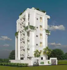
Kakatiya Diamond County
Kakatiya Green Avenues LLP · Medchal-Malkajgiri · RERA P02200000517
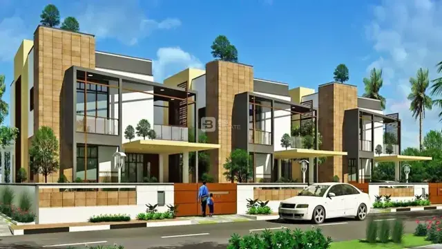
KAKATIYA DIAMOND COUNTY is a plotted development at Rampally, Keesara Mandal, Medchal-Malkajgiri District, developed by registered promoter Kakatiya Green Avenues LLP. The project covers 78408.08 Sq.Mt. and is a plotted layout; the supplied record does not establish the total number of plots or plot configurations. It is registered under TG-RERA registration P02200000517, with a proposed completion date of 30/06/2019.
01What we found
Read from TG-RERA filings, approvals, land and registration records and court records. A court case is counted only when the court record states this project's survey number with its village, or names the project.
02Check before you pay
8 items to check before you pay, 5 high - from the title chain, court records and approvals, each with what to ask the builder or your advocate. An item may not be a problem with the project: records can be incomplete.
1. Project at a glance
Project identity
| Item | Project record |
|---|---|
| Registered project name | KAKATIYA DIAMOND COUNTY RERA record |
| Project type | Plotted development / open-plot gated-community layout RERA record RERA filing |
| Phase / registered portion | No phase name or separate phase boundary is disclosed. The TG-RERA certificate identifies the project and surveys 67 P, 68 P, 69 P and 714 P. |
| TG-RERA registration | P02200000517 Approvals record |
| Registration validity | 22/03/2019 to 30/06/2019, unless extended by the Authority; the supplied certificate records no extension. This is registration validity, not an occupancy certificate. Approvals record |
| Registered promoter | Kakatiya Green Avenues LLP RERA record Corporate record |
| RERA status | Recorded as On-Going Project in the supplied project record. RERA record RERA filing |
Land and geographic identity
| Item | Project record |
|---|---|
| Locality | Rampally / Rampalle RERA record RERA filing |
| Revenue village | Rampally; the HMDA draft-layout letter spells it Rampalle Village. RERA record |
| Mandal | Keesara RERA record RERA filing |
| District | Medchal-Malkajgiri RERA record |
| PIN | 501301 RERA record |
| Project survey numbers and subdivisions | Sy. Nos. 67 P, 68 P, 69 P and 714 P; the approval letter writes these as 67(P), 68(P), 69(P) and 714(P). RERA record Land records p.1 |
| Site extent | 78408.08 Sq.Mt. Land records p.4 |
| Total / net area | Total Site area 78408.08; Net Site Area 78408.08. p.4 |
| Boundaries in the RERA record | North: neighbours’ land; South: neighbours’ land; East: neighbours’ land; West: 18 MTR ROAD. Land records |
Development identity
| Item | Project record |
|---|---|
| Sanctioning authority | Hyderabad Metropolitan Development Authority (HMDA) Approvals record |
| Principal approval | Draft layout Letter / Layout Permit No. 000045/LO/Plg/HMDA/2018, approved 20 March, 2018. Approvals record p.1 |
| Application reference | 004790/GHT/LT/U6/HMDA/06112017 Approvals record p.1 |
| Approved built-up area | 48388.03 sq. m. is recorded as “Approved Built up Area” in the RERA project fields; the HMDA letter’s land-use table separately labels 48388.03 as plotted area. RERA filing p.4 |
| Buildings / floors | Not disclosed in the supplied record; the approval is for a plotted layout, not a building configuration. |
| Layout land-use figures | Plotted area: 48388.03; layout road area: 22162.56; park: 5894.13; open space: 1963.21; amenities area: 0. p.4 |
| Plot count | The HMDA letter refers to total 44 number of plots (mortgaged plots); a total project plot count is not established by the supplied extract. p.2 |
Offering and status
| Item | Project record |
|---|---|
| Unit type | Plots; the supplied RERA data does not include a normalized plot inventory or unit count. RERA filing |
| RERA-filed plot size range / booked / available | Not disclosed in the supplied structured RERA data. |
| Construction stage | No independently verified site-progress record is supplied. The project is listed as On-Going in the project record. RERA record |
| Original / revised completion date | 30/06/2019 / 30/06/2019, as recorded in the project fields. RERA record RERA filing |
| Promoter completion undertaking | The Form B declaration states completion by 30l06l2019. |
| Occupancy / completion certificate | No occupancy or completion certificate is supplied. The HMDA record describes a draft layout permission; the RERA certificate sets registration validity dates and is not an occupancy certificate. |
2. The project story
KAKATIYA DIAMOND COUNTY is registered as a plotted development at Rampally, Keesara Mandal, Medchal-Malkajgiri District, on land identified in the RERA record as Sy. Nos. 67 P, 68 P, 69 P and 714 P. The HMDA document is a draft layout letter for an open-plot gated-community layout over 78408.08 Sq.Mt. RERA record Land records pp.1, 4
The filed plan describes plots, internal roads, park and open-space areas, and social infrastructure land. It also identifies 44 plots as mortgaged to HMDA; this is a mortgage-related plot count, not evidence of the total number of plots for sale. The supplied registration data does not establish the project’s total plot inventory, plot-by-plot sizes, bookings, or current construction completion. pp.2, 4, 6 RERA unit table
The promoter’s declaration undertakes completion by 30l06l2019. That date is distinct from the certificate’s registration-validity end date of 30/06/2019. No phase-specific completion or occupancy status, and no occupancy/completion certificate, is provided. The supplied evidence therefore does not independently establish the present on-site stage. Document index
3. Master plan, architecture & building design
The HMDA document is a draft layout for a plotted scheme, rather than a building plan with towers, floor counts, building footprints or apartment layouts. Its land-use schedule records the following: pp.1, 4, 6
| Layout component | Area recorded | Source description |
|---|---|---|
| Total site area | 78408.08 | “Total Site area” |
| Net site area | 78408.08 | “Net Site Area” |
| Plotted area | 48388.03 | “Plotted area” |
| Layout roads | 22162.56 | “Layout Road Area”; also stated as 22162.56 Sq.mtrs (28.27%) |
| Park | 5894.13 | “Park” |
| Open space | 1963.21 | “Open space”; separately stated as 1963.21 Sq.mtrs (2.50%) Social Infrastructure Area |
| Amenities area | 0 | “Amenities area” |
| Master-plan road affected area | 0 | “Master plan Road affected area” |
The HMDA letter also states Open Space Area 5894.13 Sq.mtrs (7.52%) and requires roads, open space and social infrastructure land to be handed to the local authority by registered gift deed before final layout release. These are approval-document statements and conditions, not confirmation that the handover or final layout release occurred. pp.4, 6
The supplied drawing extraction identifies two layout sheets, but no plot sizes could be extracted; it does not provide a complete plot schedule. No building, floor, parking-level, or apartment configuration is established by the supplied evidence. Layout record Floor plans
4. Homes, configurations & floor plans
This is a plotted project, not an apartment configuration. The supplied structured RERA data does not provide a plot count for the whole project, plot-size bands, booked or available plot counts, or plot-wise saleable areas. RERA record RERA unit table
A promoter/vendor listing gives plot sizes of 1514 Sq. Ft. and 3702 Sq. Ft., and a range of 1514 to 3702 sq.ft. These are vendor-sourced claims, not RERA-filed plot-size data. Promoter website
The two supplied layout sheets have no software-measured unit or plot areas. The allotment-letter and agreement-for-sale documents contain blank plot/allottee particulars in the supplied text, so they do not establish a specific plot’s size or allocation. Floor plans
5. Parking & vehicle circulation
The project is a plotted layout. No sanctioned parking count, visitor or accessible parking provision, parking structure, parking allocation, vehicle-ramp arrangement, or EV-charging provision is established in the supplied documents. The HMDA letter refers to layout roads and requires roads to be opened for access to neighbouring sites; it does not provide road widths beyond the RERA-recorded western boundary of 18 MTR ROAD. Land records
A vendor listing mentions covered car parking, but the supplied RERA and approval records do not establish its location, quantity, sanctioned status or allocation to individual plots. Promoter website
6. Amenities, recreation & open spaces
The HMDA draft-layout letter describes proposed layout works including park development, avenue plantation and open spaces. The land schedule records a park of 5894.13 and open space of 1963.21; the letter separately labels the latter as social infrastructure area. The supplied record does not establish that these works are complete or independently verified. pp.4, 6
| Description / size | 5894.13; the letter also states 5894.13 Sq.mtrs (7.52%) |
|---|---|
| Evidence source | HMDA draft-layout letter pp.4, 6 |
| Declared progress / verified status | Park development is included among the required layout works; completion is not established. |
| Description / size | 1963.21; stated as 1963.21 Sq.mtrs (2.50%) Social Infrastructure Area |
|---|---|
| Evidence source | HMDA draft-layout letter pp.4, 6 |
| Declared progress / verified status | Handover by registered gift deed is required before final layout release; completed handover is not established. |
| Description / size | No area or quantity supplied |
|---|---|
| Evidence source | HMDA draft-layout letter |
| Declared progress / verified status | Required as part of layout works; completion is not established. |
| Description / size | No RERA-filed size or quantity supplied |
|---|---|
| Evidence source | Vendor listing Promoter website |
| Declared progress / verified status | Vendor-listed only; not established as approved or delivered in the supplied project documents. |
7. Utilities, building services & safety
The HMDA draft-layout letter describes required layout works that include black-top road formation, storm-water drains, underground drainage lines and a common septic tank / STP, internal water-supply pipelines and an overhead tank, an assured water-supply source, electrical supply lines, street lights, a transformer, rainwater-harvesting pits, park development and avenue plantation. The letter directs completion of these layout works within THREE (3) YEARS. The supplied evidence does not independently confirm that these works were completed.
The RERA amenities extract lists internal roads and footpaths, water supply, sewerage, and water conservation/rainwater harvesting as available at 100%; Green Strip/TOT LOT/Park and electrical meter room/sub-station/receiving station are marked 50%. These are filed progress/availability entries, not independent verification of present operation or completion. It records storm-water drains, street lighting, community buildings, sewage/sullage treatment and disposal, solid-waste management, energy management, fire protection and aggregate recreational open space at 0%. RERA amenities
No verified capacity or detailed specification is supplied for water storage, water treatment, STP, power backup, lifts, fire systems, security systems, accessibility or waste-handling facilities. A vendor listing mentions 24x7 water supply, power backup, fire safety and security; those claims are not established by the supplied approval or RERA amenities record. Promoter website
8. Location, access & connectivity
The registered location is Rampally, Keesara Mandal, Medchal-Malkajgiri District, Telangana, PIN 501301. The RERA land record describes the western boundary as 18 MTR ROAD and the other three boundaries as neighbours’ land. The HMDA draft-layout letter refers to Rampalle Village. RERA record Land records p.1
The supplied location record does not provide a reliable project-specific approach-road description, public-transport route or measured distance from the registered project site to local services. A vendor listing identifies Rampally as the nearest landmark, without a distance. Location record Promoter website
9. Developer & development status
The registered promoter is Kakatiya Green Avenues LLP, identified in the project record as an LLP. The HMDA draft-layout letter names the LLP as applicant and identifies Mr. K. Vinay Kumar as its designated-partner representative. Mr. Vinay Kumar Koganti’s Form B declaration is filed as an authorized signatory for the promoter. RERA record Corporate record p.1
The supplied promoter identifier is masked as xxxxxx413M. The project record gives an address in Road No. 2, Keesara/Rampally, but the supplied TG-RERA certificate’s promoter-office field is incomplete; no verified official contact or website is provided here. RERA filing RERA filing
The promoter’s Form B declaration undertakes completion by 30l06l2019 and states that the land is free from encumbrances. These are promoter declarations. The supplied record contains no independently verified construction-progress update and no occupancy/completion certificate. Document index
10. Approvals, official records & documents
| Record | Supplied evidence |
|---|---|
| TG-RERA registration | Form C certificate for KAKATIYA DIAMOND COUNTY, registration P02200000517, issued 22/03/2019, valid to 30/06/2019 unless extended; no extension is recorded on the supplied certificate. |
| HMDA layout permission | Draft layout Letter / Layout Permit 000045/LO/Plg/HMDA/2018, dated 20 March, 2018, for Sy. Nos. 67(P), 68(P), 69(P), 714(P) at Rampalle Village, Keesara Mandal. pp.1, 4 |
| Approval application reference | 004790/GHT/LT/U6/HMDA/06112017 p.1 |
| HMDA conditions relevant to layout | The letter requires layout infrastructure works, transfer of roads/open space/social infrastructure by registered gift deed before final layout release, and restricts construction in plots until final layout is issued. |
| Mortgage identified in the approval letter | The letter identifies 44 plots—Plot Nos. 98 to 113, 138 to 162, and 187 to 191—totalling 7375.06 Sq.Mt., mortgaged in favour of HMDA; it states these plots are not to be conveyed until the Authority’s necessary communication. pp.2, 6 |
| Promoter declaration | Form B declaration by the promoter’s authorized signatory, dated 07th day of December 2018, including the promoter’s land-title, encumbrance and completion declarations. |
| Title report / encumbrance statement / layout drawing | A title report, encumbrance statement and layout-plan document are listed in the project file; the supplied layout-plan extraction does not establish a complete plot schedule. Document index Layout record |
| Occupancy/completion evidence | No occupancy or completion certificate is supplied in the reviewed documents. Document index |
1. Project at a glance
Project identity
Registered project name: KAKATIYA DIAMOND COUNTY
Project type: Plotted development / open-plot gated-community layout
Phase / registered portion: No phase name or separate phase boundary is disclosed. The TG-RERA certificate identifies the project and surveys 67 P, 68 P, 69 P and 714 P.
TG-RERA registration: P02200000517
Registration validity: 22/03/2019 to 30/06/2019, unless extended by the Authority; the supplied certificate records no extension. This is registration validity, not an occupancy certificate.
Registered promoter: Kakatiya Green Avenues LLP
RERA status: Recorded as On-Going Project in the supplied project record.
Land and geographic identity
Locality: Rampally / Rampalle
Revenue village: Rampally; the HMDA draft-layout letter spells it Rampalle Village.
Mandal: Keesara
District: Medchal-Malkajgiri
PIN: 501301
Project survey numbers and subdivisions: Sy. Nos. 67 P, 68 P, 69 P and 714 P; the approval letter writes these as 67(P), 68(P), 69(P) and 714(P). p.1
Site extent: 78408.08 Sq.Mt. p.4
Total / net area: Total Site area 78408.08; Net Site Area 78408.08. p.4
Boundaries in the RERA record: North: neighbours’ land; South: neighbours’ land; East: neighbours’ land; West: 18 MTR ROAD.
Development identity
Sanctioning authority: Hyderabad Metropolitan Development Authority (HMDA)
Principal approval: Draft layout Letter / Layout Permit No. 000045/LO/Plg/HMDA/2018, approved 20 March, 2018. p.1
Application reference: 004790/GHT/LT/U6/HMDA/06112017 p.1
Approved built-up area: 48388.03 sq. m. is recorded as “Approved Built up Area” in the RERA project fields; the HMDA letter’s land-use table separately labels 48388.03 as plotted area. p.4
Buildings / floors: Not disclosed in the supplied record; the approval is for a plotted layout, not a building configuration.
Layout land-use figures: Plotted area: 48388.03; layout road area: 22162.56; park: 5894.13; open space: 1963.21; amenities area: 0. p.4
Plot count: The HMDA letter refers to total 44 number of plots (mortgaged plots); a total project plot count is not established by the supplied extract. p.2
Offering and status
Unit type: Plots; the supplied RERA data does not include a normalized plot inventory or unit count.
RERA-filed plot size range / booked / available: Not disclosed in the supplied structured RERA data.
Construction stage: No independently verified site-progress record is supplied. The project is listed as On-Going in the project record.
Original / revised completion date: 30/06/2019 / 30/06/2019, as recorded in the project fields.
Promoter completion undertaking: The Form B declaration states completion by 30l06l2019.
Occupancy / completion certificate: No occupancy or completion certificate is supplied. The HMDA record describes a draft layout permission; the RERA certificate sets registration validity dates and is not an occupancy certificate.
2. The project story
KAKATIYA DIAMOND COUNTY is registered as a plotted development at Rampally, Keesara Mandal, Medchal-Malkajgiri District, on land identified in the RERA record as Sy. Nos. 67 P, 68 P, 69 P and 714 P. The HMDA document is a draft layout letter for an open-plot gated-community layout over 78408.08 Sq.Mt. pp.1, 4
The filed plan describes plots, internal roads, park and open-space areas, and social infrastructure land. It also identifies 44 plots as mortgaged to HMDA; this is a mortgage-related plot count, not evidence of the total number of plots for sale. The supplied registration data does not establish the project’s total plot inventory, plot-by-plot sizes, bookings, or current construction completion. pp.2, 4, 6
The promoter’s declaration undertakes completion by 30l06l2019. That date is distinct from the certificate’s registration-validity end date of 30/06/2019. No phase-specific completion or occupancy status, and no occupancy/completion certificate, is provided. The supplied evidence therefore does not independently establish the present on-site stage.
3. Master plan, architecture & building design
The HMDA document is a draft layout for a plotted scheme, rather than a building plan with towers, floor counts, building footprints or apartment layouts. Its land-use schedule records the following: pp.1, 4, 6
| Layout component | Area recorded | Source description |
|---|---|---|
| Total site area | 78408.08 | “Total Site area” |
| Net site area | 78408.08 | “Net Site Area” |
| Plotted area | 48388.03 | “Plotted area” |
| Layout roads | 22162.56 | “Layout Road Area”; also stated as 22162.56 Sq.mtrs (28.27%) |
| Park | 5894.13 | “Park” |
| Open space | 1963.21 | “Open space”; separately stated as 1963.21 Sq.mtrs (2.50%) Social Infrastructure Area |
| Amenities area | 0 | “Amenities area” |
| Master-plan road affected area | 0 | “Master plan Road affected area” |
The HMDA letter also states Open Space Area 5894.13 Sq.mtrs (7.52%) and requires roads, open space and social infrastructure land to be handed to the local authority by registered gift deed before final layout release. These are approval-document statements and conditions, not confirmation that the handover or final layout release occurred. pp.4, 6
The supplied drawing extraction identifies two layout sheets, but no plot sizes could be extracted; it does not provide a complete plot schedule. No building, floor, parking-level, or apartment configuration is established by the supplied evidence.
4. Homes, configurations & floor plans
This is a plotted project, not an apartment configuration. The supplied structured RERA data does not provide a plot count for the whole project, plot-size bands, booked or available plot counts, or plot-wise saleable areas.
A promoter/vendor listing gives plot sizes of 1514 Sq. Ft. and 3702 Sq. Ft., and a range of 1514 to 3702 sq.ft. These are vendor-sourced claims, not RERA-filed plot-size data.
The two supplied layout sheets have no software-measured unit or plot areas. The allotment-letter and agreement-for-sale documents contain blank plot/allottee particulars in the supplied text, so they do not establish a specific plot’s size or allocation.
5. Parking & vehicle circulation
The project is a plotted layout. No sanctioned parking count, visitor or accessible parking provision, parking structure, parking allocation, vehicle-ramp arrangement, or EV-charging provision is established in the supplied documents. The HMDA letter refers to layout roads and requires roads to be opened for access to neighbouring sites; it does not provide road widths beyond the RERA-recorded western boundary of 18 MTR ROAD.
A vendor listing mentions covered car parking, but the supplied RERA and approval records do not establish its location, quantity, sanctioned status or allocation to individual plots.
6. Amenities, recreation & open spaces
The HMDA draft-layout letter describes proposed layout works including park development, avenue plantation and open spaces. The land schedule records a park of 5894.13 and open space of 1963.21; the letter separately labels the latter as social infrastructure area. The supplied record does not establish that these works are complete or independently verified. pp.4, 6
| Description / size | 5894.13; the letter also states 5894.13 Sq.mtrs (7.52%) |
|---|---|
| Evidence source | HMDA draft-layout letter pp.4, 6 |
| Declared progress / verified status | Park development is included among the required layout works; completion is not established. |
| Description / size | 1963.21; stated as 1963.21 Sq.mtrs (2.50%) Social Infrastructure Area |
|---|---|
| Evidence source | HMDA draft-layout letter pp.4, 6 |
| Declared progress / verified status | Handover by registered gift deed is required before final layout release; completed handover is not established. |
| Description / size | No area or quantity supplied |
|---|---|
| Evidence source | HMDA draft-layout letter |
| Declared progress / verified status | Required as part of layout works; completion is not established. |
| Description / size | No RERA-filed size or quantity supplied |
|---|---|
| Evidence source | Vendor listing |
| Declared progress / verified status | Vendor-listed only; not established as approved or delivered in the supplied project documents. |
7. Utilities, building services & safety
The HMDA draft-layout letter describes required layout works that include black-top road formation, storm-water drains, underground drainage lines and a common septic tank / STP, internal water-supply pipelines and an overhead tank, an assured water-supply source, electrical supply lines, street lights, a transformer, rainwater-harvesting pits, park development and avenue plantation. The letter directs completion of these layout works within THREE (3) YEARS. The supplied evidence does not independently confirm that these works were completed.
The RERA amenities extract lists internal roads and footpaths, water supply, sewerage, and water conservation/rainwater harvesting as available at 100%; Green Strip/TOT LOT/Park and electrical meter room/sub-station/receiving station are marked 50%. These are filed progress/availability entries, not independent verification of present operation or completion. It records storm-water drains, street lighting, community buildings, sewage/sullage treatment and disposal, solid-waste management, energy management, fire protection and aggregate recreational open space at 0%.
No verified capacity or detailed specification is supplied for water storage, water treatment, STP, power backup, lifts, fire systems, security systems, accessibility or waste-handling facilities. A vendor listing mentions 24x7 water supply, power backup, fire safety and security; those claims are not established by the supplied approval or RERA amenities record.
8. Location, access & connectivity
The registered location is Rampally, Keesara Mandal, Medchal-Malkajgiri District, Telangana, PIN 501301. The RERA land record describes the western boundary as 18 MTR ROAD and the other three boundaries as neighbours’ land. The HMDA draft-layout letter refers to Rampalle Village. p.1
The supplied location record does not provide a reliable project-specific approach-road description, public-transport route or measured distance from the registered project site to local services. A vendor listing identifies Rampally as the nearest landmark, without a distance.
9. Developer & development status
The registered promoter is Kakatiya Green Avenues LLP, identified in the project record as an LLP. The HMDA draft-layout letter names the LLP as applicant and identifies Mr. K. Vinay Kumar as its designated-partner representative. Mr. Vinay Kumar Koganti’s Form B declaration is filed as an authorized signatory for the promoter. p.1
The supplied promoter identifier is masked as xxxxxx413M. The project record gives an address in Road No. 2, Keesara/Rampally, but the supplied TG-RERA certificate’s promoter-office field is incomplete; no verified official contact or website is provided here.
The promoter’s Form B declaration undertakes completion by 30l06l2019 and states that the land is free from encumbrances. These are promoter declarations. The supplied record contains no independently verified construction-progress update and no occupancy/completion certificate.
10. Approvals, official records & documents
TG-RERA registration: Form C certificate for KAKATIYA DIAMOND COUNTY, registration P02200000517, issued 22/03/2019, valid to 30/06/2019 unless extended; no extension is recorded on the supplied certificate.
HMDA layout permission: Draft layout Letter / Layout Permit 000045/LO/Plg/HMDA/2018, dated 20 March, 2018, for Sy. Nos. 67(P), 68(P), 69(P), 714(P) at Rampalle Village, Keesara Mandal. pp.1, 4
Approval application reference: 004790/GHT/LT/U6/HMDA/06112017 p.1
HMDA conditions relevant to layout: The letter requires layout infrastructure works, transfer of roads/open space/social infrastructure by registered gift deed before final layout release, and restricts construction in plots until final layout is issued.
Mortgage identified in the approval letter: The letter identifies 44 plots—Plot Nos. 98 to 113, 138 to 162, and 187 to 191—totalling 7375.06 Sq.Mt., mortgaged in favour of HMDA; it states these plots are not to be conveyed until the Authority’s necessary communication. pp.2, 6
Promoter declaration: Form B declaration by the promoter’s authorized signatory, dated 07th day of December 2018, including the promoter’s land-title, encumbrance and completion declarations.
Title report / encumbrance statement / layout drawing: A title report, encumbrance statement and layout-plan document are listed in the project file; the supplied layout-plan extraction does not establish a complete plot schedule.
Occupancy/completion evidence: No occupancy or completion certificate is supplied in the reviewed documents.
Frequently asked questions
Is KAKATIYA DIAMOND COUNTY registered with Telangana RERA?
Yes. KAKATIYA DIAMOND COUNTY is registered with the Telangana Real Estate Regulatory Authority as P02200000517; the registration status is On-Going Project.
Who is the developer of KAKATIYA DIAMOND COUNTY?
The promoter named in the RERA registration is Kakatiya Green Avenues LLP.
Where is KAKATIYA DIAMOND COUNTY located?
KAKATIYA DIAMOND COUNTY is in RAMPALLY, Keesara, Medchal-Malkajgiri, Telangana (501301).
When will KAKATIYA DIAMOND COUNTY be completed?
The promoter's proposed date of completion filed with RERA is 30/06/2019. This is the promoter's declaration, not a guarantee.
More projects in Rampally