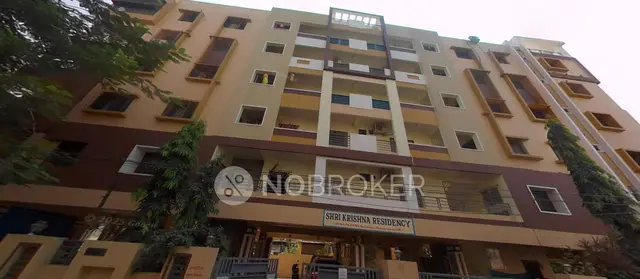
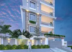
Kushal Sai Builders And Developers 2
KUSHALSAI BUILDERS AND DEVELOPERS · Rangareddy · RERA P02400000558
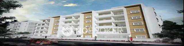
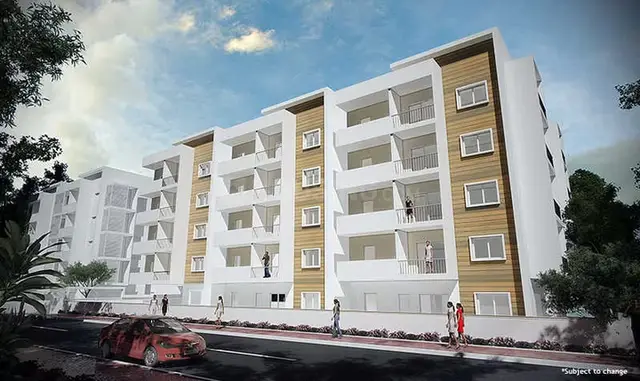
KUSHAL SAI BUILDERS AND DEVELOPERS 2 is a residential apartment project in KAMALANAGAR, Saroornagar, Ranga Reddy. The registered promoter is KUSHALSAI BUILDERS AND DEVELOPERS. The project is on 613.08 sq m of land and comprises one building with Stilt+5 floors and 16 2BHK units. It is registered under TG-RERA number P02400000558, with a proposed completion date of 22/05/2024.
More from Kushalsai Builders And Developers · 3 projects →
01What we found
Read from TG-RERA filings, approvals, land and registration records and court records. A court case is counted only when the court record states this project's survey number with its village, or names the project.
02Check before you pay
7 items to check before you pay, 4 high - from the title chain, court records and approvals, each with what to ask the builder or your advocate. An item may not be a problem with the project: records can be incomplete.
Project at a glance
Project identity
| Item | Project record |
|---|---|
| Registered project name | KUSHAL SAI BUILDERS AND DEVELOPERS 2 RERA record |
| Project type | Residential apartment project RERA record |
| Phase / registered portion | The name includes “2”; the registration certificate identifies the project, but the supplied record does not separately define the phase boundary. |
| TG-RERA registration | P02400000558, granted 02/04/2019; registration certificate states validity to 22/05/2024. The recorded status is “On-Going Project”; no extension is recorded in the supplied certificate. RERA record |
| Registered promoter | KUSHALSAI BUILDERS AND DEVELOPERS; the certificate styles the name “Kushalsai Builders And Developers.” RERA record |
| RERA status | RERA-recorded status: On-Going Project. RERA record |
Land and geographic identity
| Item | Project record |
|---|---|
| Locality | KAMALANAGAR RERA record |
| Revenue village | Kamalanagar in the project identity fields; the title report describes the land as KARMANGHAT VILLAGE. The supplied record does not reconcile these village descriptions. RERA record Land records |
| Mandal / district / PIN | Saroornagar / Ranga Reddy / 500070 RERA record |
| Project survey number and subdivision | 60-PART; the building-permission extraction also reads the survey as “60・PAR「”. RERA record Land records |
| Plot numbers | 52, 53 & 54 RERA filing |
| Registered site extent | 613.08 sq m, recorded as both total and net area; area affected in road widening/FTL/nala widening: 0 sq m. RERA filing |
| Boundaries | East: 33 FEET WIDE ROAD; West: NEIGHBOURS LAND; North: PLOT NO 55; South: PLOT NO 51 RERA filing |
Development identity
| Item | Project record |
|---|---|
| Sanctioning authority | Greater Hyderabad Municipal Corporation (GHMC), as stated in the filed building-permission record. Approvals record |
| Principal approval | Building-permission number is OCR-corrupted in the extracted letter; the RERA-filed plan approval number is 2/C23/08772/2018. The approval record gives an approval date rendered unclearly by OCR; the project fields record 22/05/2018. Approvals record RERA filing |
| Approved built-up area | 1,398.20 sq m in the permission extraction; the project fields record 1,398.21 sq m. RERA filing |
| Building count | One building / one proposed building unit in the RERA land details. RERA filing |
| Sanctioned configuration | Residential Stilt+5 floors, height 15.00 m, according to the permission extraction. |
| Parking levels / provision | The supplied plan extraction does not establish a parking count, parking-level allocation or parking layout. |
| Unit counts | 16 units recorded in the RERA unit data; the RERA land details separately record one total/proposed building unit. RERA unit table RERA filing |
Offering and status
| Item | Project record |
|---|---|
| RERA-filed configuration | 2BHK; 16 units. RERA unit table |
| RERA-filed saleable area | 87.38 sq m per unit. RERA unit table |
| Booked / available | 0 booked / 16 available in the TG-RERA portal data as read; that record has no as-of date, so counts are indicative. RERA unit table |
| Construction stage | RERA status is “On-Going Project”; no independently verified site-progress assessment is supplied. RERA record RERA amenities |
| Completion dates | Original and revised proposed completion dates are both 22/05/2024. RERA record |
| Registration validity | Certificate states 02/04/2019 to 22/05/2024; this is distinct from the completion date. |
| Occupancy / completion certificate | No occupancy or completion certificate is included in the supplied project evidence. The available permission document is a building permission, not an occupancy certificate. Document index |
The project story
This is a RERA-registered residential apartment development in the Kamalanagar locality, identified in the registration record as Saroornagar mandal, Ranga Reddy district. The registered land is described as Survey No. 60-PART, plots 52, 53 & 54, with a recorded site area of 613.08 sq m. The title-report extract separately describes Survey No. 60 Part in Karmanghat Village; the supplied evidence does not clarify how that village description relates to the project’s Kamalanagar identity. RERA record RERA filing Land records
The filed building-permission record describes residential construction of Stilt+5 floors, with an approved built-up area of 1,398.20 sq m in that extraction. The RERA unit data lists 16 two-bedroom apartments. RERA records the project as ongoing and gives 22/05/2024 as both the original and revised proposed completion date. No supplied evidence independently establishes current construction progress or confirms completion or occupation certification. RERA unit table RERA record Document index
Master plan, architecture & building design
The project record describes a single residential building, with one building unit, on a total/net site area of 613.08 sq m. The filed GHMC building-permission extraction states Stilt+5 floors, a height of 15.00 m and residential upper-floor area of 1,398.20 sq m. These are approval-record figures; the separate project-field entry gives approved built-up area as 1,398.21 sq m. RERA filing RERA filing
The available building-permission extract also records a compound wall of 79.28 RM, two rainwater-harvesting pits (RWHPs) and 30 trees. It does not provide enough usable drawing detail to describe building footprint, flats per floor, lift or stair arrangement, entries/exits, internal circulation, open-space dimensions or a phase-wise building arrangement. The uploaded floor-plan document is identified as document 34101; only one of two drawings is recorded as measured, and one remains a scan pending review. Document index Floor plans
No FSI-counted area is supplied. The 1,398.20 sq m permission-extract figure and the 1,398.21 sq m project-field figure are reported as approved built-up-area records, not as carpet or saleable area. RERA-filed saleable area is reported separately below. RERA filing RERA unit table
Homes, configurations & floor plans
| Configuration | Units | Booked | Available | RERA saleable area | Measured carpet area | Loading (if supplied) |
|---|---|---|---|---|---|---|
| 2BHK | 16 | 0 | 16 | 87.38 sq m | 68.6–72.0 sq m; median 71.5 sq m | 18% |
RERA records 16 two-bedroom units, each with a filed saleable area of 87.38 sq m. The booked and available counts are from the portal data as last read; no as-of date is attached, so they are indicative. RERA unit table
The carpet-area figures are software measurements from the approved floor-plan drawing geometry, not RERA-filed measurements, and the drawing extraction requires review. Three flat designs were measured; the measured median is 71.5 sq m (769 sq ft), with a range of 68.6–72.0 sq m (738–775 sq ft). The distinction matters: saleable area is the RERA-filed area, while the software measurement is drawing-based carpet area; the supplied drawing record notes that saleable area also counts the home’s share of common areas. Floor plans RERA unit details
The extracted typical plan identifies two bedrooms, two toilets, a living/dining area, kitchen, wash area and balcony. The balcony is marked as excluded from the software carpet-area measurement. The drawing record does not establish that these software-measured dimensions have been independently checked on site. RERA unit details
Parking & vehicle circulation
The RERA filing records a mortgage area of 159.02 sq m, but the supplied evidence does not establish the number of sanctioned parking spaces, their level or layout, or any unit-specific parking allocation. RERA filing Land records
The GHMC permission extract describes a Stilt+5-floor residential building, but the available extract does not specify parking counts, ramp arrangement, visitor or accessible spaces, EV charging, or separation of pedestrian and vehicle circulation. A marketing-style amenity list mentions covered and open car parking, but it supplies no verified count or legally documented allocation; this is not treated as proof of a particular parking entitlement. Promoter website
Amenities, recreation & open spaces
The RERA amenities record identifies the following provision and progress entries. The percentage shown is the supplied RERA-recorded percentage, not independent verification of delivery.
| Facility | Description / size | Evidence source | Declared progress / verified status |
|---|---|---|---|
| Internal roads & footpaths | Size not stated | RERA amenities | YES; 100% recorded |
| Water supply | Size/capacity not stated | RERA amenities | YES; 100% recorded |
| Sewerage (chamber, lines, septic tank, STP) | Capacity not stated | RERA amenities | YES; 100% recorded |
| Storm water drains | Size not stated | RERA amenities | YES; 100% recorded |
| Green strip / TOT LOT / park | Area not stated | RERA amenities | YES; 100% recorded |
| Street lighting | Extent not stated | RERA amenities | YES; 100% recorded |
| Water conservation / rainwater harvesting | The permission extract also records 2 RWHPs | RERA amenities | YES; 100% recorded |
| Community buildings | No size or facility detail stated | RERA amenities | 0% recorded |
| Treatment and disposal of sewage and sullage water | No capacity stated | RERA amenities | 0% recorded |
| Solid-waste management and disposal | No system detail stated | RERA amenities | 0% recorded |
| Energy management | No system detail stated | RERA amenities | 0% recorded |
| Fire protection and fire-safety requirements | No system detail stated | RERA amenities | YES; 0% recorded |
| Electrical meter room / sub-station / receiving station | No capacity stated | RERA amenities | YES; 0% recorded |
| Aggregate recreational open space | Area not stated | RERA amenities | YES; 0% recorded |
The building-permission extraction separately records 30 trees. No independent evidence of completed amenity delivery is supplied.
Utilities, building services & safety
The RERA amenities record lists water supply, sewerage (including chambers, lines, septic tank and STP), storm-water drains, water conservation/rainwater harvesting, electrical meter room/sub-station/receiving station, and fire protection and fire-safety requirements. Its progress entries vary: for example, water supply and storm-water drains are recorded at 100%, while electrical facilities and fire safety are marked “YES” with 0% recorded. These are filed progress entries, not independent confirmation of operating capacity or completion. RERA amenities
The GHMC permission extraction records two rainwater-harvesting pits and includes construction-worker safety and insurance conditions. It does not provide capacities for water storage or treatment, sewage treatment, backup power, lifts, fire systems, waste handling, security or accessible circulation. The available material therefore does not establish those service details or their present operating status. RERA amenities
Location, access & connectivity
The project’s RERA identity places it in KAMALANAGAR, Saroornagar mandal, Ranga Reddy district, PIN 500070. The land record gives the eastern boundary as a 33 FEET WIDE ROAD. The registration record also identifies plots 52, 53 & 54 and Survey No. 60-PART. RERA record RERA filing
A supplied location record gives a cadastral parcel-centroid geocode of 17.41528, 78.35459 and lists Financial District (Nanakramguda) at 1.2 km. No approach-road route, public-transport service detail or other independently measured connectivity information is supplied. Location record
Developer & development status
The registered promoter is KUSHALSAI BUILDERS AND DEVELOPERS, recorded as a partnership. The RERA filing lists Gunji Edukondalu, Oguri Shiva, Gunji Anjaneyulu, Gunji Shirisha and Gunji Govindamma as partners, and Gunji Anjaneyulu as authorized signatory. The supplied record includes no verified corporate registration identifier or official website/contact details. Corporate record Parties record
In Form B, Gunji Anjaneyulu declares that the promoter has legal title and that the land is free from encumbrances, and undertakes to complete the project within six years from registration. Those are promoter declarations in the filed affidavit. The RERA certificate records registration from 02/04/2019 to 22/05/2024; the project record gives 22/05/2024 as both original and revised proposed completion date. No extension or occupancy/completion certificate is included in the supplied evidence. RERA record
Approvals, official records & documents
| Record | What the supplied evidence establishes |
|---|---|
| TG-RERA registration certificate, document REGCERT-5340 | FORM “C” registration for KUSHAL SAI BUILDERS AND DEVELOPERS 2, registration number P02400000558, issued 02/04/2019; certificate states validity to 22/05/2024. |
| GHMC building permission, document 34098 | Extract describes a sanctioned residential building plan for site area 613.08 sq m and Stilt+5 floors. Approval-number and approval-date text in the extraction are OCR-corrupted; the project fields separately record plan approval number 2/C23/08772/2018 and approved date 22/05/2018. RERA filing |
| RERA-filed plan approval number | 2/C23/08772/2018 Approvals record |
| Form B declaration, document 34914 | Promoter affidavit containing title, encumbrance, completion-time and fund-handling declarations. |
| Legal title report, document 34099 | Extract describes a sale deed dated 21 February 2018 for Survey No. 60 Part, Karmanghat Village, covering 735 Sq.Yds. or 614.46 Sq.Mtrs. |
| Encumbrance statement, document 34087 | Project-filed encumbrance material; the supplied extract lists entries for rectification deeds and a sale deed. |
| Building-plan drawing, document 34101 | Floor-plan drawing record used for software measurement; one drawing remains a scan pending review. Floor plans |
| Occupancy/completion certificate | Not supplied in the reviewed project evidence. Document index |
Project at a glance
Project identity
Registered project name: KUSHAL SAI BUILDERS AND DEVELOPERS 2
Project type: Residential apartment project
Phase / registered portion: The name includes “2”; the registration certificate identifies the project, but the supplied record does not separately define the phase boundary.
TG-RERA registration: P02400000558, granted 02/04/2019; registration certificate states validity to 22/05/2024. The recorded status is “On-Going Project”; no extension is recorded in the supplied certificate.
Registered promoter: KUSHALSAI BUILDERS AND DEVELOPERS; the certificate styles the name “Kushalsai Builders And Developers.”
RERA status: RERA-recorded status: On-Going Project.
Land and geographic identity
Locality: KAMALANAGAR
Revenue village: Kamalanagar in the project identity fields; the title report describes the land as KARMANGHAT VILLAGE. The supplied record does not reconcile these village descriptions.
Mandal / district / PIN: Saroornagar / Ranga Reddy / 500070
Project survey number and subdivision: 60-PART; the building-permission extraction also reads the survey as “60・PAR「”.
Plot numbers: 52, 53 & 54
Registered site extent: 613.08 sq m, recorded as both total and net area; area affected in road widening/FTL/nala widening: 0 sq m.
Boundaries: East: 33 FEET WIDE ROAD; West: NEIGHBOURS LAND; North: PLOT NO 55; South: PLOT NO 51
Development identity
Sanctioning authority: Greater Hyderabad Municipal Corporation (GHMC), as stated in the filed building-permission record.
Principal approval: Building-permission number is OCR-corrupted in the extracted letter; the RERA-filed plan approval number is 2/C23/08772/2018. The approval record gives an approval date rendered unclearly by OCR; the project fields record 22/05/2018.
Approved built-up area: 1,398.20 sq m in the permission extraction; the project fields record 1,398.21 sq m.
Building count: One building / one proposed building unit in the RERA land details.
Sanctioned configuration: Residential Stilt+5 floors, height 15.00 m, according to the permission extraction.
Parking levels / provision: The supplied plan extraction does not establish a parking count, parking-level allocation or parking layout.
Unit counts: 16 units recorded in the RERA unit data; the RERA land details separately record one total/proposed building unit.
Offering and status
RERA-filed configuration: 2BHK; 16 units.
RERA-filed saleable area: 87.38 sq m per unit.
Booked / available: 0 booked / 16 available in the TG-RERA portal data as read; that record has no as-of date, so counts are indicative.
Construction stage: RERA status is “On-Going Project”; no independently verified site-progress assessment is supplied.
Completion dates: Original and revised proposed completion dates are both 22/05/2024.
Registration validity: Certificate states 02/04/2019 to 22/05/2024; this is distinct from the completion date.
Occupancy / completion certificate: No occupancy or completion certificate is included in the supplied project evidence. The available permission document is a building permission, not an occupancy certificate.
The project story
This is a RERA-registered residential apartment development in the Kamalanagar locality, identified in the registration record as Saroornagar mandal, Ranga Reddy district. The registered land is described as Survey No. 60-PART, plots 52, 53 & 54, with a recorded site area of 613.08 sq m. The title-report extract separately describes Survey No. 60 Part in Karmanghat Village; the supplied evidence does not clarify how that village description relates to the project’s Kamalanagar identity.
The filed building-permission record describes residential construction of Stilt+5 floors, with an approved built-up area of 1,398.20 sq m in that extraction. The RERA unit data lists 16 two-bedroom apartments. RERA records the project as ongoing and gives 22/05/2024 as both the original and revised proposed completion date. No supplied evidence independently establishes current construction progress or confirms completion or occupation certification.
Master plan, architecture & building design
The project record describes a single residential building, with one building unit, on a total/net site area of 613.08 sq m. The filed GHMC building-permission extraction states Stilt+5 floors, a height of 15.00 m and residential upper-floor area of 1,398.20 sq m. These are approval-record figures; the separate project-field entry gives approved built-up area as 1,398.21 sq m.
The available building-permission extract also records a compound wall of 79.28 RM, two rainwater-harvesting pits (RWHPs) and 30 trees. It does not provide enough usable drawing detail to describe building footprint, flats per floor, lift or stair arrangement, entries/exits, internal circulation, open-space dimensions or a phase-wise building arrangement. The uploaded floor-plan document is identified as document 34101; only one of two drawings is recorded as measured, and one remains a scan pending review.
No FSI-counted area is supplied. The 1,398.20 sq m permission-extract figure and the 1,398.21 sq m project-field figure are reported as approved built-up-area records, not as carpet or saleable area. RERA-filed saleable area is reported separately below.
Homes, configurations & floor plans
| Configuration | Units | Booked | Available | RERA saleable area | Measured carpet area | Loading (if supplied) |
|---|---|---|---|---|---|---|
| 2BHK | 16 | 0 | 16 | 87.38 sq m | 68.6–72.0 sq m; median 71.5 sq m | 18% |
RERA records 16 two-bedroom units, each with a filed saleable area of 87.38 sq m. The booked and available counts are from the portal data as last read; no as-of date is attached, so they are indicative.
The carpet-area figures are software measurements from the approved floor-plan drawing geometry, not RERA-filed measurements, and the drawing extraction requires review. Three flat designs were measured; the measured median is 71.5 sq m (769 sq ft), with a range of 68.6–72.0 sq m (738–775 sq ft). The distinction matters: saleable area is the RERA-filed area, while the software measurement is drawing-based carpet area; the supplied drawing record notes that saleable area also counts the home’s share of common areas.
The extracted typical plan identifies two bedrooms, two toilets, a living/dining area, kitchen, wash area and balcony. The balcony is marked as excluded from the software carpet-area measurement. The drawing record does not establish that these software-measured dimensions have been independently checked on site.
Parking & vehicle circulation
The RERA filing records a mortgage area of 159.02 sq m, but the supplied evidence does not establish the number of sanctioned parking spaces, their level or layout, or any unit-specific parking allocation.
The GHMC permission extract describes a Stilt+5-floor residential building, but the available extract does not specify parking counts, ramp arrangement, visitor or accessible spaces, EV charging, or separation of pedestrian and vehicle circulation. A marketing-style amenity list mentions covered and open car parking, but it supplies no verified count or legally documented allocation; this is not treated as proof of a particular parking entitlement.
Amenities, recreation & open spaces
The RERA amenities record identifies the following provision and progress entries. The percentage shown is the supplied RERA-recorded percentage, not independent verification of delivery.
| Facility | Description / size | Evidence source | Declared progress / verified status |
|---|---|---|---|
| Internal roads & footpaths | Size not stated | YES; 100% recorded | |
| Water supply | Size/capacity not stated | YES; 100% recorded | |
| Sewerage (chamber, lines, septic tank, STP) | Capacity not stated | YES; 100% recorded | |
| Storm water drains | Size not stated | YES; 100% recorded | |
| Green strip / TOT LOT / park | Area not stated | YES; 100% recorded | |
| Street lighting | Extent not stated | YES; 100% recorded | |
| Water conservation / rainwater harvesting | The permission extract also records 2 RWHPs | YES; 100% recorded | |
| Community buildings | No size or facility detail stated | 0% recorded | |
| Treatment and disposal of sewage and sullage water | No capacity stated | 0% recorded | |
| Solid-waste management and disposal | No system detail stated | 0% recorded | |
| Energy management | No system detail stated | 0% recorded | |
| Fire protection and fire-safety requirements | No system detail stated | YES; 0% recorded | |
| Electrical meter room / sub-station / receiving station | No capacity stated | YES; 0% recorded | |
| Aggregate recreational open space | Area not stated | YES; 0% recorded |
The building-permission extraction separately records 30 trees. No independent evidence of completed amenity delivery is supplied.
Utilities, building services & safety
The RERA amenities record lists water supply, sewerage (including chambers, lines, septic tank and STP), storm-water drains, water conservation/rainwater harvesting, electrical meter room/sub-station/receiving station, and fire protection and fire-safety requirements. Its progress entries vary: for example, water supply and storm-water drains are recorded at 100%, while electrical facilities and fire safety are marked “YES” with 0% recorded. These are filed progress entries, not independent confirmation of operating capacity or completion.
The GHMC permission extraction records two rainwater-harvesting pits and includes construction-worker safety and insurance conditions. It does not provide capacities for water storage or treatment, sewage treatment, backup power, lifts, fire systems, waste handling, security or accessible circulation. The available material therefore does not establish those service details or their present operating status.
Location, access & connectivity
The project’s RERA identity places it in KAMALANAGAR, Saroornagar mandal, Ranga Reddy district, PIN 500070. The land record gives the eastern boundary as a 33 FEET WIDE ROAD. The registration record also identifies plots 52, 53 & 54 and Survey No. 60-PART.
A supplied location record gives a cadastral parcel-centroid geocode of 17.41528, 78.35459 and lists Financial District (Nanakramguda) at 1.2 km. No approach-road route, public-transport service detail or other independently measured connectivity information is supplied.
Developer & development status
The registered promoter is KUSHALSAI BUILDERS AND DEVELOPERS, recorded as a partnership. The RERA filing lists Gunji Edukondalu, Oguri Shiva, Gunji Anjaneyulu, Gunji Shirisha and Gunji Govindamma as partners, and Gunji Anjaneyulu as authorized signatory. The supplied record includes no verified corporate registration identifier or official website/contact details.
In Form B, Gunji Anjaneyulu declares that the promoter has legal title and that the land is free from encumbrances, and undertakes to complete the project within six years from registration. Those are promoter declarations in the filed affidavit. The RERA certificate records registration from 02/04/2019 to 22/05/2024; the project record gives 22/05/2024 as both original and revised proposed completion date. No extension or occupancy/completion certificate is included in the supplied evidence.
Approvals, official records & documents
TG-RERA registration certificate, document REGCERT-5340: FORM “C” registration for KUSHAL SAI BUILDERS AND DEVELOPERS 2, registration number P02400000558, issued 02/04/2019; certificate states validity to 22/05/2024.
GHMC building permission, document 34098: Extract describes a sanctioned residential building plan for site area 613.08 sq m and Stilt+5 floors. Approval-number and approval-date text in the extraction are OCR-corrupted; the project fields separately record plan approval number 2/C23/08772/2018 and approved date 22/05/2018.
RERA-filed plan approval number: 2/C23/08772/2018
Form B declaration, document 34914: Promoter affidavit containing title, encumbrance, completion-time and fund-handling declarations.
Legal title report, document 34099: Extract describes a sale deed dated 21 February 2018 for Survey No. 60 Part, Karmanghat Village, covering 735 Sq.Yds. or 614.46 Sq.Mtrs.
Encumbrance statement, document 34087: Project-filed encumbrance material; the supplied extract lists entries for rectification deeds and a sale deed.
Building-plan drawing, document 34101: Floor-plan drawing record used for software measurement; one drawing remains a scan pending review.
Occupancy/completion certificate: Not supplied in the reviewed project evidence.
Frequently asked questions
Is KUSHAL SAI BUILDERS AND DEVELOPERS 2 registered with Telangana RERA?
Yes. KUSHAL SAI BUILDERS AND DEVELOPERS 2 is registered with the Telangana Real Estate Regulatory Authority as P02400000558; the registration status is On-Going Project.
Who is the developer of KUSHAL SAI BUILDERS AND DEVELOPERS 2?
The promoter named in the RERA registration is KUSHALSAI BUILDERS AND DEVELOPERS.
Where is KUSHAL SAI BUILDERS AND DEVELOPERS 2 located?
KUSHAL SAI BUILDERS AND DEVELOPERS 2 is in KAMALANAGAR, Saroornagar, Rangareddy, Telangana (500070).
When will KUSHAL SAI BUILDERS AND DEVELOPERS 2 be completed?
The promoter's proposed date of completion filed with RERA is 22/05/2024. This is the promoter's declaration, not a guarantee.
More projects in Kamalanagar