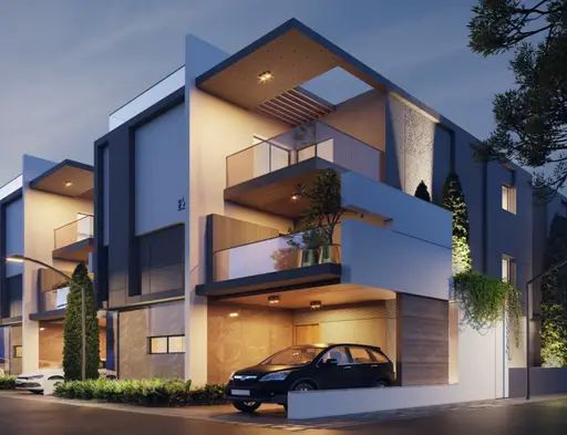
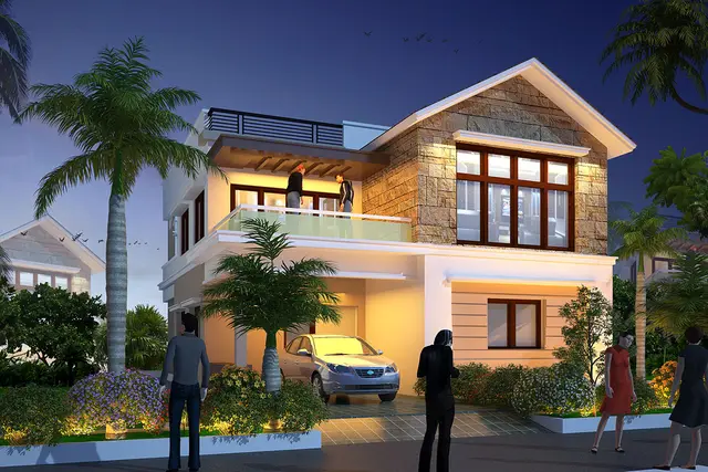
Sark Prime North Meadows - 2
SARK PROJECTS (INDIA) PRIVATE LIMITED AND OTHERS · Rangareddy · RERA P02400010169
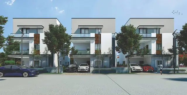
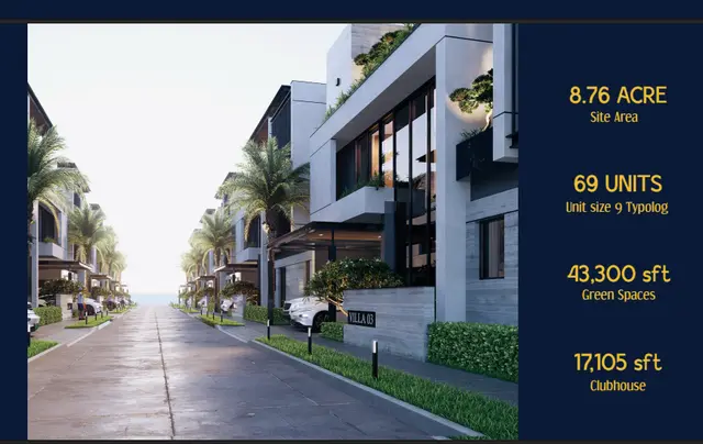
SARK PRIME NORTH MEADOWS - 2 is a residential villa / gated-community layout with housing in Mokila, Shankarpalle mandal, Ranga Reddy district. The registered promoter is SARK PROJECTS (INDIA) PRIVATE LIMITED AND OTHERS. The project covers 24,688.70 sq.m. and comprises 82 duplex villas, with residential villa blocks described as Ground + 2 upper floors; each filed unit has a saleable area of 284.2 sq.m. It is registered with TG-RERA under P02400010169, and the promoter’s Form-B declaration undertakes completion by 23rd January 2030.
📘 Project brochure from the promoter’s website ↗More from Sark Projects India Pvt Ltd · 8 projects →
01What we found
Read from TG-RERA filings, approvals, land and registration records and court records. A court case is counted only when the court record states this project's survey number with its village, or names the project.
02Check before you pay
7 items to check before you pay, 3 high - from the title chain, court records and approvals, each with what to ask the builder or your advocate. An item may not be a problem with the project: records can be incomplete.
1. Project at a glance
Project identity
| Field | Record |
|---|---|
| Registered project name | SARK PRIME NORTH MEADOWS - 2 RERA record |
| Project type | Residential villa / gated-community layout with housing; TG-RERA categorises it as a residential project. RERA record |
| Phase / registered portion | Phase or separately registered portion is not specified in the supplied record. |
| TG-RERA registration | P02400010169; Form C records registration from 23/01/2025 to 23/01/2030. RERA record |
| Registration status | New project; registration was captured on 2026-09-10. This is registration validity, not a construction-completion or occupancy certificate. RERA record Approvals record |
| Registered promoter | SARK PROJECTS (INDIA) PRIVATE LIMITED AND OTHERS. RERA record |
Land and geographic identity
| Field | Record |
|---|---|
| Locality / revenue village | Mokila; the filed plan identifies Mokila. A Gram Panchayat release also describes the site as Mokila Tanda. The project’s revenue-village identification in the RERA certificate is Mokila. RERA record |
| Mandal / district / PIN | Shankarpalle mandal, Ranga Reddy district, PIN 501203. RERA record |
| Project survey numbers | 74, 74/1, 74/1/2, 75/3/2. These are the survey numbers named in the filed project identity and approval records; the overview does not infer further parcel subdivisions. RERA record |
| Site extent | 24,688.70 sq.m. total plot area; 24,582.99 sq.m. net area after 105.71 sq.m. road-affected area. RERA filing |
| Boundaries as filed | East: Road Width - 18; west, north and south: Vacant Land. RERA filing |
| Site address description | The plan places the site in the Extended area of Erstwhile HUDA (HMDA). |
Development identity
| Field | Record |
|---|---|
| Sanctioning authority | Hyderabad Metropolitan Development Authority (HMDA); the layout record says technical approval was forwarded to the local body for final sanction. Approvals record |
| Principal approval | HMDA draft layout letter / file 060651/SKP/LT/U6/HMDA/21042023, dated 23-01-2025; Layout Permit No. 000008/LO/Plg/HMDA/2025, dated 23 January, 2025. Approvals record |
| Local-body record | Mokila Tanda Gram Panchayat release of layout-with-housing permission, file GP / 1/25-26, dated 22.08.2025. Approvals record |
| Approved area figures | HMDA plan extract states Grand Total Gross Built Up Area 25464.18, Total Built Up Area 24336.26, Proposed Net BUA Area 23304.23, and Total Net BUA Area 24334.01. The extract does not label these figures with a unit in the relevant parameter list; they should not be treated as interchangeable area measures. |
| Building arrangement / floors | Layout drawings describe individual residential villa blocks as Ground + 2 upper floors (also stated as 1 Ground + 2 upper floors); the amenities building is described as 1 Ground + 3 upper floors. The plan extract also states building heights of 10.00 MT and 9.95 MT. |
| Building / unit counts | HMDA plan extract gives Grand Total: 83 and num_units: 82.00. TG-RERA’s unit table records 82 “DUPLEX VILLA” units plus four floor-label rows that are not identified as homes for sale. RERA unit table |
| Parking | The plan records Required Parking Area 2030.58 and Proposed Parking Area 335.05; units are not specified for these area figures. No parking-space count or allocation schedule is supplied. |
Offering and status
| Field | Record |
|---|---|
| RERA-filed home configuration | DUPLEX VILLA, 82 units; saleable area 284.2 sq.m. per filed unit. RERA unit table RERA unit table |
| RERA-filed booking / availability | Portal-derived count: 0 booked and 82 available, with no as-of date attached to the count; treat as indicative. RERA unit table |
| Construction stage | The project is registered as a new project. No independently verified site-progress measurement or construction-stage report is supplied here. RERA record Document index |
| Completion date | The Form-B declaration undertakes completion by 23rd January 2030. This is distinct from the Form C registration end date of 23/01/2030. |
| Earlier / revised completion dates | No earlier or revised completion date is identified in the supplied evidence. |
| Occupancy / completion certificate | No occupancy certificate or completion certificate is included in the supplied project records. No tower-wise or phase-wise OC status is established. Document index |
2. The project story
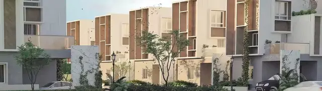
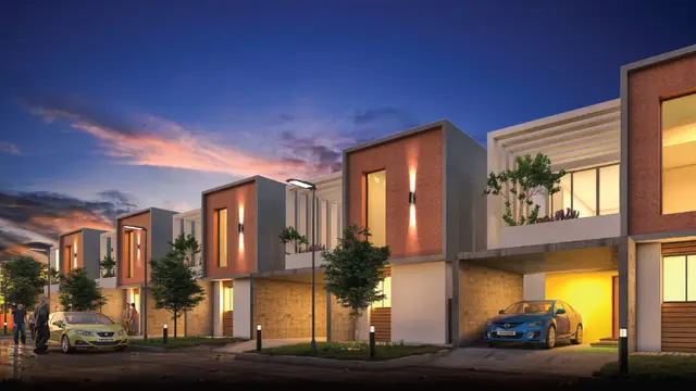
This is a gated-community residential layout with housing in Mokila, Shankarpalle mandal, on land identified in the project record as survey numbers 74, 74/1, 74/1/2 and 75/3/2. The filed configuration is a villa development: the RERA unit table lists 82 duplex villas, and the HMDA plan extract describes residential villa blocks as Ground + 2 upper floors. RERA record RERA unit table
The site’s plan area is 24,688.70 sq.m., with net area shown as 24,582.99 sq.m. after a 105.71 sq.m. road-affected deduction. The HMDA file is described as a draft layout with housing; the supplied local-body record is a later release of layout-with-housing permission. The records therefore evidence permissions and a proposed development arrangement, not independent confirmation that the works are complete.
The promoter’s Form-B affidavit undertakes completion by 23rd January 2030. No construction-progress percentage, site inspection, completion certificate or occupancy certificate is supplied, so the present physical stage and any occupied or certified portion cannot be confirmed from this evidence. Document index
3. Master plan, architecture & building design
The HMDA layout drawing describes a residential gated layout with villa use, Residential land use, and Residential zone-1 (urban areas contiguous to growth corridor). It records an abutting road width of 18.00 and proposed coverage area of 75.4 %, shown as 18535.28 in the plan extract. The plan extract does not state units beside every parameter, so these values are reproduced as recorded rather than converted or interpreted.
| Layout component | Area recorded |
|---|---|
| Total plot area | 24,688.70 sq.m. |
| Net plot area | 24,582.99 sq.m. |
| Plotted area | 14,976.99 sq.m. |
| Road area | 6,892.50 sq.m. |
| Organized open space / park / utility area | 2,713.73 sq.m. |
| Reserve road area (deduction) | 105.71 sq.m. |
| Amenity area | 0.00 sq.m. |
| Vacant plot area | 6,047.72 sq.m. |
The plan extract separately records gross built-up area, built-up area and net built-up-area figures in the development table; it does not provide a basis here to treat them as carpet area, saleable area or FSI-counted area. Residential villa blocks are shown as Ground + 2 upper floors; the amenities building is shown as Ground + 3 upper floors. No complete architectural schedule establishing villa-by-villa footprint, room layouts, circulation, or floor-by-floor arrangement is supplied in the extracted evidence.
HMDA’s draft-permission conditions identify plots 1, 2, 3, 4, 5, 10, 11, 12, 13 and 14, with a stated mortgage area of 1736.47 sq.m. The permission says these plots are not to be sold while mortgaged to HMDA. It also requires development of the layout infrastructure and amenities and transfer of roads and open spaces to the local body by registered gift deed before final layout approval. These are approval conditions, not evidence that the required works or transfers have been completed.
4. Homes, configurations & floor plans
TG-RERA’s unit table lists 82 DUPLEX VILLA units with saleable area of 284.2 sq.m. each; the portal-derived booking count is 0 booked and 82 available, with no as-of date supplied. Four other entries—“FIRST FLOOR,” “GROUND FLOOR,” “SECOND FLOOR” and “THIRD FLOOR”—are floor labels in the unit table, not additional homes for sale. RERA unit table RERA unit table
| Configuration | Units | Booked | Available | RERA saleable area | Measured carpet area | Loading (if supplied) |
|---|---|---|---|---|---|---|
| Duplex villa | 82 | 0 | 82 | 284.2 sq.m. | Not available for a RERA-matched villa configuration | Not supplied |
RERA unit table RERA unit table Floor plans
The supplied software measurement from the drawing identifies a 1BHK configuration in five measured flat designs, with median carpet area 134.7 sq.m., range 127.8–176.0 sq.m. (median 1450 sq.ft., range 1376–1895 sq.ft.). It is not matched to a RERA-filed configuration, and the drawing measurements need review; it is therefore not presented as a villa specification or RERA disclosure. Floor plans RERA unit details
Carpet area is a drawing-based measure of usable internal floor area; the RERA-filed saleable-area figure is a different area basis. The supplied evidence does not provide a measured carpet area or a loading figure for the filed duplex-villa configuration. Floor plans RERA unit table
5. Parking & vehicle circulation
The HMDA plan extract records Required Parking Area 2030.58 and Proposed Parking Area 335.05, but the supplied extract does not state units for these figures or give a count of parking spaces. It does not establish resident, visitor or accessible-space allocations, parking levels, or an allotment schedule.
The approval drawing identifies a road width of 18.00 and the layout’s total road area as 6,892.50 sq.m. It also refers to footpaths, cycling tracks and street lighting as development requirements. No driveway, ramp, pedestrian-separation, EV-charging or parking-ownership details are established by the supplied records.
6. Amenities, recreation & open spaces
The layout plan records 2,713.73 sq.m. of organized open-space / park / utility area and an amenity-area figure of 0.00 sq.m. Its drawing nevertheless labels an “AMENITIES (BUILDING)” block, described as Ground + 3 upper floors; the supplied extract does not identify its internal facilities or floor areas.
| Facility | Description / size | Evidence source | Declared progress / verified status |
|---|---|---|---|
| Organized open space / park / utility area | 2,713.73 sq.m. | HMDA layout extract | Shown in plan; completion not verified. |
| Amenities building | Labelled “AMENITIES (BUILDING)”; Ground + 3 upper floors | HMDA layout drawing | Shown in drawing; internal facilities and completion status not established. |
| Park | 2,713.73 sq.m. identified as park in HMDA draft-permission extract | HMDA draft layout letter | Permission condition calls for handover to the local body; completion and handover are not verified. |
The promoter’s brochure lists a clubhouse, swimming pool, air-conditioned gymnasium, banquet hall, children’s recreation area and indoor games. These are marketing claims, not evidence in the supplied records that the facilities are sanctioned in detail or delivered.
7. Utilities, building services & safety
The HMDA draft-permission extract specifies development of an STP, underground storm-water drainage, paved footpaths, cycling tracks and LED street lighting; it also lists rainwater-harvesting pits, water storage references, a transformer and avenue planting. These are approval-plan requirements or labels, not verified completion claims.
| Evidence in the supplied record | HMDA conditions require an STP and underground storm-water drainage. |
|---|---|
| Status / limitation | Proposed / required by the permission; no construction or commissioning evidence supplied. |
| Evidence in the supplied record | Drawing labels include rainwater-harvesting pits, “Sump / OHT,” and a hydro-pneumatic system. |
|---|---|
| Status / limitation | Source, storage capacity, treatment arrangements and operational status are not established. |
| Evidence in the supplied record | Approval extract lists a transformer / transformer yard and requires LED street lighting. |
|---|---|
| Status / limitation | Capacity, backup supply and completion status are not established. |
| Evidence in the supplied record | Permission conditions refer to paved footpaths and cycling tracks; layout drawing records road area and 18.00 road width. |
|---|---|
| Status / limitation | Works are not independently verified as complete. |
| Evidence in the supplied record | TG-RERA amenity fields include fire-protection and fire-safety requirements without a supplied progress value. RERA amenities |
|---|---|
| Status / limitation | No detailed fire-system specification or clearance evidence supplied. |
| Evidence in the supplied record | TG-RERA amenity fields list solid-waste management and disposal without a supplied progress value. RERA amenities |
|---|---|
| Status / limitation | System details and completion status are not established. |
| Evidence in the supplied record | No project-specific approved or verified details are supplied. |
|---|---|
| Status / limitation | Not established in the supplied records. |
8. Location, access & connectivity
The registered project location is Mokila, Shankarpalle, Ranga Reddy, 501203, with the project land identified in survey numbers 74, 74/1, 74/1/2 and 75/3/2. The HMDA plan describes the site as within the Extended area of Erstwhile HUDA (HMDA). RERA record
The supplied location record gives a nearest sampled Outer Ring Road interchange at approximately 12.3 km. This is a sampled distance, not a stated travel time. No other measured local-road, public-transport or landmark distances are supplied in the location evidence. Location record
The promoter brochure contains separate travel-time claims, but those are marketing statements and are not used here as verified connectivity measurements.
9. Developer & development status
The registered promoter is SARK PROJECTS (INDIA) PRIVATE LIMITED AND OTHERS; the project record describes the organization type as “Others” and the arrangement as a joint development. The identified company carries CIN U45400TG2012PTC085012 and GSTIN 36AASCS5253L1ZN. RERA record Corporate record Parties record
The RERA certificate lists the promoter address as Village: Kondapur, Mandal: Serilingampally, District: Ranga Reddy, Pin: 500032. The project filing separately records an address at 6th Floor Plot No.4, Survey No.192, Kondapur, and the promoter’s website is listed as https://www.sarkprojects.in/Sark-prime-north-meadows-2.html. Parties record
The promoter’s Form-B affidavit, signed by an authorised signatory, undertakes completion by 23rd January 2030. The supplied record does not include a measured construction-progress update or an occupancy/completion certificate, so the physical development stage cannot be confirmed here. Document index
10. Approvals, official records & documents
| Identifier / date | P02400010169; valid 23/01/2025–23/01/2030 |
|---|---|
| What the supplied document establishes | Registers SARK PRIME NORTH MEADOWS - 2 and identifies the project location and survey numbers. |
| Identifier / date | File/application 060651/SKP/LT/U6/HMDA/21042023; dated 23-01-2025 |
|---|---|
| What the supplied document establishes | Draft layout with housing plan and conditions, including infrastructure works, road/open-space handover and mortgage restriction. |
| Identifier / date | 000008/LO/Plg/HMDA/2025; 23 January, 2025 |
|---|---|
| What the supplied document establishes | Identified in the HMDA draft layout record. |
| Identifier / date | 84/2025, 83/2025; 7/1/2025 |
|---|---|
| What the supplied document establishes | HMDA approval records mortgage over specified plots, stated in the plan as 1, 2, 3, 4, 5, 10, 11, 12, 13 and 14, with area 1736.47 sq.m. |
| Identifier / date | 85/2025; 07.01.2025 |
|---|---|
| What the supplied document establishes | HMDA record states that 105.71 sq.m. road-affected area was handed to the local body by gift deed. |
| Identifier / date | File GP / 1/25-26; 22.08.2025 |
|---|---|
| What the supplied document establishes | Release of layout-with-housing permission under HMDA GP approvals for the identified project land. |
| Identifier / date | Dated August 2025 |
|---|---|
| What the supplied document establishes | Promoter declaration of title basis, encumbrance position and completion undertaking. |
| Identifier / date | Sheets 04/17–10/17 among the identified plan numbers |
|---|---|
| What the supplied document establishes | Drawing evidence for the layout and villa arrangement. The supplied extract is not a complete per-villa architectural schedule. |
| Identifier / date | Not supplied |
|---|---|
| What the supplied document establishes | No occupancy or completion certificate is established by the records provided. Document index |
The public HMDA DPMS approved-layout lookup was not reachable in the supplied verification record; this is a portal-access limitation, not evidence of a refusal or cancellation. The HMDA layout drawing and filed approval documents remain the supplied project evidence. HMDA
1. Project at a glance
Project identity
Registered project name: SARK PRIME NORTH MEADOWS - 2
Project type: Residential villa / gated-community layout with housing; TG-RERA categorises it as a residential project.
Phase / registered portion: Phase or separately registered portion is not specified in the supplied record.
TG-RERA registration: P02400010169; Form C records registration from 23/01/2025 to 23/01/2030.
Registration status: New project; registration was captured on 2026-09-10. This is registration validity, not a construction-completion or occupancy certificate.
Registered promoter: SARK PROJECTS (INDIA) PRIVATE LIMITED AND OTHERS.
Land and geographic identity
Locality / revenue village: Mokila; the filed plan identifies Mokila. A Gram Panchayat release also describes the site as Mokila Tanda. The project’s revenue-village identification in the RERA certificate is Mokila.
Mandal / district / PIN: Shankarpalle mandal, Ranga Reddy district, PIN 501203.
Project survey numbers: 74, 74/1, 74/1/2, 75/3/2. These are the survey numbers named in the filed project identity and approval records; the overview does not infer further parcel subdivisions.
Site extent: 24,688.70 sq.m. total plot area; 24,582.99 sq.m. net area after 105.71 sq.m. road-affected area.
Boundaries as filed: East: Road Width - 18; west, north and south: Vacant Land.
Site address description: The plan places the site in the Extended area of Erstwhile HUDA (HMDA).
Development identity
Sanctioning authority: Hyderabad Metropolitan Development Authority (HMDA); the layout record says technical approval was forwarded to the local body for final sanction.
Principal approval: HMDA draft layout letter / file 060651/SKP/LT/U6/HMDA/21042023, dated 23-01-2025; Layout Permit No. 000008/LO/Plg/HMDA/2025, dated 23 January, 2025.
Local-body record: Mokila Tanda Gram Panchayat release of layout-with-housing permission, file GP / 1/25-26, dated 22.08.2025.
Approved area figures: HMDA plan extract states Grand Total Gross Built Up Area 25464.18, Total Built Up Area 24336.26, Proposed Net BUA Area 23304.23, and Total Net BUA Area 24334.01. The extract does not label these figures with a unit in the relevant parameter list; they should not be treated as interchangeable area measures.
Building arrangement / floors: Layout drawings describe individual residential villa blocks as Ground + 2 upper floors (also stated as 1 Ground + 2 upper floors); the amenities building is described as 1 Ground + 3 upper floors. The plan extract also states building heights of 10.00 MT and 9.95 MT.
Building / unit counts: HMDA plan extract gives Grand Total: 83 and num_units: 82.00. TG-RERA’s unit table records 82 “DUPLEX VILLA” units plus four floor-label rows that are not identified as homes for sale.
Parking: The plan records Required Parking Area 2030.58 and Proposed Parking Area 335.05; units are not specified for these area figures. No parking-space count or allocation schedule is supplied.
Offering and status
RERA-filed home configuration: DUPLEX VILLA, 82 units; saleable area 284.2 sq.m. per filed unit.
RERA-filed booking / availability: Portal-derived count: 0 booked and 82 available, with no as-of date attached to the count; treat as indicative.
Construction stage: The project is registered as a new project. No independently verified site-progress measurement or construction-stage report is supplied here.
Completion date: The Form-B declaration undertakes completion by 23rd January 2030. This is distinct from the Form C registration end date of 23/01/2030.
Earlier / revised completion dates: No earlier or revised completion date is identified in the supplied evidence.
Occupancy / completion certificate: No occupancy certificate or completion certificate is included in the supplied project records. No tower-wise or phase-wise OC status is established.
2. The project story
This is a gated-community residential layout with housing in Mokila, Shankarpalle mandal, on land identified in the project record as survey numbers 74, 74/1, 74/1/2 and 75/3/2. The filed configuration is a villa development: the RERA unit table lists 82 duplex villas, and the HMDA plan extract describes residential villa blocks as Ground + 2 upper floors.
The site’s plan area is 24,688.70 sq.m., with net area shown as 24,582.99 sq.m. after a 105.71 sq.m. road-affected deduction. The HMDA file is described as a draft layout with housing; the supplied local-body record is a later release of layout-with-housing permission. The records therefore evidence permissions and a proposed development arrangement, not independent confirmation that the works are complete.
The promoter’s Form-B affidavit undertakes completion by 23rd January 2030. No construction-progress percentage, site inspection, completion certificate or occupancy certificate is supplied, so the present physical stage and any occupied or certified portion cannot be confirmed from this evidence.
3. Master plan, architecture & building design
The HMDA layout drawing describes a residential gated layout with villa use, Residential land use, and Residential zone-1 (urban areas contiguous to growth corridor). It records an abutting road width of 18.00 and proposed coverage area of 75.4 %, shown as 18535.28 in the plan extract. The plan extract does not state units beside every parameter, so these values are reproduced as recorded rather than converted or interpreted.
Total plot area: 24,688.70 sq.m.
Net plot area: 24,582.99 sq.m.
Plotted area: 14,976.99 sq.m.
Road area: 6,892.50 sq.m.
Organized open space / park / utility area: 2,713.73 sq.m.
Reserve road area (deduction): 105.71 sq.m.
Amenity area: 0.00 sq.m.
Vacant plot area: 6,047.72 sq.m.
The plan extract separately records gross built-up area, built-up area and net built-up-area figures in the development table; it does not provide a basis here to treat them as carpet area, saleable area or FSI-counted area. Residential villa blocks are shown as Ground + 2 upper floors; the amenities building is shown as Ground + 3 upper floors. No complete architectural schedule establishing villa-by-villa footprint, room layouts, circulation, or floor-by-floor arrangement is supplied in the extracted evidence.
HMDA’s draft-permission conditions identify plots 1, 2, 3, 4, 5, 10, 11, 12, 13 and 14, with a stated mortgage area of 1736.47 sq.m. The permission says these plots are not to be sold while mortgaged to HMDA. It also requires development of the layout infrastructure and amenities and transfer of roads and open spaces to the local body by registered gift deed before final layout approval. These are approval conditions, not evidence that the required works or transfers have been completed.
4. Homes, configurations & floor plans
TG-RERA’s unit table lists 82 DUPLEX VILLA units with saleable area of 284.2 sq.m. each; the portal-derived booking count is 0 booked and 82 available, with no as-of date supplied. Four other entries—“FIRST FLOOR,” “GROUND FLOOR,” “SECOND FLOOR” and “THIRD FLOOR”—are floor labels in the unit table, not additional homes for sale.
| Configuration | Units | Booked | Available | RERA saleable area | Measured carpet area | Loading (if supplied) |
|---|---|---|---|---|---|---|
| Duplex villa | 82 | 0 | 82 | 284.2 sq.m. | Not available for a RERA-matched villa configuration | Not supplied |
The supplied software measurement from the drawing identifies a 1BHK configuration in five measured flat designs, with median carpet area 134.7 sq.m., range 127.8–176.0 sq.m. (median 1450 sq.ft., range 1376–1895 sq.ft.). It is not matched to a RERA-filed configuration, and the drawing measurements need review; it is therefore not presented as a villa specification or RERA disclosure.
Carpet area is a drawing-based measure of usable internal floor area; the RERA-filed saleable-area figure is a different area basis. The supplied evidence does not provide a measured carpet area or a loading figure for the filed duplex-villa configuration.
5. Parking & vehicle circulation
The HMDA plan extract records Required Parking Area 2030.58 and Proposed Parking Area 335.05, but the supplied extract does not state units for these figures or give a count of parking spaces. It does not establish resident, visitor or accessible-space allocations, parking levels, or an allotment schedule.
The approval drawing identifies a road width of 18.00 and the layout’s total road area as 6,892.50 sq.m. It also refers to footpaths, cycling tracks and street lighting as development requirements. No driveway, ramp, pedestrian-separation, EV-charging or parking-ownership details are established by the supplied records.
6. Amenities, recreation & open spaces
The layout plan records 2,713.73 sq.m. of organized open-space / park / utility area and an amenity-area figure of 0.00 sq.m. Its drawing nevertheless labels an “AMENITIES (BUILDING)” block, described as Ground + 3 upper floors; the supplied extract does not identify its internal facilities or floor areas.
| Facility | Description / size | Evidence source | Declared progress / verified status |
|---|---|---|---|
| Organized open space / park / utility area | 2,713.73 sq.m. | HMDA layout extract | Shown in plan; completion not verified. |
| Amenities building | Labelled “AMENITIES (BUILDING)”; Ground + 3 upper floors | HMDA layout drawing | Shown in drawing; internal facilities and completion status not established. |
| Park | 2,713.73 sq.m. identified as park in HMDA draft-permission extract | HMDA draft layout letter | Permission condition calls for handover to the local body; completion and handover are not verified. |
The promoter’s brochure lists a clubhouse, swimming pool, air-conditioned gymnasium, banquet hall, children’s recreation area and indoor games. These are marketing claims, not evidence in the supplied records that the facilities are sanctioned in detail or delivered.
7. Utilities, building services & safety
The HMDA draft-permission extract specifies development of an STP, underground storm-water drainage, paved footpaths, cycling tracks and LED street lighting; it also lists rainwater-harvesting pits, water storage references, a transformer and avenue planting. These are approval-plan requirements or labels, not verified completion claims.
| Evidence in the supplied record | HMDA conditions require an STP and underground storm-water drainage. |
|---|---|
| Status / limitation | Proposed / required by the permission; no construction or commissioning evidence supplied. |
| Evidence in the supplied record | Drawing labels include rainwater-harvesting pits, “Sump / OHT,” and a hydro-pneumatic system. |
|---|---|
| Status / limitation | Source, storage capacity, treatment arrangements and operational status are not established. |
| Evidence in the supplied record | Approval extract lists a transformer / transformer yard and requires LED street lighting. |
|---|---|
| Status / limitation | Capacity, backup supply and completion status are not established. |
| Evidence in the supplied record | Permission conditions refer to paved footpaths and cycling tracks; layout drawing records road area and 18.00 road width. |
|---|---|
| Status / limitation | Works are not independently verified as complete. |
| Evidence in the supplied record | TG-RERA amenity fields include fire-protection and fire-safety requirements without a supplied progress value. |
|---|---|
| Status / limitation | No detailed fire-system specification or clearance evidence supplied. |
| Evidence in the supplied record | TG-RERA amenity fields list solid-waste management and disposal without a supplied progress value. |
|---|---|
| Status / limitation | System details and completion status are not established. |
| Evidence in the supplied record | No project-specific approved or verified details are supplied. |
|---|---|
| Status / limitation | Not established in the supplied records. |
8. Location, access & connectivity
The registered project location is Mokila, Shankarpalle, Ranga Reddy, 501203, with the project land identified in survey numbers 74, 74/1, 74/1/2 and 75/3/2. The HMDA plan describes the site as within the Extended area of Erstwhile HUDA (HMDA).
The supplied location record gives a nearest sampled Outer Ring Road interchange at approximately 12.3 km. This is a sampled distance, not a stated travel time. No other measured local-road, public-transport or landmark distances are supplied in the location evidence.
The promoter brochure contains separate travel-time claims, but those are marketing statements and are not used here as verified connectivity measurements.
9. Developer & development status
The registered promoter is SARK PROJECTS (INDIA) PRIVATE LIMITED AND OTHERS; the project record describes the organization type as “Others” and the arrangement as a joint development. The identified company carries CIN U45400TG2012PTC085012 and GSTIN 36AASCS5253L1ZN.
The RERA certificate lists the promoter address as Village: Kondapur, Mandal: Serilingampally, District: Ranga Reddy, Pin: 500032. The project filing separately records an address at 6th Floor Plot No.4, Survey No.192, Kondapur, and the promoter’s website is listed as https://www.sarkprojects.in/Sark-prime-north-meadows-2.html.
The promoter’s Form-B affidavit, signed by an authorised signatory, undertakes completion by 23rd January 2030. The supplied record does not include a measured construction-progress update or an occupancy/completion certificate, so the physical development stage cannot be confirmed here.
10. Approvals, official records & documents
| Identifier / date | P02400010169; valid 23/01/2025–23/01/2030 |
|---|---|
| What the supplied document establishes | Registers SARK PRIME NORTH MEADOWS - 2 and identifies the project location and survey numbers. |
| Identifier / date | File/application 060651/SKP/LT/U6/HMDA/21042023; dated 23-01-2025 |
|---|---|
| What the supplied document establishes | Draft layout with housing plan and conditions, including infrastructure works, road/open-space handover and mortgage restriction. |
| Identifier / date | 000008/LO/Plg/HMDA/2025; 23 January, 2025 |
|---|---|
| What the supplied document establishes | Identified in the HMDA draft layout record. |
| Identifier / date | 84/2025, 83/2025; 7/1/2025 |
|---|---|
| What the supplied document establishes | HMDA approval records mortgage over specified plots, stated in the plan as 1, 2, 3, 4, 5, 10, 11, 12, 13 and 14, with area 1736.47 sq.m. |
| Identifier / date | 85/2025; 07.01.2025 |
|---|---|
| What the supplied document establishes | HMDA record states that 105.71 sq.m. road-affected area was handed to the local body by gift deed. |
| Identifier / date | File GP / 1/25-26; 22.08.2025 |
|---|---|
| What the supplied document establishes | Release of layout-with-housing permission under HMDA GP approvals for the identified project land. |
| Identifier / date | Dated August 2025 |
|---|---|
| What the supplied document establishes | Promoter declaration of title basis, encumbrance position and completion undertaking. |
| Identifier / date | Sheets 04/17–10/17 among the identified plan numbers |
|---|---|
| What the supplied document establishes | Drawing evidence for the layout and villa arrangement. The supplied extract is not a complete per-villa architectural schedule. |
| Identifier / date | Not supplied |
|---|---|
| What the supplied document establishes | No occupancy or completion certificate is established by the records provided. |
The public HMDA DPMS approved-layout lookup was not reachable in the supplied verification record; this is a portal-access limitation, not evidence of a refusal or cancellation. The HMDA layout drawing and filed approval documents remain the supplied project evidence.
Frequently asked questions
Is SARK PRIME NORTH MEADOWS - 2 registered with Telangana RERA?
Yes. SARK PRIME NORTH MEADOWS - 2 is registered with the Telangana Real Estate Regulatory Authority as P02400010169; the registration status is New Project.
Who is the developer of SARK PRIME NORTH MEADOWS - 2?
The promoter named in the RERA registration is SARK PROJECTS (INDIA) PRIVATE LIMITED AND OTHERS.
Where is SARK PRIME NORTH MEADOWS - 2 located?
SARK PRIME NORTH MEADOWS - 2 is in Mokila, Shankarpalle, Rangareddy, Telangana (501203).
When will SARK PRIME NORTH MEADOWS - 2 be completed?
The promoter's proposed date of completion filed with RERA is 23/05/2030. This is the promoter's declaration, not a guarantee.
More projects in Mokila