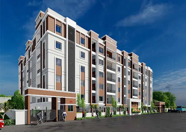
JBs PRISTINE CITY PHASE-3
JB WESTREN PROJECTS · Vikarabad · RERA P02100010790
JBs PRISTINE CITY PHASE-3 is a plotted development located in Kothagadi and Alampally, Vikarabad Mandal, Vikarabad District. The registered promoter is JB WESTREN PROJECTS. The project has a registered net land area of 187467.77 sq.m and comprises 683 residential plots, with drawing-derived plot areas ranging from 110.53 sq.m to 347.18 sq.m. It is registered with TG-RERA under P02100010790, and the promoter’s declared completion date is 07-02-2028.
More from Jb Westren Projects · 2 projects →
01What we found
Read from TG-RERA filings, approvals, land and registration records and court records. A court case is counted only when the court record states this project's survey number with its village, or names the project.
02Check before you pay
9 items to check before you pay, 3 high - from the title chain, court records and approvals, each with what to ask the builder or your advocate. An item may not be a problem with the project: records can be incomplete.
1. Project at a glance
Project identity
| Item | Record |
|---|---|
| Registered project name | JBs PRISTINE CITY PHASE-3 RERA record |
| Project type | Plotted development; the registration certificate identifies it as a plotted project RERA record |
| Phase / registered portion | Phase 3, as named in the TG-RERA certificate; the certificate lists the project land as a whole, not a separately identified subset |
| TG-RERA registration | P02100010790 RERA record |
| Registration validity | 07/02/2026 to 07/02/2028; this is the registration period, not the project-completion deadline RERA record |
| Registered promoter | JB WESTREN PROJECTS RERA record |
| RERA status in supplied record | Registered; certificate is Form C. No later extension is supplied Approvals record |
Land and geographic identity
| Item | Record |
|---|---|
| Locality | Vikarabad; the RERA certificate locates the project at Kothagadi, Vikarabad RERA record |
| Revenue villages | Kothagadi and Alampally |
| Mandal / district / PIN | Vikarabad / Vikarabad / 501102 RERA record |
| Project survey numbers as listed in the RERA certificate | 168/P, 169/P, 170, 171/P, 135/P |
| Layout-drawing survey schedule | The filed layout identifies these subdivisions: 135/2A, 135/3/1/1/1/2, 135/3/1/1/2, 135/3/2, 135/3/1/1/1/1/2, 135/3/1/2, 135/2E, 135/1, 135/3/1/1/1/1/1/1, 135/2AA1, 135/2EE2, 135/3/1/1/1/1/1/2; 171/I, 171/LU, 171/EE/2, 171/RUU, 171/YA/2, 171/YAA/1, 171/UU1, 171/E/2, 171/A2, 171/EE/1/1, 171/A1/1/2, 171AA/1/1/1, 171/RU, 171O, 171/U, 171/AA/2, 171AA/1/1/2, 171AA/1/2, 171/EE/1, 171/A1/1/1, 171/A3, 171/A4, 171/E/1/2, 171/YA/1, 171/UU; 170/2, 170/3, 170/4/1, 170/1, 170/5/2, 170/5/1, 170/4/2; 168/AA/1AA/2/1/1/2, 168/AA/2/1/1/2, 168/A/1AA/1/2, 168/AA/1AA/2/2, 168/AA/3/1/2, 168/AA/1AA/2/1/1/1/1, 168/AA/1AA/2/1/1/1/2, 168/AA/3/1/1, 168/A/2/1/1, 168/AA/1AA/1, 168/AA/3/2/2, 168/AA/2/2; 169/AA/2/1/1, 169/AA/2/2, 169/E2/2, 169/E1/1/2, 169/E, 169/AA/2/1/2; and 171, 169, 168, 167, 178, 177, 172, 176, 171AA/2, 171U. |
| Registered site extent | 187467.77 sq.m net area stated in the RERA land details RERA filing |
| Drawing area figures | Layout drawing records 188760.15 sq.m total site area, 1292.38 sq.m road-widening area, and 187467.77 sq.m net layout area |
| Boundaries | Not supplied Land records |
Development identity
| Item | Record |
|---|---|
| Sanctioning authority | Vikarabad Municipality approval for the tentative layout; the RERA filing also identifies DTCP Approvals record |
| Principal approval references | Tentative layout approval 0016/VIKA/SWDL/2026, dated 07/02/2026; application 011694/VIKA/00032/SWDL/2025. Layout drawing also carries LP NO 66/2019/H |
| Approved layout type / status stated in documents | Residential plotted layout; the municipality document calls its approval tentative. The drawing identifies a Draft Layout |
| Plots | 683 plots stated in the municipality approval and shown as Plot No. 1–683 in the drawing |
| Approved built-up area / buildings / floors | Not applicable to this plotted-layout record; no building count or building-floor configuration is supplied RERA filing |
| Mortgage area | 15972.78 sq.m in the RERA filing RERA filing |
Offering and status
| Item | Record |
|---|---|
| Offered product | Individual residential plots; the drawing’s plot schedule lists 683 plots |
| Plot-size information | Drawing-derived schedule: 683 plots with software-read areas ranging from 110.53 sq.m to 347.18 sq.m; the schedule and sizes should be checked against the drawing Layout record |
| Booked / available | No booked or available plot counts supplied RERA unit table |
| Construction / development stage | No independently verified site-progress information supplied. RERA amenity entries show 0% progress where a percentage is recorded RERA amenities |
| Completion dates | Form B promoter declaration states 07-02-2028 as the completion date; the RERA registration certificate is valid through 07/02/2028 |
| Occupancy / completion certificate | No project completion or occupancy certificate supplied. The development is a plotted layout; the municipality approval describes the layout as tentative |
2. The project story
- JBs PRISTINE CITY PHASE-3 is registered as a residential plotted development in Kothagadi and Alampally villages, Vikarabad Mandal and District. The RERA certificate names survey numbers 168/P, 169/P, 170, 171/P and 135/P; the filed drawing gives a more detailed survey-subdivision schedule in the identity table above.
- The drawing presents an open-plot layout with 683 numbered plots, internal roads, open-space areas, social infrastructure and utility land. The municipality’s approval document describes the layout approval as tentative and requires infrastructure and amenities to be completed; the supplied documents do not establish that those works are complete.
- The promoter’s Form B declares a completion date of 07-02-2028. That is a promoter undertaking, not independent confirmation of progress or delivery. The RERA record lists the project registration separately as valid from 07/02/2026 to 07/02/2028.
3. Master plan, architecture & building design
This is a plotted layout rather than a multi-storey building scheme. The filed layout records a total site area of 188760.15 sq.m, road-widening area of 1292.38 sq.m, and net layout area of 187467.77 sq.m.
The drawing’s land-use schedule allocates the net layout area as follows:
| Layout use | Area | Share shown on drawing |
|---|---|---|
| Plotted area | 105811.76 sq.m | 56.44 % |
| Road area | 57308.82 sq.m | 30.57 % |
| Open space | 17696.16 sq.m | 9.44 % |
| Social infrastructure | 4763.21 sq.m | 2.54 % |
| Utility area | 1887.74 sq.m | 1.01 % |
| Buffer area | 0.00 sq.m | 0 % |
| Common parking area | 0.00 sq.m | 0 % |
| Facilities area | 0.00 sq.m | 0 % |
| Amenities area | 0.00 sq.m | 0 % |
| Green belt area | 0.00 sq.m | 0 % |
| Future development area | 0.00 sq.m | 0 % |
- The drawing shows proposed road widths of 9.14 m, 12.19 m and 18.0 m, and identifies a proposed 24.0 m road. Its road-width schedule also contains existing/proposed road references; the drawing should be consulted for the placement and context of each road.
- The layout’s open-space components are individually labelled in the drawing as 7820.75 sq.m, 6381.39 sq.m, 2367.55 sq.m, 973.93 sq.m and 152.54 sq.m. A public utility area of 207.94 sq.m is also labelled. The drawing includes plot-number and individual plot-area schedules; its software-read plot count and size extraction should be verified against the plan. Layout record
- The municipality approval describes a residential layout with 683 plots and includes infrastructure requirements such as internal water supply, drainage, roads, parks, and utilities. No building footprints, floor plans, dwelling-unit configurations or apartment areas are supplied.
4. Homes, configurations & floor plans
- The offering evidenced here is plots, not apartments or villas. The drawing schedule identifies 683 plots, numbered 1–683. Software-measured plot areas range from 110.53 sq.m (132.2 sq.yd) to 347.18 sq.m (415.2 sq.yd), with a median of 153.29 sq.m (183.3 sq.yd). These are drawing-derived measurements, not RERA-filed apartment saleable or carpet areas. Layout record
| Plot-size band (sq.yd) | Plot-size band (sq.m) | Plots |
|---|---|---|
| 100–150 | 84–125 | 6 |
| 150–200 | 125–167 | 570 |
| 200–250 | 167–209 | 63 |
| 250–300 | 209–251 | 37 |
| 300–400 | 251–334 | 6 |
| 400–500 | 334–418 | 1 |
Layout record
- The drawing’s most common printed plot areas are 137.96 sq.m (272 plots), 153.29 sq.m (262 plots), 199.28 sq.m (23 plots), 183.95 sq.m (22 plots), and 229.93 sq.m (21 plots). Layout record
- No booked/available inventory counts, plot-wise sale status, or unit-specific sale agreements are supplied. The sample allotment letter leaves the plot number and booking/payment particulars unfilled. RERA unit table
5. Parking & vehicle circulation
- The layout drawing records 0.00 sq.m as common parking area; no sanctioned parking-space count, visitor parking, accessible parking, EV charging provision, or plot-specific parking allocation is supplied.
- The drawing identifies internal roads and road widths, including proposed road widths of 9.14 m, 12.19 m and 18.0 m and a proposed 24.0 m road. The municipality approval requires roads to remain open for access to neighbouring sites. No separate pedestrian/vehicle circulation plan, entry/exit arrangement or parking-allocation document is supplied.
6. Amenities, recreation & open spaces
The RERA amenity schedule records a set of proposed layout-level works and shows 0% progress where progress percentages are provided. The municipality approval also lists development works and facilities to be completed; those requirements do not establish completion.
| Description / size | Drawing records open space of 17696.16 sq.m overall; individual open-space labels include 7820.75 sq.m, 6381.39 sq.m, 2367.55 sq.m, 973.93 sq.m and 152.54 sq.m |
|---|---|
| Evidence source | RERA amenities |
| Declared progress / verified status | RERA schedule marks availability “YES” and progress 0%; completion not independently verified |
| Description / size | Social infrastructure area 4763.21 sq.m in the layout schedule |
|---|---|
| Evidence source | RERA amenities |
| Declared progress / verified status | RERA schedule marks availability “YES” and progress 0%; facility details and completion not supplied |
| Description / size | Road area 57308.82 sq.m in the layout schedule |
|---|---|
| Evidence source | RERA amenities |
| Declared progress / verified status | RERA schedule marks availability “YES” and progress 0% |
| Description / size | Listed in vendor-supplied marketing material; no size or capacity supplied |
|---|---|
| Evidence source | Promoter website |
| Declared progress / verified status | Marketing claims only; not established as sanctioned, RERA-declared or completed |
| Description / size | Required/listed in the municipality approval; also described in vendor marketing |
|---|---|
| Evidence source | Promoter website |
| Declared progress / verified status | Completion not independently verified |
7. Utilities, building services & safety
- The municipality approval describes layout infrastructure to be provided, including internal water-supply pipelines, an overhead tank or sump and an assured water source; underground drainage and a common septic tank/STP; storm-water drains; electrical supply lines, street lights and a transformer; solid-waste management; and rainwater-harvesting pits. These are stated development requirements, not evidence that the systems have been installed or commissioned.
- The RERA amenity schedule lists water supply, sewerage, storm-water drains, sewage treatment/disposal, solid-waste management, rainwater harvesting, energy management, street lighting and an electrical meter room/sub-station/receiving station. Progress is recorded as 0% where percentages appear; no capacity, operational status or independent inspection results are supplied. RERA amenities
- The layout drawing also labels STP, transformer, garbage house, rainwater-harvesting/percolation pits, sewage-transfer arrangements and water supply for landscaping. The municipality approval requires a water reservoir, STP or septic tank as applicable, overhead tank, street lighting, avenue planting and harvesting pits.
- No project-specific capacities, commissioning certificates, fire-safety approval, security/CCTV details, accessibility design or completed utility-service records are supplied.
8. Location, access & connectivity
- The registered location is Kothagadi and Alampally villages, Vikarabad Mandal, Vikarabad District, Telangana, PIN 501102. The supplied geocode identifies a point at TSWREIS Junior College, Kothagadi, Temple Road, Narayanpur, Vikarabad Mandal, with coordinates 17.3689895, 77.9027548. Location record
- The supplied location data identifies the nearest sampled Outer Ring Road interchange at approximately 41.9 km. Location record
- Vendor material claims proximity to Vikarabad Railway Station and Vikarabad town and refers to the Regional Ring Road, an expressway and Hyderabad-area destinations. These are vendor claims, not independently measured connectivity findings in the supplied location record. Promoter website
9. Developer & development status
- The TG-RERA-registered promoter is JB WESTREN PROJECTS, identified in the filing as a partnership. The RERA certificate gives the promoter’s location as Vikarabad, Vikarabad District, PIN 501101; the project header lists a promoter address at Plot No. 91, Kamala Nagar, Vikarabad, with project locality Kothagadi. No official telephone, email or website is supplied. Corporate record RERA filing
- The filed Form B affidavit is made by SUSKANDLA ANIL KUMAR as authorised signatory and declares a completion date of 07-02-2028. The RERA registration certificate covers 07/02/2026–07/02/2028; no extension order, booked/available inventory statement, or independently verified site-progress report is supplied. RERA unit table
- The project’s RERA amenity schedule shows 0% progress where progress figures are recorded. That is the filed status; no independent site inspection or completion evidence is provided. RERA amenities
10. Approvals, official records & documents
| Record | Supplied evidence |
|---|---|
| TG-RERA registration | Form C certificate for JBs PRISTINE CITY PHASE-3, registration P02100010790; validity 07/02/2026–07/02/2028 |
| Tentative layout approval | Vikarabad Municipality document 0016/VIKA/SWDL/2026, dated 07/02/2026, for a residential plotted layout; the approval identifies 683 plots and calls itself tentative |
| Layout drawing | File reference 011694/VIKA/00032/SWDL/2025; drawing reference LP NO 66/2019/H; layout schedule and land-use figures are shown on page 1 |
| Mortgage record | Mortgage deed 769/2026, dated 06/02/2026, is identified in the municipality approval; the supplied RERA filing records a mortgage area of 15972.78 sq.m RERA filing |
| Promoter declaration | Form B affidavit dated 09-06-2025, including the promoter’s completion undertaking and declarations |
| Commencement / completion / occupancy certificates | No separate commencement, completion or occupancy certificate for the layout’s development works is supplied Document index |
| Sales documents | Sample allotment letter and agreement-for-sale template are present, but the sample plot and transaction particulars are blank |
1. Project at a glance
Project identity
Registered project name: JBs PRISTINE CITY PHASE-3
Project type: Plotted development; the registration certificate identifies it as a plotted project
Phase / registered portion: Phase 3, as named in the TG-RERA certificate; the certificate lists the project land as a whole, not a separately identified subset
TG-RERA registration: P02100010790
Registration validity: 07/02/2026 to 07/02/2028; this is the registration period, not the project-completion deadline
Registered promoter: JB WESTREN PROJECTS
RERA status in supplied record: Registered; certificate is Form C. No later extension is supplied
Land and geographic identity
Locality: Vikarabad; the RERA certificate locates the project at Kothagadi, Vikarabad
Revenue villages: Kothagadi and Alampally
Mandal / district / PIN: Vikarabad / Vikarabad / 501102
Project survey numbers as listed in the RERA certificate: 168/P, 169/P, 170, 171/P, 135/P
Layout-drawing survey schedule: The filed layout identifies these subdivisions: 135/2A, 135/3/1/1/1/2, 135/3/1/1/2, 135/3/2, 135/3/1/1/1/1/2, 135/3/1/2, 135/2E, 135/1, 135/3/1/1/1/1/1/1, 135/2AA1, 135/2EE2, 135/3/1/1/1/1/1/2; 171/I, 171/LU, 171/EE/2, 171/RUU, 171/YA/2, 171/YAA/1, 171/UU1, 171/E/2, 171/A2, 171/EE/1/1, 171/A1/1/2, 171AA/1/1/1, 171/RU, 171O, 171/U, 171/AA/2, 171AA/1/1/2, 171AA/1/2, 171/EE/1, 171/A1/1/1, 171/A3, 171/A4, 171/E/1/2, 171/YA/1, 171/UU; 170/2, 170/3, 170/4/1, 170/1, 170/5/2, 170/5/1, 170/4/2; 168/AA/1AA/2/1/1/2, 168/AA/2/1/1/2, 168/A/1AA/1/2, 168/AA/1AA/2/2, 168/AA/3/1/2, 168/AA/1AA/2/1/1/1/1, 168/AA/1AA/2/1/1/1/2, 168/AA/3/1/1, 168/A/2/1/1, 168/AA/1AA/1, 168/AA/3/2/2, 168/AA/2/2; 169/AA/2/1/1, 169/AA/2/2, 169/E2/2, 169/E1/1/2, 169/E, 169/AA/2/1/2; and 171, 169, 168, 167, 178, 177, 172, 176, 171AA/2, 171U.
Registered site extent: 187467.77 sq.m net area stated in the RERA land details
Drawing area figures: Layout drawing records 188760.15 sq.m total site area, 1292.38 sq.m road-widening area, and 187467.77 sq.m net layout area
Boundaries: Not supplied
Development identity
Sanctioning authority: Vikarabad Municipality approval for the tentative layout; the RERA filing also identifies DTCP
Principal approval references: Tentative layout approval 0016/VIKA/SWDL/2026, dated 07/02/2026; application 011694/VIKA/00032/SWDL/2025. Layout drawing also carries LP NO 66/2019/H
Approved layout type / status stated in documents: Residential plotted layout; the municipality document calls its approval tentative. The drawing identifies a Draft Layout
Plots: 683 plots stated in the municipality approval and shown as Plot No. 1–683 in the drawing
Approved built-up area / buildings / floors: Not applicable to this plotted-layout record; no building count or building-floor configuration is supplied
Mortgage area: 15972.78 sq.m in the RERA filing
Offering and status
Offered product: Individual residential plots; the drawing’s plot schedule lists 683 plots
Plot-size information: Drawing-derived schedule: 683 plots with software-read areas ranging from 110.53 sq.m to 347.18 sq.m; the schedule and sizes should be checked against the drawing
Booked / available: No booked or available plot counts supplied
Construction / development stage: No independently verified site-progress information supplied. RERA amenity entries show 0% progress where a percentage is recorded
Completion dates: Form B promoter declaration states 07-02-2028 as the completion date; the RERA registration certificate is valid through 07/02/2028
Occupancy / completion certificate: No project completion or occupancy certificate supplied. The development is a plotted layout; the municipality approval describes the layout as tentative
2. The project story
- JBs PRISTINE CITY PHASE-3 is registered as a residential plotted development in Kothagadi and Alampally villages, Vikarabad Mandal and District. The RERA certificate names survey numbers 168/P, 169/P, 170, 171/P and 135/P; the filed drawing gives a more detailed survey-subdivision schedule in the identity table above.
- The drawing presents an open-plot layout with 683 numbered plots, internal roads, open-space areas, social infrastructure and utility land. The municipality’s approval document describes the layout approval as tentative and requires infrastructure and amenities to be completed; the supplied documents do not establish that those works are complete.
- The promoter’s Form B declares a completion date of 07-02-2028. That is a promoter undertaking, not independent confirmation of progress or delivery. The RERA record lists the project registration separately as valid from 07/02/2026 to 07/02/2028.
3. Master plan, architecture & building design
This is a plotted layout rather than a multi-storey building scheme. The filed layout records a total site area of 188760.15 sq.m, road-widening area of 1292.38 sq.m, and net layout area of 187467.77 sq.m.
The drawing’s land-use schedule allocates the net layout area as follows:
| Layout use | Area | Share shown on drawing |
|---|---|---|
| Plotted area | 105811.76 sq.m | 56.44 % |
| Road area | 57308.82 sq.m | 30.57 % |
| Open space | 17696.16 sq.m | 9.44 % |
| Social infrastructure | 4763.21 sq.m | 2.54 % |
| Utility area | 1887.74 sq.m | 1.01 % |
| Buffer area | 0.00 sq.m | 0 % |
| Common parking area | 0.00 sq.m | 0 % |
| Facilities area | 0.00 sq.m | 0 % |
| Amenities area | 0.00 sq.m | 0 % |
| Green belt area | 0.00 sq.m | 0 % |
| Future development area | 0.00 sq.m | 0 % |
- The drawing shows proposed road widths of 9.14 m, 12.19 m and 18.0 m, and identifies a proposed 24.0 m road. Its road-width schedule also contains existing/proposed road references; the drawing should be consulted for the placement and context of each road.
- The layout’s open-space components are individually labelled in the drawing as 7820.75 sq.m, 6381.39 sq.m, 2367.55 sq.m, 973.93 sq.m and 152.54 sq.m. A public utility area of 207.94 sq.m is also labelled. The drawing includes plot-number and individual plot-area schedules; its software-read plot count and size extraction should be verified against the plan.
- The municipality approval describes a residential layout with 683 plots and includes infrastructure requirements such as internal water supply, drainage, roads, parks, and utilities. No building footprints, floor plans, dwelling-unit configurations or apartment areas are supplied.
4. Homes, configurations & floor plans
- The offering evidenced here is plots, not apartments or villas. The drawing schedule identifies 683 plots, numbered 1–683. Software-measured plot areas range from 110.53 sq.m (132.2 sq.yd) to 347.18 sq.m (415.2 sq.yd), with a median of 153.29 sq.m (183.3 sq.yd). These are drawing-derived measurements, not RERA-filed apartment saleable or carpet areas.
| Plot-size band (sq.yd) | Plot-size band (sq.m) | Plots |
|---|---|---|
| 100–150 | 84–125 | 6 |
| 150–200 | 125–167 | 570 |
| 200–250 | 167–209 | 63 |
| 250–300 | 209–251 | 37 |
| 300–400 | 251–334 | 6 |
| 400–500 | 334–418 | 1 |
- The drawing’s most common printed plot areas are 137.96 sq.m (272 plots), 153.29 sq.m (262 plots), 199.28 sq.m (23 plots), 183.95 sq.m (22 plots), and 229.93 sq.m (21 plots).
- No booked/available inventory counts, plot-wise sale status, or unit-specific sale agreements are supplied. The sample allotment letter leaves the plot number and booking/payment particulars unfilled.
5. Parking & vehicle circulation
- The layout drawing records 0.00 sq.m as common parking area; no sanctioned parking-space count, visitor parking, accessible parking, EV charging provision, or plot-specific parking allocation is supplied.
- The drawing identifies internal roads and road widths, including proposed road widths of 9.14 m, 12.19 m and 18.0 m and a proposed 24.0 m road. The municipality approval requires roads to remain open for access to neighbouring sites. No separate pedestrian/vehicle circulation plan, entry/exit arrangement or parking-allocation document is supplied.
6. Amenities, recreation & open spaces
The RERA amenity schedule records a set of proposed layout-level works and shows 0% progress where progress percentages are provided. The municipality approval also lists development works and facilities to be completed; those requirements do not establish completion.
| Description / size | Drawing records open space of 17696.16 sq.m overall; individual open-space labels include 7820.75 sq.m, 6381.39 sq.m, 2367.55 sq.m, 973.93 sq.m and 152.54 sq.m |
|---|---|
| Declared progress / verified status | RERA schedule marks availability “YES” and progress 0%; completion not independently verified |
| Description / size | Social infrastructure area 4763.21 sq.m in the layout schedule |
|---|---|
| Declared progress / verified status | RERA schedule marks availability “YES” and progress 0%; facility details and completion not supplied |
| Description / size | Road area 57308.82 sq.m in the layout schedule |
|---|---|
| Declared progress / verified status | RERA schedule marks availability “YES” and progress 0% |
| Description / size | Listed in vendor-supplied marketing material; no size or capacity supplied |
|---|---|
| Declared progress / verified status | Marketing claims only; not established as sanctioned, RERA-declared or completed |
| Description / size | Required/listed in the municipality approval; also described in vendor marketing |
|---|---|
| Declared progress / verified status | Completion not independently verified |
7. Utilities, building services & safety
- The municipality approval describes layout infrastructure to be provided, including internal water-supply pipelines, an overhead tank or sump and an assured water source; underground drainage and a common septic tank/STP; storm-water drains; electrical supply lines, street lights and a transformer; solid-waste management; and rainwater-harvesting pits. These are stated development requirements, not evidence that the systems have been installed or commissioned.
- The RERA amenity schedule lists water supply, sewerage, storm-water drains, sewage treatment/disposal, solid-waste management, rainwater harvesting, energy management, street lighting and an electrical meter room/sub-station/receiving station. Progress is recorded as 0% where percentages appear; no capacity, operational status or independent inspection results are supplied.
- The layout drawing also labels STP, transformer, garbage house, rainwater-harvesting/percolation pits, sewage-transfer arrangements and water supply for landscaping. The municipality approval requires a water reservoir, STP or septic tank as applicable, overhead tank, street lighting, avenue planting and harvesting pits.
- No project-specific capacities, commissioning certificates, fire-safety approval, security/CCTV details, accessibility design or completed utility-service records are supplied.
8. Location, access & connectivity
- The registered location is Kothagadi and Alampally villages, Vikarabad Mandal, Vikarabad District, Telangana, PIN 501102. The supplied geocode identifies a point at TSWREIS Junior College, Kothagadi, Temple Road, Narayanpur, Vikarabad Mandal, with coordinates 17.3689895, 77.9027548.
- The supplied location data identifies the nearest sampled Outer Ring Road interchange at approximately 41.9 km.
- Vendor material claims proximity to Vikarabad Railway Station and Vikarabad town and refers to the Regional Ring Road, an expressway and Hyderabad-area destinations. These are vendor claims, not independently measured connectivity findings in the supplied location record.
9. Developer & development status
- The TG-RERA-registered promoter is JB WESTREN PROJECTS, identified in the filing as a partnership. The RERA certificate gives the promoter’s location as Vikarabad, Vikarabad District, PIN 501101; the project header lists a promoter address at Plot No. 91, Kamala Nagar, Vikarabad, with project locality Kothagadi. No official telephone, email or website is supplied.
- The filed Form B affidavit is made by SUSKANDLA ANIL KUMAR as authorised signatory and declares a completion date of 07-02-2028. The RERA registration certificate covers 07/02/2026–07/02/2028; no extension order, booked/available inventory statement, or independently verified site-progress report is supplied.
- The project’s RERA amenity schedule shows 0% progress where progress figures are recorded. That is the filed status; no independent site inspection or completion evidence is provided.
10. Approvals, official records & documents
TG-RERA registration: Form C certificate for JBs PRISTINE CITY PHASE-3, registration P02100010790; validity 07/02/2026–07/02/2028
Tentative layout approval: Vikarabad Municipality document 0016/VIKA/SWDL/2026, dated 07/02/2026, for a residential plotted layout; the approval identifies 683 plots and calls itself tentative
Layout drawing: File reference 011694/VIKA/00032/SWDL/2025; drawing reference LP NO 66/2019/H; layout schedule and land-use figures are shown on page 1
Mortgage record: Mortgage deed 769/2026, dated 06/02/2026, is identified in the municipality approval; the supplied RERA filing records a mortgage area of 15972.78 sq.m
Promoter declaration: Form B affidavit dated 09-06-2025, including the promoter’s completion undertaking and declarations
Commencement / completion / occupancy certificates: No separate commencement, completion or occupancy certificate for the layout’s development works is supplied
Sales documents: Sample allotment letter and agreement-for-sale template are present, but the sample plot and transaction particulars are blank
Other registrations of JBs PRISTINE CITY
Frequently asked questions
Is JBs PRISTINE CITY PHASE-3 registered with Telangana RERA?
Yes. JBs PRISTINE CITY PHASE-3 is registered with the Telangana Real Estate Regulatory Authority as P02100010790; the registration status is New Project.
Who is the developer of JBs PRISTINE CITY PHASE-3?
The promoter named in the RERA registration is JB WESTREN PROJECTS.
Where is JBs PRISTINE CITY PHASE-3 located?
JBs PRISTINE CITY PHASE-3 is in VIKARABAD, Kothagadi, Telangana (501102).
When will JBs PRISTINE CITY PHASE-3 be completed?
The promoter's proposed date of completion filed with RERA is 07/06/2028. This is the promoter's declaration, not a guarantee.
More projects in Vikarabad