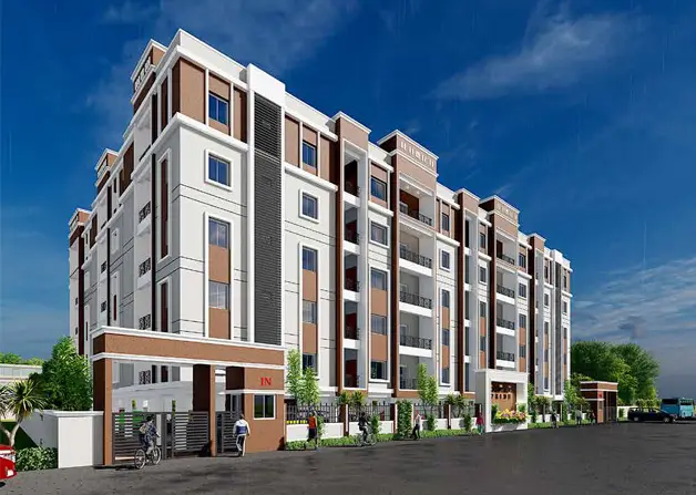
Bharathi Enclave
ARDHA SUDHAKAR REDDY AND OTHERS · Vikarabad · RERA P02100011061
BHARATHI ENCLAVE is a plotted development in Gangaram, Vikarabad mandal, Vikarabad district, developed by the registered promoter ARDHA SUDHAKAR REDDY AND OTHERS. The layout has a total and net area of 34397.50 sq.m and shows 132 plots, with sizes from 100.88 sq.m to 243.87 sq.m. The project is registered under TG-RERA number P02100011061, and the promoter’s Form B undertaking gives a completion date of 13th March, 2028.
01What we found
Read from TG-RERA filings, approvals, land and registration records and court records. A court case is counted only when the court record states this project's survey number with its village, or names the project.
02Check before you pay
8 items to check before you pay, 3 high - from the title chain, court records and approvals, each with what to ask the builder or your advocate. An item may not be a problem with the project: records can be incomplete.
Project at a glance
Project identity
| Item | Project record |
|---|---|
| Registered name | BHARATHI ENCLAVE RERA record |
| Project type | Plotted development / proposed residential open-plot layout RERA record |
| Phase or registered portion | No separate phase designation is stated; TG-RERA registration is for the project on the listed site and surveys. |
| TG-RERA registration | P02100011061 |
| Registration validity | 13/03/2026 to 13/03/2028; this is the registration-validity period, not the completion deadline. |
| Registered promoter | ARDHA SUDHAKAR REDDY AND OTHERS RERA record |
| RERA status in supplied record | Registered; certificate states a two-year validity period, subject to extension by the Authority under the Act and rules. |
Land and geographic identity
| Item | Project record |
|---|---|
| Locality / revenue village | Gangaram; the approval and RERA certificate identify Gangaram village. RERA record |
| Mandal / district / PIN | Vikarabad mandal, Vikarabad district; PIN 501101. RERA record |
| Project survey numbers | 64/E, 64/A2, 64/A1, 64/E, 64/A, 64/A1 and 64/AA as stated in the layout instrument. |
| RERA certificate survey numbers | 64/E, 64/A2, 64/A1, 64/A, 64/AA. |
| Subdivisions | The project filing does not specify further subdivisions beyond the survey-number notation above. |
| Registered layout area | 34397.50 sq.m total and net layout area, as shown in the layout plan. |
| Boundaries | North: existing 60 feet road; South: land in Sy. Nos. 58 and 65; East: land in Sy. No. 63; West: land in Sy. Nos. 70 and 71. RERA filing |
Development identity
| Item | Project record |
|---|---|
| Sanctioning authority | DTCP layout plan, delegated to Vikarabad Municipality; the tentative layout approval names Vikarabad Municipality as authority. Approvals record |
| Principal layout approval | 0018/VIKA/SWDL/2026, dated 13/03/2026. Approvals record |
| Application / file number | 005139/VIKA/00012/SWDL/2025. Approvals record |
| Development form | Tentative residential open-plot layout; plots numbered 1 through 132. |
| Approved built-up area | Not disclosed for this plotted-layout offering. RERA filing |
| Tower/block count and floor configuration | Not applicable to the described plotted layout; no building floor configuration is stated in the supplied project record. |
| RERA-declared plot count | The supplied registration certificate extract does not state a unit count; the layout plan records 132 plots. |
| Parking | The layout land-use statement records Common Parking Area: 0.00 sq.m (0%). No individual plot parking allocation or parking-space count is provided. |
Offering and status
| Item | Project record |
|---|---|
| Offering | Open plots in a proposed residential layout; the plan shows 132 numbered plots. |
| Plot sizes / counts by size | Software-read plot schedule: 132 plots, with sizes from 100.88 sq.m to 243.87 sq.m; median 139.35 sq.m. The schedule extraction should be checked against the drawing. Layout record |
| Construction stage | No project-site construction progress percentage or independently verified site stage is supplied. The layout approval is described as tentative. |
| Completion dates | Promoter Form B undertakes completion by 13th March, 2028. The layout approval separately requires infrastructure and amenities to be completed within two years from the tentative layout plan date. |
| Occupancy / completion certificate | No occupancy or completion certificate is supplied for this plotted layout. The approval states that an occupancy certificate is required before occupation of any building. |
The project story
BHARATHI ENCLAVE is registered as a plotted-development project in Gangaram village, Vikarabad mandal and district. Its approved layout material describes a residential open-plot scheme, with plots numbered 1 through 132 and land reserved for roads, open space, social infrastructure and utilities. RERA record
The layout plan identifies a total and net layout area of 34397.50 sq.m. Its land-use schedule allocates 18085.09 sq.m to plots, 12002.24 sq.m to roads, 3102.67 sq.m to open space, 860.85 sq.m to social infrastructure and 346.74 sq.m to utilities. These are layout-plan figures, not measurements of completed works.
The Municipality’s document is titled an approval for a tentative layout plan and says the applicant is responsible for developing the layout; it also sets a two-year period for completing infrastructure and amenities. The supplied records do not establish the present physical completion of roads, utilities, parks or other works. No occupancy or completion certificate is included.
Master plan, architecture & building design
The project is a plotted layout rather than a documented apartment or villa building scheme. The layout drawing shows 132 plots, numbered 1 through 132, within a stated total and net layout area of 34397.50 sq.m. It gives road widths of 18.29m, 9.14m, 9.15m, 11.73m and 10.38m. The plan’s sanctioned parameters also state an existing and proposed road width of 18.29m.
The layout plan’s land-use schedule is:
| Layout use | Area | Share shown on plan |
|---|---|---|
| Plotted area | 18085.09 sq.m | 52.58 % |
| Road area | 12002.24 sq.m | 34.89 % |
| Open space area | 3102.67 sq.m | 9.02 % |
| Social infrastructure area | 860.85 sq.m | 2.50 % |
| Utility area | 346.74 sq.m | 1.01 % |
| Buffer area | 0.00 sq.m | 0 % |
| Common parking area | 0.00 sq.m | 0 % |
| Facilities area | 0.00 sq.m | 0 % |
| Green belt area | 0.00 sq.m | 0 % |
The layout sheet separately identifies open-space components of 2719.26 sq.m and 383.41 sq.m. It shows a proposed mortgage area of 3014.87 sq.m (16.67 %) and states a required mortgage area of 2712.76 (15.00 %).
No building footprints, building heights, floor plans, apartment layouts or building-level phase arrangement are established by the supplied drawings. The layout approval calls for internal roads, open spaces and utility provisions; it does not demonstrate that these works have been completed.
Homes, configurations & floor plans
This project is presented in the RERA filing as a plotted layout, not as an apartment or villa offering. The supplied layout drawing records 132 plots; no RERA-filed plot-by-plot schedule with individual plot sizes or booking/availability counts is included in the registration-certificate extract.
| Configuration | Units | Booked | Available | RERA saleable area | Measured carpet area | Loading (if supplied) |
|---|---|---|---|---|---|---|
| Plots | 132 shown in the layout plan | Not disclosed | Not disclosed | Not stated | Not applicable | Not supplied |
The separate software-read schedule reports 132 plots, with areas from 100.88 sq.m to 243.87 sq.m and a median of 139.35 sq.m; these are drawing-derived readings, not RERA-filed saleable-area figures, and should be verified against the layout drawing. Layout record The supplied floor-plan data reports two layout sheets and no apartment floor plans to measure. Floor plans
Parking & vehicle circulation
The layout land-use statement records Common Parking Area: 0.00 sq.m (0%). No number of parking bays, visitor or accessible spaces, parking allocation by plot, or legally documented exclusive parking rights is supplied.
The layout drawing shows internal roads with widths of 18.29m, 9.14m, 9.15m, 11.73m and 10.38m. The tentative approval requires roads to remain open for access to neighbouring sites and says the layout owner/developer is not to construct a compound wall or fencing around the site. These are approval terms, not confirmation that the roads are complete.
Amenities, recreation & open spaces
The layout approval and plan identify the following facilities or reserved areas. The record does not establish that they have been completed or independently inspected.
| Facility | Description / size | Evidence source | Declared progress / verified status |
|---|---|---|---|
| Open space / park | 3102.67 sq.m total; plan separately labels 2719.26 sq.m and 383.41 sq.m open-space components | Shown/reserved on plan; completion not verified | |
| Tot-lot | Identified as a layout provision; no size supplied | Approval condition requires fencing and maintenance as greenery; completion not verified | |
| Social infrastructure | 860.85 sq.m | Reserved on plan; facility or completion details not supplied | |
| Public utility / utility area | 346.74 sq.m | Reserved on plan; completion not verified | |
| Avenue/peripheral planting and greenery | Tree plantation and peripheral greenery required by approval; no area or quantity supplied | Required by approval; completion not verified |
No clubhouse, gym, swimming pool or other indoor amenity is established by the project’s supplied layout-plan records.
Utilities, building services & safety
The tentative layout approval lists proposed infrastructure including a water reservoir, overhead tank, sump, internal water-supply pipelines, septic tank, sewerage treatment plant, underground drainage lines, storm-water drains, street lights, electric transformer, solid-waste management, rainwater-harvesting pits and park development. It requires the applicant to complete layout infrastructure and amenities within two years from the tentative layout-plan date. These are approval-document provisions; the supplied evidence does not verify installation, capacity or operational status.
The layout-plan conditions also call for a rainwater-harvesting structure/percolation pit, transformer space and a garbage house. The plan does not provide capacities or a completion status for these items.
The approval states that an occupancy certificate is required before occupying any building and includes conditions relating to fire-safety provisions and an occupancy fire NOC before issuance of an occupancy certificate. These conditions do not establish that a fire clearance or occupancy certificate has been issued for the project.
Location, access & connectivity
The registered location is Gangaram, Vikarabad mandal, Vikarabad district, Telangana, PIN 501101. The project boundary description identifies an existing 60 feet road on the north, land in Survey Nos. 58 and 65 to the south, Survey No. 63 to the east, and Survey Nos. 70 and 71 to the west. RERA record RERA filing
A supplied location record gives the nearest sampled Outer Ring Road interchange at approximately 44.8 km; this is a measured location-data estimate, not a travel-time claim. Location record
Developer & development status
The registered promoter is ARDHA SUDHAKAR REDDY AND OTHERS. The registration certificate identifies that name as the promoter; the supplied evidence does not establish a specific legal-entity type or provide a registered office address and official contact details. Corporate record
The layout plan names six landowners: Sri Ardha Sudhakar Reddy, Sri Vishwanatham Vijay Kumar, Sri Vishwanatham Raghavender, Sri Soma Narsimulu, Sri Nadirige Chandrashekar Reddy and Sri K Ravinder Reddy. The RERA filing describes the organization type as “Others” and the arrangement as “Joint Development.” RERA filing
The promoter’s Form B declaration, dated 20th April, 2026, undertakes project completion by 13th March, 2028. The supplied material provides no independent construction-progress verification. The RERA certificate is valid through 13/03/2028; that registration period and the promoter’s completion undertaking are separate records.
Approvals, official records & documents
| Identifier / date | P02100011061; valid 13/03/2026–13/03/2028 |
|---|---|
| What it establishes | Registration of BHARATHI ENCLAVE and the registered promoter and site details. |
| Identifier / date | 0018/VIKA/SWDL/2026; 13/03/2026; Vikarabad Municipality |
|---|---|
| What it establishes | Tentative residential layout approval for the listed survey numbers, showing 132 plots and reserved land-use areas. |
| Identifier / date | File 005139/VIKA/00012/SWDL/2025; approval date 13/03/2026 |
|---|---|
| What it establishes | Plan identifies the layout, survey numbers, 132 plots, roads, open space, social infrastructure and utilities. |
| Identifier / date | Mortgage Deed No. 1350/2026, dated 04/03/2026 |
|---|---|
| What it establishes | The tentative-layout record refers to a mortgage of a plot in the proposed layout in favour of the Municipality/Municipal Corporation. |
| Identifier / date | 20th April, 2026 |
|---|---|
| What it establishes | Promoter declaration on title basis, encumbrance status, separate-account obligations and completion undertaking. |
| Identifier / date | Not supplied as an issued project certificate |
|---|---|
| What it establishes | The approval document contains requirements concerning commencement notice, completion notice and occupancy certificate; no issued certificate is established here. |
The supplied records identify an approved layout and a TG-RERA registration. They do not provide a project completion or occupancy certificate, verified site-progress report, or confirmed completion status for the listed infrastructure.
Project at a glance
Project identity
Registered name: BHARATHI ENCLAVE
Project type: Plotted development / proposed residential open-plot layout
Phase or registered portion: No separate phase designation is stated; TG-RERA registration is for the project on the listed site and surveys.
TG-RERA registration: P02100011061
Registration validity: 13/03/2026 to 13/03/2028; this is the registration-validity period, not the completion deadline.
Registered promoter: ARDHA SUDHAKAR REDDY AND OTHERS
RERA status in supplied record: Registered; certificate states a two-year validity period, subject to extension by the Authority under the Act and rules.
Land and geographic identity
Locality / revenue village: Gangaram; the approval and RERA certificate identify Gangaram village.
Mandal / district / PIN: Vikarabad mandal, Vikarabad district; PIN 501101.
Project survey numbers: 64/E, 64/A2, 64/A1, 64/E, 64/A, 64/A1 and 64/AA as stated in the layout instrument.
RERA certificate survey numbers: 64/E, 64/A2, 64/A1, 64/A, 64/AA.
Subdivisions: The project filing does not specify further subdivisions beyond the survey-number notation above.
Registered layout area: 34397.50 sq.m total and net layout area, as shown in the layout plan.
Boundaries: North: existing 60 feet road; South: land in Sy. Nos. 58 and 65; East: land in Sy. No. 63; West: land in Sy. Nos. 70 and 71.
Development identity
Sanctioning authority: DTCP layout plan, delegated to Vikarabad Municipality; the tentative layout approval names Vikarabad Municipality as authority.
Principal layout approval: 0018/VIKA/SWDL/2026, dated 13/03/2026.
Application / file number: 005139/VIKA/00012/SWDL/2025.
Development form: Tentative residential open-plot layout; plots numbered 1 through 132.
Approved built-up area: Not disclosed for this plotted-layout offering.
Tower/block count and floor configuration: Not applicable to the described plotted layout; no building floor configuration is stated in the supplied project record.
RERA-declared plot count: The supplied registration certificate extract does not state a unit count; the layout plan records 132 plots.
Parking: The layout land-use statement records Common Parking Area: 0.00 sq.m (0%). No individual plot parking allocation or parking-space count is provided.
Offering and status
Offering: Open plots in a proposed residential layout; the plan shows 132 numbered plots.
Plot sizes / counts by size: Software-read plot schedule: 132 plots, with sizes from 100.88 sq.m to 243.87 sq.m; median 139.35 sq.m. The schedule extraction should be checked against the drawing.
Construction stage: No project-site construction progress percentage or independently verified site stage is supplied. The layout approval is described as tentative.
Completion dates: Promoter Form B undertakes completion by 13th March, 2028. The layout approval separately requires infrastructure and amenities to be completed within two years from the tentative layout plan date.
Occupancy / completion certificate: No occupancy or completion certificate is supplied for this plotted layout. The approval states that an occupancy certificate is required before occupation of any building.
The project story
BHARATHI ENCLAVE is registered as a plotted-development project in Gangaram village, Vikarabad mandal and district. Its approved layout material describes a residential open-plot scheme, with plots numbered 1 through 132 and land reserved for roads, open space, social infrastructure and utilities.
The layout plan identifies a total and net layout area of 34397.50 sq.m. Its land-use schedule allocates 18085.09 sq.m to plots, 12002.24 sq.m to roads, 3102.67 sq.m to open space, 860.85 sq.m to social infrastructure and 346.74 sq.m to utilities. These are layout-plan figures, not measurements of completed works.
The Municipality’s document is titled an approval for a tentative layout plan and says the applicant is responsible for developing the layout; it also sets a two-year period for completing infrastructure and amenities. The supplied records do not establish the present physical completion of roads, utilities, parks or other works. No occupancy or completion certificate is included.
Master plan, architecture & building design
The project is a plotted layout rather than a documented apartment or villa building scheme. The layout drawing shows 132 plots, numbered 1 through 132, within a stated total and net layout area of 34397.50 sq.m. It gives road widths of 18.29m, 9.14m, 9.15m, 11.73m and 10.38m. The plan’s sanctioned parameters also state an existing and proposed road width of 18.29m.
The layout plan’s land-use schedule is:
| Layout use | Area | Share shown on plan |
|---|---|---|
| Plotted area | 18085.09 sq.m | 52.58 % |
| Road area | 12002.24 sq.m | 34.89 % |
| Open space area | 3102.67 sq.m | 9.02 % |
| Social infrastructure area | 860.85 sq.m | 2.50 % |
| Utility area | 346.74 sq.m | 1.01 % |
| Buffer area | 0.00 sq.m | 0 % |
| Common parking area | 0.00 sq.m | 0 % |
| Facilities area | 0.00 sq.m | 0 % |
| Green belt area | 0.00 sq.m | 0 % |
The layout sheet separately identifies open-space components of 2719.26 sq.m and 383.41 sq.m. It shows a proposed mortgage area of 3014.87 sq.m (16.67 %) and states a required mortgage area of 2712.76 (15.00 %).
No building footprints, building heights, floor plans, apartment layouts or building-level phase arrangement are established by the supplied drawings. The layout approval calls for internal roads, open spaces and utility provisions; it does not demonstrate that these works have been completed.
Homes, configurations & floor plans
This project is presented in the RERA filing as a plotted layout, not as an apartment or villa offering. The supplied layout drawing records 132 plots; no RERA-filed plot-by-plot schedule with individual plot sizes or booking/availability counts is included in the registration-certificate extract.
| Configuration | Units | Booked | Available | RERA saleable area | Measured carpet area | Loading (if supplied) |
|---|---|---|---|---|---|---|
| Plots | 132 shown in the layout plan | Not disclosed | Not disclosed | Not stated | Not applicable | Not supplied |
The separate software-read schedule reports 132 plots, with areas from 100.88 sq.m to 243.87 sq.m and a median of 139.35 sq.m; these are drawing-derived readings, not RERA-filed saleable-area figures, and should be verified against the layout drawing. The supplied floor-plan data reports two layout sheets and no apartment floor plans to measure.
Parking & vehicle circulation
The layout land-use statement records Common Parking Area: 0.00 sq.m (0%). No number of parking bays, visitor or accessible spaces, parking allocation by plot, or legally documented exclusive parking rights is supplied.
The layout drawing shows internal roads with widths of 18.29m, 9.14m, 9.15m, 11.73m and 10.38m. The tentative approval requires roads to remain open for access to neighbouring sites and says the layout owner/developer is not to construct a compound wall or fencing around the site. These are approval terms, not confirmation that the roads are complete.
Amenities, recreation & open spaces
The layout approval and plan identify the following facilities or reserved areas. The record does not establish that they have been completed or independently inspected.
| Facility | Description / size | Evidence source | Declared progress / verified status |
|---|---|---|---|
| Open space / park | 3102.67 sq.m total; plan separately labels 2719.26 sq.m and 383.41 sq.m open-space components | Shown/reserved on plan; completion not verified | |
| Tot-lot | Identified as a layout provision; no size supplied | Approval condition requires fencing and maintenance as greenery; completion not verified | |
| Social infrastructure | 860.85 sq.m | Reserved on plan; facility or completion details not supplied | |
| Public utility / utility area | 346.74 sq.m | Reserved on plan; completion not verified | |
| Avenue/peripheral planting and greenery | Tree plantation and peripheral greenery required by approval; no area or quantity supplied | Required by approval; completion not verified |
No clubhouse, gym, swimming pool or other indoor amenity is established by the project’s supplied layout-plan records.
Utilities, building services & safety
The tentative layout approval lists proposed infrastructure including a water reservoir, overhead tank, sump, internal water-supply pipelines, septic tank, sewerage treatment plant, underground drainage lines, storm-water drains, street lights, electric transformer, solid-waste management, rainwater-harvesting pits and park development. It requires the applicant to complete layout infrastructure and amenities within two years from the tentative layout-plan date. These are approval-document provisions; the supplied evidence does not verify installation, capacity or operational status.
The layout-plan conditions also call for a rainwater-harvesting structure/percolation pit, transformer space and a garbage house. The plan does not provide capacities or a completion status for these items.
The approval states that an occupancy certificate is required before occupying any building and includes conditions relating to fire-safety provisions and an occupancy fire NOC before issuance of an occupancy certificate. These conditions do not establish that a fire clearance or occupancy certificate has been issued for the project.
Location, access & connectivity
The registered location is Gangaram, Vikarabad mandal, Vikarabad district, Telangana, PIN 501101. The project boundary description identifies an existing 60 feet road on the north, land in Survey Nos. 58 and 65 to the south, Survey No. 63 to the east, and Survey Nos. 70 and 71 to the west.
A supplied location record gives the nearest sampled Outer Ring Road interchange at approximately 44.8 km; this is a measured location-data estimate, not a travel-time claim.
Developer & development status
The registered promoter is ARDHA SUDHAKAR REDDY AND OTHERS. The registration certificate identifies that name as the promoter; the supplied evidence does not establish a specific legal-entity type or provide a registered office address and official contact details.
The layout plan names six landowners: Sri Ardha Sudhakar Reddy, Sri Vishwanatham Vijay Kumar, Sri Vishwanatham Raghavender, Sri Soma Narsimulu, Sri Nadirige Chandrashekar Reddy and Sri K Ravinder Reddy. The RERA filing describes the organization type as “Others” and the arrangement as “Joint Development.”
The promoter’s Form B declaration, dated 20th April, 2026, undertakes project completion by 13th March, 2028. The supplied material provides no independent construction-progress verification. The RERA certificate is valid through 13/03/2028; that registration period and the promoter’s completion undertaking are separate records.
Approvals, official records & documents
| Identifier / date | P02100011061; valid 13/03/2026–13/03/2028 |
|---|---|
| What it establishes | Registration of BHARATHI ENCLAVE and the registered promoter and site details. |
| Identifier / date | 0018/VIKA/SWDL/2026; 13/03/2026; Vikarabad Municipality |
|---|---|
| What it establishes | Tentative residential layout approval for the listed survey numbers, showing 132 plots and reserved land-use areas. |
| Identifier / date | File 005139/VIKA/00012/SWDL/2025; approval date 13/03/2026 |
|---|---|
| What it establishes | Plan identifies the layout, survey numbers, 132 plots, roads, open space, social infrastructure and utilities. |
| Identifier / date | Mortgage Deed No. 1350/2026, dated 04/03/2026 |
|---|---|
| What it establishes | The tentative-layout record refers to a mortgage of a plot in the proposed layout in favour of the Municipality/Municipal Corporation. |
| Identifier / date | 20th April, 2026 |
|---|---|
| What it establishes | Promoter declaration on title basis, encumbrance status, separate-account obligations and completion undertaking. |
| Identifier / date | Not supplied as an issued project certificate |
|---|---|
| What it establishes | The approval document contains requirements concerning commencement notice, completion notice and occupancy certificate; no issued certificate is established here. |
The supplied records identify an approved layout and a TG-RERA registration. They do not provide a project completion or occupancy certificate, verified site-progress report, or confirmed completion status for the listed infrastructure.
Frequently asked questions
Is BHARATHI ENCLAVE registered with Telangana RERA?
Yes. BHARATHI ENCLAVE is registered with the Telangana Real Estate Regulatory Authority as P02100011061; the registration status is New Project.
Who is the developer of BHARATHI ENCLAVE?
The promoter named in the RERA registration is ARDHA SUDHAKAR REDDY AND OTHERS.
Where is BHARATHI ENCLAVE located?
BHARATHI ENCLAVE is in Gangaram, Vikarabad, Telangana (501101).
When will BHARATHI ENCLAVE be completed?
The promoter's proposed date of completion filed with RERA is 13/07/2028. This is the promoter's declaration, not a guarantee.
More projects in Gangaram