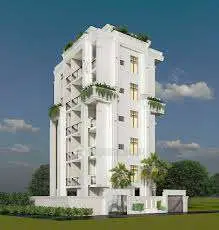
Sri Venkateshwara Enclave
NVSR DEVELOPERS · Medchal-Malkajgiri · RERA P02200011425
SRI VENKATESHWARA ENCLAVE is a plotted development in Rampally, Keesara Mandal, Medchal-Malkajgiri District, developed by registered promoter NVSR DEVELOPERS, represented by MADA VENKAT REDDY AND OTHERS. The registered site extent is 26,785.95 sq. m., including a net area of 25,775.90 sq. m.; the supplied records do not disclose the number or sizes of plots, or any tower or floor count. The TG-RERA registration number is P02200011425, and the proposed completion date is 14/04/2029.
01What we found
Read from TG-RERA filings, approvals, land and registration records and court records. A court case is counted only when the court record states this project's survey number with its village, or names the project.
02Check before you pay
6 items to check before you pay, 2 high - from the title chain, court records and approvals, each with what to ask the builder or your advocate. An item may not be a problem with the project: records can be incomplete.
1. Project at a glance
Project identity
| Item | Record |
|---|---|
| Registered project name | SRI VENKATESHWARA ENCLAVE RERA record |
| Project type | Plotted development; HMDA instrument describes a “LAYOUT WITH HOUSING” and a draft plotted-layout proposal. RERA record |
| Phase / registered portion | No separate phase name or phase number is disclosed. TG-RERA registration covers the project identified as Survey Nos. 551/p and 552/p. |
| TG-RERA registration number | P02200011425 RERA record |
| Registration validity | 15/04/2026 to 14/04/2029; the certificate records a period of 2 Years, 11 Months, 30 Day. This is registration validity, not a statement that development is complete. |
| Registered promoter | NVSR DEVELOPERS, represented on the registration certificate by MADA VENKAT REDDY AND OTHERS. Corporate record |
| RERA status | TG-RERA Form ‘C’ certificate records registration granted under section 5; certificate issue date 18/11/2026. |
Land and geographic identity
| Item | Record |
|---|---|
| Locality | RERA filing locality: KEESARA MANDAL. The permission letter identifies the site at Rampally Village. RERA record Promoter website |
| Revenue village | Rampally; also rendered as Rampalle in the case-search record. RERA record |
| Mandal | Keesara RERA record |
| District | Medchal-Malkajgiri RERA record |
| PIN | 501302 RERA record |
| Project survey numbers / subdivisions | 551/p and 552/p; the HMDA letter also writes these as 551P and 552P. It separately refers to sy no. 555/p in describing the water-body area handed over; that reference is not listed as a project survey number in the RERA certificate. RERA record |
| Registered site extent | 26,785.95 sq. m. total area, including 1,010.05 sq. m. affected by road widening/FTL/Nala widening, and 25,775.90 sq. m. net area in the RERA filing. The HMDA permission letter states the layout extent as 25775.9 Sqmt and labels its area schedule “Total Net Layout.” RERA filing |
| Boundaries filed with RERA | East: MAIN ROAD 18 M EXISTING RD WIDTH 30M PROPOSED RD; West: NEIGHBOURS LAND; North: NEIGHBOURS LAND; South: EXISTING HOUSES. RERA filing |
Development identity
| Item | Record |
|---|---|
| Sanctioning authority | Hyderabad Metropolitan Development Authority (HMDA) Approvals record |
| Principal layout approval | Approval No. 2020/HMDA/SWDL/2026, dated 15/04/2026. Application No. 010402/HMDA/03055/SWDL/MDL2/2025. The permission is for a draft plotted layout. Approvals record |
| Approved built-up area | RERA filing states 15,657.15 sq. m. as “Approved Built up Area”; the HMDA schedule labels 15,657.15 as “Plotted Area.” These are the filed labels and should not be read as interchangeable area definitions. RERA filing |
| Mortgage area | 2,481.54 sq. m.; HMDA identifies this with plots 77–80 and 88–93, described as 10 plots. RERA filing |
| Buildings, floors and parking levels | Not disclosed in the supplied evidence for this plotted-layout project. Document index |
| Layout area schedule | Plotted Area 15,657.15 (60.74%); Road Area 7,332.95 (28.45%); Open Space Area 1,935.17 (7.51%); Social Infrastructure Area 645.82 (2.51%); Utilities Area 204.81 (0.79%); Total Net Layout 25,775.9 (100.0%). |
Offering and status
| Item | Record |
|---|---|
| Unit type | Plots; the project is filed as Plotted Development. RERA record |
| Plot count and size range | Not disclosed in the supplied records. The HMDA letter identifies particular mortgaged plots, but does not provide the complete plot schedule. |
| Booked / available counts | Not disclosed in the supplied records. Document index |
| Construction / development stage | The HMDA document is a draft-layout technical permission with development works required before final layout release. No independent site-progress verification is supplied. |
| Completion deadline | RERA filing states proposed completion 14/04/2029. This is the filed completion date, separate from registration validity. RERA record |
| Occupancy / completion certificate status | No occupancy certificate or completion certificate is identified in the supplied records; the HMDA document describes draft permission and prerequisites for final layout release. Document index |
2. The project story
SRI VENKATESHWARA ENCLAVE is a plotted-layout development identified in the RERA record at Rampally, Keesara Mandal, Medchal-Malkajgiri District, on Survey Nos. 551/p and 552/p. The HMDA permission letter calls it a “LAYOUT WITH HOUSING” proposal, but also states that the applicant is not to construct buildings on the plots until HMDA issues the final layout. The available record therefore supports describing a proposed plotted layout—not completed homes or completed plot infrastructure. RERA record
The HMDA letter’s area schedule allocates 15,657.15 to plotted area, 7,332.95 to roads, 1,935.17 to open space, 645.82 to social infrastructure and 204.81 to utilities, within a 25,775.9 total net layout. The letter requires road formation, drainage, water and electrical infrastructure, park development and other stated works, and says these works are to be completed within THREE (3) YEARS. No site inspection or independently verified construction-progress record is supplied.
The RERA filing proposes completion by 14/04/2029; the registration certificate is valid through that date. Neither the proposed deadline nor the certificate establishes that the layout works have been completed or that final layout release has occurred. RERA record
3. Master plan, architecture & building design
The available plan evidence concerns a plotted layout rather than apartment-building or tower design. HMDA’s area schedule records 25,775.9 as “Total Net Layout” and divides it into plotted, road, open-space, social-infrastructure and utility areas as shown above. It records 0.0 for buffer area, common parking area and amenities area in the schedule; those entries describe the schedule and do not establish that no facilities are required or proposed elsewhere in the permission conditions.
The permission letter requires open-space, social-infrastructure, utility and road areas to be handed over to the local body by registered gift deed before release of the final layout. It also requires access roads to be opened to neighbouring sites and prohibits a compound wall or fencing around the site. The supplied material does not include a readable plot-by-plot sanctioned drawing, plot count or plot-size schedule.
No building count, floor configuration, height, building footprint, apartment mix, or building-level circulation information is available. The project’s “Approved Built up Area” field is 15,657.15 sq. m., while the HMDA area schedule labels that figure “Plotted Area”; the labels are retained as recorded and are not treated here as equivalent measurements. RERA filing
4. Homes, configurations & floor plans
This is filed as a plotted development. The supplied records do not provide plot counts, plot-size bands, plot-wise availability or a complete plot schedule. The HMDA permission letter identifies plots 77–80 and 88–93 as mortgaged to HMDA; it does not establish which plots are available for purchase. RERA record
| Configuration | Units | Booked | Available | RERA saleable area | Measured carpet area | Loading (if supplied) |
|---|---|---|---|---|---|---|
| Plots | Not disclosed | Not disclosed | Not disclosed | Not disclosed | Not applicable / not supplied | Not supplied |
No floor plans or software-measured plot or room areas are supplied. Document index
5. Parking & vehicle circulation
The HMDA area schedule records 0.0 as “Common Parking Area.” It does not provide a parking-space count or a plot-wise parking allocation. The permission letter requires roads and internal access works, including road formation and access to neighbouring sites, but the supplied evidence does not specify vehicle-entry locations, turning arrangements, pedestrian separation, accessible parking, or EV charging.
HMDA identifies plots 77 to 80 and 88 to 93 (10 plots) as mortgaged to the Metropolitan Commissioner, HMDA, and says the applicant is not permitted to sell those plots while they remain mortgaged. This is a recorded mortgage condition, not evidence of an individual buyer’s parking entitlement.
6. Amenities, recreation & open spaces
The HMDA permission letter lists facilities and infrastructure to be developed. The RERA amenity record marks several infrastructure items “YES” with 100% values, but the supplied data does not establish that those items have been independently inspected or verified as complete. RERA amenities
| Description / size | Not disclosed |
|---|---|
| Evidence source | RERA amenities |
| Declared progress / verified status | No progress or verification stated |
| Description / size | Open Space Area: 1,935.17; schedule records 7.51%. No cycling-track size or quantity supplied. |
|---|---|
| Declared progress / verified status | Required by the permission letter; completion not independently verified |
| Description / size | 1,935.17 open-space area; the schedule records Green Belt Area as 0. |
|---|---|
| Evidence source | RERA amenities |
| Declared progress / verified status | RERA-declared status shown; no independent completion verification |
| Description / size | Social Infrastructure Area: 645.82 (2.51%). No building, capacity or facility specification supplied. |
|---|---|
| Evidence source | RERA amenities |
| Declared progress / verified status | Area is scheduled; facility delivery status not verified |
7. Utilities, building services & safety
The HMDA permission letter requires road formation with blacktop, storm-water drains, underground drainage lines and a common septic tank/STP; internal water-supply pipelines and an overhead tank; an assured water-supply source; electrical supply lines, street lights and a transformer; avenue planting; park development; rainwater-harvesting pits; solid-waste and bio-compost facilities; and cycling tracks. These are permission-letter requirements, not independently confirmed completed works.
The RERA amenity record marks internal roads and footpaths, water supply, sewerage, storm-water drains, street lighting, water conservation/rainwater harvesting, and electrical meter room/sub-station/receiving station “YES” at 100%. It records 0% for treatment and disposal of sewage and sullage water, solid-waste management and disposal, energy management, fire protection and fire-safety requirements. These are recorded declaration values; the supplied evidence does not provide independent completion checks or design capacities. RERA amenities
No specific water source, storage capacity, STP capacity or reuse arrangement, electrical-substation capacity, backup-power provision, fire-system design, security system, accessibility provision or utility commissioning evidence is supplied. RERA amenities
8. Location, access & connectivity
The RERA filing places the project in Rampally, Keesara Mandal, Medchal-Malkajgiri District, PIN 501302; the filing’s locality field says KEESARA MANDAL. The HMDA permission letter likewise identifies Rampally Village, Keesara Mandal and Medchal-Malkajgiri District. RERA record Promoter website
The filed eastern boundary is MAIN ROAD 18 M EXISTING RD WIDTH 30M PROPOSED RD. HMDA also refers to a 100’0” Master plan road and roads of 18 mts and above in its permission material. The project location record gives the nearest sampled Outer Ring Road interchange as approximately 5.2 km; this is a mapped distance, not a travel-time estimate. RERA filing Location record
The supplied evidence does not identify public-transport routes, stops or measured distances to other landmarks. The cadastral point in the location record is labelled a parcel centroid, not a surveyed site entrance. Location record
9. Developer & development status
The registered promoter is NVSR DEVELOPERS, identified in the filing as a Partnership. The RERA record names MADA VENKAT REDDY as authorized signatory; the registration certificate describes the promoter as “NVSR DEVELOPERS represented by Mr./Ms. MADA VENKAT REDDY AND OTHERS.” The supplied records list GSTIN 36AAUFN9798E1Z9. Corporate record Parties record
The registration certificate gives a promoter-office address as Village: Mandal: Kapra, District: MedchalMalkajgiri, Pin: 500062. No official website or project contact details are supplied in the overview data.
The HMDA permission letter requires specified layout development works to be completed within THREE (3) YEARS and links final layout release to completion of the works and handover of specified areas. The RERA filing states proposed completion 14/04/2029. No independent progress report or completion/occupancy certificate is supplied. RERA record
10. Approvals, official records & documents
| Identifier / date | Registration P02200011425; certificate issued 18/11/2026; valid 15/04/2026–14/04/2029 |
|---|---|
| What the supplied record establishes | Records registration of SRI VENKATESHWARA ENCLAVE under section 5 and identifies Survey Nos. 551/p and 552/p. |
| Identifier / date | Approval 2020/HMDA/SWDL/2026, dated 15/04/2026; application 010402/HMDA/03055/SWDL/MDL2/2025 |
|---|---|
| What the supplied record establishes | Describes technical approval for a draft plotted layout and states conditions applying before final layout release. |
| Identifier / date | 3646/2026, dated 04/04/2026 |
|---|---|
| What the supplied record establishes | HMDA letter records mortgage of plots 77–80 and 88–93, total 2,481.54 sq. m., in favour of the Metropolitan Commissioner, HMDA. |
| Identifier / date | 3645/2026, dated 04.04.2026 |
|---|---|
| What the supplied record establishes | HMDA letter refers to a registered rectification gift deed and describes road-affected and water-body areas as handed over to the local authority. |
| Identifier / date | Lr No. G1/MMC/GHAT/05/1544/2026, date recorded as O7/04/2026 |
|---|---|
| What the supplied record establishes | Number and date are reproduced as extracted from the supplied permission record. |
| Identifier / date | Number ILLEGIBLE, dated 14/03/2026 |
|---|---|
| What the supplied record establishes | The supplied extraction does not provide a readable letter number. |
| Identifier / date | Commencement-certificate-labelled records 759053 and 759051; layout-plan record 759045; title-report records 762013–762046 (including 762039 not listed), 762150, 762006–762012, 762163, 762164, 762203, and 761271; mortgage-deed records 767281 and 762161; encumbrance-statement records 763788, 762166 and 765905 |
|---|---|
| What the supplied record establishes | These are listed in the supplied document register; their contents are not extracted here except where identified above. No occupancy or completion certificate is identified in the supplied records. Document index |
The HMDA permission letter states that the permission is not proof of land title. Detailed title, encumbrance, sanction-condition and legal review are addressed in their respective report sections.
1. Project at a glance
Project identity
Registered project name: SRI VENKATESHWARA ENCLAVE
Project type: Plotted development; HMDA instrument describes a “LAYOUT WITH HOUSING” and a draft plotted-layout proposal.
Phase / registered portion: No separate phase name or phase number is disclosed. TG-RERA registration covers the project identified as Survey Nos. 551/p and 552/p.
TG-RERA registration number: P02200011425
Registration validity: 15/04/2026 to 14/04/2029; the certificate records a period of 2 Years, 11 Months, 30 Day. This is registration validity, not a statement that development is complete.
Registered promoter: NVSR DEVELOPERS, represented on the registration certificate by MADA VENKAT REDDY AND OTHERS.
RERA status: TG-RERA Form ‘C’ certificate records registration granted under section 5; certificate issue date 18/11/2026.
Land and geographic identity
Locality: RERA filing locality: KEESARA MANDAL. The permission letter identifies the site at Rampally Village.
Revenue village: Rampally; also rendered as Rampalle in the case-search record.
Mandal: Keesara
District: Medchal-Malkajgiri
PIN: 501302
Project survey numbers / subdivisions: 551/p and 552/p; the HMDA letter also writes these as 551P and 552P. It separately refers to sy no. 555/p in describing the water-body area handed over; that reference is not listed as a project survey number in the RERA certificate.
Registered site extent: 26,785.95 sq. m. total area, including 1,010.05 sq. m. affected by road widening/FTL/Nala widening, and 25,775.90 sq. m. net area in the RERA filing. The HMDA permission letter states the layout extent as 25775.9 Sqmt and labels its area schedule “Total Net Layout.”
Boundaries filed with RERA: East: MAIN ROAD 18 M EXISTING RD WIDTH 30M PROPOSED RD; West: NEIGHBOURS LAND; North: NEIGHBOURS LAND; South: EXISTING HOUSES.
Development identity
Sanctioning authority: Hyderabad Metropolitan Development Authority (HMDA)
Principal layout approval: Approval No. 2020/HMDA/SWDL/2026, dated 15/04/2026. Application No. 010402/HMDA/03055/SWDL/MDL2/2025. The permission is for a draft plotted layout.
Approved built-up area: RERA filing states 15,657.15 sq. m. as “Approved Built up Area”; the HMDA schedule labels 15,657.15 as “Plotted Area.” These are the filed labels and should not be read as interchangeable area definitions.
Mortgage area: 2,481.54 sq. m.; HMDA identifies this with plots 77–80 and 88–93, described as 10 plots.
Buildings, floors and parking levels: Not disclosed in the supplied evidence for this plotted-layout project.
Layout area schedule: Plotted Area 15,657.15 (60.74%); Road Area 7,332.95 (28.45%); Open Space Area 1,935.17 (7.51%); Social Infrastructure Area 645.82 (2.51%); Utilities Area 204.81 (0.79%); Total Net Layout 25,775.9 (100.0%).
Offering and status
Unit type: Plots; the project is filed as Plotted Development.
Plot count and size range: Not disclosed in the supplied records. The HMDA letter identifies particular mortgaged plots, but does not provide the complete plot schedule.
Booked / available counts: Not disclosed in the supplied records.
Construction / development stage: The HMDA document is a draft-layout technical permission with development works required before final layout release. No independent site-progress verification is supplied.
Completion deadline: RERA filing states proposed completion 14/04/2029. This is the filed completion date, separate from registration validity.
Occupancy / completion certificate status: No occupancy certificate or completion certificate is identified in the supplied records; the HMDA document describes draft permission and prerequisites for final layout release.
2. The project story
SRI VENKATESHWARA ENCLAVE is a plotted-layout development identified in the RERA record at Rampally, Keesara Mandal, Medchal-Malkajgiri District, on Survey Nos. 551/p and 552/p. The HMDA permission letter calls it a “LAYOUT WITH HOUSING” proposal, but also states that the applicant is not to construct buildings on the plots until HMDA issues the final layout. The available record therefore supports describing a proposed plotted layout—not completed homes or completed plot infrastructure.
The HMDA letter’s area schedule allocates 15,657.15 to plotted area, 7,332.95 to roads, 1,935.17 to open space, 645.82 to social infrastructure and 204.81 to utilities, within a 25,775.9 total net layout. The letter requires road formation, drainage, water and electrical infrastructure, park development and other stated works, and says these works are to be completed within THREE (3) YEARS. No site inspection or independently verified construction-progress record is supplied.
The RERA filing proposes completion by 14/04/2029; the registration certificate is valid through that date. Neither the proposed deadline nor the certificate establishes that the layout works have been completed or that final layout release has occurred.
3. Master plan, architecture & building design
The available plan evidence concerns a plotted layout rather than apartment-building or tower design. HMDA’s area schedule records 25,775.9 as “Total Net Layout” and divides it into plotted, road, open-space, social-infrastructure and utility areas as shown above. It records 0.0 for buffer area, common parking area and amenities area in the schedule; those entries describe the schedule and do not establish that no facilities are required or proposed elsewhere in the permission conditions.
The permission letter requires open-space, social-infrastructure, utility and road areas to be handed over to the local body by registered gift deed before release of the final layout. It also requires access roads to be opened to neighbouring sites and prohibits a compound wall or fencing around the site. The supplied material does not include a readable plot-by-plot sanctioned drawing, plot count or plot-size schedule.
No building count, floor configuration, height, building footprint, apartment mix, or building-level circulation information is available. The project’s “Approved Built up Area” field is 15,657.15 sq. m., while the HMDA area schedule labels that figure “Plotted Area”; the labels are retained as recorded and are not treated here as equivalent measurements.
4. Homes, configurations & floor plans
This is filed as a plotted development. The supplied records do not provide plot counts, plot-size bands, plot-wise availability or a complete plot schedule. The HMDA permission letter identifies plots 77–80 and 88–93 as mortgaged to HMDA; it does not establish which plots are available for purchase.
| Configuration | Units | Booked | Available | RERA saleable area | Measured carpet area | Loading (if supplied) |
|---|---|---|---|---|---|---|
| Plots | Not disclosed | Not disclosed | Not disclosed | Not disclosed | Not applicable / not supplied | Not supplied |
No floor plans or software-measured plot or room areas are supplied.
5. Parking & vehicle circulation
The HMDA area schedule records 0.0 as “Common Parking Area.” It does not provide a parking-space count or a plot-wise parking allocation. The permission letter requires roads and internal access works, including road formation and access to neighbouring sites, but the supplied evidence does not specify vehicle-entry locations, turning arrangements, pedestrian separation, accessible parking, or EV charging.
HMDA identifies plots 77 to 80 and 88 to 93 (10 plots) as mortgaged to the Metropolitan Commissioner, HMDA, and says the applicant is not permitted to sell those plots while they remain mortgaged. This is a recorded mortgage condition, not evidence of an individual buyer’s parking entitlement.
6. Amenities, recreation & open spaces
The HMDA permission letter lists facilities and infrastructure to be developed. The RERA amenity record marks several infrastructure items “YES” with 100% values, but the supplied data does not establish that those items have been independently inspected or verified as complete.
| Description / size | Not disclosed |
|---|---|
| Declared progress / verified status | No progress or verification stated |
| Description / size | Open Space Area: 1,935.17; schedule records 7.51%. No cycling-track size or quantity supplied. |
|---|---|
| Declared progress / verified status | Required by the permission letter; completion not independently verified |
| Description / size | 1,935.17 open-space area; the schedule records Green Belt Area as 0. |
|---|---|
| Declared progress / verified status | RERA-declared status shown; no independent completion verification |
| Description / size | Social Infrastructure Area: 645.82 (2.51%). No building, capacity or facility specification supplied. |
|---|---|
| Declared progress / verified status | Area is scheduled; facility delivery status not verified |
7. Utilities, building services & safety
The HMDA permission letter requires road formation with blacktop, storm-water drains, underground drainage lines and a common septic tank/STP; internal water-supply pipelines and an overhead tank; an assured water-supply source; electrical supply lines, street lights and a transformer; avenue planting; park development; rainwater-harvesting pits; solid-waste and bio-compost facilities; and cycling tracks. These are permission-letter requirements, not independently confirmed completed works.
The RERA amenity record marks internal roads and footpaths, water supply, sewerage, storm-water drains, street lighting, water conservation/rainwater harvesting, and electrical meter room/sub-station/receiving station “YES” at 100%. It records 0% for treatment and disposal of sewage and sullage water, solid-waste management and disposal, energy management, fire protection and fire-safety requirements. These are recorded declaration values; the supplied evidence does not provide independent completion checks or design capacities.
No specific water source, storage capacity, STP capacity or reuse arrangement, electrical-substation capacity, backup-power provision, fire-system design, security system, accessibility provision or utility commissioning evidence is supplied.
8. Location, access & connectivity
The RERA filing places the project in Rampally, Keesara Mandal, Medchal-Malkajgiri District, PIN 501302; the filing’s locality field says KEESARA MANDAL. The HMDA permission letter likewise identifies Rampally Village, Keesara Mandal and Medchal-Malkajgiri District.
The filed eastern boundary is MAIN ROAD 18 M EXISTING RD WIDTH 30M PROPOSED RD. HMDA also refers to a 100’0” Master plan road and roads of 18 mts and above in its permission material. The project location record gives the nearest sampled Outer Ring Road interchange as approximately 5.2 km; this is a mapped distance, not a travel-time estimate.
The supplied evidence does not identify public-transport routes, stops or measured distances to other landmarks. The cadastral point in the location record is labelled a parcel centroid, not a surveyed site entrance.
9. Developer & development status
The registered promoter is NVSR DEVELOPERS, identified in the filing as a Partnership. The RERA record names MADA VENKAT REDDY as authorized signatory; the registration certificate describes the promoter as “NVSR DEVELOPERS represented by Mr./Ms. MADA VENKAT REDDY AND OTHERS.” The supplied records list GSTIN 36AAUFN9798E1Z9.
The registration certificate gives a promoter-office address as Village: Mandal: Kapra, District: MedchalMalkajgiri, Pin: 500062. No official website or project contact details are supplied in the overview data.
The HMDA permission letter requires specified layout development works to be completed within THREE (3) YEARS and links final layout release to completion of the works and handover of specified areas. The RERA filing states proposed completion 14/04/2029. No independent progress report or completion/occupancy certificate is supplied.
10. Approvals, official records & documents
| Identifier / date | Registration P02200011425; certificate issued 18/11/2026; valid 15/04/2026–14/04/2029 |
|---|---|
| What the supplied record establishes | Records registration of SRI VENKATESHWARA ENCLAVE under section 5 and identifies Survey Nos. 551/p and 552/p. |
| Identifier / date | Approval 2020/HMDA/SWDL/2026, dated 15/04/2026; application 010402/HMDA/03055/SWDL/MDL2/2025 |
|---|---|
| What the supplied record establishes | Describes technical approval for a draft plotted layout and states conditions applying before final layout release. |
| Identifier / date | 3646/2026, dated 04/04/2026 |
|---|---|
| What the supplied record establishes | HMDA letter records mortgage of plots 77–80 and 88–93, total 2,481.54 sq. m., in favour of the Metropolitan Commissioner, HMDA. |
| Identifier / date | 3645/2026, dated 04.04.2026 |
|---|---|
| What the supplied record establishes | HMDA letter refers to a registered rectification gift deed and describes road-affected and water-body areas as handed over to the local authority. |
| Identifier / date | Lr No. G1/MMC/GHAT/05/1544/2026, date recorded as O7/04/2026 |
|---|---|
| What the supplied record establishes | Number and date are reproduced as extracted from the supplied permission record. |
| Identifier / date | Number ILLEGIBLE, dated 14/03/2026 |
|---|---|
| What the supplied record establishes | The supplied extraction does not provide a readable letter number. |
| Identifier / date | Commencement-certificate-labelled records 759053 and 759051; layout-plan record 759045; title-report records 762013–762046 (including 762039 not listed), 762150, 762006–762012, 762163, 762164, 762203, and 761271; mortgage-deed records 767281 and 762161; encumbrance-statement records 763788, 762166 and 765905 |
|---|---|
| What the supplied record establishes | These are listed in the supplied document register; their contents are not extracted here except where identified above. No occupancy or completion certificate is identified in the supplied records. |
The HMDA permission letter states that the permission is not proof of land title. Detailed title, encumbrance, sanction-condition and legal review are addressed in their respective report sections.
Frequently asked questions
Is SRI VENKATESHWARA ENCLAVE registered with Telangana RERA?
Yes. SRI VENKATESHWARA ENCLAVE is registered with the Telangana Real Estate Regulatory Authority as P02200011425; the registration status is New Project.
Who is the developer of SRI VENKATESHWARA ENCLAVE?
The promoter named in the RERA registration is NVSR DEVELOPERS.
Where is SRI VENKATESHWARA ENCLAVE located?
SRI VENKATESHWARA ENCLAVE is in KEESARA MANDAL, Rampally, Keesara, Medchal-Malkajgiri, Telangana (501302).
When will SRI VENKATESHWARA ENCLAVE be completed?
The promoter's proposed date of completion filed with RERA is 14/04/2029. This is the promoter's declaration, not a guarantee.
More projects in Rampally