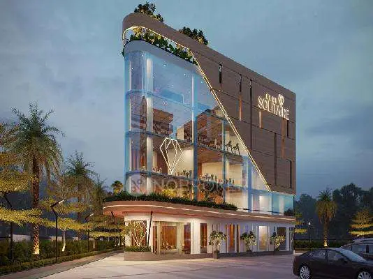
Empire Insignia
EMPIRE DELTA PROJECTS LLP · Rangareddy · RERA P02400000456
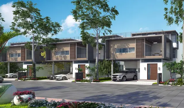
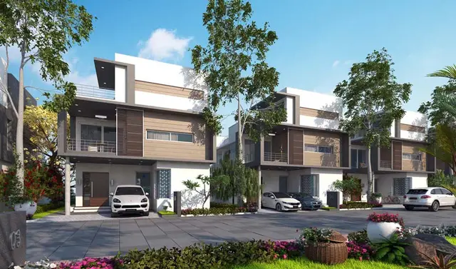
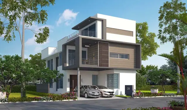
EMPIRE INSIGNIA is a residential villa / group-development project at PEERAMCHERUVU, Gandipet Mandal, Ranga Reddy District, developed by registered promoter EMPIRE DELTA PROJECTS LLP. The project covers 30,351.17 sq. m. and comprises 96 residential houses; completion and layout records describe a Ground + 2 Upper Floors development, while the RERA-filed configuration label is GROUND PLUS TWO, with a saleable area of 315.19 sq. m. per unit. It is registered under TG-RERA number P02400000456, with proposed completion recorded as 31/12/2019.
More from Empire Delta Projects LLP · 7 projects →
01What we found
Read from TG-RERA filings, approvals, land and registration records and court records. A court case is counted only when the court record states this project's survey number with its village, or names the project.
02Check before you pay
9 items to check before you pay, 3 high - from the title chain, court records and approvals, each with what to ask the builder or your advocate. An item may not be a problem with the project: records can be incomplete.
1. Project at a glance
Project identity
| Field | Record |
|---|---|
| Registered project name | EMPIRE INSIGNIA RERA record |
| Project type | Residential villa / group-development project RERA record RERA filing |
| Phase / registered portion | Phase not separately identified in the supplied record; registration is for the project named above |
| TG-RERA registration | P02400000456 RERA record |
| Registration validity | 13/03/2019 to 31/12/2019; the certificate records no extension |
| Registered promoter | EMPIRE DELTA PROJECTS LLP, an LLP RERA record Corporate record |
| RERA status | The project record describes it as “On-Going Project”; this is distinct from the registration-validity dates above RERA record RERA filing |
Land and geographic identity
| Field | Record |
|---|---|
| Locality / revenue village | PEERAMCHERUVU / Peeramcheruvu; the supplied records also spell the village “Peerancheru” and “Peeramcheru” RERA record RERA filing |
| Mandal | Gandipet; some filed drawing records refer to Rajendranagar Mandal RERA record |
| District / PIN | Ranga Reddy / 500086 RERA record |
| Project survey number(s) / subdivision | Survey No. 5; filed approval records identify Sy.No.5/p and Sy.No.5/P. The supplied records do not identify further subdivisions RERA filing |
| Registered site extent | 30,351.17 sq. m. in project land details; completion/layout records describe the extent as 7.5 Acres (or) 36,300.00 sq yds (or) 30,351.17 sq mts RERA filing |
| Net / total area and affected area | Total area 30,351.17 sq. m.; net area 30,351.17 sq. m.; area affected in road widening/FTL of tanks/nala widening recorded as 0 sq. m. RERA filing |
| Boundaries recorded in RERA filing | North: EXISTING 12 MTRS ROAD; south, east and west: NEIGHBOURS LAND RERA filing |
Development identity
| Field | Record |
|---|---|
| Sanctioning / layout authorities | HMDA is named for the layout permit and technical approval; Bandlaguda Jagir Municipal Corporation issued the Final Layout With Housing Releasing Orders Approvals record |
| Principal approval | Final Layout Permit No. 01/LO/Plg/HMDA/2017, dated 05.09.2020, as recorded in the architect’s certificate |
| Local authority proceedings | Proc.No.GL / 4549 2O2O, recorded for the final layout release dated 29,12.2O20 |
| Approved built-up area | RERA land details state 28,814.70 sq. m. as “Approved Built up Area” RERA filing |
| Development scale | 96 residential houses/villas; the RERA filing records 96 total building units and 96 proposed units RERA filing |
| Building/floor configuration | Completion/layout records describe Ground + 2 Upper Floors; technical drawings show G+2 configurations for several villa types, while a separate drawing shows a Type-B G+1 sanction. The supplied records do not establish a single floor configuration for every unit |
| Parking | Technical drawings include parking areas within individual villa designs; no complete project-wide sanctioned parking count or unit-allocation schedule is supplied |
Offering and status
| Field | Record |
|---|---|
| RERA-filed unit configuration | Filed as GROUND PLUS TWO; this is the filing’s configuration label, not a villa-type breakdown RERA unit details [unit_types] |
| RERA-filed saleable area | 315.19 sq. m. per unit [unit_types] RERA unit details |
| Booked / available | 28 booked; 68 available in the portal-derived RERA unit record. The record supplies no as-of date, so these counts are indicative and should be rechecked RERA unit table RERA unit details |
| Construction stage | RERA header labels the project “On-Going Project.” An architect’s certificate dated 10.09.2020 certifies completion; a local-authority document is titled as a completion/occupancy-certificate document but its extracted substance is a final layout release. The supplied evidence does not establish the scope or issuance of a project/tower occupancy certificate RERA record |
| Original / revised completion dates | Both recorded as 31/12/2019 RERA record RERA filing |
| Occupancy certificate status and scope | Not independently established by the supplied extracts. The architect’s certificate identifies occupancy-certificate details, but those details and their precise scope are not set out in the extracted text |
2. The project story
Empire Insignia is registered as a residential group-development project on Survey No. 5 at Peeramcheruvu, Gandipet Mandal, Ranga Reddy District. The RERA record describes a 30,351.17 sq. m. site with 96 residential units; filed completion and layout documents describe 96 houses in a Ground + 2 Upper Floors development. RERA record RERA filing
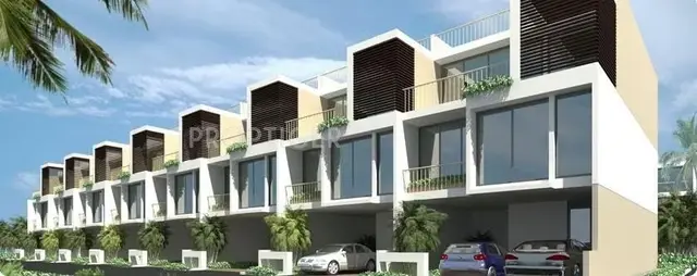
The record includes HMDA technical drawings for multiple villa types and a local-authority final layout release. The drawings show individual plot-based house designs rather than a conventional apartment-tower arrangement. The project unit table records 96 units under the label “GROUND PLUS TWO,” but does not provide a RERA-filed breakdown by villa configuration. RERA unit details
The project is labelled “On-Going Project” in the RERA header, with the filed completion date of 31/12/2019. Separately, an architect’s certificate dated 10.09.2020 certifies completion and identifies occupancy-certificate details. The supplied extracts do not establish whether an occupancy certificate was issued for the whole project, a particular portion, or individual buildings; the listed booked and available counts are portal-derived and undated. These are record statements, not an independent site inspection or verification of current construction or possession status. RERA record RERA unit table
3. Master plan, architecture & building design
The registered land record gives a total/net site area of 30,351.17 sq. m. and an approved built-up area of 28,814.70 sq. m. The latter is the figure labelled “Approved Built up Area” in the filing; it should not be treated as carpet area, saleable area or a separately verified FSI-counted area. RERA filing RERA filing
The final-layout and architect-certificate extracts describe 96 residential houses on Sy.No.5/P, with a stated total height of 9.45 m in the local-authority document and 9.45 M in the architect’s certificate. Technical drawings include G+2 villa designs identified as Types B, C, D and E, with drawings showing east- and west-facing types and plot-specific building information. A separate Type-B drawing records a G+1 sanction for plots 56 to 58. The supplied material does not provide a complete building-by-building schedule reconciling those configurations across all 96 houses.
Examples of drawing-recorded dimensions include Type B parking area 17.60 sq. m., ground-floor area 89.50 sq. m., first-floor area 121.50 sq. m. and proposed second-floor area 69.40 sq. m.; the drawing records total (G+2 floor) builtup area as 298.50 sq. m. Type C entries include parking area 19.55 sq. m., ground-floor area 90.15 sq. m., first-floor area 117.00 sq. m. and proposed second-floor area 63.00 sq. m. The drawings also include other plot/type-specific figures; these examples do not establish a uniform design for every villa.
The local-authority document records that roads and open spaces were taken over under a registered gift deed, and lists water supply, sewerage, drainage disposal systems and rain-water harvesting structure. The supplied extracts do not include a complete dimensioned master layout from which internal-road geometry, open-space areas, building footprints or site-wide circulation can be described reliably.
4. Homes, configurations & floor plans
| Configuration | Units | Booked | Available | RERA saleable area | Measured carpet area | Loading (if supplied) |
|---|---|---|---|---|---|---|
| GROUND PLUS TWO (filed label; villa configuration not specified) | 96 | 28 | 68 | 315.19 sq. m. | Not measured from the supplied drawings | Not supplied |
RERA unit details RERA unit table [unit_types]
The RERA unit record supplies one saleable-area figure and does not break the 96 homes into villa types. The three supplied floor-plan drawings are scans pending measurement; no software-measured carpet areas or room dimensions are available. Saleable area and carpet area are different measurements: the RERA-filed saleable area is the figure above, while drawing-based carpet measurement would require review of the drawings and is not provided here. The supplied record does not provide a loading calculation or a RERA-filed unit-by-unit schedule of balconies, decks or utility areas. Floor plans RERA unit details
5. Parking & vehicle circulation
HMDA technical drawings show parking areas within individual villa designs; examples include 17.60 sq. m. for Type B and 19.55 sq. m. for Type C. These are drawing-level area entries, not a project-wide space count or proof of exclusive parking allocation to a buyer.
The supplied evidence does not establish the total number of sanctioned car or two-wheeler spaces, visitor or accessible parking, parking allotments by unit, or the details of any project-wide vehicle entry, exit, ramp or driveway arrangement.
6. Amenities, recreation & open spaces
The RERA amenities record reports several project infrastructure and community items as available at 100%. This is a portal-recorded status, not an independent inspection. RERA amenities
| Facility | Description / size | Evidence source | Declared progress / verified status |
|---|---|---|---|
| Internal roads & footpaths | No size supplied | RERA amenities record RERA amenities | Reported 100%; not independently verified |
| Green strip / tot lot / park | No area supplied | RERA amenities record RERA amenities | Reported 100%; not independently verified |
| Community buildings | No size or capacity supplied | RERA amenities record RERA amenities | Reported 100%; not independently verified |
| Aggregate recreational open space | Area not supplied | RERA amenities record RERA amenities | Reported 100%; not independently verified |
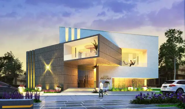
The developer’s brochure additionally describes a clubhouse and recreational facilities, including a swimming pool, gymnasium, multipurpose hall, conference room, indoor and outdoor games, squash court, children’s play area, yoga and meditation room, play area/tot lot, tree-lined avenues, amphitheatre, outdoor yoga platform, reflective water body, manicured lawns, beach-volleyball court and badminton court. These are promoter-marketed descriptions; the supplied record does not establish their sanctioned details, sizes or present completion status. [web_documents]
7. Utilities, building services & safety
The RERA amenities record reports water supply, sewerage, storm-water drains, treatment and disposal of sewage and sullage water, solid-waste management and disposal, water conservation/rainwater harvesting, street lighting, and an electrical meter room/sub-station/receiving station as available at 100%. The same record lists energy management and fire protection/fire-safety requirements at 0%. These are recorded progress percentages, not independent verification or a determination of statutory compliance. RERA amenities
The final-layout document lists water supply, sewerage, drainage disposal systems and rain-water harvesting structure; the HMDA plan extract also refers to an STP and water sump. The supplied material does not state water sources or storage capacities, STP capacity or reuse arrangements, electrical-substation capacity, backup-system capacity, or fire-system specifications.
The developer’s brochure describes provision for a lift in each villa, three-phase supply, individual meter boards, DG backup, intercom and security/CCTV. These are promoter-marketed specifications, not evidence of installed capacity or independently verified operation. No lift capacity, backup capacity, fire-access details or accessibility provisions are supplied.
8. Location, access & connectivity
The registered project location is Peeramcheruvu, Gandipet Mandal, Ranga Reddy District, PIN 500086, on Survey No. 5, with the RERA filing recording an existing 12-metre road along the north boundary. RERA record RERA filing RERA filing
The supplied mapped-location record gives the cadastral parcel centroid as 17.41528, 78.35459. Its listed nearby points include Financial District (Nanakramguda) at 1.2 km, IndusInd Bank at 0.4 km, an unnamed bus station at 2.2 km, Manuu Polytechnic Hyderabad at 1.6 km, Sankaraya Eye Hospital at 1.6 km, ADP at 0.0 km, South India Shopping Mall at 2.6 km, an unnamed park at 1.2 km and Nanakramguda Government Primary School at 0.5 km. These are supplied mapped distances; no route or travel-time measurement is provided. Location record
9. Developer & development status
The registered legal promoter is EMPIRE DELTA PROJECTS LLP, an LLP, with GSTIN 36AAFFE6187R1ZL. The RERA record lists its address as GAMUT DI LUSSO, ROAD NO.12,, GIRIDHARI EXECUTIVE PARK ROAD, PEERAMCHERUVU, Gandipet, Ranga Reddy, 500086. Corporate record Parties record RERA filing The supplied promoter contact material lists [email protected], phone numbers 9618 400 400, 9963 500 500, and www.empiredelta.com.
The RERA record identifies Arjun Yeratha Reddy as authorized signatory and Damugatla Suchit Reddy, Yeratha Achyuth Reddy and Damugatla Vikas Reddy as partners. Parties record The project’s RERA header gives proposed and revised completion dates as 31/12/2019 and labels the project “On-Going Project”; the architect’s certificate separately records completion certification dated 10.09.2020. The supplied material does not establish the current construction status or the precise scope of occupancy certification. RERA record
10. Approvals, official records & documents
| Record | What the supplied document establishes |
|---|---|
| TG-RERA Form C, registration P02400000456 | Registers EMPIRE INSIGNIA from 13/03/2019 to 31/12/2019; the certificate records no extension |
| HMDA technical sanction drawings | Drawings for residential units under a group-development scheme on Survey No. 5, forwarded to the Municipality/Local Body for final sanction subject to conditions; includes multiple villa-type drawings and a prior HMDA mortgage reference |
| HMDA layout permit / architect’s certificate | Records Final Layout Permit No. 01/LO/Plg/HMDA/2017, dated 05.09.2020, and a 96-house scheme on Sy.No.5/P; architect’s certificate dated 10.09.2020 certifies completion |
| Bandlaguda Jagir Municipal Corporation final-layout release | Final Layout With Housing Releasing Orders under Proc.No.GL / 4549 2O2O, describing 96 units and recording roads/open spaces taken over under a registered gift deed |
| RERA filing: approved built-up area and land | Records 28,814.70 sq. m. approved built-up area, total/net site area 30,351.17 sq. m. and 96 total/proposed units RERA filing RERA filing |
| RERA amenities record | Lists infrastructure/community facilities and portal progress percentages; these are recorded statuses, not independent verification RERA amenities |
| Layout-plan extract | Refers to HMDA and a group-development scheme, but the OCR does not clearly establish the full approval number, complete land-use statement or unit/plot count |
| Building-plan extracts | Include a Type-B G+1 drawing for plots 56 to 58 and HMDA G+2 villa-type drawings; these extracts do not provide a complete building-by-building schedule for the 96 homes |
The supplied extracts do not provide a clearly identified, project-wide occupancy certificate with its date and scope. The local-authority document supplied under the completion/occupancy-document category describes a final layout release; the architect’s certificate refers to occupancy-certificate details without setting out their full particulars in the extracted text.
1. Project at a glance
Project identity
Registered project name: EMPIRE INSIGNIA
Project type: Residential villa / group-development project
Phase / registered portion: Phase not separately identified in the supplied record; registration is for the project named above
TG-RERA registration: P02400000456
Registration validity: 13/03/2019 to 31/12/2019; the certificate records no extension
Registered promoter: EMPIRE DELTA PROJECTS LLP, an LLP
RERA status: The project record describes it as “On-Going Project”; this is distinct from the registration-validity dates above
Land and geographic identity
Locality / revenue village: PEERAMCHERUVU / Peeramcheruvu; the supplied records also spell the village “Peerancheru” and “Peeramcheru”
Mandal: Gandipet; some filed drawing records refer to Rajendranagar Mandal
District / PIN: Ranga Reddy / 500086
Project survey number(s) / subdivision: Survey No. 5; filed approval records identify Sy.No.5/p and Sy.No.5/P. The supplied records do not identify further subdivisions
Registered site extent: 30,351.17 sq. m. in project land details; completion/layout records describe the extent as 7.5 Acres (or) 36,300.00 sq yds (or) 30,351.17 sq mts
Net / total area and affected area: Total area 30,351.17 sq. m.; net area 30,351.17 sq. m.; area affected in road widening/FTL of tanks/nala widening recorded as 0 sq. m.
Boundaries recorded in RERA filing: North: EXISTING 12 MTRS ROAD; south, east and west: NEIGHBOURS LAND
Development identity
Sanctioning / layout authorities: HMDA is named for the layout permit and technical approval; Bandlaguda Jagir Municipal Corporation issued the Final Layout With Housing Releasing Orders
Principal approval: Final Layout Permit No. 01/LO/Plg/HMDA/2017, dated 05.09.2020, as recorded in the architect’s certificate
Local authority proceedings: Proc.No.GL / 4549 2O2O, recorded for the final layout release dated 29,12.2O20
Approved built-up area: RERA land details state 28,814.70 sq. m. as “Approved Built up Area”
Development scale: 96 residential houses/villas; the RERA filing records 96 total building units and 96 proposed units
Building/floor configuration: Completion/layout records describe Ground + 2 Upper Floors; technical drawings show G+2 configurations for several villa types, while a separate drawing shows a Type-B G+1 sanction. The supplied records do not establish a single floor configuration for every unit
Parking: Technical drawings include parking areas within individual villa designs; no complete project-wide sanctioned parking count or unit-allocation schedule is supplied
Offering and status
RERA-filed unit configuration: Filed as GROUND PLUS TWO; this is the filing’s configuration label, not a villa-type breakdown [unit_types]
RERA-filed saleable area: 315.19 sq. m. per unit [unit_types]
Booked / available: 28 booked; 68 available in the portal-derived RERA unit record. The record supplies no as-of date, so these counts are indicative and should be rechecked
Construction stage: RERA header labels the project “On-Going Project.” An architect’s certificate dated 10.09.2020 certifies completion; a local-authority document is titled as a completion/occupancy-certificate document but its extracted substance is a final layout release. The supplied evidence does not establish the scope or issuance of a project/tower occupancy certificate
Original / revised completion dates: Both recorded as 31/12/2019
Occupancy certificate status and scope: Not independently established by the supplied extracts. The architect’s certificate identifies occupancy-certificate details, but those details and their precise scope are not set out in the extracted text
2. The project story
Empire Insignia is registered as a residential group-development project on Survey No. 5 at Peeramcheruvu, Gandipet Mandal, Ranga Reddy District. The RERA record describes a 30,351.17 sq. m. site with 96 residential units; filed completion and layout documents describe 96 houses in a Ground + 2 Upper Floors development.
The record includes HMDA technical drawings for multiple villa types and a local-authority final layout release. The drawings show individual plot-based house designs rather than a conventional apartment-tower arrangement. The project unit table records 96 units under the label “GROUND PLUS TWO,” but does not provide a RERA-filed breakdown by villa configuration.
The project is labelled “On-Going Project” in the RERA header, with the filed completion date of 31/12/2019. Separately, an architect’s certificate dated 10.09.2020 certifies completion and identifies occupancy-certificate details. The supplied extracts do not establish whether an occupancy certificate was issued for the whole project, a particular portion, or individual buildings; the listed booked and available counts are portal-derived and undated. These are record statements, not an independent site inspection or verification of current construction or possession status.
3. Master plan, architecture & building design
The registered land record gives a total/net site area of 30,351.17 sq. m. and an approved built-up area of 28,814.70 sq. m. The latter is the figure labelled “Approved Built up Area” in the filing; it should not be treated as carpet area, saleable area or a separately verified FSI-counted area.
The final-layout and architect-certificate extracts describe 96 residential houses on Sy.No.5/P, with a stated total height of 9.45 m in the local-authority document and 9.45 M in the architect’s certificate. Technical drawings include G+2 villa designs identified as Types B, C, D and E, with drawings showing east- and west-facing types and plot-specific building information. A separate Type-B drawing records a G+1 sanction for plots 56 to 58. The supplied material does not provide a complete building-by-building schedule reconciling those configurations across all 96 houses.
Examples of drawing-recorded dimensions include Type B parking area 17.60 sq. m., ground-floor area 89.50 sq. m., first-floor area 121.50 sq. m. and proposed second-floor area 69.40 sq. m.; the drawing records total (G+2 floor) builtup area as 298.50 sq. m. Type C entries include parking area 19.55 sq. m., ground-floor area 90.15 sq. m., first-floor area 117.00 sq. m. and proposed second-floor area 63.00 sq. m. The drawings also include other plot/type-specific figures; these examples do not establish a uniform design for every villa.
The local-authority document records that roads and open spaces were taken over under a registered gift deed, and lists water supply, sewerage, drainage disposal systems and rain-water harvesting structure. The supplied extracts do not include a complete dimensioned master layout from which internal-road geometry, open-space areas, building footprints or site-wide circulation can be described reliably.
4. Homes, configurations & floor plans
| Configuration | Units | Booked | Available | RERA saleable area | Measured carpet area | Loading (if supplied) |
|---|---|---|---|---|---|---|
| GROUND PLUS TWO (filed label; villa configuration not specified) | 96 | 28 | 68 | 315.19 sq. m. | Not measured from the supplied drawings | Not supplied |
[unit_types]
The RERA unit record supplies one saleable-area figure and does not break the 96 homes into villa types. The three supplied floor-plan drawings are scans pending measurement; no software-measured carpet areas or room dimensions are available. Saleable area and carpet area are different measurements: the RERA-filed saleable area is the figure above, while drawing-based carpet measurement would require review of the drawings and is not provided here. The supplied record does not provide a loading calculation or a RERA-filed unit-by-unit schedule of balconies, decks or utility areas.
5. Parking & vehicle circulation
HMDA technical drawings show parking areas within individual villa designs; examples include 17.60 sq. m. for Type B and 19.55 sq. m. for Type C. These are drawing-level area entries, not a project-wide space count or proof of exclusive parking allocation to a buyer.
The supplied evidence does not establish the total number of sanctioned car or two-wheeler spaces, visitor or accessible parking, parking allotments by unit, or the details of any project-wide vehicle entry, exit, ramp or driveway arrangement.
6. Amenities, recreation & open spaces
The RERA amenities record reports several project infrastructure and community items as available at 100%. This is a portal-recorded status, not an independent inspection.
| Facility | Description / size | Evidence source | Declared progress / verified status |
|---|---|---|---|
| Internal roads & footpaths | No size supplied | RERA amenities record | Reported 100%; not independently verified |
| Green strip / tot lot / park | No area supplied | RERA amenities record | Reported 100%; not independently verified |
| Community buildings | No size or capacity supplied | RERA amenities record | Reported 100%; not independently verified |
| Aggregate recreational open space | Area not supplied | RERA amenities record | Reported 100%; not independently verified |
The developer’s brochure additionally describes a clubhouse and recreational facilities, including a swimming pool, gymnasium, multipurpose hall, conference room, indoor and outdoor games, squash court, children’s play area, yoga and meditation room, play area/tot lot, tree-lined avenues, amphitheatre, outdoor yoga platform, reflective water body, manicured lawns, beach-volleyball court and badminton court. These are promoter-marketed descriptions; the supplied record does not establish their sanctioned details, sizes or present completion status. [web_documents]
7. Utilities, building services & safety
The RERA amenities record reports water supply, sewerage, storm-water drains, treatment and disposal of sewage and sullage water, solid-waste management and disposal, water conservation/rainwater harvesting, street lighting, and an electrical meter room/sub-station/receiving station as available at 100%. The same record lists energy management and fire protection/fire-safety requirements at 0%. These are recorded progress percentages, not independent verification or a determination of statutory compliance.
The final-layout document lists water supply, sewerage, drainage disposal systems and rain-water harvesting structure; the HMDA plan extract also refers to an STP and water sump. The supplied material does not state water sources or storage capacities, STP capacity or reuse arrangements, electrical-substation capacity, backup-system capacity, or fire-system specifications.
The developer’s brochure describes provision for a lift in each villa, three-phase supply, individual meter boards, DG backup, intercom and security/CCTV. These are promoter-marketed specifications, not evidence of installed capacity or independently verified operation. No lift capacity, backup capacity, fire-access details or accessibility provisions are supplied.
8. Location, access & connectivity
The registered project location is Peeramcheruvu, Gandipet Mandal, Ranga Reddy District, PIN 500086, on Survey No. 5, with the RERA filing recording an existing 12-metre road along the north boundary.
The supplied mapped-location record gives the cadastral parcel centroid as 17.41528, 78.35459. Its listed nearby points include Financial District (Nanakramguda) at 1.2 km, IndusInd Bank at 0.4 km, an unnamed bus station at 2.2 km, Manuu Polytechnic Hyderabad at 1.6 km, Sankaraya Eye Hospital at 1.6 km, ADP at 0.0 km, South India Shopping Mall at 2.6 km, an unnamed park at 1.2 km and Nanakramguda Government Primary School at 0.5 km. These are supplied mapped distances; no route or travel-time measurement is provided.
9. Developer & development status
The registered legal promoter is EMPIRE DELTA PROJECTS LLP, an LLP, with GSTIN 36AAFFE6187R1ZL. The RERA record lists its address as GAMUT DI LUSSO, ROAD NO.12,, GIRIDHARI EXECUTIVE PARK ROAD, PEERAMCHERUVU, Gandipet, Ranga Reddy, 500086. The supplied promoter contact material lists [email protected], phone numbers 9618 400 400, 9963 500 500, and www.empiredelta.com.
The RERA record identifies Arjun Yeratha Reddy as authorized signatory and Damugatla Suchit Reddy, Yeratha Achyuth Reddy and Damugatla Vikas Reddy as partners. The project’s RERA header gives proposed and revised completion dates as 31/12/2019 and labels the project “On-Going Project”; the architect’s certificate separately records completion certification dated 10.09.2020. The supplied material does not establish the current construction status or the precise scope of occupancy certification.
10. Approvals, official records & documents
TG-RERA Form C, registration P02400000456: Registers EMPIRE INSIGNIA from 13/03/2019 to 31/12/2019; the certificate records no extension
HMDA technical sanction drawings: Drawings for residential units under a group-development scheme on Survey No. 5, forwarded to the Municipality/Local Body for final sanction subject to conditions; includes multiple villa-type drawings and a prior HMDA mortgage reference
HMDA layout permit / architect’s certificate: Records Final Layout Permit No. 01/LO/Plg/HMDA/2017, dated 05.09.2020, and a 96-house scheme on Sy.No.5/P; architect’s certificate dated 10.09.2020 certifies completion
Bandlaguda Jagir Municipal Corporation final-layout release: Final Layout With Housing Releasing Orders under Proc.No.GL / 4549 2O2O, describing 96 units and recording roads/open spaces taken over under a registered gift deed
RERA filing: approved built-up area and land: Records 28,814.70 sq. m. approved built-up area, total/net site area 30,351.17 sq. m. and 96 total/proposed units
RERA amenities record: Lists infrastructure/community facilities and portal progress percentages; these are recorded statuses, not independent verification
Layout-plan extract: Refers to HMDA and a group-development scheme, but the OCR does not clearly establish the full approval number, complete land-use statement or unit/plot count
Building-plan extracts: Include a Type-B G+1 drawing for plots 56 to 58 and HMDA G+2 villa-type drawings; these extracts do not provide a complete building-by-building schedule for the 96 homes
The supplied extracts do not provide a clearly identified, project-wide occupancy certificate with its date and scope. The local-authority document supplied under the completion/occupancy-document category describes a final layout release; the architect’s certificate refers to occupancy-certificate details without setting out their full particulars in the extracted text.
Frequently asked questions
Is EMPIRE INSIGNIA registered with Telangana RERA?
Yes. EMPIRE INSIGNIA is registered with the Telangana Real Estate Regulatory Authority as P02400000456; the registration status is On-Going Project.
Who is the developer of EMPIRE INSIGNIA?
The promoter named in the RERA registration is EMPIRE DELTA PROJECTS LLP.
Where is EMPIRE INSIGNIA located?
EMPIRE INSIGNIA is in PEERAMCHERUVU, Gandipet, Rangareddy, Telangana (500086).
When will EMPIRE INSIGNIA be completed?
The promoter's proposed date of completion filed with RERA is 31/12/2019. This is the promoter's declaration, not a guarantee.
More projects in Peeramchruvu