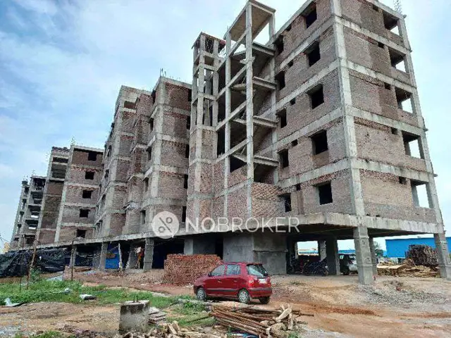
Hiranya Meadows
VENU · Sangareddy · RERA P01100010616
HIRANYA MEADOWS is a plotted development in NANDIGAMA1 (V), PATANCHERU (M), Sanga Reddy (Dist.), Telangana. The registered promoter is VENU GOPAL GUNDA. The filed layout records a total site area of 16943.24 Sq.Mtrs, 58 plots, and plot sizes from 106.51 sqm to 410.03 sqm; building floors and home configurations are not disclosed. It is registered with TG-RERA under P01100010616, with registration valid from 02/07/2025 to 02/07/2028 and proposed completion by 02/07/2028.
01What we found
Read from TG-RERA filings, approvals, land and registration records and court records. A court case is counted only when the court record states this project's survey number with its village, or names the project.
02Check before you pay
8 items to check before you pay, 3 high - from the title chain, court records and approvals, each with what to ask the builder or your advocate. An item may not be a problem with the project: records can be incomplete.
1. Project at a glance
Project identity
| Field | Project record |
|---|---|
| Registered name | HIRANYA MEADOWS RERA record |
| Project type | Plotted development / open plotted layout RERA record |
| Phase / registered portion | No phase number is disclosed; the registration and filed layout concern the plotted development described below. RERA record |
| TG-RERA registration | P01100010616 RERA record |
| Registration validity | 02/07/2025 to 02/07/2028 RERA record |
| Registered promoter | VENU GOPAL GUNDA; the certificate also identifies the project promoter as “VENU.” RERA record |
| RERA status | Registered; the supplied certificate states a three-year validity period, subject to extension under the Act and rules. |
Land and geographic identity
| Field | Project record |
|---|---|
| Registered location | NANDIGAMA1 (V), PATANCHERU (M), Sanga Reddy (Dist.), Telangana RERA record |
| Revenue village | Nandigama / NANDIGAMA1 is the village named in the project record and filed layout documents. RERA record |
| Mandal / district / PIN | PATANCHERU / Sangareddy / 502300 RERA record |
| Project survey numbers and subdivisions | 63/1/3/2, 63/1/3/1, 63/1/3/1, 63/1/3/3, 63/1/1A, 63/1/1A/1/3, 63/1/1A/1/2, 64/LU RERA record. The layout-plan extraction also lists 63/1/3/1/1 among its survey identifiers. |
| Total and net site area | The filed layout records Total Site area 16943.24 Sq.Mtrs, Master plan Road affected area 267.05 Sq.Mtrs, and Net Site Area 16676.2 Sq.Mtrs. |
| Boundaries | East: NEIGHBOUR LAND; West: NEIGHBOUR; North: NEIGHBOUR LAND; South: ROAD RERA record |
Development identity
| Field | Project record |
|---|---|
| Sanctioning authority | Hyderabad Metropolitan Development Authority (HMDA) Approvals record |
| Principal approval | Layout Permit / proceedings 003533/LO/HMDA/1044/SKP/2025, dated 02 July, 2025; the supplied record describes the layout permission as a draft layout approval. Approvals record |
| Approved built-up area | The filed plan records TOTAL PROPOSED BUILT UP AREA EXCLUDING PARKING: 0.00 and TOTAL PROPOSED BUILT UP AREA INCLUDING PARKING: 0.00 for the plotted layout. |
| Development scale | 58 plots are stated in the filed layout drawing and approval record. Layout record |
| Building / floor configuration | Not applicable to the filed plotted-layout approval; no building floors or tower configuration are disclosed. |
| Parking | No common parking area is shown in the layout land-use schedule (0.00); plot-specific parking provision or allocation is not disclosed. |
Offering and status
| Field | Project record |
|---|---|
| Offering | Plots in a 58-plot layout; individual plot schedule and dimensions are described below. Layout record |
| Booked / available plots | Not disclosed in the supplied RERA unit or inventory data. |
| Construction stage | A project-wide independently verified site-progress figure is not supplied. A promoter affidavit dated 08 February, 2025 states that no development works had been carried out as of that affidavit date. |
| Completion dates | The registration certificate is valid through 02/07/2028. The Form-B declaration separately undertakes completion by 02/07/2028. |
| Occupancy / completion certificate | No occupancy or completion certificate is identified in the supplied project documents. The record concerns a plotted layout; its layout-release status is described below. Document index |
2. The project story
HIRANYA MEADOWS is registered as a plotted-development project at Nandigama village, Patancheru mandal, Sangareddy district. The filed HMDA layout material describes an open layout containing 58 plots, roads, park/open space, utility land and social-infrastructure land; it does not describe apartment blocks or building construction. RERA record Layout record
The filed layout permission sets out development works and states that final layout release is subject to completion of those works and handover of specified layout areas to the local body. It also records ten plots reserved under a mortgage to HMDA. These are approval-document conditions, not evidence that the infrastructure or final release has been completed.
The project’s RERA registration and promoter’s declared completion date are separate from the layout’s development timetable: registration is valid to 02/07/2028, while the layout approval material directs completion of development works within three (3) years. The supplied material does not establish current on-site completion or an issued final layout release.
3. Master plan, architecture & building design
This is a plotted layout, not a building project in the supplied sanctioned plan. The filed layout schedule identifies 58 plots and records the following land-use allocation: Layout record
| Layout component | Area | Filed share |
|---|---|---|
| Plotted area | 9698.78 Sq.Mtrs | 58.16% |
| Layout roads | 4925.58 Sq.Mtrs | 29.54% |
| Open space / park | 1297.97 Sq.Mtrs | 7.78% |
| Social infrastructure | 495.95 Sq.Mtrs | 2.97% |
| Utilities area | 257.81 Sq.Mtrs | 1.55% |
| Amenities area | 0.00 | 0.00% |
The layout drawing records internal roads of 12.00 mt. and 9.00 mt. wide, an 18.00 MT WIDE EXISTING road and a 30.00 MT WIDE PROPOSED ROAD. It also identifies the project as having no proposed built-up area.
The layout plan is drawing-derived evidence of the plot schedule and land-use arrangement; the supplied data does not include building floor plans or architectural specifications for homes. Layout record Floor plans
4. Homes, configurations & floor plans
The RERA-filed development is plotted. The layout drawing’s software-read schedule identifies 58 plots, with sizes from 106.51 sqm to 410.03 sqm; median size is 162.96 sqm. These are drawing-derived measurements, not RERA-filed saleable-area figures. Layout record
| Plot-size band | Number of plots |
|---|---|
| 100–150 sq yd (84–125 sqm) | 2 |
| 150–200 sq yd (125–167 sqm) | 35 |
| 200–250 sq yd (167–209 sqm) | 18 |
| 300–400 sq yd (251–334 sqm) | 1 |
| 400–500 sq yd (334–418 sqm) | 2 |
The drawing analysis reports 58 plots with sizes and says their summed areas match the plotted area in the drawing’s area statement; it recommends checking the extracted schedule against the drawing. No RERA-filed plot-wise saleable areas, booked counts, or available counts are supplied. Layout record
Building floor plans are not available for measurement: the supplied drawing record reports four drawings, with 0 measured, 2 scans pending, and 2 with no flats. The floor-plan tool’s carpet-area figures therefore cannot be reported for this plotted project. Floor plans
5. Parking & vehicle circulation
The filed layout schedule records 0.00 Common Parking Area. It gives no count of parking spaces, no visitor or accessible parking allocation, and no buyer-specific parking allotments.
The layout drawing identifies internal road widths of 12.00 mt. and 9.00 mt., as well as an existing 18.00 MT road and proposed 30.00 MT road. The supplied material does not specify parking bays, ramps, separate pedestrian routes, EV charging, or exclusive parking rights for plot purchasers.
6. Amenities, recreation & open spaces
The filed layout specifies land for a park/open space, social infrastructure and utilities. The approval conditions describe infrastructure to be developed; the supplied evidence does not independently verify that these works or facilities are complete.
| Facility | Description / size | Evidence source | Declared progress / verified status |
|---|---|---|---|
| Park / open space | 1297.97 Sq.Mtrs; 7.78% of net layout area | Provided for in filed layout; completion not independently verified | |
| Social infrastructure | 495.95 Sq.Mtrs; 2.97% | Provided for in filed layout; completion not independently verified | |
| Tot-lot | Identified on the technical layout extraction; no size supplied | Drawing/approval reference; completion not independently verified | |
| Avenue plantation | Required in the layout development conditions | Condition for development; completion not independently verified |
A third-party vendor record lists a clubhouse, swimming pool, gymnasium, multipurpose hall, children’s play areas and other facilities. These are marketing-source claims, not facilities established by the supplied RERA-filed layout record, which lists Amenities Area 0. Promoter website
7. Utilities, building services & safety
The filed layout approval conditions and utility schedule identify proposed or required infrastructure including water supply, sewerage, storm-water management, electrical services and lighting. These are approval-record provisions; the supplied material does not establish installation, commissioning, capacity, or completed-service status.
| Evidence in the project record | Internal water-supply pipelines, overhead tank, sumps and arrangements for a potable-water connection are stated in the layout conditions. |
|---|---|
| Status supported by supplied evidence | Specified for development; completion and capacity not verified |
| Evidence in the project record | Common septic tank / STP, sewerage lines and an independent sewerage-disposal system are described in the layout conditions. |
|---|---|
| Status supported by supplied evidence | Specified for development; system type, capacity and completion not verified |
| Evidence in the project record | Underground storm-water drainage, drainage/channelisation, and rainwater-harvesting pits are stated in the conditions. |
|---|---|
| Status supported by supplied evidence | Specified for development; completion not verified |
| Evidence in the project record | Electrical supply lines, transformer yard and street lighting are stated; the conditions specify LED street lighting. |
|---|---|
| Status supported by supplied evidence | Specified for development; installation and capacity not verified |
| Evidence in the project record | The conditions call for a waste-disposal space, a bio-compost unit and source segregation. |
|---|---|
| Status supported by supplied evidence | Required by the filed conditions; provision and operation not verified |
| Evidence in the project record | Road formation, drainage, footpaths, paving and cycling tracks are included in the development conditions. |
|---|---|
| Status supported by supplied evidence | Specified for development; completion not verified |
| Evidence in the project record | No project-specific fire-system details, lifts, accessibility features, or related capacities are supplied for this plotted layout. |
|---|---|
| Status supported by supplied evidence | Not disclosed |
8. Location, access & connectivity
The project’s registered geographic description is NANDIGAMA1 (V), PATANCHERU (M), Sanga Reddy (Dist.), Telangana, PIN 502300. The project record gives boundaries of neighbouring land to the east and north, a neighbour to the west, and a road to the south. RERA record
A cadastral-parcel centroid is supplied at 17.41528, 78.35459. The location dataset lists nearby mapped places and distances, including Financial District (Nanakramguda) — 1.2 km, IndusInd Bank — 0.4 km, an unnamed bus station — 2.2 km, Manuu Polytechnic Hyderabad — 1.6 km, Sankaraya Eye Hospital — 1.6 km, South india shopping mall — 2.6 km, and Nanakramguda Govt primary school — 0.5 km. These are dataset distance measurements; no travel times or route descriptions are supplied. Location record
9. Developer & development status
The RERA certificate identifies VENU GOPAL GUNDA as promoter. The project record does not establish a legal entity type, corporate identifier, registered office for a separate company, or official project contact details. Corporate record
The filed Form-B declaration states that the project would be completed by 02/07/2028. A separate Development and Construction Authorization Agreement dated 07 February 2026 records an arrangement between eight stated owners and Sri Gunda Venugopal as developer for a plotted residential layout, authorising development and the pursuit of approvals.
An affidavit dated 08 February 2025 states that no plot had been sold and no development work had been carried out as of that date. This is a dated promoter declaration, not an independent current-site progress assessment.
10. Approvals, official records & documents
| Record | Supplied project evidence |
|---|---|
| TG-RERA registration | Form C certificate for HIRANYA MEADOWS, registration P01100010616, valid 02/07/2025–02/07/2028. |
| HMDA layout permission | 003533/LO/HMDA/1044/SKP/2025, dated 02 July, 2025; the filed layout material describes a draft layout permission and sets out conditions for development and final layout release. |
| Layout drawing | HMDA technical-approval layout drawing, file TS/018708/2025, showing 58 plots and land-use schedule. |
| HMDA mortgage | Mortgage document 14740/2025, dated 10 June, 2025, covering ten specified plots totalling 1559.39 Sq.Mt. in favour of the Metropolitan Commissioner, HMDA. |
| Road-affected-area gift deed | Gift deed 14739/2025, dated 10/06/2025, for 267.05 Sq.mtrs of road-affected area in favour of Gram Panchayat Nandigama, as recorded in the HMDA material. |
| Promoter declaration | Form-B affidavit-cum-declaration stating a completion undertaking of 02/07/2028. |
| Development authorization | Development and Construction Authorization Agreement dated 07 February 2026 between stated owners and Sri Gunda Venugopal as developer. |
The supplied project record does not identify an occupancy or completion certificate. The HMDA layout documents describe development and handover conditions preceding final layout release; the materials supplied here do not establish that final release has occurred.
1. Project at a glance
Project identity
Registered name: HIRANYA MEADOWS
Project type: Plotted development / open plotted layout
Phase / registered portion: No phase number is disclosed; the registration and filed layout concern the plotted development described below.
TG-RERA registration: P01100010616
Registration validity: 02/07/2025 to 02/07/2028
Registered promoter: VENU GOPAL GUNDA; the certificate also identifies the project promoter as “VENU.”
RERA status: Registered; the supplied certificate states a three-year validity period, subject to extension under the Act and rules.
Land and geographic identity
Registered location: NANDIGAMA1 (V), PATANCHERU (M), Sanga Reddy (Dist.), Telangana
Revenue village: Nandigama / NANDIGAMA1 is the village named in the project record and filed layout documents.
Mandal / district / PIN: PATANCHERU / Sangareddy / 502300
Project survey numbers and subdivisions: 63/1/3/2, 63/1/3/1, 63/1/3/1, 63/1/3/3, 63/1/1A, 63/1/1A/1/3, 63/1/1A/1/2, 64/LU. The layout-plan extraction also lists 63/1/3/1/1 among its survey identifiers.
Total and net site area: The filed layout records Total Site area 16943.24 Sq.Mtrs, Master plan Road affected area 267.05 Sq.Mtrs, and Net Site Area 16676.2 Sq.Mtrs.
Boundaries: East: NEIGHBOUR LAND; West: NEIGHBOUR; North: NEIGHBOUR LAND; South: ROAD
Development identity
Sanctioning authority: Hyderabad Metropolitan Development Authority (HMDA)
Principal approval: Layout Permit / proceedings 003533/LO/HMDA/1044/SKP/2025, dated 02 July, 2025; the supplied record describes the layout permission as a draft layout approval.
Approved built-up area: The filed plan records TOTAL PROPOSED BUILT UP AREA EXCLUDING PARKING: 0.00 and TOTAL PROPOSED BUILT UP AREA INCLUDING PARKING: 0.00 for the plotted layout.
Development scale: 58 plots are stated in the filed layout drawing and approval record.
Building / floor configuration: Not applicable to the filed plotted-layout approval; no building floors or tower configuration are disclosed.
Parking: No common parking area is shown in the layout land-use schedule (0.00); plot-specific parking provision or allocation is not disclosed.
Offering and status
Offering: Plots in a 58-plot layout; individual plot schedule and dimensions are described below.
Booked / available plots: Not disclosed in the supplied RERA unit or inventory data.
Construction stage: A project-wide independently verified site-progress figure is not supplied. A promoter affidavit dated 08 February, 2025 states that no development works had been carried out as of that affidavit date.
Completion dates: The registration certificate is valid through 02/07/2028. The Form-B declaration separately undertakes completion by 02/07/2028.
Occupancy / completion certificate: No occupancy or completion certificate is identified in the supplied project documents. The record concerns a plotted layout; its layout-release status is described below.
2. The project story
HIRANYA MEADOWS is registered as a plotted-development project at Nandigama village, Patancheru mandal, Sangareddy district. The filed HMDA layout material describes an open layout containing 58 plots, roads, park/open space, utility land and social-infrastructure land; it does not describe apartment blocks or building construction.
The filed layout permission sets out development works and states that final layout release is subject to completion of those works and handover of specified layout areas to the local body. It also records ten plots reserved under a mortgage to HMDA. These are approval-document conditions, not evidence that the infrastructure or final release has been completed.
The project’s RERA registration and promoter’s declared completion date are separate from the layout’s development timetable: registration is valid to 02/07/2028, while the layout approval material directs completion of development works within three (3) years. The supplied material does not establish current on-site completion or an issued final layout release.
3. Master plan, architecture & building design
This is a plotted layout, not a building project in the supplied sanctioned plan. The filed layout schedule identifies 58 plots and records the following land-use allocation:
| Layout component | Area | Filed share |
|---|---|---|
| Plotted area | 9698.78 Sq.Mtrs | 58.16% |
| Layout roads | 4925.58 Sq.Mtrs | 29.54% |
| Open space / park | 1297.97 Sq.Mtrs | 7.78% |
| Social infrastructure | 495.95 Sq.Mtrs | 2.97% |
| Utilities area | 257.81 Sq.Mtrs | 1.55% |
| Amenities area | 0.00 | 0.00% |
The layout drawing records internal roads of 12.00 mt. and 9.00 mt. wide, an 18.00 MT WIDE EXISTING road and a 30.00 MT WIDE PROPOSED ROAD. It also identifies the project as having no proposed built-up area.
The layout plan is drawing-derived evidence of the plot schedule and land-use arrangement; the supplied data does not include building floor plans or architectural specifications for homes.
4. Homes, configurations & floor plans
The RERA-filed development is plotted. The layout drawing’s software-read schedule identifies 58 plots, with sizes from 106.51 sqm to 410.03 sqm; median size is 162.96 sqm. These are drawing-derived measurements, not RERA-filed saleable-area figures.
100–150 sq yd (84–125 sqm): 2
150–200 sq yd (125–167 sqm): 35
200–250 sq yd (167–209 sqm): 18
300–400 sq yd (251–334 sqm): 1
400–500 sq yd (334–418 sqm): 2
The drawing analysis reports 58 plots with sizes and says their summed areas match the plotted area in the drawing’s area statement; it recommends checking the extracted schedule against the drawing. No RERA-filed plot-wise saleable areas, booked counts, or available counts are supplied.
Building floor plans are not available for measurement: the supplied drawing record reports four drawings, with 0 measured, 2 scans pending, and 2 with no flats. The floor-plan tool’s carpet-area figures therefore cannot be reported for this plotted project.
5. Parking & vehicle circulation
The filed layout schedule records 0.00 Common Parking Area. It gives no count of parking spaces, no visitor or accessible parking allocation, and no buyer-specific parking allotments.
The layout drawing identifies internal road widths of 12.00 mt. and 9.00 mt., as well as an existing 18.00 MT road and proposed 30.00 MT road. The supplied material does not specify parking bays, ramps, separate pedestrian routes, EV charging, or exclusive parking rights for plot purchasers.
6. Amenities, recreation & open spaces
The filed layout specifies land for a park/open space, social infrastructure and utilities. The approval conditions describe infrastructure to be developed; the supplied evidence does not independently verify that these works or facilities are complete.
| Facility | Description / size | Evidence source | Declared progress / verified status |
|---|---|---|---|
| Park / open space | 1297.97 Sq.Mtrs; 7.78% of net layout area | Provided for in filed layout; completion not independently verified | |
| Social infrastructure | 495.95 Sq.Mtrs; 2.97% | Provided for in filed layout; completion not independently verified | |
| Tot-lot | Identified on the technical layout extraction; no size supplied | Drawing/approval reference; completion not independently verified | |
| Avenue plantation | Required in the layout development conditions | Condition for development; completion not independently verified |
A third-party vendor record lists a clubhouse, swimming pool, gymnasium, multipurpose hall, children’s play areas and other facilities. These are marketing-source claims, not facilities established by the supplied RERA-filed layout record, which lists Amenities Area 0.
7. Utilities, building services & safety
The filed layout approval conditions and utility schedule identify proposed or required infrastructure including water supply, sewerage, storm-water management, electrical services and lighting. These are approval-record provisions; the supplied material does not establish installation, commissioning, capacity, or completed-service status.
| Evidence in the project record | Internal water-supply pipelines, overhead tank, sumps and arrangements for a potable-water connection are stated in the layout conditions. |
|---|---|
| Status supported by supplied evidence | Specified for development; completion and capacity not verified |
| Evidence in the project record | Common septic tank / STP, sewerage lines and an independent sewerage-disposal system are described in the layout conditions. |
|---|---|
| Status supported by supplied evidence | Specified for development; system type, capacity and completion not verified |
| Evidence in the project record | Underground storm-water drainage, drainage/channelisation, and rainwater-harvesting pits are stated in the conditions. |
|---|---|
| Status supported by supplied evidence | Specified for development; completion not verified |
| Evidence in the project record | Electrical supply lines, transformer yard and street lighting are stated; the conditions specify LED street lighting. |
|---|---|
| Status supported by supplied evidence | Specified for development; installation and capacity not verified |
| Evidence in the project record | The conditions call for a waste-disposal space, a bio-compost unit and source segregation. |
|---|---|
| Status supported by supplied evidence | Required by the filed conditions; provision and operation not verified |
| Evidence in the project record | Road formation, drainage, footpaths, paving and cycling tracks are included in the development conditions. |
|---|---|
| Status supported by supplied evidence | Specified for development; completion not verified |
| Evidence in the project record | No project-specific fire-system details, lifts, accessibility features, or related capacities are supplied for this plotted layout. |
|---|---|
| Status supported by supplied evidence | Not disclosed |
8. Location, access & connectivity
The project’s registered geographic description is NANDIGAMA1 (V), PATANCHERU (M), Sanga Reddy (Dist.), Telangana, PIN 502300. The project record gives boundaries of neighbouring land to the east and north, a neighbour to the west, and a road to the south.
A cadastral-parcel centroid is supplied at 17.41528, 78.35459. The location dataset lists nearby mapped places and distances, including Financial District (Nanakramguda) — 1.2 km, IndusInd Bank — 0.4 km, an unnamed bus station — 2.2 km, Manuu Polytechnic Hyderabad — 1.6 km, Sankaraya Eye Hospital — 1.6 km, South india shopping mall — 2.6 km, and Nanakramguda Govt primary school — 0.5 km. These are dataset distance measurements; no travel times or route descriptions are supplied.
9. Developer & development status
The RERA certificate identifies VENU GOPAL GUNDA as promoter. The project record does not establish a legal entity type, corporate identifier, registered office for a separate company, or official project contact details.
The filed Form-B declaration states that the project would be completed by 02/07/2028. A separate Development and Construction Authorization Agreement dated 07 February 2026 records an arrangement between eight stated owners and Sri Gunda Venugopal as developer for a plotted residential layout, authorising development and the pursuit of approvals.
An affidavit dated 08 February 2025 states that no plot had been sold and no development work had been carried out as of that date. This is a dated promoter declaration, not an independent current-site progress assessment.
10. Approvals, official records & documents
TG-RERA registration: Form C certificate for HIRANYA MEADOWS, registration P01100010616, valid 02/07/2025–02/07/2028.
HMDA layout permission: 003533/LO/HMDA/1044/SKP/2025, dated 02 July, 2025; the filed layout material describes a draft layout permission and sets out conditions for development and final layout release.
Layout drawing: HMDA technical-approval layout drawing, file TS/018708/2025, showing 58 plots and land-use schedule.
HMDA mortgage: Mortgage document 14740/2025, dated 10 June, 2025, covering ten specified plots totalling 1559.39 Sq.Mt. in favour of the Metropolitan Commissioner, HMDA.
Road-affected-area gift deed: Gift deed 14739/2025, dated 10/06/2025, for 267.05 Sq.mtrs of road-affected area in favour of Gram Panchayat Nandigama, as recorded in the HMDA material.
Promoter declaration: Form-B affidavit-cum-declaration stating a completion undertaking of 02/07/2028.
Development authorization: Development and Construction Authorization Agreement dated 07 February 2026 between stated owners and Sri Gunda Venugopal as developer.
The supplied project record does not identify an occupancy or completion certificate. The HMDA layout documents describe development and handover conditions preceding final layout release; the materials supplied here do not establish that final release has occurred.
Frequently asked questions
Is HIRANYA MEADOWS registered with Telangana RERA?
Yes. HIRANYA MEADOWS is registered with the Telangana Real Estate Regulatory Authority as P01100010616; the registration status is New Project.
Who is the developer of HIRANYA MEADOWS?
The promoter named in the RERA registration is VENU.
Where is HIRANYA MEADOWS located?
HIRANYA MEADOWS is in Sy.Nos.63/1/3/2, 63/1/3/1, 63/1/3/1, 63/1/3/3, 63/1/1A, 63/1/1A,63/1/1A/1/3,63/1/1A/1/2,64/LU, situatedatNANDIGAMA1(V),P, PATANCHERU, Sangareddy, Telangana (502300).
When will HIRANYA MEADOWS be completed?
The promoter's proposed date of completion filed with RERA is 02/11/2028. This is the promoter's declaration, not a guarantee.
More projects in Patancheru