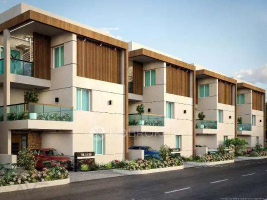
Golden Heights
TREND INFRATECH · Medchal-Malkajgiri · RERA P02200010331
GOLDEN HEIGHTS is an open-plot layout in Aushapur Village, Ghatkesar Mandal, Medchal-Malkajgiri District, developed by registered promoter TREND INFRATECH. The layout records a total area of 10,737.78 sq.m and a net area of 9,898.37 sq.m, with 37 plots ranging from 125.42 sq.m to 281.61 sq.m; towers and floors are not disclosed. Its TG-RERA registration number is P02200010331, and the proposed completion date recorded in the project header is 03/03/2029.
More from Trend Infratech · 2 projects →
01What we found
Read from TG-RERA filings, approvals, land and registration records and court records. A court case is counted only when the court record states this project's survey number with its village, or names the project.
02Check before you pay
10 items to check before you pay, 3 high - from the title chain, court records and approvals, each with what to ask the builder or your advocate. An item may not be a problem with the project: records can be incomplete.
1. Project at a glance
Project identity
| Item | Record |
|---|---|
| Registered project name | GOLDEN HEIGHTS RERA record |
| Project type | Plotted development / layout with open plots in the filed layout plan. The registration certificate’s extracted project-type field says “apartment”; the certificate otherwise identifies the project and land, while the layout-plan document identifies a plotted layout. RERA record |
| Phase / registered portion | No phase designation is stated in the RERA identity record. The registration identifies land in Survey Nos. 278/PART and 281/PART, Aushapur. RERA record |
| TG-RERA registration number | P02200010331 RERA record |
| Registration validity | 04/11/2025–03/11/2028, as recorded in the certificate. This is registration validity, not the completion deadline. RERA record |
| Registered promoter | TREND INFRATECH; entity type recorded as Partnership. RERA record Corporate record |
| RERA status | New Project; registration certificate issued. RERA record |
Land and geographic identity
| Item | Record |
|---|---|
| Locality / revenue village | Aushapur Village RERA record RERA filing |
| Mandal | Ghatkesar RERA record RERA filing |
| District | Medchal-Malkajgiri RERA record RERA filing |
| PIN | 501301 RERA filing |
| Project survey numbers | Survey No. 278/PART and Survey No. 281/PART RERA record |
| Registered site extent | The project land record states total area 10,737.78 sq.m, affected area 839.41 sq.m and net area 9,898.37 sq.m. The filed layout plan likewise records total layout area 10,737.78 sq.m and net layout area 9,898.37 sq.m. RERA filing |
| Boundaries as filed | East: MAIN RD 18M EXISTING RD WIDTH 30M PROPOSED RDWIDTH; West: EXISTING PLOTS; North: EXISTING HMDA LAYOUT; South: EXISTING G P LAYOUT PLOTS. RERA filing |
| Cadastral record scope | A Bhu Bharati record is supplied for 278/PART, with extent 60,790.69 sq.m and an extent basis of “whole_survey.” It is a survey-level record, not an extent measurement of the project parcel. Cadastral map |
Development identity
| Item | Record |
|---|---|
| Sanctioning authority | Hyderabad Metropolitan Development Authority (HMDA); the draft layout letter records delegation to Ghatkesar Municipality. Approvals record |
| Principal layout identifiers | Filed plan-approval number 003207/HMDA/00925/SWDL/GTK/2025; layout approval number LP.NO.000109/LO/PLG/HMDA/2022; draft layout approval number 0930/HMDA/SWDL/2025. RERA record Approvals record |
| Approval date recorded | 04/11/2025 Approvals record |
| Approved built-up area | 6,753.30 sq.m, shown in the RERA project fields as “Approved Built up Area.” The layout plan separately labels 6,753.30 sq.m as plotted area. RERA filing |
| Buildings / floors | Not disclosed for this plotted layout; the filed layout documents state that building construction in plots is not allowed until HMDA issues the final layout. |
| Parking | No common parking area is shown in the filed layout area schedule (0.00 sq.m). Plot-specific parking counts or allocations are not supplied. |
| Plot count | 37 plots, read from the plot schedule on the drawing. This is a drawing-derived count, not a stated count in the extracted draft-layout letter. Layout record |
Offering and status
| Item | Record |
|---|---|
| Offering | Open plots; the layout drawing’s software-read schedule contains 37 plots with sizes from 125.42 sq.m to 281.61 sq.m. RERA record Layout record |
| Booked / available | Not disclosed in the supplied project data. Document index |
| Construction stage | The registration identifies a new project. No independently verified site-progress record is supplied. The draft layout letter sets out development works and bars construction on plots until final layout issuance. RERA record |
| Completion dates | Form-B promoter declaration: 03/11/2028. RERA header proposed completion date: 03/03/2029. RERA record |
| Occupancy / completion certificate | No project occupancy or completion certificate is supplied. The filed documents concern a draft layout and describe OC as a later requirement before occupation/building use. Document index |
2. The project story
GOLDEN HEIGHTS is registered with TG-RERA as a new project promoted by TREND INFRATECH, on land identified in the registration as Survey Nos. 278/PART and 281/PART in Aushapur Village, Ghatkesar Mandal, Medchal-Malkajgiri District. Its filed layout material describes an open-plot layout rather than an apartment-building development. RERA record
The layout plan records 10,737.78 sq.m as total layout area, including 839.41 sq.m affected by road widening, and 9,898.37 sq.m as net layout area. The drawing-derived plot schedule indicates 37 plots; plot sizes span 125.42–281.61 sq.m. The layout is identified as a draft layout, and the supplied approval letter says plots may not be built on until HMDA issues the final layout. No construction-progress evidence or occupancy/completion certificate is supplied for the project. RERA filing Layout record
3. Master plan, architecture & building design
This is a plotted layout, so the supplied design evidence concerns plot arrangement and shared land uses rather than towers, floors or apartment plans. The filed layout drawing records a net layout area of 9,898.37 sq.m, with the following area schedule. Plot count and plot-size data are software-read from the drawing and should be checked against the source drawing. Layout record
| Layout use | Area | Share of net layout area | Evidence |
|---|---|---|---|
| Plotted area | 6,753.30 sq.m | 68.23% | Filed layout plan |
| Roads | 1,998.39 sq.m | 20.19% | Filed layout plan |
| Open space / park | 751.38 sq.m | 7.59% | Filed layout plan |
| Social infrastructure | 253.64 sq.m | 2.56% | Filed layout plan |
| Utilities | 141.66 sq.m | 1.43% | Filed layout plan |
| Buffer area | 0.00 sq.m | 0% | Filed layout plan |
| Common parking area | 0.00 sq.m | 0% | Filed layout plan |
| Facilities area | 0.00 sq.m | 0% | Filed layout plan |
| Green belt area | 0.00 sq.m | 0% | Filed layout plan |
The drawing-derived plot schedule contains 37 plots, with stated software-read sizes from 125.42 sq.m to 281.61 sq.m. The most frequent printed size is 167.23 sq.m (24 plots); other listed common sizes are 281.61 sq.m (4 plots) and 125.42 sq.m (3 plots). These are drawing-derived measurements, not RERA-filed saleable-area disclosures. Layout record
Road widths recorded in the filed layout material include 9.14m, 18m, 30m, 7.62m and 12.19m; the plan also labels 9.14M WIDE ROAD, 18m Existing Road Width, 30m Proposed Road Width, EXISTING 60' WIDE ROAD, PROPOSED 100' WIDE ROAD and PROPOSED 40' WIDE ROAD.
The filed approval material identifies a 839.41 sq.m road-affected portion, a 751.38 sq.m open-space area, 253.64 sq.m social-infrastructure area and 141.66 sq.m utility area. The drawing lists “Multiple Use Zone: 689.32 Sq.Yds or 576.36 Sq.Mts.” The supplied extracts do not explain how that multiple-use figure relates to the area schedule.
4. Homes, configurations & floor plans
The registered land and layout evidence describes an open-plot offering, not an evidenced apartment configuration schedule. The supplied vendor data lists “2 BHK Flat” and plot configurations, but these are vendor claims and are not used here to characterize the RERA-filed project offering. The layout drawing provides the following software-measured plot information; it is not a RERA-filed unit inventory. RERA record Promoter website Layout record
| Plot information | Drawing-derived value |
|---|---|
| Number of plots | 37 |
| Smallest plot | 125.42 sq.m (150.0 sq.yd) |
| Median plot size | 167.23 sq.m (200.0 sq.yd) |
| Largest plot | 281.61 sq.m (336.8 sq.yd) |
| 150–200 sq.yd band | 3 plots |
| 200–250 sq.yd band | 27 plots |
| 250–300 sq.yd band | 3 plots |
| 300–400 sq.yd band | 4 plots |
No booked/available counts, plot-by-plot RERA saleable areas, carpet areas, or plot-specific sale agreements are supplied. The floor-plan set contains two layout sheets and no measured floor plans or flats. Document index Floor plans RERA unit table
5. Parking & vehicle circulation
The filed layout area schedule shows 0.00 sq.m for common parking area. No number of parking bays, visitor or accessible spaces, plot-specific parking allocation, or EV-charging installation is evidenced in the supplied records.
The layout documents list internal roads and footpaths as a project facility and identify several road widths. The extracted records do not specify vehicle entry/exit arrangements, internal driveway dimensions, pedestrian-vehicle separation or parking allocation. RERA amenities
6. Amenities, recreation & open spaces
The TG-RERA amenity record marks several layout and service items “YES,” but all listed progress percentages are 0. The records do not establish that these facilities have been completed or independently inspected. The approval documents also identify planned or required layout works; those are not evidence of delivery. RERA amenities
| Facility | Green strip / tot lot / park |
|---|---|
| Description / size | Open-space area: 751.38 sq.m |
| Evidence source | RERA amenities |
| Declared progress / verified status | Listed “YES”; 0% progress recorded. No independent completion verification supplied. |
| Facility | Park development |
|---|---|
| Description / size | No further size or facility detail supplied |
| Declared progress / verified status | Required/planned in the draft-layout material; completion not verified. |
| Facility | Cycle track |
|---|---|
| Description / size | No size or specification supplied |
| Declared progress / verified status | Listed in the filed layout amenities/utilities; progress or completion not established. |
| Facility | Social infrastructure |
|---|---|
| Description / size | 253.64 sq.m |
| Declared progress / verified status | Area identified in layout records; delivery status not verified. |
| Facility | Public utility / utility area |
|---|---|
| Description / size | 141.66 sq.m |
| Declared progress / verified status | Area identified in layout records; delivery status not verified. |
| Facility | Internal roads and footpaths |
|---|---|
| Description / size | Road area: 1,998.39 sq.m |
| Evidence source | RERA amenities |
| Declared progress / verified status | Listed “YES”; 0% progress recorded. No independent completion verification supplied. |
7. Utilities, building services & safety
The layout amenity record lists water supply, sewerage (chambers, lines, septic tank and STP), storm-water drains, street lighting, rainwater harvesting, and an electrical meter room/substation/receiving station as “YES”; each has 0% progress recorded. These entries indicate recorded facilities, not completed or independently verified services. RERA amenities
The draft-layout documents additionally identify a common septic tank / STP, overhead tank (OHT), transformer, transformer yard, dust bin, and rainwater-harvesting pits. The approval material requires road formation, storm-water drains, underground drainage, water supply, electrical supply, street lights, transformer, avenue planting, park development and rainwater-harvesting pits; it also requires a septage-treatment mechanism for layouts under 10 acres. No capacities, water source, treatment capacity, backup-power capacity, security systems, accessibility features or service commissioning records are supplied.
The filed plan conditions state that a rainwater-harvesting structure/percolation pit and garbage house are to be provided, and that the mortgaged area is not to be sold until the specified authority requirements are met. They also require applicable fire-safety and technical-personnel measures. These are approval conditions, not confirmation that the works are complete or that a statutory clearance has been issued.
8. Location, access & connectivity
The registered project location is Aushapur Village, Ghatkesar Mandal, Medchal-Malkajgiri District, PIN 501301. The filed layout boundary schedule describes an existing 18m road and a proposed 30m road along the eastern boundary, with existing plots to the west, an existing HMDA layout to the north and existing G.P. layout plots to the south. RERA record RERA filing RERA filing
A supplied location record gives the nearest sampled Outer Ring Road interchange at approximately 6.1 km. No public-transport routes, verified travel times or additional measured access distances are supplied. Location record
9. Developer & development status
The registered promoter is TREND INFRATECH, recorded as a partnership, with GSTIN 36ABHFM9222A1ZI. The RERA filing identifies GADDAM MANOJ REDDY as authorized signatory and KANDAKATLA RAJKIRAN REDDY as a partner. The promoter address in the project fields is B, GURRAMGUDA, AUSHAPUR VILLAGE, GHATKESAR MANDAL, Ghatkesar, Medchal-Malkajgiri, 501301. A website is recorded at https://www.trendinfratech.com. Corporate record Parties record RERA filing
The promoter’s Form-B declaration states a completion date of 03/11/2028. The project header records proposed completion as 03/03/2029; no construction-progress evidence or completion certificate is supplied. The TG-RERA registration remains valid through 03/11/2028 as recorded in the certificate; registration validity, the promoter’s declared completion date, the header completion date and occupancy status are separate record items. RERA record Document index
The RERA filing records a designated account with ICICI Bank Ltd, Hyderabad–Hayatnagar branch, account ending 1870. Parties record
10. Approvals, official records & documents
| Identifier / date | P02200010331; valid 04/11/2025–03/11/2028 |
|---|---|
| Scope and source | Form “C” certificate for GOLDEN HEIGHTS, identifying promoter TREND INFRATECH and Survey Nos. 278/PART and 281/PART, Aushapur, Ghatkesar. |
| Identifier / date | 003207/HMDA/00925/SWDL/GTK/2025; dated 04/11/2025 |
|---|---|
| Scope and source | Layout drawing and area schedule filed with TG-RERA; drawing stamp is read from the text layer and marked as needing review. Approvals record |
| Identifier / date | LP.NO.000109/LO/PLG/HMDA/2022 |
|---|---|
| Scope and source | HMDA identifier recorded in the filed layout-plan extraction. |
| Identifier / date | 0930/HMDA/SWDL/2025; dated 04/11/2025 |
|---|---|
| Scope and source | HMDA technical/draft-layout material for the open-plot layout; it states that the permission is not proof of title and that construction in plots is not permitted until final layout issuance. |
| Identifier / date | 0930/HMDA/SWDL/2025 |
|---|---|
| Scope and source | Draft-layout permission letter extracted as issued by Ghatkesar Municipality, with conditions for development and transfer of specified layout areas before final layout release. |
| Identifier / date | Document No. 7076/2025; 30/10/2025 |
|---|---|
| Scope and source | Registered mortgage of Plot Nos. 14–19, measuring 1,077.39 sq.m, in favour of the Metropolitan Commissioner, HMDA. |
| Identifier / date | Document No. 7077/2025; 30/10/2025 |
|---|---|
| Scope and source | Registered gift deed for 839.41 sq.m road-affected area to the local body, as described in the filed layout records. |
| Identifier / date | Filed for GOLDEN HEIGHTS |
|---|---|
| Scope and source | Promoter declaration by GADDAM MANOJ REDDY, authorized signatory for TREND INFRATECH, including the declared completion date and project-fund commitments. |
| Identifier / date | Document No. 7076/2025 referenced |
|---|---|
| Scope and source | Letter concerning the mortgaged 1,077.39 sq.m and requesting that the specified property not be conveyed until further communication. |
No occupancy or completion certificate is included in the supplied project documents. The supplied records identify a draft layout; they do not establish final layout release.
1. Project at a glance
Project identity
Registered project name: GOLDEN HEIGHTS
Project type: Plotted development / layout with open plots in the filed layout plan. The registration certificate’s extracted project-type field says “apartment”; the certificate otherwise identifies the project and land, while the layout-plan document identifies a plotted layout.
Phase / registered portion: No phase designation is stated in the RERA identity record. The registration identifies land in Survey Nos. 278/PART and 281/PART, Aushapur.
TG-RERA registration number: P02200010331
Registration validity: 04/11/2025–03/11/2028, as recorded in the certificate. This is registration validity, not the completion deadline.
Registered promoter: TREND INFRATECH; entity type recorded as Partnership.
RERA status: New Project; registration certificate issued.
Land and geographic identity
Locality / revenue village: Aushapur Village
Mandal: Ghatkesar
District: Medchal-Malkajgiri
PIN: 501301
Project survey numbers: Survey No. 278/PART and Survey No. 281/PART
Registered site extent: The project land record states total area 10,737.78 sq.m, affected area 839.41 sq.m and net area 9,898.37 sq.m. The filed layout plan likewise records total layout area 10,737.78 sq.m and net layout area 9,898.37 sq.m.
Boundaries as filed: East: MAIN RD 18M EXISTING RD WIDTH 30M PROPOSED RDWIDTH; West: EXISTING PLOTS; North: EXISTING HMDA LAYOUT; South: EXISTING G P LAYOUT PLOTS.
Cadastral record scope: A Bhu Bharati record is supplied for 278/PART, with extent 60,790.69 sq.m and an extent basis of “whole_survey.” It is a survey-level record, not an extent measurement of the project parcel.
Development identity
Sanctioning authority: Hyderabad Metropolitan Development Authority (HMDA); the draft layout letter records delegation to Ghatkesar Municipality.
Principal layout identifiers: Filed plan-approval number 003207/HMDA/00925/SWDL/GTK/2025; layout approval number LP.NO.000109/LO/PLG/HMDA/2022; draft layout approval number 0930/HMDA/SWDL/2025.
Approval date recorded: 04/11/2025
Approved built-up area: 6,753.30 sq.m, shown in the RERA project fields as “Approved Built up Area.” The layout plan separately labels 6,753.30 sq.m as plotted area.
Buildings / floors: Not disclosed for this plotted layout; the filed layout documents state that building construction in plots is not allowed until HMDA issues the final layout.
Parking: No common parking area is shown in the filed layout area schedule (0.00 sq.m). Plot-specific parking counts or allocations are not supplied.
Plot count: 37 plots, read from the plot schedule on the drawing. This is a drawing-derived count, not a stated count in the extracted draft-layout letter.
Offering and status
Offering: Open plots; the layout drawing’s software-read schedule contains 37 plots with sizes from 125.42 sq.m to 281.61 sq.m.
Booked / available: Not disclosed in the supplied project data.
Construction stage: The registration identifies a new project. No independently verified site-progress record is supplied. The draft layout letter sets out development works and bars construction on plots until final layout issuance.
Completion dates: Form-B promoter declaration: 03/11/2028. RERA header proposed completion date: 03/03/2029.
Occupancy / completion certificate: No project occupancy or completion certificate is supplied. The filed documents concern a draft layout and describe OC as a later requirement before occupation/building use.
2. The project story
GOLDEN HEIGHTS is registered with TG-RERA as a new project promoted by TREND INFRATECH, on land identified in the registration as Survey Nos. 278/PART and 281/PART in Aushapur Village, Ghatkesar Mandal, Medchal-Malkajgiri District. Its filed layout material describes an open-plot layout rather than an apartment-building development.
The layout plan records 10,737.78 sq.m as total layout area, including 839.41 sq.m affected by road widening, and 9,898.37 sq.m as net layout area. The drawing-derived plot schedule indicates 37 plots; plot sizes span 125.42–281.61 sq.m. The layout is identified as a draft layout, and the supplied approval letter says plots may not be built on until HMDA issues the final layout. No construction-progress evidence or occupancy/completion certificate is supplied for the project.
3. Master plan, architecture & building design
This is a plotted layout, so the supplied design evidence concerns plot arrangement and shared land uses rather than towers, floors or apartment plans. The filed layout drawing records a net layout area of 9,898.37 sq.m, with the following area schedule. Plot count and plot-size data are software-read from the drawing and should be checked against the source drawing.
| Layout use | Area | Share of net layout area | Evidence |
|---|---|---|---|
| Plotted area | 6,753.30 sq.m | 68.23% | Filed layout plan |
| Roads | 1,998.39 sq.m | 20.19% | Filed layout plan |
| Open space / park | 751.38 sq.m | 7.59% | Filed layout plan |
| Social infrastructure | 253.64 sq.m | 2.56% | Filed layout plan |
| Utilities | 141.66 sq.m | 1.43% | Filed layout plan |
| Buffer area | 0.00 sq.m | 0% | Filed layout plan |
| Common parking area | 0.00 sq.m | 0% | Filed layout plan |
| Facilities area | 0.00 sq.m | 0% | Filed layout plan |
| Green belt area | 0.00 sq.m | 0% | Filed layout plan |
The drawing-derived plot schedule contains 37 plots, with stated software-read sizes from 125.42 sq.m to 281.61 sq.m. The most frequent printed size is 167.23 sq.m (24 plots); other listed common sizes are 281.61 sq.m (4 plots) and 125.42 sq.m (3 plots). These are drawing-derived measurements, not RERA-filed saleable-area disclosures.
Road widths recorded in the filed layout material include 9.14m, 18m, 30m, 7.62m and 12.19m; the plan also labels 9.14M WIDE ROAD, 18m Existing Road Width, 30m Proposed Road Width, EXISTING 60' WIDE ROAD, PROPOSED 100' WIDE ROAD and PROPOSED 40' WIDE ROAD.
The filed approval material identifies a 839.41 sq.m road-affected portion, a 751.38 sq.m open-space area, 253.64 sq.m social-infrastructure area and 141.66 sq.m utility area. The drawing lists “Multiple Use Zone: 689.32 Sq.Yds or 576.36 Sq.Mts.” The supplied extracts do not explain how that multiple-use figure relates to the area schedule.
4. Homes, configurations & floor plans
The registered land and layout evidence describes an open-plot offering, not an evidenced apartment configuration schedule. The supplied vendor data lists “2 BHK Flat” and plot configurations, but these are vendor claims and are not used here to characterize the RERA-filed project offering. The layout drawing provides the following software-measured plot information; it is not a RERA-filed unit inventory.
Number of plots: 37
Smallest plot: 125.42 sq.m (150.0 sq.yd)
Median plot size: 167.23 sq.m (200.0 sq.yd)
Largest plot: 281.61 sq.m (336.8 sq.yd)
150–200 sq.yd band: 3 plots
200–250 sq.yd band: 27 plots
250–300 sq.yd band: 3 plots
300–400 sq.yd band: 4 plots
No booked/available counts, plot-by-plot RERA saleable areas, carpet areas, or plot-specific sale agreements are supplied. The floor-plan set contains two layout sheets and no measured floor plans or flats.
5. Parking & vehicle circulation
The filed layout area schedule shows 0.00 sq.m for common parking area. No number of parking bays, visitor or accessible spaces, plot-specific parking allocation, or EV-charging installation is evidenced in the supplied records.
The layout documents list internal roads and footpaths as a project facility and identify several road widths. The extracted records do not specify vehicle entry/exit arrangements, internal driveway dimensions, pedestrian-vehicle separation or parking allocation.
6. Amenities, recreation & open spaces
The TG-RERA amenity record marks several layout and service items “YES,” but all listed progress percentages are 0. The records do not establish that these facilities have been completed or independently inspected. The approval documents also identify planned or required layout works; those are not evidence of delivery.
| Facility | Green strip / tot lot / park |
|---|---|
| Description / size | Open-space area: 751.38 sq.m |
| Declared progress / verified status | Listed “YES”; 0% progress recorded. No independent completion verification supplied. |
| Facility | Park development |
|---|---|
| Description / size | No further size or facility detail supplied |
| Declared progress / verified status | Required/planned in the draft-layout material; completion not verified. |
| Facility | Cycle track |
|---|---|
| Description / size | No size or specification supplied |
| Declared progress / verified status | Listed in the filed layout amenities/utilities; progress or completion not established. |
| Facility | Social infrastructure |
|---|---|
| Description / size | 253.64 sq.m |
| Declared progress / verified status | Area identified in layout records; delivery status not verified. |
| Facility | Public utility / utility area |
|---|---|
| Description / size | 141.66 sq.m |
| Declared progress / verified status | Area identified in layout records; delivery status not verified. |
| Facility | Internal roads and footpaths |
|---|---|
| Description / size | Road area: 1,998.39 sq.m |
| Declared progress / verified status | Listed “YES”; 0% progress recorded. No independent completion verification supplied. |
7. Utilities, building services & safety
The layout amenity record lists water supply, sewerage (chambers, lines, septic tank and STP), storm-water drains, street lighting, rainwater harvesting, and an electrical meter room/substation/receiving station as “YES”; each has 0% progress recorded. These entries indicate recorded facilities, not completed or independently verified services.
The draft-layout documents additionally identify a common septic tank / STP, overhead tank (OHT), transformer, transformer yard, dust bin, and rainwater-harvesting pits. The approval material requires road formation, storm-water drains, underground drainage, water supply, electrical supply, street lights, transformer, avenue planting, park development and rainwater-harvesting pits; it also requires a septage-treatment mechanism for layouts under 10 acres. No capacities, water source, treatment capacity, backup-power capacity, security systems, accessibility features or service commissioning records are supplied.
The filed plan conditions state that a rainwater-harvesting structure/percolation pit and garbage house are to be provided, and that the mortgaged area is not to be sold until the specified authority requirements are met. They also require applicable fire-safety and technical-personnel measures. These are approval conditions, not confirmation that the works are complete or that a statutory clearance has been issued.
8. Location, access & connectivity
The registered project location is Aushapur Village, Ghatkesar Mandal, Medchal-Malkajgiri District, PIN 501301. The filed layout boundary schedule describes an existing 18m road and a proposed 30m road along the eastern boundary, with existing plots to the west, an existing HMDA layout to the north and existing G.P. layout plots to the south.
A supplied location record gives the nearest sampled Outer Ring Road interchange at approximately 6.1 km. No public-transport routes, verified travel times or additional measured access distances are supplied.
9. Developer & development status
The registered promoter is TREND INFRATECH, recorded as a partnership, with GSTIN 36ABHFM9222A1ZI. The RERA filing identifies GADDAM MANOJ REDDY as authorized signatory and KANDAKATLA RAJKIRAN REDDY as a partner. The promoter address in the project fields is B, GURRAMGUDA, AUSHAPUR VILLAGE, GHATKESAR MANDAL, Ghatkesar, Medchal-Malkajgiri, 501301. A website is recorded at https://www.trendinfratech.com.
The promoter’s Form-B declaration states a completion date of 03/11/2028. The project header records proposed completion as 03/03/2029; no construction-progress evidence or completion certificate is supplied. The TG-RERA registration remains valid through 03/11/2028 as recorded in the certificate; registration validity, the promoter’s declared completion date, the header completion date and occupancy status are separate record items.
The RERA filing records a designated account with ICICI Bank Ltd, Hyderabad–Hayatnagar branch, account ending 1870.
10. Approvals, official records & documents
| Identifier / date | P02200010331; valid 04/11/2025–03/11/2028 |
|---|---|
| Scope and source | Form “C” certificate for GOLDEN HEIGHTS, identifying promoter TREND INFRATECH and Survey Nos. 278/PART and 281/PART, Aushapur, Ghatkesar. |
| Identifier / date | 003207/HMDA/00925/SWDL/GTK/2025; dated 04/11/2025 |
|---|---|
| Scope and source | Layout drawing and area schedule filed with TG-RERA; drawing stamp is read from the text layer and marked as needing review. |
| Identifier / date | LP.NO.000109/LO/PLG/HMDA/2022 |
|---|---|
| Scope and source | HMDA identifier recorded in the filed layout-plan extraction. |
| Identifier / date | 0930/HMDA/SWDL/2025; dated 04/11/2025 |
|---|---|
| Scope and source | HMDA technical/draft-layout material for the open-plot layout; it states that the permission is not proof of title and that construction in plots is not permitted until final layout issuance. |
| Identifier / date | 0930/HMDA/SWDL/2025 |
|---|---|
| Scope and source | Draft-layout permission letter extracted as issued by Ghatkesar Municipality, with conditions for development and transfer of specified layout areas before final layout release. |
| Identifier / date | Document No. 7076/2025; 30/10/2025 |
|---|---|
| Scope and source | Registered mortgage of Plot Nos. 14–19, measuring 1,077.39 sq.m, in favour of the Metropolitan Commissioner, HMDA. |
| Identifier / date | Document No. 7077/2025; 30/10/2025 |
|---|---|
| Scope and source | Registered gift deed for 839.41 sq.m road-affected area to the local body, as described in the filed layout records. |
| Identifier / date | Filed for GOLDEN HEIGHTS |
|---|---|
| Scope and source | Promoter declaration by GADDAM MANOJ REDDY, authorized signatory for TREND INFRATECH, including the declared completion date and project-fund commitments. |
| Identifier / date | Document No. 7076/2025 referenced |
|---|---|
| Scope and source | Letter concerning the mortgaged 1,077.39 sq.m and requesting that the specified property not be conveyed until further communication. |
No occupancy or completion certificate is included in the supplied project documents. The supplied records identify a draft layout; they do not establish final layout release.
Frequently asked questions
Is GOLDEN HEIGHTS registered with Telangana RERA?
Yes. GOLDEN HEIGHTS is registered with the Telangana Real Estate Regulatory Authority as P02200010331; the registration status is New Project.
Who is the developer of GOLDEN HEIGHTS?
The promoter named in the RERA registration is TREND INFRATECH.
Where is GOLDEN HEIGHTS located?
GOLDEN HEIGHTS is in GHATKESAR MANDAL, Aushapur, Ghatkesar, Medchal-Malkajgiri, Telangana (501301).
When will GOLDEN HEIGHTS be completed?
The promoter's proposed date of completion filed with RERA is 03/03/2029. This is the promoter's declaration, not a guarantee.
More projects in Aushapur