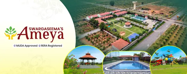
SWARGASEEMAs AMEYA
SWARGA SEEMA SANDAL WOOD FARMS PRIVATE LIMITED · Mahabubnagar · RERA P01400010250
SWARGASEEMAs AMEYA is a plotted development in Thirumalapur, Rajapoor mandal, Mahabubnagar district, developed by the registered promoter SWARGA SEEMA SANDAL WOOD FARMS PRIVATE LIMITED. It covers 49,741.13 sq.m and comprises 144 plots, with plot areas ranging from 131.32–320.98 sq.m; no towers or floors are disclosed. The project is registered with TG-RERA under P01400010250, with proposed completion on 29/02/2028.
More from Swarga Seema Sandal Wood Farms Pvt Ltd · 8 projects →
01What we found
Read from TG-RERA filings, approvals, land and registration records and court records. A court case is counted only when the court record states this project's survey number with its village, or names the project.
02Check before you pay
8 items to check before you pay, 3 high - from the title chain, court records and approvals, each with what to ask the builder or your advocate. An item may not be a problem with the project: records can be incomplete.
1. Project at a glance
Project identity
| Field | Project record |
|---|---|
| Registered project name | SWARGASEEMAs AMEYA RERA record |
| Project type | Plotted development / residential open-plotted layout RERA record |
| Phase / registered portion | No separate phase name disclosed; registration is for the project on the stated land RERA record |
| TG-RERA registration | P01400010250 RERA record |
| Registration validity | 30/10/2025–30/10/2027; the registration certificate states a two-year term, subject to extension under the Act and rules RERA record |
| RERA status | New project; registration certificate filed RERA record Approvals record |
| Registered promoter | SWARGA SEEMA SANDAL WOOD FARMS PRIVATE LIMITED RERA record Corporate record |
Land and geographic identity
| Field | Project record |
|---|---|
| Locality / revenue village | Thirumalapur (also shown as THIRUMALAPUR / Thirumalapur Village in project records) RERA record |
| Mandal | Rajapoor (also written Rajapur in approval documents) RERA record |
| District | Mahabubnagar RERA record |
| PIN | 509202 RERA record |
| Project survey numbers / subdivisions | 89/PART and 96/PART RERA record |
| Registered site extent | 49,741.13 sq.m RERA filing |
| Net / total layout area | Net Layout Area: 49,741.13 sq.m; Total Layout Area: 49,741.13 sq.m |
| Boundaries | Not disclosed in the supplied project record Land records |
Development identity
| Field | Project record |
|---|---|
| Sanctioning authority shown in RERA filing | DTCP RERA record Approvals record |
| Principal approval identifiers | RERA-filed plan approval 0026/GP/SWDL/2025-REV; the layout drawing also records T.L.P.NO.36/2022/H RERA record Approvals record |
| Approval date recorded | 30/10/2025 Approvals record |
| Approved built-up area | 27,758.84 sq.m is recorded in the RERA filing as “Approved Built up Area”; the supplied evidence does not identify it as plot saleable area RERA filing |
| Layout organization | 144 plots, numbered 1–144 on the drawing |
| Buildings / floors / parking levels | Not applicable to the plotted-layout offering as described in the supplied plan; no separate building or floor configuration is disclosed |
| Mortgage area recorded | 4,164.64 sq.m (15.00%) RERA filing |
Offering and status
| Field | Project record |
|---|---|
| Unit type | Plots; individual plot areas are shown on the layout schedule |
| Plot count and size range | 144 plots; software-read drawing range 131.32–320.98 sq.m (157.1–383.9 sq.yd) Layout record |
| Booked / available counts | Not disclosed in the supplied evidence RERA filing |
| Construction / development stage | The supplied records establish a tentative layout approval and RERA registration; no independent site-progress verification is provided |
| Proposed completion | 29/02/2028, as recorded in the RERA filing RERA record RERA filing |
| Registration validity vs completion | Registration is shown as valid through 30/10/2027; the proposed completion date is 29/02/2028. These are distinct dates RERA record |
| Occupancy / completion certificate status | No occupancy or completion certificate is supplied; the project is a plotted layout, and the available approval is described as tentative |
2. The project story
SWARGASEEMAs AMEYA is registered as a 144-plot residential open-layout project in Thirumalapur revenue village, Rajapoor mandal, Mahabubnagar district, on survey subdivisions 89/PART and 96/PART. Its registered land extent and net layout area are each 49,741.13 sq.m. The layout drawing allocates land among plots, roads, open space/parks, social infrastructure and utilities. RERA record
The project record identifies the layout approval as tentative. The Gram Panchayat approval document describes the layout as tentative and states that infrastructure and amenities are to be completed within two years from the tentative layout plan date; it also makes the release of development and building permissions subject to the stated development and mortgage conditions. The supplied materials do not provide independently verified on-site progress or an occupancy/completion certificate.
The RERA filing records a proposed completion date of 29/02/2028. That date is the promoter’s filed project timeline, not evidence that development has been completed. RERA filing
3. Master plan, architecture & building design
The approved-layout drawing describes a revised draft residential open-plotted layout on survey subdivisions 89/PART and 96/PART, with a site plan at 1:400 and plot areas shown for plots 1–144. It records a total and net layout area of 49,741.13 sq.m.
| Layout land use | Area | Share recorded on drawing |
|---|---|---|
| Plotted area | 27,758.84 sq.m | 55.81% |
| Road area | 15,689.62 sq.m | 31.54% |
| Open space / park | 4,514.72 sq.m | 9.08% |
| Social infrastructure | 1,266.47 sq.m | 2.55% |
| Utility area | 511.48 sq.m | 1.03% |
| Buffer, common parking, facilities and green belt | 0.00 sq.m each | 0% each |
| Total layout area | 49,741.13 sq.m | 100% |
The drawing records road widths of 10.06m, 12.19m and 18.29m, and identifies an existing 33'-0" wide road; it also labels an 18m existing/proposed road width. Internal road and plot circulation are therefore shown in the layout record, but no separate traffic or access assessment is supplied.
The plan identifies park/open-space areas, social infrastructure and utility land. It also labels items including a public utility, OHT/sump, STP, septic tank, transformer space, garbage house, tot-lot and water-harvesting pit. These are plan labels or stated provisions; the evidence does not establish that they are completed or operational.
The RERA filing’s 27,758.84 sq.m approved built-up area is a filed area figure; it should not be read as the area of the plots available for purchase or as a buyer’s plot area. No apartment floor plans, building heights or residential building floor configuration are supplied. RERA filing Floor plans
4. Homes, configurations & floor plans
This is a plotted development, rather than an apartment configuration. The approved-layout drawing provides a schedule for 144 plots. The plot count and size readings below are software-measured from the drawing and should be checked against the original plan. Layout record
| Plot information | Supplied drawing-derived record |
|---|---|
| Plots | 144 |
| Smallest to largest plot | 131.32–320.98 sq.m (157.1–383.9 sq.yd) |
| Size bands | 43 plots at 150–200 sq.yd; 62 at 200–250 sq.yd; 18 at 250–300 sq.yd; 21 at 300–400 sq.yd |
| Most frequent sizes listed | 183.95 sq.m (220.0 sq.yd): 24 plots; 167.23 sq.m (200.0 sq.yd): 15 plots; 137.96 sq.m (165.0 sq.yd): 14 plots; 200.67 sq.m (240.0 sq.yd): 11 plots; 165.26 sq.m (197.6 sq.yd): 11 plots |
The supplied data does not give plot-wise booking or availability status. Apartment carpet-area measurements and unit floor plans are not applicable to the plotted offering; the floor-plan evidence records two layout sheets and no measured apartment plans. Layout record Floor plans
5. Parking & vehicle circulation
The layout land-use statement records 0.00 sq.m under common parking area. The supplied evidence does not specify a sanctioned parking-space count, visitor or accessible parking, EV charging provision for plots, or a plot-wise parking allocation. A separate vendor record mentions “Open Parking,” but it does not establish a sanctioned count or a buyer’s exclusive parking right. Promoter website
The layout shows internal roads with recorded widths of 10.06m, 12.19m and 18.29m, and an existing 33'-0" wide road. It does not provide a quantified vehicle-circulation plan, driveway allocation or pedestrian-separation detail in the supplied extract.
6. Amenities, recreation & open spaces
| Facility | Parks / open space |
|---|---|
| Description / size | 4,514.72 sq.m; drawing identifies open-space/park components of 1,718.99 sq.m, 2,274.51 sq.m and 521.21 sq.m |
| Declared progress / verified status | Shown in layout; completion not independently verified |
| Facility | Tot-lot / green strip |
|---|---|
| Description / size | Named in the layout and amenity schedule |
| Evidence source | RERA amenities |
| Declared progress / verified status | Listed; completion not independently verified |
| Facility | No additional sports facilities identified |
|---|---|
| Description / size | Not disclosed |
| Evidence source | RERA amenities Document index |
| Declared progress / verified status | Not established |
| Facility | No clubhouse or indoor facility identified |
|---|---|
| Description / size | Not disclosed |
| Evidence source | RERA amenities Document index |
| Declared progress / verified status | Not established |
| Facility | Social infrastructure |
|---|---|
| Description / size | 1,266.47 sq.m on the layout land-use statement |
| Declared progress / verified status | Land reservation shown; specific facility and completion status not supplied |
| Facility | Public utility |
|---|---|
| Description / size | Identified on the layout drawing |
| Declared progress / verified status | Shown; completion not independently verified |
The RERA amenity schedule marks Internal Roads & Footpaths, Water Supply, Sewerage (Chamber, Lines, Septic Tank, STP), Storm Water Drains, Green Strip/TOT LOT/Park, Street Lighting, and Electrical Meter Room, Sub-Station, Receiving Station as “YES”; the listed progress percentages are 0. The schedule also lists community buildings, sewage/sullage treatment and disposal, solid-waste management, rainwater harvesting, energy management, fire protection and recreational open space, without a “YES” value in the supplied extract. RERA amenities
7. Utilities, building services & safety
The tentative layout materials state that development works are to include road formation with blacktop, storm-water drains, underground drainage lines and a common septic tank/STP, internal water-supply pipelines, an overhead tank, an assured water-supply source, electrical supply lines and street lights, a transformer, avenue plantation, park development and rainwater-harvesting pits. These are stated plan requirements or proposed provisions; the supplied evidence does not establish their installed capacity, commissioning or operational status. The layout drawing also labels an OHT/sump, STP, septic tank, water-harvesting pit, transformer space and garbage house. The RERA amenity schedule records water supply, sewerage, storm-water drains, street lighting and an electrical meter room/sub-station/receiving station as “YES,” with listed progress percentages of 0. RERA amenities
No project-specific capacity figures are supplied for water storage or treatment, sewerage treatment, power supply or backup. The supplied layout evidence does not establish completed fire systems, lifts, security/CCTV, waste segregation or accessible circulation. Document index RERA amenities
8. Location, access & connectivity
The registered project location is Thirumalapur, Rajapoor, Mahabubnagar, Telangana 509202, on survey subdivisions 89/PART and 96/PART. The mapped parcel-centroid coordinates supplied are 16.91696242926959, 78.11655018330943. RERA record Cadastral map
The layout record identifies an existing 33'-0" wide road and records internal road widths of 10.06m, 12.19m and 18.29m. The supplied location data lists the nearest sampled Outer Ring Road interchange at approximately 48.2 km. No public-transport services, additional landmarks or measured travel times are provided. Location record
9. Developer & development status
The registered promoter is SWARGA SEEMA SANDAL WOOD FARMS PRIVATE LIMITED, a private limited company. The supplied corporate record lists GSTIN 36AAYCS4135K1ZO. The RERA registration certificate identifies the company as promoter and names CHANDRA CHANDRASEKHAR as its representative. Corporate record
The registered project records INJAM BALAKRISHNA as a landowner/promoter participant under a revenue-share arrangement. The filed development agreement summary states a 30% owner / 70% developer sharing arrangement. Parties record
The project is recorded as a new project, with proposed completion on 29/02/2028 and RERA registration validity through 30/10/2027. The available approval is tentative; the supplied evidence contains no independently verified construction-progress report or occupancy/completion certificate. RERA record
10. Approvals, official records & documents
| Identifier / date | P01400010250; valid 30/10/2025–30/10/2027 |
|---|---|
| What the supplied document establishes | Form C certificate for SWARGASEEMAs AMEYA, identifying the promoter, location and project survey numbers |
| Identifier / date | 0026/GP/SWDL/2025-REV; recorded date 30/10/2025 |
|---|---|
| What the supplied document establishes | Project filing identifies this as its plan approval number RERA record Approvals record |
| Identifier / date | T.L.P.NO.36/2022/H; file no. 006423/GP/00020/SWDL/2025-REV; 30/10/2025 |
|---|---|
| What the supplied document establishes | Revised draft residential open-plotted layout for 144 plots on survey subdivisions 89/PART and 96/PART; records layout area, land-use split and conditions |
| Identifier / date | 0026/GP/SWDL/2025-REV; application no. 006423/GP/00020/SWDL/2025-REV; 30/10/2025 |
|---|---|
| What the supplied document establishes | Thirumalapur Gram Panchayat document describes tentative layout approval for 144 plots and states that it is not proof of title |
| Identifier / date | Application no. 006423/GP/00020/SWDL/2025-REV |
|---|---|
| What the supplied document establishes | States the proposal was under process and that the letter is not approval of the proposal or permission for development |
| Identifier / date | Drawing filed as 621464 |
|---|---|
| What the supplied document establishes | Records plot, road, park/open-space, social-infrastructure and utility areas, plus plan labels for infrastructure |
| Identifier / date | Not supplied |
|---|---|
| What the supplied document establishes | No such certificate is established by the documents provided Document index |
1. Project at a glance
Project identity
Registered project name: SWARGASEEMAs AMEYA
Project type: Plotted development / residential open-plotted layout
Phase / registered portion: No separate phase name disclosed; registration is for the project on the stated land
TG-RERA registration: P01400010250
Registration validity: 30/10/2025–30/10/2027; the registration certificate states a two-year term, subject to extension under the Act and rules
RERA status: New project; registration certificate filed
Registered promoter: SWARGA SEEMA SANDAL WOOD FARMS PRIVATE LIMITED
Land and geographic identity
Locality / revenue village: Thirumalapur (also shown as THIRUMALAPUR / Thirumalapur Village in project records)
Mandal: Rajapoor (also written Rajapur in approval documents)
District: Mahabubnagar
PIN: 509202
Project survey numbers / subdivisions: 89/PART and 96/PART
Registered site extent: 49,741.13 sq.m
Net / total layout area: Net Layout Area: 49,741.13 sq.m; Total Layout Area: 49,741.13 sq.m
Boundaries: Not disclosed in the supplied project record
Development identity
Sanctioning authority shown in RERA filing: DTCP
Principal approval identifiers: RERA-filed plan approval 0026/GP/SWDL/2025-REV; the layout drawing also records T.L.P.NO.36/2022/H
Approval date recorded: 30/10/2025
Approved built-up area: 27,758.84 sq.m is recorded in the RERA filing as “Approved Built up Area”; the supplied evidence does not identify it as plot saleable area
Layout organization: 144 plots, numbered 1–144 on the drawing
Buildings / floors / parking levels: Not applicable to the plotted-layout offering as described in the supplied plan; no separate building or floor configuration is disclosed
Mortgage area recorded: 4,164.64 sq.m (15.00%)
Offering and status
Unit type: Plots; individual plot areas are shown on the layout schedule
Plot count and size range: 144 plots; software-read drawing range 131.32–320.98 sq.m (157.1–383.9 sq.yd)
Booked / available counts: Not disclosed in the supplied evidence
Construction / development stage: The supplied records establish a tentative layout approval and RERA registration; no independent site-progress verification is provided
Proposed completion: 29/02/2028, as recorded in the RERA filing
Registration validity vs completion: Registration is shown as valid through 30/10/2027; the proposed completion date is 29/02/2028. These are distinct dates
Occupancy / completion certificate status: No occupancy or completion certificate is supplied; the project is a plotted layout, and the available approval is described as tentative
2. The project story
SWARGASEEMAs AMEYA is registered as a 144-plot residential open-layout project in Thirumalapur revenue village, Rajapoor mandal, Mahabubnagar district, on survey subdivisions 89/PART and 96/PART. Its registered land extent and net layout area are each 49,741.13 sq.m. The layout drawing allocates land among plots, roads, open space/parks, social infrastructure and utilities.
The project record identifies the layout approval as tentative. The Gram Panchayat approval document describes the layout as tentative and states that infrastructure and amenities are to be completed within two years from the tentative layout plan date; it also makes the release of development and building permissions subject to the stated development and mortgage conditions. The supplied materials do not provide independently verified on-site progress or an occupancy/completion certificate.
The RERA filing records a proposed completion date of 29/02/2028. That date is the promoter’s filed project timeline, not evidence that development has been completed.
3. Master plan, architecture & building design
The approved-layout drawing describes a revised draft residential open-plotted layout on survey subdivisions 89/PART and 96/PART, with a site plan at 1:400 and plot areas shown for plots 1–144. It records a total and net layout area of 49,741.13 sq.m.
| Layout land use | Area | Share recorded on drawing |
|---|---|---|
| Plotted area | 27,758.84 sq.m | 55.81% |
| Road area | 15,689.62 sq.m | 31.54% |
| Open space / park | 4,514.72 sq.m | 9.08% |
| Social infrastructure | 1,266.47 sq.m | 2.55% |
| Utility area | 511.48 sq.m | 1.03% |
| Buffer, common parking, facilities and green belt | 0.00 sq.m each | 0% each |
| Total layout area | 49,741.13 sq.m | 100% |
The drawing records road widths of 10.06m, 12.19m and 18.29m, and identifies an existing 33'-0" wide road; it also labels an 18m existing/proposed road width. Internal road and plot circulation are therefore shown in the layout record, but no separate traffic or access assessment is supplied.
The plan identifies park/open-space areas, social infrastructure and utility land. It also labels items including a public utility, OHT/sump, STP, septic tank, transformer space, garbage house, tot-lot and water-harvesting pit. These are plan labels or stated provisions; the evidence does not establish that they are completed or operational.
The RERA filing’s 27,758.84 sq.m approved built-up area is a filed area figure; it should not be read as the area of the plots available for purchase or as a buyer’s plot area. No apartment floor plans, building heights or residential building floor configuration are supplied.
4. Homes, configurations & floor plans
This is a plotted development, rather than an apartment configuration. The approved-layout drawing provides a schedule for 144 plots. The plot count and size readings below are software-measured from the drawing and should be checked against the original plan.
Plots: 144
Smallest to largest plot: 131.32–320.98 sq.m (157.1–383.9 sq.yd)
Size bands: 43 plots at 150–200 sq.yd; 62 at 200–250 sq.yd; 18 at 250–300 sq.yd; 21 at 300–400 sq.yd
Most frequent sizes listed: 183.95 sq.m (220.0 sq.yd): 24 plots; 167.23 sq.m (200.0 sq.yd): 15 plots; 137.96 sq.m (165.0 sq.yd): 14 plots; 200.67 sq.m (240.0 sq.yd): 11 plots; 165.26 sq.m (197.6 sq.yd): 11 plots
The supplied data does not give plot-wise booking or availability status. Apartment carpet-area measurements and unit floor plans are not applicable to the plotted offering; the floor-plan evidence records two layout sheets and no measured apartment plans.
5. Parking & vehicle circulation
The layout land-use statement records 0.00 sq.m under common parking area. The supplied evidence does not specify a sanctioned parking-space count, visitor or accessible parking, EV charging provision for plots, or a plot-wise parking allocation. A separate vendor record mentions “Open Parking,” but it does not establish a sanctioned count or a buyer’s exclusive parking right.
The layout shows internal roads with recorded widths of 10.06m, 12.19m and 18.29m, and an existing 33'-0" wide road. It does not provide a quantified vehicle-circulation plan, driveway allocation or pedestrian-separation detail in the supplied extract.
6. Amenities, recreation & open spaces
| Facility | Parks / open space |
|---|---|
| Description / size | 4,514.72 sq.m; drawing identifies open-space/park components of 1,718.99 sq.m, 2,274.51 sq.m and 521.21 sq.m |
| Declared progress / verified status | Shown in layout; completion not independently verified |
| Facility | Tot-lot / green strip |
|---|---|
| Description / size | Named in the layout and amenity schedule |
| Declared progress / verified status | Listed; completion not independently verified |
| Facility | No additional sports facilities identified |
|---|---|
| Description / size | Not disclosed |
| Declared progress / verified status | Not established |
| Facility | No clubhouse or indoor facility identified |
|---|---|
| Description / size | Not disclosed |
| Declared progress / verified status | Not established |
| Facility | Social infrastructure |
|---|---|
| Description / size | 1,266.47 sq.m on the layout land-use statement |
| Declared progress / verified status | Land reservation shown; specific facility and completion status not supplied |
| Facility | Public utility |
|---|---|
| Description / size | Identified on the layout drawing |
| Declared progress / verified status | Shown; completion not independently verified |
The RERA amenity schedule marks Internal Roads & Footpaths, Water Supply, Sewerage (Chamber, Lines, Septic Tank, STP), Storm Water Drains, Green Strip/TOT LOT/Park, Street Lighting, and Electrical Meter Room, Sub-Station, Receiving Station as “YES”; the listed progress percentages are 0. The schedule also lists community buildings, sewage/sullage treatment and disposal, solid-waste management, rainwater harvesting, energy management, fire protection and recreational open space, without a “YES” value in the supplied extract.
7. Utilities, building services & safety
The tentative layout materials state that development works are to include road formation with blacktop, storm-water drains, underground drainage lines and a common septic tank/STP, internal water-supply pipelines, an overhead tank, an assured water-supply source, electrical supply lines and street lights, a transformer, avenue plantation, park development and rainwater-harvesting pits. These are stated plan requirements or proposed provisions; the supplied evidence does not establish their installed capacity, commissioning or operational status. The layout drawing also labels an OHT/sump, STP, septic tank, water-harvesting pit, transformer space and garbage house. The RERA amenity schedule records water supply, sewerage, storm-water drains, street lighting and an electrical meter room/sub-station/receiving station as “YES,” with listed progress percentages of 0.
No project-specific capacity figures are supplied for water storage or treatment, sewerage treatment, power supply or backup. The supplied layout evidence does not establish completed fire systems, lifts, security/CCTV, waste segregation or accessible circulation.
8. Location, access & connectivity
The registered project location is Thirumalapur, Rajapoor, Mahabubnagar, Telangana 509202, on survey subdivisions 89/PART and 96/PART. The mapped parcel-centroid coordinates supplied are 16.91696242926959, 78.11655018330943.
The layout record identifies an existing 33'-0" wide road and records internal road widths of 10.06m, 12.19m and 18.29m. The supplied location data lists the nearest sampled Outer Ring Road interchange at approximately 48.2 km. No public-transport services, additional landmarks or measured travel times are provided.
9. Developer & development status
The registered promoter is SWARGA SEEMA SANDAL WOOD FARMS PRIVATE LIMITED, a private limited company. The supplied corporate record lists GSTIN 36AAYCS4135K1ZO. The RERA registration certificate identifies the company as promoter and names CHANDRA CHANDRASEKHAR as its representative.
The registered project records INJAM BALAKRISHNA as a landowner/promoter participant under a revenue-share arrangement. The filed development agreement summary states a 30% owner / 70% developer sharing arrangement.
The project is recorded as a new project, with proposed completion on 29/02/2028 and RERA registration validity through 30/10/2027. The available approval is tentative; the supplied evidence contains no independently verified construction-progress report or occupancy/completion certificate.
10. Approvals, official records & documents
| Identifier / date | P01400010250; valid 30/10/2025–30/10/2027 |
|---|---|
| What the supplied document establishes | Form C certificate for SWARGASEEMAs AMEYA, identifying the promoter, location and project survey numbers |
| Identifier / date | 0026/GP/SWDL/2025-REV; recorded date 30/10/2025 |
|---|---|
| What the supplied document establishes | Project filing identifies this as its plan approval number |
| Identifier / date | T.L.P.NO.36/2022/H; file no. 006423/GP/00020/SWDL/2025-REV; 30/10/2025 |
|---|---|
| What the supplied document establishes | Revised draft residential open-plotted layout for 144 plots on survey subdivisions 89/PART and 96/PART; records layout area, land-use split and conditions |
| Identifier / date | 0026/GP/SWDL/2025-REV; application no. 006423/GP/00020/SWDL/2025-REV; 30/10/2025 |
|---|---|
| What the supplied document establishes | Thirumalapur Gram Panchayat document describes tentative layout approval for 144 plots and states that it is not proof of title |
| Identifier / date | Application no. 006423/GP/00020/SWDL/2025-REV |
|---|---|
| What the supplied document establishes | States the proposal was under process and that the letter is not approval of the proposal or permission for development |
| Identifier / date | Drawing filed as 621464 |
|---|---|
| What the supplied document establishes | Records plot, road, park/open-space, social-infrastructure and utility areas, plus plan labels for infrastructure |
| Identifier / date | Not supplied |
|---|---|
| What the supplied document establishes | No such certificate is established by the documents provided |
Other registrations of SWARGASEEMAs AMEYA
Frequently asked questions
Is SWARGASEEMAs AMEYA registered with Telangana RERA?
Yes. SWARGASEEMAs AMEYA is registered with the Telangana Real Estate Regulatory Authority as P01400010250; the registration status is New Project.
Who is the developer of SWARGASEEMAs AMEYA?
The promoter named in the RERA registration is SWARGA SEEMA SANDAL WOOD FARMS PRIVATE LIMITED.
Where is SWARGASEEMAs AMEYA located?
SWARGASEEMAs AMEYA is in THIRUMALAPUR, Rajapoor, Mahabubnagar, Telangana (509202).
When will SWARGASEEMAs AMEYA be completed?
The promoter's proposed date of completion filed with RERA is 29/02/2028. This is the promoter's declaration, not a guarantee.
More projects in Thirumalapur