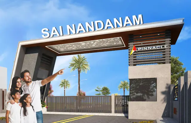
Sai Nandanam
PINNACLE LANDMARK · Yadadri Bhuvanagiri · RERA P02000010290
SAI NANDANAM is a plotted development in Alair, Alair Mandal, Yadadri Bhuvanagiri District, developed by the registered promoter PINNACLE LANDMARK. The layout covers 39197.63 sq.mts and includes 161 plots; it is not an apartment project, and no plot configurations are stated in the RERA record. The project is registered under TG-RERA number P02000010290, with proposed completion recorded as 19/01/2028.
01What we found
Read from TG-RERA filings, approvals, land and registration records and court records. A court case is counted only when the court record states this project's survey number with its village, or names the project.
02Check before you pay
7 items to check before you pay, 3 high - from the title chain, court records and approvals, each with what to ask the builder or your advocate. An item may not be a problem with the project: records can be incomplete.
1. Project at a glance
Project identity
| Field | Record |
|---|---|
| Registered project name | SAI NANDANAM RERA record |
| Project type | Plotted development / layout RERA record RERA filing |
| Phase / registered portion | New Project; the registered land is identified as Survey No. 461/PART. A separate phase breakdown is not disclosed. RERA record RERA filing |
| TG-RERA registration | P02000010290 RERA record Approvals record |
| Registration validity | 19/09/2025 to 19/09/2027; this is registration validity, not the project completion date. Approvals record |
| Registered promoter | PINNACLE LANDMARK, identified in the filing as a partnership RERA record RERA filing Corporate record |
| RERA status | Registered; the certificate records a two-year validity period. Approvals record |
Land and geographic identity
| Field | Record |
|---|---|
| Locality | Alair RERA record RERA filing |
| Revenue village | Alair Revenue Village; also described in the filed layout material as Alair Town. |
| Mandal | Alair RERA record RERA filing |
| District | Yadadri Bhuvanagiri RERA record |
| PIN | 508101 RERA record RERA filing |
| Project survey number / subdivision | 461/PART RERA record RERA filing |
| Filed site extent | 39197.63 sq.mts total area; 15018.51 sq.mts recorded as affected in road widening/FTL of tanks/nala widening; 24179.12 sq.mts net area. RERA filing |
| Layout drawing area statement | 39195.98 sq.mt extent; the drawing’s land-use table states 39195.87 as total net layout. |
| Boundaries | North, south, east and west: “Neighbors Land.” RERA filing |
| Cadastral survey record | The cadastral record gives whole-survey extent 71300.53 sqm for 461/PART; this is a survey-level record, not the project’s registered site extent. Cadastral map |
Development identity
| Field | Record |
|---|---|
| Sanctioning authority | Alair Municipality/Municipal Corporation; the RERA filing also lists DTCP as the authority for plan approval. Approvals record |
| Principal approval | Tentative layout plan 0002/LO/3102/2025, approved 19 September, 2025. |
| Application / plan reference | 001573/LO/ALAI/3102/0001/2025 Approvals record |
| LTP licence | TS/007072/2025 Approvals record |
| Approved built-up area | Not applicable/disclosed as 0.00 in the layout plan parameters, both excluding and including parking; this is a plotted layout, not an approved apartment-building scheme. |
| Plots | 161 individual plots in the layout plan. |
| Buildings / floors / parking levels | No building count, floor configuration, or parking levels are stated in the supplied approval material. The tentative approval says only detached single-family dwelling houses may be built on sites. |
| Mortgage area | The filing records 3760.06 sq.mts; the layout approval identifies 28 plots reserved for mortgage and lists the mortgage deed as 13049/2025. RERA filing |
Offering and status
| Field | Record |
|---|---|
| Offered property | Residential plots; the RERA filing describes a plotted development. RERA filing |
| Plot count and size | The layout drawing’s schedule contains 161 plots; software-measured sizes range from 109.71 sqm to 401.16 sqm, with a median of 139.29 sqm. These are drawing-derived measurements, not RERA-filed unit-area figures. Layout record |
| Booked / available plots | Not disclosed in the supplied evidence. |
| Construction stage | The project is a registered new project. The available evidence records tentative layout approval and promoter declarations; it does not establish independently verified site progress. RERA record |
| Completion dates | Promoter’s Form B undertaking: 19/09/2027. The registration header separately records proposed completion 19/01/2028. RERA record |
| Occupancy / completion certificate | No occupancy or completion certificate is supplied. The approval is for a tentative layout plan, not an occupancy certificate. |
2. The project story
- SAI NANDANAM is a proposed residential plotted layout in Alair Revenue Village, Alair Mandal, Yadadri Bhuvanagiri District, on land identified in the RERA record as Survey No. 461/PART. The registered project offers plots rather than apartments or villas; the layout drawing records 161 plots. RERA record
- The tentative layout approval dated 19 September, 2025 sets out roads, parks/open space, social infrastructure and utility land. Its conditions require the owner/developer to complete layout infrastructure and amenities within two years of approval, and specify that only detached dwelling houses for single-family occupation may be built on a site. These are approval terms and proposed layout works, not evidence that the works have been completed.
- The promoter’s Form B declares a completion undertaking of 19/09/2027; the project header separately lists a proposed completion date of 19/01/2028. No supplied record verifies construction progress or an occupancy/completion certificate. RERA record
3. Master plan, architecture & building design
- The approved material concerns a plotted layout, not apartment blocks. The tentative layout plan records 161 individual plots and a total layout extent of 39195.98 sq.mt. Its land-use table records plotted area of 24177.93, roads of 10106.21, organized open space/park area of 3528.85, social infrastructure of 990.82, and utility area of 392.06; figures are quoted as printed in the plan.
- The drawing identifies internal road widths of 9.14 mt and 12.00 mt, and existing and proposed roads of 30.00 MT and 10.00 MT. The tentative approval requires road access to neighbouring sites and prohibits a compound wall or fencing around the site. It also states that only detached single-family dwelling houses may be built on a site. No building footprints, building heights, or floor plans for homes are established by the supplied records.
- The layout plan states 0.00 proposed built-up area, both excluding and including parking; no apartment-building built-up area is supplied.
4. Homes, configurations & floor plans
This is a plotted project, not an apartment configuration. The supplied layout drawing lists 161 plots. The following sizes are software-measured from the approved layout drawing and are not RERA-filed plot-area figures. Layout record
| Plot-size band | Number of plots |
|---|---|
| 100–150 sq yd | 4 |
| 150–200 sq yd | 132 |
| 200–250 sq yd | 13 |
| 250–300 sq yd | 9 |
| 300–400 sq yd | 1 |
| 400–500 sq yd | 2 |
Software-measured plot sizes range from 109.71 sqm (131.2 sq yd) to 401.16 sqm (479.8 sq yd), with a median of 139.29 sqm (166.6 sq yd). Plot areas describe the individual plot, not a house’s carpet area or built-up area. The supplied drawing records do not provide house floor plans or dwelling-area measurements. Layout record Floor plans
5. Parking & vehicle circulation
The supplied layout approval records 0.00 common parking area and does not state a sanctioned count of parking spaces, a resident or visitor allocation, or parking arrangements for future homes. No parking levels or ramps are identified. The layout plan includes internal roads, but no specific vehicle-entry/exit arrangement or pedestrian-separation provision is evidenced.
6. Amenities, recreation & open spaces
The layout approval and RERA-filed amenity schedule identify proposed layout facilities. The approval conditions require the developer to complete the works; the supplied records do not independently verify completed facilities. RERA amenities
| Description / size | Organized open space/park area 3528.85 in the layout plan’s land-use table; the tentative approval states 9%. |
|---|---|
| Evidence source | Layout plan and tentative approval |
| Declared progress / verified status | Proposed/required by approval; completion not independently verified. |
| Description / size | 990.82 in the layout plan’s land-use table. |
|---|---|
| Evidence source | Layout plan |
| Declared progress / verified status | Land reserved; facility details and completion status are not supplied. |
| Description / size | 10106.21 road area; road widths listed as 9.14 mt and 12.00 mt internal roads, plus 30.00 MT and 10.00 MT existing/proposed roads. |
|---|---|
| Evidence source | Layout plan and tentative approval |
| Declared progress / verified status | Proposed/required layout works; completion not independently verified. |
| Description / size | 392.06 in the layout plan’s land-use table. |
|---|---|
| Evidence source | Layout plan |
| Declared progress / verified status | Land reserved; specific facility completion is not established. |
7. Utilities, building services & safety
- The tentative layout approval describes proposed infrastructure including an assured water source, internal water-supply pipelines and an overhead tank; underground drainage and a common septic tank/STP; storm-water drains and rainwater-harvesting pits; electrical supply lines, transformer and street lights; avenue planting and park development. It also lists solid-waste management among the facilities to be handed over with the reserved utility area. These are approval conditions and required works, not evidence of completed or operational services.
- The RERA-filed amenity schedule records water supply, sewerage, storm-water drains, street lighting, rainwater harvesting, and fire protection/fire-safety requirements, each with 10% shown in the supplied data. This is a recorded progress figure in the filing, not an independent inspection or confirmation of statutory compliance. RERA amenities
- No service capacities, accessibility details, security systems, or completed utility commissioning records are supplied.
8. Location, access & connectivity
- The registered location is Alair, Alair Mandal, Yadadri Bhuvanagiri District, PIN 508101; the project land is recorded under Survey No. 461/PART. RERA record
- The cadastral parcel centroid is recorded at 17.64391313285062, 79.07125202994115. The location dataset gives the nearest sampled Outer Ring Road interchange at approximately 46.8 km. Cadastral map Location record
- The tentative layout plan identifies existing and proposed roads of 30.00 MT and 10.00 MT, as well as internal roads of 9.14 mt and 12.00 mt. The supplied evidence does not provide verified public-transport details or measured distances to local landmarks.
9. Developer & development status
- The TG-RERA-registered promoter is PINNACLE LANDMARK, identified in the filing as a partnership. The supplied corporate identifier is GSTIN 36ABDFP5030D1ZN. The RERA certificate names the promoter and identifies NARENDRA KUMAR KARNATAPU as representing it. RERA filing Corporate record
- The promoter’s Form B, signed by Karnatapu Narendra Kumar as partner, declares a project completion date of 19/09/2027 and states that the land is free from encumbrances. These are promoter declarations in the registration filing.
- The tentative approval requires infrastructure and amenities to be completed within two years from approval on 19 September, 2025. No independent site-progress report or completion/occupancy certificate is supplied.
10. Approvals, official records & documents
| Identifier / date | P02000010290; valid 19/09/2025–19/09/2027 |
|---|---|
| Scope and evidence | Form C identifies SAI NANDANAM, PINNACLE LANDMARK and Survey No. 461/PART. |
| Identifier / date | 0002/LO/3102/2025; 19 September, 2025 |
|---|---|
| Scope and evidence | Approval by Alair Municipality/Municipal Corporation for a plotted layout; includes approval conditions and reserved/mortgaged plots. |
| Identifier / date | 001573/LO/ALAI/3102/0001/2025 |
|---|---|
| Scope and evidence | Layout drawing identifies 161 plots and records the land-use table, road widths and utility/open-space areas. |
| Identifier / date | TS/007072/2025 |
|---|---|
| Scope and evidence | Listed with the layout plan details. |
| Identifier / date | 13049/2025; 17 September, 2025 |
|---|---|
| Scope and evidence | The tentative approval identifies 28 listed plots mortgaged in favour of the Municipality/Municipal Corporation. |
| Identifier / date | 04 October, 2025 |
|---|---|
| Scope and evidence | Promoter declaration covering title basis, encumbrance statement, separate-account obligations and completion undertaking. |
The supplied records do not include an occupancy/completion certificate or evidence that the layout infrastructure has been independently verified as complete.
1. Project at a glance
Project identity
Registered project name: SAI NANDANAM
Project type: Plotted development / layout
Phase / registered portion: New Project; the registered land is identified as Survey No. 461/PART. A separate phase breakdown is not disclosed.
TG-RERA registration: P02000010290
Registration validity: 19/09/2025 to 19/09/2027; this is registration validity, not the project completion date.
Registered promoter: PINNACLE LANDMARK, identified in the filing as a partnership
RERA status: Registered; the certificate records a two-year validity period.
Land and geographic identity
Locality: Alair
Revenue village: Alair Revenue Village; also described in the filed layout material as Alair Town.
Mandal: Alair
District: Yadadri Bhuvanagiri
PIN: 508101
Project survey number / subdivision: 461/PART
Filed site extent: 39197.63 sq.mts total area; 15018.51 sq.mts recorded as affected in road widening/FTL of tanks/nala widening; 24179.12 sq.mts net area.
Layout drawing area statement: 39195.98 sq.mt extent; the drawing’s land-use table states 39195.87 as total net layout.
Boundaries: North, south, east and west: “Neighbors Land.”
Cadastral survey record: The cadastral record gives whole-survey extent 71300.53 sqm for 461/PART; this is a survey-level record, not the project’s registered site extent.
Development identity
Sanctioning authority: Alair Municipality/Municipal Corporation; the RERA filing also lists DTCP as the authority for plan approval.
Principal approval: Tentative layout plan 0002/LO/3102/2025, approved 19 September, 2025.
Application / plan reference: 001573/LO/ALAI/3102/0001/2025
LTP licence: TS/007072/2025
Approved built-up area: Not applicable/disclosed as 0.00 in the layout plan parameters, both excluding and including parking; this is a plotted layout, not an approved apartment-building scheme.
Plots: 161 individual plots in the layout plan.
Buildings / floors / parking levels: No building count, floor configuration, or parking levels are stated in the supplied approval material. The tentative approval says only detached single-family dwelling houses may be built on sites.
Mortgage area: The filing records 3760.06 sq.mts; the layout approval identifies 28 plots reserved for mortgage and lists the mortgage deed as 13049/2025.
Offering and status
Offered property: Residential plots; the RERA filing describes a plotted development.
Plot count and size: The layout drawing’s schedule contains 161 plots; software-measured sizes range from 109.71 sqm to 401.16 sqm, with a median of 139.29 sqm. These are drawing-derived measurements, not RERA-filed unit-area figures.
Booked / available plots: Not disclosed in the supplied evidence.
Construction stage: The project is a registered new project. The available evidence records tentative layout approval and promoter declarations; it does not establish independently verified site progress.
Completion dates: Promoter’s Form B undertaking: 19/09/2027. The registration header separately records proposed completion 19/01/2028.
Occupancy / completion certificate: No occupancy or completion certificate is supplied. The approval is for a tentative layout plan, not an occupancy certificate.
2. The project story
- SAI NANDANAM is a proposed residential plotted layout in Alair Revenue Village, Alair Mandal, Yadadri Bhuvanagiri District, on land identified in the RERA record as Survey No. 461/PART. The registered project offers plots rather than apartments or villas; the layout drawing records 161 plots.
- The tentative layout approval dated 19 September, 2025 sets out roads, parks/open space, social infrastructure and utility land. Its conditions require the owner/developer to complete layout infrastructure and amenities within two years of approval, and specify that only detached dwelling houses for single-family occupation may be built on a site. These are approval terms and proposed layout works, not evidence that the works have been completed.
- The promoter’s Form B declares a completion undertaking of 19/09/2027; the project header separately lists a proposed completion date of 19/01/2028. No supplied record verifies construction progress or an occupancy/completion certificate.
3. Master plan, architecture & building design
- The approved material concerns a plotted layout, not apartment blocks. The tentative layout plan records 161 individual plots and a total layout extent of 39195.98 sq.mt. Its land-use table records plotted area of 24177.93, roads of 10106.21, organized open space/park area of 3528.85, social infrastructure of 990.82, and utility area of 392.06; figures are quoted as printed in the plan.
- The drawing identifies internal road widths of 9.14 mt and 12.00 mt, and existing and proposed roads of 30.00 MT and 10.00 MT. The tentative approval requires road access to neighbouring sites and prohibits a compound wall or fencing around the site. It also states that only detached single-family dwelling houses may be built on a site. No building footprints, building heights, or floor plans for homes are established by the supplied records.
- The layout plan states 0.00 proposed built-up area, both excluding and including parking; no apartment-building built-up area is supplied.
4. Homes, configurations & floor plans
This is a plotted project, not an apartment configuration. The supplied layout drawing lists 161 plots. The following sizes are software-measured from the approved layout drawing and are not RERA-filed plot-area figures.
100–150 sq yd: 4
150–200 sq yd: 132
200–250 sq yd: 13
250–300 sq yd: 9
300–400 sq yd: 1
400–500 sq yd: 2
Software-measured plot sizes range from 109.71 sqm (131.2 sq yd) to 401.16 sqm (479.8 sq yd), with a median of 139.29 sqm (166.6 sq yd). Plot areas describe the individual plot, not a house’s carpet area or built-up area. The supplied drawing records do not provide house floor plans or dwelling-area measurements.
5. Parking & vehicle circulation
The supplied layout approval records 0.00 common parking area and does not state a sanctioned count of parking spaces, a resident or visitor allocation, or parking arrangements for future homes. No parking levels or ramps are identified. The layout plan includes internal roads, but no specific vehicle-entry/exit arrangement or pedestrian-separation provision is evidenced.
6. Amenities, recreation & open spaces
The layout approval and RERA-filed amenity schedule identify proposed layout facilities. The approval conditions require the developer to complete the works; the supplied records do not independently verify completed facilities.
| Description / size | Organized open space/park area 3528.85 in the layout plan’s land-use table; the tentative approval states 9%. |
|---|---|
| Evidence source | Layout plan and tentative approval |
| Declared progress / verified status | Proposed/required by approval; completion not independently verified. |
| Description / size | 990.82 in the layout plan’s land-use table. |
|---|---|
| Evidence source | Layout plan |
| Declared progress / verified status | Land reserved; facility details and completion status are not supplied. |
| Description / size | 10106.21 road area; road widths listed as 9.14 mt and 12.00 mt internal roads, plus 30.00 MT and 10.00 MT existing/proposed roads. |
|---|---|
| Evidence source | Layout plan and tentative approval |
| Declared progress / verified status | Proposed/required layout works; completion not independently verified. |
| Description / size | 392.06 in the layout plan’s land-use table. |
|---|---|
| Evidence source | Layout plan |
| Declared progress / verified status | Land reserved; specific facility completion is not established. |
7. Utilities, building services & safety
- The tentative layout approval describes proposed infrastructure including an assured water source, internal water-supply pipelines and an overhead tank; underground drainage and a common septic tank/STP; storm-water drains and rainwater-harvesting pits; electrical supply lines, transformer and street lights; avenue planting and park development. It also lists solid-waste management among the facilities to be handed over with the reserved utility area. These are approval conditions and required works, not evidence of completed or operational services.
- The RERA-filed amenity schedule records water supply, sewerage, storm-water drains, street lighting, rainwater harvesting, and fire protection/fire-safety requirements, each with 10% shown in the supplied data. This is a recorded progress figure in the filing, not an independent inspection or confirmation of statutory compliance.
- No service capacities, accessibility details, security systems, or completed utility commissioning records are supplied.
8. Location, access & connectivity
- The registered location is Alair, Alair Mandal, Yadadri Bhuvanagiri District, PIN 508101; the project land is recorded under Survey No. 461/PART.
- The cadastral parcel centroid is recorded at 17.64391313285062, 79.07125202994115. The location dataset gives the nearest sampled Outer Ring Road interchange at approximately 46.8 km.
- The tentative layout plan identifies existing and proposed roads of 30.00 MT and 10.00 MT, as well as internal roads of 9.14 mt and 12.00 mt. The supplied evidence does not provide verified public-transport details or measured distances to local landmarks.
9. Developer & development status
- The TG-RERA-registered promoter is PINNACLE LANDMARK, identified in the filing as a partnership. The supplied corporate identifier is GSTIN 36ABDFP5030D1ZN. The RERA certificate names the promoter and identifies NARENDRA KUMAR KARNATAPU as representing it.
- The promoter’s Form B, signed by Karnatapu Narendra Kumar as partner, declares a project completion date of 19/09/2027 and states that the land is free from encumbrances. These are promoter declarations in the registration filing.
- The tentative approval requires infrastructure and amenities to be completed within two years from approval on 19 September, 2025. No independent site-progress report or completion/occupancy certificate is supplied.
10. Approvals, official records & documents
| Identifier / date | P02000010290; valid 19/09/2025–19/09/2027 |
|---|---|
| Scope and evidence | Form C identifies SAI NANDANAM, PINNACLE LANDMARK and Survey No. 461/PART. |
| Identifier / date | 0002/LO/3102/2025; 19 September, 2025 |
|---|---|
| Scope and evidence | Approval by Alair Municipality/Municipal Corporation for a plotted layout; includes approval conditions and reserved/mortgaged plots. |
| Identifier / date | 001573/LO/ALAI/3102/0001/2025 |
|---|---|
| Scope and evidence | Layout drawing identifies 161 plots and records the land-use table, road widths and utility/open-space areas. |
| Identifier / date | TS/007072/2025 |
|---|---|
| Scope and evidence | Listed with the layout plan details. |
| Identifier / date | 13049/2025; 17 September, 2025 |
|---|---|
| Scope and evidence | The tentative approval identifies 28 listed plots mortgaged in favour of the Municipality/Municipal Corporation. |
| Identifier / date | 04 October, 2025 |
|---|---|
| Scope and evidence | Promoter declaration covering title basis, encumbrance statement, separate-account obligations and completion undertaking. |
The supplied records do not include an occupancy/completion certificate or evidence that the layout infrastructure has been independently verified as complete.
Frequently asked questions
Is SAI NANDANAM registered with Telangana RERA?
Yes. SAI NANDANAM is registered with the Telangana Real Estate Regulatory Authority as P02000010290; the registration status is New Project.
Who is the developer of SAI NANDANAM?
The promoter named in the RERA registration is PINNACLE LANDMARK.
Where is SAI NANDANAM located?
SAI NANDANAM is in Alair, Yadadri Bhuvanagiri, Telangana (508101).
When will SAI NANDANAM be completed?
The promoter's proposed date of completion filed with RERA is 19/01/2028. This is the promoter's declaration, not a guarantee.
More projects in Alair