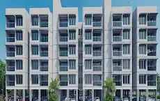
Cristal County II
BHASHYAM PROJECTS · Rangareddy · RERA P02400001331
CRISTAL COUNTY II is a plotted development by BHASHYAM PROJECTS in Nandigama, Nandigama Mandal, Ranga Reddy District. The RERA land record gives a site extent of 61,430.14 sq m; the layout drawing shows plots numbered 1 to 197, with no RERA-filed plot-size schedule supplied. The TG-RERA registration number is P02400001331, and the proposed completion date was 11/10/2021.
More from Bhashyam Projects · 10 projects →
01What we found
Read from TG-RERA filings, approvals, land and registration records and court records. A court case is counted only when the court record states this project's survey number with its village, or names the project.
02Check before you pay
6 items to check before you pay, 3 high - from the title chain, court records and approvals, each with what to ask the builder or your advocate. An item may not be a problem with the project: records can be incomplete.
1. Project at a glance
Project identity
| Item | Project record |
|---|---|
| Registered name | CRISTAL COUNTY II RERA record |
| Project type / phase | Plotted development; registered portion described as CRISTAL COUNTY II. A separate phase number is not disclosed. RERA record |
| TG-RERA registration | P02400001331 |
| Registration validity | 11/11/2019 to 11/10/2021; the certificate states a one-year validity and that extension is possible under the Act and Rules. The supplied certificate records no extension. Registration validity is distinct from the completion date. |
| Registered promoter | BHASHYAM PROJECTS RERA record Corporate record |
| RERA status | The project is recorded as “New Project”; the registration certificate’s stated validity ended on 11/10/2021. No current registration-extension record or current project-status entry is supplied. RERA record |
Land and geographic identity
| Item | Project record |
|---|---|
| Locality / revenue village | Nandigama; the RERA registration certificate gives locality as Nandigama. RERA record |
| Mandal / district / PIN | Nandigama Mandal; Ranga Reddy District; 502300. RERA record RERA filing |
| Project survey numbers | 365, 371, 372, 373/P, 375, 376, 377, 378/P (as stated in the RERA registration certificate). |
| Survey numbers in final-layout records | HMDA final-layout documents also list 365, 371, 372, 373, 375, 376, 377, 378, 379, 380; the RERA filing identifies the project survey numbers above. |
| Registered site extent | 61,430.14 sq m in the RERA land record. RERA filing |
| Layout drawing extent | 61,430.63 sq m on the final-layout drawing. Layout record |
| Boundaries stated in RERA filing | East: OTHER LAND; West: OTHER LAND; North: OTHER LAND; South: ROAD WIDTH 12 19. RERA filing |
Development identity
| Item | Project record |
|---|---|
| Sanctioning authority | Hyderabad Metropolitan Development Authority (HMDA). Approvals record |
| Principal final-layout approval | HMDA Final Layout Letter, 000215/LQ/Plg/HMDA/2018, dated 22 April, 2019. The layout drawing also records permit 000215/LO/Plg/HMDA/2018, dated 22-04-2019. |
| Approved built-up area | 38,313.00 sq m is recorded under RERA “Approved Built up Area”; no building-floor schedule is supplied to explain its scope for this plotted layout. RERA filing |
| Buildings / floors | Not applicable to the evidenced plotted-layout offering; no building count or residential floor configuration is disclosed. RERA record |
| Layout land-use figures | The drawing-derived layout record lists 38,313.00 sq m plotted area, 16,582.43 sq m roads, 4,994.23 sq m parks/open space, 1,540.45 sq m social infrastructure and 0.00 sq m amenities. Layout record |
| Unit count | The layout drawing shows plot numbers 1 to 197; this is a software-read count from the drawing, not a RERA-filed unit count. Layout record |
| Mortgage area | 5,899.20 sq m declared in the RERA land fields. RERA filing |
Offering and status
| Item | Project record |
|---|---|
| Offering | Residential plots; no RERA-filed plot-size schedule, booked/available inventory, or plot-wise saleable area is supplied in this evidence set. RERA record RERA unit table |
| Original proposed completion | 11/10/2021 in the project information fields. RERA filing |
| Promoter’s Form-B completion undertaking | 22/04/2022. This is a promoter declaration, not evidence of a revised RERA completion date or an extension order. |
| Construction / development stage | RERA progress extract records internal roads and footpaths at 80%, water supply at 60%, sewerage at 40%, green strip/tot lot/park at 30%, and street lighting at 10%. These are reported progress figures; no independent site verification is supplied. RERA amenities |
| Occupancy/completion certificate | No occupancy or completion certificate is supplied in the evidence pack. For a plotted layout, the supplied records concern layout approval; they do not establish a project-wide completion certificate. Document index Approvals record |
2. The project story
CRISTAL COUNTY II is registered as a residential plotted development by BHASHYAM PROJECTS, at Nandigama in Nandigama Mandal, Ranga Reddy District. The RERA certificate identifies the project survey numbers as 365, 371, 372, 373/P, 375, 376, 377, 378/P. HMDA’s final-layout record describes a residential layout with open plots and records roads and open spaces as handed over to the local authority; the registration materials do not describe apartment blocks or a tower-based development. RERA record
The layout drawing depicts a plotted area, internal roads, open space/park and social-infrastructure land. It shows plot numbers 1–197, but the count is software-read and is not a RERA-filed inventory count. The project’s proposed completion date in the project-information fields was 11/10/2021; the promoter’s Form-B declaration separately undertook completion by 22/04/2022. The available records do not establish which date, if either, was later approved as an extension, nor do they independently verify present site progress or completion. Layout record RERA filing
3. Master plan, architecture & building design
This is a plotted layout, not a building plan for apartment or villa blocks. No building count, floor configuration, apartment arrangement, or building footprint is evidenced. The supplied 38,313.00 sq m RERA “Approved Built up Area” is reproduced as filed and is not treated here as plot saleable area. RERA filing
The HMDA final-layout record covers 61,430.63 sq m and identifies a residential final layout across the survey numbers listed in that approval. Its area schedule records 38,313.00 sq m as plotted area, 16,582.43 sq m as roads, 4,994.23 sq m as parks/open space and 1,540.45 sq m as social infrastructure; the drawing-derived layout summary separately records 0.00 sq m for amenities. These are layout land-use figures, not saleable or carpet area. Layout record
The RERA land record gives a site extent of 61,430.14 sq m, while the HMDA layout documents state 61,430.63 sq m. The final-layout drawing specifies road widths of 12.19 and 9.14m. The layout record lists rainwater-harvesting pits, water and drainage pipelines, electrical lines, manholes, avenue plantations, a sump, overhead water tank and transformer as infrastructure provisions; these document descriptions do not establish present completion. RERA filing
4. Homes, configurations & floor plans
The registered offering is plots. A RERA-filed plot-size schedule, unit-wise booked/available counts and plot saleable-area figures are not supplied. The layout drawing’s software-read count is 197 plots, numbered 1 to 197; the drawing extraction reports no plot sizes, so size bands cannot be provided. RERA record Layout record RERA unit table
A third-party vendor record describes a plot configuration with a “saleable” range of 1683 - 1818 Sq Feet; this is not a RERA-filed figure and is not used as the project’s registered plot-size schedule. Promoter website
The supplied floor-plan review reports five drawings: 0 measured, 3 scans pending, and 2 with no flats. Carpet-area measurements and apartment configurations are therefore not available for this plotted project. Floor plans
5. Parking & vehicle circulation
The layout drawing shows internal roads with widths of 12.19 and 9.14m, and records roads as part of the layout provision. The RERA materials supplied do not establish a parking-space count, visitor or accessible parking, parking allocation to individual plots, or a parking allotment arrangement.
6. Amenities, recreation & open spaces
The following progress percentages are in the supplied RERA amenity/progress record. They are reported figures, not independently verified completion status. RERA amenities
| Facility | Description / size | Evidence source | Declared progress / verified status |
|---|---|---|---|
| Internal roads & footpaths | Layout roads; drawing records widths of 12.19 and 9.14m. | RERA amenities | 80% reported; not independently verified. |
| Green strip / tot lot / park | The layout area schedule records 4,994.23 sq m for parks/open space. | RERA amenities Layout record | 30% reported; not independently verified. |
| Community buildings | No size or facility detail supplied. | RERA amenities | 0% reported. |
| Recreational open space | No separate progress figure beyond the layout open-space entry. | RERA amenities Layout record | 0% reported in the amenity record; not independently verified. |
| Social infrastructure | 1,540.45 sq m in the layout drawing’s area schedule. | Layout record | No progress figure supplied. |
| Swimming pool, clubhouse, badminton court, walking/jogging track and playground | Listed in a third-party vendor amenity list; no corresponding RERA-filed or approved facility detail is supplied here. | Promoter website | Vendor-listed only; delivery status not established. |
| Flower gardens and avenue plantation | Avenue plantations are listed in layout infrastructure; flower gardens are vendor-listed. | Promoter website | No completion verification supplied. |
7. Utilities, building services & safety
The HMDA layout drawing lists water pipe lines, drainage pipe lines, electrical lines, manholes, sump, overhead water tank (O.H.T), transformer (TR) and Harvesting Pits 4X4X6 61 No's as layout provisions. The amenity-progress record reports water supply at 60%, sewerage at 40%, and water conservation/rainwater harvesting at 0%. These are documentary descriptions and reported progress figures, not independent confirmation of operational service or completion. RERA amenities
The amenity record reports storm-water drains, sewage/sullage treatment and disposal, solid-waste management, energy management, fire protection/fire-safety requirements, and electrical meter room/sub-station/receiving station at 0%. It gives no capacities or technical specifications for water storage, sewerage treatment, electrical backup, waste systems, security or accessibility. RERA amenities
8. Location, access & connectivity
The official project record places CRISTAL COUNTY II at Nandigama, Nandigama Mandal, Ranga Reddy District, PIN 502300. The HMDA final-layout document identifies Nandigaon/Nandigama village and Patancheruvu Mandal in its layout records. RERA record
The final-layout records refer to roads of 12.19 and 9.14m and state that roads and open spaces were taken over by the local authority; one cited deed is gift deed 12853/2019, dated 19-03-2019. No independently sourced public-transport, landmark-distance or travel-time information is supplied for the registered location.
9. Developer & development status
The registered promoter is BHASHYAM PROJECTS, identified in the RERA filing as a Partnership. The RERA project record lists BHASHYAM NAVEEN as authorized signatory and BHASHYAM LAVANYA as partner. The supplied promoter address is SRIRAMASETHU NILAYAM, S R NAGAR, NANDIGAMA, NANDIGAMA, Nandigama, Ranga Reddy, 502300; the registration certificate separately prints a promoter-office address at Shamshabad, Ranga Reddy District, PIN 500038. Corporate record Parties record
The promoter’s Form-B affidavit, dated 06/07/2019, declares legal title, states that the land is free from encumbrances, and undertakes completion by 22/04/2022. These are promoter declarations. The available RERA progress record reports development figures for roads, water, sewerage, green space and street lighting; it does not provide an independently verified current construction or completion assessment. RERA amenities
10. Approvals, official records & documents
| Record | What the supplied material identifies |
|---|---|
| TG-RERA registration certificate | FORM C registration P02400001331 for CRISTAL COUNTY II, promoter Bhashyam Projects; validity 11/11/2019–11/10/2021. |
| HMDA final-layout letter | Final residential layout approval 000215/LQ/Plg/HMDA/2018, dated 22 April, 2019, for the listed Nandigaon/Nandigama survey parcels; roads and open spaces are recorded as handed over to the local authority. |
| HMDA final-layout drawing | Permit 000215/LO/Plg/HMDA/2018, dated 22-04-2019; area and layout provisions are described in the drawing. |
| Earlier HMDA layout record | Approval L_P.No.13/Lo/PIgHMDA/2016, dated 21-3-2018, filed as a layout-plan document. |
| Promoter declaration | Form-B affidavit by B Naveen, authorized signatory of BHASHYAM PROJECTS, dated 06/07/2019, containing title, encumbrance, project-fund and completion declarations. |
| Other approval-type upload | Document 72978 contains an OCR-extracted LP number 000215/O/L/HDA/20186 and date 22.03.2019; applicant, location and extent are not legible in the supplied text. |
| Completion / occupancy certificate | No completion or occupancy certificate is included in the supplied materials. Document index |
1. Project at a glance
Project identity
Registered name: CRISTAL COUNTY II
Project type / phase: Plotted development; registered portion described as CRISTAL COUNTY II. A separate phase number is not disclosed.
TG-RERA registration: P02400001331
Registration validity: 11/11/2019 to 11/10/2021; the certificate states a one-year validity and that extension is possible under the Act and Rules. The supplied certificate records no extension. Registration validity is distinct from the completion date.
Registered promoter: BHASHYAM PROJECTS
RERA status: The project is recorded as “New Project”; the registration certificate’s stated validity ended on 11/10/2021. No current registration-extension record or current project-status entry is supplied.
Land and geographic identity
Locality / revenue village: Nandigama; the RERA registration certificate gives locality as Nandigama.
Mandal / district / PIN: Nandigama Mandal; Ranga Reddy District; 502300.
Project survey numbers: 365, 371, 372, 373/P, 375, 376, 377, 378/P (as stated in the RERA registration certificate).
Survey numbers in final-layout records: HMDA final-layout documents also list 365, 371, 372, 373, 375, 376, 377, 378, 379, 380; the RERA filing identifies the project survey numbers above.
Registered site extent: 61,430.14 sq m in the RERA land record.
Layout drawing extent: 61,430.63 sq m on the final-layout drawing.
Boundaries stated in RERA filing: East: OTHER LAND; West: OTHER LAND; North: OTHER LAND; South: ROAD WIDTH 12 19.
Development identity
Sanctioning authority: Hyderabad Metropolitan Development Authority (HMDA).
Principal final-layout approval: HMDA Final Layout Letter, 000215/LQ/Plg/HMDA/2018, dated 22 April, 2019. The layout drawing also records permit 000215/LO/Plg/HMDA/2018, dated 22-04-2019.
Approved built-up area: 38,313.00 sq m is recorded under RERA “Approved Built up Area”; no building-floor schedule is supplied to explain its scope for this plotted layout.
Buildings / floors: Not applicable to the evidenced plotted-layout offering; no building count or residential floor configuration is disclosed.
Layout land-use figures: The drawing-derived layout record lists 38,313.00 sq m plotted area, 16,582.43 sq m roads, 4,994.23 sq m parks/open space, 1,540.45 sq m social infrastructure and 0.00 sq m amenities.
Unit count: The layout drawing shows plot numbers 1 to 197; this is a software-read count from the drawing, not a RERA-filed unit count.
Mortgage area: 5,899.20 sq m declared in the RERA land fields.
Offering and status
Offering: Residential plots; no RERA-filed plot-size schedule, booked/available inventory, or plot-wise saleable area is supplied in this evidence set.
Original proposed completion: 11/10/2021 in the project information fields.
Promoter’s Form-B completion undertaking: 22/04/2022. This is a promoter declaration, not evidence of a revised RERA completion date or an extension order.
Construction / development stage: RERA progress extract records internal roads and footpaths at 80%, water supply at 60%, sewerage at 40%, green strip/tot lot/park at 30%, and street lighting at 10%. These are reported progress figures; no independent site verification is supplied.
Occupancy/completion certificate: No occupancy or completion certificate is supplied in the evidence pack. For a plotted layout, the supplied records concern layout approval; they do not establish a project-wide completion certificate.
2. The project story
CRISTAL COUNTY II is registered as a residential plotted development by BHASHYAM PROJECTS, at Nandigama in Nandigama Mandal, Ranga Reddy District. The RERA certificate identifies the project survey numbers as 365, 371, 372, 373/P, 375, 376, 377, 378/P. HMDA’s final-layout record describes a residential layout with open plots and records roads and open spaces as handed over to the local authority; the registration materials do not describe apartment blocks or a tower-based development.
The layout drawing depicts a plotted area, internal roads, open space/park and social-infrastructure land. It shows plot numbers 1–197, but the count is software-read and is not a RERA-filed inventory count. The project’s proposed completion date in the project-information fields was 11/10/2021; the promoter’s Form-B declaration separately undertook completion by 22/04/2022. The available records do not establish which date, if either, was later approved as an extension, nor do they independently verify present site progress or completion.
3. Master plan, architecture & building design
This is a plotted layout, not a building plan for apartment or villa blocks. No building count, floor configuration, apartment arrangement, or building footprint is evidenced. The supplied 38,313.00 sq m RERA “Approved Built up Area” is reproduced as filed and is not treated here as plot saleable area.
The HMDA final-layout record covers 61,430.63 sq m and identifies a residential final layout across the survey numbers listed in that approval. Its area schedule records 38,313.00 sq m as plotted area, 16,582.43 sq m as roads, 4,994.23 sq m as parks/open space and 1,540.45 sq m as social infrastructure; the drawing-derived layout summary separately records 0.00 sq m for amenities. These are layout land-use figures, not saleable or carpet area.
The RERA land record gives a site extent of 61,430.14 sq m, while the HMDA layout documents state 61,430.63 sq m. The final-layout drawing specifies road widths of 12.19 and 9.14m. The layout record lists rainwater-harvesting pits, water and drainage pipelines, electrical lines, manholes, avenue plantations, a sump, overhead water tank and transformer as infrastructure provisions; these document descriptions do not establish present completion.
4. Homes, configurations & floor plans
The registered offering is plots. A RERA-filed plot-size schedule, unit-wise booked/available counts and plot saleable-area figures are not supplied. The layout drawing’s software-read count is 197 plots, numbered 1 to 197; the drawing extraction reports no plot sizes, so size bands cannot be provided.
A third-party vendor record describes a plot configuration with a “saleable” range of 1683 - 1818 Sq Feet; this is not a RERA-filed figure and is not used as the project’s registered plot-size schedule.
The supplied floor-plan review reports five drawings: 0 measured, 3 scans pending, and 2 with no flats. Carpet-area measurements and apartment configurations are therefore not available for this plotted project.
5. Parking & vehicle circulation
The layout drawing shows internal roads with widths of 12.19 and 9.14m, and records roads as part of the layout provision. The RERA materials supplied do not establish a parking-space count, visitor or accessible parking, parking allocation to individual plots, or a parking allotment arrangement.
6. Amenities, recreation & open spaces
The following progress percentages are in the supplied RERA amenity/progress record. They are reported figures, not independently verified completion status.
| Facility | Description / size | Evidence source | Declared progress / verified status |
|---|---|---|---|
| Internal roads & footpaths | Layout roads; drawing records widths of 12.19 and 9.14m. | 80% reported; not independently verified. | |
| Green strip / tot lot / park | The layout area schedule records 4,994.23 sq m for parks/open space. | 30% reported; not independently verified. | |
| Community buildings | No size or facility detail supplied. | 0% reported. | |
| Recreational open space | No separate progress figure beyond the layout open-space entry. | 0% reported in the amenity record; not independently verified. | |
| Social infrastructure | 1,540.45 sq m in the layout drawing’s area schedule. | No progress figure supplied. | |
| Swimming pool, clubhouse, badminton court, walking/jogging track and playground | Listed in a third-party vendor amenity list; no corresponding RERA-filed or approved facility detail is supplied here. | Vendor-listed only; delivery status not established. | |
| Flower gardens and avenue plantation | Avenue plantations are listed in layout infrastructure; flower gardens are vendor-listed. | No completion verification supplied. |
7. Utilities, building services & safety
The HMDA layout drawing lists water pipe lines, drainage pipe lines, electrical lines, manholes, sump, overhead water tank (O.H.T), transformer (TR) and Harvesting Pits 4X4X6 61 No's as layout provisions. The amenity-progress record reports water supply at 60%, sewerage at 40%, and water conservation/rainwater harvesting at 0%. These are documentary descriptions and reported progress figures, not independent confirmation of operational service or completion.
The amenity record reports storm-water drains, sewage/sullage treatment and disposal, solid-waste management, energy management, fire protection/fire-safety requirements, and electrical meter room/sub-station/receiving station at 0%. It gives no capacities or technical specifications for water storage, sewerage treatment, electrical backup, waste systems, security or accessibility.
8. Location, access & connectivity
The official project record places CRISTAL COUNTY II at Nandigama, Nandigama Mandal, Ranga Reddy District, PIN 502300. The HMDA final-layout document identifies Nandigaon/Nandigama village and Patancheruvu Mandal in its layout records.
The final-layout records refer to roads of 12.19 and 9.14m and state that roads and open spaces were taken over by the local authority; one cited deed is gift deed 12853/2019, dated 19-03-2019. No independently sourced public-transport, landmark-distance or travel-time information is supplied for the registered location.
9. Developer & development status
The registered promoter is BHASHYAM PROJECTS, identified in the RERA filing as a Partnership. The RERA project record lists BHASHYAM NAVEEN as authorized signatory and BHASHYAM LAVANYA as partner. The supplied promoter address is SRIRAMASETHU NILAYAM, S R NAGAR, NANDIGAMA, NANDIGAMA, Nandigama, Ranga Reddy, 502300; the registration certificate separately prints a promoter-office address at Shamshabad, Ranga Reddy District, PIN 500038.
The promoter’s Form-B affidavit, dated 06/07/2019, declares legal title, states that the land is free from encumbrances, and undertakes completion by 22/04/2022. These are promoter declarations. The available RERA progress record reports development figures for roads, water, sewerage, green space and street lighting; it does not provide an independently verified current construction or completion assessment.
10. Approvals, official records & documents
TG-RERA registration certificate: FORM C registration P02400001331 for CRISTAL COUNTY II, promoter Bhashyam Projects; validity 11/11/2019–11/10/2021.
HMDA final-layout letter: Final residential layout approval 000215/LQ/Plg/HMDA/2018, dated 22 April, 2019, for the listed Nandigaon/Nandigama survey parcels; roads and open spaces are recorded as handed over to the local authority.
HMDA final-layout drawing: Permit 000215/LO/Plg/HMDA/2018, dated 22-04-2019; area and layout provisions are described in the drawing.
Earlier HMDA layout record: Approval L_P.No.13/Lo/PIgHMDA/2016, dated 21-3-2018, filed as a layout-plan document.
Promoter declaration: Form-B affidavit by B Naveen, authorized signatory of BHASHYAM PROJECTS, dated 06/07/2019, containing title, encumbrance, project-fund and completion declarations.
Other approval-type upload: Document 72978 contains an OCR-extracted LP number 000215/O/L/HDA/20186 and date 22.03.2019; applicant, location and extent are not legible in the supplied text.
Completion / occupancy certificate: No completion or occupancy certificate is included in the supplied materials.
Frequently asked questions
Is CRISTAL COUNTY II registered with Telangana RERA?
Yes. CRISTAL COUNTY II is registered with the Telangana Real Estate Regulatory Authority as P02400001331; the registration status is New Project.
Who is the developer of CRISTAL COUNTY II?
The promoter named in the RERA registration is BHASHYAM PROJECTS.
Where is CRISTAL COUNTY II located?
CRISTAL COUNTY II is in NANDIGAMA, Rangareddy, Telangana (502300).
When will CRISTAL COUNTY II be completed?
The promoter's proposed date of completion filed with RERA is 11/10/2021. This is the promoter's declaration, not a guarantee.
More projects in Nandhigam