Empire Capetown
EMPIRE DELTA PROJECTS LLP · Sangareddy · RERA P01100003334
EMPIRE CAPETOWN is a plotted development at KANDI, KANDI mandal, Sangareddy district, with the filing locality listed as OPP ZPH SCHOOL. The registered promoter is EMPIRE DELTA PROJECTS LLP. The layout covers a total site area of 89,654.03 sq.m and is software-read from the approved drawing as containing 234 residential plots, with plot sizes ranging from 135.95–478.14 sq.m; towers and floors are not applicable to the open-layout proposal. It is registered with TG-RERA under P01100003334, with proposed completion by 25/02/2024.
📘 Project brochure from the promoter’s website ↗More from Empire Delta Projects LLP · 7 projects →
01What we found
Read from TG-RERA filings, approvals, land and registration records and court records. A court case is counted only when the court record states this project's survey number with its village, or names the project.
02Check before you pay
9 items to check before you pay, 3 high - from the title chain, court records and approvals, each with what to ask the builder or your advocate. An item may not be a problem with the project: records can be incomplete.
1. Project at a glance
Project identity
| Field | Project record |
|---|---|
| Registered project name | EMPIRE CAPETOWN RERA record |
| Project type | Plotted development / open residential layout RERA record RERA filing |
| Phase / registered portion | Phase not separately stated; TG-RERA registration is for the project identified by the listed Kandi survey numbers |
| TG-RERA registration | P01100003334 |
| Registration validity | 25/08/2021 to 25/02/2024; the supplied certificate records a two-year validity. This is registration validity, not a statement of the layout’s approval or completion status. |
| Registered promoter | EMPIRE DELTA PROJECTS LLP (also written “Empire Delta Projects Llp” in the certificate) RERA record Corporate record |
| Status shown in RERA filing | “New Project” RERA filing |
Land and geographic identity
| Field | Project record |
|---|---|
| Locality / site address | KANDI; filing locality: OPP ZPH SCHOOL. RERA record RERA filing |
| Revenue village | KANDI RERA record Land records |
| Mandal | KANDI RERA record Land records |
| District | Sangareddy RERA record Land records |
| PIN | 502285 RERA record |
| Project survey numbers | 729, 730, 733, 734, 736, 737, 738, 739, 740, 745, 746, 747, 749, 750, 751, 752, 753, 754 and 755 RERA record Land records |
| Subdivisions | The registration identifies the parent survey numbers above, without subdivisions. The supplied land-record extract lists multiple subdivisions under several of those parent numbers; it does not establish which subdivisions are held by the project. Land records |
| Site extent | Total site area 89,654.03 sq.m; net area 89,459.14 sq.m; area affected in road widening/FTL/Nala widening 194.89 sq.m. These are RERA-filed land figures. RERA filing |
| Boundaries in RERA filing | North: ROAD WIDTH 60 MTS; South: NALA; East: NEIGHBOURS LAND; West: NALA. RERA filing |
Development identity
| Field | Project record |
|---|---|
| Sanctioning authority | Hyderabad Metropolitan Development Authority (HMDA) Approvals record |
| Principal layout approval | Layout Permit No. 000127/LO/Plg/HMDA/2021, dated 26 February, 2021. The RERA filing gives the shortened number 000127/LO/Plg/HMDA/. Approvals record |
| Final-layout record | HMDA final layout release dated 18 April, 2023, associated with file/application 057649/LT/SKP/FLT/U6/HMDA/04112022; the filed records also include 057649/L51 SKP/FLT/06/ HMDA/04112022. Approvals record |
| Approved built-up area | Not disclosed in the supplied records; this is a plotted layout, not a building scheme. RERA filing |
| Towers / blocks and floor configuration | Not applicable to the approved open-layout proposal; no building count or floor schedule is supplied. |
| Layout scale from drawing | 234 plots, with plot numbers and areas software-read from the approved layout drawing; the drawing’s own area statement is reported to match the summed plot areas. This is a drawing-derived count, not an independently verified site count. Layout record |
| Approval status | RERA-filed material includes a draft layout letter and later final-layout records. The final-layout record includes an architect’s completion certificate; the supplied materials do not establish current on-site condition. |
Offering and status
| Field | Project record |
|---|---|
| Offered unit type | Residential plots RERA filing |
| Plot-size range | 135.95–478.14 sq.m (software-measured from the approved drawing); the corresponding supplied range is 162.6–571.9 sq.yd. Layout record |
| Booked / available counts | Not disclosed in the supplied project evidence. RERA filing |
| Construction / development stage | The filing labels the project “New Project”; an HMDA final-layout release and an architect’s completion certificate are present in the supplied records. No current independent site-progress assessment is supplied. RERA filing |
| Original completion undertaking | 25/02/2024, as shown in the project filing and registration record. RERA record |
| Revised completion date | Not disclosed in the supplied evidence. |
| Occupancy / completion-certificate status | The project is a plotted layout. The supplied file set includes a final-layout release and architect’s completion certificate; it does not provide a separate building occupancy certificate for homes. |
2. The project story
EMPIRE CAPETOWN is registered with TG-RERA as a residential plotted-development project at Kandi village, Kandi mandal, Sangareddy district. The registered land schedule covers survey numbers 729, 730, 733, 734, 736, 737, 738, 739, 740, 745, 746, 747, 749, 750, 751, 752, 753, 754 and 755. RERA record Land records
The approved-layout drawing is software-read as containing 234 numbered plots. The supplied records describe roads, parks/open space, social-infrastructure land and amenity land within the layout; they do not provide a current independent inspection of construction or delivery of those features. Layout record
The registration certificate records a validity period ending 25/02/2024, while the promoter’s Form B declaration undertakes completion by that date. Those dates do not, by themselves, establish present site completion. Separately, the supplied HMDA file includes a final-layout release dated 18 April, 2023 and an architect’s completion certificate.
3. Master plan, architecture & building design
This is an open plotted layout rather than a multi-storey building project. The RERA-filed land schedule states a total site area of 89,654.03 sq.m and net area of 89,459.14 sq.m. RERA filing
The approved-layout drawing’s area statement reports:
| Layout use | Area | Basis |
|---|---|---|
| Plots | 48,913.70 sq.m | Software-read from layout drawing / area statement Layout record |
| Roads | 25,451.98 sq.m | Software-read from layout drawing / area statement Layout record |
| Parks / open space | 12,103.69 sq.m | Software-read from layout drawing / area statement Layout record |
| Social infrastructure | 2,278.26 sq.m | Software-read from layout drawing / area statement Layout record |
| Amenities | 710.10 sq.m | Software-read from layout drawing / area statement Layout record |
The HMDA final-layout record separately lists 12,103.69 for “Organized open space/park Area/Uitility Area,” 2,278.26 for “Social Infrastructure Area,” 251.73 for “AccessoryUse Area,” and 194.89 for “BuffeZone Area.” These are labels and figures in the filed approval extraction; the record also lists a net plot area of 89,459.14 and total plot area of 89,654.03.
The final-layout extraction identifies residential plot use and residential zone, and records a 60.00 abutting-road width. It also lists internal-road widths including 12.0 M W D INTERNAL ROAD, existing 12.19m [40'-0"] WIDE ROAD, existing 9.14M [30'-0"] WIDE ROAD, and tower-line roads marked [10.06m] and [12.19m].
The layout drawing records 35 plots—78–85, 88–94, 97–106 and 109–118—as a 7,424.81 sq.m mortgage area for the approving authority, described in the drawing data as securing completion of layout infrastructure. Layout record
4. Homes, configurations & floor plans
The offering evidenced in the RERA filing is residential plots, not apartments. No RERA-filed apartment configuration, carpet-area schedule, booked/available inventory, or apartment floor plans are supplied. RERA filing RERA unit table
The approved-layout drawing is software-read as showing 234 plots. These plot counts and areas are drawing-derived and should be checked against the stamped approved drawing and the specific plot schedule for a purchase. Layout record
| Plot-size band | Plot count | Measurement basis |
|---|---|---|
| 150–200 sq.yd | 3 | Software-measured from drawing Layout record |
| 200–250 sq.yd | 133 | Software-measured from drawing Layout record |
| 250–300 sq.yd | 67 | Software-measured from drawing Layout record |
| 300–400 sq.yd | 26 | Software-measured from drawing Layout record |
| 400–500 sq.yd | 4 | Software-measured from drawing Layout record |
| 500–1000 sq.yd | 1 | Software-measured from drawing Layout record |
The software-read plot areas range from 135.95 sq.m (162.6 sq.yd) to 478.14 sq.m (571.9 sq.yd), with a median of 194.37 sq.m (232.5 sq.yd). These are drawing measurements, not a RERA-filed carpet or saleable-area schedule for any particular plot. Confirm the area and boundaries of the individual plot against the approved plan and transaction documents. Layout record
5. Parking & vehicle circulation
The supplied records do not establish a parking-space count, visitor or accessible parking provision, or parking allotments for individual plots. No parking level or vehicle ramp is applicable to the plotted-layout records supplied. Layout record
The final-layout extraction identifies internal roads and a walking/cycling track marked 2.0M. The layout drawing also gives road-area and road-width information; it does not establish a separate pedestrian-only network or the current completed condition of roads. Layout record
6. Amenities, recreation & open spaces
The final-layout approval extraction lists the following layout provisions. These are recorded in the filed approval/drawing material; the supplied evidence does not independently verify that each is complete or operating.
| Facility | Description / size | Evidence source | Declared progress / verified status |
|---|---|---|---|
| Parks / organized open space | 12,103.69 sq.m in the area statement | Layout record | Layout provision recorded; current site condition not independently verified |
| Tot lots | 410.03, 3,448.88, 1,412.30 and 1,451.05 (the approval extraction labels these “MTS”) | Listed in final-layout extraction; completion not independently verified | |
| Social infrastructure | 2,278.26 sq.m in the area statement; approval extraction also lists “AREA FOR SOCIAL INFRASTRUCTURE 1445.20 MTS” | Layout record | Provision recorded; delivery/status not independently verified |
| Amenity area | 710.09 MTS in approval extraction; 710.10 sq.m in drawing-derived land-use schedule | Layout record | Provision recorded; delivery/status not independently verified |
| Utility land / facilities | Overhead tank 131.21 MTS; septic tank 94.11 MTS; additional utility areas 223.98 MTS and 251.72 MTS | Listed in approval extraction; operating status not independently verified | |
| Garbage area | Listed, no area supplied | Listed; delivery/status not independently verified | |
| Transformer yard | Listed, no area supplied | Listed; delivery/status not independently verified | |
| Walking/cycling track | 2.0M CYCLIE & WALKING TRACK as printed in the approval extraction | Listed; delivery/status not independently verified |
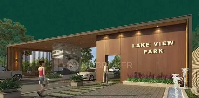
The developer-site brochure also claims a grand entrance arch, compound wall and 24/7 security, landscaped parks, internal CC roads, street lighting, underground water pipeline, underground sewerage, underground electricity cabling, overhead water tank, avenue plantation and kids’ play area. These are promotional claims in a layout flyer that does not itself print the project name, registration number, approval number or specific location; they are not treated here as verified or delivered facilities.
7. Utilities, building services & safety
The HMDA final-layout extraction lists an overhead tank, septic tank, other utility areas, garbage provision and transformer yard. It also names nala and irrigation-channel features in its notes. The supplied record does not establish water source or storage capacity, sewage-treatment capacity, reuse arrangements, storm-water design details, electrical-supply capacity, backup provision, or current operating status.
The RERA amenities record marks internal roads and footpaths, water supply, sewerage, storm-water drains, green strip/tot lot/park, street lighting and rainwater harvesting as available at 100%. It marks community buildings, treatment and disposal of sewage and sullage water, solid-waste management, energy management, fire protection and safety, electrical meter room/substation/receiving station, and aggregate recreational open space at 0%. These are RERA-recorded progress values, not independent site verification. RERA amenities
The supplied record does not specify fire-safety systems, fire clearances, accessibility features, CCTV, waste-segregation arrangements, or emergency access. The brochure’s security and utility statements remain promotional claims. RERA amenities
8. Location, access & connectivity
The registered project location is KANDI, Kandi mandal, Sangareddy district, Telangana, PIN 502285; the RERA address field gives the locality as OPP ZPH SCHOOL. The filing describes the northern boundary as ROAD WIDTH 60 MTS and the eastern boundary as neighbouring land, with nala on the southern and western boundaries. RERA record RERA filing RERA filing
The location record gives coordinates 17.5812658, 78.1084523 for Kandi, Kandi mandal, Sangareddy, Telangana, 502285, and records the nearest sampled Outer Ring Road interchange at 17.0 km (approx). Location record
The promoter-site material describes the project as being on the Mumbai highway and lists travel-time/distance claims to nearby places. These are marketing claims, not independently measured connectivity findings. Promoter website
9. Developer & development status
The registered legal promoter is EMPIRE DELTA PROJECTS LLP, an LLP. The supplied corporate identifier is GSTIN 36AAFFE6187R1ZL; the RERA filing displays the masked identifier xxxxxx187R. The project filing gives the promoter address as GAMUT DI LUSSO, ROAD NO.12,, MUMBAI HIGHWAY, OPP ZPH SCHOOL, KANDI, Sangareddy, 502285. RERA record Corporate record Parties record
The project evidence identifies ARJUN YERATHA REDDY as authorized signatory and DAMUGATLA SUCHIT REDDY, YERATHA ACHYUTH REDDY and DAMUGATLA VIKAS REDDY as partners. Parties record
The project website supplied is https://empiredelta.com/empire-capetown/index.html. The brochure lists sales contacts 9353 500 800 and 9963 500 500 and www.empiredelta.com. Parties record
The promoter’s Form B affidavit, dated 19th April, 2021 at Hyderabad, declares legal title/development documentation, states the land is free from encumbrances, and undertakes completion by 25ft Febru ary 2024 as transcribed in the supplied extraction. These are promoter declarations; the supplied evidence does not provide an independent current site-progress assessment.
10. Approvals, official records & documents
| Identifier / date | P01100003334, issued 25/08/2021; validity to 25/02/2024 |
|---|---|
| What the supplied record establishes | Form C registration for EMPIRE CAPETOWN; includes a separate-account condition. |
| Identifier / date | 000127/LO/Plg/HMDA/2021, 26 February, 2021; proceedings 035700/SKP/LT/U6/HMDA/29032020 |
|---|---|
| What the supplied record establishes | Draft layout letter for the plotted open-layout proposal at Kandi, covering the registered survey schedule. |
| Identifier / date | Permit 000127/LO/Plg/HMDA/2021; file/application 057649/LT/SKP/FLT/U6/HMDA/04112022; dated 18 April, 2023 |
|---|---|
| What the supplied record establishes | Filed extraction includes an architect’s completion certificate and final residential open-layout approval for net area 89,459.14 sq.m. |
| Identifier / date | 057649/L51 SKP/FLT/06/ HMDA/04112022, dated 18/04/2023 |
|---|---|
| What the supplied record establishes | Final-layout record for the Kandi survey schedule. |
| Identifier / date | 10569/2023, dated 03/28/2023 as transcribed |
|---|---|
| What the supplied record establishes | Referenced in the HMDA final-layout record. |
| Identifier / date | 19th April, 2021 |
|---|---|
| What the supplied record establishes | Promoter affidavit covering title/encumbrance declarations, completion undertaking and project-fund commitments. |
| Identifier / date | Document 174334 |
|---|---|
| What the supplied record establishes | The supplied extraction identifies a title opinion dated as transcribed 2310612021; the final opinion is not present in the supplied OCR. |
| Identifier / date | Statement 53419370 |
|---|---|
| What the supplied record establishes | Government of Telangana Registration and Stamps Department statement covering the printed search period 01-10-2007 to 12-02-2021; it records transactions and is not a nil-search certificate. |
The supplied records contain a draft layout letter, final-layout material, an architect’s completion certificate, a registration certificate and filed title/encumbrance documents. The title-report extraction is incomplete, and the layout drawing is software-read; this overview does not independently verify title, plot boundaries, infrastructure completion or current site condition. Layout record
1. Project at a glance
Project identity
Registered project name: EMPIRE CAPETOWN
Project type: Plotted development / open residential layout
Phase / registered portion: Phase not separately stated; TG-RERA registration is for the project identified by the listed Kandi survey numbers
TG-RERA registration: P01100003334
Registration validity: 25/08/2021 to 25/02/2024; the supplied certificate records a two-year validity. This is registration validity, not a statement of the layout’s approval or completion status.
Registered promoter: EMPIRE DELTA PROJECTS LLP (also written “Empire Delta Projects Llp” in the certificate)
Status shown in RERA filing: “New Project”
Land and geographic identity
Locality / site address: KANDI; filing locality: OPP ZPH SCHOOL.
Revenue village: KANDI
Mandal: KANDI
District: Sangareddy
PIN: 502285
Project survey numbers: 729, 730, 733, 734, 736, 737, 738, 739, 740, 745, 746, 747, 749, 750, 751, 752, 753, 754 and 755
Subdivisions: The registration identifies the parent survey numbers above, without subdivisions. The supplied land-record extract lists multiple subdivisions under several of those parent numbers; it does not establish which subdivisions are held by the project.
Site extent: Total site area 89,654.03 sq.m; net area 89,459.14 sq.m; area affected in road widening/FTL/Nala widening 194.89 sq.m. These are RERA-filed land figures.
Boundaries in RERA filing: North: ROAD WIDTH 60 MTS; South: NALA; East: NEIGHBOURS LAND; West: NALA.
Development identity
Sanctioning authority: Hyderabad Metropolitan Development Authority (HMDA)
Principal layout approval: Layout Permit No. 000127/LO/Plg/HMDA/2021, dated 26 February, 2021. The RERA filing gives the shortened number 000127/LO/Plg/HMDA/.
Final-layout record: HMDA final layout release dated 18 April, 2023, associated with file/application 057649/LT/SKP/FLT/U6/HMDA/04112022; the filed records also include 057649/L51 SKP/FLT/06/ HMDA/04112022.
Approved built-up area: Not disclosed in the supplied records; this is a plotted layout, not a building scheme.
Towers / blocks and floor configuration: Not applicable to the approved open-layout proposal; no building count or floor schedule is supplied.
Layout scale from drawing: 234 plots, with plot numbers and areas software-read from the approved layout drawing; the drawing’s own area statement is reported to match the summed plot areas. This is a drawing-derived count, not an independently verified site count.
Approval status: RERA-filed material includes a draft layout letter and later final-layout records. The final-layout record includes an architect’s completion certificate; the supplied materials do not establish current on-site condition.
Offering and status
Offered unit type: Residential plots
Plot-size range: 135.95–478.14 sq.m (software-measured from the approved drawing); the corresponding supplied range is 162.6–571.9 sq.yd.
Booked / available counts: Not disclosed in the supplied project evidence.
Construction / development stage: The filing labels the project “New Project”; an HMDA final-layout release and an architect’s completion certificate are present in the supplied records. No current independent site-progress assessment is supplied.
Original completion undertaking: 25/02/2024, as shown in the project filing and registration record.
Revised completion date: Not disclosed in the supplied evidence.
Occupancy / completion-certificate status: The project is a plotted layout. The supplied file set includes a final-layout release and architect’s completion certificate; it does not provide a separate building occupancy certificate for homes.
2. The project story
EMPIRE CAPETOWN is registered with TG-RERA as a residential plotted-development project at Kandi village, Kandi mandal, Sangareddy district. The registered land schedule covers survey numbers 729, 730, 733, 734, 736, 737, 738, 739, 740, 745, 746, 747, 749, 750, 751, 752, 753, 754 and 755.
The approved-layout drawing is software-read as containing 234 numbered plots. The supplied records describe roads, parks/open space, social-infrastructure land and amenity land within the layout; they do not provide a current independent inspection of construction or delivery of those features.
The registration certificate records a validity period ending 25/02/2024, while the promoter’s Form B declaration undertakes completion by that date. Those dates do not, by themselves, establish present site completion. Separately, the supplied HMDA file includes a final-layout release dated 18 April, 2023 and an architect’s completion certificate.
3. Master plan, architecture & building design
This is an open plotted layout rather than a multi-storey building project. The RERA-filed land schedule states a total site area of 89,654.03 sq.m and net area of 89,459.14 sq.m.
The approved-layout drawing’s area statement reports:
| Layout use | Area | Basis |
|---|---|---|
| Plots | 48,913.70 sq.m | Software-read from layout drawing / area statement |
| Roads | 25,451.98 sq.m | Software-read from layout drawing / area statement |
| Parks / open space | 12,103.69 sq.m | Software-read from layout drawing / area statement |
| Social infrastructure | 2,278.26 sq.m | Software-read from layout drawing / area statement |
| Amenities | 710.10 sq.m | Software-read from layout drawing / area statement |
The HMDA final-layout record separately lists 12,103.69 for “Organized open space/park Area/Uitility Area,” 2,278.26 for “Social Infrastructure Area,” 251.73 for “AccessoryUse Area,” and 194.89 for “BuffeZone Area.” These are labels and figures in the filed approval extraction; the record also lists a net plot area of 89,459.14 and total plot area of 89,654.03.
The final-layout extraction identifies residential plot use and residential zone, and records a 60.00 abutting-road width. It also lists internal-road widths including 12.0 M W D INTERNAL ROAD, existing 12.19m [40'-0"] WIDE ROAD, existing 9.14M [30'-0"] WIDE ROAD, and tower-line roads marked [10.06m] and [12.19m].
The layout drawing records 35 plots—78–85, 88–94, 97–106 and 109–118—as a 7,424.81 sq.m mortgage area for the approving authority, described in the drawing data as securing completion of layout infrastructure.
4. Homes, configurations & floor plans
The offering evidenced in the RERA filing is residential plots, not apartments. No RERA-filed apartment configuration, carpet-area schedule, booked/available inventory, or apartment floor plans are supplied.
The approved-layout drawing is software-read as showing 234 plots. These plot counts and areas are drawing-derived and should be checked against the stamped approved drawing and the specific plot schedule for a purchase.
| Plot-size band | Plot count | Measurement basis |
|---|---|---|
| 150–200 sq.yd | 3 | Software-measured from drawing |
| 200–250 sq.yd | 133 | Software-measured from drawing |
| 250–300 sq.yd | 67 | Software-measured from drawing |
| 300–400 sq.yd | 26 | Software-measured from drawing |
| 400–500 sq.yd | 4 | Software-measured from drawing |
| 500–1000 sq.yd | 1 | Software-measured from drawing |
The software-read plot areas range from 135.95 sq.m (162.6 sq.yd) to 478.14 sq.m (571.9 sq.yd), with a median of 194.37 sq.m (232.5 sq.yd). These are drawing measurements, not a RERA-filed carpet or saleable-area schedule for any particular plot. Confirm the area and boundaries of the individual plot against the approved plan and transaction documents.
5. Parking & vehicle circulation
The supplied records do not establish a parking-space count, visitor or accessible parking provision, or parking allotments for individual plots. No parking level or vehicle ramp is applicable to the plotted-layout records supplied.
The final-layout extraction identifies internal roads and a walking/cycling track marked 2.0M. The layout drawing also gives road-area and road-width information; it does not establish a separate pedestrian-only network or the current completed condition of roads.
6. Amenities, recreation & open spaces
The final-layout approval extraction lists the following layout provisions. These are recorded in the filed approval/drawing material; the supplied evidence does not independently verify that each is complete or operating.
| Facility | Description / size | Evidence source | Declared progress / verified status |
|---|---|---|---|
| Parks / organized open space | 12,103.69 sq.m in the area statement | Layout provision recorded; current site condition not independently verified | |
| Tot lots | 410.03, 3,448.88, 1,412.30 and 1,451.05 (the approval extraction labels these “MTS”) | Listed in final-layout extraction; completion not independently verified | |
| Social infrastructure | 2,278.26 sq.m in the area statement; approval extraction also lists “AREA FOR SOCIAL INFRASTRUCTURE 1445.20 MTS” | Provision recorded; delivery/status not independently verified | |
| Amenity area | 710.09 MTS in approval extraction; 710.10 sq.m in drawing-derived land-use schedule | Provision recorded; delivery/status not independently verified | |
| Utility land / facilities | Overhead tank 131.21 MTS; septic tank 94.11 MTS; additional utility areas 223.98 MTS and 251.72 MTS | Listed in approval extraction; operating status not independently verified | |
| Garbage area | Listed, no area supplied | Listed; delivery/status not independently verified | |
| Transformer yard | Listed, no area supplied | Listed; delivery/status not independently verified | |
| Walking/cycling track | 2.0M CYCLIE & WALKING TRACK as printed in the approval extraction | Listed; delivery/status not independently verified |
The developer-site brochure also claims a grand entrance arch, compound wall and 24/7 security, landscaped parks, internal CC roads, street lighting, underground water pipeline, underground sewerage, underground electricity cabling, overhead water tank, avenue plantation and kids’ play area. These are promotional claims in a layout flyer that does not itself print the project name, registration number, approval number or specific location; they are not treated here as verified or delivered facilities.
7. Utilities, building services & safety
The HMDA final-layout extraction lists an overhead tank, septic tank, other utility areas, garbage provision and transformer yard. It also names nala and irrigation-channel features in its notes. The supplied record does not establish water source or storage capacity, sewage-treatment capacity, reuse arrangements, storm-water design details, electrical-supply capacity, backup provision, or current operating status.
The RERA amenities record marks internal roads and footpaths, water supply, sewerage, storm-water drains, green strip/tot lot/park, street lighting and rainwater harvesting as available at 100%. It marks community buildings, treatment and disposal of sewage and sullage water, solid-waste management, energy management, fire protection and safety, electrical meter room/substation/receiving station, and aggregate recreational open space at 0%. These are RERA-recorded progress values, not independent site verification.
The supplied record does not specify fire-safety systems, fire clearances, accessibility features, CCTV, waste-segregation arrangements, or emergency access. The brochure’s security and utility statements remain promotional claims.
8. Location, access & connectivity
The registered project location is KANDI, Kandi mandal, Sangareddy district, Telangana, PIN 502285; the RERA address field gives the locality as OPP ZPH SCHOOL. The filing describes the northern boundary as ROAD WIDTH 60 MTS and the eastern boundary as neighbouring land, with nala on the southern and western boundaries.
The location record gives coordinates 17.5812658, 78.1084523 for Kandi, Kandi mandal, Sangareddy, Telangana, 502285, and records the nearest sampled Outer Ring Road interchange at 17.0 km (approx).
The promoter-site material describes the project as being on the Mumbai highway and lists travel-time/distance claims to nearby places. These are marketing claims, not independently measured connectivity findings.
9. Developer & development status
The registered legal promoter is EMPIRE DELTA PROJECTS LLP, an LLP. The supplied corporate identifier is GSTIN 36AAFFE6187R1ZL; the RERA filing displays the masked identifier xxxxxx187R. The project filing gives the promoter address as GAMUT DI LUSSO, ROAD NO.12,, MUMBAI HIGHWAY, OPP ZPH SCHOOL, KANDI, Sangareddy, 502285.
The project evidence identifies ARJUN YERATHA REDDY as authorized signatory and DAMUGATLA SUCHIT REDDY, YERATHA ACHYUTH REDDY and DAMUGATLA VIKAS REDDY as partners.
The project website supplied is https://empiredelta.com/empire-capetown/index.html. The brochure lists sales contacts 9353 500 800 and 9963 500 500 and www.empiredelta.com.
The promoter’s Form B affidavit, dated 19th April, 2021 at Hyderabad, declares legal title/development documentation, states the land is free from encumbrances, and undertakes completion by 25ft Febru ary 2024 as transcribed in the supplied extraction. These are promoter declarations; the supplied evidence does not provide an independent current site-progress assessment.
10. Approvals, official records & documents
| Identifier / date | P01100003334, issued 25/08/2021; validity to 25/02/2024 |
|---|---|
| What the supplied record establishes | Form C registration for EMPIRE CAPETOWN; includes a separate-account condition. |
| Identifier / date | 000127/LO/Plg/HMDA/2021, 26 February, 2021; proceedings 035700/SKP/LT/U6/HMDA/29032020 |
|---|---|
| What the supplied record establishes | Draft layout letter for the plotted open-layout proposal at Kandi, covering the registered survey schedule. |
| Identifier / date | Permit 000127/LO/Plg/HMDA/2021; file/application 057649/LT/SKP/FLT/U6/HMDA/04112022; dated 18 April, 2023 |
|---|---|
| What the supplied record establishes | Filed extraction includes an architect’s completion certificate and final residential open-layout approval for net area 89,459.14 sq.m. |
| Identifier / date | 057649/L51 SKP/FLT/06/ HMDA/04112022, dated 18/04/2023 |
|---|---|
| What the supplied record establishes | Final-layout record for the Kandi survey schedule. |
| Identifier / date | 10569/2023, dated 03/28/2023 as transcribed |
|---|---|
| What the supplied record establishes | Referenced in the HMDA final-layout record. |
| Identifier / date | 19th April, 2021 |
|---|---|
| What the supplied record establishes | Promoter affidavit covering title/encumbrance declarations, completion undertaking and project-fund commitments. |
| Identifier / date | Document 174334 |
|---|---|
| What the supplied record establishes | The supplied extraction identifies a title opinion dated as transcribed 2310612021; the final opinion is not present in the supplied OCR. |
| Identifier / date | Statement 53419370 |
|---|---|
| What the supplied record establishes | Government of Telangana Registration and Stamps Department statement covering the printed search period 01-10-2007 to 12-02-2021; it records transactions and is not a nil-search certificate. |
The supplied records contain a draft layout letter, final-layout material, an architect’s completion certificate, a registration certificate and filed title/encumbrance documents. The title-report extraction is incomplete, and the layout drawing is software-read; this overview does not independently verify title, plot boundaries, infrastructure completion or current site condition.
Frequently asked questions
Is EMPIRE CAPETOWN registered with Telangana RERA?
Yes. EMPIRE CAPETOWN is registered with the Telangana Real Estate Regulatory Authority as P01100003334; the registration status is New Project.
Who is the developer of EMPIRE CAPETOWN?
The promoter named in the RERA registration is EMPIRE DELTA PROJECTS LLP.
Where is EMPIRE CAPETOWN located?
EMPIRE CAPETOWN is in OPP ZPH SCHOOL, KANDI, Sangareddy, Telangana (502285).
When will EMPIRE CAPETOWN be completed?
The promoter's proposed date of completion filed with RERA is 25/02/2024. This is the promoter's declaration, not a guarantee.
More projects in Kandi