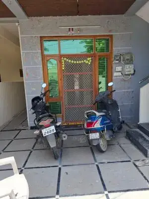
Virumbu Heights
M/s VIRUMBU CONSTRUCTIONS · Hanamkonda · RERA P00300004161
VIRUMBU HEIGHTS is a residential apartment project in SUBEDARI, Hanamkonda, Warangal Urban. It is being developed by the registered promoter M/s VIRUMBU CONSTRUCTIONS, a partnership. The project has a site area of 998.76 sq.m. and one building with 1 stilt + 5 upper floors, comprising 20 homes: 15 2BHK and 5 3BHK, with RERA-filed saleable areas of 104.36 sq.m. and 141.67 sq.m., respectively. Its TG-RERA registration is P00300004161, and its proposed and revised proposed completion dates are both 13/07/2027.
01What we found
Read from TG-RERA filings, approvals, land and registration records and court records. A court case is counted only when the court record states this project's survey number with its village, or names the project.
02Check before you pay
11 items to check before you pay, 3 high - from the title chain, court records and approvals, each with what to ask the builder or your advocate. An item may not be a problem with the project: records can be incomplete.
1. Project at a glance
Project identity
| Field | Record |
|---|---|
| Registered project name | VIRUMBU HEIGHTS RERA record |
| Project type | Residential apartment project RERA filing |
| Phase / registered portion | A single proposed residential apartment building is recorded; no separate phase name is disclosed |
| TG-RERA registration | P00300004161 Approvals record |
| Registration validity | 25/02/2022 to 13/03/2027, unless extended by the Authority |
| Registered promoter | M/s VIRUMBU CONSTRUCTIONS; partnership Parties record Corporate record |
| RERA status | “On-Going Project” in the project record RERA record |
Land and geographic identity
| Field | Record |
|---|---|
| Registered locality | SUBEDARI RERA record |
| Revenue village | Subedari in the project record RERA filing |
| Mandal / district / PIN | Hanamkonda / Warangal Urban / 506001 RERA record |
| Project survey number / subdivision | Not disclosed in the project land fields; the title documents identify Sy.No. 465, Waddepally Revenue Village. The record does not establish that as the registered project survey number for the Subedari site Land records |
| Site identifier | Plot No. 1-9-534 RERA filing |
| Site extent | 998.76 sq.m. total and net area; road-affected area recorded as 0 sq.m. RERA filing |
| Boundaries | East: 40 FEET ROAD; West: HOUSE OF PRABHAKAR; North: HNO 1-9-533 OF RAGHURAM; South: HNO 1-9-535 OF GURU BALVINDER SINGH RERA filing |
Development identity
| Field | Record |
|---|---|
| Sanctioning authority | Greater Warangal Municipal Corporation Approvals record |
| Principal building permit | 3006/24556/W37/2020, approved 13 March 2021 Approvals record |
| Approved built-up area | 2,084.28 sq.m. in the RERA project fields RERA filing |
| Building count | 1 building RERA filing |
| Sanctioned floor configuration | 1 stilt + 5 upper floors; building height 14.8 m |
| Parking levels / provision | Stilt and cellar are referred to in the permit’s parking condition, but the supplied extract does not establish a cellar level or provide a parking-space count |
| Units | 20 total units in the RERA record: 15 2BHK and 5 3BHK RERA unit table |
Offering and status
| Field | Record |
|---|---|
| RERA-filed configurations and saleable area | 2BHK: 104.36 sq.m.; 3BHK: 141.67 sq.m. RERA unit table |
| Booked / available | RERA portal snapshot lists 0 booked and 15 available 2BHK units, and 0 booked and 5 available 3BHK units; the booking record has no as-of date and is indicative RERA unit table |
| Construction stage | Project is recorded as on-going; the supplied material does not give independently verified physical progress RERA record RERA amenities |
| Completion dates | Proposed and revised proposed completion dates are both 13/07/2027 RERA filing |
| Registration expiry | 13/03/2027; this is the registration validity date, not the stated completion date |
| Occupancy / completion certificate | No occupancy or completion certificate is supplied for the project; the building permit requires completion notice and an occupancy certificate before occupation |
2. The project story
VIRUMBU HEIGHTS is registered as a residential apartment project in Subedari, Hanamkonda, with a registered site identified as Plot No. 1-9-534. The RERA record describes one building and 20 proposed homes: 15 two-bedroom and 5 three-bedroom apartments. The project’s proposed and revised completion date is 13/07/2027. RERA record RERA filing RERA filing RERA unit table
The Greater Warangal Municipal Corporation permit sanctions a proposed residential apartment building with one stilt and five upper floors. The project is recorded as on-going, but the supplied record does not independently establish the current construction stage. Amenity progress entries are filed percentages, not independent site verification. No occupancy or completion certificate is included in the evidence supplied for this overview. RERA record RERA amenities
3. Master plan, architecture & building design
The building permit records a single residential building on a net site area of 998.76 sq.m., with a building height of 14.8 m and residential upper-floor area of 2,035.90 sq.m. It also lists a stilt area of 447.92 sq.m. The RERA project fields separately state an approved built-up area of 2,084.28 sq.m.; these are distinct filed figures and are not interchangeable. RERA filing
The approved configuration is one stilt plus five upper floors. The supplied plan document is identified in the RERA file as a building-plan/layout-plan item, but its extracted drawing content is unavailable; details such as flats per floor, lifts, stairs, entrances, circulation, and internal arrangement cannot be confirmed from the available evidence. Document index
The permit lists a 50.27 sq.m. tot-lot, transformer space and a garbage house. It also requires tree planting along the periphery and at the front, and maintenance of a peripheral greenery strip. These are permit conditions or listed provision, not evidence that the facilities have been completed.
4. Homes, configurations & floor plans
The RERA filing lists 20 homes: 15 2BHK and 5 3BHK. The filing describes their respective saleable areas as 104.36 sq.m. and 141.67 sq.m. Drawing-based carpet areas below are software measurements from the supplied plan record, not RERA-filed measurements, and are flagged for review. RERA unit table RERA unit details Floor plans
| Configuration | Units | Booked | Available | RERA saleable area | Measured carpet area | Loading (if supplied) |
|---|---|---|---|---|---|---|
| 2BHK | 15 | 0 | 15 | 104.36 sq.m. | 64.3–99.9 sq.m.; median 71.3 sq.m. (software-measured) | 32% |
| 3BHK | 5 | 0 | 5 | 141.67 sq.m. | 89.5–97.9 sq.m.; median 93.7 sq.m. (software-measured) | 34% |
Software measurement covered five 2BHK designs and two 3BHK designs. The measured carpet-area ranges and loading figures are drawing-derived and require review; they are not RERA disclosures. Saleable area is the RERA-filed figure and should not be read as carpet area; the supplied drawing analysis notes that saleable area includes the home’s share of common areas. The available booking counts have no stated snapshot date. RERA unit details Floor plans RERA unit table
One measured 2BHK drawing panel identifies a bedroom, master bedroom, living/dining, kitchen, two toilets, balcony and utility; one 3BHK panel identifies three bedrooms, living/dining, kitchen, three toilets, balcony and utility. These are drawing-derived descriptions, not independent measurements of completed homes. RERA unit details
5. Parking & vehicle circulation
The building permit states that cellar and stilt areas approved for parking are to be used exclusively for vehicle parking, without partition walls or rolling shutters. The permit extract reports a stilt area of 447.92 sq.m.; it does not establish the number of parking spaces or confirm a cellar level. No resident, visitor, accessible or two-wheeler space counts, ramp details, EV provision, or unit-specific parking allocations are supplied. A drawn or designated parking area should not be treated as proof of exclusive ownership.
6. Amenities, recreation & open spaces
The RERA amenity record contains 14 entries. Its percentage figures are portal-declared progress fields; they do not independently verify completion. The building permit separately lists a tot-lot and other site provisions. RERA amenities
| Facility | Description / size | Evidence source | Declared progress / verified status |
|---|---|---|---|
| Green strip / tot-lot / park | Permit lists a tot-lot of 50.27 sq.m.; peripheral greenery and tree planting are also required by the permit | RERA amenities | RERA amenity entry: 0%; completion not independently verified |
| Aggregate recreational open space | No area specified in the supplied RERA amenity record | RERA amenities | Listed “YES”; 0%; completion not independently verified |
| Community buildings | No description or size supplied | RERA amenities | 0%; no completion evidence supplied |
| Internal roads and footpaths | No dimensions or layout detail supplied | RERA amenities | 0%; no completion evidence supplied |
| Street lighting | No details supplied | RERA amenities | 0%; no completion evidence supplied |
No evidence supplied here establishes a clubhouse or indoor recreation facilities, sports facilities, or convenience/community amenities beyond the entries shown.
7. Utilities, building services & safety
The RERA amenity record marks water supply as available “YES” with 50% progress, and water conservation/rainwater harvesting as “YES” with 50% progress. The permit requires a rainwater-harvesting percolation pit and lists six rainwater-harvesting structures; their completion is not independently verified. RERA amenities
Sewerage (including chambers, lines, septic tank and STP) is marked “YES” with 0% progress; treatment and disposal of sewage and sullage water are listed at 0%. Storm-water drains, solid-waste management and disposal, energy management, and fire protection/fire-safety requirements are each listed at 0%. The permit requires a garbage house and space for a transformer, while the RERA amenity record marks an electrical meter room/sub-station/receiving station “YES” at 0%. These records do not establish installed capacity or completed operation. RERA amenities
No supplied material specifies water source or storage capacity, STP capacity or reuse arrangement, electrical supply or backup, lift numbers or capacities, fire-system details, security/CCTV, or accessibility provisions. The permit states that occupancy requires an occupancy certificate; the supplied evidence does not include one.
8. Location, access & connectivity
The project is recorded in Subedari, Hanamkonda, Warangal Urban, PIN 506001, at Plot No. 1-9-534. Its filed boundaries identify a 40 FEET ROAD to the east, with neighbouring properties on the other three sides. RERA record RERA filing
The supplied location record provides a cadastral parcel-centroid coordinate of 17.41528, 78.35459 and lists Financial District (Nanakramguda) at 1.2 km. The record does not supply a source description or methodology for that connectivity entry, so it should be treated as a listed distance, not a verified travel route or travel time. No public-transport details or further approach-road information are supplied. Location record
9. Developer & development status
The registered promoter is M/s VIRUMBU CONSTRUCTIONS, recorded as a partnership, with GSTIN 36AATFV7701NIZC. The promoter address in the project record is GANGASANI NILAYAM, KANAKADURGA COLONY, BASITH NAGAR, SUBEDARI, Hanamkonda, Warangal Urban, 506001. No official website or contact details are supplied in the reviewed material. Parties record Corporate record
The project is recorded as on-going, with a proposed and revised completion date of 13/07/2027. This is the promoter’s recorded project timeline; no independent construction-progress verification or occupancy certificate is supplied. The permit covers the proposed residential building described in this overview. RERA record RERA filing
10. Approvals, official records & documents
| Evidence supplied | Form C, registration P00300004161, issued 25/02/2022; valid through 13/03/2027 unless extended |
|---|---|
| Scope / note | VIRUMBU HEIGHTS |
| Evidence supplied | Greater Warangal Municipal Corporation, permit/file no. 3006/24556/W37/2020, approved 13 March 2021 |
|---|---|
| Scope / note | Sanctions one proposed residential building with 1 stilt and 5 upper floors |
| Evidence supplied | RERA document record identifies a building-plan/layout-plan item, but the extracted plan content is unavailable Document index |
|---|---|
| Scope / note | Drawing-level review of layouts and detailed building services is limited |
| Evidence supplied | Promoter declaration filed in the RERA record |
|---|---|
| Scope / note | The supplied extraction states that the printed registration number and some declaration details are not reliably legible |
| Evidence supplied | Advocate’s title report and registered gift, supplementary and development-agreement documents are listed in the project evidence |
|---|---|
| Scope / note | Their land identity is recorded as Sy.No. 465, Waddepally Revenue Village; the project land fields identify Subedari and do not disclose a survey number |
| Evidence supplied | Not supplied |
|---|---|
| Scope / note | The building permit requires completion notice and occupancy certificate before occupation |
1. Project at a glance
Project identity
Registered project name: VIRUMBU HEIGHTS
Project type: Residential apartment project
Phase / registered portion: A single proposed residential apartment building is recorded; no separate phase name is disclosed
TG-RERA registration: P00300004161
Registration validity: 25/02/2022 to 13/03/2027, unless extended by the Authority
Registered promoter: M/s VIRUMBU CONSTRUCTIONS; partnership
RERA status: “On-Going Project” in the project record
Land and geographic identity
Registered locality: SUBEDARI
Revenue village: Subedari in the project record
Mandal / district / PIN: Hanamkonda / Warangal Urban / 506001
Project survey number / subdivision: Not disclosed in the project land fields; the title documents identify Sy.No. 465, Waddepally Revenue Village. The record does not establish that as the registered project survey number for the Subedari site
Site identifier: Plot No. 1-9-534
Site extent: 998.76 sq.m. total and net area; road-affected area recorded as 0 sq.m.
Boundaries: East: 40 FEET ROAD; West: HOUSE OF PRABHAKAR; North: HNO 1-9-533 OF RAGHURAM; South: HNO 1-9-535 OF GURU BALVINDER SINGH
Development identity
Sanctioning authority: Greater Warangal Municipal Corporation
Principal building permit: 3006/24556/W37/2020, approved 13 March 2021
Approved built-up area: 2,084.28 sq.m. in the RERA project fields
Building count: 1 building
Sanctioned floor configuration: 1 stilt + 5 upper floors; building height 14.8 m
Parking levels / provision: Stilt and cellar are referred to in the permit’s parking condition, but the supplied extract does not establish a cellar level or provide a parking-space count
Units: 20 total units in the RERA record: 15 2BHK and 5 3BHK
Offering and status
RERA-filed configurations and saleable area: 2BHK: 104.36 sq.m.; 3BHK: 141.67 sq.m.
Booked / available: RERA portal snapshot lists 0 booked and 15 available 2BHK units, and 0 booked and 5 available 3BHK units; the booking record has no as-of date and is indicative
Construction stage: Project is recorded as on-going; the supplied material does not give independently verified physical progress
Completion dates: Proposed and revised proposed completion dates are both 13/07/2027
Registration expiry: 13/03/2027; this is the registration validity date, not the stated completion date
Occupancy / completion certificate: No occupancy or completion certificate is supplied for the project; the building permit requires completion notice and an occupancy certificate before occupation
2. The project story
VIRUMBU HEIGHTS is registered as a residential apartment project in Subedari, Hanamkonda, with a registered site identified as Plot No. 1-9-534. The RERA record describes one building and 20 proposed homes: 15 two-bedroom and 5 three-bedroom apartments. The project’s proposed and revised completion date is 13/07/2027.
The Greater Warangal Municipal Corporation permit sanctions a proposed residential apartment building with one stilt and five upper floors. The project is recorded as on-going, but the supplied record does not independently establish the current construction stage. Amenity progress entries are filed percentages, not independent site verification. No occupancy or completion certificate is included in the evidence supplied for this overview.
3. Master plan, architecture & building design
The building permit records a single residential building on a net site area of 998.76 sq.m., with a building height of 14.8 m and residential upper-floor area of 2,035.90 sq.m. It also lists a stilt area of 447.92 sq.m. The RERA project fields separately state an approved built-up area of 2,084.28 sq.m.; these are distinct filed figures and are not interchangeable.
The approved configuration is one stilt plus five upper floors. The supplied plan document is identified in the RERA file as a building-plan/layout-plan item, but its extracted drawing content is unavailable; details such as flats per floor, lifts, stairs, entrances, circulation, and internal arrangement cannot be confirmed from the available evidence.
The permit lists a 50.27 sq.m. tot-lot, transformer space and a garbage house. It also requires tree planting along the periphery and at the front, and maintenance of a peripheral greenery strip. These are permit conditions or listed provision, not evidence that the facilities have been completed.
4. Homes, configurations & floor plans
The RERA filing lists 20 homes: 15 2BHK and 5 3BHK. The filing describes their respective saleable areas as 104.36 sq.m. and 141.67 sq.m. Drawing-based carpet areas below are software measurements from the supplied plan record, not RERA-filed measurements, and are flagged for review.
| Configuration | Units | Booked | Available | RERA saleable area | Measured carpet area | Loading (if supplied) |
|---|---|---|---|---|---|---|
| 2BHK | 15 | 0 | 15 | 104.36 sq.m. | 64.3–99.9 sq.m.; median 71.3 sq.m. (software-measured) | 32% |
| 3BHK | 5 | 0 | 5 | 141.67 sq.m. | 89.5–97.9 sq.m.; median 93.7 sq.m. (software-measured) | 34% |
Software measurement covered five 2BHK designs and two 3BHK designs. The measured carpet-area ranges and loading figures are drawing-derived and require review; they are not RERA disclosures. Saleable area is the RERA-filed figure and should not be read as carpet area; the supplied drawing analysis notes that saleable area includes the home’s share of common areas. The available booking counts have no stated snapshot date.
One measured 2BHK drawing panel identifies a bedroom, master bedroom, living/dining, kitchen, two toilets, balcony and utility; one 3BHK panel identifies three bedrooms, living/dining, kitchen, three toilets, balcony and utility. These are drawing-derived descriptions, not independent measurements of completed homes.
5. Parking & vehicle circulation
The building permit states that cellar and stilt areas approved for parking are to be used exclusively for vehicle parking, without partition walls or rolling shutters. The permit extract reports a stilt area of 447.92 sq.m.; it does not establish the number of parking spaces or confirm a cellar level. No resident, visitor, accessible or two-wheeler space counts, ramp details, EV provision, or unit-specific parking allocations are supplied. A drawn or designated parking area should not be treated as proof of exclusive ownership.
6. Amenities, recreation & open spaces
The RERA amenity record contains 14 entries. Its percentage figures are portal-declared progress fields; they do not independently verify completion. The building permit separately lists a tot-lot and other site provisions.
| Facility | Description / size | Evidence source | Declared progress / verified status |
|---|---|---|---|
| Green strip / tot-lot / park | Permit lists a tot-lot of 50.27 sq.m.; peripheral greenery and tree planting are also required by the permit | RERA amenity entry: 0%; completion not independently verified | |
| Aggregate recreational open space | No area specified in the supplied RERA amenity record | Listed “YES”; 0%; completion not independently verified | |
| Community buildings | No description or size supplied | 0%; no completion evidence supplied | |
| Internal roads and footpaths | No dimensions or layout detail supplied | 0%; no completion evidence supplied | |
| Street lighting | No details supplied | 0%; no completion evidence supplied |
No evidence supplied here establishes a clubhouse or indoor recreation facilities, sports facilities, or convenience/community amenities beyond the entries shown.
7. Utilities, building services & safety
The RERA amenity record marks water supply as available “YES” with 50% progress, and water conservation/rainwater harvesting as “YES” with 50% progress. The permit requires a rainwater-harvesting percolation pit and lists six rainwater-harvesting structures; their completion is not independently verified.
Sewerage (including chambers, lines, septic tank and STP) is marked “YES” with 0% progress; treatment and disposal of sewage and sullage water are listed at 0%. Storm-water drains, solid-waste management and disposal, energy management, and fire protection/fire-safety requirements are each listed at 0%. The permit requires a garbage house and space for a transformer, while the RERA amenity record marks an electrical meter room/sub-station/receiving station “YES” at 0%. These records do not establish installed capacity or completed operation.
No supplied material specifies water source or storage capacity, STP capacity or reuse arrangement, electrical supply or backup, lift numbers or capacities, fire-system details, security/CCTV, or accessibility provisions. The permit states that occupancy requires an occupancy certificate; the supplied evidence does not include one.
8. Location, access & connectivity
The project is recorded in Subedari, Hanamkonda, Warangal Urban, PIN 506001, at Plot No. 1-9-534. Its filed boundaries identify a 40 FEET ROAD to the east, with neighbouring properties on the other three sides.
The supplied location record provides a cadastral parcel-centroid coordinate of 17.41528, 78.35459 and lists Financial District (Nanakramguda) at 1.2 km. The record does not supply a source description or methodology for that connectivity entry, so it should be treated as a listed distance, not a verified travel route or travel time. No public-transport details or further approach-road information are supplied.
9. Developer & development status
The registered promoter is M/s VIRUMBU CONSTRUCTIONS, recorded as a partnership, with GSTIN 36AATFV7701NIZC. The promoter address in the project record is GANGASANI NILAYAM, KANAKADURGA COLONY, BASITH NAGAR, SUBEDARI, Hanamkonda, Warangal Urban, 506001. No official website or contact details are supplied in the reviewed material.
The project is recorded as on-going, with a proposed and revised completion date of 13/07/2027. This is the promoter’s recorded project timeline; no independent construction-progress verification or occupancy certificate is supplied. The permit covers the proposed residential building described in this overview.
10. Approvals, official records & documents
| Evidence supplied | Form C, registration P00300004161, issued 25/02/2022; valid through 13/03/2027 unless extended |
|---|---|
| Scope / note | VIRUMBU HEIGHTS |
| Evidence supplied | Greater Warangal Municipal Corporation, permit/file no. 3006/24556/W37/2020, approved 13 March 2021 |
|---|---|
| Scope / note | Sanctions one proposed residential building with 1 stilt and 5 upper floors |
| Evidence supplied | RERA document record identifies a building-plan/layout-plan item, but the extracted plan content is unavailable |
|---|---|
| Scope / note | Drawing-level review of layouts and detailed building services is limited |
| Evidence supplied | Promoter declaration filed in the RERA record |
|---|---|
| Scope / note | The supplied extraction states that the printed registration number and some declaration details are not reliably legible |
| Evidence supplied | Advocate’s title report and registered gift, supplementary and development-agreement documents are listed in the project evidence |
|---|---|
| Scope / note | Their land identity is recorded as Sy.No. 465, Waddepally Revenue Village; the project land fields identify Subedari and do not disclose a survey number |
| Evidence supplied | Not supplied |
|---|---|
| Scope / note | The building permit requires completion notice and occupancy certificate before occupation |
Frequently asked questions
Is VIRUMBU HEIGHTS registered with Telangana RERA?
Yes. VIRUMBU HEIGHTS is registered with the Telangana Real Estate Regulatory Authority as P00300004161; the registration status is On-Going Project.
Who is the developer of VIRUMBU HEIGHTS?
The promoter named in the RERA registration is M/s VIRUMBU CONSTRUCTIONS.
Where is VIRUMBU HEIGHTS located?
VIRUMBU HEIGHTS is in SUBEDARI, Hanamkonda, Telangana (506001).
When will VIRUMBU HEIGHTS be completed?
The promoter's proposed date of completion filed with RERA is 13/07/2027. This is the promoter's declaration, not a guarantee.
More projects in Subedari