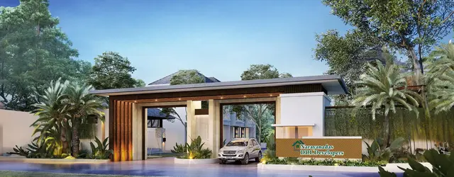
True Highlands Phase-I
VERITA INFRA INDIA LLP · Mahabubnagar · RERA P01400003980
TRUE HIGHLANDS PHASE-I is a plotted development in Mothighanapur, Balanagar Mandal, Mahabubnagar District, developed by registered promoter VERITA INFRA INDIA LLP. The registered site extent is 286153.21 sq. m, and the filed draft layout permission states 871 plots; buildings, floors and plot configurations are not disclosed. The project is registered with TG-RERA under P01400003980, with proposed completion on 15/12/2023.
More from Verita Infra India LLP · 8 projects →
01What we found
Read from TG-RERA filings, approvals, land and registration records and court records. A court case is counted only when the court record states this project's survey number with its village, or names the project.
02Check before you pay
7 items to check before you pay, 5 high - from the title chain, court records and approvals, each with what to ask the builder or your advocate. An item may not be a problem with the project: records can be incomplete.
1. Project at a glance
Project identity
| Item | Project record |
|---|---|
| Registered project | TRUE HIGHLANDS PHASE-I |
| Project type | Plotted development |
| Phase / registered portion | Phase-I; the registration identifies this phase. The supplied record does not define its precise boundary against any other phase. |
| TG-RERA registration | P01400003980 |
| Registration validity | 22/01/2022 to 15/12/2023; the certificate records no extension. Registration validity is distinct from the project’s completion deadline and from occupancy/completion certification. |
| Registered promoter | VERITA INFRA INDIA LLP, an LLP |
| RERA status in supplied record | Registered under section 5. The record lists the project as “New Project”; the supplied evidence does not establish a current registration extension or completion certificate. |
RERA record RERA filing
Land and geographic identity
| Item | Project record |
|---|---|
| Locality / revenue location | Mothighanapur; the registration gives Mothighanapur as village and Mothiganapur Revenue village appears in the filed layout permission. |
| Revenue village(s) | Mothighanapur (also rendered “Mothiganapur” in the filed permission); no other project revenue village is identified in the supplied records. |
| Mandal / district / PIN | Balanagar / Mahabubnagar / 509202 |
| All project survey numbers and subdivisions | 390/P, 402/P, 404/P, 405/P, 406/P, 407/P, 429/P, 430/P, 431/P, 432/P, 434/P & 473/P |
| Registered site extent | 286153.21 sq. m in the RERA project record. |
| Total / net area | The RERA land record lists total area and net area each as 286153.21 sq. m, with affected area 0 sq. m. |
| Boundaries | East: OTHERS LAND; West: OTHERS LAND; North: OTHERS LAND; South: OTHERS LAND AND 33 FT ROAD. |
RERA record RERA filing RERA filing
Development identity
| Item | Project record |
|---|---|
| Sanctioning authority | Director of Town and Country Planning; the filed permission delegates to Gangadharpally Gram Panchayat. |
| Principal approval | Draft Technical Layout Pattern, Draft - TLP.No. 368/2021/H, approved 15-12-2021; file Lr.Roc.No.19822/2514/2021/e-Panchayat; application 19822/2514. |
| Approved development | Plotted layout; the permission states 871 plots. |
| Approved built-up area | RERA record: 158033.79 sq. m. The supplied evidence does not identify this as a layout-wide building approval or provide a plot-by-plot built-up schedule. |
| Buildings / floors | Not disclosed in the supplied project record; the development is a plotted layout, not a documented apartment-tower scheme. |
| Parking | No sanctioned parking count, parking levels or plot-specific parking allocation is established by the supplied evidence. |
Approvals record RERA filing
Offering and status
| Item | Project record |
|---|---|
| Offering | Plots; the RERA record identifies the project as plotted development. |
| RERA unit count / plot-size schedule | The filed layout permission states 871 plots. A RERA unit inventory, plot-size schedule, booked/available counts and plot-wise saleable-area schedule were not supplied. |
| RERA-filed area figure | The RERA land record lists 286153.21 sq. m as net and total area. |
| Construction / development stage | No independently verified site-progress report or current construction-stage evidence was supplied. |
| Completion timeline | RERA record proposed completion: 15/12/2023. The Form B declaration states a two-year completion undertaking; its period is not a substitute for the registration’s stated date. |
| Occupancy / completion certificate | No occupancy or completion certificate is included in the supplied evidence. For this plotted layout, the available approval is a draft layout permission; final-layout release and completion status are not established here. |
RERA record RERA filing RERA filing
2. The project story
TRUE HIGHLANDS PHASE-I is registered with TG-RERA as a plotted development in Mothighanapur, Balanagar Mandal, Mahabubnagar District. Its registered land schedule covers 390/P, 402/P, 404/P, 405/P, 406/P, 407/P, 429/P, 430/P, 431/P, 432/P, 434/P and 473/P. The filed DTCP permission describes a draft layout of 871 plots, with roads, open space, reserved school and shop sites, and infrastructure works specified as development conditions. RERA record RERA filing
The registration’s proposed completion date is 15/12/2023, but the evidence supplied does not establish the present physical progress, whether the layout works are complete, whether final layout release has occurred, or whether a completion/occupancy certificate has been issued. No site inspection or independently verified progress evidence is provided; the project’s current stage therefore remains unverified. RERA record
3. Master plan, architecture & building design
This is a plotted layout rather than a documented multi-storey building project. The filed draft layout approval gives 871 plots and records the following land-use components: 10.00% open space (Ac. 7.071 Cents; 34223.64 Sq. Yds.), 34.77% roads (Ac. 24.588 Cents; 119005.92 Sq. Yds.), and 55.23% plotted area (Ac. 39.051 Cents; 189006.84 Sq. Yds.). It also identifies a primary school site (Ac. 1.506 Cents; 7289.04 Sq. Yds.), nursery school site (Ac. 0.34 Cents; 1645.60 Sq. Yds.), convenient-shop sites, Plot Nos. 297 to 309 (Ac. 0.625 Cents; 3025.00 Sq. Yds.), and mortgage area of 15.07% (Ac. 5.886 Cents; 28488.24 Sq. Yds., Plot Nos. 512 to 652).
The permission requires open-space and road areas to be handed to the Gram Panchayat by registered gift deed before final layout release, and identifies the mortgage plots as a development-condition security. It also specifies road formation and drainage, storm-water channelization, greenery and rainwater-harvesting pits, street lighting and electricity, sewerage disposal, and protected water supply. These are approval conditions or stated provisions—not evidence that the works have been completed.
The registered site extent is 286153.21 sq. m; the RERA record also reports approved built-up area of 158033.79 sq. m. The supplied materials do not provide a legible layout drawing, plot-by-plot dimensions, road widths, building footprints, or a construction schedule by plot. Two floor-plan drawings are listed, but neither has been measured and no flats are identified in them; floor-plan measurements therefore cannot describe this plotted offering. RERA filing RERA filing Floor plans
4. Homes, configurations & floor plans
The supplied RERA material does not provide a plot-size schedule, plot-wise saleable areas, or booked and available plot counts. No RERA unit-type inventory table was supplied. RERA record Document index
| Configuration | Units | Booked | Available | RERA saleable area | Measured carpet area | Loading (if supplied) |
|---|---|---|---|---|---|---|
| Plots | 871 (as stated in draft layout permission) | Not disclosed | Not disclosed | Plot-wise area not disclosed | Not applicable | Not disclosed |
No carpet-area measurement is available. The two listed floor-plan drawings are pending scan measurement; they do not provide verified plot dimensions. A third-party vendor record lists “Plot” as “saleable 1320 Sq. Ft.”, but this is not presented as a TG-RERA-filed plot-size schedule. Floor plans Promoter website
5. Parking & vehicle circulation
The supplied project evidence does not establish a sanctioned parking-space count, visitor or accessible parking provision, dedicated parking areas, parking allocation to individual plots, or EV-charging facilities. The layout approval requires roads to be formed and opened for access to neighbouring sites, but the supplied extract does not give road widths, driveway dimensions, or separate pedestrian routes. RERA amenities Document index
6. Amenities, recreation & open spaces
The draft layout approval identifies reserved land and requires specified infrastructure and landscape works. The RERA amenity record lists facilities, but its supplied progress figures are 0 and do not establish completion. RERA amenities
| Description / size | Ac. 7.071 Cents; 34223.64 Sq. Yds. (10.00%); to be handed over to the Gram Panchayat by registered gift deed before final layout release. |
|---|---|
| Evidence source | Draft layout approval |
| Declared progress / verified status | Approval condition; completion/transfer not established. |
| Description / size | Ac. 1.506 Cents; 7289.04 Sq. Yds. |
|---|---|
| Evidence source | Draft layout approval |
| Declared progress / verified status | Reserved site; construction or operation not established. |
| Description / size | Ac. 0.34 Cents; 1645.60 Sq. Yds. |
|---|---|
| Evidence source | Draft layout approval |
| Declared progress / verified status | Reserved site; construction or operation not established. |
| Description / size | Plot Nos. 297 to 309; Ac. 0.625 Cents; 3025.00 Sq. Yds. |
|---|---|
| Evidence source | Draft layout approval |
| Declared progress / verified status | Reserved sites; construction or operation not established. |
| Description / size | Greenery in the layout, including avenue plantation in public open spaces; fencing of open spaces is also specified. |
|---|---|
| Evidence source | Draft layout approval |
| Declared progress / verified status | Required development works; completion not established. |
| Description / size | Listed in the RERA amenity record; no area or detailed design supplied there. |
|---|---|
| Evidence source | RERA amenity record |
| Declared progress / verified status | Progress shown as 0; independent completion verification not supplied. |
| Description / size | Listed in the RERA amenity record; no type, size or capacity supplied. |
|---|---|
| Evidence source | RERA amenity record |
| Declared progress / verified status | Progress shown as 0; independent completion verification not supplied. |
RERA amenities
7. Utilities, building services & safety
The draft layout approval specifies road formation, drains and nala channelization for storm-water runoff, rainwater-harvesting pits, street lighting and electricity, sewerage disposal, and protected water supply. The RERA amenity record also lists water supply, sewerage, storm-water drains, sewage/sullage treatment and disposal, solid-waste management, water conservation and harvesting, and an electrical meter room/sub-station/receiving station. The supplied record does not provide capacities, technical designs, service-provider details, completion certificates or verified operating status. RERA amenities
No fire-protection system, emergency access specification, CCTV/access-control arrangement, backup-power capacity, accessibility design or completed utility commissioning evidence is established in the supplied project materials. Their inclusion cannot be inferred from the layout’s general infrastructure conditions. RERA amenities Document index
8. Location, access & connectivity
The registered location is Mothighanapur, Balanagar Mandal, Mahabubnagar District, PIN 509202. The cadastral parcel centroid is recorded at 16.99600, 78.14355; this is a software-provided centroid, not a surveyed entrance or address point. The project boundary description identifies “OTHERS LAND” on the east, west and north, and “OTHERS LAND AND 33 FT ROAD” on the south. RERA record RERA filing Cadastral map
The supplied location record gives the nearest sampled Outer Ring Road interchange at approximately 40.0 km. No verified public-transport stops, approach-road route, or measured distances to local services are supplied in the official project record. Location record
9. Developer & development status
The registered promoter is VERITA INFRA INDIA LLP, an LLP. The supplied corporate identifier is GSTIN 36AAOFB3211G1ZR. The RERA application record lists the promoter office as 2nd FLOOR, SHANGRILLA PLAZA, ROAD NO 2 BANJARA HILLS, and the registration certificate prints a promoter-office location as Hyderabad, PIN 500036. No official website or contact details are supplied. Corporate record RERA filing RERA filing
The Form B affidavit is a promoter declaration signed by M.V. Mallikarjuna Reddy as authorized signatory and says the land has legal title, is free from encumbrances, and that completion would occur within two years. These are declarations in the filing, not independent verification of title, encumbrance status or project completion. The evidence supplied does not establish current construction progress or final-layout release.
10. Approvals, official records & documents
| Record | What the supplied material establishes |
|---|---|
| TG-RERA registration certificate, P01400003980 | Registers TRUE HIGHLANDS PHASE-I under section 5; states validity from 22/01/2022 to 15/12/2023 and records no extension. |
| Draft layout permission, Draft - TLP.No. 368/2021/H | Director of Town and Country Planning approval dated 15-12-2021, file Lr.Roc.No.19822/2514/2021/e-Panchayat, application 19822/2514; describes 871 plots and development conditions. |
| Commencement/layout-related extract, TLP No. 368/2021/H | Supplied OCR identifies an applicant, owner, extent and survey numbers, but does not provide a legible heading, full sanction details or layout conditions. |
| Form B declaration | Promoter affidavit concerning title, encumbrances, completion, project funds and approvals. It is a promoter declaration. |
| Final layout release / completion or occupancy certificate | Not included in the supplied evidence. Document index |
The site and survey schedule in the registration is 390/P, 402/P, 404/P, 405/P, 406/P, 407/P, 429/P, 430/P, 431/P, 432/P, 434/P and 473/P. The supplied records do not include a complete, legible approved layout drawing or a final layout release document. Document index
1. Project at a glance
Project identity
Registered project: TRUE HIGHLANDS PHASE-I
Project type: Plotted development
Phase / registered portion: Phase-I; the registration identifies this phase. The supplied record does not define its precise boundary against any other phase.
TG-RERA registration: P01400003980
Registration validity: 22/01/2022 to 15/12/2023; the certificate records no extension. Registration validity is distinct from the project’s completion deadline and from occupancy/completion certification.
Registered promoter: VERITA INFRA INDIA LLP, an LLP
RERA status in supplied record: Registered under section 5. The record lists the project as “New Project”; the supplied evidence does not establish a current registration extension or completion certificate.
Land and geographic identity
Locality / revenue location: Mothighanapur; the registration gives Mothighanapur as village and Mothiganapur Revenue village appears in the filed layout permission.
Revenue village(s): Mothighanapur (also rendered “Mothiganapur” in the filed permission); no other project revenue village is identified in the supplied records.
Mandal / district / PIN: Balanagar / Mahabubnagar / 509202
All project survey numbers and subdivisions: 390/P, 402/P, 404/P, 405/P, 406/P, 407/P, 429/P, 430/P, 431/P, 432/P, 434/P & 473/P
Registered site extent: 286153.21 sq. m in the RERA project record.
Total / net area: The RERA land record lists total area and net area each as 286153.21 sq. m, with affected area 0 sq. m.
Boundaries: East: OTHERS LAND; West: OTHERS LAND; North: OTHERS LAND; South: OTHERS LAND AND 33 FT ROAD.
Development identity
Sanctioning authority: Director of Town and Country Planning; the filed permission delegates to Gangadharpally Gram Panchayat.
Principal approval: Draft Technical Layout Pattern, Draft - TLP.No. 368/2021/H, approved 15-12-2021; file Lr.Roc.No.19822/2514/2021/e-Panchayat; application 19822/2514.
Approved development: Plotted layout; the permission states 871 plots.
Approved built-up area: RERA record: 158033.79 sq. m. The supplied evidence does not identify this as a layout-wide building approval or provide a plot-by-plot built-up schedule.
Buildings / floors: Not disclosed in the supplied project record; the development is a plotted layout, not a documented apartment-tower scheme.
Parking: No sanctioned parking count, parking levels or plot-specific parking allocation is established by the supplied evidence.
Offering and status
Offering: Plots; the RERA record identifies the project as plotted development.
RERA unit count / plot-size schedule: The filed layout permission states 871 plots. A RERA unit inventory, plot-size schedule, booked/available counts and plot-wise saleable-area schedule were not supplied.
RERA-filed area figure: The RERA land record lists 286153.21 sq. m as net and total area.
Construction / development stage: No independently verified site-progress report or current construction-stage evidence was supplied.
Completion timeline: RERA record proposed completion: 15/12/2023. The Form B declaration states a two-year completion undertaking; its period is not a substitute for the registration’s stated date.
Occupancy / completion certificate: No occupancy or completion certificate is included in the supplied evidence. For this plotted layout, the available approval is a draft layout permission; final-layout release and completion status are not established here.
2. The project story
TRUE HIGHLANDS PHASE-I is registered with TG-RERA as a plotted development in Mothighanapur, Balanagar Mandal, Mahabubnagar District. Its registered land schedule covers 390/P, 402/P, 404/P, 405/P, 406/P, 407/P, 429/P, 430/P, 431/P, 432/P, 434/P and 473/P. The filed DTCP permission describes a draft layout of 871 plots, with roads, open space, reserved school and shop sites, and infrastructure works specified as development conditions.
The registration’s proposed completion date is 15/12/2023, but the evidence supplied does not establish the present physical progress, whether the layout works are complete, whether final layout release has occurred, or whether a completion/occupancy certificate has been issued. No site inspection or independently verified progress evidence is provided; the project’s current stage therefore remains unverified.
3. Master plan, architecture & building design
This is a plotted layout rather than a documented multi-storey building project. The filed draft layout approval gives 871 plots and records the following land-use components: 10.00% open space (Ac. 7.071 Cents; 34223.64 Sq. Yds.), 34.77% roads (Ac. 24.588 Cents; 119005.92 Sq. Yds.), and 55.23% plotted area (Ac. 39.051 Cents; 189006.84 Sq. Yds.). It also identifies a primary school site (Ac. 1.506 Cents; 7289.04 Sq. Yds.), nursery school site (Ac. 0.34 Cents; 1645.60 Sq. Yds.), convenient-shop sites, Plot Nos. 297 to 309 (Ac. 0.625 Cents; 3025.00 Sq. Yds.), and mortgage area of 15.07% (Ac. 5.886 Cents; 28488.24 Sq. Yds., Plot Nos. 512 to 652).
The permission requires open-space and road areas to be handed to the Gram Panchayat by registered gift deed before final layout release, and identifies the mortgage plots as a development-condition security. It also specifies road formation and drainage, storm-water channelization, greenery and rainwater-harvesting pits, street lighting and electricity, sewerage disposal, and protected water supply. These are approval conditions or stated provisions—not evidence that the works have been completed.
The registered site extent is 286153.21 sq. m; the RERA record also reports approved built-up area of 158033.79 sq. m. The supplied materials do not provide a legible layout drawing, plot-by-plot dimensions, road widths, building footprints, or a construction schedule by plot. Two floor-plan drawings are listed, but neither has been measured and no flats are identified in them; floor-plan measurements therefore cannot describe this plotted offering.
4. Homes, configurations & floor plans
The supplied RERA material does not provide a plot-size schedule, plot-wise saleable areas, or booked and available plot counts. No RERA unit-type inventory table was supplied.
| Configuration | Units | Booked | Available | RERA saleable area | Measured carpet area | Loading (if supplied) |
|---|---|---|---|---|---|---|
| Plots | 871 (as stated in draft layout permission) | Not disclosed | Not disclosed | Plot-wise area not disclosed | Not applicable | Not disclosed |
No carpet-area measurement is available. The two listed floor-plan drawings are pending scan measurement; they do not provide verified plot dimensions. A third-party vendor record lists “Plot” as “saleable 1320 Sq. Ft.”, but this is not presented as a TG-RERA-filed plot-size schedule.
5. Parking & vehicle circulation
The supplied project evidence does not establish a sanctioned parking-space count, visitor or accessible parking provision, dedicated parking areas, parking allocation to individual plots, or EV-charging facilities. The layout approval requires roads to be formed and opened for access to neighbouring sites, but the supplied extract does not give road widths, driveway dimensions, or separate pedestrian routes.
6. Amenities, recreation & open spaces
The draft layout approval identifies reserved land and requires specified infrastructure and landscape works. The RERA amenity record lists facilities, but its supplied progress figures are 0 and do not establish completion.
| Description / size | Ac. 7.071 Cents; 34223.64 Sq. Yds. (10.00%); to be handed over to the Gram Panchayat by registered gift deed before final layout release. |
|---|---|
| Evidence source | Draft layout approval |
| Declared progress / verified status | Approval condition; completion/transfer not established. |
| Description / size | Ac. 1.506 Cents; 7289.04 Sq. Yds. |
|---|---|
| Evidence source | Draft layout approval |
| Declared progress / verified status | Reserved site; construction or operation not established. |
| Description / size | Ac. 0.34 Cents; 1645.60 Sq. Yds. |
|---|---|
| Evidence source | Draft layout approval |
| Declared progress / verified status | Reserved site; construction or operation not established. |
| Description / size | Plot Nos. 297 to 309; Ac. 0.625 Cents; 3025.00 Sq. Yds. |
|---|---|
| Evidence source | Draft layout approval |
| Declared progress / verified status | Reserved sites; construction or operation not established. |
| Description / size | Greenery in the layout, including avenue plantation in public open spaces; fencing of open spaces is also specified. |
|---|---|
| Evidence source | Draft layout approval |
| Declared progress / verified status | Required development works; completion not established. |
| Description / size | Listed in the RERA amenity record; no area or detailed design supplied there. |
|---|---|
| Evidence source | RERA amenity record |
| Declared progress / verified status | Progress shown as 0; independent completion verification not supplied. |
| Description / size | Listed in the RERA amenity record; no type, size or capacity supplied. |
|---|---|
| Evidence source | RERA amenity record |
| Declared progress / verified status | Progress shown as 0; independent completion verification not supplied. |
7. Utilities, building services & safety
The draft layout approval specifies road formation, drains and nala channelization for storm-water runoff, rainwater-harvesting pits, street lighting and electricity, sewerage disposal, and protected water supply. The RERA amenity record also lists water supply, sewerage, storm-water drains, sewage/sullage treatment and disposal, solid-waste management, water conservation and harvesting, and an electrical meter room/sub-station/receiving station. The supplied record does not provide capacities, technical designs, service-provider details, completion certificates or verified operating status.
No fire-protection system, emergency access specification, CCTV/access-control arrangement, backup-power capacity, accessibility design or completed utility commissioning evidence is established in the supplied project materials. Their inclusion cannot be inferred from the layout’s general infrastructure conditions.
8. Location, access & connectivity
The registered location is Mothighanapur, Balanagar Mandal, Mahabubnagar District, PIN 509202. The cadastral parcel centroid is recorded at 16.99600, 78.14355; this is a software-provided centroid, not a surveyed entrance or address point. The project boundary description identifies “OTHERS LAND” on the east, west and north, and “OTHERS LAND AND 33 FT ROAD” on the south.
The supplied location record gives the nearest sampled Outer Ring Road interchange at approximately 40.0 km. No verified public-transport stops, approach-road route, or measured distances to local services are supplied in the official project record.
9. Developer & development status
The registered promoter is VERITA INFRA INDIA LLP, an LLP. The supplied corporate identifier is GSTIN 36AAOFB3211G1ZR. The RERA application record lists the promoter office as 2nd FLOOR, SHANGRILLA PLAZA, ROAD NO 2 BANJARA HILLS, and the registration certificate prints a promoter-office location as Hyderabad, PIN 500036. No official website or contact details are supplied.
The Form B affidavit is a promoter declaration signed by M.V. Mallikarjuna Reddy as authorized signatory and says the land has legal title, is free from encumbrances, and that completion would occur within two years. These are declarations in the filing, not independent verification of title, encumbrance status or project completion. The evidence supplied does not establish current construction progress or final-layout release.
10. Approvals, official records & documents
TG-RERA registration certificate, P01400003980: Registers TRUE HIGHLANDS PHASE-I under section 5; states validity from 22/01/2022 to 15/12/2023 and records no extension.
Draft layout permission, Draft - TLP.No. 368/2021/H: Director of Town and Country Planning approval dated 15-12-2021, file Lr.Roc.No.19822/2514/2021/e-Panchayat, application 19822/2514; describes 871 plots and development conditions.
Commencement/layout-related extract, TLP No. 368/2021/H: Supplied OCR identifies an applicant, owner, extent and survey numbers, but does not provide a legible heading, full sanction details or layout conditions.
Form B declaration: Promoter affidavit concerning title, encumbrances, completion, project funds and approvals. It is a promoter declaration.
Final layout release / completion or occupancy certificate: Not included in the supplied evidence.
The site and survey schedule in the registration is 390/P, 402/P, 404/P, 405/P, 406/P, 407/P, 429/P, 430/P, 431/P, 432/P, 434/P and 473/P. The supplied records do not include a complete, legible approved layout drawing or a final layout release document.
Frequently asked questions
Is TRUE HIGHLANDS PHASE-I registered with Telangana RERA?
Yes. TRUE HIGHLANDS PHASE-I is registered with the Telangana Real Estate Regulatory Authority as P01400003980; the registration status is New Project.
Who is the developer of TRUE HIGHLANDS PHASE-I?
The promoter named in the RERA registration is VERITA INFRA INDIA LLP.
Where is TRUE HIGHLANDS PHASE-I located?
TRUE HIGHLANDS PHASE-I is in Balanagar, Mothighanapur, Mahabubnagar, Telangana (509202).
When will TRUE HIGHLANDS PHASE-I be completed?
The promoter's proposed date of completion filed with RERA is 15/12/2023. This is the promoter's declaration, not a guarantee.
More projects in Mothighanapur