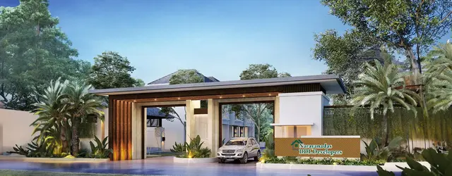
Narayanadas Ddl Developers
M/s DDL DEVELOPERS · Mahabubnagar · RERA P01400008940
NARAYANADAS DDL DEVELOPERS is a plotted development in Mothighanapur, Balanagar mandal, Mahabubnagar district. The registered promoter is M/s DDL DEVELOPERS, a partnership. The layout covers 14,809.08 sq.m and comprises 37 residential plots; plot sizes measured from the approved layout drawing are 148.03–311.09 sq.m, with no tower or floor configuration stated. It is registered with TG-RERA as P01400008940, with proposed completion by 06.02.2025.
📘 Project brochure from the promoter’s website ↗More from Ddl Developers · 2 projects →
01What we found
Read from TG-RERA filings, approvals, land and registration records and court records. A court case is counted only when the court record states this project's survey number with its village, or names the project.
02Check before you pay
8 items to check before you pay, 3 high - from the title chain, court records and approvals, each with what to ask the builder or your advocate. An item may not be a problem with the project: records can be incomplete.
1. Project at a glance
Project identity
| Fact | Record |
|---|---|
| Registered project name | NARAYANADAS DDL DEVELOPERS RERA record |
| Project type / registered portion | Plotted development; the registration is for a layout comprising 37 plots. The RERA record does not identify a separate phase. RERA record |
| TG-RERA registration | P01400008940 |
| Registration validity | 16/02/2023 to 06/02/2025; the supplied certificate records no extension. Validity is separate from the completion undertaking and from the later completion evidence. |
| Registered promoter | M/s DDL DEVELOPERS, a partnership. RERA record Corporate record |
| RERA project status | New Project in the registration record. RERA record |
| Current construction / completion status | An architect’s Form 1A dated 30/09/2025 certifies overall completion; see the phase-scope qualification below. |
Land and geographic identity
| Fact | Record |
|---|---|
| Locality | Mothighanpur / Mothighanapoor RERA record |
| Revenue village | Mothighanapur (also rendered in project documents as Mothighanapoor) RERA record |
| Mandal / district / PIN | Balanagar / Mahabubnagar / 509202 RERA record |
| Project survey numbers | 84 Part and 85 Part; approval documents specify Sy. Nos 84/PART and 85/PART. RERA record |
| RERA-filed site area | Total and net area: 14,809.08 sq.m. RERA filing |
| Layout-drawing area | 14,808.96 sq.m net layout area, as recorded in the final layout letter and layout drawing. Layout record |
| Boundaries | North: LAND IN SY NO 84; South: LAND IN SY NO 94 AND 95; East: LAND IN SY NO 86 AND ROAD; West: LAND IN SY NO 84 85 AND ROAD. RERA filing |
Development identity
| Fact | Record |
|---|---|
| Tentative layout approval | MUDA, approval no. 206075/LP/GP/204899/0004/2022, dated 16-02-2023. Approvals record |
| Final layout approval | HMDA, layout permit no. 0622/HMDA/SWFL/2025, dated 18/09/2025; file no. 004991/HMDA/01500/SWFL/SKP1/2025. Approvals record |
| Approved plot count | 37 plots. |
| Approved built-up area | 7,208.70 sq.m is recorded in the RERA project fields; no building-floor configuration is supplied for this plotted layout. RERA filing |
| Layout land-use allocation | Final layout record: Plotted Area 7286.44 sq.m; Road Affected Area 0; Organized Open Space / Park Area 1334.68 sq.m; Amenities Area 0; Social Infrastructure Area 429.03 sq.m; Road Area 5599.56 sq.m; Utilities Area 159.24 sq.m; Total Net Layout 14808.96 sq.m. |
| Buildings / floors | Not applicable to the registered offering as described: this is a plotted layout. The final layout letter states that plots are for residential dwelling-house use. RERA record |
Offering and status
| Fact | Record |
|---|---|
| Offered unit type | Residential plots; the registration/layout approval documents identify 37 plots. |
| Plot sizes | Software-measured from the approved layout drawing: 148.03–311.09 sq.m; median 193.15 sq.m. These are drawing-derived measurements, not RERA-filed saleable-area figures. Layout record |
| Booked / available counts | Not disclosed in the supplied evidence. |
| Construction stage | The architect’s Form 1A, dated 30/09/2025, certifies completion in all aspects of the registered project; the certificate identifies OC 3847/2023/YTDA, issued by VTDA on 08.02.2024. The supplied material does not set out a tower- or phase-wise scope. |
| Completion dates | Form B completion undertaking: 06.02.2025. Registration certificate end date: 06/02/2025. |
| Occupancy / completion evidence | The Form 1A identifies an occupancy certificate; the separate HMDA document is a Final Layout Letter, not an apartment-building OC. The evidence does not establish building-level OC status for individual plot purchasers’ future homes. |
2. The project story
NARAYANADAS DDL DEVELOPERS is a residential open-plot layout registered with TG-RERA as P01400008940, on parts of Survey Nos. 84 and 85 in Mothighanapur village, Balanagar mandal, Mahabubnagar district. Its approved layout provides 37 plots, with separate areas identified for roads, park/open space, utilities and social infrastructure. The final layout letter restricts plots to residential dwelling-house use; it does not describe an apartment or multi-building development.
The registration certificate ran from 16/02/2023 to 06/02/2025, and the promoter’s Form B also undertook completion by 06.02.2025. Separately, the architect’s Form 1A dated 30/09/2025 certifies overall completion and identifies an OC issued by VTDA on 08.02.2024. These are the supplied documentary statements; no independent site inspection is provided. The evidence does not specify progress by individual plot, or establish an occupancy certificate for homes that plot purchasers may later construct.
3. Master plan, architecture & building design
The project is a plotted layout, so the available design evidence concerns the layout rather than apartment plans, towers or building floors. The tentative layout approval identifies 37 plots and allocates land to plotted area, roads, park/open space, utilities and social infrastructure. The final layout record describes a net layout of 14,808.96 sq.m and records 0 sq.m as road-affected area.
The layout drawing’s software-read plot schedule covers 37 plots. Its measured plot-area range is 148.03–311.09 sq.m, with a median of 193.15 sq.m; the drawing-derived measurements should be checked against the approved drawing. Layout record
The tentative approval calls for infrastructure and amenity works, including roads, drains and nala channelization, greenery and avenue planting, rainwater-harvesting pits, street lighting, sewerage disposal and protected water supply. The final layout letter records that the roads, open spaces, social infrastructure and utilities were taken over by the local authority, and records relinquishment of the mortgaged plots. These documents describe layout approval and handover records; they do not supply building designs or dimensions for future homes.
4. Homes, configurations & floor plans
| Configuration | Units | Booked | Available | RERA saleable area | Measured carpet area | Loading (if supplied) |
|---|---|---|---|---|---|---|
| Residential plots | 37 | Not disclosed | Not disclosed | Not disclosed | Not applicable | Not supplied |
The plot count comes from the layout approval. The drawing-derived plot-size range is 148.03–311.09 sq.m, with a median of 193.15 sq.m; the layout schedule lists 11 plots in the 150–200 sq.yd band, 18 in the 200–250 sq.yd band, 5 in the 250–300 sq.yd band and 3 in the 300–400 sq.yd band. These are software-measured/read-from-drawing figures, not RERA-filed saleable-area figures. No apartment floor plans or carpet-area measurements are supplied. Layout record Floor plans
5. Parking & vehicle circulation
The supplied evidence does not establish a project-wide count or allocation of purchaser parking spaces, visitor spaces, accessible bays, or EV charging. The tentative layout approval requires roads to remain open for accessibility to neighbouring sites and says no compound wall or fencing is to be constructed around the site under that approval. The final layout letter likewise states that roads must remain open for free public access and that no compound wall is permitted. The approval documents do not provide road-width measurements in the extracted evidence.
6. Amenities, recreation & open spaces
| Description / size | Final layout records 1334.68 sq.m; the tentative approval separately identifies open space (park). |
|---|---|
| Declared progress / verified status | Approved land allocation; the supplied record does not independently verify the park’s completed condition. |
| Description / size | Final layout records 5599.56 sq.m. |
|---|---|
| Declared progress / verified status | Layout allocation and handover are recorded; no independent physical inspection supplied. |
| Description / size | 159.24 sq.m in the final layout record. |
|---|---|
| Declared progress / verified status | Land allocation recorded; individual utility installations are not independently verified here. |
| Description / size | 429.03 sq.m in the final layout record. |
|---|---|
| Declared progress / verified status | Land allocation and handover are recorded; the specific facility is not identified in the supplied evidence. |
| Description / size | No area or facility identified in the supplied RERA amenities data. |
|---|---|
| Evidence source | RERA amenities |
| Declared progress / verified status | RERA amenities record shows 0% progress. |
The approved layout’s use schedule includes park/open space, roads, utilities and social infrastructure. The tentative approval also lists a water reservoir, septic tank / sewage treatment plant, electric transformer and solid-waste management among works to be provided; their completion is not independently established by the supplied material.
7. Utilities, building services & safety
The tentative layout approval requires protected water supply, an overhead tank or sump as applicable, septic tank and/or sewage treatment facilities, storm-water drainage and nala channelization, rainwater-harvesting pits, street lighting, electricity facilities, and solid-waste-management provision. It also refers to a water reservoir, septic tank / STP, electric transformer and solid waste management in the utility allocation. These are approval requirements and listed infrastructure, not independent confirmation that each system is installed and operational.
The RERA amenities data records internal roads and footpaths, green strip/park, street lighting and water conservation/rainwater harvesting at 100%; water supply, sewerage, storm-water drains, treatment and disposal of sewage/sullage, solid-waste management, electrical meter room/substation and energy management are each recorded at 0%. The supplied evidence does not give water or storage capacities, treatment capacity, electrical capacity, backup arrangements, security systems, accessibility features or fire-safety details. RERA amenities
8. Location, access & connectivity
The registered location is Mothighanapur village, Balanagar mandal, Mahabubnagar district, Telangana, PIN 509202, at Survey Nos. 84 Part and 85 Part. The cadastral parcel centroid is 16.99054, 78.18023. The nearest sampled Outer Ring Road interchange is recorded at approximately 37.6 km. RERA record Cadastral map Location record
No public-transport route, approach-road measurement or verified travel-time information is supplied. The promoter’s brochure makes additional connectivity claims, but the project record provided here does not supply measured distances or travel times for those claims. Promoter website
9. Developer & development status
The registered promoter is M/s DDL DEVELOPERS, identified in the RERA record as a partnership. Its GSTIN is 36AASFD6529P1ZV. The supplied RERA record lists the promoter address at THE SURABHIMAHAS, Mothighanpur GP, Mothighanpur, Balanagar, Mahabubnagar, PIN 509202; the registration certificate separately records the promoter office as Nacharam, Uppal mandal, Medchal-Malkajgiri district, PIN 500076. Corporate record Parties record
The Form B affidavit dated 18 September 2024 is a promoter declaration, including the completion undertaking of 06.02.2025 and declarations about land, project accounts, audits and pending approvals. The registration certificate states validity through 06/02/2025 and records no extension in the supplied certificate. The architect’s Form 1A dated 30/09/2025 subsequently certifies overall completion and identifies OC 3847/2023/YTDA issued by VTDA on 08.02.2024. No independent construction-site verification is supplied, and the certificate’s extracted text does not provide a plot-by-plot or phase-wise completion breakdown.
10. Approvals, official records & documents
| Identifier / date | P01400008940; 16/02/2023–06/02/2025 |
|---|---|
| What the supplied document records | Form C registration for NARAYANADAS DDL DEVELOPERS. |
| Identifier / date | MUDA 206075/LP/GP/204899/0004/2022; 16-02-2023 |
|---|---|
| What the supplied document records | Tentative layout approval for 37 plots in Survey Nos. 84/PART and 85/PART. |
| Identifier / date | 18 September 2024 |
|---|---|
| What the supplied document records | Promoter declarations and completion undertaking by 06.02.2025. |
| Identifier / date | 3847/2023/YTDA; OC date 08.02.2024; Form 1A dated 30/09/2025 |
|---|---|
| What the supplied document records | Architect certifies completion in all aspects and identifies an occupancy certificate issued by VTDA. |
| Identifier / date | HMDA 0622/HMDA/SWFL/2025; 18/09/2025; file 004991/HMDA/01500/SWFL/SKP1/2025 |
|---|---|
| What the supplied document records | Final layout letter for 37 plots; records road, open-space, social-infrastructure and utility handover, and relinquishment deed 11411/2025 dated 16/09/2025 for the mortgaged plots. |
| Identifier / date | Document 489275 |
|---|---|
| What the supplied document records | Drawing-derived plot schedule and land-use measurements; software-read values should be checked against the drawing. Layout record |
The supplied evidence does not include a building-by-building commencement certificate or building plans for purchasers’ future homes. The final layout letter is a layout approval record; the architect’s Form 1A separately identifies the OC for the registered project.
1. Project at a glance
Project identity
Registered project name: NARAYANADAS DDL DEVELOPERS
Project type / registered portion: Plotted development; the registration is for a layout comprising 37 plots. The RERA record does not identify a separate phase.
TG-RERA registration: P01400008940
Registration validity: 16/02/2023 to 06/02/2025; the supplied certificate records no extension. Validity is separate from the completion undertaking and from the later completion evidence.
Registered promoter: M/s DDL DEVELOPERS, a partnership.
RERA project status: New Project in the registration record.
Current construction / completion status: An architect’s Form 1A dated 30/09/2025 certifies overall completion; see the phase-scope qualification below.
Land and geographic identity
Locality: Mothighanpur / Mothighanapoor
Revenue village: Mothighanapur (also rendered in project documents as Mothighanapoor)
Mandal / district / PIN: Balanagar / Mahabubnagar / 509202
Project survey numbers: 84 Part and 85 Part; approval documents specify Sy. Nos 84/PART and 85/PART.
RERA-filed site area: Total and net area: 14,809.08 sq.m.
Layout-drawing area: 14,808.96 sq.m net layout area, as recorded in the final layout letter and layout drawing.
Boundaries: North: LAND IN SY NO 84; South: LAND IN SY NO 94 AND 95; East: LAND IN SY NO 86 AND ROAD; West: LAND IN SY NO 84 85 AND ROAD.
Development identity
Tentative layout approval: MUDA, approval no. 206075/LP/GP/204899/0004/2022, dated 16-02-2023.
Final layout approval: HMDA, layout permit no. 0622/HMDA/SWFL/2025, dated 18/09/2025; file no. 004991/HMDA/01500/SWFL/SKP1/2025.
Approved plot count: 37 plots.
Approved built-up area: 7,208.70 sq.m is recorded in the RERA project fields; no building-floor configuration is supplied for this plotted layout.
Layout land-use allocation: Final layout record: Plotted Area 7286.44 sq.m; Road Affected Area 0; Organized Open Space / Park Area 1334.68 sq.m; Amenities Area 0; Social Infrastructure Area 429.03 sq.m; Road Area 5599.56 sq.m; Utilities Area 159.24 sq.m; Total Net Layout 14808.96 sq.m.
Buildings / floors: Not applicable to the registered offering as described: this is a plotted layout. The final layout letter states that plots are for residential dwelling-house use.
Offering and status
Offered unit type: Residential plots; the registration/layout approval documents identify 37 plots.
Plot sizes: Software-measured from the approved layout drawing: 148.03–311.09 sq.m; median 193.15 sq.m. These are drawing-derived measurements, not RERA-filed saleable-area figures.
Booked / available counts: Not disclosed in the supplied evidence.
Construction stage: The architect’s Form 1A, dated 30/09/2025, certifies completion in all aspects of the registered project; the certificate identifies OC 3847/2023/YTDA, issued by VTDA on 08.02.2024. The supplied material does not set out a tower- or phase-wise scope.
Completion dates: Form B completion undertaking: 06.02.2025. Registration certificate end date: 06/02/2025.
Occupancy / completion evidence: The Form 1A identifies an occupancy certificate; the separate HMDA document is a Final Layout Letter, not an apartment-building OC. The evidence does not establish building-level OC status for individual plot purchasers’ future homes.
2. The project story
NARAYANADAS DDL DEVELOPERS is a residential open-plot layout registered with TG-RERA as P01400008940, on parts of Survey Nos. 84 and 85 in Mothighanapur village, Balanagar mandal, Mahabubnagar district. Its approved layout provides 37 plots, with separate areas identified for roads, park/open space, utilities and social infrastructure. The final layout letter restricts plots to residential dwelling-house use; it does not describe an apartment or multi-building development.
The registration certificate ran from 16/02/2023 to 06/02/2025, and the promoter’s Form B also undertook completion by 06.02.2025. Separately, the architect’s Form 1A dated 30/09/2025 certifies overall completion and identifies an OC issued by VTDA on 08.02.2024. These are the supplied documentary statements; no independent site inspection is provided. The evidence does not specify progress by individual plot, or establish an occupancy certificate for homes that plot purchasers may later construct.
3. Master plan, architecture & building design
The project is a plotted layout, so the available design evidence concerns the layout rather than apartment plans, towers or building floors. The tentative layout approval identifies 37 plots and allocates land to plotted area, roads, park/open space, utilities and social infrastructure. The final layout record describes a net layout of 14,808.96 sq.m and records 0 sq.m as road-affected area.
The layout drawing’s software-read plot schedule covers 37 plots. Its measured plot-area range is 148.03–311.09 sq.m, with a median of 193.15 sq.m; the drawing-derived measurements should be checked against the approved drawing.
The tentative approval calls for infrastructure and amenity works, including roads, drains and nala channelization, greenery and avenue planting, rainwater-harvesting pits, street lighting, sewerage disposal and protected water supply. The final layout letter records that the roads, open spaces, social infrastructure and utilities were taken over by the local authority, and records relinquishment of the mortgaged plots. These documents describe layout approval and handover records; they do not supply building designs or dimensions for future homes.
4. Homes, configurations & floor plans
| Configuration | Units | Booked | Available | RERA saleable area | Measured carpet area | Loading (if supplied) |
|---|---|---|---|---|---|---|
| Residential plots | 37 | Not disclosed | Not disclosed | Not disclosed | Not applicable | Not supplied |
The plot count comes from the layout approval. The drawing-derived plot-size range is 148.03–311.09 sq.m, with a median of 193.15 sq.m; the layout schedule lists 11 plots in the 150–200 sq.yd band, 18 in the 200–250 sq.yd band, 5 in the 250–300 sq.yd band and 3 in the 300–400 sq.yd band. These are software-measured/read-from-drawing figures, not RERA-filed saleable-area figures. No apartment floor plans or carpet-area measurements are supplied.
5. Parking & vehicle circulation
The supplied evidence does not establish a project-wide count or allocation of purchaser parking spaces, visitor spaces, accessible bays, or EV charging. The tentative layout approval requires roads to remain open for accessibility to neighbouring sites and says no compound wall or fencing is to be constructed around the site under that approval. The final layout letter likewise states that roads must remain open for free public access and that no compound wall is permitted. The approval documents do not provide road-width measurements in the extracted evidence.
6. Amenities, recreation & open spaces
| Description / size | Final layout records 1334.68 sq.m; the tentative approval separately identifies open space (park). |
|---|---|
| Declared progress / verified status | Approved land allocation; the supplied record does not independently verify the park’s completed condition. |
| Description / size | Final layout records 5599.56 sq.m. |
|---|---|
| Declared progress / verified status | Layout allocation and handover are recorded; no independent physical inspection supplied. |
| Description / size | 159.24 sq.m in the final layout record. |
|---|---|
| Declared progress / verified status | Land allocation recorded; individual utility installations are not independently verified here. |
| Description / size | 429.03 sq.m in the final layout record. |
|---|---|
| Declared progress / verified status | Land allocation and handover are recorded; the specific facility is not identified in the supplied evidence. |
| Description / size | No area or facility identified in the supplied RERA amenities data. |
|---|---|
| Declared progress / verified status | RERA amenities record shows 0% progress. |
The approved layout’s use schedule includes park/open space, roads, utilities and social infrastructure. The tentative approval also lists a water reservoir, septic tank / sewage treatment plant, electric transformer and solid-waste management among works to be provided; their completion is not independently established by the supplied material.
7. Utilities, building services & safety
The tentative layout approval requires protected water supply, an overhead tank or sump as applicable, septic tank and/or sewage treatment facilities, storm-water drainage and nala channelization, rainwater-harvesting pits, street lighting, electricity facilities, and solid-waste-management provision. It also refers to a water reservoir, septic tank / STP, electric transformer and solid waste management in the utility allocation. These are approval requirements and listed infrastructure, not independent confirmation that each system is installed and operational.
The RERA amenities data records internal roads and footpaths, green strip/park, street lighting and water conservation/rainwater harvesting at 100%; water supply, sewerage, storm-water drains, treatment and disposal of sewage/sullage, solid-waste management, electrical meter room/substation and energy management are each recorded at 0%. The supplied evidence does not give water or storage capacities, treatment capacity, electrical capacity, backup arrangements, security systems, accessibility features or fire-safety details.
8. Location, access & connectivity
The registered location is Mothighanapur village, Balanagar mandal, Mahabubnagar district, Telangana, PIN 509202, at Survey Nos. 84 Part and 85 Part. The cadastral parcel centroid is 16.99054, 78.18023. The nearest sampled Outer Ring Road interchange is recorded at approximately 37.6 km.
No public-transport route, approach-road measurement or verified travel-time information is supplied. The promoter’s brochure makes additional connectivity claims, but the project record provided here does not supply measured distances or travel times for those claims.
9. Developer & development status
The registered promoter is M/s DDL DEVELOPERS, identified in the RERA record as a partnership. Its GSTIN is 36AASFD6529P1ZV. The supplied RERA record lists the promoter address at THE SURABHIMAHAS, Mothighanpur GP, Mothighanpur, Balanagar, Mahabubnagar, PIN 509202; the registration certificate separately records the promoter office as Nacharam, Uppal mandal, Medchal-Malkajgiri district, PIN 500076.
The Form B affidavit dated 18 September 2024 is a promoter declaration, including the completion undertaking of 06.02.2025 and declarations about land, project accounts, audits and pending approvals. The registration certificate states validity through 06/02/2025 and records no extension in the supplied certificate. The architect’s Form 1A dated 30/09/2025 subsequently certifies overall completion and identifies OC 3847/2023/YTDA issued by VTDA on 08.02.2024. No independent construction-site verification is supplied, and the certificate’s extracted text does not provide a plot-by-plot or phase-wise completion breakdown.
10. Approvals, official records & documents
| Identifier / date | P01400008940; 16/02/2023–06/02/2025 |
|---|---|
| What the supplied document records | Form C registration for NARAYANADAS DDL DEVELOPERS. |
| Identifier / date | MUDA 206075/LP/GP/204899/0004/2022; 16-02-2023 |
|---|---|
| What the supplied document records | Tentative layout approval for 37 plots in Survey Nos. 84/PART and 85/PART. |
| Identifier / date | 18 September 2024 |
|---|---|
| What the supplied document records | Promoter declarations and completion undertaking by 06.02.2025. |
| Identifier / date | 3847/2023/YTDA; OC date 08.02.2024; Form 1A dated 30/09/2025 |
|---|---|
| What the supplied document records | Architect certifies completion in all aspects and identifies an occupancy certificate issued by VTDA. |
| Identifier / date | HMDA 0622/HMDA/SWFL/2025; 18/09/2025; file 004991/HMDA/01500/SWFL/SKP1/2025 |
|---|---|
| What the supplied document records | Final layout letter for 37 plots; records road, open-space, social-infrastructure and utility handover, and relinquishment deed 11411/2025 dated 16/09/2025 for the mortgaged plots. |
| Identifier / date | Document 489275 |
|---|---|
| What the supplied document records | Drawing-derived plot schedule and land-use measurements; software-read values should be checked against the drawing. |
The supplied evidence does not include a building-by-building commencement certificate or building plans for purchasers’ future homes. The final layout letter is a layout approval record; the architect’s Form 1A separately identifies the OC for the registered project.
Frequently asked questions
Is NARAYANADAS DDL DEVELOPERS registered with Telangana RERA?
Yes. NARAYANADAS DDL DEVELOPERS is registered with the Telangana Real Estate Regulatory Authority as P01400008940; the registration status is New Project.
Who is the developer of NARAYANADAS DDL DEVELOPERS?
The promoter named in the RERA registration is M/s DDL DEVELOPERS.
Where is NARAYANADAS DDL DEVELOPERS located?
NARAYANADAS DDL DEVELOPERS is in Mothighanpur, Mothighanapur, Balanagar, Mahabubnagar, Telangana (509202).
When will NARAYANADAS DDL DEVELOPERS be completed?
The promoter's proposed date of completion filed with RERA is 06/02/2025. This is the promoter's declaration, not a guarantee.