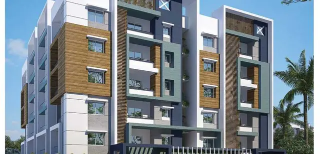
Tirumala Hills
SAI BALAJI INFRA DEVELOPERS · Rangareddy · RERA P02400006049
TIRUMALA HILLS is a plotted development in Farooqnagar, Farooqnagar mandal, Ranga Reddy district, developed by registered promoter SAI BALAJI INFRA DEVELOPERS. The filed draft layout covers 127 plots on a site recorded as Ac.9.437 cents; 45675.08 Sq. Yds., and no building floors or plot configurations are stated. The project is registered with TG-RERA under P02400006049, with a proposed completion date of 10 MAY 2024.
01What we found
Read from TG-RERA filings, approvals, land and registration records and court records. A court case is counted only when the court record states this project's survey number with its village, or names the project.
02Check before you pay
6 items to check before you pay, 4 high - from the title chain, court records and approvals, each with what to ask the builder or your advocate. An item may not be a problem with the project: records can be incomplete.
1. Project at a glance
Project identity
| Field | Record |
|---|---|
| Registered project name | TIRUMALA HILLS RERA record |
| Project type | Plotted development RERA record |
| Phase / registered portion | Phase not disclosed; the registration and layout records identify the project/layout, but do not identify a separate phase. RERA record |
| TG-RERA registration | P02400006049 RERA record |
| Registration validity | 18/04/2023–10/05/2024; the certificate records no extension. Registration validity is distinct from the completion undertaking and from occupancy/completion certification. |
| Registered promoter | SAI BALAJI INFRA DEVELOPERS RERA record Corporate record |
| RERA status in supplied record | New Project; registration certificate issued. The supplied record does not establish a current registration status beyond the stated validity period. RERA record |
Land and geographic identity
| Field | Record |
|---|---|
| Locality / revenue village | Project header and RERA certificate identify Farooqnagar. The filed draft layout names Choudammagutta Thanda; both names are preserved as recorded. RERA record |
| Mandal / district / PIN | Farooqnagar mandal; Ranga Reddy district; 509216. RERA record |
| Project survey numbers | 523/P, 524/P, 528/P RERA record Land records |
| Registered site extent | The filed draft layout states Ac.9.437 cents; 45675.08 Sq. Yds. The RERA land details record total area 45675.08 sqmts, affected area 18043.52 sqmts, and net area 27631.56 sqmts. These are reported as recorded, without conversion or reconciliation. RERA filing |
| Boundaries | East, west, north and south: NEIGHBOURS LAND (as entered in RERA land details). RERA filing |
Development identity
| Field | Record |
|---|---|
| Sanctioning authority / principal approval | Director of Town and Country Planning; draft Technical Layout Pattern Draft - TLP.No.124/2021/H, approved date 01-05-2021. The document also identifies file Lr.Roc.No.20036/304/2021/e-Panchayat and application 20036/304. Approvals record |
| Approved development form | Draft layout for 127 plots. The record gives no tower/block or building floor configuration for this plotted development. |
| Area figures in RERA layout document | Layout area: Ac. 9.437 Cents; 45675.08 Sq. Yds.; plotted area: Ac. 5.709 Cents; 27631.56 Sq. Yds. (60.49%); road area: Ac. 2.785 Cents; 13479.40 Sq. Yds. (29.51%); open space: Ac. 0.943 Cents; 4564.12 Sq. Yds. (10.00%). Mortgage area is listed as Ac. 0.875 Cents; 4235.00 Sq. Yds. (15.32%). |
| Approved built-up area | RERA project fields state 27631.56 sqmts as “Approved Built up Area”; the supplied layout approval describes a plotted layout, not a building schedule. RERA filing |
| Parking | No parking-space count or parking-level schedule is established in the supplied project records. RERA amenities |
Offering and status
| Field | Record |
|---|---|
| RERA-filed offering | Plotted development; the filed draft layout records 127 plots. Plot-by-plot sizes and inventory counts are not supplied in the extracted records. RERA record |
| Booked / available counts | Not disclosed in the supplied project evidence. RERA record |
| Construction/development progress | RERA amenity data records listed infrastructure items at varying reported percentages; these are progress entries in the supplied record, not independent site verification. See sections 6–7. RERA amenities |
| Completion undertaking | Form B declares completion by 10 MAY 2024. |
| Occupancy/completion certificate | No occupancy or completion certificate is included in the supplied evidence. The layout document describes a draft layout and requires completion of development works and subsequent final-layout processing. |
2. The project story
TIRUMALA HILLS is registered with TG-RERA as a plotted development under P02400006049, promoted by SAI BALAJI INFRA DEVELOPERS. The RERA-filed layout document describes a 127-plot scheme on survey numbers 523/P, 524/P and 528/P, in the Farooqnagar area of Ranga Reddy district. The approval document identifies the site as Choudammagutta Thanda, while the project header and registration certificate identify Farooqnagar. RERA record
The draft layout allocates land among plotted area, roads and open space, and identifies a group of plots as mortgage land in favour of the Gram Panchayat. It also describes development works including roads, drains, greenery, street lighting, electricity, sewerage disposal and protected water supply. These are approval conditions or required works; the supplied evidence does not independently establish their completion.
The promoter’s Form B undertaking specifies completion by 10 MAY 2024. The supplied project evidence does not include a completion/occupancy certificate or a final-layout release, and its infrastructure progress entries should not be read as an independently verified site inspection. RERA amenities
3. Master plan, architecture & building design
This is a plotted layout rather than a documented apartment or multi-building scheme. The filed draft approval records 127 plots and the following land-use split: 60.49% plotted area, 29.51% roads and 10.00% open space. It separately identifies 15.32% mortgage area, comprising Plot Nos. 38 to 55 and 59, stated as Ac.0.875 cents or 4235.00 Sq. Yards.
The approval conditions call for roads to be formed and opened for access to neighbouring sites, drains and nala channelization, greenery, fencing of open spaces, street lighting and electricity, and sewerage disposal and protected water supply. The document also requires the open-space and road areas to be handed over to the Gram Panchayat by registered gift deed before release of the final layout. The supplied records do not establish whether these works, handovers or final-layout steps have been completed.
The available floor-plan record contains two drawings, both pending scan review; no plot-level architectural drawings or measurements are supplied. Building footprints, building count, floor configuration and residential/commercial building allocation are not applicable or not established for this plotted-layout record. Floor plans
4. Homes, configurations & floor plans
The RERA-filed approval describes 127 plots, but the supplied records do not provide plot-by-plot dimensions, plot-size bands, booked/available counts or a complete plot inventory.
| Configuration | Units | Booked | Available | RERA saleable area | Measured carpet area | Loading (if supplied) |
|---|---|---|---|---|---|---|
| Plots | 127 in the filed draft layout | Not disclosed | Not disclosed | Plot-wise area not disclosed | Not applicable / not supplied | Not supplied |
A third-party listing describes plot sizes as 1,687–4,393 sq ft, but this is not a RERA-filed plot schedule and is not used here as an established project measurement. Promoter website
The supplied drawing record reports two drawings awaiting scan review, with no software-measured carpet-area results. Carpet-area measurements for homes therefore cannot be reported; for this plotted development, plot area and any eventual building area are distinct measures. Floor plans
5. Parking & vehicle circulation
No sanctioned parking count, visitor or accessible parking provision, parking arrangement, vehicle entry/exit plan, driveway dimensions or parking allocation document is supplied. The draft layout requires road formation and access to neighbouring sites, but does not establish parking-space quantities or exclusive parking rights for purchasers.
6. Amenities, recreation & open spaces
The layout approval specifies open space and certain infrastructure works. The separate RERA amenity record contains progress percentages, which are reported as filed progress data rather than independently verified completion.
| Facility | Description / size | Evidence source | Declared progress / verified status |
|---|---|---|---|
| Open space / recreational open space | Ac.0.943 cents; 4564.12 Sq. Yds. (10.00%) in the layout approval | RERA amenities | RERA amenity entry: 0%; not independently verified as delivered. |
| Internal roads & footpaths | Layout roads: Ac.2.785 cents; 13479.40 Sq. Yds. (29.51%) | RERA amenities | RERA amenity entry: 50%; not independently verified. |
| Storm-water drains | No dimensions supplied | RERA amenities | RERA amenity entry: 40%; not independently verified. |
| Green strip / tot lot / park | No size or facility count supplied | RERA amenities | RERA amenity entry: 0%; not independently verified. |
| Street lighting | No quantity or specification supplied | RERA amenities | RERA amenity entry: 0%; not independently verified. |
| Water conservation / rainwater harvesting | No system capacity or quantity supplied | RERA amenities | RERA amenity entry: 0%; not independently verified. |
| Community buildings | No building size or use schedule supplied | RERA amenities | RERA amenity entry: 0%; not independently verified. |
The draft approval also requires greenery and fencing of open spaces and the development of roads and drains; these are conditions for the layout, not evidence that the facilities have been completed. No RERA-filed clubhouse or indoor/sports facility specifications are established by the supplied project documents. RERA amenities
7. Utilities, building services & safety
The layout approval requires the developer to undertake, under Gram Panchayat supervision, road formation, drains and nala channelization, greenery, fencing of open spaces, street lighting and electricity facilities, sewerage disposal and protected water supply. These are specified development works; completion is not independently verified in the supplied evidence.
| Supplied evidence | Protected water supply is a layout-development condition; the RERA amenity record lists Water Supply. No source, storage or treatment capacity is supplied. RERA amenities |
|---|---|
| Recorded progress / status | RERA amenity entry: 30%; not independently verified. |
| Supplied evidence | Approval requires sewerage disposal and drain/nala works. The RERA amenity record lists sewerage and treatment/disposal of sewage and sullage water. No STP capacity or reuse details are supplied. RERA amenities |
|---|---|
| Recorded progress / status | Sewerage and treatment/disposal entries: 0%; storm-water drains: 40%; not independently verified. |
| Supplied evidence | Electrical facilities and street lighting are layout-development conditions. The RERA amenity list includes an electrical meter room/sub-station/receiving station, without specifications. RERA amenities |
|---|---|
| Recorded progress / status | Street lighting and electrical meter room/sub-station/receiving station entries: 0%; not independently verified. |
| Supplied evidence | RERA amenity list includes Fire Protection and Fire Safety Requirements; no system details or clearance document is supplied. RERA amenities |
|---|---|
| Recorded progress / status | 0% recorded; no independent verification. |
| Supplied evidence | RERA amenity list includes Solid Waste Management and Disposal; no method or capacity supplied. RERA amenities |
|---|---|
| Recorded progress / status | 0% recorded; no independent verification. |
| Supplied evidence | No project-specific RERA specification or completion record supplied. RERA amenities |
|---|---|
| Recorded progress / status | Not established in the RERA-filed project evidence. |
| Supplied evidence | No accessibility design or facility details supplied. Floor plans |
|---|---|
| Recorded progress / status | Not established. |
8. Location, access & connectivity
The project is identified in the RERA header and registration certificate as Farooqnagar, Farooqnagar mandal, Ranga Reddy district, PIN 509216. The filed draft layout identifies the site as Choudammagutta Thanda, within Farooqnagar mandal, and names survey numbers 523/P, 524/P and 528/P. RERA record
The available location record gives a cadastral parcel-centroid coordinate of 17.41528, 78.35459. It supplies one connectivity distance: Financial District (Nanakramguda), 1.2 km. No approach-road name, public-transport route or independently verified landmark distance is supplied. Location record
9. Developer & development status
The registered promoter is SAI BALAJI INFRA DEVELOPERS, identified in the project record as a partnership. Its GSTIN is 36ADWFS4532N1Z7. The supplied records name Sidhartha Middhinti as a partner and Ravinder Reddy Chigurla pally as an authorized signatory. Corporate record Parties record
The registration certificate gives the promoter’s office as Village: Karmanghat, Mandal: Saroornagar, District: Ranga Reddy, Pin: 500079. The project header separately records a Farooqnagar address; no official website or contact details are supplied. RERA record
Form B, dated 03/11/2022, declares a project completion date of 10 MAY 2024. The TG-RERA certificate records validity through 10/05/2024 and says registration may be extended in accordance with the Act and Rules; the supplied certificate records extended: false. No completion/occupancy certificate or final-layout release is included.
10. Approvals, official records & documents
| Record | What the supplied document establishes |
|---|---|
| TG-RERA registration certificate, P02400006049 | Form C records registration of TIRUMALA HILLS under section 5, valid 18/04/2023–10/05/2024, for the identified survey numbers. |
| Draft Technical Layout Pattern, Draft - TLP.No.124/2021/H | Director of Town and Country Planning document dated 01-05-2021 for a 127-plot layout; file Lr.Roc.No.20036/304/2021/e-Panchayat, application 20036/304. It records conditions and states the permission is not proof of land title. |
| Form B declaration | Authorized signatory C. Ravinder Reddy’s affidavit-cum-declaration, dated 03/11/2022, includes a completion undertaking of 10 MAY 2024 and promoter declarations concerning title, encumbrances and project accounts. |
| Title report / sale deed document | The supplied title-report record describes a deed dated 20 April 2019 conveying Acs.02-00 in Sy.Nos. 523/2A1 and 523/2/A2, Kishan Nagar, to Sai Balaji Infra Developers and Chigurlapally Ravinder Reddy. |
| Completion / occupancy records | No completion certificate, occupancy certificate or final-layout release is included in the supplied evidence. Document index |
| Layout-plan file | A layout-plan document is listed in the project record, but the supplied extraction does not provide its drawing contents for review. Document index |
1. Project at a glance
Project identity
Registered project name: TIRUMALA HILLS
Project type: Plotted development
Phase / registered portion: Phase not disclosed; the registration and layout records identify the project/layout, but do not identify a separate phase.
TG-RERA registration: P02400006049
Registration validity: 18/04/2023–10/05/2024; the certificate records no extension. Registration validity is distinct from the completion undertaking and from occupancy/completion certification.
Registered promoter: SAI BALAJI INFRA DEVELOPERS
RERA status in supplied record: New Project; registration certificate issued. The supplied record does not establish a current registration status beyond the stated validity period.
Land and geographic identity
Locality / revenue village: Project header and RERA certificate identify Farooqnagar. The filed draft layout names Choudammagutta Thanda; both names are preserved as recorded.
Mandal / district / PIN: Farooqnagar mandal; Ranga Reddy district; 509216.
Project survey numbers: 523/P, 524/P, 528/P
Registered site extent: The filed draft layout states Ac.9.437 cents; 45675.08 Sq. Yds. The RERA land details record total area 45675.08 sqmts, affected area 18043.52 sqmts, and net area 27631.56 sqmts. These are reported as recorded, without conversion or reconciliation.
Boundaries: East, west, north and south: NEIGHBOURS LAND (as entered in RERA land details).
Development identity
Sanctioning authority / principal approval: Director of Town and Country Planning; draft Technical Layout Pattern Draft - TLP.No.124/2021/H, approved date 01-05-2021. The document also identifies file Lr.Roc.No.20036/304/2021/e-Panchayat and application 20036/304.
Approved development form: Draft layout for 127 plots. The record gives no tower/block or building floor configuration for this plotted development.
Area figures in RERA layout document: Layout area: Ac. 9.437 Cents; 45675.08 Sq. Yds.; plotted area: Ac. 5.709 Cents; 27631.56 Sq. Yds. (60.49%); road area: Ac. 2.785 Cents; 13479.40 Sq. Yds. (29.51%); open space: Ac. 0.943 Cents; 4564.12 Sq. Yds. (10.00%). Mortgage area is listed as Ac. 0.875 Cents; 4235.00 Sq. Yds. (15.32%).
Approved built-up area: RERA project fields state 27631.56 sqmts as “Approved Built up Area”; the supplied layout approval describes a plotted layout, not a building schedule.
Parking: No parking-space count or parking-level schedule is established in the supplied project records.
Offering and status
RERA-filed offering: Plotted development; the filed draft layout records 127 plots. Plot-by-plot sizes and inventory counts are not supplied in the extracted records.
Booked / available counts: Not disclosed in the supplied project evidence.
Construction/development progress: RERA amenity data records listed infrastructure items at varying reported percentages; these are progress entries in the supplied record, not independent site verification. See sections 6–7.
Completion undertaking: Form B declares completion by 10 MAY 2024.
Occupancy/completion certificate: No occupancy or completion certificate is included in the supplied evidence. The layout document describes a draft layout and requires completion of development works and subsequent final-layout processing.
2. The project story
TIRUMALA HILLS is registered with TG-RERA as a plotted development under P02400006049, promoted by SAI BALAJI INFRA DEVELOPERS. The RERA-filed layout document describes a 127-plot scheme on survey numbers 523/P, 524/P and 528/P, in the Farooqnagar area of Ranga Reddy district. The approval document identifies the site as Choudammagutta Thanda, while the project header and registration certificate identify Farooqnagar.
The draft layout allocates land among plotted area, roads and open space, and identifies a group of plots as mortgage land in favour of the Gram Panchayat. It also describes development works including roads, drains, greenery, street lighting, electricity, sewerage disposal and protected water supply. These are approval conditions or required works; the supplied evidence does not independently establish their completion.
The promoter’s Form B undertaking specifies completion by 10 MAY 2024. The supplied project evidence does not include a completion/occupancy certificate or a final-layout release, and its infrastructure progress entries should not be read as an independently verified site inspection.
3. Master plan, architecture & building design
This is a plotted layout rather than a documented apartment or multi-building scheme. The filed draft approval records 127 plots and the following land-use split: 60.49% plotted area, 29.51% roads and 10.00% open space. It separately identifies 15.32% mortgage area, comprising Plot Nos. 38 to 55 and 59, stated as Ac.0.875 cents or 4235.00 Sq. Yards.
The approval conditions call for roads to be formed and opened for access to neighbouring sites, drains and nala channelization, greenery, fencing of open spaces, street lighting and electricity, and sewerage disposal and protected water supply. The document also requires the open-space and road areas to be handed over to the Gram Panchayat by registered gift deed before release of the final layout. The supplied records do not establish whether these works, handovers or final-layout steps have been completed.
The available floor-plan record contains two drawings, both pending scan review; no plot-level architectural drawings or measurements are supplied. Building footprints, building count, floor configuration and residential/commercial building allocation are not applicable or not established for this plotted-layout record.
4. Homes, configurations & floor plans
The RERA-filed approval describes 127 plots, but the supplied records do not provide plot-by-plot dimensions, plot-size bands, booked/available counts or a complete plot inventory.
| Configuration | Units | Booked | Available | RERA saleable area | Measured carpet area | Loading (if supplied) |
|---|---|---|---|---|---|---|
| Plots | 127 in the filed draft layout | Not disclosed | Not disclosed | Plot-wise area not disclosed | Not applicable / not supplied | Not supplied |
A third-party listing describes plot sizes as 1,687–4,393 sq ft, but this is not a RERA-filed plot schedule and is not used here as an established project measurement.
The supplied drawing record reports two drawings awaiting scan review, with no software-measured carpet-area results. Carpet-area measurements for homes therefore cannot be reported; for this plotted development, plot area and any eventual building area are distinct measures.
5. Parking & vehicle circulation
No sanctioned parking count, visitor or accessible parking provision, parking arrangement, vehicle entry/exit plan, driveway dimensions or parking allocation document is supplied. The draft layout requires road formation and access to neighbouring sites, but does not establish parking-space quantities or exclusive parking rights for purchasers.
6. Amenities, recreation & open spaces
The layout approval specifies open space and certain infrastructure works. The separate RERA amenity record contains progress percentages, which are reported as filed progress data rather than independently verified completion.
| Facility | Description / size | Evidence source | Declared progress / verified status |
|---|---|---|---|
| Open space / recreational open space | Ac.0.943 cents; 4564.12 Sq. Yds. (10.00%) in the layout approval | RERA amenity entry: 0%; not independently verified as delivered. | |
| Internal roads & footpaths | Layout roads: Ac.2.785 cents; 13479.40 Sq. Yds. (29.51%) | RERA amenity entry: 50%; not independently verified. | |
| Storm-water drains | No dimensions supplied | RERA amenity entry: 40%; not independently verified. | |
| Green strip / tot lot / park | No size or facility count supplied | RERA amenity entry: 0%; not independently verified. | |
| Street lighting | No quantity or specification supplied | RERA amenity entry: 0%; not independently verified. | |
| Water conservation / rainwater harvesting | No system capacity or quantity supplied | RERA amenity entry: 0%; not independently verified. | |
| Community buildings | No building size or use schedule supplied | RERA amenity entry: 0%; not independently verified. |
The draft approval also requires greenery and fencing of open spaces and the development of roads and drains; these are conditions for the layout, not evidence that the facilities have been completed. No RERA-filed clubhouse or indoor/sports facility specifications are established by the supplied project documents.
7. Utilities, building services & safety
The layout approval requires the developer to undertake, under Gram Panchayat supervision, road formation, drains and nala channelization, greenery, fencing of open spaces, street lighting and electricity facilities, sewerage disposal and protected water supply. These are specified development works; completion is not independently verified in the supplied evidence.
| Supplied evidence | Protected water supply is a layout-development condition; the RERA amenity record lists Water Supply. No source, storage or treatment capacity is supplied. |
|---|---|
| Recorded progress / status | RERA amenity entry: 30%; not independently verified. |
| Supplied evidence | Approval requires sewerage disposal and drain/nala works. The RERA amenity record lists sewerage and treatment/disposal of sewage and sullage water. No STP capacity or reuse details are supplied. |
|---|---|
| Recorded progress / status | Sewerage and treatment/disposal entries: 0%; storm-water drains: 40%; not independently verified. |
| Supplied evidence | Electrical facilities and street lighting are layout-development conditions. The RERA amenity list includes an electrical meter room/sub-station/receiving station, without specifications. |
|---|---|
| Recorded progress / status | Street lighting and electrical meter room/sub-station/receiving station entries: 0%; not independently verified. |
| Supplied evidence | RERA amenity list includes Fire Protection and Fire Safety Requirements; no system details or clearance document is supplied. |
|---|---|
| Recorded progress / status | 0% recorded; no independent verification. |
| Supplied evidence | RERA amenity list includes Solid Waste Management and Disposal; no method or capacity supplied. |
|---|---|
| Recorded progress / status | 0% recorded; no independent verification. |
| Supplied evidence | No project-specific RERA specification or completion record supplied. |
|---|---|
| Recorded progress / status | Not established in the RERA-filed project evidence. |
| Supplied evidence | No accessibility design or facility details supplied. |
|---|---|
| Recorded progress / status | Not established. |
8. Location, access & connectivity
The project is identified in the RERA header and registration certificate as Farooqnagar, Farooqnagar mandal, Ranga Reddy district, PIN 509216. The filed draft layout identifies the site as Choudammagutta Thanda, within Farooqnagar mandal, and names survey numbers 523/P, 524/P and 528/P.
The available location record gives a cadastral parcel-centroid coordinate of 17.41528, 78.35459. It supplies one connectivity distance: Financial District (Nanakramguda), 1.2 km. No approach-road name, public-transport route or independently verified landmark distance is supplied.
9. Developer & development status
The registered promoter is SAI BALAJI INFRA DEVELOPERS, identified in the project record as a partnership. Its GSTIN is 36ADWFS4532N1Z7. The supplied records name Sidhartha Middhinti as a partner and Ravinder Reddy Chigurla pally as an authorized signatory.
The registration certificate gives the promoter’s office as Village: Karmanghat, Mandal: Saroornagar, District: Ranga Reddy, Pin: 500079. The project header separately records a Farooqnagar address; no official website or contact details are supplied.
Form B, dated 03/11/2022, declares a project completion date of 10 MAY 2024. The TG-RERA certificate records validity through 10/05/2024 and says registration may be extended in accordance with the Act and Rules; the supplied certificate records extended: false. No completion/occupancy certificate or final-layout release is included.
10. Approvals, official records & documents
TG-RERA registration certificate, P02400006049: Form C records registration of TIRUMALA HILLS under section 5, valid 18/04/2023–10/05/2024, for the identified survey numbers.
Draft Technical Layout Pattern, Draft - TLP.No.124/2021/H: Director of Town and Country Planning document dated 01-05-2021 for a 127-plot layout; file Lr.Roc.No.20036/304/2021/e-Panchayat, application 20036/304. It records conditions and states the permission is not proof of land title.
Form B declaration: Authorized signatory C. Ravinder Reddy’s affidavit-cum-declaration, dated 03/11/2022, includes a completion undertaking of 10 MAY 2024 and promoter declarations concerning title, encumbrances and project accounts.
Title report / sale deed document: The supplied title-report record describes a deed dated 20 April 2019 conveying Acs.02-00 in Sy.Nos. 523/2A1 and 523/2/A2, Kishan Nagar, to Sai Balaji Infra Developers and Chigurlapally Ravinder Reddy.
Completion / occupancy records: No completion certificate, occupancy certificate or final-layout release is included in the supplied evidence.
Layout-plan file: A layout-plan document is listed in the project record, but the supplied extraction does not provide its drawing contents for review.
Frequently asked questions
Is TIRUMALA HILLS registered with Telangana RERA?
Yes. TIRUMALA HILLS is registered with the Telangana Real Estate Regulatory Authority as P02400006049; the registration status is New Project.
Who is the developer of TIRUMALA HILLS?
The promoter named in the RERA registration is SAI BALAJI INFRA DEVELOPERS.
Where is TIRUMALA HILLS located?
TIRUMALA HILLS is in Farooqnagar, Rangareddy, Telangana (509216).
When will TIRUMALA HILLS be completed?
The promoter's proposed date of completion filed with RERA is 10/05/2024. This is the promoter's declaration, not a guarantee.
More projects in Farooqnagar