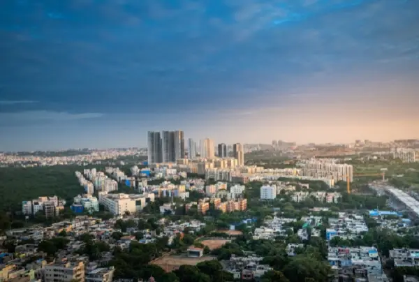
Hari Hara Avenue
SREE GAYATHRI DEVELOPERS · Nalgonda · RERA P01800011335
HARI HARA AVENUE is an open plotted development at Nomula, Nakrekal Mandal, Nalgonda District. The registered promoter is SREE GAYATHRI DEVELOPERS. The registered site extent is 67,784.85 sq. m, and the draft layout approval states 241 plots; plot size configurations are not disclosed. The project is registered with TG-RERA under P01800011335, with a promoter-stated completion date of 14/06/2028.
01What we found
Read from TG-RERA filings, approvals, land and registration records and court records. A court case is counted only when the court record states this project's survey number with its village, or names the project.
02Check before you pay
7 items to check before you pay, 3 high - from the title chain, court records and approvals, each with what to ask the builder or your advocate. An item may not be a problem with the project: records can be incomplete.
1. Project at a glance
Project identity
| Field | Project record |
|---|---|
| Registered project | HARI HARA AVENUE RERA record |
| Project type | Plotted development / open plotted layout RERA record |
| Phase or registered portion | No phase number is disclosed; the RERA record identifies the project land as Survey Nos. 327/Part and 331/Part |
| TG-RERA registration | P01800011335; registration certificate issued in Form C |
| Registration validity | 15/06/2026 to 14/06/2028; this is the registration validity period, not evidence that the layout is complete or occupied |
| Registered promoter | SREE GAYATHRI DEVELOPERS; partnership RERA record Corporate record |
| RERA status | Registered; the certificate records no extension |
Land and geographic identity
| Field | Project record |
|---|---|
| Locality | Nomula / Nomula Gram Panchayat RERA record |
| Revenue village | Nomula RERA record |
| Mandal / district / PIN | Nakrekal / Nalgonda / 508210 RERA record |
| Project survey numbers | 327/Part and 331/Part |
| Landowner survey subdivisions identified in filed declarations | 327/4/2, 327/4/3/2, 331/1/4, 331/1/3 and 331/1/2 |
| Registered site extent | The project registration header reports 67,784.85 sq. m total and net area, with 0 area affected by road widening/FTL/Nala widening RERA record Land records |
| Layout extent stated in draft approval | Ac. 16.75 Cents; 81070.00 Sq. Yas; the Gram Panchayat communication also states Ac. 16.75 cents |
| Boundaries in RERA filing | East: 33 FEET ROAD; West: 66 FEET ROAD; North: 33 FEET ROAD; South: GUNDAMA RAJU KALAYAN RAOLANDAND OTHERS RERA record |
Development identity
| Field | Project record |
|---|---|
| Sanctioning authority | Director of Town and Country Planning (DT&CP), with development permission communicated by Nomula Gram Panchayat |
| Principal approval | Draft- TLP.No.20/2026/H, dated 15-06-2026 |
| Gram Panchayat reference | Draft Technical Layout Pattern 20/2026/H; permission communication Lr. No: 28/2026. |
| Development represented in filed layout approval | 241 plots |
| Layout land-use figures in draft approval | Total layout: 16.75 Acs - Cents; 81070.00 Sq. Yas; open space: 10.00%, 1.675 Acs - Cents; 8107.00 Sq. Yas; roads: 31.36%, 5.254 Acs - Cents; 25429.36 Sq. Yas; plotted area: 58.64%, 9.821 Acs - Cents; 47533.64 Sq. Yas; mortgage area: 15.10%, 1.483 Acs - Cents; 7177.72 Sq.Yards |
| Approved built-up area / buildings and floors | Not applicable to the supplied plotted-layout record; no building count, floor configuration or approved built-up-area figure is disclosed for this layout RERA record |
| Final layout release | The supplied approvals describe a draft layout and set conditions to complete development works, mortgage specified plots and gift specified areas before final layout release |
Offering and status
| Field | Project record |
|---|---|
| Offering | Plots in a plotted development; the draft layout approval states 241 plots |
| Plot size range / plot-wise inventory | Not disclosed in the supplied records |
| Booked / available plots | Not disclosed in the supplied records |
| Construction or development stage | The approvals permit development under a draft layout and require layout works; no independently verified site-progress report is supplied |
| Promoter-stated completion | 14/06/2028 in the Form B declaration |
| Occupancy / completion certificate | No occupancy or completion certificate is supplied. The project is a plotted layout; the supplied record does not establish completion of its layout works or final layout release |
2. The project story
- HARI HARA AVENUE is registered as an open plotted development at Nomula, in Nakrekal Mandal, Nalgonda District. Its RERA-filed land identity is Survey Nos. 327/Part and 331/Part; the filed declarations also identify landowner subdivisions 327/4/2, 327/4/3/2, 331/1/4, 331/1/3 and 331/1/2. RERA record
- The DT&CP document is for a draft layout and records 241 plots. It allocates land among plots, roads, open space and a mortgaged area. The Gram Panchayat’s permission is to take up development under that draft layout; it requires development works and specified mortgage and gift steps before release of the final layout. The approvals therefore describe a proposed layout and its conditions, not completed works or a final layout release.
- The promoter’s Form B declaration undertakes completion by 14/06/2028. The RERA certificate is valid through that date, but registration validity and the promoter’s completion undertaking do not establish that development has been completed. No site-verified progress assessment or completion/occupancy certificate is included in the supplied evidence.
3. Master plan, architecture & building design
- This is a plotted layout, not a residential-building project in the supplied plans. The draft layout approval states a total layout area of 16.75 Acs - Cents; 81070.00 Sq. Yas, comprising a 58.64% plotted area (9.821 Acs - Cents; 47533.64 Sq. Yas), 31.36% roads (5.254 Acs - Cents; 25429.36 Sq. Yas), 10.00% open space (1.675 Acs - Cents; 8107.00 Sq. Yas), and a stated 15.10% mortgage area (1.483 Acs - Cents; 7177.72 Sq.Yards). The mortgage area is identified as Plot Nos. 1 to 36 & 38.
- The draft approval calls for the plots and open spaces to be demarcated on the ground; roads to be formed with suitable gradients and drainage; open spaces to be fenced; avenue planting and rainwater-harvesting pits; and street lighting and electricity, sewerage-disposal and protected-water-supply systems. These are approval requirements, not evidence that the works have been completed.
- The supplied evidence does not include a readable layout drawing or plot-wise schedule. The layout-plan upload is recorded as not extracted, and the one drawing in the floor-plan set is still pending scan; no measured drawings are available. Accordingly, plot arrangement, individual plot dimensions, internal road geometry and on-drawing measurements cannot be described from this evidence. Floor plans
4. Homes, configurations & floor plans
- The offering is plots rather than apartments. The DT&CP draft-layout extraction states 241 plots, but the supplied record does not provide plot-wise numbers, sizes, configuration bands, booked counts or available counts.
| Configuration | Units | Booked | Available | RERA saleable area | Measured carpet area | Loading (if supplied) |
|---|---|---|---|---|---|---|
| Plots | 241 (as stated in draft layout approval) | Not disclosed | Not disclosed | Not disclosed | Not applicable | Not disclosed |
- The RERA-filed allotment-letter template is partially filled: plot/allottee details, booking amount, payment milestones and approval particulars remain blank. It does not establish a particular plot allocation or sale.
5. Parking & vehicle circulation
The supplied project records do not state a parking-space count, parking arrangement, visitor or accessible parking provision, or plot-wise parking allocation. The draft approval does require internal roads to be formed and opened for access to neighbouring sites; no road-width schedule or vehicle-circulation drawing is available in the extracted materials.
6. Amenities, recreation & open spaces
The filed draft approval identifies open space and several proposed layout services. The RERA amenities record lists facilities as available in the project entry, but reports 0 progress for each listed item; this is a filed declaration/status entry, not independent verification of completion. RERA amenities
| Description / size | 10.00%; 1.675 Acs - Cents; 8107.00 Sq. Yas |
|---|---|
| Declared progress / verified status | Required to be handed over by registered gift deed before final layout release; completion not verified |
| Description / size | Size and specific arrangement not disclosed |
|---|---|
| Evidence source | RERA amenities |
| Declared progress / verified status | Listed as available: YES; progress 0; completion not independently verified |
| Description / size | No size or description supplied |
|---|---|
| Evidence source | RERA amenities |
| Declared progress / verified status | Listed without an availability value; progress 0 |
| Description / size | Road area: 31.36%, 5.254 Acs - Cents; 25429.36 Sq. Yas; footpath details not supplied |
|---|---|
| Evidence source | RERA amenities |
| Declared progress / verified status | Road formation and handover are approval requirements; progress is 0 in the amenities record; completion not verified |
| Description / size | Avenue plantation in public open spaces; no quantity or size supplied |
|---|---|
| Declared progress / verified status | Required by the approval; completion not verified |
| Description / size | Quantity and capacity not supplied |
|---|---|
| Evidence source | RERA amenities |
| Declared progress / verified status | Required/listed; amenities progress 0; completion not verified |
7. Utilities, building services & safety
- The draft approval requires the developer to provide a protected water-supply system, sewerage-disposal system, street lighting and electricity; construct side drains and channelize nalas for stormwater runoff; and provide rainwater-harvesting pits. The RERA amenities entry also lists water supply, sewerage, storm-water drains, water conservation/rainwater harvesting, energy management, and an electrical meter room/sub-station/receiving station, each with 0 progress recorded. These are filed or approval-described provisions, not verified operational services. RERA amenities
- The record does not specify water source or storage capacity, sewage-treatment or reuse capacity, electrical-substation capacity, backup power, waste-management arrangements, security systems, accessibility features or fire/life-safety systems. The RERA amenities list includes fire protection and fire-safety requirements but gives no availability value or technical detail, and records progress as 0. RERA amenities
8. Location, access & connectivity
- The registered location is Nomula village, Nakrekal Mandal, Nalgonda District, Telangana, PIN 508210. The RERA filing gives the site boundaries as 33 FEET ROAD to the east, 66 FEET ROAD to the west, 33 FEET ROAD to the north, and GUNDAMA RAJU KALAYAN RAOLANDAND OTHERS to the south. RERA record
- The location data provides one approximate connectivity reference: the nearest sampled Outer Ring Road interchange is 17.3 km away. The site geocode is identified as a cadastral parcel centroid at 17.17113, 78.69625; it is not presented as a surveyed site entrance or travel-time measurement. Location record
9. Developer & development status
- The registered promoter is SREE GAYATHRI DEVELOPERS, a partnership. Its supplied corporate identifier is GSTIN 36AEUFS5927G1ZD. The RERA-filed address details identify the promoter at P NO 33/P, GAYATHRI, GAYATHRI NAGAR, NOMULA, Nomula, Nakrekal, Nalgonda, 508210; the Form B declaration separately states a registered-office address at P No.33/P, Gayatri Nagar, Suchitra, Hyderabad, Medchal Malkajgiri, Telangana-500067. RERA record Corporate record
- The project is represented in the supplied RERA records as a plotted layout under draft-layout approvals. The Form B declares completion by 14/06/2028. No construction-progress certification, final layout release, or completion/occupancy certificate is supplied, so the project’s current physical completion status cannot be established from this record.
10. Approvals, official records & documents
| What the supplied evidence establishes | Form C for HARI HARA AVENUE, registration P01800011335, issued 24/10/2026, valid 15/06/2026–14/06/2028; includes the stated 70% separate-account condition |
|---|
| What the supplied evidence establishes | Draft Technical Layout Pattern Draft- TLP.No.20/2026/H, dated 15-06-2026, for Survey Nos. 327/Part and 331/Part, Nomula; records layout land use and conditions |
|---|
| What the supplied evidence establishes | Permission to take up development under Draft TLP 20/2026/H, communication Lr. No: 28/2026.; records mortgage, gift, development-work and final-layout conditions |
|---|
| What the supplied evidence establishes | Promoter declares development rights under registered Development Agreement-cum-Irrevocable GPA documents 151/2026 and 150/2026, dated 04-03-2026, and undertakes completion by 14/06/2028 |
|---|
| What the supplied evidence establishes | Records an undertaking concerning supplementary agreements and proposed plot shares; the document states that supplementary agreements were in process |
|---|
| What the supplied evidence establishes | Partially filled project template; individual plot and allottee particulars are blank |
|---|
| What the supplied evidence establishes | The layout-plan item was not extracted; no final layout release, project-completion certificate or occupancy certificate is supplied |
|---|
1. Project at a glance
Project identity
Registered project: HARI HARA AVENUE
Project type: Plotted development / open plotted layout
Phase or registered portion: No phase number is disclosed; the RERA record identifies the project land as Survey Nos. 327/Part and 331/Part
TG-RERA registration: P01800011335; registration certificate issued in Form C
Registration validity: 15/06/2026 to 14/06/2028; this is the registration validity period, not evidence that the layout is complete or occupied
Registered promoter: SREE GAYATHRI DEVELOPERS; partnership
RERA status: Registered; the certificate records no extension
Land and geographic identity
Locality: Nomula / Nomula Gram Panchayat
Revenue village: Nomula
Mandal / district / PIN: Nakrekal / Nalgonda / 508210
Project survey numbers: 327/Part and 331/Part
Landowner survey subdivisions identified in filed declarations: 327/4/2, 327/4/3/2, 331/1/4, 331/1/3 and 331/1/2
Registered site extent: The project registration header reports 67,784.85 sq. m total and net area, with 0 area affected by road widening/FTL/Nala widening
Layout extent stated in draft approval: Ac. 16.75 Cents; 81070.00 Sq. Yas; the Gram Panchayat communication also states Ac. 16.75 cents
Boundaries in RERA filing: East: 33 FEET ROAD; West: 66 FEET ROAD; North: 33 FEET ROAD; South: GUNDAMA RAJU KALAYAN RAOLANDAND OTHERS
Development identity
Sanctioning authority: Director of Town and Country Planning (DT&CP), with development permission communicated by Nomula Gram Panchayat
Principal approval: Draft- TLP.No.20/2026/H, dated 15-06-2026
Gram Panchayat reference: Draft Technical Layout Pattern 20/2026/H; permission communication Lr. No: 28/2026.
Development represented in filed layout approval: 241 plots
Layout land-use figures in draft approval: Total layout: 16.75 Acs - Cents; 81070.00 Sq. Yas; open space: 10.00%, 1.675 Acs - Cents; 8107.00 Sq. Yas; roads: 31.36%, 5.254 Acs - Cents; 25429.36 Sq. Yas; plotted area: 58.64%, 9.821 Acs - Cents; 47533.64 Sq. Yas; mortgage area: 15.10%, 1.483 Acs - Cents; 7177.72 Sq.Yards
Approved built-up area / buildings and floors: Not applicable to the supplied plotted-layout record; no building count, floor configuration or approved built-up-area figure is disclosed for this layout
Final layout release: The supplied approvals describe a draft layout and set conditions to complete development works, mortgage specified plots and gift specified areas before final layout release
Offering and status
Offering: Plots in a plotted development; the draft layout approval states 241 plots
Plot size range / plot-wise inventory: Not disclosed in the supplied records
Booked / available plots: Not disclosed in the supplied records
Construction or development stage: The approvals permit development under a draft layout and require layout works; no independently verified site-progress report is supplied
Promoter-stated completion: 14/06/2028 in the Form B declaration
Occupancy / completion certificate: No occupancy or completion certificate is supplied. The project is a plotted layout; the supplied record does not establish completion of its layout works or final layout release
2. The project story
- HARI HARA AVENUE is registered as an open plotted development at Nomula, in Nakrekal Mandal, Nalgonda District. Its RERA-filed land identity is Survey Nos. 327/Part and 331/Part; the filed declarations also identify landowner subdivisions 327/4/2, 327/4/3/2, 331/1/4, 331/1/3 and 331/1/2.
- The DT&CP document is for a draft layout and records 241 plots. It allocates land among plots, roads, open space and a mortgaged area. The Gram Panchayat’s permission is to take up development under that draft layout; it requires development works and specified mortgage and gift steps before release of the final layout. The approvals therefore describe a proposed layout and its conditions, not completed works or a final layout release.
- The promoter’s Form B declaration undertakes completion by 14/06/2028. The RERA certificate is valid through that date, but registration validity and the promoter’s completion undertaking do not establish that development has been completed. No site-verified progress assessment or completion/occupancy certificate is included in the supplied evidence.
3. Master plan, architecture & building design
- This is a plotted layout, not a residential-building project in the supplied plans. The draft layout approval states a total layout area of 16.75 Acs - Cents; 81070.00 Sq. Yas, comprising a 58.64% plotted area (9.821 Acs - Cents; 47533.64 Sq. Yas), 31.36% roads (5.254 Acs - Cents; 25429.36 Sq. Yas), 10.00% open space (1.675 Acs - Cents; 8107.00 Sq. Yas), and a stated 15.10% mortgage area (1.483 Acs - Cents; 7177.72 Sq.Yards). The mortgage area is identified as Plot Nos. 1 to 36 & 38.
- The draft approval calls for the plots and open spaces to be demarcated on the ground; roads to be formed with suitable gradients and drainage; open spaces to be fenced; avenue planting and rainwater-harvesting pits; and street lighting and electricity, sewerage-disposal and protected-water-supply systems. These are approval requirements, not evidence that the works have been completed.
- The supplied evidence does not include a readable layout drawing or plot-wise schedule. The layout-plan upload is recorded as not extracted, and the one drawing in the floor-plan set is still pending scan; no measured drawings are available. Accordingly, plot arrangement, individual plot dimensions, internal road geometry and on-drawing measurements cannot be described from this evidence.
4. Homes, configurations & floor plans
- The offering is plots rather than apartments. The DT&CP draft-layout extraction states 241 plots, but the supplied record does not provide plot-wise numbers, sizes, configuration bands, booked counts or available counts.
| Configuration | Units | Booked | Available | RERA saleable area | Measured carpet area | Loading (if supplied) |
|---|---|---|---|---|---|---|
| Plots | 241 (as stated in draft layout approval) | Not disclosed | Not disclosed | Not disclosed | Not applicable | Not disclosed |
- The RERA-filed allotment-letter template is partially filled: plot/allottee details, booking amount, payment milestones and approval particulars remain blank. It does not establish a particular plot allocation or sale.
5. Parking & vehicle circulation
The supplied project records do not state a parking-space count, parking arrangement, visitor or accessible parking provision, or plot-wise parking allocation. The draft approval does require internal roads to be formed and opened for access to neighbouring sites; no road-width schedule or vehicle-circulation drawing is available in the extracted materials.
6. Amenities, recreation & open spaces
The filed draft approval identifies open space and several proposed layout services. The RERA amenities record lists facilities as available in the project entry, but reports 0 progress for each listed item; this is a filed declaration/status entry, not independent verification of completion.
| Facility | Description / size | Evidence source | Declared progress / verified status |
|---|---|---|---|
| Open space / park | 10.00%; 1.675 Acs - Cents; 8107.00 Sq. Yas | Required to be handed over by registered gift deed before final layout release; completion not verified | |
| Green strip / tot lot / park | Size and specific arrangement not disclosed | Listed as available: YES; progress 0; completion not independently verified | |
| Community buildings | No size or description supplied | Listed without an availability value; progress 0 | |
| Internal roads and footpaths | Road area: 31.36%, 5.254 Acs - Cents; 25429.36 Sq. Yas; footpath details not supplied | Road formation and handover are approval requirements; progress is 0 in the amenities record; completion not verified | |
| Avenue plantation / landscaping | Avenue plantation in public open spaces; no quantity or size supplied | Required by the approval; completion not verified | |
| Rainwater-harvesting pits | Quantity and capacity not supplied | Required/listed; amenities progress 0; completion not verified |
7. Utilities, building services & safety
- The draft approval requires the developer to provide a protected water-supply system, sewerage-disposal system, street lighting and electricity; construct side drains and channelize nalas for stormwater runoff; and provide rainwater-harvesting pits. The RERA amenities entry also lists water supply, sewerage, storm-water drains, water conservation/rainwater harvesting, energy management, and an electrical meter room/sub-station/receiving station, each with 0 progress recorded. These are filed or approval-described provisions, not verified operational services.
- The record does not specify water source or storage capacity, sewage-treatment or reuse capacity, electrical-substation capacity, backup power, waste-management arrangements, security systems, accessibility features or fire/life-safety systems. The RERA amenities list includes fire protection and fire-safety requirements but gives no availability value or technical detail, and records progress as 0.
8. Location, access & connectivity
- The registered location is Nomula village, Nakrekal Mandal, Nalgonda District, Telangana, PIN 508210. The RERA filing gives the site boundaries as 33 FEET ROAD to the east, 66 FEET ROAD to the west, 33 FEET ROAD to the north, and GUNDAMA RAJU KALAYAN RAOLANDAND OTHERS to the south.
- The location data provides one approximate connectivity reference: the nearest sampled Outer Ring Road interchange is 17.3 km away. The site geocode is identified as a cadastral parcel centroid at 17.17113, 78.69625; it is not presented as a surveyed site entrance or travel-time measurement.
9. Developer & development status
- The registered promoter is SREE GAYATHRI DEVELOPERS, a partnership. Its supplied corporate identifier is GSTIN 36AEUFS5927G1ZD. The RERA-filed address details identify the promoter at P NO 33/P, GAYATHRI, GAYATHRI NAGAR, NOMULA, Nomula, Nakrekal, Nalgonda, 508210; the Form B declaration separately states a registered-office address at P No.33/P, Gayatri Nagar, Suchitra, Hyderabad, Medchal Malkajgiri, Telangana-500067.
- The project is represented in the supplied RERA records as a plotted layout under draft-layout approvals. The Form B declares completion by 14/06/2028. No construction-progress certification, final layout release, or completion/occupancy certificate is supplied, so the project’s current physical completion status cannot be established from this record.
10. Approvals, official records & documents
| What the supplied evidence establishes | Form C for HARI HARA AVENUE, registration P01800011335, issued 24/10/2026, valid 15/06/2026–14/06/2028; includes the stated 70% separate-account condition |
|---|
| What the supplied evidence establishes | Draft Technical Layout Pattern Draft- TLP.No.20/2026/H, dated 15-06-2026, for Survey Nos. 327/Part and 331/Part, Nomula; records layout land use and conditions |
|---|
| What the supplied evidence establishes | Permission to take up development under Draft TLP 20/2026/H, communication Lr. No: 28/2026.; records mortgage, gift, development-work and final-layout conditions |
|---|
| What the supplied evidence establishes | Promoter declares development rights under registered Development Agreement-cum-Irrevocable GPA documents 151/2026 and 150/2026, dated 04-03-2026, and undertakes completion by 14/06/2028 |
|---|
| What the supplied evidence establishes | Records an undertaking concerning supplementary agreements and proposed plot shares; the document states that supplementary agreements were in process |
|---|
| What the supplied evidence establishes | Partially filled project template; individual plot and allottee particulars are blank |
|---|
| What the supplied evidence establishes | The layout-plan item was not extracted; no final layout release, project-completion certificate or occupancy certificate is supplied |
|---|
Frequently asked questions
Is HARI HARA AVENUE registered with Telangana RERA?
Yes. HARI HARA AVENUE is registered with the Telangana Real Estate Regulatory Authority as P01800011335; the registration status is New Project.
Who is the developer of HARI HARA AVENUE?
The promoter named in the RERA registration is SREE GAYATHRI DEVELOPERS.
Where is HARI HARA AVENUE located?
HARI HARA AVENUE is in NOMULA, Nakrekal, Nalgonda, Telangana (508210).
When will HARI HARA AVENUE be completed?
The promoter's proposed date of completion filed with RERA is 14/06/2028. This is the promoter's declaration, not a guarantee.
More projects in Nakrekal