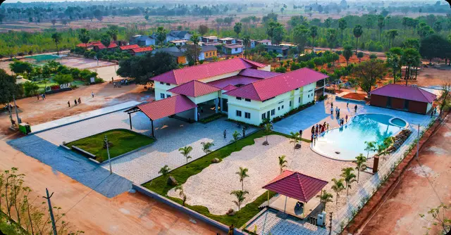
Sri Varenya Venture
SRI AVENUE INFRA DEVELOPERS · Jangaon · RERA P00600006611
SRI VARENYA VENTURE is a plotted development at Raghavapur Revenue Village, Ghanpur (Station) Mandal, Jangaon District. The registered promoter is SRI AVENUE INFRA DEVELOPERS, a partnership. The RERA land record states a site extent of 24,990.25 sq m; the tentative layout approval states 89 plots, and the drawing-derived plot sizes range from 149.85 sq m to 351.91 sq m. It is registered under TG-RERA number P00600006611, with a RERA-filed completion date of 16/05/2025.
01What we found
Read from TG-RERA filings, approvals, land and registration records and court records. A court case is counted only when the court record states this project's survey number with its village, or names the project.
02Check before you pay
8 items to check before you pay, 3 high - from the title chain, court records and approvals, each with what to ask the builder or your advocate. An item may not be a problem with the project: records can be incomplete.
1. Project at a glance
Project identity
| Field | Record |
|---|---|
| Registered project name | SRI VARENYA VENTURE RERA record |
| Project type | Plotted development / plotted layout RERA record RERA filing |
| Phase / registered portion | Phase not identified in the supplied record; registration is for the named plotted project RERA record |
| TG-RERA registration number | P00600006611 Approvals record |
| Registration validity | 26/07/2023 to 16/05/2025; the supplied certificate records no extension. This is the registration period, not a completion certificate. Approvals record |
| Registered promoter | SRI AVENUE INFRA DEVELOPERS, a partnership RERA record Corporate record |
| RERA status | Registration certificate issued; the supplied registration period has ended. Current registration status is not established by these records. |
Land and geographic identity
| Field | Record |
|---|---|
| Locality / revenue village | Rghavapur; the layout approval identifies Raghavapur Revenue Village RERA record Land records |
| Mandal | Ghanpur (Station) Mandal |
| District | Jangaon District RERA record Land records |
| PIN | 506301 in the project record and registration certificate RERA record |
| Project survey numbers and subdivisions | 253/B, 254/A/1, 254/B, 254/C, 255, 256/1, 256/2, 257/A, 257/B/1 Land records |
| Registered site extent | 24,990.25 sq m in the RERA land record Land records |
| Layout approval extent | The tentative layout approval states Ac. 6.175 cents; 29888.088 Sq.Yds |
| Layout drawing area statement | 25,958.48 sq m total site area, including 968.44 sq m road-widening area; the drawing’s land-use table uses a base of 24,990.03 sq m Layout record |
| Net area | 24,990.25 sq m in the RERA land record Land records |
| Boundaries | North: ROAD; south, east and west: OTHERS LAND Land records |
Development identity
| Field | Record |
|---|---|
| Sanctioning authority | KUDA Urban Development Authority; the supplied approval is for a Tentative Layout Plan Approvals record |
| Principal approval number / date | 258102/LP/GP/213547/0002/2023, approved 16-05-2023 Approvals record |
| Delegated authority noted in approval | Raghavapur Grampanchayat |
| Approved built-up area | 19,598.5 sq m recorded in the project fields; the supplied material does not identify this as a building or floor-area schedule RERA filing |
| Buildings / floors | Not disclosed for this plotted layout. Building floor configuration and parking levels are not applicable or established in the supplied layout record. Document index |
| Plots | Tentative approval states 89 plots; the layout drawing schedule was software-read as 87 plots and should be checked against the approved drawing. Layout record |
| Layout mortgage area | Approval states Ac 0.733 cents; 3545.626 Sq.Yds, comprising plots 21–24, 47–50 and 74–77, mortgaged in favour of the Grampanchayat. |
Offering and status
| Field | Record |
|---|---|
| Offering | Residential plots; individual plot inventory, plot numbers available for sale, and booked/available counts are not supplied. RERA filing Layout record |
| Plot-size range from drawing | Software-read 149.85–351.91 sq m (179.2–420.9 sq yd); this is drawing-derived, not a RERA-filed unit-size schedule. Layout record |
| RERA-filed completion date | 16/05/2025 RERA record RERA filing |
| Promoter’s Form B completion undertaking | 16/05/2026 |
| Construction / development stage | RERA record marks completeness at 70%; this is a filed status, not independent site verification. RERA record |
| Occupancy / completion certificate | No occupancy or completion certificate is included in the supplied documents. The layout approval requires a work-completion certificate for final layout approval. Document index |
2. The project story
SRI VARENYA VENTURE is a proposed residential plotted layout at Raghavapur Revenue Village, Ghanpur (Station) Mandal, Jangaon District. Its registered land identity covers survey subdivisions 253/B, 254/A/1, 254/B, 254/C, 255, 256/1, 256/2, 257/A and 257/B/1. The project record identifies a site extent of 24,990.25 sq m; the approval and layout drawing provide their own stated area figures in the identity table above. RERA record Land records Layout record
The principal approval on file is a Tentative Layout Plan issued by KUDA Urban Development Authority on 16-05-2023. It describes a layout of 89 plots and requires infrastructure works before final layout approval. The drawing-based extraction records the plot schedule and land-use allocation; its plot count is software-read and should be verified against the drawing. The RERA-filed 70% completeness figure is a promoter-filed status and does not independently establish the current condition of roads, utilities or plots. Layout record RERA record
The offering is plots rather than apartments or a multi-building residential scheme. No unit-by-unit availability, booking schedule, construction progress by plot, or issued completion/occupancy certificate is provided in the supplied record. The promoter’s Form B declares a completion undertaking of 16/05/2026, while the registration certificate states registration validity through 16/05/2025; these are separate recorded dates.
3. Master plan, architecture & building design
The project is a plotted layout, so the available design evidence concerns the layout arrangement and land-use allocation rather than building plans, elevations or floor plans. No tower/block arrangement, building footprint, floor configuration, apartment circulation, or building height is established by the supplied documents. The record lists an approved built-up area of 19,598.5 sq m, but does not provide a corresponding building schedule or identify the area basis. RERA filing
The approval’s land-use statement allocates 63.8588013464564282410112189% to plotted area, 23.5672291841069482081661334% to roads, 9.0377206278981546248025213% to park/open space, 1.009402145814892653233048% to utilities and 2.5268066797812248399762465% to social infrastructure. It also states a mortgage area of 11.8630062216787168007734281% of plotted area.
The software-read layout drawing gives the following land-use areas; these are drawing-derived figures, not a substitute for the authority’s detailed approved plan:
| Land use | Drawing-derived area | Share shown in drawing |
|---|---|---|
| Plots | 15,958.34 sq m | 63.86% |
| Roads | 5,889.46 sq m | 23.57% |
| Parks / open space | 2,258.53 sq m | 9.04% |
| Utilities | 252.25 sq m | 1.01% |
| Social infrastructure | 631.45 sq m | 2.53% |
| Amenities | 0.0 sq m | 0.00% |
Layout record
The drawing extraction reports 87 scheduled plots with sizes from 149.85 sq m to 351.91 sq m, and a median size of 153.3 sq m. It records 41 plots at 153.30 sq m, 11 at 149.85 sq m and 10 at 158.87 sq m. These figures were read by software from the approved layout drawing; verify plot numbers and dimensions against the original drawing before purchase. Layout record
4. Homes, configurations & floor plans
The project offers plots; no apartment configuration, RERA-filed apartment saleable area, or unit-level booking/availability schedule is supplied. The layout extraction records 87 scheduled plots and drawing-derived size bands as follows. Plot sizes are software-measured from the drawing, not a RERA-filed unit schedule. Layout record
| Plot-size band | Number of plots |
|---|---|
| 150–200 sq yd (125–167 sq m) | 62 |
| 200–250 sq yd (167–209 sq m) | 2 |
| 250–300 sq yd (209–251 sq m) | 9 |
| 300–400 sq yd (251–334 sq m) | 13 |
| 400–500 sq yd (334–418 sq m) | 1 |
The extracted drawing reports the smallest plot as 149.85 sq m (179.2 sq yd), median as 153.3 sq m (183.3 sq yd) and largest as 351.91 sq m (420.9 sq yd). No carpet area or apartment floor plan is applicable to the plotted offering. The approval condition states that only a detached dwelling house designed for one family may be built on a site, subject to the approval’s terms and any required future competent-authority approval. Layout record
5. Parking & vehicle circulation
The supplied record does not state parking-space counts, visitor or accessible parking, parking allocation to individual plots, or a parking-level design. The tentative layout approval identifies roads and requires roads to be formed and opened for access to neighbouring sites; it does not establish exclusive parking rights for any buyer. Layout record
The approval requires road formation, including suitable gradients, curbstones, metalling of carriageways and side drains. It also requires roads to be opened for accessibility to neighbouring sites and prohibits a compound wall or fencing around the site under the stated approval condition. Completion of these works is not independently verified in the supplied material.
6. Amenities, recreation & open spaces
The tentative approval specifies layout-level open space, social infrastructure, utilities and roads, and describes works and facilities to be provided. The approval also lists possible social-infrastructure uses and convenience facilities; the supplied record does not establish that each listed use has been built or delivered.
| Description / size | Approval: Ac 0.558 cents; drawing extraction: 2,258.53 sq m |
|---|---|
| Evidence source | Layout record |
| Declared progress / verified status | Approval requires developed open space to be handed over by registered gift deed; completion/hand-over not verified |
| Description / size | Approval: Ac 1.455 cents; drawing extraction: 5,889.46 sq m |
|---|---|
| Evidence source | Layout record |
| Declared progress / verified status | Road formation and access works are required; completion not independently verified |
| Description / size | Approval states Ac 0.156 cents; 755.214 Sq. Yds and gives 2.5268066797812248399762465% |
|---|---|
| Declared progress / verified status | Approval requires handover by registered gift deed; delivery not verified |
| Description / size | Approval: Ac 0.062 cents; 301.691 Sq.Yds; listed uses include water reservoir, septic tank/STP, electric transformer and solid-waste management |
|---|---|
| Declared progress / verified status | Proposed/required by approval; installed status not verified |
| Description / size | Required in the layout, including avenue plantation in public open spaces |
|---|---|
| Declared progress / verified status | Required work; completion not verified |
| Description / size | Required by approval |
|---|---|
| Declared progress / verified status | Required work; completion not verified |
| Description / size | Approval extraction lists pharmacy, clinic, school, play school, creche, dispensary and convenience shops |
|---|---|
| Declared progress / verified status | Listed in approval extraction; the supplied evidence does not confirm construction, operating status or individual areas |
The RERA amenities record marks internal roads and footpaths, water supply, sewerage, storm-water drains, green strip/park, street lighting, rainwater harvesting, electrical meter room/sub-station/receiving station and aggregate recreational open space as “YES”, with 0% recorded for each item. This is a filed amenities record, not independent confirmation of delivery. RERA amenities
7. Utilities, building services & safety
The tentative approval requires a protected water-supply system, an overhead tank or sump, sewerage disposal, a septic tank as applicable, sewerage-treatment provision, storm-water drains and nala channelization, rainwater-harvesting pits, street lighting, electricity facilities and solid-waste management. The approval also lists a water reservoir, septic tank/STP, electric transformer and solid-waste management among utility uses. The supplied evidence does not state capacities or independently verify installation or operation.
The RERA amenities record marks water supply, sewerage (including chambers, lines, septic tank and STP), storm-water drains, water conservation/rainwater harvesting, street lighting and electrical meter room/sub-station/receiving station as “YES”; each is recorded at 0%. Fire protection and fire safety requirements are listed but not marked “YES” in the supplied record. No fire-system design, lift, backup-power, CCTV, security-access, waste-segregation or accessibility specifications are established for this plotted layout. RERA amenities
8. Location, access & connectivity
The registered project location is Rghavapur / Raghavapur Revenue Village, Ghanpur (Station) Mandal, Jangaon District, PIN 506301. The layout approval identifies a northern boundary as ROAD and requires internal roads to be formed and opened to neighbouring sites. The supplied project evidence does not identify a named approach road, public-transport service, or measured distance to local landmarks. RERA record Land records
A location record supplies a cadastral-parcel-centroid coordinate of 17.41528, 78.35459 and a connectivity entry of Financial District (Nanakramguda), 1.2 km. The supplied data does not establish a route or measurement method for that connectivity entry; no travel time is provided. Location record
9. Developer & development status
The registered promoter is SRI AVENUE INFRA DEVELOPERS, recorded as a partnership. The firm’s registration acknowledgement identifies firm number 684 of 2022 and names RAJESH VARMA ALLAM and SAVITRI ALLAM as partners; the supplied documents identify Rajesh Varma Allam as managing partner/authorised signatory. Its GSTIN is 36AEVFS3898D1Z8. Corporate record
The project record gives the promoter address as SRI NILAYAM, SARASWATHI NAGAR, RAGHAVAPUR, RGHAVAPUR, Jangaon, 506301. The Form B affidavit by ALLAM RAJESH VRMA declares a completion date of 16/05/2026, and the project record separately lists 70% completeness. These are promoter-filed declarations; the supplied material does not independently verify current site progress or completion. Parties record RERA record
10. Approvals, official records & documents
| Details | Form C; P00600006611; issued 26/07/2023; validity stated through 16/05/2025 |
|---|
| Details | KUDA Urban Development Authority; approval no. 258102/LP/GP/213547/0002/2023; dated 16-05-2023; for the listed Raghavapur survey subdivisions |
|---|
| Details | Two layout sheets; plot schedule and land-use data extracted from drawing; plot sizes and plot count are software-read |
|---|---|
| Source | Layout record |
| Details | Promoter declaration includes title/encumbrance statements, project-fund declarations and completion undertaking of 16/05/2026 |
|---|
| Details | Firm registration acknowledgement, partnership deed and authorised-signatory declaration |
|---|
| Details | No completion or occupancy certificate supplied; the tentative approval requires a work-completion certificate for final layout approval |
|---|---|
| Source | Document index |
The tentative approval states that it is not proof of land title and requires a work-completion certificate from a Licensed Technical Person for approval of the final layout plan. This overview identifies the records supplied; it does not establish that the approval conditions or required works have been completed.
1. Project at a glance
Project identity
Registered project name: SRI VARENYA VENTURE
Project type: Plotted development / plotted layout
Phase / registered portion: Phase not identified in the supplied record; registration is for the named plotted project
TG-RERA registration number: P00600006611
Registration validity: 26/07/2023 to 16/05/2025; the supplied certificate records no extension. This is the registration period, not a completion certificate.
Registered promoter: SRI AVENUE INFRA DEVELOPERS, a partnership
RERA status: Registration certificate issued; the supplied registration period has ended. Current registration status is not established by these records.
Land and geographic identity
Locality / revenue village: Rghavapur; the layout approval identifies Raghavapur Revenue Village
Mandal: Ghanpur (Station) Mandal
District: Jangaon District
PIN: 506301 in the project record and registration certificate
Project survey numbers and subdivisions: 253/B, 254/A/1, 254/B, 254/C, 255, 256/1, 256/2, 257/A, 257/B/1
Registered site extent: 24,990.25 sq m in the RERA land record
Layout approval extent: The tentative layout approval states Ac. 6.175 cents; 29888.088 Sq.Yds
Layout drawing area statement: 25,958.48 sq m total site area, including 968.44 sq m road-widening area; the drawing’s land-use table uses a base of 24,990.03 sq m
Net area: 24,990.25 sq m in the RERA land record
Boundaries: North: ROAD; south, east and west: OTHERS LAND
Development identity
Sanctioning authority: KUDA Urban Development Authority; the supplied approval is for a Tentative Layout Plan
Principal approval number / date: 258102/LP/GP/213547/0002/2023, approved 16-05-2023
Delegated authority noted in approval: Raghavapur Grampanchayat
Approved built-up area: 19,598.5 sq m recorded in the project fields; the supplied material does not identify this as a building or floor-area schedule
Buildings / floors: Not disclosed for this plotted layout. Building floor configuration and parking levels are not applicable or established in the supplied layout record.
Plots: Tentative approval states 89 plots; the layout drawing schedule was software-read as 87 plots and should be checked against the approved drawing.
Layout mortgage area: Approval states Ac 0.733 cents; 3545.626 Sq.Yds, comprising plots 21–24, 47–50 and 74–77, mortgaged in favour of the Grampanchayat.
Offering and status
Offering: Residential plots; individual plot inventory, plot numbers available for sale, and booked/available counts are not supplied.
Plot-size range from drawing: Software-read 149.85–351.91 sq m (179.2–420.9 sq yd); this is drawing-derived, not a RERA-filed unit-size schedule.
RERA-filed completion date: 16/05/2025
Promoter’s Form B completion undertaking: 16/05/2026
Construction / development stage: RERA record marks completeness at 70%; this is a filed status, not independent site verification.
Occupancy / completion certificate: No occupancy or completion certificate is included in the supplied documents. The layout approval requires a work-completion certificate for final layout approval.
2. The project story
SRI VARENYA VENTURE is a proposed residential plotted layout at Raghavapur Revenue Village, Ghanpur (Station) Mandal, Jangaon District. Its registered land identity covers survey subdivisions 253/B, 254/A/1, 254/B, 254/C, 255, 256/1, 256/2, 257/A and 257/B/1. The project record identifies a site extent of 24,990.25 sq m; the approval and layout drawing provide their own stated area figures in the identity table above.
The principal approval on file is a Tentative Layout Plan issued by KUDA Urban Development Authority on 16-05-2023. It describes a layout of 89 plots and requires infrastructure works before final layout approval. The drawing-based extraction records the plot schedule and land-use allocation; its plot count is software-read and should be verified against the drawing. The RERA-filed 70% completeness figure is a promoter-filed status and does not independently establish the current condition of roads, utilities or plots.
The offering is plots rather than apartments or a multi-building residential scheme. No unit-by-unit availability, booking schedule, construction progress by plot, or issued completion/occupancy certificate is provided in the supplied record. The promoter’s Form B declares a completion undertaking of 16/05/2026, while the registration certificate states registration validity through 16/05/2025; these are separate recorded dates.
3. Master plan, architecture & building design
The project is a plotted layout, so the available design evidence concerns the layout arrangement and land-use allocation rather than building plans, elevations or floor plans. No tower/block arrangement, building footprint, floor configuration, apartment circulation, or building height is established by the supplied documents. The record lists an approved built-up area of 19,598.5 sq m, but does not provide a corresponding building schedule or identify the area basis.
The approval’s land-use statement allocates 63.8588013464564282410112189% to plotted area, 23.5672291841069482081661334% to roads, 9.0377206278981546248025213% to park/open space, 1.009402145814892653233048% to utilities and 2.5268066797812248399762465% to social infrastructure. It also states a mortgage area of 11.8630062216787168007734281% of plotted area.
The software-read layout drawing gives the following land-use areas; these are drawing-derived figures, not a substitute for the authority’s detailed approved plan:
| Land use | Drawing-derived area | Share shown in drawing |
|---|---|---|
| Plots | 15,958.34 sq m | 63.86% |
| Roads | 5,889.46 sq m | 23.57% |
| Parks / open space | 2,258.53 sq m | 9.04% |
| Utilities | 252.25 sq m | 1.01% |
| Social infrastructure | 631.45 sq m | 2.53% |
| Amenities | 0.0 sq m | 0.00% |
The drawing extraction reports 87 scheduled plots with sizes from 149.85 sq m to 351.91 sq m, and a median size of 153.3 sq m. It records 41 plots at 153.30 sq m, 11 at 149.85 sq m and 10 at 158.87 sq m. These figures were read by software from the approved layout drawing; verify plot numbers and dimensions against the original drawing before purchase.
4. Homes, configurations & floor plans
The project offers plots; no apartment configuration, RERA-filed apartment saleable area, or unit-level booking/availability schedule is supplied. The layout extraction records 87 scheduled plots and drawing-derived size bands as follows. Plot sizes are software-measured from the drawing, not a RERA-filed unit schedule.
150–200 sq yd (125–167 sq m): 62
200–250 sq yd (167–209 sq m): 2
250–300 sq yd (209–251 sq m): 9
300–400 sq yd (251–334 sq m): 13
400–500 sq yd (334–418 sq m): 1
The extracted drawing reports the smallest plot as 149.85 sq m (179.2 sq yd), median as 153.3 sq m (183.3 sq yd) and largest as 351.91 sq m (420.9 sq yd). No carpet area or apartment floor plan is applicable to the plotted offering. The approval condition states that only a detached dwelling house designed for one family may be built on a site, subject to the approval’s terms and any required future competent-authority approval.
5. Parking & vehicle circulation
The supplied record does not state parking-space counts, visitor or accessible parking, parking allocation to individual plots, or a parking-level design. The tentative layout approval identifies roads and requires roads to be formed and opened for access to neighbouring sites; it does not establish exclusive parking rights for any buyer.
The approval requires road formation, including suitable gradients, curbstones, metalling of carriageways and side drains. It also requires roads to be opened for accessibility to neighbouring sites and prohibits a compound wall or fencing around the site under the stated approval condition. Completion of these works is not independently verified in the supplied material.
6. Amenities, recreation & open spaces
The tentative approval specifies layout-level open space, social infrastructure, utilities and roads, and describes works and facilities to be provided. The approval also lists possible social-infrastructure uses and convenience facilities; the supplied record does not establish that each listed use has been built or delivered.
| Description / size | Approval: Ac 0.558 cents; drawing extraction: 2,258.53 sq m |
|---|---|
| Declared progress / verified status | Approval requires developed open space to be handed over by registered gift deed; completion/hand-over not verified |
| Description / size | Approval: Ac 1.455 cents; drawing extraction: 5,889.46 sq m |
|---|---|
| Declared progress / verified status | Road formation and access works are required; completion not independently verified |
| Description / size | Approval states Ac 0.156 cents; 755.214 Sq. Yds and gives 2.5268066797812248399762465% |
|---|---|
| Declared progress / verified status | Approval requires handover by registered gift deed; delivery not verified |
| Description / size | Approval: Ac 0.062 cents; 301.691 Sq.Yds; listed uses include water reservoir, septic tank/STP, electric transformer and solid-waste management |
|---|---|
| Declared progress / verified status | Proposed/required by approval; installed status not verified |
| Description / size | Required in the layout, including avenue plantation in public open spaces |
|---|---|
| Declared progress / verified status | Required work; completion not verified |
| Description / size | Required by approval |
|---|---|
| Declared progress / verified status | Required work; completion not verified |
| Description / size | Approval extraction lists pharmacy, clinic, school, play school, creche, dispensary and convenience shops |
|---|---|
| Declared progress / verified status | Listed in approval extraction; the supplied evidence does not confirm construction, operating status or individual areas |
The RERA amenities record marks internal roads and footpaths, water supply, sewerage, storm-water drains, green strip/park, street lighting, rainwater harvesting, electrical meter room/sub-station/receiving station and aggregate recreational open space as “YES”, with 0% recorded for each item. This is a filed amenities record, not independent confirmation of delivery.
7. Utilities, building services & safety
The tentative approval requires a protected water-supply system, an overhead tank or sump, sewerage disposal, a septic tank as applicable, sewerage-treatment provision, storm-water drains and nala channelization, rainwater-harvesting pits, street lighting, electricity facilities and solid-waste management. The approval also lists a water reservoir, septic tank/STP, electric transformer and solid-waste management among utility uses. The supplied evidence does not state capacities or independently verify installation or operation.
The RERA amenities record marks water supply, sewerage (including chambers, lines, septic tank and STP), storm-water drains, water conservation/rainwater harvesting, street lighting and electrical meter room/sub-station/receiving station as “YES”; each is recorded at 0%. Fire protection and fire safety requirements are listed but not marked “YES” in the supplied record. No fire-system design, lift, backup-power, CCTV, security-access, waste-segregation or accessibility specifications are established for this plotted layout.
8. Location, access & connectivity
The registered project location is Rghavapur / Raghavapur Revenue Village, Ghanpur (Station) Mandal, Jangaon District, PIN 506301. The layout approval identifies a northern boundary as ROAD and requires internal roads to be formed and opened to neighbouring sites. The supplied project evidence does not identify a named approach road, public-transport service, or measured distance to local landmarks.
A location record supplies a cadastral-parcel-centroid coordinate of 17.41528, 78.35459 and a connectivity entry of Financial District (Nanakramguda), 1.2 km. The supplied data does not establish a route or measurement method for that connectivity entry; no travel time is provided.
9. Developer & development status
The registered promoter is SRI AVENUE INFRA DEVELOPERS, recorded as a partnership. The firm’s registration acknowledgement identifies firm number 684 of 2022 and names RAJESH VARMA ALLAM and SAVITRI ALLAM as partners; the supplied documents identify Rajesh Varma Allam as managing partner/authorised signatory. Its GSTIN is 36AEVFS3898D1Z8.
The project record gives the promoter address as SRI NILAYAM, SARASWATHI NAGAR, RAGHAVAPUR, RGHAVAPUR, Jangaon, 506301. The Form B affidavit by ALLAM RAJESH VRMA declares a completion date of 16/05/2026, and the project record separately lists 70% completeness. These are promoter-filed declarations; the supplied material does not independently verify current site progress or completion.
10. Approvals, official records & documents
| Details | Form C; P00600006611; issued 26/07/2023; validity stated through 16/05/2025 |
|---|
| Details | KUDA Urban Development Authority; approval no. 258102/LP/GP/213547/0002/2023; dated 16-05-2023; for the listed Raghavapur survey subdivisions |
|---|
| Details | Two layout sheets; plot schedule and land-use data extracted from drawing; plot sizes and plot count are software-read |
|---|
| Details | Promoter declaration includes title/encumbrance statements, project-fund declarations and completion undertaking of 16/05/2026 |
|---|
| Details | Firm registration acknowledgement, partnership deed and authorised-signatory declaration |
|---|
| Details | No completion or occupancy certificate supplied; the tentative approval requires a work-completion certificate for final layout approval |
|---|
The tentative approval states that it is not proof of land title and requires a work-completion certificate from a Licensed Technical Person for approval of the final layout plan. This overview identifies the records supplied; it does not establish that the approval conditions or required works have been completed.
Frequently asked questions
Is SRI VARENYA VENTURE registered with Telangana RERA?
Yes. SRI VARENYA VENTURE is registered with the Telangana Real Estate Regulatory Authority as P00600006611; the registration status is New Project.
Who is the developer of SRI VARENYA VENTURE?
The promoter named in the RERA registration is SRI AVENUE INFRA DEVELOPERS.
Where is SRI VARENYA VENTURE located?
SRI VARENYA VENTURE is in RGHAVAPUR, Jangaon, Telangana (506301).
When will SRI VARENYA VENTURE be completed?
The promoter's proposed date of completion filed with RERA is 16/05/2025. This is the promoter's declaration, not a guarantee.
More projects in Jangaon