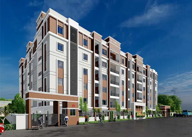
Silver Space
SHATHABDHI TOWNSHIPS PVT LTD · Vikarabad · RERA P02100004406
SILVER SPACE is a plotted development / residential layout in VIKARABAD, Vikarabad mandal, Vikarabad district. The registered promoter is SHATHABDHI TOWNSHIPS PVT LTD. The registered site extent is 95465.343 sq.mts, and the layout records describe 277 plots for dwelling houses; tower, floor and home configurations are not disclosed. It is registered under TG-RERA number P02100004406, with a promoter-declared completion date of 05/03/2027.
More from Shathabdhi Townships Pvt Ltd · 21 projects →
01What we found
Read from TG-RERA filings, approvals, land and registration records and court records. A court case is counted only when the court record states this project's survey number with its village, or names the project.
02Check before you pay
8 items to check before you pay, 3 high - from the title chain, court records and approvals, each with what to ask the builder or your advocate. An item may not be a problem with the project: records can be incomplete.
Project at a glance
Project identity
| Item | Project record |
|---|---|
| Registered project name | SILVER SPACE RERA record |
| Project type | Plotted development / residential layout RERA record RERA filing |
| Phase / registered portion | A registered project; a separate phase or phase-wise boundary is not disclosed in the supplied record. RERA record |
| TG-RERA registration | P02100004406 RERA record |
| Registration validity | 11/04/2022 to 05/03/2027; the registration certificate states four years and that it may be extended by the Authority under the Act and Rules. Validity is not the same as a completion certificate. |
| Registered promoter | SHATHABDHI TOWNSHIPS PVT LTD RERA record |
| RERA project status | “New Project” in the RERA project record. The supplied data does not provide a verified construction-stage assessment. RERA filing RERA record |
Land and geographic identity
| Item | Project record |
|---|---|
| Locality | VIKARABAD RERA record RERA filing |
| Revenue villages | Ananthagiripally village and Girgitpally village are named in the layout/approval records. The RERA survey description says “35/P OF ANANTHAGIRIPALLY VILLAGE,105/PAND OF GIRIPALLY VILLAGE.” |
| Mandal / district | Vikarabad mandal / Vikarabad district RERA record |
| PIN | 501101 RERA record |
| Project survey numbers and subdivisions | 35/P (Ananthagiripally) and 105/P (Girgitpally; the registration certificate records “105/PAND OF GIRIPALLY VILLAGE”). Land records |
| Registered site extent | 95465.343 sq.mts total area; 95465.34 sq.mts net area. The RERA land record reports 00 area affected in road widening/FTL of tanks/nala widening. Land records RERA filing |
| Layout extent in approval proceedings | Ac.23.59 cents in the final layout-release record. |
| Boundaries | North, south, east and west are recorded as NA; boundary descriptions are not supplied. Land records |
Development identity
| Item | Project record |
|---|---|
| Sanctioning / layout authorities in filed records | Director of Town and Country Planning (technical layout pattern) and Vikarabad Municipality (final layout release). |
| Principal layout reference | TLP No. 57/2021/H; the final layout-release proceedings are G/TPO/617/Layout/2019-20, approved 23.09.2024. |
| Layout arrangement | 277 plots are stated in the technical-layout and final-release records. |
| Site-area distribution in final-release record | Plotted area: Ac. 13.309 cents (56.38%); open space: Ac. 2.349 Cents (10.00%); roads: Ac.7.932 cents (33.62%); total: Ac.23.59 cents (100.00%). |
| Building / floor configuration | Not applicable as a multi-storey building specification in the supplied record; no tower count, floor configuration or approved built-up area is disclosed. The final layout conditions describe plots for dwelling houses. RERA filing |
| Approved versus RERA-declared plot count | The layout records state 277 plots. A separate RERA inventory count is not supplied. |
Offering and status
| Item | Project record |
|---|---|
| Unit type | Plots / residential land. Plot-size bands and individual plot dimensions are not supplied here. RERA filing Promoter website |
| Booked / available counts | Not disclosed in the supplied evidence. RERA filing |
| Construction stage | No independently verified site-progress measurement is supplied. The supplied RERA amenity fields show 0% progress for listed items; those entries do not establish overall plot or infrastructure completion. RERA amenities |
| Promoter-declared completion date | 05/03/2027, stated in the Form B declaration. |
| Registration deadline / validity | Registration is recorded as valid until 05/03/2027. This is distinct from evidence of completed development. |
| Completion / occupancy record | The final-layout proceedings are recorded as completion-certified and include an “Occupancy certificate number” field. The supplied material describes a final layout release, not a building-by-building occupancy certificate; its scope should therefore be read as the layout record. |
The project story
SILVER SPACE is a plotted residential layout registered under TG-RERA as project P02100004406. Its filed land identity covers 35/P of Ananthagiripally village and 105/P of Girgitpally village in Vikarabad mandal and district. The RERA land record gives a site extent of 95465.343 sq.mts; the layout proceedings separately describe a layout of Ac.23.59 cents. RERA record Land records
The technical-layout and final-release records describe 277 plots, with land allocated to plots, roads and open space. The final-release proceedings say the sites are for dwelling houses and that shops, business premises and industrial units are not allowed except on sites specially reserved for those uses. No individual plot-size schedule, booking inventory, construction-stage report, or independently verified site-progress assessment is included in the supplied evidence.
The promoter’s Form B declaration undertakes completion by 05/03/2027. This is a declared timeline, not independent confirmation of progress or completion.
Master plan, architecture & building design
This is a plotted layout rather than a documented apartment or multi-tower scheme. The technical-layout records describe 277 plots over Ac.23.59 cents and show roads and reserved open space. The final layout-release record allocates Ac. 13.309 cents (56.38%) to plotted area, Ac. 2.349 Cents (10.00%) to open space and Ac.7.932 cents (33.62%) to roads.
The layout plan records proposed widening of an existing 40'-0" road to 100'-0" as per the master plan. The plan also identifies the reserved open space as park land.
No building footprints, approved built-up area, plot-by-plot dimensions, building heights, floor plans or residential-unit schedule are supplied. The final layout proceedings state that each approved plot is for a dwelling house and restrict other uses, subject to the stated exceptions for specially reserved sites. RERA filing
Homes, configurations & floor plans
The offering is recorded as plotted development. The available evidence states 277 plots in the layout proceedings but does not provide individual plot sizes, plot-wise RERA inventory, booked or available counts, or RERA-filed saleable areas.
The supplied plan-measurement record contains two drawings, with 0 measured and 2 scans pending; it identifies no flats. Accordingly, there are no verified drawing-based carpet or room measurements to report. Floor plans
| Configuration | Units | Booked | Available | RERA saleable area | Measured carpet area | Loading (if supplied) |
|---|---|---|---|---|---|---|
| Residential plots | 277 in layout approval records; separate RERA inventory count not supplied | Not disclosed | Not disclosed | Not disclosed | Not applicable / not supplied | Not supplied |
Parking & vehicle circulation
The supplied evidence does not establish a sanctioned parking count, visitor or accessible parking provision, plot-wise parking allocation, or parking-specific circulation arrangement. No exclusive parking right can be inferred from the layout records.
The layout approval material records a road area of Ac.7.932 cents (33.62%). The plan’s road-widening note refers to widening an existing 40'-0" road to 100'-0"; the supplied evidence does not detail plot-level driveways, pedestrian separation, ramps or vehicle entries and exits.
Amenities, recreation & open spaces
The approved layout records reserve Ac. 2.349 Cents (10.00%) as open space and identify park/open-space use. The supplied RERA amenity fields list the facilities below; the recorded progress for each listed item is 0% where a percentage is shown. These fields are not evidence of independent completion verification. RERA amenities
| Description / size | Ac. 2.349 Cents (10.00%) in the final layout-release record; the technical-layout record also describes reserved park/open space. |
|---|---|
| Declared progress / verified status | Approved/reserved in layout record; no independent completion verification supplied. |
| Description / size | Listed in the RERA amenity fields; no separate size supplied. |
|---|---|
| Evidence source | RERA amenities |
| Declared progress / verified status | 0% recorded; independent verification not supplied. |
| Description / size | Listed; no size or capacity supplied. |
|---|---|
| Evidence source | RERA amenities |
| Declared progress / verified status | 0% recorded; independent verification not supplied. |
Utilities, building services & safety
The RERA amenity fields list Water Supply and Sewerage (Chamber, Lines, Septic Tank, STP) as “YES.” They also list storm-water drains, street lighting, treatment and disposal of sewage and sullage water, solid-waste management, water conservation/rainwater harvesting, energy management, fire protection and fire safety, and an electrical meter room/sub-station/receiving station. No capacities, design details or independent completion verification are supplied. RERA amenities
For the listed items with progress percentages, the RERA amenity record shows 0%. The promoter website lists additional features, including underground drainage, water-harvesting pits, an overhead water tank, electricity, power backup, security and CCTV; these are promoter-marketed claims and are not confirmation of sanctioned or delivered facilities. RERA amenities Promoter website
Location, access & connectivity
The registered location is VIKARABAD, Vikarabad mandal, Vikarabad district, PIN 501101. The cadastral parcel centroid is recorded as 17.41528, 78.35459. RERA record RERA filing Location record
No approach-road description, public-transport information or measured distance to a nearby landmark is supplied in the project location record. The promoter website claims “55Kms. from APPA junction.” This is a promoter-stated connectivity claim, not an independently verified distance. Location record Promoter website
Developer & development status
The registered promoter is SHATHABDHI TOWNSHIPS PVT LTD, recorded as a private limited company. The corporate record gives GSTIN 36AALCS9200L1ZZ. The listed project-registration address is FLAT NO 203,204, VAMSHI RAMS JYOTHI PRIME, ERRUM MANZIL, VIKARABAD, with PIN 501101. RERA record Corporate record RERA filing
The supplied promoter website is https://shathabdhitownships.com/project/land-for-sale-in-vikarabad/. The RERA record lists KASU SRINIVAS REDDY as authorized signatory and director. The Form B declaration, made by K. Srinivas Reddy as managing director and authorized representative, states a completion date of 05-03-2027 and declares the land free from encumbrances; these are promoter declarations. Parties record Corporate record
No independently verified construction-progress assessment is supplied. The RERA amenity record lists progress as 0% for the amenities with a percentage entry. RERA amenities
Approvals, official records & documents
| Record | What the supplied evidence identifies |
|---|---|
| TG-RERA registration certificate | Form C registration for SILVER SPACE, number P02100004406, valid 11/04/2022–05/03/2027. |
| Technical layout pattern | Director of Town and Country Planning communication for a technical layout pattern covering 35/P and 105/P, describing 277 plots and an extent of Ac. 23.59 Gts; approved date 05-03-2021. |
| Final layout release | Vikarabad Municipality proceedings G/TPO/617/Layout/2019-20, dated 23.09.2024, recording the 277-plot layout and its land-use distribution. The proceedings state that approval of the layout does not confer or alter ownership. |
| Roads and open-space handover / mortgage entry | The final layout-release record refers to roads and open space handed over to Vikarabad Municipality under Doc. 4496/2021, dated 18.09.2021. |
| Promoter declaration | Form B filed by SHATHABDHI TOWNSHIPS PVT LTD, stating its title basis, no encumbrances, 70% separate-account undertaking and completion by 5-03-2027. |
| Layout plan | Filed plan confirming T.L.P.NO.57/2021/H, showing reserved open space, road area and a road-widening note. |
| Occupancy / completion documentation | The supplied final-layout proceedings carry completion-certified and occupancy-certificate-number fields, but the record provided is a final layout-release document, not a building-specific OC. |
The evidence index above identifies the principal supplied project records. It does not include a plot-wise inventory schedule or a separate building-specific completion/occupancy certificate.
Project at a glance
Project identity
Registered project name: SILVER SPACE
Project type: Plotted development / residential layout
Phase / registered portion: A registered project; a separate phase or phase-wise boundary is not disclosed in the supplied record.
TG-RERA registration: P02100004406
Registration validity: 11/04/2022 to 05/03/2027; the registration certificate states four years and that it may be extended by the Authority under the Act and Rules. Validity is not the same as a completion certificate.
Registered promoter: SHATHABDHI TOWNSHIPS PVT LTD
RERA project status: “New Project” in the RERA project record. The supplied data does not provide a verified construction-stage assessment.
Land and geographic identity
Locality: VIKARABAD
Revenue villages: Ananthagiripally village and Girgitpally village are named in the layout/approval records. The RERA survey description says “35/P OF ANANTHAGIRIPALLY VILLAGE,105/PAND OF GIRIPALLY VILLAGE.”
Mandal / district: Vikarabad mandal / Vikarabad district
PIN: 501101
Project survey numbers and subdivisions: 35/P (Ananthagiripally) and 105/P (Girgitpally; the registration certificate records “105/PAND OF GIRIPALLY VILLAGE”).
Registered site extent: 95465.343 sq.mts total area; 95465.34 sq.mts net area. The RERA land record reports 00 area affected in road widening/FTL of tanks/nala widening.
Layout extent in approval proceedings: Ac.23.59 cents in the final layout-release record.
Boundaries: North, south, east and west are recorded as NA; boundary descriptions are not supplied.
Development identity
Sanctioning / layout authorities in filed records: Director of Town and Country Planning (technical layout pattern) and Vikarabad Municipality (final layout release).
Principal layout reference: TLP No. 57/2021/H; the final layout-release proceedings are G/TPO/617/Layout/2019-20, approved 23.09.2024.
Layout arrangement: 277 plots are stated in the technical-layout and final-release records.
Site-area distribution in final-release record: Plotted area: Ac. 13.309 cents (56.38%); open space: Ac. 2.349 Cents (10.00%); roads: Ac.7.932 cents (33.62%); total: Ac.23.59 cents (100.00%).
Building / floor configuration: Not applicable as a multi-storey building specification in the supplied record; no tower count, floor configuration or approved built-up area is disclosed. The final layout conditions describe plots for dwelling houses.
Approved versus RERA-declared plot count: The layout records state 277 plots. A separate RERA inventory count is not supplied.
Offering and status
Unit type: Plots / residential land. Plot-size bands and individual plot dimensions are not supplied here.
Booked / available counts: Not disclosed in the supplied evidence.
Construction stage: No independently verified site-progress measurement is supplied. The supplied RERA amenity fields show 0% progress for listed items; those entries do not establish overall plot or infrastructure completion.
Promoter-declared completion date: 05/03/2027, stated in the Form B declaration.
Registration deadline / validity: Registration is recorded as valid until 05/03/2027. This is distinct from evidence of completed development.
Completion / occupancy record: The final-layout proceedings are recorded as completion-certified and include an “Occupancy certificate number” field. The supplied material describes a final layout release, not a building-by-building occupancy certificate; its scope should therefore be read as the layout record.
The project story
SILVER SPACE is a plotted residential layout registered under TG-RERA as project P02100004406. Its filed land identity covers 35/P of Ananthagiripally village and 105/P of Girgitpally village in Vikarabad mandal and district. The RERA land record gives a site extent of 95465.343 sq.mts; the layout proceedings separately describe a layout of Ac.23.59 cents.
The technical-layout and final-release records describe 277 plots, with land allocated to plots, roads and open space. The final-release proceedings say the sites are for dwelling houses and that shops, business premises and industrial units are not allowed except on sites specially reserved for those uses. No individual plot-size schedule, booking inventory, construction-stage report, or independently verified site-progress assessment is included in the supplied evidence.
The promoter’s Form B declaration undertakes completion by 05/03/2027. This is a declared timeline, not independent confirmation of progress or completion.
Master plan, architecture & building design
This is a plotted layout rather than a documented apartment or multi-tower scheme. The technical-layout records describe 277 plots over Ac.23.59 cents and show roads and reserved open space. The final layout-release record allocates Ac. 13.309 cents (56.38%) to plotted area, Ac. 2.349 Cents (10.00%) to open space and Ac.7.932 cents (33.62%) to roads.
The layout plan records proposed widening of an existing 40'-0" road to 100'-0" as per the master plan. The plan also identifies the reserved open space as park land.
No building footprints, approved built-up area, plot-by-plot dimensions, building heights, floor plans or residential-unit schedule are supplied. The final layout proceedings state that each approved plot is for a dwelling house and restrict other uses, subject to the stated exceptions for specially reserved sites.
Homes, configurations & floor plans
The offering is recorded as plotted development. The available evidence states 277 plots in the layout proceedings but does not provide individual plot sizes, plot-wise RERA inventory, booked or available counts, or RERA-filed saleable areas.
The supplied plan-measurement record contains two drawings, with 0 measured and 2 scans pending; it identifies no flats. Accordingly, there are no verified drawing-based carpet or room measurements to report.
| Configuration | Units | Booked | Available | RERA saleable area | Measured carpet area | Loading (if supplied) |
|---|---|---|---|---|---|---|
| Residential plots | 277 in layout approval records; separate RERA inventory count not supplied | Not disclosed | Not disclosed | Not disclosed | Not applicable / not supplied | Not supplied |
Parking & vehicle circulation
The supplied evidence does not establish a sanctioned parking count, visitor or accessible parking provision, plot-wise parking allocation, or parking-specific circulation arrangement. No exclusive parking right can be inferred from the layout records.
The layout approval material records a road area of Ac.7.932 cents (33.62%). The plan’s road-widening note refers to widening an existing 40'-0" road to 100'-0"; the supplied evidence does not detail plot-level driveways, pedestrian separation, ramps or vehicle entries and exits.
Amenities, recreation & open spaces
The approved layout records reserve Ac. 2.349 Cents (10.00%) as open space and identify park/open-space use. The supplied RERA amenity fields list the facilities below; the recorded progress for each listed item is 0% where a percentage is shown. These fields are not evidence of independent completion verification.
| Facility | Description / size | Evidence source | Declared progress / verified status |
|---|---|---|---|
| Park / open space | Ac. 2.349 Cents (10.00%) in the final layout-release record; the technical-layout record also describes reserved park/open space. | Approved/reserved in layout record; no independent completion verification supplied. | |
| Green strip / tot lot / park | Listed in the RERA amenity fields; no separate size supplied. | 0% recorded; independent verification not supplied. | |
| Community buildings | Listed; no size or capacity supplied. | 0% recorded; independent verification not supplied. |
Utilities, building services & safety
The RERA amenity fields list Water Supply and Sewerage (Chamber, Lines, Septic Tank, STP) as “YES.” They also list storm-water drains, street lighting, treatment and disposal of sewage and sullage water, solid-waste management, water conservation/rainwater harvesting, energy management, fire protection and fire safety, and an electrical meter room/sub-station/receiving station. No capacities, design details or independent completion verification are supplied.
For the listed items with progress percentages, the RERA amenity record shows 0%. The promoter website lists additional features, including underground drainage, water-harvesting pits, an overhead water tank, electricity, power backup, security and CCTV; these are promoter-marketed claims and are not confirmation of sanctioned or delivered facilities.
Location, access & connectivity
The registered location is VIKARABAD, Vikarabad mandal, Vikarabad district, PIN 501101. The cadastral parcel centroid is recorded as 17.41528, 78.35459.
No approach-road description, public-transport information or measured distance to a nearby landmark is supplied in the project location record. The promoter website claims “55Kms. from APPA junction.” This is a promoter-stated connectivity claim, not an independently verified distance.
Developer & development status
The registered promoter is SHATHABDHI TOWNSHIPS PVT LTD, recorded as a private limited company. The corporate record gives GSTIN 36AALCS9200L1ZZ. The listed project-registration address is FLAT NO 203,204, VAMSHI RAMS JYOTHI PRIME, ERRUM MANZIL, VIKARABAD, with PIN 501101.
The supplied promoter website is https://shathabdhitownships.com/project/land-for-sale-in-vikarabad/. The RERA record lists KASU SRINIVAS REDDY as authorized signatory and director. The Form B declaration, made by K. Srinivas Reddy as managing director and authorized representative, states a completion date of 05-03-2027 and declares the land free from encumbrances; these are promoter declarations.
No independently verified construction-progress assessment is supplied. The RERA amenity record lists progress as 0% for the amenities with a percentage entry.
Approvals, official records & documents
TG-RERA registration certificate: Form C registration for SILVER SPACE, number P02100004406, valid 11/04/2022–05/03/2027.
Technical layout pattern: Director of Town and Country Planning communication for a technical layout pattern covering 35/P and 105/P, describing 277 plots and an extent of Ac. 23.59 Gts; approved date 05-03-2021.
Final layout release: Vikarabad Municipality proceedings G/TPO/617/Layout/2019-20, dated 23.09.2024, recording the 277-plot layout and its land-use distribution. The proceedings state that approval of the layout does not confer or alter ownership.
Roads and open-space handover / mortgage entry: The final layout-release record refers to roads and open space handed over to Vikarabad Municipality under Doc. 4496/2021, dated 18.09.2021.
Promoter declaration: Form B filed by SHATHABDHI TOWNSHIPS PVT LTD, stating its title basis, no encumbrances, 70% separate-account undertaking and completion by 5-03-2027.
Layout plan: Filed plan confirming T.L.P.NO.57/2021/H, showing reserved open space, road area and a road-widening note.
Occupancy / completion documentation: The supplied final-layout proceedings carry completion-certified and occupancy-certificate-number fields, but the record provided is a final layout-release document, not a building-specific OC.
The evidence index above identifies the principal supplied project records. It does not include a plot-wise inventory schedule or a separate building-specific completion/occupancy certificate.
Frequently asked questions
Is SILVER SPACE registered with Telangana RERA?
Yes. SILVER SPACE is registered with the Telangana Real Estate Regulatory Authority as P02100004406; the registration status is New Project.
Who is the developer of SILVER SPACE?
The promoter named in the RERA registration is SHATHABDHI TOWNSHIPS PVT LTD.
Where is SILVER SPACE located?
SILVER SPACE is in VIKARABAD, Telangana (501101).
When will SILVER SPACE be completed?
The promoter's proposed date of completion filed with RERA is 05/03/2027. This is the promoter's declaration, not a guarantee.
More projects in Vikarabad