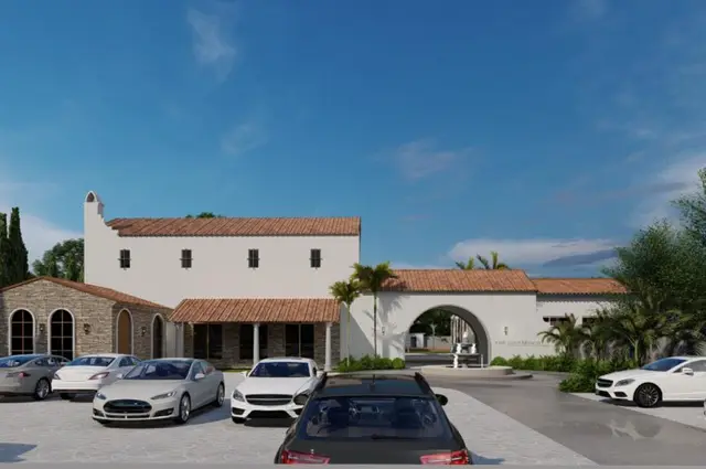
Sark Green Leaf
SARK PROJECTS INDIA PRIVATE LIMITED AND OTHERS · Rangareddy · RERA P02400008711
SARK GREEN LEAF is a plotted development at Kothur, Kandukur Mandal, Ranga Reddy District. The registered promoter is SARK PROJECTS INDIA PRIVATE LIMITED AND OTHERS. The project covers 39,658.16 sq.m and the layout shows 135 residential plots, with plot sizes of 107.86–360.37 sq.m (129–431 sq.yd); buildings and floors are not disclosed. It is registered with TG-RERA under P02400008711, and the promoter’s proposed completion date is 18 September 2024.
More from Sark Projects India Pvt Ltd · 8 projects →
01What we found
Read from TG-RERA filings, approvals, land and registration records and court records. A court case is counted only when the court record states this project's survey number with its village, or names the project.
02Check before you pay
9 items to check before you pay, 4 high - from the title chain, court records and approvals, each with what to ask the builder or your advocate. An item may not be a problem with the project: records can be incomplete.
Project at a glance
Project identity
| Field | Record |
|---|---|
| Registered project name | SARK GREEN LEAF RERA record |
| Project type | Plotted development / open residential layout RERA record RERA filing |
| Phase / registered portion | Phase not separately identified; registration covers the project land in the survey numbers listed below |
| TG-RERA registration | P02400008711 RERA record Approvals record |
| Registration validity | 28/08/2024 to 18/09/2024, as stated in the registration certificate Approvals record |
| Registered promoter | SARK PROJECTS INDIA PRIVATE LIMITED AND OTHERS RERA record Corporate record |
| RERA status in supplied record | The certificate supplies the validity dates above. A current extension or other updated registration status is not supplied. Approvals record |
Land and geographic identity
| Field | Record |
|---|---|
| Locality / revenue village | Kothur / KOTHUR RERA record RERA filing |
| Mandal | Kandukur RERA record RERA filing |
| District | Ranga Reddy RERA record RERA filing |
| PIN | 509228 RERA record |
| Project survey numbers | 59P, 60P, 71, 72, 73, 74P, 82P RERA record RERA filing |
| Site extent | Total area 39,658.16 sq.m; road-widening-affected area 459.23 sq.m; net area 39,198.93 sq.m RERA filing |
| Boundaries stated in the RERA project record | East: neighbours’ land; West: neighbours’ land; North: neighbours’ land; South: road RERA filing |
Development identity
| Field | Record |
|---|---|
| Sanctioning authority | Hyderabad Metropolitan Development Authority (HMDA) Approvals record |
| Principal layout approval | Layout Permit 000322/LO/Plg/HMDA/2021, dated 18 September 2021; file 026379/SMD/LT/U6/HMDA/30072019 Approvals record |
| Approved built-up area | 22,421.35 sq.m is recorded as “Approved Built up Area” in the project fields; the layout record labels the same figure “plotted area.” It is not a building-area specification for constructed homes. RERA filing Layout record |
| Layout scale | 135 plots, as shown in the layout drawing and project filing Layout record |
| Buildings / floors | Not disclosed as a building development; this is a plotted layout. RERA record |
| Parking | No parking-space count or parking-level provision is established in the supplied project record. |
Offering and status
| Field | Record |
|---|---|
| Offering | Residential plots; the approved layout records 135 plots. |
| Plot size range | Software-read from the approved layout drawing: 107.86–360.37 sq.m (129–431 sq.yd); verify against the drawing. Layout record |
| Booked / available counts | Not established by the supplied data. The filing includes a March 2024 intimation concerning plot sales, but it does not provide a verified current inventory count. |
| Construction stage | No independently verified site-progress report is supplied. RERA records a completion undertaking, not verified completion. |
| Completion date | Promoter’s Form B undertaking: 18 September 2024. |
| Occupancy / completion certificate | Not applicable as a building-level OC is not established for this plotted-layout record; no layout completion/final-release evidence is supplied here. The filed Form 1A text reads “NOT APPLICABLE.” |
The project story
SARK GREEN LEAF is registered as a residential plotted layout at Kothur, Kandukur Mandal, Ranga Reddy District. Its registered land comprises survey numbers 59P, 60P, 71, 72, 73, 74P and 82P. The filed layout shows 135 plots, internal roads, open space/park and social-infrastructure land. This is a plot offering, not an apartment or villa scheme in the supplied RERA record. RERA record RERA filing
HMDA’s record describes the approval as a draft layout. The conditions include completion of layout development works and handover of roads, open spaces and social-infrastructure land to the local body before release of final layout plans. The supplied evidence does not establish that those works are complete, that the final layout has been released, or that the plots are currently available for sale.
The promoter’s Form B states a project completion undertaking of 18 September 2024. This is the promoter’s declared deadline; it is not independent evidence of physical completion.
Master plan, architecture & building design
The approved drawing is a draft open-layout plan, not a building or floor-plan set. It identifies the layout’s residential use and contains no evidenced tower, apartment, villa, building-height or floor-configuration details.
The layout record states a total site area of 39,658.16 sq.m, including 459.23 sq.m affected by road widening, leaving a net layout area of 39,198.93 sq.m. Its area statement allocates the net area as follows: RERA filing
| Layout use | Area |
|---|---|
| Plotted area | 22,421.35 sq.m |
| Layout road area | 12,415.02 sq.m |
| Park | 3,380.78 sq.m |
| Social infrastructure | 981.31 sq.m |
| Amenity area | 0.00 sq.m |
| Road-widening-affected area | 459.23 sq.m |
The software-read layout analysis identifies 135 plots and a plot-size range of 107.86–360.37 sq.m (129–431 sq.yd), with the drawing’s plot-area total matching its plotted-area statement. These are drawing-derived measurements, not a RERA-filed unit-area schedule. The layout includes 33-foot-wide roads and identifies an existing 60-foot-wide road and a 300-foot Regional Ring Road on the drawing; these labels are not a statement of project travel distances or current road completion. Layout record
Homes, configurations & floor plans
This project is recorded as plotted development, so apartment configurations and apartment carpet areas do not apply. The layout drawing shows 135 plots. The following plot sizes are software-read from the approved drawing and should be checked against it; no booked or currently available plot count is established. Layout record
| Plot information | Record |
|---|---|
| Plot count | 135 |
| Software-measured size range | 107.86–360.37 sq.m (129–431 sq.yd) |
| Common printed sizes | 167 sq.yd (60 plots); 200 sq.yd (19); 180 sq.yd (7); 251 sq.yd (4); 217 sq.yd (4) |
| Drawing-derived measured carpet area | Not applicable to plots |
| Booked / available count | Not established in the supplied data |
The drawing-analysis record says plot numbers and areas were read from the layout and that the total plotted area matches the drawing’s own area statement. This is a software-measured drawing interpretation, not a separate RERA inventory disclosure. Layout record
Parking & vehicle circulation
The supplied layout evidence does not establish a parking-space count, dedicated visitor or accessible spaces, mechanical parking, EV charging, or an individual plot’s parking allocation. A third-party listing mentions covered car parking, but this is not supported as a sanctioned or allocated provision in the supplied RERA/layout documents and is therefore not presented as an established project facility. Promoter website
The layout approval requires roads to be opened for access to neighbouring sites and restricts construction or fencing that would block those roads while the layout conditions remain applicable. The approved drawing labels 33-foot-wide roads and an existing 60-foot-wide road.
Amenities, recreation & open spaces
The layout documents list some infrastructure and site features, while the RERA amenity record gives status percentages. These figures are recorded disclosures, not independent verification of completion. The layout approval also states that roads, open space and social-infrastructure land are to be handed over to the local body before release of final layout plans.
| Facility | Park / open space |
|---|---|
| Description / size | Park area 3,380.78 sq.m; the plan’s land-use statement also includes “organized open space/park area/utility area” at this area. |
| Evidence source | Layout record |
| Declared progress / verified status | RERA amenity record reports green strip/tot lot/park at 98%; not independently verified complete. RERA amenities |
| Facility | Tot lot |
|---|---|
| Description / size | Listed on layout drawing. |
| Declared progress / verified status | Completion status not independently verified. |
| Facility | Social-infrastructure land |
|---|---|
| Description / size | 981.31 sq.m in the layout area statement. |
| Declared progress / verified status | Handover to the local body is a stated layout condition; completion/handover not established here. |
| Facility | Community buildings |
|---|---|
| Description / size | No evidenced building or facility specification. |
| Evidence source | RERA amenities |
| Declared progress / verified status | RERA amenity record reports 0%. |
| Facility | Utility land |
|---|---|
| Description / size | Utility 320.34 sq.m and Utility 118.81 sq.m are listed on the layout drawing. |
| Declared progress / verified status | Use and completion status not established. |
A third-party listing names a clubhouse, swimming pool, gym and children’s play area. These are not substantiated as sanctioned or delivered facilities in the supplied layout/RERA evidence. Promoter website
Utilities, building services & safety
The layout approval lists proposed infrastructure, and the project’s RERA amenity record reports percentages for selected services. The record does not provide capacities or independent confirmation of completion. RERA amenities
| Service | Evidence in the record |
|---|---|
| Water | Layout approval lists internal water-supply pipelines and an overhead tank; RERA amenity record reports water supply at 100%. Source, storage capacity and independent completion verification are not supplied. RERA amenities |
| Sewerage / drainage | Layout approval lists underground drainage, a common septic tank / STP and storm-water drains; RERA amenity record reports sewerage and storm-water drains at 98%, and sewage/sullage treatment and disposal at 98%. Capacity and independent verification are not supplied. RERA amenities |
| Electrical / lighting | Layout approval lists street lights and a transformer; RERA amenity record reports street lighting at 100% and electrical meter room/sub-station/receiving station at 98%. No supply capacity or backup provision is established. RERA amenities |
| Rainwater / waste | Layout approval lists rainwater-harvesting pits, solid-waste disposal and bio-compost; RERA amenity record reports water conservation/rainwater harvesting and solid-waste management at 98%. RERA amenities |
| Fire and life safety | No project-specific fire-safety provision or clearance is established in the supplied layout record; the RERA amenity record reports 0% for fire protection and fire-safety requirements. RERA amenities |
| Accessibility / security | No accessible-circulation, CCTV, access-control or security-system specification is supplied. RERA amenities |
Location, access & connectivity
The registered location is Kothur, Kandukur Mandal, Ranga Reddy District, Telangana, PIN 509228. The cadastral parcel centroid supplied for the site is 17.071566165885994, 78.46485093625517. RERA record RERA filing Cadastral map
The layout drawing identifies 33-foot-wide internal roads, an existing 60-foot-wide road and a 300-foot Regional Ring Road. A location record lists the nearest sampled Outer Ring Road interchange at approximately 18.0 km; it does not provide a route or travel time. A vendor listing names Tukkuguda as the nearest landmark, but no measured distance is supplied. Location record Promoter website
Developer & development status
The registered promoter is SARK PROJECTS INDIA PRIVATE LIMITED AND OTHERS. The project filing describes the promoter organization as “JOINT DEVELOPERS”; its GSTIN is 36AASCS5253L1ZN. The project evidence identifies the promoter entity type as private limited company. RERA record RERA filing Corporate record
The HMDA draft-layout record identifies SARK PROJECTS INDIA PVT LTD and SARK FORTUNE PROJECTS as applicants/developers. The promoter’s Form B is signed by G. Venkateswara Rao as authorized signatory and declares a completion undertaking of 18 September 2024. These records do not establish the current construction/development stage or final layout release.
The supplied registration certificate identifies the promoter’s address as Village Kondapur, Mandal Serilingampally, District Ranga Reddy, PIN 500032. No official contact details or promoter website are supplied here.
Approvals, official records & documents
| Record | What it establishes in this overview |
|---|---|
| TG-RERA Form C certificate, P02400008711 | Registration identity, registered location and survey numbers; certificate states validity from 28/08/2024 to 18/09/2024. |
| HMDA layout permit 000322/LO/Plg/HMDA/2021, dated 18 September 2021 | Draft layout approval for the Kothur survey parcels; the record includes layout area allocation, plot count and conditions. |
| HMDA layout drawing, file 026379/SMD/LT/U6/HMDA/30072019 | Drawing identifies the proposed residential open layout, 135 plots, roads, park/open-space, social-infrastructure and utility areas. |
| Layout permission approval and challan references | Document cites HMDA permit 000322/LO/plg/HMDA/2021 and references 4504097423, 23052202048 and 240104. |
| Promoter Form B declaration, February 2024 | Promoter declaration on title, encumbrance, separate-account obligations and the 18 September 2024 completion undertaking. |
| Plot-sale intimation to TS RERA, application REA02400072868, dated 01/03/2024 | Filing describes an intimation concerning plot sales and a stated total of 135 plots. |
| Form 1A architect completion certificate | Supplied extraction reads “NOT APPLICABLE”; it does not establish project completion. |
| HMDA-related mortgage and road-affected-area gift references | The layout record identifies mortgage deed 12946/2021 and registered gift deed 15097/2021; the layout conditions specify handover and release requirements. |
The public HMDA layout lookup is recorded as unavailable in the supplied evidence; that access limitation does not itself establish refusal or approval status beyond the documents listed above. HMDA
Project at a glance
Project identity
Registered project name: SARK GREEN LEAF
Project type: Plotted development / open residential layout
Phase / registered portion: Phase not separately identified; registration covers the project land in the survey numbers listed below
TG-RERA registration: P02400008711
Registration validity: 28/08/2024 to 18/09/2024, as stated in the registration certificate
Registered promoter: SARK PROJECTS INDIA PRIVATE LIMITED AND OTHERS
RERA status in supplied record: The certificate supplies the validity dates above. A current extension or other updated registration status is not supplied.
Land and geographic identity
Locality / revenue village: Kothur / KOTHUR
Mandal: Kandukur
District: Ranga Reddy
PIN: 509228
Project survey numbers: 59P, 60P, 71, 72, 73, 74P, 82P
Site extent: Total area 39,658.16 sq.m; road-widening-affected area 459.23 sq.m; net area 39,198.93 sq.m
Boundaries stated in the RERA project record: East: neighbours’ land; West: neighbours’ land; North: neighbours’ land; South: road
Development identity
Sanctioning authority: Hyderabad Metropolitan Development Authority (HMDA)
Principal layout approval: Layout Permit 000322/LO/Plg/HMDA/2021, dated 18 September 2021; file 026379/SMD/LT/U6/HMDA/30072019
Approved built-up area: 22,421.35 sq.m is recorded as “Approved Built up Area” in the project fields; the layout record labels the same figure “plotted area.” It is not a building-area specification for constructed homes.
Layout scale: 135 plots, as shown in the layout drawing and project filing
Buildings / floors: Not disclosed as a building development; this is a plotted layout.
Parking: No parking-space count or parking-level provision is established in the supplied project record.
Offering and status
Offering: Residential plots; the approved layout records 135 plots.
Plot size range: Software-read from the approved layout drawing: 107.86–360.37 sq.m (129–431 sq.yd); verify against the drawing.
Booked / available counts: Not established by the supplied data. The filing includes a March 2024 intimation concerning plot sales, but it does not provide a verified current inventory count.
Construction stage: No independently verified site-progress report is supplied. RERA records a completion undertaking, not verified completion.
Completion date: Promoter’s Form B undertaking: 18 September 2024.
Occupancy / completion certificate: Not applicable as a building-level OC is not established for this plotted-layout record; no layout completion/final-release evidence is supplied here. The filed Form 1A text reads “NOT APPLICABLE.”
The project story
SARK GREEN LEAF is registered as a residential plotted layout at Kothur, Kandukur Mandal, Ranga Reddy District. Its registered land comprises survey numbers 59P, 60P, 71, 72, 73, 74P and 82P. The filed layout shows 135 plots, internal roads, open space/park and social-infrastructure land. This is a plot offering, not an apartment or villa scheme in the supplied RERA record.
HMDA’s record describes the approval as a draft layout. The conditions include completion of layout development works and handover of roads, open spaces and social-infrastructure land to the local body before release of final layout plans. The supplied evidence does not establish that those works are complete, that the final layout has been released, or that the plots are currently available for sale.
The promoter’s Form B states a project completion undertaking of 18 September 2024. This is the promoter’s declared deadline; it is not independent evidence of physical completion.
Master plan, architecture & building design
The approved drawing is a draft open-layout plan, not a building or floor-plan set. It identifies the layout’s residential use and contains no evidenced tower, apartment, villa, building-height or floor-configuration details.
The layout record states a total site area of 39,658.16 sq.m, including 459.23 sq.m affected by road widening, leaving a net layout area of 39,198.93 sq.m. Its area statement allocates the net area as follows:
Plotted area: 22,421.35 sq.m
Layout road area: 12,415.02 sq.m
Park: 3,380.78 sq.m
Social infrastructure: 981.31 sq.m
Amenity area: 0.00 sq.m
Road-widening-affected area: 459.23 sq.m
The software-read layout analysis identifies 135 plots and a plot-size range of 107.86–360.37 sq.m (129–431 sq.yd), with the drawing’s plot-area total matching its plotted-area statement. These are drawing-derived measurements, not a RERA-filed unit-area schedule. The layout includes 33-foot-wide roads and identifies an existing 60-foot-wide road and a 300-foot Regional Ring Road on the drawing; these labels are not a statement of project travel distances or current road completion.
Homes, configurations & floor plans
This project is recorded as plotted development, so apartment configurations and apartment carpet areas do not apply. The layout drawing shows 135 plots. The following plot sizes are software-read from the approved drawing and should be checked against it; no booked or currently available plot count is established.
Plot count: 135
Software-measured size range: 107.86–360.37 sq.m (129–431 sq.yd)
Common printed sizes: 167 sq.yd (60 plots); 200 sq.yd (19); 180 sq.yd (7); 251 sq.yd (4); 217 sq.yd (4)
Drawing-derived measured carpet area: Not applicable to plots
Booked / available count: Not established in the supplied data
The drawing-analysis record says plot numbers and areas were read from the layout and that the total plotted area matches the drawing’s own area statement. This is a software-measured drawing interpretation, not a separate RERA inventory disclosure.
Parking & vehicle circulation
The supplied layout evidence does not establish a parking-space count, dedicated visitor or accessible spaces, mechanical parking, EV charging, or an individual plot’s parking allocation. A third-party listing mentions covered car parking, but this is not supported as a sanctioned or allocated provision in the supplied RERA/layout documents and is therefore not presented as an established project facility.
The layout approval requires roads to be opened for access to neighbouring sites and restricts construction or fencing that would block those roads while the layout conditions remain applicable. The approved drawing labels 33-foot-wide roads and an existing 60-foot-wide road.
Amenities, recreation & open spaces
The layout documents list some infrastructure and site features, while the RERA amenity record gives status percentages. These figures are recorded disclosures, not independent verification of completion. The layout approval also states that roads, open space and social-infrastructure land are to be handed over to the local body before release of final layout plans.
| Facility | Park / open space |
|---|---|
| Description / size | Park area 3,380.78 sq.m; the plan’s land-use statement also includes “organized open space/park area/utility area” at this area. |
| Declared progress / verified status | RERA amenity record reports green strip/tot lot/park at 98%; not independently verified complete. |
| Facility | Tot lot |
|---|---|
| Description / size | Listed on layout drawing. |
| Declared progress / verified status | Completion status not independently verified. |
| Facility | Social-infrastructure land |
|---|---|
| Description / size | 981.31 sq.m in the layout area statement. |
| Declared progress / verified status | Handover to the local body is a stated layout condition; completion/handover not established here. |
| Facility | Community buildings |
|---|---|
| Description / size | No evidenced building or facility specification. |
| Declared progress / verified status | RERA amenity record reports 0%. |
| Facility | Utility land |
|---|---|
| Description / size | Utility 320.34 sq.m and Utility 118.81 sq.m are listed on the layout drawing. |
| Declared progress / verified status | Use and completion status not established. |
A third-party listing names a clubhouse, swimming pool, gym and children’s play area. These are not substantiated as sanctioned or delivered facilities in the supplied layout/RERA evidence.
Utilities, building services & safety
The layout approval lists proposed infrastructure, and the project’s RERA amenity record reports percentages for selected services. The record does not provide capacities or independent confirmation of completion.
Water: Layout approval lists internal water-supply pipelines and an overhead tank; RERA amenity record reports water supply at 100%. Source, storage capacity and independent completion verification are not supplied.
Sewerage / drainage: Layout approval lists underground drainage, a common septic tank / STP and storm-water drains; RERA amenity record reports sewerage and storm-water drains at 98%, and sewage/sullage treatment and disposal at 98%. Capacity and independent verification are not supplied.
Electrical / lighting: Layout approval lists street lights and a transformer; RERA amenity record reports street lighting at 100% and electrical meter room/sub-station/receiving station at 98%. No supply capacity or backup provision is established.
Rainwater / waste: Layout approval lists rainwater-harvesting pits, solid-waste disposal and bio-compost; RERA amenity record reports water conservation/rainwater harvesting and solid-waste management at 98%.
Fire and life safety: No project-specific fire-safety provision or clearance is established in the supplied layout record; the RERA amenity record reports 0% for fire protection and fire-safety requirements.
Accessibility / security: No accessible-circulation, CCTV, access-control or security-system specification is supplied.
Location, access & connectivity
The registered location is Kothur, Kandukur Mandal, Ranga Reddy District, Telangana, PIN 509228. The cadastral parcel centroid supplied for the site is 17.071566165885994, 78.46485093625517.
The layout drawing identifies 33-foot-wide internal roads, an existing 60-foot-wide road and a 300-foot Regional Ring Road. A location record lists the nearest sampled Outer Ring Road interchange at approximately 18.0 km; it does not provide a route or travel time. A vendor listing names Tukkuguda as the nearest landmark, but no measured distance is supplied.
Developer & development status
The registered promoter is SARK PROJECTS INDIA PRIVATE LIMITED AND OTHERS. The project filing describes the promoter organization as “JOINT DEVELOPERS”; its GSTIN is 36AASCS5253L1ZN. The project evidence identifies the promoter entity type as private limited company.
The HMDA draft-layout record identifies SARK PROJECTS INDIA PVT LTD and SARK FORTUNE PROJECTS as applicants/developers. The promoter’s Form B is signed by G. Venkateswara Rao as authorized signatory and declares a completion undertaking of 18 September 2024. These records do not establish the current construction/development stage or final layout release.
The supplied registration certificate identifies the promoter’s address as Village Kondapur, Mandal Serilingampally, District Ranga Reddy, PIN 500032. No official contact details or promoter website are supplied here.
Approvals, official records & documents
TG-RERA Form C certificate, P02400008711: Registration identity, registered location and survey numbers; certificate states validity from 28/08/2024 to 18/09/2024.
HMDA layout permit 000322/LO/Plg/HMDA/2021, dated 18 September 2021: Draft layout approval for the Kothur survey parcels; the record includes layout area allocation, plot count and conditions.
HMDA layout drawing, file 026379/SMD/LT/U6/HMDA/30072019: Drawing identifies the proposed residential open layout, 135 plots, roads, park/open-space, social-infrastructure and utility areas.
Layout permission approval and challan references: Document cites HMDA permit 000322/LO/plg/HMDA/2021 and references 4504097423, 23052202048 and 240104.
Promoter Form B declaration, February 2024: Promoter declaration on title, encumbrance, separate-account obligations and the 18 September 2024 completion undertaking.
Plot-sale intimation to TS RERA, application REA02400072868, dated 01/03/2024: Filing describes an intimation concerning plot sales and a stated total of 135 plots.
Form 1A architect completion certificate: Supplied extraction reads “NOT APPLICABLE”; it does not establish project completion.
HMDA-related mortgage and road-affected-area gift references: The layout record identifies mortgage deed 12946/2021 and registered gift deed 15097/2021; the layout conditions specify handover and release requirements.
The public HMDA layout lookup is recorded as unavailable in the supplied evidence; that access limitation does not itself establish refusal or approval status beyond the documents listed above.
Frequently asked questions
Is SARK GREEN LEAF registered with Telangana RERA?
Yes. SARK GREEN LEAF is registered with the Telangana Real Estate Regulatory Authority as P02400008711; the registration status is New Project.
Who is the developer of SARK GREEN LEAF?
The promoter named in the RERA registration is SARK PROJECTS INDIA PRIVATE LIMITED AND OTHERS.
Where is SARK GREEN LEAF located?
SARK GREEN LEAF is in Kothur, Kandukur, Rangareddy, Telangana (509228).
When will SARK GREEN LEAF be completed?
The promoter's proposed date of completion filed with RERA is 18/09/2024. This is the promoter's declaration, not a guarantee.
More projects in Kothur