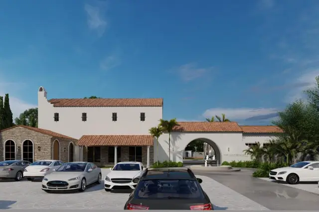
Mythirs Natural Island
HI - ROCK INFRA · Rangareddy · RERA P02400001634
MYTHIRS NATURAL ISLAND is a plotted development in Kothur, Kandukur, Ranga Reddy District, developed by registered promoter HI - ROCK INFRA. The registered site area is 20243.61 sqm and the net layout area is 19086.25 sqm; the project is a residential open-plots layout, with no plot count or plot sizes disclosed in the supplied RERA extracts. TG-RERA registration number P02400001634 records proposed completion on 10/10/2022.
01What we found
Read from TG-RERA filings, approvals, land and registration records and court records. A court case is counted only when the court record states this project's survey number with its village, or names the project.
02Check before you pay
9 items to check before you pay, 6 high - from the title chain, court records and approvals, each with what to ask the builder or your advocate. An item may not be a problem with the project: records can be incomplete.
1. Project at a glance
Project identity
| Field | Record |
|---|---|
| Registered project | MYTHIRS NATURAL ISLAND RERA record |
| Project type | Plotted development / proposed residential open-plots layout RERA record |
| Phase / registered portion | No phase is identified; registration is for the project recorded in Survey No. 154 |
| TG-RERA registration | P02400001634 |
| Registration validity | Certificate states valid from 09/02/2020 to 10/10/2022, unless extended by the Authority; the supplied record says no extension |
| Registered promoter | HI - ROCK INFRA (also written “Hi-Rock Infra” in the certificate); partnership RERA record RERA filing |
| RERA status | Registration certificate issued under section 5; the recorded validity end date has passed, and no extension is recorded in the supplied evidence |
Land and geographic identity
| Field | Record |
|---|---|
| Locality / revenue village | Kothur / KOTHUR; the approval and RERA records identify Kothur Village RERA record RERA filing |
| Mandal / district / PIN | Kandukur / Ranga Reddy / 501359 RERA record |
| Project survey number(s) | Survey No. 154; no project subdivision is specified in the RERA identity or approved layout record |
| Whole-survey reference | Cadastral record reports Survey No. 154 extent as 48016.33 sqm; this is the whole-survey record, not the stated project site extent Cadastral map |
| Registered site area | 20243.61 sqm RERA filing |
| Net layout area | 19086.25 sqm RERA filing |
| Area affected by road widening | 1157.36 sqm RERA filing |
| Boundaries recorded by promoter | East: Neighbours Land; West: ROAD WIDTH 60; North: Neighbours Land; South: Neighbours land RERA filing |
Development identity
| Field | Record |
|---|---|
| Sanctioning authority | Hyderabad Metropolitan Development Authority (HMDA) |
| Principal layout approval | HMDA Layout Permit No. 000299/LO/Plg/HMDA/2019, dated 10 October, 2019; described in the filed documents as a draft layout approval |
| Approved built-up area | RERA filing records 10902.46 sqm as approved built-up area; the layout drawing labels the same figure “Plotted Area” RERA filing Layout record |
| Buildings / floor configuration | Not applicable to the filed plotted-layout proposal; no building count, building floors, or parking levels are disclosed |
| Layout area allocation | Plotted Area 10902.46 sqm; Road Area 5843.88 sqm; Organized open space/park Area/Utility Area 1838.17 sqm; Social Infrastructure Area 501.56 sqm; Amenity Area 0.00 |
| Authority mortgage | Plot Nos. 1/P, 2 & 3, stated as 2204.87 Sq.mts, mortgaged in favour of HMDA; the draft approval says these plots cannot be sold while under mortgage |
Offering and status
| Field | Record |
|---|---|
| Unit type | Plots RERA record |
| Plot count / sizes in RERA filing | Not disclosed in the supplied RERA extracts; the approved drawing’s plot details are not available here as a complete, verified plot schedule Layout record |
| Booking / availability | Not disclosed in the supplied project evidence |
| Construction / development stage | No independently verified site-progress information is supplied. The filed approval is a draft layout subject to development works and release conditions |
| Completion date | RERA filing records proposed completion 10/10/2022 RERA record |
| Occupancy / completion certificate | Not applicable to a plotted layout as an apartment-building OC in the supplied record; no final layout release or layout completion certificate is supplied RERA record |
2. The project story
- MYTHIRS NATURAL ISLAND is registered as a plotted residential development in Kothur Village, Kandukur Mandal, Ranga Reddy District, on Survey No. 154. The RERA record identifies a site area of 20243.61 sqm and a net layout area of 19086.25 sqm after recording 1157.36 sqm as affected by road widening. RERA record RERA filing
- The filed HMDA material describes a proposed residential draft layout, not an apartment or villa scheme. It allocates land to plots, roads, open space/park/utility and social infrastructure. The approval records 60.00 as the abutting road width and identifies an area under mortgage to HMDA.
- The documents describe development and infrastructure works as conditions to final layout release, including internal roads and open spaces, water arrangements, drainage and other site services. The supplied evidence does not establish the present completion of those works or independently verify current site progress. The RERA-filed proposed completion date is 10/10/2022; registration validity is separately recorded through 10/10/2022, with no extension shown in the supplied certificate record. RERA record
3. Master plan, architecture & building design
- This is a plotted layout, so the relevant design evidence is the layout plan rather than building or floor plans. The HMDA drawing records total site area of 20243.61 sqm, net area of 19086.25 sqm, and 1157.36 sqm affected by road widening. It allocates 10902.46 sqm to plots, 5843.88 sqm to roads, 1838.17 sqm to organized open space/park/utility, and 501.56 sqm to social infrastructure; the drawing states Amenity Area 0.00. Layout record
- The layout drawing and HMDA draft letter identify Plot Nos. 1/P, 2 & 3, with an area of 2204.87 sqm, as mortgaged to HMDA. The draft approval makes sale of those mortgaged plots conditional on their release. The supplied layout extraction does not provide a complete verified plot schedule or enough detail to describe individual plot sizes and arrangement. Layout record
- No apartment blocks, floors, lifts, building footprints, or building circulation plans are disclosed. A software-measurement record reports two layout sheets and no measured floor-plan units; it provides no software-measured carpet areas. Floor plans
4. Homes, configurations & floor plans
The RERA record identifies plots, but the supplied extracts do not provide a verified count of plots, plot-by-plot areas, booking status, or availability. No apartment configurations or RERA saleable-area schedule is supplied. RERA record Layout record
| Configuration | Units | Booked | Available | RERA saleable area | Measured carpet area | Loading (if supplied) |
|---|---|---|---|---|---|---|
| Plots | Not disclosed | Not disclosed | Not disclosed | Not disclosed | Not applicable | Not disclosed |
The approved layout’s land-use allocation is listed in the master-plan section. It is a layout-level area statement, not a schedule of individual plot sizes. The supplied floor-plan review records two layout sheets and no measured units; therefore, no drawing-based carpet or room measurements are available. Floor plans
5. Parking & vehicle circulation
- No project-wide parking-space count, visitor or accessible parking provision, or plot-level parking allocation is disclosed in the supplied project evidence. Building parking levels and ramps are not applicable to the filed plotted-layout proposal. Layout record
- The layout drawing records roads and a 60.00 abutting road width. The HMDA draft letter requires roads to be opened for access to neighbouring sites and describes internal infrastructure works, but the supplied evidence does not establish their current completion.
6. Amenities, recreation & open spaces
The layout approval records land reserved for open-space and social-infrastructure uses. The RERA amenities data marks some infrastructure categories as available but records 0 progress for every listed item; this is filed status data, not independent confirmation of delivery. RERA amenities
| Facility | Description / size | Evidence source | Declared progress / verified status |
|---|---|---|---|
| Organized open space / park / utility area | 1838.17 sqm in layout area statement | Layout allocation recorded; completion not independently verified | |
| Social infrastructure | 501.56 sqm | Layout allocation recorded; completion not independently verified | |
| Internal roads and footpaths | Area allocated to roads: 5843.88 sqm | RERA amenities | RERA amenities data says “YES”; progress recorded as 0; completion not independently verified |
| Green strip / tot lot / park | No separate facility size stated | RERA amenities | RERA amenities data says “YES”; progress recorded as 0; completion not independently verified |
| Community buildings | No size or facility description supplied | RERA amenities | Progress recorded as 0; availability not recorded |
| Amenity area | 0.00 in the layout drawing | Drawing allocation; not a statement that individual recreational features are delivered |
A third-party vendor record lists facilities including a basketball court, bike track, community garden, gym, indoor games and play area, among others. These are vendor-listed claims, not established by the supplied RERA or HMDA approval evidence, and are not treated as sanctioned or delivered facilities here. Promoter website
7. Utilities, building services & safety
The HMDA draft letter sets out site-service requirements, including potable/drinking-water connections, sewerage or septage treatment provisions, solid-waste handling, storm-water drainage, a transformer yard, street lighting, footpaths and cycling tracks. These are approval-condition descriptions; the supplied record does not verify their completion.
| Evidence in the project record | RERA amenities data lists Water Supply as “YES”. HMDA draft conditions require arrangements for potable/drinking-water connectivity. |
|---|---|
| Status shown | RERA progress recorded as 0; installation or service availability not independently verified RERA amenities |
| Evidence in the project record | RERA amenities data lists sewerage and storm-water drains as “YES”. HMDA conditions specify a septage-treatment mechanism for layouts below 10 acres, and specify STP provision for layouts over 10 acres. |
|---|---|
| Status shown | Progress recorded as 0; no completed system independently verified RERA amenities |
| Evidence in the project record | RERA amenities data lists water conservation/rainwater harvesting as “YES”; the layout drawing extraction also lists a water-harvesting pit. |
|---|---|
| Status shown | Progress recorded as 0; completion not independently verified RERA amenities |
| Evidence in the project record | HMDA draft conditions refer to solid-waste disposal space, a bio-compost unit and source segregation; RERA amenities data lists solid-waste management and disposal. |
|---|---|
| Status shown | Progress recorded as 0; completion not independently verified RERA amenities |
| Evidence in the project record | HMDA conditions specify a transformer yard and LED street lighting; RERA amenities data includes an electrical meter room/sub-station/receiving station category. |
|---|---|
| Status shown | RERA progress recorded as 0; completed provision not independently verified RERA amenities |
| Evidence in the project record | RERA amenities data includes a fire-protection and fire-safety category. No project-specific system, design details or completion evidence is supplied. |
|---|---|
| Status shown | Progress recorded as 0; no compliance conclusion can be drawn RERA amenities |
| Evidence in the project record | No building lifts or building-level accessibility details are disclosed; the proposal is a plotted layout. |
|---|---|
| Status shown | Not established in the supplied evidence |
8. Location, access & connectivity
- The registered location is Kothur (KOTHUR revenue village), Kandukur Mandal, Ranga Reddy District, PIN 501359. The project is recorded in Survey No. 154. RERA record RERA filing
- The HMDA layout record states an abutting road width of 60.00 and includes a 1157.36 sqm area affected by a proposed 30 mtrs-wide master-plan road. It also requires the layout roads to be opened for access to neighbouring sites. These are approval-record details; the supplied evidence does not establish current road works or public-transport service.
- The location data gives the nearest sampled Outer Ring Road interchange at approximately 17.1 km. No other measured distances or verified travel times are supplied. Location record
9. Developer & development status
- The registered promoter is HI - ROCK INFRA, recorded as a partnership. The RERA identity lists partners Vegunta Madhavi and Vegunta Prakash Babu, with Vegunta Prakash Babu identified as authorized signatory. RERA record RERA filing Corporate record
- The registration certificate gives the promoter office as Village: Gachi Bowli, Mandal: Serilingampally, District: Ranga Reddy, PIN 500032. The project record separately lists an address at My Home Abhra, C Block, Kothur, Kothur, Kandukur, Ranga Reddy, 501359. No official website or contact details are supplied. Corporate record
- The RERA-filed proposed completion date is 10/10/2022. No phase-wise progress schedule, independently verified construction progress, final layout release, or completion certificate is supplied. The HMDA draft approval describes development works as conditions to final release. RERA record
10. Approvals, official records & documents
| Identifier / date | P02400001634; issued 09/02/2020; validity stated through 10/10/2022 |
|---|---|
| Scope and evidence | MYTHIRS NATURAL ISLAND; Survey No. 154; promoter Hi-Rock Infra |
| Identifier / date | 000299/LO/Plg/HMDA/2019; 10 October, 2019 |
|---|---|
| Scope and evidence | Proposed residential draft layout in Survey No. 154; approval document records site-area allocation and conditions |
| Identifier / date | 025193/SMD/LT/U6/HMDA/27062019 |
|---|---|
| Scope and evidence | Printed in the layout approval records |
| Identifier / date | 02-12-2019 |
|---|---|
| Scope and evidence | NOC refers to HMDA’s draft open-plots layout approval |
| Identifier / date | Sheet 01/01 |
|---|---|
| Scope and evidence | Drawing identifies the proposed residential draft layout and HMDA mortgage area |
| Identifier / date | No legible project-specific completion details in supplied OCR |
|---|---|
| Scope and evidence | The extracted form contains alternative title statements and a statement that the land is free from encumbrances, but the OCR does not show which title alternative is selected or identify filled project details |
| Identifier / date | Not supplied |
|---|---|
| Scope and evidence | No such document is present in the supplied project evidence |
The layout approval is expressly described in the filed materials as a draft approval with conditions; the supplied documents do not include evidence that those conditions have been completed or that a final layout release has been issued.
1. Project at a glance
Project identity
Registered project: MYTHIRS NATURAL ISLAND
Project type: Plotted development / proposed residential open-plots layout
Phase / registered portion: No phase is identified; registration is for the project recorded in Survey No. 154
TG-RERA registration: P02400001634
Registration validity: Certificate states valid from 09/02/2020 to 10/10/2022, unless extended by the Authority; the supplied record says no extension
Registered promoter: HI - ROCK INFRA (also written “Hi-Rock Infra” in the certificate); partnership
RERA status: Registration certificate issued under section 5; the recorded validity end date has passed, and no extension is recorded in the supplied evidence
Land and geographic identity
Locality / revenue village: Kothur / KOTHUR; the approval and RERA records identify Kothur Village
Mandal / district / PIN: Kandukur / Ranga Reddy / 501359
Project survey number(s): Survey No. 154; no project subdivision is specified in the RERA identity or approved layout record
Whole-survey reference: Cadastral record reports Survey No. 154 extent as 48016.33 sqm; this is the whole-survey record, not the stated project site extent
Registered site area: 20243.61 sqm
Net layout area: 19086.25 sqm
Area affected by road widening: 1157.36 sqm
Boundaries recorded by promoter: East: Neighbours Land; West: ROAD WIDTH 60; North: Neighbours Land; South: Neighbours land
Development identity
Sanctioning authority: Hyderabad Metropolitan Development Authority (HMDA)
Principal layout approval: HMDA Layout Permit No. 000299/LO/Plg/HMDA/2019, dated 10 October, 2019; described in the filed documents as a draft layout approval
Approved built-up area: RERA filing records 10902.46 sqm as approved built-up area; the layout drawing labels the same figure “Plotted Area”
Buildings / floor configuration: Not applicable to the filed plotted-layout proposal; no building count, building floors, or parking levels are disclosed
Layout area allocation: Plotted Area 10902.46 sqm; Road Area 5843.88 sqm; Organized open space/park Area/Utility Area 1838.17 sqm; Social Infrastructure Area 501.56 sqm; Amenity Area 0.00
Authority mortgage: Plot Nos. 1/P, 2 & 3, stated as 2204.87 Sq.mts, mortgaged in favour of HMDA; the draft approval says these plots cannot be sold while under mortgage
Offering and status
Unit type: Plots
Plot count / sizes in RERA filing: Not disclosed in the supplied RERA extracts; the approved drawing’s plot details are not available here as a complete, verified plot schedule
Booking / availability: Not disclosed in the supplied project evidence
Construction / development stage: No independently verified site-progress information is supplied. The filed approval is a draft layout subject to development works and release conditions
Completion date: RERA filing records proposed completion 10/10/2022
Occupancy / completion certificate: Not applicable to a plotted layout as an apartment-building OC in the supplied record; no final layout release or layout completion certificate is supplied
2. The project story
- MYTHIRS NATURAL ISLAND is registered as a plotted residential development in Kothur Village, Kandukur Mandal, Ranga Reddy District, on Survey No. 154. The RERA record identifies a site area of 20243.61 sqm and a net layout area of 19086.25 sqm after recording 1157.36 sqm as affected by road widening.
- The filed HMDA material describes a proposed residential draft layout, not an apartment or villa scheme. It allocates land to plots, roads, open space/park/utility and social infrastructure. The approval records 60.00 as the abutting road width and identifies an area under mortgage to HMDA.
- The documents describe development and infrastructure works as conditions to final layout release, including internal roads and open spaces, water arrangements, drainage and other site services. The supplied evidence does not establish the present completion of those works or independently verify current site progress. The RERA-filed proposed completion date is 10/10/2022; registration validity is separately recorded through 10/10/2022, with no extension shown in the supplied certificate record.
3. Master plan, architecture & building design
- This is a plotted layout, so the relevant design evidence is the layout plan rather than building or floor plans. The HMDA drawing records total site area of 20243.61 sqm, net area of 19086.25 sqm, and 1157.36 sqm affected by road widening. It allocates 10902.46 sqm to plots, 5843.88 sqm to roads, 1838.17 sqm to organized open space/park/utility, and 501.56 sqm to social infrastructure; the drawing states Amenity Area 0.00.
- The layout drawing and HMDA draft letter identify Plot Nos. 1/P, 2 & 3, with an area of 2204.87 sqm, as mortgaged to HMDA. The draft approval makes sale of those mortgaged plots conditional on their release. The supplied layout extraction does not provide a complete verified plot schedule or enough detail to describe individual plot sizes and arrangement.
- No apartment blocks, floors, lifts, building footprints, or building circulation plans are disclosed. A software-measurement record reports two layout sheets and no measured floor-plan units; it provides no software-measured carpet areas.
4. Homes, configurations & floor plans
The RERA record identifies plots, but the supplied extracts do not provide a verified count of plots, plot-by-plot areas, booking status, or availability. No apartment configurations or RERA saleable-area schedule is supplied.
| Configuration | Units | Booked | Available | RERA saleable area | Measured carpet area | Loading (if supplied) |
|---|---|---|---|---|---|---|
| Plots | Not disclosed | Not disclosed | Not disclosed | Not disclosed | Not applicable | Not disclosed |
The approved layout’s land-use allocation is listed in the master-plan section. It is a layout-level area statement, not a schedule of individual plot sizes. The supplied floor-plan review records two layout sheets and no measured units; therefore, no drawing-based carpet or room measurements are available.
5. Parking & vehicle circulation
- No project-wide parking-space count, visitor or accessible parking provision, or plot-level parking allocation is disclosed in the supplied project evidence. Building parking levels and ramps are not applicable to the filed plotted-layout proposal.
- The layout drawing records roads and a 60.00 abutting road width. The HMDA draft letter requires roads to be opened for access to neighbouring sites and describes internal infrastructure works, but the supplied evidence does not establish their current completion.
6. Amenities, recreation & open spaces
The layout approval records land reserved for open-space and social-infrastructure uses. The RERA amenities data marks some infrastructure categories as available but records 0 progress for every listed item; this is filed status data, not independent confirmation of delivery.
| Facility | Description / size | Evidence source | Declared progress / verified status |
|---|---|---|---|
| Organized open space / park / utility area | 1838.17 sqm in layout area statement | Layout allocation recorded; completion not independently verified | |
| Social infrastructure | 501.56 sqm | Layout allocation recorded; completion not independently verified | |
| Internal roads and footpaths | Area allocated to roads: 5843.88 sqm | RERA amenities data says “YES”; progress recorded as 0; completion not independently verified | |
| Green strip / tot lot / park | No separate facility size stated | RERA amenities data says “YES”; progress recorded as 0; completion not independently verified | |
| Community buildings | No size or facility description supplied | Progress recorded as 0; availability not recorded | |
| Amenity area | 0.00 in the layout drawing | Drawing allocation; not a statement that individual recreational features are delivered |
A third-party vendor record lists facilities including a basketball court, bike track, community garden, gym, indoor games and play area, among others. These are vendor-listed claims, not established by the supplied RERA or HMDA approval evidence, and are not treated as sanctioned or delivered facilities here.
7. Utilities, building services & safety
The HMDA draft letter sets out site-service requirements, including potable/drinking-water connections, sewerage or septage treatment provisions, solid-waste handling, storm-water drainage, a transformer yard, street lighting, footpaths and cycling tracks. These are approval-condition descriptions; the supplied record does not verify their completion.
| Evidence in the project record | RERA amenities data lists Water Supply as “YES”. HMDA draft conditions require arrangements for potable/drinking-water connectivity. |
|---|---|
| Status shown | RERA progress recorded as 0; installation or service availability not independently verified |
| Evidence in the project record | RERA amenities data lists sewerage and storm-water drains as “YES”. HMDA conditions specify a septage-treatment mechanism for layouts below 10 acres, and specify STP provision for layouts over 10 acres. |
|---|---|
| Status shown | Progress recorded as 0; no completed system independently verified |
| Evidence in the project record | RERA amenities data lists water conservation/rainwater harvesting as “YES”; the layout drawing extraction also lists a water-harvesting pit. |
|---|---|
| Status shown | Progress recorded as 0; completion not independently verified |
| Evidence in the project record | HMDA draft conditions refer to solid-waste disposal space, a bio-compost unit and source segregation; RERA amenities data lists solid-waste management and disposal. |
|---|---|
| Status shown | Progress recorded as 0; completion not independently verified |
| Evidence in the project record | HMDA conditions specify a transformer yard and LED street lighting; RERA amenities data includes an electrical meter room/sub-station/receiving station category. |
|---|---|
| Status shown | RERA progress recorded as 0; completed provision not independently verified |
| Evidence in the project record | RERA amenities data includes a fire-protection and fire-safety category. No project-specific system, design details or completion evidence is supplied. |
|---|---|
| Status shown | Progress recorded as 0; no compliance conclusion can be drawn |
| Evidence in the project record | No building lifts or building-level accessibility details are disclosed; the proposal is a plotted layout. |
|---|---|
| Status shown | Not established in the supplied evidence |
8. Location, access & connectivity
- The registered location is Kothur (KOTHUR revenue village), Kandukur Mandal, Ranga Reddy District, PIN 501359. The project is recorded in Survey No. 154.
- The HMDA layout record states an abutting road width of 60.00 and includes a 1157.36 sqm area affected by a proposed 30 mtrs-wide master-plan road. It also requires the layout roads to be opened for access to neighbouring sites. These are approval-record details; the supplied evidence does not establish current road works or public-transport service.
- The location data gives the nearest sampled Outer Ring Road interchange at approximately 17.1 km. No other measured distances or verified travel times are supplied.
9. Developer & development status
- The registered promoter is HI - ROCK INFRA, recorded as a partnership. The RERA identity lists partners Vegunta Madhavi and Vegunta Prakash Babu, with Vegunta Prakash Babu identified as authorized signatory.
- The registration certificate gives the promoter office as Village: Gachi Bowli, Mandal: Serilingampally, District: Ranga Reddy, PIN 500032. The project record separately lists an address at My Home Abhra, C Block, Kothur, Kothur, Kandukur, Ranga Reddy, 501359. No official website or contact details are supplied.
- The RERA-filed proposed completion date is 10/10/2022. No phase-wise progress schedule, independently verified construction progress, final layout release, or completion certificate is supplied. The HMDA draft approval describes development works as conditions to final release.
10. Approvals, official records & documents
| Identifier / date | P02400001634; issued 09/02/2020; validity stated through 10/10/2022 |
|---|---|
| Scope and evidence | MYTHIRS NATURAL ISLAND; Survey No. 154; promoter Hi-Rock Infra |
| Identifier / date | 000299/LO/Plg/HMDA/2019; 10 October, 2019 |
|---|---|
| Scope and evidence | Proposed residential draft layout in Survey No. 154; approval document records site-area allocation and conditions |
| Identifier / date | 025193/SMD/LT/U6/HMDA/27062019 |
|---|---|
| Scope and evidence | Printed in the layout approval records |
| Identifier / date | 02-12-2019 |
|---|---|
| Scope and evidence | NOC refers to HMDA’s draft open-plots layout approval |
| Identifier / date | Sheet 01/01 |
|---|---|
| Scope and evidence | Drawing identifies the proposed residential draft layout and HMDA mortgage area |
| Identifier / date | No legible project-specific completion details in supplied OCR |
|---|---|
| Scope and evidence | The extracted form contains alternative title statements and a statement that the land is free from encumbrances, but the OCR does not show which title alternative is selected or identify filled project details |
| Identifier / date | Not supplied |
|---|---|
| Scope and evidence | No such document is present in the supplied project evidence |
The layout approval is expressly described in the filed materials as a draft approval with conditions; the supplied documents do not include evidence that those conditions have been completed or that a final layout release has been issued.
Frequently asked questions
Is MYTHIRS NATURAL ISLAND registered with Telangana RERA?
Yes. MYTHIRS NATURAL ISLAND is registered with the Telangana Real Estate Regulatory Authority as P02400001634; the registration status is New Project.
Who is the developer of MYTHIRS NATURAL ISLAND?
The promoter named in the RERA registration is HI - ROCK INFRA.
Where is MYTHIRS NATURAL ISLAND located?
MYTHIRS NATURAL ISLAND is in Kothur, Kandukur, Rangareddy, Telangana (501359).
When will MYTHIRS NATURAL ISLAND be completed?
The promoter's proposed date of completion filed with RERA is 10/10/2022. This is the promoter's declaration, not a guarantee.
More projects in Kothur