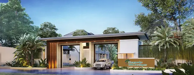
Rock Meadows
SRI RAMA BHOOMI DEVELOPERS · Mahabubnagar · RERA P01400008425
ROCK MEADOWS is a plotted development in Gouthapur, Balanagar Mandal, Mahabubnagar District, developed by the registered promoter Sri Rama Bhoomi Developers. The registered site extent is 46,280.88 sq. m, and the layout records identify 198 open plots; no building or floor configuration is recorded. The layout drawing gives plot sizes of 117.31–292.64 sq. m (140.3–350.0 sq. yds). The TG-RERA registration number is P01400008425, and the proposed completion date is 30/11/2026.
More from Sri Rama Bhoomi Developers LLP · 4 projects →
01What we found
Read from TG-RERA filings, approvals, land and registration records and court records. A court case is counted only when the court record states this project's survey number with its village, or names the project.
02Check before you pay
8 items to check before you pay, 3 high - from the title chain, court records and approvals, each with what to ask the builder or your advocate. An item may not be a problem with the project: records can be incomplete.
1. Project at a glance
Project identity
| Field | Record |
|---|---|
| Registered project name | ROCK MEADOWS RERA record |
| Project type | Plotted development / open-plot layout RERA record |
| Phase / registered portion | Phase not separately identified; registration is for the project ROCK MEADOWS RERA record |
| TG-RERA registration number | P01400008425 RERA record |
| Registration validity | Certificate states 28/06/2024 to 16/05/2026; the supplied record says no extension |
| Registered promoter | Sri Rama Bhoomi Developers; the filed documents identify the entity as M/s Sri Rama Bhoomi Developers LLP RERA record Corporate record |
| RERA status | New Project; certificate granted under section 5 RERA record |
Land and geographic identity
| Field | Record |
|---|---|
| Locality | Gouthapur / Gouthpoor; the RERA certificate records Gouthapur RERA record |
| Revenue villages | Gouthapur and Vanamavaniguda are named in the project survey description and final-layout record RERA record |
| Mandal / district | Balanagar Mandal, Mahabubnagar District RERA record |
| PIN | 575117 RERA record |
| Project survey numbers and subdivisions | Sy. Nos. 34/27 and 34/28 of Gouthapur; Sy. Nos. 2A/1/1 and 2A/1/2 of Vanamavaniguda RERA record |
| Registered site extent | 46,280.88 sq. m in the RERA land record Land records |
| Final-layout extent | 46,280.56 sq. m total net layout area |
| Layout-drawing extent | 46,280.38 sq. m net layout area; 46,506.86 sq. m total site area Layout record |
| Boundaries in RERA land record | North: 12 meter wide road; South, East and West: neighbours’ land Land records |
Development identity
| Field | Record |
|---|---|
| Principal layout approval | Tentative layout approval No. 252037/LP/GP/204889/0001/2023, dated 16-05-2024; authority recorded as MUDA Approvals record |
| Final layout permit | No. 0858/HMDA/SWFL/2025, dated 24/10/2025; HMDA Approvals record |
| Other project approval reference | HMDA file/application No. 006326/HMDA/01913/SWFL/SKP1/2025 Approvals record |
| Approved built-up area | Not disclosed in the supplied project record; the 27,608 sq. m figure is recorded as approved built-up area in the RERA fields, but the project is a plotted layout and its meaning is not further specified there RERA filing |
| Buildings / floors | No building or floor configuration is recorded for the plotted-layout project |
| Layout plots | 198 plots in the tentative and final-layout records |
| Roads / parks / other land uses | Final-layout record identifies plotted area, road-affected area, roads, organized open space/park, social infrastructure and utilities |
| Mortgage area | RERA fields report 5,338 sq. m; the tentative approval identifies 6,384.918 sq. yds as mortgage area RERA filing |
Offering and status
| Field | Record |
|---|---|
| Unit type | Open plots; no apartment or villa configuration is established by the supplied RERA record RERA record |
| Plot count and sizes | Drawing-derived schedule: 198 plots, 117.31–292.64 sq. m (140.3–350.0 sq. yds); software-read from the layout drawing Layout record |
| Booked / available counts | Not established by the supplied evidence RERA record Document index |
| Development stage | The supplied record includes a final layout permit; it does not provide independently verified on-site construction progress |
| Promoter-declared completion date | 16-05-2026 in Form B |
| RERA proposed completion date | 30/11/2026 RERA record |
| Occupancy / completion certificate status | The project is a plotted layout. The supplied documents include a final layout permit dated 24/10/2025 and an architect’s certificate referring to an HMDA occupancy certificate; the certificate’s scope is not stated as a plot-by-plot OC |
2. The project story
ROCK MEADOWS is registered as a plotted development in the Gouthapur and Vanamavaniguda revenue-village survey lands, in Balanagar Mandal, Mahabubnagar District. Its registered project description and layout documents identify four survey subdivisions: 34/27 and 34/28 of Gouthapur, and 2A/1/1 and 2A/1/2 of Vanamavaniguda. RERA record
The filed layout records describe 198 residential plots, with land allocated to roads, open space/parks, utilities and social infrastructure. The final-layout letter says plots are for residential dwelling-house use and that roads are to remain open for public access. The layout drawing’s plot schedule and area statement are software-read evidence, rather than a RERA-filed unit inventory. Layout record
The record shows tentative layout approval in May 2024 and a final layout permit in October 2025. It does not establish the current physical completion of roads, utilities, parks or individual plot infrastructure through independent site verification. An architect’s certificate dated 31-03-2026 describes overall project completion and cites an HMDA occupancy certificate dated 24/10/2025; the supplied record does not specify that certificate’s plot-by-plot scope.
3. Master plan, architecture & building design
This is a plotted layout, not a multi-storey residential building scheme in the supplied records. No building count, floor configuration, tower arrangement, building footprint, or building circulation plan is provided.
The final-layout record states a net layout area of 46,280.56 sq. m and identifies the following land-use areas.
| Layout component | Area (sq. m) | Share stated in final-layout record |
|---|---|---|
| Plotted area | 27,697.34 | 59.85% |
| Road-affected area | 226.48 | 0.49% |
| Organized open space / park | 4,193.27 | 9.06% |
| Social infrastructure | 1,176.89 | 2.54% |
| Roads | 12,746.07 | 27.54% |
| Utilities | 466.99 | 1.01% |
| Amenities area | 0 | 0.0% |
| Total net layout | 46,280.56 | 100.0% |
The approved layout records show 198 plots. The layout drawing’s software-read schedule also counts 198 plots and reports a plot-size range of 117.31–292.64 sq. m (140.3–350.0 sq. yds); these are drawing-derived readings, not RERA-filed saleable-area figures. Layout record
The tentative approval identifies roads, park/open space, utilities, social infrastructure and a mortgage area. It also lists water-reservoir, septic-tank/STP, electrical-transformer and solid-waste-management works among utility provisions. The final-layout record refers to roads, open spaces, utilities and social infrastructure being handed over through registered gift-deed documentation.
4. Homes, configurations & floor plans
The supplied RERA material identifies a plotted layout, not apartment configurations. No RERA-filed plot-wise saleable-area schedule, booking inventory or availability count is supplied. RERA record Document index
The layout drawing has a software-read plot schedule; its plot counts and sizes should be checked against the underlying drawing. No carpet-area measurement is applicable or provided for these open plots. Layout record Floor plans
| Plot size band | Plots |
|---|---|
| 100–150 sq. yds (84–125 sq. m) | 17 |
| 150–200 sq. yds (125–167 sq. m) | 155 |
| 200–250 sq. yds (167–209 sq. m) | 14 |
| 250–300 sq. yds (209–251 sq. m) | 9 |
| 300–400 sq. yds (251–334 sq. m) | 3 |
The software-read overall plot-size range is 117.31–292.64 sq. m (140.3–350.0 sq. yds), with a median of 125.42 sq. m (150.0 sq. yds). These measurements are derived from the layout drawing, not stated as RERA-filed saleable areas. Layout record
5. Parking & vehicle circulation
The supplied records do not establish a parking-space count, visitor or accessible parking provision, mechanical parking, or plot-specific parking allocation. No exclusive parking rights can be inferred from the layout records.
The final-layout letter says roads must remain open for free access to the public and to interior lands; it does not provide road-width or vehicle-circulation details in the supplied extract. The tentative approval also requires roads to be opened for access to neighbouring sites.
6. Amenities, recreation & open spaces
The final-layout record provides for open space/park, social infrastructure and utilities; the tentative approval lists infrastructure and utility works. The records do not establish independent site verification that these facilities have been completed.
| Facility | Description / size | Evidence source | Declared progress / verified status |
|---|---|---|---|
| Organized open space / park | 4,193.27 sq. m; 9.06% in the final-layout land-use statement | Included in final-layout record; completion not independently verified | |
| Roads | 12,746.07 sq. m in final-layout land-use statement | Included in final-layout record; completion not independently verified | |
| Social infrastructure | 1,176.89 sq. m in final-layout land-use statement | Included in final-layout record; completion not independently verified | |
| Utilities land | 466.99 sq. m in final-layout land-use statement | Included in final-layout record; completion not independently verified | |
| Community buildings | No size or facility detail supplied | RERA amenities | No completion status established |
| Recreation-area aggregate | No separate figure supplied in the RERA amenity record | RERA amenities | No completion status established |
The tentative approval mentions possible social/community-service uses such as a pharmacy, clinic, school, play school, creche, dispensary and convenience shops. It does not establish that these are delivered facilities within the layout. The supplied marketing-brochure extraction is not confirmed as project-specific, so its amenity claims are not treated here as project evidence.
7. Utilities, building services & safety
The layout approvals describe proposed or required site infrastructure; the supplied material does not establish its present operational status or capacity.
| Evidence in the project record | Tentative approval lists a water reservoir; final-layout record refers to water supply |
|---|---|
| Status shown | Approval/record description; source, storage capacity and completion are not established |
| Evidence in the project record | Tentative approval lists a septic tank and sewerage treatment plant; final-layout record refers to sewerage and drainage disposal systems |
|---|---|
| Status shown | Approval/record description; capacity, reuse arrangements and completion are not established |
| Evidence in the project record | Final-layout conditions refer to rain-water-harvesting structures; tentative approval requires sufficient harvesting pits |
|---|---|
| Status shown | Required/provided-for in the approval record; completion is not independently verified |
| Evidence in the project record | Tentative approval lists solid-waste management among utilities |
|---|---|
| Status shown | Approval condition/description; operational arrangements and completion are not established |
| Evidence in the project record | Tentative approval lists an electric transformer; final-layout record lists street lighting |
|---|---|
| Status shown | Approval/record description; capacity and completion are not established |
| Evidence in the project record | No project-specific system, capacity or clearance detail supplied |
|---|---|
| Status shown | Not established in the supplied evidence RERA amenities |
| Evidence in the project record | No accessible circulation or facility details supplied |
|---|---|
| Status shown | Not established in the supplied evidence |
8. Location, access & connectivity
The registered location is Gouthapur, Balanagar Mandal, Mahabubnagar District; the project survey description also includes land in Vanamavaniguda. The RERA certificate records locality Gouthapur and PIN 575117. RERA record
The RERA land record gives a 12 meter wide road on the north boundary, with neighbouring land on the other three boundaries. The final-layout conditions require roads to remain open for public access. Land records The cadastral parcel centroid is recorded at 16.937738058734652, 78.22023476609662; the nearest sampled Outer Ring Road interchange is approximately 39.4 km away. Cadastral map Location record
No verified public-transport route, travel time, or additional measured landmark distance is supplied. Location record
9. Developer & development status
The registered promoter is Sri Rama Bhoomi Developers; the filed Form-B declaration and layout documents identify the promoter as M/s Sri Rama Bhoomi Developers LLP. The supplied corporate record gives GSTIN 36AEKFS5383Q1Z0. RERA record Corporate record
The RERA certificate lists the promoter’s office as Village: Domaripochampally, Mandal: Dundigal Gandimaisamma, District: Medchal-Malkajgiri, PIN 500043. The supplied project record does not provide an official project contact number or verified promoter website. Corporate record
Form B records a promoter undertaking to complete the project by 16-05-2026. The project header separately records 30/11/2026 as proposed completion. These are completion-date records, separate from the RERA certificate’s stated registration validity ending 16/05/2026. RERA record
The supplied evidence contains an architect’s overall-completion certificate dated 31-03-2026, which cites an HMDA occupancy certificate. This is a document-based certification; the supplied material does not describe independent site inspection or establish the certificate’s precise scope across the layout.
10. Approvals, official records & documents
| Identifier / date | P01400008425; issued 28/06/2024; stated validity to 16/05/2026 |
|---|---|
| What it records | Section 5 registration for ROCK MEADOWS |
| Identifier / date | 252037/LP/GP/204889/0001/2023; 16-05-2024 |
|---|---|
| What it records | MUDA approval for a tentative layout covering the four project survey numbers and 198 plots |
| Identifier / date | 0858/HMDA/SWFL/2025; 24/10/2025 |
|---|---|
| What it records | HMDA final-layout letter for 198 plots; includes land-use statement and conditions |
| Identifier / date | 006326/HMDA/01913/SWFL/SKP1/2025 |
|---|---|
| What it records | Reference identified in the final-layout and architect-certificate records |
| Identifier / date | 4537/2024; 20/04/2024 |
|---|---|
| What it records | Final-layout letter refers to handover of roads, open spaces, social infrastructure and utilities by registered gift deed |
| Identifier / date | 12506/2025; 15/10/2025 |
|---|---|
| What it records | Final-layout letter refers to relinquishment concerning mortgaged plots |
| Identifier / date | Filed for ROCK MEADOWS |
|---|---|
| What it records | Promoter declaration, including title and encumbrance statements and a stated completion undertaking |
| Identifier / date | 31-03-2026; cites HMDA certificate 006326/HMDA/01913/SWFL/SKP1/2025 dated 24/10/2025 |
|---|---|
| What it records | Architect certificate describes overall completion of the registered project |
The supplied approval and completion records are the documentary basis for this overview. Full approval conditions and title evidence are addressed in their respective report sections.
1. Project at a glance
Project identity
Registered project name: ROCK MEADOWS
Project type: Plotted development / open-plot layout
Phase / registered portion: Phase not separately identified; registration is for the project ROCK MEADOWS
TG-RERA registration number: P01400008425
Registration validity: Certificate states 28/06/2024 to 16/05/2026; the supplied record says no extension
Registered promoter: Sri Rama Bhoomi Developers; the filed documents identify the entity as M/s Sri Rama Bhoomi Developers LLP
RERA status: New Project; certificate granted under section 5
Land and geographic identity
Locality: Gouthapur / Gouthpoor; the RERA certificate records Gouthapur
Revenue villages: Gouthapur and Vanamavaniguda are named in the project survey description and final-layout record
Mandal / district: Balanagar Mandal, Mahabubnagar District
PIN: 575117
Project survey numbers and subdivisions: Sy. Nos. 34/27 and 34/28 of Gouthapur; Sy. Nos. 2A/1/1 and 2A/1/2 of Vanamavaniguda
Registered site extent: 46,280.88 sq. m in the RERA land record
Final-layout extent: 46,280.56 sq. m total net layout area
Layout-drawing extent: 46,280.38 sq. m net layout area; 46,506.86 sq. m total site area
Boundaries in RERA land record: North: 12 meter wide road; South, East and West: neighbours’ land
Development identity
Principal layout approval: Tentative layout approval No. 252037/LP/GP/204889/0001/2023, dated 16-05-2024; authority recorded as MUDA
Final layout permit: No. 0858/HMDA/SWFL/2025, dated 24/10/2025; HMDA
Other project approval reference: HMDA file/application No. 006326/HMDA/01913/SWFL/SKP1/2025
Approved built-up area: Not disclosed in the supplied project record; the 27,608 sq. m figure is recorded as approved built-up area in the RERA fields, but the project is a plotted layout and its meaning is not further specified there
Buildings / floors: No building or floor configuration is recorded for the plotted-layout project
Layout plots: 198 plots in the tentative and final-layout records
Roads / parks / other land uses: Final-layout record identifies plotted area, road-affected area, roads, organized open space/park, social infrastructure and utilities
Mortgage area: RERA fields report 5,338 sq. m; the tentative approval identifies 6,384.918 sq. yds as mortgage area
Offering and status
Unit type: Open plots; no apartment or villa configuration is established by the supplied RERA record
Plot count and sizes: Drawing-derived schedule: 198 plots, 117.31–292.64 sq. m (140.3–350.0 sq. yds); software-read from the layout drawing
Booked / available counts: Not established by the supplied evidence
Development stage: The supplied record includes a final layout permit; it does not provide independently verified on-site construction progress
Promoter-declared completion date: 16-05-2026 in Form B
RERA proposed completion date: 30/11/2026
Occupancy / completion certificate status: The project is a plotted layout. The supplied documents include a final layout permit dated 24/10/2025 and an architect’s certificate referring to an HMDA occupancy certificate; the certificate’s scope is not stated as a plot-by-plot OC
2. The project story
ROCK MEADOWS is registered as a plotted development in the Gouthapur and Vanamavaniguda revenue-village survey lands, in Balanagar Mandal, Mahabubnagar District. Its registered project description and layout documents identify four survey subdivisions: 34/27 and 34/28 of Gouthapur, and 2A/1/1 and 2A/1/2 of Vanamavaniguda.
The filed layout records describe 198 residential plots, with land allocated to roads, open space/parks, utilities and social infrastructure. The final-layout letter says plots are for residential dwelling-house use and that roads are to remain open for public access. The layout drawing’s plot schedule and area statement are software-read evidence, rather than a RERA-filed unit inventory.
The record shows tentative layout approval in May 2024 and a final layout permit in October 2025. It does not establish the current physical completion of roads, utilities, parks or individual plot infrastructure through independent site verification. An architect’s certificate dated 31-03-2026 describes overall project completion and cites an HMDA occupancy certificate dated 24/10/2025; the supplied record does not specify that certificate’s plot-by-plot scope.
3. Master plan, architecture & building design
This is a plotted layout, not a multi-storey residential building scheme in the supplied records. No building count, floor configuration, tower arrangement, building footprint, or building circulation plan is provided.
The final-layout record states a net layout area of 46,280.56 sq. m and identifies the following land-use areas.
| Layout component | Area (sq. m) | Share stated in final-layout record |
|---|---|---|
| Plotted area | 27,697.34 | 59.85% |
| Road-affected area | 226.48 | 0.49% |
| Organized open space / park | 4,193.27 | 9.06% |
| Social infrastructure | 1,176.89 | 2.54% |
| Roads | 12,746.07 | 27.54% |
| Utilities | 466.99 | 1.01% |
| Amenities area | 0 | 0.0% |
| Total net layout | 46,280.56 | 100.0% |
The approved layout records show 198 plots. The layout drawing’s software-read schedule also counts 198 plots and reports a plot-size range of 117.31–292.64 sq. m (140.3–350.0 sq. yds); these are drawing-derived readings, not RERA-filed saleable-area figures.
The tentative approval identifies roads, park/open space, utilities, social infrastructure and a mortgage area. It also lists water-reservoir, septic-tank/STP, electrical-transformer and solid-waste-management works among utility provisions. The final-layout record refers to roads, open spaces, utilities and social infrastructure being handed over through registered gift-deed documentation.
4. Homes, configurations & floor plans
The supplied RERA material identifies a plotted layout, not apartment configurations. No RERA-filed plot-wise saleable-area schedule, booking inventory or availability count is supplied.
The layout drawing has a software-read plot schedule; its plot counts and sizes should be checked against the underlying drawing. No carpet-area measurement is applicable or provided for these open plots.
100–150 sq. yds (84–125 sq. m): 17
150–200 sq. yds (125–167 sq. m): 155
200–250 sq. yds (167–209 sq. m): 14
250–300 sq. yds (209–251 sq. m): 9
300–400 sq. yds (251–334 sq. m): 3
The software-read overall plot-size range is 117.31–292.64 sq. m (140.3–350.0 sq. yds), with a median of 125.42 sq. m (150.0 sq. yds). These measurements are derived from the layout drawing, not stated as RERA-filed saleable areas.
5. Parking & vehicle circulation
The supplied records do not establish a parking-space count, visitor or accessible parking provision, mechanical parking, or plot-specific parking allocation. No exclusive parking rights can be inferred from the layout records.
The final-layout letter says roads must remain open for free access to the public and to interior lands; it does not provide road-width or vehicle-circulation details in the supplied extract. The tentative approval also requires roads to be opened for access to neighbouring sites.
6. Amenities, recreation & open spaces
The final-layout record provides for open space/park, social infrastructure and utilities; the tentative approval lists infrastructure and utility works. The records do not establish independent site verification that these facilities have been completed.
| Facility | Description / size | Evidence source | Declared progress / verified status |
|---|---|---|---|
| Organized open space / park | 4,193.27 sq. m; 9.06% in the final-layout land-use statement | Included in final-layout record; completion not independently verified | |
| Roads | 12,746.07 sq. m in final-layout land-use statement | Included in final-layout record; completion not independently verified | |
| Social infrastructure | 1,176.89 sq. m in final-layout land-use statement | Included in final-layout record; completion not independently verified | |
| Utilities land | 466.99 sq. m in final-layout land-use statement | Included in final-layout record; completion not independently verified | |
| Community buildings | No size or facility detail supplied | No completion status established | |
| Recreation-area aggregate | No separate figure supplied in the RERA amenity record | No completion status established |
The tentative approval mentions possible social/community-service uses such as a pharmacy, clinic, school, play school, creche, dispensary and convenience shops. It does not establish that these are delivered facilities within the layout. The supplied marketing-brochure extraction is not confirmed as project-specific, so its amenity claims are not treated here as project evidence.
7. Utilities, building services & safety
The layout approvals describe proposed or required site infrastructure; the supplied material does not establish its present operational status or capacity.
| Evidence in the project record | Tentative approval lists a water reservoir; final-layout record refers to water supply |
|---|---|
| Status shown | Approval/record description; source, storage capacity and completion are not established |
| Evidence in the project record | Tentative approval lists a septic tank and sewerage treatment plant; final-layout record refers to sewerage and drainage disposal systems |
|---|---|
| Status shown | Approval/record description; capacity, reuse arrangements and completion are not established |
| Evidence in the project record | Final-layout conditions refer to rain-water-harvesting structures; tentative approval requires sufficient harvesting pits |
|---|---|
| Status shown | Required/provided-for in the approval record; completion is not independently verified |
| Evidence in the project record | Tentative approval lists solid-waste management among utilities |
|---|---|
| Status shown | Approval condition/description; operational arrangements and completion are not established |
| Evidence in the project record | Tentative approval lists an electric transformer; final-layout record lists street lighting |
|---|---|
| Status shown | Approval/record description; capacity and completion are not established |
| Evidence in the project record | No project-specific system, capacity or clearance detail supplied |
|---|---|
| Status shown | Not established in the supplied evidence |
| Evidence in the project record | No accessible circulation or facility details supplied |
|---|---|
| Status shown | Not established in the supplied evidence |
8. Location, access & connectivity
The registered location is Gouthapur, Balanagar Mandal, Mahabubnagar District; the project survey description also includes land in Vanamavaniguda. The RERA certificate records locality Gouthapur and PIN 575117.
The RERA land record gives a 12 meter wide road on the north boundary, with neighbouring land on the other three boundaries. The final-layout conditions require roads to remain open for public access. The cadastral parcel centroid is recorded at 16.937738058734652, 78.22023476609662; the nearest sampled Outer Ring Road interchange is approximately 39.4 km away.
No verified public-transport route, travel time, or additional measured landmark distance is supplied.
9. Developer & development status
The registered promoter is Sri Rama Bhoomi Developers; the filed Form-B declaration and layout documents identify the promoter as M/s Sri Rama Bhoomi Developers LLP. The supplied corporate record gives GSTIN 36AEKFS5383Q1Z0.
The RERA certificate lists the promoter’s office as Village: Domaripochampally, Mandal: Dundigal Gandimaisamma, District: Medchal-Malkajgiri, PIN 500043. The supplied project record does not provide an official project contact number or verified promoter website.
Form B records a promoter undertaking to complete the project by 16-05-2026. The project header separately records 30/11/2026 as proposed completion. These are completion-date records, separate from the RERA certificate’s stated registration validity ending 16/05/2026.
The supplied evidence contains an architect’s overall-completion certificate dated 31-03-2026, which cites an HMDA occupancy certificate. This is a document-based certification; the supplied material does not describe independent site inspection or establish the certificate’s precise scope across the layout.
10. Approvals, official records & documents
| Identifier / date | P01400008425; issued 28/06/2024; stated validity to 16/05/2026 |
|---|---|
| What it records | Section 5 registration for ROCK MEADOWS |
| Identifier / date | 252037/LP/GP/204889/0001/2023; 16-05-2024 |
|---|---|
| What it records | MUDA approval for a tentative layout covering the four project survey numbers and 198 plots |
| Identifier / date | 0858/HMDA/SWFL/2025; 24/10/2025 |
|---|---|
| What it records | HMDA final-layout letter for 198 plots; includes land-use statement and conditions |
| Identifier / date | 006326/HMDA/01913/SWFL/SKP1/2025 |
|---|---|
| What it records | Reference identified in the final-layout and architect-certificate records |
| Identifier / date | 4537/2024; 20/04/2024 |
|---|---|
| What it records | Final-layout letter refers to handover of roads, open spaces, social infrastructure and utilities by registered gift deed |
| Identifier / date | 12506/2025; 15/10/2025 |
|---|---|
| What it records | Final-layout letter refers to relinquishment concerning mortgaged plots |
| Identifier / date | Filed for ROCK MEADOWS |
|---|---|
| What it records | Promoter declaration, including title and encumbrance statements and a stated completion undertaking |
| Identifier / date | 31-03-2026; cites HMDA certificate 006326/HMDA/01913/SWFL/SKP1/2025 dated 24/10/2025 |
|---|---|
| What it records | Architect certificate describes overall completion of the registered project |
The supplied approval and completion records are the documentary basis for this overview. Full approval conditions and title evidence are addressed in their respective report sections.
Frequently asked questions
Is ROCK MEADOWS registered with Telangana RERA?
Yes. ROCK MEADOWS is registered with the Telangana Real Estate Regulatory Authority as P01400008425; the registration status is New Project.
Who is the developer of ROCK MEADOWS?
The promoter named in the RERA registration is SRI RAMA BHOOMI DEVELOPERS.
Where is ROCK MEADOWS located?
ROCK MEADOWS is in GOUTHPOOR, Gouthapur, Balanagar, Mahabubnagar, Telangana (575117).
When will ROCK MEADOWS be completed?
The promoter's proposed date of completion filed with RERA is 30/11/2026. This is the promoter's declaration, not a guarantee.
More projects in Gouthapur