Navya Sarovar - II
NAVYA DEVELOPERS · Sangareddy · RERA P01100001107
NAVYA SAROVAR - II is a residential plotted development in INOLE, PATANCHERU Mandal, Sangareddy District, developed by the registered promoter Navya Developers. The registered site extent is 14005.33 sq. m; the project is a plotted layout, and the number and sizes of plots are not disclosed in the supplied RERA record. It is registered under TG-RERA number P01100001107, with proposed completion on 15/06/2022.
More from Navya Developers · 19 projects →
01What we found
Read from TG-RERA filings, approvals, land and registration records and court records. A court case is counted only when the court record states this project's survey number with its village, or names the project.
02Check before you pay
8 items to check before you pay, 4 high - from the title chain, court records and approvals, each with what to ask the builder or your advocate. An item may not be a problem with the project: records can be incomplete.
1. Project at a glance
Project identity
| Item | Record |
|---|---|
| Registered project name | NAVYA SAROVAR - II RERA record |
| Project type | Plotted development / proposed residential layout RERA record |
| Phase or registered portion | Phase not separately identified; registration is for NAVYA SAROVAR - II. RERA record |
| TG-RERA registration | P01100001107 |
| Registration validity | 05/08/2019–15/06/2022; the supplied certificate records no extension. This is the registration period, not a statement of the project’s completion or occupancy status. |
| Registered promoter | Navya Developers (also written as M/s NAVYA DEVELOPERS in filed documents). RERA record |
| RERA status | The record labels the project “New Project”; registration has a stated end date of 15/06/2022. Current registration status is not established by the supplied documents. RERA record |
Land and geographic identity
| Item | Record |
|---|---|
| Locality / revenue village | INOLE is the registered locality; the RERA record identifies the village as PATANCHERU E. The layout drawing names Rameshwar Banda. RERA record RERA filing |
| Mandal / district / PIN | PATANCHERU / Sangareddy / 502319 RERA record RERA filing |
| Project survey number | SY NO 181/ P (also shown in the layout drawing as 181/P). No further project subdivision is stated in the registration identity. RERA record |
| Registered site extent | 14005.33 sq. m; the layout drawing also states plot area and net area as 14005.33. RERA filing |
| Boundaries in the RERA record | East: SY NO 185; West: SY NO 181 P; North: SY NO 182; South: SY NO 181 P. RERA filing |
| Parcel-record context | The supplied cadastral record identifies SYNO181/P, subdivision P, and a whole-survey extent of 30270.15 sq. m. This is a survey-level record, not the registered project extent. Cadastral map |
Development identity
| Item | Record |
|---|---|
| Sanctioning authority | HMDA Approvals record |
| Principal layout approval | 000166/LO/Plg/HMDA/2019, dated 15-06-2019; layout reference 022926/SKP/LT/U6/HMDA/23042019, dated 15-06-2019. Approvals record |
| Final layout number recorded by architect | 046218/LT/SKP/FLT/U6/HMDA/09062021, marked completed 27.07.2021 in the architect’s certificate. Approvals record |
| Approved built-up area | The RERA filing states 8680.62 sq. m as approved built-up area. The project is plotted; building count, floor configuration, parking levels and approved home count are not disclosed in the supplied evidence. RERA filing |
| Layout land-use statement | Plotted Area 8680.61; Road Area 3693.42; Organized open space/park Area/Utility Area 1272.49; Social Infrastructure Area 358.81; AccessoryUse Area 58.97. These are drawing-extracted figures; the drawing also includes a separate “Vacant Plot Area” entry of 13946.35, whose scope is not explained in the supplied record. Layout record |
| Road width stated on layout | 12.00 |
| Authority-mortgaged plots | Plots 11 to 19 (total 09 number of plots), area 1366.73 Sq.mtrs in favour of HMDA, as shown on the layout record. Layout record |
Offering and status
| Item | Record |
|---|---|
| Unit type | Residential plots; a RERA-filed plot count and plot-size schedule are not supplied in the available material. RERA record RERA unit table |
| Filed saleable area, booked/available counts | Not disclosed in the supplied RERA fields or available unit schedule. RERA unit table |
| Drawing-based plot measurements | Plot count and sizes are not complete in the drawing extraction; no plot-size range can be confirmed from it. Layout record |
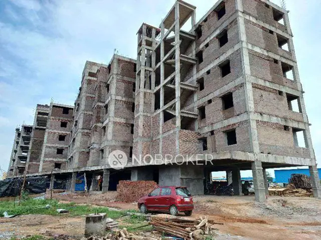
| Construction / development stage | RERA data reports 80% completeness; this is a filed progress figure, not independent site verification. RERA record |
| Completion dates | Promoter-declared proposed completion: 15/06/2022. The Form B declaration states completion within 3 Years from project registration. RERA record |
| Completion / occupancy document | An architect’s Form–1A dated 31/07/2021 certifies completion of development work and records the final layout as completed on 27.07.2021. It is an architect’s certificate, not an occupancy certificate for buildings. |
| Occupancy status | No building occupancy certificate is evidenced. The project is a plotted layout, and the supplied record does not establish a separate occupancy certificate for the layout. Document index |
2. The project story
- NAVYA SAROVAR - II is registered as a residential plotted development in survey SY NO 181/ P, in the RERA-identified village PATANCHERU E, Patancheru Mandal, Sangareddy District. The filed layout identifies Rameshwar Banda and shows internal roads, plots, open-space/park and social-infrastructure areas. RERA record RERA filing
- The HMDA layout drawing lists a 12.00 abutting road width and identifies plots 11 to 19 as mortgaged to HMDA pending completion of layout infrastructure. The drawing states that the developer is responsible for development work and that the open spaces are to be developed under the layout conditions.
- The RERA record reports 80% completeness. Separately, the architect’s Form–1A certifies completion of development work and records a final layout number completed on 27.07.2021. These are document assertions; the supplied material does not provide an independent site inspection confirming present on-ground condition. RERA record
3. Master plan, architecture & building design
- This is a plotted layout, not a multi-storey residential building project in the supplied plans. The RERA land record gives a total and net site area of 14005.33 sq. m; the layout drawing likewise states plot area and net area of 14005.33. RERA filing
- The drawing-derived land-use schedule lists 8680.61 for plotted area, 3693.42 for roads, 1272.49 for organized open space/park/utility area, 358.81 for social infrastructure and 58.97 for accessory use. It also contains a separate 13946.35 “Vacant Plot Area” entry; its meaning or relationship to the other entries is not specified in the supplied extraction. Layout record
- The layout plan identifies HMDA approval 000166/LO/Plg/HMDA/2019 and reference 022926/SKP/LT/U6/HMDA/23042019. It names survey 181/P, gives a road width of 12.00, and shows nine authority-mortgaged plots, numbered 11 to 19. The supplied drawing extraction does not establish a complete plot schedule or detailed circulation and landscape design beyond those stated areas and road information. Layout record
- The RERA filing records approved built-up area of 8680.62 sq. m. No building footprints, building count, floor configuration, tower height or building-level plan details are available in the supplied evidence. RERA filing
4. Homes, configurations & floor plans
The registered offering is plotted. The supplied material does not include a complete TG-RERA unit schedule showing plot counts, booked or available counts, or RERA-filed saleable areas.
| Configuration | Units | Booked | Available | RERA saleable area | Measured carpet area | Loading (if supplied) |
|---|---|---|---|---|---|---|
| Residential plot | Not disclosed | Not disclosed | Not disclosed | Not disclosed | Not applicable / not supplied | Not supplied |
The HMDA drawing extraction is incomplete for plot count and sizes. The separate vendor data contains plot-area claims, but those are not used here as RERA-filed offering details. Layout record RERA unit table Promoter website
5. Parking & vehicle circulation
The supplied evidence does not establish parking counts, visitor or accessible parking, parking allocation to individual plots, or a separate vehicle-circulation design. The layout drawing gives an abutting road width of 12.00 and states that plots 11 to 19 are mortgaged to HMDA; it does not establish private parking rights or allocations.
6. Amenities, recreation & open spaces
| Facility | Description / size | Evidence source | Declared progress / verified status |
|---|---|---|---|
| Internal roads and footpaths | RERA amenities record shows YES, 100%. | RERA amenities | Filing-reported; not independently inspected. |
| Water supply | RERA amenities record shows YES, 100%. | RERA amenities | Filing-reported; source, capacity and present operation are not supplied. |
| Green strip / tot lot / park | RERA amenities record shows YES, 100%. | RERA amenities | Filing-reported; not independently inspected. |
| Street lighting | RERA amenities record shows YES, 100%. | RERA amenities | Filing-reported; not independently inspected. |
| Water conservation / rainwater harvesting | RERA amenities record shows YES, 100%. | RERA amenities | Filing-reported; system details and independent verification are not supplied. |
| Organized open space / park / utility area | 1272.49 in the layout land-use statement. | Layout record | Drawing-stated area; current site condition not independently verified. |
| Social infrastructure area | 358.81 in the layout land-use statement. | Layout record | Drawing-stated area; facility type and delivery status are not specified. |
| Accessory use area | 58.97 in the drawing extraction. | Drawing-stated; specific facility is not identified. |
The RERA amenities record lists sewerage, storm-water drains, community buildings, sewage treatment/disposal, solid-waste management, energy management, fire protection and electrical meter room/sub-station/receiving station at 0%. No further facility descriptions or completion evidence for these items are supplied. RERA amenities
7. Utilities, building services & safety
- The RERA amenities record reports water supply at 100%, and water conservation/rainwater harvesting at 100%. It does not state the water source, storage or treatment capacity. Sewerage and storm-water drains are recorded at 0%, as are sewage/sullage treatment and disposal and solid-waste management. RERA amenities
- Electrical meter room/sub-station/receiving station and energy management are recorded at 0%. Fire protection and fire-safety requirements are also recorded at 0%. No power-backup, lift, CCTV, security, access-control, fire-system capacity or accessibility details are established in the RERA project evidence supplied here. RERA amenities
8. Location, access & connectivity
The registered location is INOLE, village PATANCHERU E, Patancheru Mandal, Sangareddy District, PIN 502319. The layout drawing names Rameshwar Banda, and the RERA certificate identifies the locality as PATANCHERU E, PATANCHERU. RERA record RERA filing
The supplied location data identifies the nearest sampled Outer Ring Road interchange at approximately 1.6 km. No approach-road route, public-transport details or additional verified distances are provided in the location record. Location record
9. Developer & development status
- The registered promoter is NAVYA DEVELOPERS, identified in the RERA record as a Partnership. The supplied corporate identifier is GSTIN 36AAIFN5015G1ZF. The project record lists SRIDHARA REDDY P S as authorized signatory and SUSMITHA P V V as partner. The registered office address, official contact details and official website are not established in the supplied evidence. RERA record RERA filing Corporate record Parties record
- In Form B, dated 15th day of July.2019, the promoter declared legal title, stated that the project land was free from encumbrances, and undertook completion within 3 Years from registration. These are promoter declarations in the registration material.
- The RERA record reports 80% completeness; the architect’s Form–1A separately certifies completion of development work and records the final layout as completed on 27.07.2021. Neither item is an independent current-site verification. The RERA certificate states validity through 15/06/2022 and no extension is recorded in the supplied certificate. RERA record
10. Approvals, official records & documents
| Details | FORM ‘C’; project NAVYA SAROVAR - II, registration P01100001107, promoter Navya Developers; issued 05/08/2019, valid through 15/06/2022. |
|---|
| Details | Layout Permit 000166/LO/Plg/HMDA/2019, dated 15-06-2019; layout reference 022926/SKP/LT/U6/HMDA/23042019. |
|---|
| Details | Final Layout No. 046218/LT/SKP/FLT/U6/HMDA/09062021, recorded as completed on 27.07.2021 in the architect’s certificate. |
|---|
| Details | Form–1A, dated 31/07/2021, certifying completion of development work for the registered plotted project. |
|---|
| Details | Form B dated 15th day of July.2019, including title, encumbrance, funding and completion declarations. |
|---|
| Details | Proposed residential draft layout in survey 181/P, naming HMDA, the promoter, land-use figures, road width and HMDA-mortgaged plots. |
|---|
The supplied material does not include a building occupancy certificate or a complete plot schedule. The completion evidence described above is the architect’s certificate for layout-development work.
1. Project at a glance
Project identity
Registered project name: NAVYA SAROVAR - II
Project type: Plotted development / proposed residential layout
Phase or registered portion: Phase not separately identified; registration is for NAVYA SAROVAR - II.
TG-RERA registration: P01100001107
Registration validity: 05/08/2019–15/06/2022; the supplied certificate records no extension. This is the registration period, not a statement of the project’s completion or occupancy status.
Registered promoter: Navya Developers (also written as M/s NAVYA DEVELOPERS in filed documents).
RERA status: The record labels the project “New Project”; registration has a stated end date of 15/06/2022. Current registration status is not established by the supplied documents.
Land and geographic identity
Locality / revenue village: INOLE is the registered locality; the RERA record identifies the village as PATANCHERU E. The layout drawing names Rameshwar Banda.
Mandal / district / PIN: PATANCHERU / Sangareddy / 502319
Project survey number: SY NO 181/ P (also shown in the layout drawing as 181/P). No further project subdivision is stated in the registration identity.
Registered site extent: 14005.33 sq. m; the layout drawing also states plot area and net area as 14005.33.
Boundaries in the RERA record: East: SY NO 185; West: SY NO 181 P; North: SY NO 182; South: SY NO 181 P.
Parcel-record context: The supplied cadastral record identifies SYNO181/P, subdivision P, and a whole-survey extent of 30270.15 sq. m. This is a survey-level record, not the registered project extent.
Development identity
Sanctioning authority: HMDA
Principal layout approval: 000166/LO/Plg/HMDA/2019, dated 15-06-2019; layout reference 022926/SKP/LT/U6/HMDA/23042019, dated 15-06-2019.
Final layout number recorded by architect: 046218/LT/SKP/FLT/U6/HMDA/09062021, marked completed 27.07.2021 in the architect’s certificate.
Approved built-up area: The RERA filing states 8680.62 sq. m as approved built-up area. The project is plotted; building count, floor configuration, parking levels and approved home count are not disclosed in the supplied evidence.
Layout land-use statement: Plotted Area 8680.61; Road Area 3693.42; Organized open space/park Area/Utility Area 1272.49; Social Infrastructure Area 358.81; AccessoryUse Area 58.97. These are drawing-extracted figures; the drawing also includes a separate “Vacant Plot Area” entry of 13946.35, whose scope is not explained in the supplied record.
Road width stated on layout: 12.00
Authority-mortgaged plots: Plots 11 to 19 (total 09 number of plots), area 1366.73 Sq.mtrs in favour of HMDA, as shown on the layout record.
Offering and status
Unit type: Residential plots; a RERA-filed plot count and plot-size schedule are not supplied in the available material.
Filed saleable area, booked/available counts: Not disclosed in the supplied RERA fields or available unit schedule.
Drawing-based plot measurements: Plot count and sizes are not complete in the drawing extraction; no plot-size range can be confirmed from it.
Construction / development stage: RERA data reports 80% completeness; this is a filed progress figure, not independent site verification.
Completion dates: Promoter-declared proposed completion: 15/06/2022. The Form B declaration states completion within 3 Years from project registration.
Completion / occupancy document: An architect’s Form–1A dated 31/07/2021 certifies completion of development work and records the final layout as completed on 27.07.2021. It is an architect’s certificate, not an occupancy certificate for buildings.
Occupancy status: No building occupancy certificate is evidenced. The project is a plotted layout, and the supplied record does not establish a separate occupancy certificate for the layout.
2. The project story
- NAVYA SAROVAR - II is registered as a residential plotted development in survey SY NO 181/ P, in the RERA-identified village PATANCHERU E, Patancheru Mandal, Sangareddy District. The filed layout identifies Rameshwar Banda and shows internal roads, plots, open-space/park and social-infrastructure areas.
- The HMDA layout drawing lists a 12.00 abutting road width and identifies plots 11 to 19 as mortgaged to HMDA pending completion of layout infrastructure. The drawing states that the developer is responsible for development work and that the open spaces are to be developed under the layout conditions.
- The RERA record reports 80% completeness. Separately, the architect’s Form–1A certifies completion of development work and records a final layout number completed on 27.07.2021. These are document assertions; the supplied material does not provide an independent site inspection confirming present on-ground condition.
3. Master plan, architecture & building design
- This is a plotted layout, not a multi-storey residential building project in the supplied plans. The RERA land record gives a total and net site area of 14005.33 sq. m; the layout drawing likewise states plot area and net area of 14005.33.
- The drawing-derived land-use schedule lists 8680.61 for plotted area, 3693.42 for roads, 1272.49 for organized open space/park/utility area, 358.81 for social infrastructure and 58.97 for accessory use. It also contains a separate 13946.35 “Vacant Plot Area” entry; its meaning or relationship to the other entries is not specified in the supplied extraction.
- The layout plan identifies HMDA approval 000166/LO/Plg/HMDA/2019 and reference 022926/SKP/LT/U6/HMDA/23042019. It names survey 181/P, gives a road width of 12.00, and shows nine authority-mortgaged plots, numbered 11 to 19. The supplied drawing extraction does not establish a complete plot schedule or detailed circulation and landscape design beyond those stated areas and road information.
- The RERA filing records approved built-up area of 8680.62 sq. m. No building footprints, building count, floor configuration, tower height or building-level plan details are available in the supplied evidence.
4. Homes, configurations & floor plans
The registered offering is plotted. The supplied material does not include a complete TG-RERA unit schedule showing plot counts, booked or available counts, or RERA-filed saleable areas.
| Configuration | Units | Booked | Available | RERA saleable area | Measured carpet area | Loading (if supplied) |
|---|---|---|---|---|---|---|
| Residential plot | Not disclosed | Not disclosed | Not disclosed | Not disclosed | Not applicable / not supplied | Not supplied |
The HMDA drawing extraction is incomplete for plot count and sizes. The separate vendor data contains plot-area claims, but those are not used here as RERA-filed offering details.
5. Parking & vehicle circulation
The supplied evidence does not establish parking counts, visitor or accessible parking, parking allocation to individual plots, or a separate vehicle-circulation design. The layout drawing gives an abutting road width of 12.00 and states that plots 11 to 19 are mortgaged to HMDA; it does not establish private parking rights or allocations.
6. Amenities, recreation & open spaces
| Facility | Description / size | Evidence source | Declared progress / verified status |
|---|---|---|---|
| Internal roads and footpaths | RERA amenities record shows YES, 100%. | Filing-reported; not independently inspected. | |
| Water supply | RERA amenities record shows YES, 100%. | Filing-reported; source, capacity and present operation are not supplied. | |
| Green strip / tot lot / park | RERA amenities record shows YES, 100%. | Filing-reported; not independently inspected. | |
| Street lighting | RERA amenities record shows YES, 100%. | Filing-reported; not independently inspected. | |
| Water conservation / rainwater harvesting | RERA amenities record shows YES, 100%. | Filing-reported; system details and independent verification are not supplied. | |
| Organized open space / park / utility area | 1272.49 in the layout land-use statement. | Drawing-stated area; current site condition not independently verified. | |
| Social infrastructure area | 358.81 in the layout land-use statement. | Drawing-stated area; facility type and delivery status are not specified. | |
| Accessory use area | 58.97 in the drawing extraction. | Drawing-stated; specific facility is not identified. |
The RERA amenities record lists sewerage, storm-water drains, community buildings, sewage treatment/disposal, solid-waste management, energy management, fire protection and electrical meter room/sub-station/receiving station at 0%. No further facility descriptions or completion evidence for these items are supplied.
7. Utilities, building services & safety
- The RERA amenities record reports water supply at 100%, and water conservation/rainwater harvesting at 100%. It does not state the water source, storage or treatment capacity. Sewerage and storm-water drains are recorded at 0%, as are sewage/sullage treatment and disposal and solid-waste management.
- Electrical meter room/sub-station/receiving station and energy management are recorded at 0%. Fire protection and fire-safety requirements are also recorded at 0%. No power-backup, lift, CCTV, security, access-control, fire-system capacity or accessibility details are established in the RERA project evidence supplied here.
8. Location, access & connectivity
The registered location is INOLE, village PATANCHERU E, Patancheru Mandal, Sangareddy District, PIN 502319. The layout drawing names Rameshwar Banda, and the RERA certificate identifies the locality as PATANCHERU E, PATANCHERU.
The supplied location data identifies the nearest sampled Outer Ring Road interchange at approximately 1.6 km. No approach-road route, public-transport details or additional verified distances are provided in the location record.
9. Developer & development status
- The registered promoter is NAVYA DEVELOPERS, identified in the RERA record as a Partnership. The supplied corporate identifier is GSTIN 36AAIFN5015G1ZF. The project record lists SRIDHARA REDDY P S as authorized signatory and SUSMITHA P V V as partner. The registered office address, official contact details and official website are not established in the supplied evidence.
- In Form B, dated 15th day of July.2019, the promoter declared legal title, stated that the project land was free from encumbrances, and undertook completion within 3 Years from registration. These are promoter declarations in the registration material.
- The RERA record reports 80% completeness; the architect’s Form–1A separately certifies completion of development work and records the final layout as completed on 27.07.2021. Neither item is an independent current-site verification. The RERA certificate states validity through 15/06/2022 and no extension is recorded in the supplied certificate.
10. Approvals, official records & documents
| Details | FORM ‘C’; project NAVYA SAROVAR - II, registration P01100001107, promoter Navya Developers; issued 05/08/2019, valid through 15/06/2022. |
|---|
| Details | Layout Permit 000166/LO/Plg/HMDA/2019, dated 15-06-2019; layout reference 022926/SKP/LT/U6/HMDA/23042019. |
|---|
| Details | Final Layout No. 046218/LT/SKP/FLT/U6/HMDA/09062021, recorded as completed on 27.07.2021 in the architect’s certificate. |
|---|
| Details | Form–1A, dated 31/07/2021, certifying completion of development work for the registered plotted project. |
|---|
| Details | Form B dated 15th day of July.2019, including title, encumbrance, funding and completion declarations. |
|---|
| Details | Proposed residential draft layout in survey 181/P, naming HMDA, the promoter, land-use figures, road width and HMDA-mortgaged plots. |
|---|
The supplied material does not include a building occupancy certificate or a complete plot schedule. The completion evidence described above is the architect’s certificate for layout-development work.
Frequently asked questions
Is NAVYA SAROVAR - II registered with Telangana RERA?
Yes. NAVYA SAROVAR - II is registered with the Telangana Real Estate Regulatory Authority as P01100001107; the registration status is New Project.
Who is the developer of NAVYA SAROVAR - II?
The promoter named in the RERA registration is NAVYA DEVELOPERS.
Where is NAVYA SAROVAR - II located?
NAVYA SAROVAR - II is in INOLE, PATANCHERU E, PATANCHERU, Sangareddy, Telangana (502319).
When will NAVYA SAROVAR - II be completed?
The promoter's proposed date of completion filed with RERA is 15/06/2022. This is the promoter's declaration, not a guarantee.
More projects in Patancheru