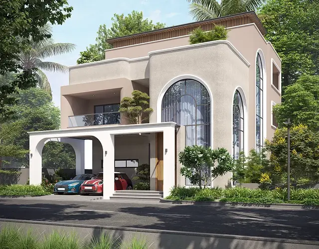
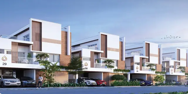
Green Aero View Phase II
PAVAN LIFESPACE DEVELOPERS · Rangareddy · RERA P02400002270
GREEN AERO VIEW PHASE II is a plotted development in Mankal, Maheshwaram Mandal, Ranga Reddy District, developed by registered promoter PAVAN LIFESPACE DEVELOPERS. The RERA land details record a site extent of 48,038.92 sq. m, and the layout drawing identifies 135 residential plots; tower or block count and floor configuration are not disclosed. The plots identified on the drawing range from 121.24 sq. m (145 sq. yd) to 318.56 sq. m (381 sq. yd). The project is registered under TG-RERA registration P02400002270, with proposed completion on 05/05/2022.
More from Pavan Lifespace Developers · 4 projects →
01What we found
Read from TG-RERA filings, approvals, land and registration records and court records. A court case is counted only when the court record states this project's survey number with its village, or names the project.
02Check before you pay
9 items to check before you pay, 6 high - from the title chain, court records and approvals, each with what to ask the builder or your advocate. An item may not be a problem with the project: records can be incomplete.
1. Project at a glance
Project identity
| Item | Record |
|---|---|
| Registered project name | GREEN AERO VIEW PHASE II RERA record |
| Project type | Plotted development RERA record |
| Phase / registered portion | Phase II; the registration certificate identifies the project as GREEN AERO VIEW PHASE II. RERA record |
| TG-RERA registration | P02400002270 RERA record |
| Registration validity | 30/10/2020 to 05/05/2022; the certificate extract records no extension. This is registration validity, not an occupancy or completion certificate. RERA record |
| Registered promoter | PAVAN LIFESPACE DEVELOPERS; entity type: Partnership. RERA record Corporate record |
| RERA status in supplied record | “New Project”; the registration term shown above has expired, and no extension is recorded in the supplied certificate extract. RERA record |
Land and geographic identity
| Item | Record |
|---|---|
| Locality / revenue village | Mankal; the RERA record identifies Mankal, while the layout documents use “Mankal” / “Mankal ORRGC Village.” RERA record |
| Mandal / district / PIN | Maheshwaram / Ranga Reddy / 501359 RERA record |
| Project survey identity | Survey Nos. 813/815 in the RERA registration record. The layout approval documents describe Sy.Nos. 813/PART and 815/PART; the Thukkuguda proceedings also contain the OCR-rendered survey reference “Sy.No.8t]r,” which is not reliably legible. RERA record |
| Registered site extent | 48,038.92 sq. m (RERA land details). RERA filing |
| Area figures in layout approval | HMDA draft-layout letter states total site area 90,834.71 sq. m and net site area 42,795.79 sq. m. |
| Boundaries in RERA filing | North, south, east and west: “open land.” RERA filing |
Development identity
| Item | Record |
|---|---|
| Sanctioning authority | Hyderabad Metropolitan Development Authority (HMDA); local release proceedings are recorded by Thukkuguda Municipality. RERA record |
| Principal layout approval | HMDA approval No. 000342/LO/Plg/HMDA/2019, dated 18 November 2019; draft layout letter for open plots. |
| Local release proceedings | Proceedings No. Gl/4092/TM/RR/20 1 9, dated 04.01.2020; OCR-rendered approval number appears as 000342/LOtPlgtHlvIDN2}lg. |
| Approved built-up area in RERA record | 26,811.29 sq. m; the RERA filing labels this “Approved Built up Area.” RERA filing |
| Development form | Plotted layout; building or tower count, floor configuration and building parking levels are not disclosed in the supplied project record. RERA record Document index |
| Layout roads | HMDA letter specifies road widths including 18 mts and 60 feet and above; the local proceedings refer to roads “18 mts and above.” |
Offering and status
| Item | Record |
|---|---|
| Offering | Residential plots; no RERA unit-type count, plot inventory booking/availability count or plot saleable-area range is supplied. RERA record RERA filing |
| Plot layout drawing data | Software-measured from the approved layout drawing: 135 plots with printed sizes; smallest 121.24 sq. m (145 sq. yd), median 175.59 sq. m (210 sq. yd), largest 318.56 sq. m (381 sq. yd). Layout record |
| Registered proposed completion | 05/05/2022 RERA record |
| Construction / development stage | RERA amenity schedule reports varying declared progress for layout works; these are filing figures, not independent site verification. RERA amenities |
| OC / completion certificate | No occupancy or completion certificate for the project is identified in the supplied documents. Document index |
2. The project story
GREEN AERO VIEW PHASE II is registered as a plotted development in Mankal, Maheshwaram Mandal, Ranga Reddy District. The filed offering is residential plots within a layout, rather than apartments or towers. The layout is organized around internal roads, parks/open space and social-infrastructure land; the drawing-derived record identifies 135 plots. RERA record RERA filing Layout record
The HMDA record is a draft-layout letter dated 18 November 2019, followed by local-authority release proceedings dated 04.01.2020. Those records describe plot-layout development and require completion of layout infrastructure; the local proceedings state that development works are to be completed within three years. The RERA certificate separately records registration through 05/05/2022. These approval, development and registration dates are distinct; the supplied evidence does not establish an occupancy/completion certificate or independently verified site completion.
3. Master plan, architecture & building design
This is a plotted layout, so the available design evidence concerns plot arrangement and shared layout infrastructure, not apartment plans or building elevations. The HMDA draft-layout letter records a total site area of 90,834.71 sq. m and a net site area of 42,795.79 sq. m. It lists 26,811.29 sq. m as plotted area, 11,346.39 sq. m as layout road area, 3,567.98 sq. m as park, and 1,070.18 sq. m as social infrastructure. The RERA land-details field separately records a site extent of 48,038.92 sq. m. RERA filing
The software-measured layout drawing contains 135 plots with sizes printed on the drawing. The drawing-derived land-use summary reports 26,811.29 sq. m plotted area, 11,346.39 sq. m roads, 3,567.98 sq. m parks/open space, and 1,070.18 sq. m social infrastructure. These are layout-drawing readings, not apartment saleable or carpet-area figures. Layout record
The layout approval identifies 21 plots—Nos. 146–160 and 173–178, totaling 4,120.70 sq. m—as mortgaged to HMDA. The local proceedings prohibit sale of the mortgaged plots and require the layout works to be completed. The HMDA letter also records roads, organized open space and social-infrastructure areas for handover to the local body through registered gift deed.
4. Homes, configurations & floor plans
The registered offering is plotted; no apartment configurations, RERA-filed apartment saleable areas, or apartment booked/available counts are supplied. RERA record RERA filing
| Plot information | Supplied figure |
|---|---|
| Plots identified on layout drawing | 135 Layout record |
| Smallest plot | 121.24 sq. m / 145 sq. yd Layout record |
| Median plot | 175.59 sq. m / 210 sq. yd Layout record |
| Largest plot | 318.56 sq. m / 381 sq. yd Layout record |
| Most frequent printed sizes | 210 sq. yd: 33 plots; 200 sq. yd: 28; 306 sq. yd: 9; 232 sq. yd: 6; 324 sq. yd: 4 Layout record |
The plot counts and sizes are software-measured from text on the layout drawing and should be checked against the drawing. The supplied record does not give plot-wise booking or availability status. Layout record
5. Parking & vehicle circulation
No project-wide parking-space count, visitor or accessible-parking count, parking allocation schedule, or plot-specific parking arrangement is supplied. The project is recorded as a plotted layout, not a building development with basement, stilt or podium parking. RERA record Document index
The layout approval calls for internal roads, including road widths described as 18 mts and 60 feet and above, and states that roads should remain open for access to neighbouring sites. It also requires paved footpaths and cycling tracks. The supplied record does not establish the completed condition of these circulation features.
6. Amenities, recreation & open spaces
The following progress percentages are the project’s RERA-filed amenity schedule. They are declared progress values, not independent verification of completion. RERA amenities
| Facility | Description / size | Evidence source | Declared progress / verified status |
|---|---|---|---|
| Internal roads and footpaths | Layout roads and footpaths | RERA amenities | 45%; not independently verified |
| Green strip / tot lot / park | Layout open-space/park provision; 3,567.98 sq. m park in HMDA layout record | RERA amenities | 0%; not independently verified |
| Community buildings | Listed in the RERA amenity schedule; no size or building detail supplied | RERA amenities | 0%; not independently verified |
| Recreational open space | Aggregate area listed; no separate progress or delivery evidence supplied | RERA amenities Layout record | 0%; not independently verified |
The promoter website’s amenity list includes a kids’ play area, but the supplied RERA amenity schedule does not establish its size, delivery status or independent completion. Promoter website
7. Utilities, building services & safety
The HMDA draft-layout letter specifies layout infrastructure including underground storm-water drainage, underground drainage lines and a common septic tank/STP, internal water-supply pipelines and overhead tank, an assured water-supply source, electrical supply lines, street lights, transformer, park development and rainwater-harvesting pits. It also calls for solid-waste disposal space, source segregation, a bio-compost unit and cycling tracks. These are approval requirements/proposed layout provisions; the supplied record does not independently confirm installation or operation.
| Evidence in supplied record | Water supply is listed; approval calls for internal pipelines, overhead tank, assured potable-water source and necessary connectivity. RERA amenities |
|---|---|
| RERA-filed progress / status | 2% in the RERA amenity schedule; not independently verified |
| Evidence in supplied record | Approval specifies underground drainage and common septic tank/STP; the RERA schedule lists sewerage chambers, lines, septic tank and STP. RERA amenities |
|---|---|
| RERA-filed progress / status | Sewerage: 60%; storm-water drains: 0%; not independently verified |
| Evidence in supplied record | Rainwater-harvesting pits are specified in the approval; water conservation/rainwater harvesting is listed in the RERA schedule. RERA amenities |
|---|---|
| RERA-filed progress / status | 0%; not independently verified |
| Evidence in supplied record | Approval specifies electrical lines, transformer and street lighting; RERA schedule lists an electrical meter room/sub-station/receiving station. RERA amenities |
|---|---|
| RERA-filed progress / status | Street lighting: 0%; electrical facility: 0%; not independently verified |
| Evidence in supplied record | Approval calls for a designated waste-disposal area and source segregation; the RERA schedule lists solid-waste management and disposal. RERA amenities |
|---|---|
| RERA-filed progress / status | 0%; not independently verified |
| Evidence in supplied record | Fire protection is listed in the RERA amenity schedule; approval also calls for paved footpaths. No system details, capacity or completion evidence is supplied. RERA amenities |
|---|---|
| RERA-filed progress / status | Fire protection: 0%; not independently verified |
8. Location, access & connectivity
The RERA project location is Mankal, Maheshwaram Mandal, Ranga Reddy District, Telangana, PIN 501359. The layout approval documents refer to Mankal / Mankal ORRGC Village and Thukkuguda Municipality. RERA record
The supplied location record identifies the nearest sampled Outer Ring Road interchange at approximately 10.6 km. This is a supplied mapped distance, not a travel-time estimate. Location record
The promoter website states that the project is 400 metres from the ORR Service Road and gives drive-time claims for the airport, rail/metro and Gachibowli; these are promoter-marketed claims, not independently measured distances or travel times in the supplied official project record. Promoter website
9. Developer & development status
The registered promoter is PAVAN LIFESPACE DEVELOPERS, recorded as a partnership. The supplied corporate record names SURYA PAVAN REDDY KOMATIREDDY as authorized signatory and KOMATIREDDY CHANDRA PAVAN REDDY as partner. The partnership deed is identified in the document record, but no corporate registration identifier is supplied here. Corporate record
The project registration certificate lists the promoter office as “Village: Mandal: KHAIRTABAD, District: Hyderabad, Pin: 500034”; the supplied corporate profile separately gives K.R. Chambers, Kaushik Society, Road No. 12, Banjara Hills. Corporate record
The RERA record declares proposed completion by 05/05/2022 and registration validity through that same date; no extension is recorded in the supplied certificate extract. The RERA amenity schedule reports progress for certain layout works, but no independent site inspection or completion certificate is supplied. RERA record RERA amenities
10. Approvals, official records & documents
| Document / identifier | P02400002270; Form C; issued 30/10/2020; validity to 05/05/2022 |
|---|---|
| Relevance | Registration of GREEN AERO VIEW PHASE II and stated registration conditions |
| Document / identifier | Approval No. 000342/LO/Plg/HMDA/2019; dated 18 November 2019; application No. 028191/ZA/LO/U6/HMDA/17092019 |
|---|---|
| Relevance | Draft layout approval for Sy.Nos. 813/PART and 815/PART, with layout area schedule and infrastructure conditions |
| Document / identifier | Proceedings No. Gl/4092/TM/RR/20 1 9; dated 04.01.2020 |
|---|---|
| Relevance | Local release proceedings concerning the HMDA draft layout and conditions |
| Document / identifier | Document 92393; two layout sheets; software-measured plot and land-use readings Layout record |
|---|---|
| Relevance | Plot count, plot sizes and layout land-use summary |
| Document / identifier | Not identified in supplied documents Document index |
|---|---|
| Relevance | No project completion or occupancy certificate is evidenced by the supplied material |
The HMDA approval is described as a draft-layout letter; the supplied evidence index does not identify a separate final layout permit or project completion/occupancy certificate. Document index
1. Project at a glance
Project identity
Registered project name: GREEN AERO VIEW PHASE II
Project type: Plotted development
Phase / registered portion: Phase II; the registration certificate identifies the project as GREEN AERO VIEW PHASE II.
TG-RERA registration: P02400002270
Registration validity: 30/10/2020 to 05/05/2022; the certificate extract records no extension. This is registration validity, not an occupancy or completion certificate.
Registered promoter: PAVAN LIFESPACE DEVELOPERS; entity type: Partnership.
RERA status in supplied record: “New Project”; the registration term shown above has expired, and no extension is recorded in the supplied certificate extract.
Land and geographic identity
Locality / revenue village: Mankal; the RERA record identifies Mankal, while the layout documents use “Mankal” / “Mankal ORRGC Village.”
Mandal / district / PIN: Maheshwaram / Ranga Reddy / 501359
Project survey identity: Survey Nos. 813/815 in the RERA registration record. The layout approval documents describe Sy.Nos. 813/PART and 815/PART; the Thukkuguda proceedings also contain the OCR-rendered survey reference “Sy.No.8t]r,” which is not reliably legible.
Registered site extent: 48,038.92 sq. m (RERA land details).
Area figures in layout approval: HMDA draft-layout letter states total site area 90,834.71 sq. m and net site area 42,795.79 sq. m.
Boundaries in RERA filing: North, south, east and west: “open land.”
Development identity
Sanctioning authority: Hyderabad Metropolitan Development Authority (HMDA); local release proceedings are recorded by Thukkuguda Municipality.
Principal layout approval: HMDA approval No. 000342/LO/Plg/HMDA/2019, dated 18 November 2019; draft layout letter for open plots.
Local release proceedings: Proceedings No. Gl/4092/TM/RR/20 1 9, dated 04.01.2020; OCR-rendered approval number appears as 000342/LOtPlgtHlvIDN2}lg.
Approved built-up area in RERA record: 26,811.29 sq. m; the RERA filing labels this “Approved Built up Area.”
Development form: Plotted layout; building or tower count, floor configuration and building parking levels are not disclosed in the supplied project record.
Layout roads: HMDA letter specifies road widths including 18 mts and 60 feet and above; the local proceedings refer to roads “18 mts and above.”
Offering and status
Offering: Residential plots; no RERA unit-type count, plot inventory booking/availability count or plot saleable-area range is supplied.
Plot layout drawing data: Software-measured from the approved layout drawing: 135 plots with printed sizes; smallest 121.24 sq. m (145 sq. yd), median 175.59 sq. m (210 sq. yd), largest 318.56 sq. m (381 sq. yd).
Registered proposed completion: 05/05/2022
Construction / development stage: RERA amenity schedule reports varying declared progress for layout works; these are filing figures, not independent site verification.
OC / completion certificate: No occupancy or completion certificate for the project is identified in the supplied documents.
2. The project story
GREEN AERO VIEW PHASE II is registered as a plotted development in Mankal, Maheshwaram Mandal, Ranga Reddy District. The filed offering is residential plots within a layout, rather than apartments or towers. The layout is organized around internal roads, parks/open space and social-infrastructure land; the drawing-derived record identifies 135 plots.
The HMDA record is a draft-layout letter dated 18 November 2019, followed by local-authority release proceedings dated 04.01.2020. Those records describe plot-layout development and require completion of layout infrastructure; the local proceedings state that development works are to be completed within three years. The RERA certificate separately records registration through 05/05/2022. These approval, development and registration dates are distinct; the supplied evidence does not establish an occupancy/completion certificate or independently verified site completion.
3. Master plan, architecture & building design
This is a plotted layout, so the available design evidence concerns plot arrangement and shared layout infrastructure, not apartment plans or building elevations. The HMDA draft-layout letter records a total site area of 90,834.71 sq. m and a net site area of 42,795.79 sq. m. It lists 26,811.29 sq. m as plotted area, 11,346.39 sq. m as layout road area, 3,567.98 sq. m as park, and 1,070.18 sq. m as social infrastructure. The RERA land-details field separately records a site extent of 48,038.92 sq. m.
The software-measured layout drawing contains 135 plots with sizes printed on the drawing. The drawing-derived land-use summary reports 26,811.29 sq. m plotted area, 11,346.39 sq. m roads, 3,567.98 sq. m parks/open space, and 1,070.18 sq. m social infrastructure. These are layout-drawing readings, not apartment saleable or carpet-area figures.
The layout approval identifies 21 plots—Nos. 146–160 and 173–178, totaling 4,120.70 sq. m—as mortgaged to HMDA. The local proceedings prohibit sale of the mortgaged plots and require the layout works to be completed. The HMDA letter also records roads, organized open space and social-infrastructure areas for handover to the local body through registered gift deed.
4. Homes, configurations & floor plans
The registered offering is plotted; no apartment configurations, RERA-filed apartment saleable areas, or apartment booked/available counts are supplied.
Plots identified on layout drawing: 135
Smallest plot: 121.24 sq. m / 145 sq. yd
Median plot: 175.59 sq. m / 210 sq. yd
Largest plot: 318.56 sq. m / 381 sq. yd
Most frequent printed sizes: 210 sq. yd: 33 plots; 200 sq. yd: 28; 306 sq. yd: 9; 232 sq. yd: 6; 324 sq. yd: 4
The plot counts and sizes are software-measured from text on the layout drawing and should be checked against the drawing. The supplied record does not give plot-wise booking or availability status.
5. Parking & vehicle circulation
No project-wide parking-space count, visitor or accessible-parking count, parking allocation schedule, or plot-specific parking arrangement is supplied. The project is recorded as a plotted layout, not a building development with basement, stilt or podium parking.
The layout approval calls for internal roads, including road widths described as 18 mts and 60 feet and above, and states that roads should remain open for access to neighbouring sites. It also requires paved footpaths and cycling tracks. The supplied record does not establish the completed condition of these circulation features.
6. Amenities, recreation & open spaces
The following progress percentages are the project’s RERA-filed amenity schedule. They are declared progress values, not independent verification of completion.
| Facility | Description / size | Evidence source | Declared progress / verified status |
|---|---|---|---|
| Internal roads and footpaths | Layout roads and footpaths | 45%; not independently verified | |
| Green strip / tot lot / park | Layout open-space/park provision; 3,567.98 sq. m park in HMDA layout record | 0%; not independently verified | |
| Community buildings | Listed in the RERA amenity schedule; no size or building detail supplied | 0%; not independently verified | |
| Recreational open space | Aggregate area listed; no separate progress or delivery evidence supplied | 0%; not independently verified |
The promoter website’s amenity list includes a kids’ play area, but the supplied RERA amenity schedule does not establish its size, delivery status or independent completion.
7. Utilities, building services & safety
The HMDA draft-layout letter specifies layout infrastructure including underground storm-water drainage, underground drainage lines and a common septic tank/STP, internal water-supply pipelines and overhead tank, an assured water-supply source, electrical supply lines, street lights, transformer, park development and rainwater-harvesting pits. It also calls for solid-waste disposal space, source segregation, a bio-compost unit and cycling tracks. These are approval requirements/proposed layout provisions; the supplied record does not independently confirm installation or operation.
| Evidence in supplied record | Water supply is listed; approval calls for internal pipelines, overhead tank, assured potable-water source and necessary connectivity. |
|---|---|
| RERA-filed progress / status | 2% in the RERA amenity schedule; not independently verified |
| Evidence in supplied record | Approval specifies underground drainage and common septic tank/STP; the RERA schedule lists sewerage chambers, lines, septic tank and STP. |
|---|---|
| RERA-filed progress / status | Sewerage: 60%; storm-water drains: 0%; not independently verified |
| Evidence in supplied record | Rainwater-harvesting pits are specified in the approval; water conservation/rainwater harvesting is listed in the RERA schedule. |
|---|---|
| RERA-filed progress / status | 0%; not independently verified |
| Evidence in supplied record | Approval specifies electrical lines, transformer and street lighting; RERA schedule lists an electrical meter room/sub-station/receiving station. |
|---|---|
| RERA-filed progress / status | Street lighting: 0%; electrical facility: 0%; not independently verified |
| Evidence in supplied record | Approval calls for a designated waste-disposal area and source segregation; the RERA schedule lists solid-waste management and disposal. |
|---|---|
| RERA-filed progress / status | 0%; not independently verified |
| Evidence in supplied record | Fire protection is listed in the RERA amenity schedule; approval also calls for paved footpaths. No system details, capacity or completion evidence is supplied. |
|---|---|
| RERA-filed progress / status | Fire protection: 0%; not independently verified |
8. Location, access & connectivity
The RERA project location is Mankal, Maheshwaram Mandal, Ranga Reddy District, Telangana, PIN 501359. The layout approval documents refer to Mankal / Mankal ORRGC Village and Thukkuguda Municipality.
The supplied location record identifies the nearest sampled Outer Ring Road interchange at approximately 10.6 km. This is a supplied mapped distance, not a travel-time estimate.
The promoter website states that the project is 400 metres from the ORR Service Road and gives drive-time claims for the airport, rail/metro and Gachibowli; these are promoter-marketed claims, not independently measured distances or travel times in the supplied official project record.
9. Developer & development status
The registered promoter is PAVAN LIFESPACE DEVELOPERS, recorded as a partnership. The supplied corporate record names SURYA PAVAN REDDY KOMATIREDDY as authorized signatory and KOMATIREDDY CHANDRA PAVAN REDDY as partner. The partnership deed is identified in the document record, but no corporate registration identifier is supplied here.
The project registration certificate lists the promoter office as “Village: Mandal: KHAIRTABAD, District: Hyderabad, Pin: 500034”; the supplied corporate profile separately gives K.R. Chambers, Kaushik Society, Road No. 12, Banjara Hills.
The RERA record declares proposed completion by 05/05/2022 and registration validity through that same date; no extension is recorded in the supplied certificate extract. The RERA amenity schedule reports progress for certain layout works, but no independent site inspection or completion certificate is supplied.
10. Approvals, official records & documents
| Document / identifier | P02400002270; Form C; issued 30/10/2020; validity to 05/05/2022 |
|---|---|
| Relevance | Registration of GREEN AERO VIEW PHASE II and stated registration conditions |
| Document / identifier | Approval No. 000342/LO/Plg/HMDA/2019; dated 18 November 2019; application No. 028191/ZA/LO/U6/HMDA/17092019 |
|---|---|
| Relevance | Draft layout approval for Sy.Nos. 813/PART and 815/PART, with layout area schedule and infrastructure conditions |
| Document / identifier | Proceedings No. Gl/4092/TM/RR/20 1 9; dated 04.01.2020 |
|---|---|
| Relevance | Local release proceedings concerning the HMDA draft layout and conditions |
| Document / identifier | Document 92393; two layout sheets; software-measured plot and land-use readings |
|---|---|
| Relevance | Plot count, plot sizes and layout land-use summary |
| Document / identifier | Not identified in supplied documents |
|---|---|
| Relevance | No project completion or occupancy certificate is evidenced by the supplied material |
The HMDA approval is described as a draft-layout letter; the supplied evidence index does not identify a separate final layout permit or project completion/occupancy certificate.
Other registrations of Green Aero View
Frequently asked questions
Is GREEN AERO VIEW PHASE II registered with Telangana RERA?
Yes. GREEN AERO VIEW PHASE II is registered with the Telangana Real Estate Regulatory Authority as P02400002270; the registration status is New Project.
Who is the developer of GREEN AERO VIEW PHASE II?
The promoter named in the RERA registration is PAVAN LIFESPACE DEVELOPERS.
Where is GREEN AERO VIEW PHASE II located?
GREEN AERO VIEW PHASE II is in mankal, Maheshwaram, Rangareddy, Telangana (501359).
When will GREEN AERO VIEW PHASE II be completed?
The promoter's proposed date of completion filed with RERA is 05/05/2022. This is the promoter's declaration, not a guarantee.
More projects in Mankal