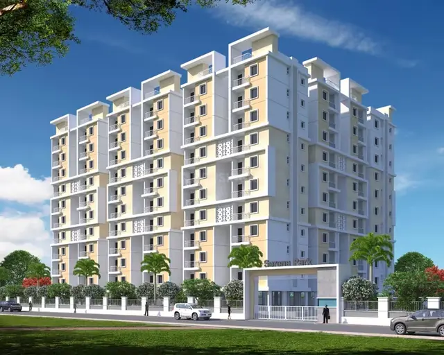
Gayathri Enclave
DHARANI PRIME INFRA DEVELOPERS · Medchal-Malkajgiri · RERA P02200009185
GAYATHRI ENCLAVE is a plotted development / residential layout in Ghatkesar, Ghatkesar Mandal, Medchal-Malkajgiri District, developed by registered promoter DHARANI PRIME INFRA DEVELOPERS. The project covers 21347.58 sq.m. and the approved layout provides for 61 residential plots, with plot areas from 125.42 sq.m. to 392.61 sq.m. It is registered under TG-RERA registration P02200009185, and its proposed completion date is 14/08/2025.
01What we found
Read from TG-RERA filings, approvals, land and registration records and court records. A court case is counted only when the court record states this project's survey number with its village, or names the project.
02Check before you pay
8 items to check before you pay, 3 high - from the title chain, court records and approvals, each with what to ask the builder or your advocate. An item may not be a problem with the project: records can be incomplete.
1. Project at a glance
Project identity
| Field | Record |
|---|---|
| Registered project name | GAYATHRI ENCLAVE RERA record RERA filing |
| Project type | Plotted development / residential layout RERA record RERA filing |
| Phase or registered portion | Not separately identified; the RERA record identifies the project as a whole RERA filing [REGCERT-63526] |
| TG-RERA registration | P02200009185; registered from 14/08/2023 to 14/08/2025 RERA record [REGCERT-63526] |
| Registered promoter | DHARANI PRIME INFRA DEVELOPERS, identified as a partnership in the RERA record RERA record RERA filing |
| RERA status | Recorded as On-Going Project. The registration certificate states a two-year validity ending 14/08/2025 and no extension is recorded in the supplied certificate. Registration validity is distinct from the completion deadline. RERA record [REGCERT-63526] |
| Completion deadline in RERA record | 14/08/2025 proposed and revised proposed completion date RERA record RERA filing |
| Occupancy/completion certificate | Not established in the supplied project documents; the registered development is a plotted layout, and no project-level OC or completion certificate is supplied. Document index |
Land and geographic identity
| Field | Record |
|---|---|
| Locality / revenue village | Ghatkesar; approval documents identify Ghatkesar Village (one document specifies “Ghatkesar (P)”). No other revenue village is identified for the project. RERA record RERA filing p1 |
| Mandal | Ghatkesar RERA record RERA filing |
| District | Medchal-Malkajgiri RERA record RERA filing |
| PIN | 501301 RERA record [REGCERT-63526] |
| Project survey numbers | Survey Nos. 287 and 293; the final layout letter specifies 287 and 293 PARTS. The registration record does not enumerate the project’s individual survey subdivisions. RERA filing p1 [REGCERT-63526] |
| Total site area | 21347.58 sq.m. RERA filing p1 |
| Net site area | 18846.43 sq.m. p1 |
| Area affected by road widening / FTL / nala widening | 2328.25 sq.m. as recorded in the RERA land details and final layout letter RERA filing p1 |
| Boundaries | East: NEIGHBOURS LAND; West: WATER BODY; North: EXISTING 30 FEET WIDE ROAD; South: NEIGHBOURS LAND RERA filing |
Development identity
| Field | Record |
|---|---|
| Sanctioning authority | HMDA Approvals record |
| Principal final layout approval | 005400/FLT/HMDA/1217/GHT/2024, approved 20 September, 2024; final residential layout permission Approvals record |
| Earlier layout document | Draft layout letter 011682/LO/HMDA/2425/GHT/2022, approved 14 August, 2023 Approvals record |
| Approved built-up area | The final layout letter records 0 Total Built up Area. It is a plotted layout approval, not a building-plan approval for houses on the plots. p1 |
| Buildings, floors and parking levels | No project buildings, floor configuration or parking levels are specified in the supplied layout approval and RERA record. RERA filing |
| Approved plots | 61 plots |
| RERA-declared plots | The supplied RERA material identifies a plotted development; a separate RERA inventory count is not provided. RERA filing [REGCERT-63526] |
Offering and status
| Field | Record |
|---|---|
| Offering | Residential plots; the final layout letter restricts plots to residential dwelling-house use. |
| Plot count and sizes | The approved drawing schedule is software-read as 61 plots; areas range from 125.42 sq.m. to 392.61 sq.m. These drawing-derived measurements should be checked against the approved drawing. Layout record |
| Booked / available counts | Not disclosed in the supplied RERA inventory data. RERA filing |
| Construction stage | RERA records 80% completeness; this is a recorded project figure, not an independent site inspection. RERA record |
| Completion dates | Original and revised proposed date: 14/08/2025 RERA record RERA filing |
| OC / completion status | No OC or completion certificate is supplied; the project concerns plots, and no house-by-house construction or occupancy status is established. Document index |
2. The project story
- GAYATHRI ENCLAVE is a residential plotted layout at Ghatkesar, in Ghatkesar Mandal, Medchal-Malkajgiri District. Its registered land identity is Survey Nos. 287 and 293; the final layout letter describes the land as Survey Nos. 287 and 293 PARTS. The approved layout provides for 61 residential plots rather than a single apartment or villa building. RERA record RERA filing
- The final layout permission is recorded under HMDA approval 005400/FLT/HMDA/1217/GHT/2024, dated 20 September, 2024. The drawing-derived schedule records plot areas from 125.42 sq.m. to 392.61 sq.m.; individual plots are the purchasable form of development identified in the supplied record. The material supplied does not establish which plots are currently available or booked. Layout record
- The RERA filing records 80% completeness, but the supplied evidence does not identify which development works that percentage covers or independently verify the site condition. The RERA completion date is 14/08/2025; the registration certificate’s validity period ended on the same date, and the supplied certificate does not record an extension. These dates describe different matters, and neither establishes that the layout has received an occupancy certificate. RERA record [REGCERT-63526] Document index
3. Master plan, architecture & building design
This is a plotted layout, so the supplied approved plan concerns plot arrangement and site land uses, not a multi-storey building design. The final layout letter records a total site area of 21347.58 sq.m., net site area of 18846.43 sq.m., and road-affected area of 2328.25 sq.m. p1
The drawing-derived land-use figures are:
| Layout use | Area | Share / record |
|---|---|---|
| Plotted area | 11173.4 sq.m. | p1 |
| Layout roads | 5235.67 sq.m. | p1 |
| Open space / park | 1413.81 sq.m. | |
| Social infrastructure | 471.71 sq.m. | p1 |
| Utilities | 206.28 sq.m. | p1 |
| Amenities area | 0 sq.m. | p1 |
The layout schedule software-read from the approved drawing identifies 61 plots, with areas from 125.42 sq.m. to 392.61 sq.m. The drawing review states that the plot-area total matches the plotted area in the drawing’s area statement; plot counts and sizes remain drawing-derived and should be checked against the source drawing. Layout record
The final layout letter describes road, open-space, social-infrastructure and utility areas as handed over to the local authority by registered gift deed 2649/2024, dated 02 May, 2024. It also records a relinquishment deed concerning the mortgaged plots, 5588/2024, dated 11 September, 2024. No house-level building plans, building footprints, floor counts, building heights or individual plot house designs are supplied. p1–2
4. Homes, configurations & floor plans
The registered offering evidenced here is plots, not apartment configurations. The final layout approval identifies 61 residential plots. Plot sizes below are software-measured from the approved layout drawing, not RERA-filed saleable or carpet areas. Layout record
| Plot configuration / size band | Plot count | Drawing-measured area |
|---|---|---|
| 150–200 sq.yd. (125–167 sq.m.) | 14 | Band as extracted from drawing |
| 200–250 sq.yd. (167–209 sq.m.) | 32 | Band as extracted from drawing |
| 250–300 sq.yd. (209–251 sq.m.) | 10 | Band as extracted from drawing |
| 300–400 sq.yd. (251–334 sq.m.) | 4 | Band as extracted from drawing |
| 400–500 sq.yd. (334–418 sq.m.) | 1 | Band as extracted from drawing |
The smallest software-read plot is 125.42 sq.m. (150.0 sq.yd.), the median is 167.23 sq.m. (200.0 sq.yd.), and the largest is 392.61 sq.m. (469.6 sq.yd.). Individual availability, booking status and plot-specific measurements are not supplied as RERA inventory figures. Layout record
The supplied floor-plan review contains four layout sheets and no measured building-floor plans. Consequently, there are no evidenced room layouts, house dimensions, balconies, utilities within homes, carpet areas or saleable areas to report. Floor plans
5. Parking & vehicle circulation
The supplied project record does not state a sanctioned parking count, visitor or accessible parking provision, or plot-wise parking allocation. No parking levels, ramps, mechanical parking, EV charging or legally documented parking allotments are identified. The final layout letter requires roads to remain open for public access and prohibits a compound wall around the site; it does not specify a parking arrangement for individual future dwellings. Document index
6. Amenities, recreation & open spaces
The final layout approval identifies open space/park, social infrastructure and utility land. The RERA amenity record lists selected layout infrastructure and shows other listed items at 0%; these entries describe the recorded disclosure, not an independent inspection of delivery. RERA amenities
| Facility | Description / size | Evidence source | Declared progress / verified status |
|---|---|---|---|
| Open space / park | 1413.81 sq.m. | Final layout letter; layout area statement Layout record | Included in final layout land-use record; independent completion verification not supplied |
| Social infrastructure | 471.71 sq.m. | Final layout letter | Area identified in approval; specific facility or building is not described |
| Green strip / park | Listed as available, 100% | RERA amenity record RERA amenities | RERA-recorded percentage; not independently verified |
| Internal roads and footpaths | Listed as available, 100% | RERA amenity record RERA amenities | RERA-recorded percentage; not independently verified |
| Community buildings | 0% in amenity record | RERA amenity record RERA amenities | No completed or available community building established by this entry |
Promotional-source amenities such as a clubhouse, swimming pool, gym and children’s play area are not established as sanctioned or delivered facilities in the supplied RERA and layout records, and are therefore not presented as project facilities here. Promoter website RERA amenities
7. Utilities, building services & safety
The final layout letter states that the layout has water supply, sewerage and drainage-disposal systems, street lighting, rainwater-harvesting structure and other civic amenities. It also calls for those systems to be properly maintained. These are approval-document statements; the supplied evidence does not independently verify their operational status or specify capacities.
| Evidence in the record | Final layout letter identifies water supply; RERA amenity record lists water supply at 100% RERA amenities |
|---|---|
| Status / limitation | Capacity, source, storage and treatment details not supplied; percentage is a record entry, not independent verification |
| Evidence in the record | Final layout letter identifies sewerage and drainage-disposal systems; RERA amenity record lists sewerage at 100% RERA amenities |
|---|---|
| Status / limitation | No STP capacity, reuse arrangement or detailed drainage design supplied |
| Evidence in the record | Listed at 0% in the RERA amenity record RERA amenities |
|---|---|
| Status / limitation | No further design or completion evidence supplied |
| Evidence in the record | Identified in the final layout letter; RERA amenity record lists water conservation/rainwater harvesting at 100% RERA amenities |
|---|---|
| Status / limitation | Structure capacity and independent operational verification not supplied |
| Evidence in the record | Identified in the final layout letter; listed at 0% in the RERA amenity record RERA amenities |
|---|---|
| Status / limitation | Completion status is not established by the supplied material |
| Evidence in the record | RERA amenity record lists electrical meter room, sub-station or receiving station at 100% RERA amenities |
|---|---|
| Status / limitation | Capacity, supply arrangement and backup details not supplied |
| Evidence in the record | Fire protection and fire-safety requirements listed at 0% RERA amenities |
|---|---|
| Status / limitation | No project-specific fire-system design or clearance supplied; these are plots, not a single approved building |
| Evidence in the record | Solid-waste management and disposal listed at 0% RERA amenities |
|---|---|
| Status / limitation | No project-specific waste system details supplied |
| Evidence in the record | Not disclosed for the plotted layout Document index RERA amenities |
|---|---|
| Status / limitation | No building-level service details supplied |
8. Location, access & connectivity
The registered location is Ghatkesar, Ghatkesar Mandal, Medchal-Malkajgiri District, Telangana, PIN 501301. The project is identified with Survey Nos. 287 and 293 in Ghatkesar; the final layout letter specifies 287 and 293 PARTS. The recorded north boundary is an EXISTING 30 FEET WIDE ROAD; the west boundary is WATER BODY. RERA record RERA filing
The cadastral parcel centroid is supplied at 17.445238635226715, 78.69643905912022. The nearest sampled Outer Ring Road interchange is listed at 1.8 km; this is a location-data measurement, not a travel-time estimate. Cadastral map Location record
The final layout approval requires roads to be kept open for free access to the public and to neighbouring interior lands. The supplied data does not document public-transport routes or verified distances to other landmarks.
9. Developer & development status
The registered promoter is DHARANI PRIME INFRA DEVELOPERS, identified in the RERA filing as a partnership. The promoter’s RERA-recorded address is Hill Colony, Ghatkesar, Ghatkesar, Ghatkesar, Medchal-Malkajgiri, 501301. The registration certificate separately states a promoter office at Village: VANASTHALIPURAM, Mandal: Hayathnagar, District: Ranga Reddy, PIN 501505. RERA filing Parties record [REGCERT-63526]
The RERA record gives a project completeness figure of 80% and a completion date of 14/08/2025. These are filing/status figures; the supplied pack does not provide a site inspection, dated progress photographs or work-by-work construction report to independently verify them. No phase-wise or plot-wise completion status is supplied. RERA record RERA filing
10. Approvals, official records & documents
| Identifier / date | P02200009185; valid 14/08/2023–14/08/2025 |
|---|---|
| Scope and source | FORM C records registration of GAYATHRI ENCLAVE under section 5; includes a separate-account condition. [REGCERT-63526] |
| Identifier / date | 011682/LO/HMDA/2425/GHT/2022; 14 August, 2023 |
|---|---|
| Scope and source | HMDA draft open plotted-layout permission for Survey Nos. 287 and 293. |
| Identifier / date | 005400/FLT/HMDA/1217/GHT/2024; 20 September, 2024 |
|---|---|
| Scope and source | HMDA/TG-bPASS final residential layout permission for Survey Nos. 287 and 293 PARTS, identifying 61 plots. |
| Identifier / date | 2649/2024; 02 May, 2024 |
|---|---|
| Scope and source | Final layout letter records handover of roads, open spaces, social infrastructure and utilities to the local authority. |
| Identifier / date | 5588/2024; 11 September, 2024 |
|---|---|
| Scope and source | Final layout letter records relinquishment concerning mortgaged plots. |
| Identifier / date | Dated 13 November, 2024 |
|---|---|
| Scope and source | Promoter declaration states a completion date of 14 August 2025 and makes title, encumbrance and project-fund declarations. |
| Identifier / date | Four sheets; source document 512521 |
|---|---|
| Scope and source | Software-read plot schedule and land-use information used for the drawing-derived description above. Layout record |
The supplied documents do not include an occupancy certificate, project-level completion certificate, or building plans for houses on the plots. The final layout letter identifies the layout approval and its recorded land uses; its detailed conditions are indexed here, with the approval record available at **.
1. Project at a glance
Project identity
Registered project name: GAYATHRI ENCLAVE
Project type: Plotted development / residential layout
Phase or registered portion: Not separately identified; the RERA record identifies the project as a whole [REGCERT-63526]
TG-RERA registration: P02200009185; registered from 14/08/2023 to 14/08/2025 [REGCERT-63526]
Registered promoter: DHARANI PRIME INFRA DEVELOPERS, identified as a partnership in the RERA record
RERA status: Recorded as On-Going Project. The registration certificate states a two-year validity ending 14/08/2025 and no extension is recorded in the supplied certificate. Registration validity is distinct from the completion deadline. [REGCERT-63526]
Completion deadline in RERA record: 14/08/2025 proposed and revised proposed completion date
Occupancy/completion certificate: Not established in the supplied project documents; the registered development is a plotted layout, and no project-level OC or completion certificate is supplied.
Land and geographic identity
Locality / revenue village: Ghatkesar; approval documents identify Ghatkesar Village (one document specifies “Ghatkesar (P)”). No other revenue village is identified for the project. p1
Mandal: Ghatkesar
District: Medchal-Malkajgiri
PIN: 501301 [REGCERT-63526]
Project survey numbers: Survey Nos. 287 and 293; the final layout letter specifies 287 and 293 PARTS. The registration record does not enumerate the project’s individual survey subdivisions. p1 [REGCERT-63526]
Total site area: 21347.58 sq.m. p1
Net site area: 18846.43 sq.m. p1
Area affected by road widening / FTL / nala widening: 2328.25 sq.m. as recorded in the RERA land details and final layout letter p1
Boundaries: East: NEIGHBOURS LAND; West: WATER BODY; North: EXISTING 30 FEET WIDE ROAD; South: NEIGHBOURS LAND
Development identity
Sanctioning authority: HMDA
Principal final layout approval: 005400/FLT/HMDA/1217/GHT/2024, approved 20 September, 2024; final residential layout permission
Earlier layout document: Draft layout letter 011682/LO/HMDA/2425/GHT/2022, approved 14 August, 2023
Approved built-up area: The final layout letter records 0 Total Built up Area. It is a plotted layout approval, not a building-plan approval for houses on the plots. p1
Buildings, floors and parking levels: No project buildings, floor configuration or parking levels are specified in the supplied layout approval and RERA record.
Approved plots: 61 plots
RERA-declared plots: The supplied RERA material identifies a plotted development; a separate RERA inventory count is not provided. [REGCERT-63526]
Offering and status
Offering: Residential plots; the final layout letter restricts plots to residential dwelling-house use.
Plot count and sizes: The approved drawing schedule is software-read as 61 plots; areas range from 125.42 sq.m. to 392.61 sq.m. These drawing-derived measurements should be checked against the approved drawing.
Booked / available counts: Not disclosed in the supplied RERA inventory data.
Construction stage: RERA records 80% completeness; this is a recorded project figure, not an independent site inspection.
Completion dates: Original and revised proposed date: 14/08/2025
OC / completion status: No OC or completion certificate is supplied; the project concerns plots, and no house-by-house construction or occupancy status is established.
2. The project story
- GAYATHRI ENCLAVE is a residential plotted layout at Ghatkesar, in Ghatkesar Mandal, Medchal-Malkajgiri District. Its registered land identity is Survey Nos. 287 and 293; the final layout letter describes the land as Survey Nos. 287 and 293 PARTS. The approved layout provides for 61 residential plots rather than a single apartment or villa building.
- The final layout permission is recorded under HMDA approval 005400/FLT/HMDA/1217/GHT/2024, dated 20 September, 2024. The drawing-derived schedule records plot areas from 125.42 sq.m. to 392.61 sq.m.; individual plots are the purchasable form of development identified in the supplied record. The material supplied does not establish which plots are currently available or booked.
- The RERA filing records 80% completeness, but the supplied evidence does not identify which development works that percentage covers or independently verify the site condition. The RERA completion date is 14/08/2025; the registration certificate’s validity period ended on the same date, and the supplied certificate does not record an extension. These dates describe different matters, and neither establishes that the layout has received an occupancy certificate. [REGCERT-63526]
3. Master plan, architecture & building design
This is a plotted layout, so the supplied approved plan concerns plot arrangement and site land uses, not a multi-storey building design. The final layout letter records a total site area of 21347.58 sq.m., net site area of 18846.43 sq.m., and road-affected area of 2328.25 sq.m. p1
The drawing-derived land-use figures are:
| Layout use | Area | Share / record |
|---|---|---|
| Plotted area | 11173.4 sq.m. | p1 |
| Layout roads | 5235.67 sq.m. | p1 |
| Open space / park | 1413.81 sq.m. | |
| Social infrastructure | 471.71 sq.m. | p1 |
| Utilities | 206.28 sq.m. | p1 |
| Amenities area | 0 sq.m. | p1 |
The layout schedule software-read from the approved drawing identifies 61 plots, with areas from 125.42 sq.m. to 392.61 sq.m. The drawing review states that the plot-area total matches the plotted area in the drawing’s area statement; plot counts and sizes remain drawing-derived and should be checked against the source drawing.
The final layout letter describes road, open-space, social-infrastructure and utility areas as handed over to the local authority by registered gift deed 2649/2024, dated 02 May, 2024. It also records a relinquishment deed concerning the mortgaged plots, 5588/2024, dated 11 September, 2024. No house-level building plans, building footprints, floor counts, building heights or individual plot house designs are supplied. p1–2
4. Homes, configurations & floor plans
The registered offering evidenced here is plots, not apartment configurations. The final layout approval identifies 61 residential plots. Plot sizes below are software-measured from the approved layout drawing, not RERA-filed saleable or carpet areas.
| Plot configuration / size band | Plot count | Drawing-measured area |
|---|---|---|
| 150–200 sq.yd. (125–167 sq.m.) | 14 | Band as extracted from drawing |
| 200–250 sq.yd. (167–209 sq.m.) | 32 | Band as extracted from drawing |
| 250–300 sq.yd. (209–251 sq.m.) | 10 | Band as extracted from drawing |
| 300–400 sq.yd. (251–334 sq.m.) | 4 | Band as extracted from drawing |
| 400–500 sq.yd. (334–418 sq.m.) | 1 | Band as extracted from drawing |
The smallest software-read plot is 125.42 sq.m. (150.0 sq.yd.), the median is 167.23 sq.m. (200.0 sq.yd.), and the largest is 392.61 sq.m. (469.6 sq.yd.). Individual availability, booking status and plot-specific measurements are not supplied as RERA inventory figures.
The supplied floor-plan review contains four layout sheets and no measured building-floor plans. Consequently, there are no evidenced room layouts, house dimensions, balconies, utilities within homes, carpet areas or saleable areas to report.
5. Parking & vehicle circulation
The supplied project record does not state a sanctioned parking count, visitor or accessible parking provision, or plot-wise parking allocation. No parking levels, ramps, mechanical parking, EV charging or legally documented parking allotments are identified. The final layout letter requires roads to remain open for public access and prohibits a compound wall around the site; it does not specify a parking arrangement for individual future dwellings.
6. Amenities, recreation & open spaces
The final layout approval identifies open space/park, social infrastructure and utility land. The RERA amenity record lists selected layout infrastructure and shows other listed items at 0%; these entries describe the recorded disclosure, not an independent inspection of delivery.
| Facility | Description / size | Evidence source | Declared progress / verified status |
|---|---|---|---|
| Open space / park | 1413.81 sq.m. | Final layout letter; layout area statement | Included in final layout land-use record; independent completion verification not supplied |
| Social infrastructure | 471.71 sq.m. | Final layout letter | Area identified in approval; specific facility or building is not described |
| Green strip / park | Listed as available, 100% | RERA amenity record | RERA-recorded percentage; not independently verified |
| Internal roads and footpaths | Listed as available, 100% | RERA amenity record | RERA-recorded percentage; not independently verified |
| Community buildings | 0% in amenity record | RERA amenity record | No completed or available community building established by this entry |
Promotional-source amenities such as a clubhouse, swimming pool, gym and children’s play area are not established as sanctioned or delivered facilities in the supplied RERA and layout records, and are therefore not presented as project facilities here.
7. Utilities, building services & safety
The final layout letter states that the layout has water supply, sewerage and drainage-disposal systems, street lighting, rainwater-harvesting structure and other civic amenities. It also calls for those systems to be properly maintained. These are approval-document statements; the supplied evidence does not independently verify their operational status or specify capacities.
| Evidence in the record | Final layout letter identifies water supply; RERA amenity record lists water supply at 100% |
|---|---|
| Status / limitation | Capacity, source, storage and treatment details not supplied; percentage is a record entry, not independent verification |
| Evidence in the record | Final layout letter identifies sewerage and drainage-disposal systems; RERA amenity record lists sewerage at 100% |
|---|---|
| Status / limitation | No STP capacity, reuse arrangement or detailed drainage design supplied |
| Evidence in the record | Listed at 0% in the RERA amenity record |
|---|---|
| Status / limitation | No further design or completion evidence supplied |
| Evidence in the record | Identified in the final layout letter; RERA amenity record lists water conservation/rainwater harvesting at 100% |
|---|---|
| Status / limitation | Structure capacity and independent operational verification not supplied |
| Evidence in the record | Identified in the final layout letter; listed at 0% in the RERA amenity record |
|---|---|
| Status / limitation | Completion status is not established by the supplied material |
| Evidence in the record | RERA amenity record lists electrical meter room, sub-station or receiving station at 100% |
|---|---|
| Status / limitation | Capacity, supply arrangement and backup details not supplied |
| Evidence in the record | Fire protection and fire-safety requirements listed at 0% |
|---|---|
| Status / limitation | No project-specific fire-system design or clearance supplied; these are plots, not a single approved building |
| Evidence in the record | Solid-waste management and disposal listed at 0% |
|---|---|
| Status / limitation | No project-specific waste system details supplied |
| Evidence in the record | Not disclosed for the plotted layout |
|---|---|
| Status / limitation | No building-level service details supplied |
8. Location, access & connectivity
The registered location is Ghatkesar, Ghatkesar Mandal, Medchal-Malkajgiri District, Telangana, PIN 501301. The project is identified with Survey Nos. 287 and 293 in Ghatkesar; the final layout letter specifies 287 and 293 PARTS. The recorded north boundary is an EXISTING 30 FEET WIDE ROAD; the west boundary is WATER BODY.
The cadastral parcel centroid is supplied at 17.445238635226715, 78.69643905912022. The nearest sampled Outer Ring Road interchange is listed at 1.8 km; this is a location-data measurement, not a travel-time estimate.
The final layout approval requires roads to be kept open for free access to the public and to neighbouring interior lands. The supplied data does not document public-transport routes or verified distances to other landmarks.
9. Developer & development status
The registered promoter is DHARANI PRIME INFRA DEVELOPERS, identified in the RERA filing as a partnership. The promoter’s RERA-recorded address is Hill Colony, Ghatkesar, Ghatkesar, Ghatkesar, Medchal-Malkajgiri, 501301. The registration certificate separately states a promoter office at Village: VANASTHALIPURAM, Mandal: Hayathnagar, District: Ranga Reddy, PIN 501505. [REGCERT-63526]
The RERA record gives a project completeness figure of 80% and a completion date of 14/08/2025. These are filing/status figures; the supplied pack does not provide a site inspection, dated progress photographs or work-by-work construction report to independently verify them. No phase-wise or plot-wise completion status is supplied.
10. Approvals, official records & documents
| Identifier / date | P02200009185; valid 14/08/2023–14/08/2025 |
|---|---|
| Scope and source | FORM C records registration of GAYATHRI ENCLAVE under section 5; includes a separate-account condition. [REGCERT-63526] |
| Identifier / date | 011682/LO/HMDA/2425/GHT/2022; 14 August, 2023 |
|---|---|
| Scope and source | HMDA draft open plotted-layout permission for Survey Nos. 287 and 293. |
| Identifier / date | 005400/FLT/HMDA/1217/GHT/2024; 20 September, 2024 |
|---|---|
| Scope and source | HMDA/TG-bPASS final residential layout permission for Survey Nos. 287 and 293 PARTS, identifying 61 plots. |
| Identifier / date | 2649/2024; 02 May, 2024 |
|---|---|
| Scope and source | Final layout letter records handover of roads, open spaces, social infrastructure and utilities to the local authority. |
| Identifier / date | 5588/2024; 11 September, 2024 |
|---|---|
| Scope and source | Final layout letter records relinquishment concerning mortgaged plots. |
| Identifier / date | Dated 13 November, 2024 |
|---|---|
| Scope and source | Promoter declaration states a completion date of 14 August 2025 and makes title, encumbrance and project-fund declarations. |
| Identifier / date | Four sheets; source document 512521 |
|---|---|
| Scope and source | Software-read plot schedule and land-use information used for the drawing-derived description above. |
The supplied documents do not include an occupancy certificate, project-level completion certificate, or building plans for houses on the plots. The final layout letter identifies the layout approval and its recorded land uses; its detailed conditions are indexed here, with the approval record available at **.
Frequently asked questions
Is GAYATHRI ENCLAVE registered with Telangana RERA?
Yes. GAYATHRI ENCLAVE is registered with the Telangana Real Estate Regulatory Authority as P02200009185; the registration status is On-Going Project.
Who is the developer of GAYATHRI ENCLAVE?
The promoter named in the RERA registration is DHARANI PRIME INFRA DEVELOPERS.
Where is GAYATHRI ENCLAVE located?
GAYATHRI ENCLAVE is in Ghatkesar, Medchal-Malkajgiri, Telangana (501301).
When will GAYATHRI ENCLAVE be completed?
The promoter's proposed date of completion filed with RERA is 14/08/2025. This is the promoter's declaration, not a guarantee.
More projects in Ghatkesar