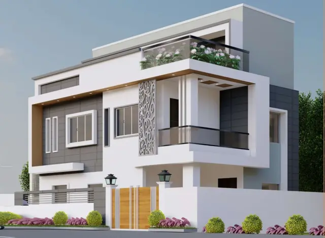
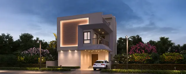
Eastern Heights
NISHIJA INFRA LLP · Medchal-Malkajgiri · RERA P02200004037
EASTERN HEIGHTS is a plotted development of residential plots situated at GHATKESAR-ORRGC VILLAGE, GHATKESAR MUNCIPALITY-ORRGC MANDAL, MEDCHAL-MALKAJGIRI DIST, developed by Nishija Infra LLP. The supplied RERA land record lists a total/net area of 61,436.28 sq. m; the project is a plotted layout, not a building scheme, and a complete plot count and RERA-filed plot-size bands are not supplied. It is registered under TG-RERA number P02200004037, with proposed completion on 01/03/2028.
01What we found
Read from TG-RERA filings, approvals, land and registration records and court records. A court case is counted only when the court record states this project's survey number with its village, or names the project.
02Check before you pay
8 items to check before you pay, 4 high - from the title chain, court records and approvals, each with what to ask the builder or your advocate. An item may not be a problem with the project: records can be incomplete.
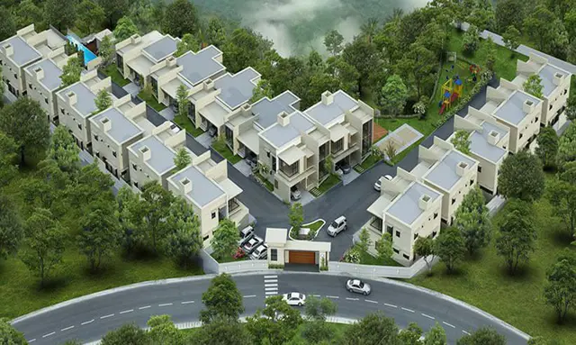
1. Project at a glance
Project identity
| Field | Record |
|---|---|
| Registered project name | EASTERN HEIGHTS RERA record |
| Project type | Plotted development / plotted open layout RERA record |
| Phase or registered portion | No phase designation is disclosed. The registration covers the listed survey numbers below. |
| TG-RERA registration | P02200004037 |
| Registration validity | 31/01/2022 to 01/11/2027; the certificate records a five-year validity period. This is registration validity, not the project completion deadline. |
| Registered promoter | Nishija Infra LLP, an LLP RERA record Corporate record |
| RERA status | The supplied certificate records registration. No extension is recorded in the supplied certificate. |
Land and geographic identity
| Field | Record |
|---|---|
| Registered locality | SITUATED AT GHATKESAR-ORRGC VILLAGE, GHATKESAR MUNCIPALITY-ORRGC MANDAL, MEDCHAL-MALKAJGIRI DIST RERA record |
| Revenue village | Ghatkesar-ORRGC Village (also recorded as Ghatkesar) RERA record |
| Mandal | Ghatkesar Muncipality-ORRGC Mandal |
| District | Medchal-Malkajgiri |
| PIN | 501301 RERA record |
| Project survey numbers and subdivisions | 506/P, 527/P, 543/3, 543/4/P, 543/5/P, 543/6/P, 543/7/P, 543/8/P, 543/9 |
| Registered site extent | The supplied RERA land record lists total/net area as 61,436.28 sq. m. RERA filing |
| Plan-area figures | The HMDA draft-layout letter records total site area 494,747.03 sq. m, master-plan road affected area 26,560.13 sq. m, and net site area 468,186.9 sq. m. |
| Boundaries | North: ROAD; South, East and West: OTHERS LAND. RERA filing |
Development identity
| Field | Record |
|---|---|
| Sanctioning authority | Hyderabad Metropolitan Development Authority (HMDA); the draft letter forwards the plan to Ghatkesar Municipality for further action and release. |
| Principal approval | HMDA approval 000360/LO/Plg/HMDA/2021, dated 01 November, 2021; identified in the document as a draft layout letter. Approvals record |
| Approved built-up area | RERA project fields record 303,751.94 sq. m as approved built-up area. RERA filing |
| Layout land-use areas in the draft letter | Plotted area 303,751.94 sq. m; layout roads 113,103.95 sq. m; park 38,424.04 sq. m; open space 11,860.25 sq. m; amenities area 1,045.23 sq. m. |
| Buildings/floors | Not disclosed as a building scheme; this is a plotted layout. The draft letter says buildings are not to be constructed on plots until final layout issuance. |
| Parking | No project-wide parking count or individual plot parking allocation is supplied. |
| Unit/plot count | A complete RERA-filed plot count is not available in the supplied records. The drawing-derived data says plot information is incomplete. Layout record |
Offering and status
| Field | Record |
|---|---|
| Unit type | Residential plots. RERA record |
| Plot sizes / saleable area | RERA-filed plot-size bands are not supplied. The promoter website lists plot sizes of 200, 267, 398, 450, 550 and 600 Sq. Yards, and also a generic “saleable 1800 sq.ft” entry; these are promoter-marketed claims, not RERA-filed unit details. Promoter website |
| Booked/available counts | Not disclosed in the supplied evidence. Layout record |
| Construction stage | RERA header records 70% completeness; this is a filed/recorded figure, not an independently verified site measurement. RERA record |
| Completion dates | RERA header gives proposed completion 01/03/2028. The Form-B affidavit dated 9tr,day of A rgust 2A21 separately states a one-year completion undertaking. These are the supplied records’ respective statements. RERA record |
| Occupancy/completion certificate | No occupancy or completion certificate is supplied. The project is a plotted layout; the HMDA document is described as draft layout permission, with final release subject to conditions. |
2. The project story
EASTERN HEIGHTS is registered with TG-RERA as a plotted development in Ghatkesar, Medchal-Malkajgiri district. The registered land identity covers nine survey-number entries: 506/P, 527/P, 543/3, 543/4/P, 543/5/P, 543/6/P, 543/7/P, 543/8/P and 543/9.
The HMDA-filed document describes a draft open-plot layout and records proposed internal roads, parks/open space, social infrastructure and an amenities area. Its stated conditions include completion of layout development works, access through roads, handover of specified areas to the local body, and further compliance before final layout release and release of mortgaged plots. The document expressly says the permission is not proof of land title.
The RERA header reports 70% completeness, but the supplied material does not establish which layout works are complete or independently verify that percentage. No occupancy/completion certificate or final-layout release is included in the supplied records. RERA record
3. Master plan, architecture & building design
This is a plotted layout rather than a tower or apartment development. The HMDA draft-layout letter records total site area of 494,747.03 sq. m, including 26,560.13 sq. m affected by a proposed master-plan road, and a net site area of 468,186.9 sq. m.
| Layout component | Area recorded | Evidence |
|---|---|---|
| Plotted area | 303,751.94 sq. m | HMDA draft-layout letter |
| Layout road area | 113,103.95 sq. m | HMDA draft-layout letter |
| Park | 38,424.04 sq. m | HMDA draft-layout letter |
| Open space | 11,860.25 sq. m | HMDA draft-layout letter |
| Amenities area | 1,045.23 sq. m | HMDA draft-layout letter |
| Proposed master-plan road affected area | 26,560.13 sq. m | HMDA draft-layout letter |
The letter identifies a 30m wide proposed master plan road and internal road widths of 18 mts and above. It also records that the site is to remain without an enclosing compound wall under the draft conditions and that roads must remain accessible to neighbouring sites.
The drawing-derived layout data is explicitly incomplete: plot records are not complete and no plot-size measurements were extracted. Accordingly, a verified plot count, plot arrangement by size, and precise distribution of all land-use components cannot be established from the supplied evidence. Layout record
4. Homes, configurations & floor plans
The project offers plots, not apartments. The supplied RERA evidence does not provide a verified count of plots, booked plots, available plots or RERA-filed plot-size bands. Layout record
The promoter website markets plot sizes of 200, 267, 398, 450, 550 and 600 Sq. Yards. These are attributed marketing claims; the available layout extraction does not verify the plot inventory or sizes. Promoter website Layout record
The floor-plan record contains two layout sheets but no measured units; it reports no flats. Apartment carpet-area, saleable-area and loading comparisons are therefore not applicable on the supplied evidence. Floor plans
5. Parking & vehicle circulation
The HMDA draft letter records layout roads of 18 mts and above and a 30m wide proposed master plan road. It also requires roads to be opened for accessibility to neighbouring sites.
No project-wide parking count, visitor or accessible parking provision, EV charging provision, or plot-specific parking allocation is disclosed in the supplied evidence. The marketed and drawing records do not establish exclusive parking rights for any plot. Promoter website
6. Amenities, recreation & open spaces
The HMDA draft-layout letter lists proposed layout infrastructure and amenities, while the RERA amenity fields mark several layout-level facilities “YES” with progress values of 0. These records do not establish that the facilities have been completed or independently verified. RERA amenities
| Category | Facility | Description / size | Evidence source | Declared progress / verified status |
|---|---|---|---|---|
| Landscape/open space | Park | 38,424.04 sq. m | HMDA draft-layout letter | Area recorded in draft layout; completion not verified |
| Landscape/open space | Open space | 11,860.25 sq. m | HMDA draft-layout letter | Area recorded in draft layout; completion not verified |
| Landscape/open space | Green strip / tot lot / park | No separate size supplied | RERA amenity fields RERA amenities | “YES”; progress 0 |
| Sports/recreation | Avenue plantation | No quantity supplied | HMDA draft-layout letter | Proposed; completion not verified |
| Convenience/community | Amenities area | 1,045.23 sq. m | HMDA draft-layout letter | Area recorded; specific facility schedule and completion status not supplied |
| Convenience/community | Community buildings | No size or capacity supplied | RERA amenity fields RERA amenities | Listed; progress 0 |
The promoter website additionally markets a clubhouse, lounge, banquet hall, guest rooms, library, business lounge, swimming pool, courts, gym, landscaped parks, gardens, jogging track and children’s play areas, among other facilities. These are promoter-marketed claims; the supplied HMDA and RERA records do not confirm their delivery. Promoter website
7. Utilities, building services & safety
The HMDA draft-layout letter lists a common septic tank/STP, internal water-supply pipelines, an overhead tank, transformer, rainwater-harvesting pits and a bio-compost unit as proposed layout works. It does not supply capacities or evidence of completion.
| Evidence in supplied record | Internal water-supply pipelines and overhead tank listed in the draft-layout letter. |
|---|---|
| Status/limitation | Proposed; capacity and completion not stated. |
| Evidence in supplied record | Common septic tank/STP listed; RERA amenity fields include sewerage and storm-water drains. |
|---|---|
| Status/limitation | RERA amenity progress is 0; capacity and completed status are not established. RERA amenities |
| Evidence in supplied record | Transformer and transformer yard listed in the draft-layout letter; RERA amenity fields include electrical meter room/sub-station/receiving station. |
|---|---|
| Status/limitation | Proposed/listed; capacity and completion not stated. RERA amenities |
| Evidence in supplied record | Rainwater-harvesting pits and bio-compost unit listed; RERA fields include water conservation and solid-waste management. |
|---|---|
| Status/limitation | Proposed/listed; operating status not verified. RERA amenities |
| Evidence in supplied record | RERA amenity fields list fire protection and fire-safety requirements. |
|---|---|
| Status/limitation | Progress 0; no detailed system or clearance evidence supplied. RERA amenities |
| Evidence in supplied record | Draft conditions require roads to be opened for access to neighbouring sites. |
|---|---|
| Status/limitation | No accessible-pathway or accessibility specification supplied. |
No evidence is supplied for utility capacities, backup power arrangements, CCTV/access-control specifications, or completed safety systems. Promoter-marketed claims about underground utilities and 24×7 security are not treated as verified project provisions. Promoter website
8. Location, access & connectivity
The registered location is Ghatkesar-ORRGC Village, Ghatkesar Muncipality-ORRGC Mandal, Medchal-Malkajgiri district, PIN 501301. The cadastral parcel centroid is 17.44179, 78.68015. RERA record Cadastral map
The supplied location record identifies the nearest sampled Outer Ring Road interchange at approximately 0.9 km. Location record
The promoter website describes the project as being on Warangal National Highway and advertises travel-time claims to ORR Exit No. 9 and named institutions and destinations. Those promotional travel-time claims are not independently measured in the supplied evidence and are not used here as verified connectivity facts. Promoter website
9. Developer & development status
The registered promoter is NISHIJA INFRA LLP, an LLP, with GSTIN 36AAQFN3824R1ZF. The project record lists P GANGADHARA RAO and PEDDIREDDY ADITYA REDDY as partners and authorised signatories. Corporate record RERA record RERA filing
The promoter address recorded in the project information is PLOT NO 158, PRASHASAN NAGAR, with the project locality and survey numbers also appearing in the address record. The TG-RERA certificate gives the promoter office as “Village: Mandal: District: Hyderabad, Pin: 500033.” RERA filing
The promoter website listed in the supplied record is easternheights.in. The RERA header reports 70% completeness and proposed completion 01/03/2028; these are record statements, not independently verified progress or a completion certificate. No phase-wise development schedule or final-layout release is supplied. Parties record RERA record
10. Approvals, official records & documents
| What the supplied document establishes | FORM C registration for EASTERN HEIGHTS, P02200004037, valid 31/01/2022–01/11/2027. |
|---|
| What the supplied document establishes | Draft layout letter for a plotted open layout; approval number 000360/LO/Plg/HMDA/2021, dated 01 November, 2021. It records conditions and states that permission is not proof of land title. |
|---|
| What the supplied document establishes | Application 047631/ZOB/LT/U6/HMDA/28072021. |
|---|
| What the supplied document establishes | Mortgage over plots 107–199, total 93 plots, 45,784.40 sq. m, under document 7016 of 2021; and plots 77–106, total 30 plots, 15,651.88 sq. m, under document 7017 of 2021, in HMDA’s favour. |
|---|
| What the supplied document establishes | The letter records gift deed 7015/2021, dated 23.08.2021, for the 26,560.13 sq. m master-plan-road-affected area in favour of the local body. |
|---|
| What the supplied document establishes | Form-B affidavit by Nishija Infra LLP declares legal title/development basis, no encumbrances, 70% separate-account obligations and a one-year completion undertaking; declaration date is extracted as “9tr,day of A rgust 2A21.” |
|---|
| What the supplied document establishes | No occupancy or completion certificate, or final-layout release document, is included in the supplied evidence. |
|---|---|
| Reference | Document index |
1. Project at a glance
Project identity
Registered project name: EASTERN HEIGHTS
Project type: Plotted development / plotted open layout
Phase or registered portion: No phase designation is disclosed. The registration covers the listed survey numbers below.
TG-RERA registration: P02200004037
Registration validity: 31/01/2022 to 01/11/2027; the certificate records a five-year validity period. This is registration validity, not the project completion deadline.
Registered promoter: Nishija Infra LLP, an LLP
RERA status: The supplied certificate records registration. No extension is recorded in the supplied certificate.
Land and geographic identity
Registered locality: SITUATED AT GHATKESAR-ORRGC VILLAGE, GHATKESAR MUNCIPALITY-ORRGC MANDAL, MEDCHAL-MALKAJGIRI DIST
Revenue village: Ghatkesar-ORRGC Village (also recorded as Ghatkesar)
Mandal: Ghatkesar Muncipality-ORRGC Mandal
District: Medchal-Malkajgiri
PIN: 501301
Project survey numbers and subdivisions: 506/P, 527/P, 543/3, 543/4/P, 543/5/P, 543/6/P, 543/7/P, 543/8/P, 543/9
Registered site extent: The supplied RERA land record lists total/net area as 61,436.28 sq. m.
Plan-area figures: The HMDA draft-layout letter records total site area 494,747.03 sq. m, master-plan road affected area 26,560.13 sq. m, and net site area 468,186.9 sq. m.
Boundaries: North: ROAD; South, East and West: OTHERS LAND.
Development identity
Sanctioning authority: Hyderabad Metropolitan Development Authority (HMDA); the draft letter forwards the plan to Ghatkesar Municipality for further action and release.
Principal approval: HMDA approval 000360/LO/Plg/HMDA/2021, dated 01 November, 2021; identified in the document as a draft layout letter.
Approved built-up area: RERA project fields record 303,751.94 sq. m as approved built-up area.
Layout land-use areas in the draft letter: Plotted area 303,751.94 sq. m; layout roads 113,103.95 sq. m; park 38,424.04 sq. m; open space 11,860.25 sq. m; amenities area 1,045.23 sq. m.
Buildings/floors: Not disclosed as a building scheme; this is a plotted layout. The draft letter says buildings are not to be constructed on plots until final layout issuance.
Parking: No project-wide parking count or individual plot parking allocation is supplied.
Unit/plot count: A complete RERA-filed plot count is not available in the supplied records. The drawing-derived data says plot information is incomplete.
Offering and status
Unit type: Residential plots.
Plot sizes / saleable area: RERA-filed plot-size bands are not supplied. The promoter website lists plot sizes of 200, 267, 398, 450, 550 and 600 Sq. Yards, and also a generic “saleable 1800 sq.ft” entry; these are promoter-marketed claims, not RERA-filed unit details.
Booked/available counts: Not disclosed in the supplied evidence.
Construction stage: RERA header records 70% completeness; this is a filed/recorded figure, not an independently verified site measurement.
Completion dates: RERA header gives proposed completion 01/03/2028. The Form-B affidavit dated 9tr,day of A rgust 2A21 separately states a one-year completion undertaking. These are the supplied records’ respective statements.
Occupancy/completion certificate: No occupancy or completion certificate is supplied. The project is a plotted layout; the HMDA document is described as draft layout permission, with final release subject to conditions.
2. The project story
EASTERN HEIGHTS is registered with TG-RERA as a plotted development in Ghatkesar, Medchal-Malkajgiri district. The registered land identity covers nine survey-number entries: 506/P, 527/P, 543/3, 543/4/P, 543/5/P, 543/6/P, 543/7/P, 543/8/P and 543/9.
The HMDA-filed document describes a draft open-plot layout and records proposed internal roads, parks/open space, social infrastructure and an amenities area. Its stated conditions include completion of layout development works, access through roads, handover of specified areas to the local body, and further compliance before final layout release and release of mortgaged plots. The document expressly says the permission is not proof of land title.
The RERA header reports 70% completeness, but the supplied material does not establish which layout works are complete or independently verify that percentage. No occupancy/completion certificate or final-layout release is included in the supplied records.
3. Master plan, architecture & building design
This is a plotted layout rather than a tower or apartment development. The HMDA draft-layout letter records total site area of 494,747.03 sq. m, including 26,560.13 sq. m affected by a proposed master-plan road, and a net site area of 468,186.9 sq. m.
| Layout component | Area recorded | Evidence |
|---|---|---|
| Plotted area | 303,751.94 sq. m | HMDA draft-layout letter |
| Layout road area | 113,103.95 sq. m | HMDA draft-layout letter |
| Park | 38,424.04 sq. m | HMDA draft-layout letter |
| Open space | 11,860.25 sq. m | HMDA draft-layout letter |
| Amenities area | 1,045.23 sq. m | HMDA draft-layout letter |
| Proposed master-plan road affected area | 26,560.13 sq. m | HMDA draft-layout letter |
The letter identifies a 30m wide proposed master plan road and internal road widths of 18 mts and above. It also records that the site is to remain without an enclosing compound wall under the draft conditions and that roads must remain accessible to neighbouring sites.
The drawing-derived layout data is explicitly incomplete: plot records are not complete and no plot-size measurements were extracted. Accordingly, a verified plot count, plot arrangement by size, and precise distribution of all land-use components cannot be established from the supplied evidence.
4. Homes, configurations & floor plans
The project offers plots, not apartments. The supplied RERA evidence does not provide a verified count of plots, booked plots, available plots or RERA-filed plot-size bands.
The promoter website markets plot sizes of 200, 267, 398, 450, 550 and 600 Sq. Yards. These are attributed marketing claims; the available layout extraction does not verify the plot inventory or sizes.
The floor-plan record contains two layout sheets but no measured units; it reports no flats. Apartment carpet-area, saleable-area and loading comparisons are therefore not applicable on the supplied evidence.
5. Parking & vehicle circulation
The HMDA draft letter records layout roads of 18 mts and above and a 30m wide proposed master plan road. It also requires roads to be opened for accessibility to neighbouring sites.
No project-wide parking count, visitor or accessible parking provision, EV charging provision, or plot-specific parking allocation is disclosed in the supplied evidence. The marketed and drawing records do not establish exclusive parking rights for any plot.
6. Amenities, recreation & open spaces
The HMDA draft-layout letter lists proposed layout infrastructure and amenities, while the RERA amenity fields mark several layout-level facilities “YES” with progress values of 0. These records do not establish that the facilities have been completed or independently verified.
| Category | Facility | Description / size | Evidence source | Declared progress / verified status |
|---|---|---|---|---|
| Landscape/open space | Park | 38,424.04 sq. m | HMDA draft-layout letter | Area recorded in draft layout; completion not verified |
| Landscape/open space | Open space | 11,860.25 sq. m | HMDA draft-layout letter | Area recorded in draft layout; completion not verified |
| Landscape/open space | Green strip / tot lot / park | No separate size supplied | RERA amenity fields | “YES”; progress 0 |
| Sports/recreation | Avenue plantation | No quantity supplied | HMDA draft-layout letter | Proposed; completion not verified |
| Convenience/community | Amenities area | 1,045.23 sq. m | HMDA draft-layout letter | Area recorded; specific facility schedule and completion status not supplied |
| Convenience/community | Community buildings | No size or capacity supplied | RERA amenity fields | Listed; progress 0 |
The promoter website additionally markets a clubhouse, lounge, banquet hall, guest rooms, library, business lounge, swimming pool, courts, gym, landscaped parks, gardens, jogging track and children’s play areas, among other facilities. These are promoter-marketed claims; the supplied HMDA and RERA records do not confirm their delivery.
7. Utilities, building services & safety
The HMDA draft-layout letter lists a common septic tank/STP, internal water-supply pipelines, an overhead tank, transformer, rainwater-harvesting pits and a bio-compost unit as proposed layout works. It does not supply capacities or evidence of completion.
| Evidence in supplied record | Internal water-supply pipelines and overhead tank listed in the draft-layout letter. |
|---|---|
| Status/limitation | Proposed; capacity and completion not stated. |
| Evidence in supplied record | Common septic tank/STP listed; RERA amenity fields include sewerage and storm-water drains. |
|---|---|
| Status/limitation | RERA amenity progress is 0; capacity and completed status are not established. |
| Evidence in supplied record | Transformer and transformer yard listed in the draft-layout letter; RERA amenity fields include electrical meter room/sub-station/receiving station. |
|---|---|
| Status/limitation | Proposed/listed; capacity and completion not stated. |
| Evidence in supplied record | Rainwater-harvesting pits and bio-compost unit listed; RERA fields include water conservation and solid-waste management. |
|---|---|
| Status/limitation | Proposed/listed; operating status not verified. |
| Evidence in supplied record | RERA amenity fields list fire protection and fire-safety requirements. |
|---|---|
| Status/limitation | Progress 0; no detailed system or clearance evidence supplied. |
| Evidence in supplied record | Draft conditions require roads to be opened for access to neighbouring sites. |
|---|---|
| Status/limitation | No accessible-pathway or accessibility specification supplied. |
No evidence is supplied for utility capacities, backup power arrangements, CCTV/access-control specifications, or completed safety systems. Promoter-marketed claims about underground utilities and 24×7 security are not treated as verified project provisions.
8. Location, access & connectivity
The registered location is Ghatkesar-ORRGC Village, Ghatkesar Muncipality-ORRGC Mandal, Medchal-Malkajgiri district, PIN 501301. The cadastral parcel centroid is 17.44179, 78.68015.
The supplied location record identifies the nearest sampled Outer Ring Road interchange at approximately 0.9 km.
The promoter website describes the project as being on Warangal National Highway and advertises travel-time claims to ORR Exit No. 9 and named institutions and destinations. Those promotional travel-time claims are not independently measured in the supplied evidence and are not used here as verified connectivity facts.
9. Developer & development status
The registered promoter is NISHIJA INFRA LLP, an LLP, with GSTIN 36AAQFN3824R1ZF. The project record lists P GANGADHARA RAO and PEDDIREDDY ADITYA REDDY as partners and authorised signatories.
The promoter address recorded in the project information is PLOT NO 158, PRASHASAN NAGAR, with the project locality and survey numbers also appearing in the address record. The TG-RERA certificate gives the promoter office as “Village: Mandal: District: Hyderabad, Pin: 500033.”
The promoter website listed in the supplied record is easternheights.in. The RERA header reports 70% completeness and proposed completion 01/03/2028; these are record statements, not independently verified progress or a completion certificate. No phase-wise development schedule or final-layout release is supplied.
10. Approvals, official records & documents
| What the supplied document establishes | FORM C registration for EASTERN HEIGHTS, P02200004037, valid 31/01/2022–01/11/2027. |
|---|
| What the supplied document establishes | Draft layout letter for a plotted open layout; approval number 000360/LO/Plg/HMDA/2021, dated 01 November, 2021. It records conditions and states that permission is not proof of land title. |
|---|
| What the supplied document establishes | Application 047631/ZOB/LT/U6/HMDA/28072021. |
|---|
| What the supplied document establishes | Mortgage over plots 107–199, total 93 plots, 45,784.40 sq. m, under document 7016 of 2021; and plots 77–106, total 30 plots, 15,651.88 sq. m, under document 7017 of 2021, in HMDA’s favour. |
|---|
| What the supplied document establishes | The letter records gift deed 7015/2021, dated 23.08.2021, for the 26,560.13 sq. m master-plan-road-affected area in favour of the local body. |
|---|
| What the supplied document establishes | Form-B affidavit by Nishija Infra LLP declares legal title/development basis, no encumbrances, 70% separate-account obligations and a one-year completion undertaking; declaration date is extracted as “9tr,day of A rgust 2A21.” |
|---|
| What the supplied document establishes | No occupancy or completion certificate, or final-layout release document, is included in the supplied evidence. |
|---|
Frequently asked questions
Is EASTERN HEIGHTS registered with Telangana RERA?
Yes. EASTERN HEIGHTS is registered with the Telangana Real Estate Regulatory Authority as P02200004037; the registration status is New Project.
Who is the developer of EASTERN HEIGHTS?
The promoter named in the RERA registration is NISHIJA INFRA LLP.
Where is EASTERN HEIGHTS located?
EASTERN HEIGHTS is in SITUATED AT GHATKESAR-ORRGC VILLAGE, GHATKESAR MUNCIPALITY-ORRGC MANDAL, MEDCHAL-MALKAJGIRI DIST, Ghatkesar, Medchal-Malkajgiri, Telangana (501301).
When will EASTERN HEIGHTS be completed?
The promoter's proposed date of completion filed with RERA is 01/03/2028. This is the promoter's declaration, not a guarantee.
More projects in Ghatkesar