Brooke Bond Valley
HILLAND TECHNOLOGIES PRIVATE LIMITED · Medchal-Malkajgiri · RERA P02200006158
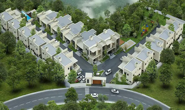
BROOKE BOND VALLEY is a plotted development / residential open-plot layout in Ghatkesar - ORRGC, Ghatkesar Mandal, Medchal-Malkajgiri District. The registered promoter is HILLAND TECHNOLOGIES PRIVATE LIMITED. The registered site extent is 101529.06 sq m total, with 86143.94 sq m net area; the records do not disclose a tower or block count, floors, verified plot count or plot-size range. The offering is residential open plots, and TG-RERA registration P02200006158 records a proposed completion of 03rd DECEMBER 2024.
01What we found
Read from TG-RERA filings, approvals, land and registration records and court records. A court case is counted only when the court record states this project's survey number with its village, or names the project.
02Check before you pay
6 items to check before you pay, 4 high - from the title chain, court records and approvals, each with what to ask the builder or your advocate. An item may not be a problem with the project: records can be incomplete.
1. Project at a glance
Project identity
| Field | Record |
|---|---|
| Registered project name | BROOKE BOND VALLEY RERA record |
| Project type | Plotted development / residential open-plot layout RERA record |
| Phase or registered portion | Not separately identified; registration is for the project named above RERA record |
| TG-RERA registration | P02200006158 |
| Registration validity | 24/04/2023 to 03/12/2024; certificate records no extension |
| Registered promoter | HILLAND TECHNOLOGIES PRIVATE LIMITED RERA record Corporate record |
| RERA status in supplied record | New Project. Registration validity ended on 03/12/2024; no extension is recorded in the supplied registration certificate. This is separate from the completion undertaking and does not establish occupancy or completion status. RERA record |
Land and geographic identity
| Field | Record |
|---|---|
| Locality / revenue village | Ghatkesar - ORRGC / Ghatkesar RERA record |
| Mandal | Ghatkesar RERA record |
| District | Medchal-Malkajgiri RERA record |
| PIN | 501301 RERA record |
| Project survey numbers and subdivisions | Old Sy.No.509 (New Sy. 590); Old Sy.No.510 (New Sy. 591); Old Sy.No.511 (New Sy. 592/1); Old Sy.No.511 (New Sy. 592/2); Old Sy.No.519 (New Sy. 600). RERA record |
| Registered site extent | 101529.06 sq m total; 86143.94 sq m net area RERA filing |
| Area affected in road widening / FTL of tanks / nala widening | 15385.12 sq m, as recorded in the RERA land details RERA filing |
| Layout area in final layout letter | 86,143.94 Sqm |
| Boundaries | North: Road; South: Land in Sy No. 593; East: Land in Sy Nos 597, 598, 599 and 601; West: Vagu and land in Sy No. 589 RERA filing |
Development identity
| Field | Record |
|---|---|
| Sanctioning authority | Hyderabad Metropolitan Development Authority (HMDA) Approvals record |
| Principal approval | Final Layout Permit 000083/LO/Plg/HMDA/2022, approved date recorded as 03 December 2022 Approvals record |
| Related file / application number | 057039/LT/ZOB/FLT/U6/HMDA/27092022 Approvals record |
| Approved built-up area | 55667.61 sq m is recorded in the RERA project information; the supplied material does not clarify its relationship to plot-area or building-permission calculations. RERA filing |
| Buildings / towers and floor configuration | Not disclosed in the supplied project record. The approval is for a plotted layout; individual building permissions are to be considered separately under the approval conditions. |
| Parking levels and approved parking count | Not disclosed in the supplied material. |
| Approved versus RERA-declared plots / unit counts | Not established from the supplied records. The layout drawing is not fully machine-readable for plot count or plot sizes. Layout record |
Offering and status
| Field | Record |
|---|---|
| Offering | Residential open plots; no verified plot count or plot-size range is available in the supplied data. Layout record |
| Booked / available counts | Not supplied in the records provided for this overview. |
| Declared project completion | Promoter’s Form B undertakes completion by 03rd DECEMBER 2024. This is a promoter declaration, not independent verification of completion. |
| Construction / development stage | RERA amenity records show differing declared progress by item; see sections 6 and 9. No independent site verification is supplied. RERA amenities |
| Occupancy / completion certificate | No occupancy or completion certificate is identified in the supplied documents. The approval concerns a layout; individual building permission is addressed separately in its conditions. |
2. The project story
BROOKE BOND VALLEY is registered as a plotted residential development at Ghatkesar - ORRGC, in Ghatkesar Mandal, Medchal-Malkajgiri District. The registered land identity covers five old-to-new survey references, including two subdivisions of Old Sy.No.511. HMDA’s final layout letter describes a residential open-plot layout over 86,143.94 Sqm and requires the building sites to be used for residential dwelling houses; individual building permissions are to be considered separately. RERA record
The project’s recorded total site area is 101529.06 sq m and its net area is 86143.94 sq m. Its approval records roads and open spaces handed over to the local authority by registered gift deed No. 6689/2022. The supplied RERA record does not establish a verified plot count, plot-size range, or the completion status of individual plots or any future dwellings. RERA filing Layout record
The promoter’s Form B declares a completion undertaking of 03rd DECEMBER 2024. RERA-filed amenity entries report progress for layout infrastructure, but these are declared figures rather than an independent inspection of site conditions. No occupancy or completion certificate is supplied for the layout or any individual dwelling. RERA amenities
3. Master plan, architecture & building design
The project is a plotted layout, rather than a multi-tower building scheme in the supplied approval. HMDA’s final layout letter records a layout extent of 86,143.94 Sqm and permit No. 000083/LO/Plg/HMDA/2022. Its conditions provide for residential dwelling houses on the sanctioned building sites and state that individual building permissions are considered separately. Building count, height, floor configuration, building footprints, and apartment arrangements are therefore not established by the supplied project documents.
The RERA land details give a total area of 101529.06 sq m, a net area of 86143.94 sq m and 15385.12 sq m affected in the recorded road-widening/FTL/nala-widening field. The approved-layout drawing is available as two sheets, but the software-derived plot count and individual plot sizes are incomplete and require checking against the drawing. RERA filing Layout record
The layout record identifies these land-use figures: roads 21541.67 sq m; parks/open space 6746.62 sq m in the drawing-derived layout summary; and social infrastructure 2187.77 sq m. The municipality letter separately itemizes park area 6469.28 Sq. Mts and utility area 277.34 Sq. Mts, alongside roads and social infrastructure. These are figures appearing in the respective supplied records; this overview does not reconcile them. Layout record
4. Homes, configurations & floor plans
The offering evidenced by the TG-RERA project and HMDA approval is residential plots. A verified plot count, plot-size bands, booked/available inventory, and plot-wise RERA saleable areas are not available in the supplied records. The layout sheets are not fully machine-readable for plot-level extraction. Layout record
| Configuration | Units | Booked | Available | RERA saleable area | Measured carpet area | Loading (if supplied) |
|---|---|---|---|---|---|---|
| Residential plots | Not disclosed | Not supplied | Not supplied | Not supplied | Not applicable / not supplied | Not supplied |
The two supplied drawing sheets are layout sheets, not apartment floor plans; no software-measured carpet or room dimensions are available. Floor plans Layout record
5. Parking & vehicle circulation
The supplied records do not establish a sanctioned parking-space count, visitor or accessible parking provision, parking levels, or plot-wise parking allocation. The vendor data mentions “ample parking lot for a bike,” but that is a third-party promotional statement, not an approved count or documented allotment. Promoter website
HMDA’s final layout conditions state that roads are to remain open for free access to the general public and that no compound wall is permitted on the interior lands. The layout record includes roads totalling 21541.67 sq m. Details of entrances, exits, ramps, internal driveway geometry, pedestrian separation and EV charging are not supplied. Layout record
6. Amenities, recreation & open spaces
The following progress percentages come from RERA amenity records. They are declared progress entries; the supplied material does not provide independent verification of completion.
| Facility | Description / size | Evidence source | Declared progress / verified status |
|---|---|---|---|
| Clubhouse / indoor — Community buildings | No size or facility detail supplied | RERA amenities | 0%; not independently verified |
| Sports / recreation — No specific sports facility established in the supplied RERA amenity record | Not supplied | RERA amenities | Not disclosed |
| Landscape / open space — Green strip / tot lot / park | Layout drawing summary records parks/open space 6746.62 sq m; municipality letter itemizes park area 6469.28 Sq. Mts | Layout record | RERA entry 80%; no independent completion verification |
| Convenience / community — Social infrastructure land | 2187.77 Sq. Mts in the municipality letter and layout record | Layout record | No specific facility or delivery status supplied |
| Convenience / community — Utility land | 277.34 Sq. Mts in municipality letter | Land area recorded; facility status not supplied |
The vendor lists additional features—including a cycling track, yoga deck and landscaped garden—but these are third-party promotional claims and are not established as sanctioned or delivered facilities by the supplied RERA and approval records. Promoter website
7. Utilities, building services & safety
HMDA’s final layout letter describes the layout as provided with water supply, sewerage and drainage disposal systems, street lighting, rainwater-harvesting structure and other civic amenities. It assigns proper and effective maintenance of those services to the local body and provides for maintenance of roads and open spaces. This is an approval-document description, not independent confirmation of present operation.
| Service | Supplied evidence |
|---|---|
| Water | HMDA approval describes water supply; RERA amenity record reports Water Supply at 80%. A bore-water source appears only in the vendor specifications and is not confirmed as the project’s RERA-filed supply arrangement. RERA amenities Promoter website |
| Sewerage and drainage | HMDA approval describes sewerage and drainage disposal systems. RERA amenity entries report sewerage and treatment/disposal of sewage and sullage water at 80%; storm-water drains are reported at 80%. No treatment capacity, reuse details or independent commissioning evidence is supplied. RERA amenities |
| Rainwater harvesting | HMDA approval describes a rainwater-harvesting structure; the RERA entry reports water conservation/rainwater harvesting at 40%. RERA amenities |
| Electrical and lighting | Street lighting is reported at 40% in the RERA amenity record. The electrical meter room/sub-station/receiving-station entry reports 0%; capacity and supply details are not supplied. RERA amenities |
| Fire and life safety | RERA amenity record reports fire protection/fire-safety requirements at 0%. No project-specific fire-system details or clearance are supplied. RERA amenities |
| Waste management and security | The RERA solid-waste-management entry has no supplied progress value; CCTV and security are mentioned only in vendor material. RERA amenities Promoter website |
| Lifts, accessibility and backup power | Not established for this plotted-layout record in the supplied RERA or approval documents. Vendor material mentions lift and power backup, but provides no project-specific quantities or capacities. Promoter website |
8. Location, access & connectivity
The registered location is Ghatkesar - ORRGC, Ghatkesar Mandal, Medchal-Malkajgiri District, Telangana 501301. The project survey identity and boundaries are set out in section 1. RERA record
The supplied location data gives the nearest sampled Outer Ring Road interchange at approximately 0.7 km. This is the only measured connectivity distance supplied. No verified travel times, public-transport details, or measured distances to schools, airports, railway stations or other landmarks are provided. Location record
9. Developer & development status
The registered promoter is HILLAND TECHNOLOGIES PRIVATE LIMITED, a private limited company. The supplied corporate identifier is GSTIN 36AAFCH6217A1Z0; the company identifier shown in the title material is U72900T2021PTC147773. The project authorization names PAILLA SHEKHAR REDDY as authorized signatory and PAILLA VANITHA as a director. The supplied record gives the promoter’s address as Road No 47, Jubilee Hills, Ghatkesar - ORRGC, Ghatkesar, Medchal-Malkajgiri, 501301; an independently verified registered office address or official contact details are not supplied. Corporate record Parties record
The promoter’s Form B, dated 13 March 2023, declares legal title, no encumbrances, and completion by 03rd DECEMBER 2024. Those statements are promoter declarations. The RERA registration certificate records validity through 03/12/2024, with no extension identified in the supplied certificate. These dates describe different matters: the declared project completion deadline and the registration-validity period. No independent construction inspection or occupancy/completion certificate is provided.
10. Approvals, official records & documents
| Identifier / date | P02200006158; issued 24/04/2023; validity to 03/12/2024 |
|---|---|
| What it establishes | Registration of BROOKE BOND VALLEY and its recorded validity period. |
| Identifier / date | Final Layout Permit 000083/LO/Plg/HMDA/2022; approved date 03 December 2022 |
|---|---|
| What it establishes | Final residential open-plot layout approval over 86,143.94 Sqm, subject to the listed conditions. |
| Identifier / date | 057039/LT/ZOB/FLT/U6/HMDA/27092022 |
|---|---|
| What it establishes | File and application identifier appearing in the layout approval record. |
| Identifier / date | MCG/1087/2022, dated 26.09.2022 |
|---|---|
| What it establishes | Municipality record concerning the residential draft layout and handover of roads, park, utility and social-infrastructure areas by gift deed. |
| Identifier / date | 6689/2022, dated 20.09.2022 |
|---|---|
| What it establishes | HMDA letter records roads and open spaces handed over to the local authority; municipality letter lists road, park, utility and social-infrastructure areas. |
| Identifier / date | 8102 of 2022, dated 24.12.2022 |
|---|---|
| What it establishes | Cited in HMDA’s final layout letter in connection with mortgaged plots. |
| Identifier / date | Dated 13 March 2023 |
|---|---|
| What it establishes | Promoter’s declarations concerning title, encumbrances, project obligations and completion undertaking. |
| Identifier / date | Two layout sheets |
|---|---|
| What it establishes | Drawing-based land-use summary is available; plot-count and plot-size extraction is incomplete and requires drawing-level verification. Layout record |
| Identifier / date | Not identified in supplied documents |
|---|---|
| What it establishes | No such certificate is established by the supplied project records. Document index |
1. Project at a glance
Project identity
Registered project name: BROOKE BOND VALLEY
Project type: Plotted development / residential open-plot layout
Phase or registered portion: Not separately identified; registration is for the project named above
TG-RERA registration: P02200006158
Registration validity: 24/04/2023 to 03/12/2024; certificate records no extension
Registered promoter: HILLAND TECHNOLOGIES PRIVATE LIMITED
RERA status in supplied record: New Project. Registration validity ended on 03/12/2024; no extension is recorded in the supplied registration certificate. This is separate from the completion undertaking and does not establish occupancy or completion status.
Land and geographic identity
Locality / revenue village: Ghatkesar - ORRGC / Ghatkesar
Mandal: Ghatkesar
District: Medchal-Malkajgiri
PIN: 501301
Project survey numbers and subdivisions: Old Sy.No.509 (New Sy. 590); Old Sy.No.510 (New Sy. 591); Old Sy.No.511 (New Sy. 592/1); Old Sy.No.511 (New Sy. 592/2); Old Sy.No.519 (New Sy. 600).
Registered site extent: 101529.06 sq m total; 86143.94 sq m net area
Area affected in road widening / FTL of tanks / nala widening: 15385.12 sq m, as recorded in the RERA land details
Layout area in final layout letter: 86,143.94 Sqm
Boundaries: North: Road; South: Land in Sy No. 593; East: Land in Sy Nos 597, 598, 599 and 601; West: Vagu and land in Sy No. 589
Development identity
Sanctioning authority: Hyderabad Metropolitan Development Authority (HMDA)
Principal approval: Final Layout Permit 000083/LO/Plg/HMDA/2022, approved date recorded as 03 December 2022
Related file / application number: 057039/LT/ZOB/FLT/U6/HMDA/27092022
Approved built-up area: 55667.61 sq m is recorded in the RERA project information; the supplied material does not clarify its relationship to plot-area or building-permission calculations.
Buildings / towers and floor configuration: Not disclosed in the supplied project record. The approval is for a plotted layout; individual building permissions are to be considered separately under the approval conditions.
Parking levels and approved parking count: Not disclosed in the supplied material.
Approved versus RERA-declared plots / unit counts: Not established from the supplied records. The layout drawing is not fully machine-readable for plot count or plot sizes.
Offering and status
Offering: Residential open plots; no verified plot count or plot-size range is available in the supplied data.
Booked / available counts: Not supplied in the records provided for this overview.
Declared project completion: Promoter’s Form B undertakes completion by 03rd DECEMBER 2024. This is a promoter declaration, not independent verification of completion.
Construction / development stage: RERA amenity records show differing declared progress by item; see sections 6 and 9. No independent site verification is supplied.
Occupancy / completion certificate: No occupancy or completion certificate is identified in the supplied documents. The approval concerns a layout; individual building permission is addressed separately in its conditions.
2. The project story
BROOKE BOND VALLEY is registered as a plotted residential development at Ghatkesar - ORRGC, in Ghatkesar Mandal, Medchal-Malkajgiri District. The registered land identity covers five old-to-new survey references, including two subdivisions of Old Sy.No.511. HMDA’s final layout letter describes a residential open-plot layout over 86,143.94 Sqm and requires the building sites to be used for residential dwelling houses; individual building permissions are to be considered separately.
The project’s recorded total site area is 101529.06 sq m and its net area is 86143.94 sq m. Its approval records roads and open spaces handed over to the local authority by registered gift deed No. 6689/2022. The supplied RERA record does not establish a verified plot count, plot-size range, or the completion status of individual plots or any future dwellings.
The promoter’s Form B declares a completion undertaking of 03rd DECEMBER 2024. RERA-filed amenity entries report progress for layout infrastructure, but these are declared figures rather than an independent inspection of site conditions. No occupancy or completion certificate is supplied for the layout or any individual dwelling.
3. Master plan, architecture & building design
The project is a plotted layout, rather than a multi-tower building scheme in the supplied approval. HMDA’s final layout letter records a layout extent of 86,143.94 Sqm and permit No. 000083/LO/Plg/HMDA/2022. Its conditions provide for residential dwelling houses on the sanctioned building sites and state that individual building permissions are considered separately. Building count, height, floor configuration, building footprints, and apartment arrangements are therefore not established by the supplied project documents.
The RERA land details give a total area of 101529.06 sq m, a net area of 86143.94 sq m and 15385.12 sq m affected in the recorded road-widening/FTL/nala-widening field. The approved-layout drawing is available as two sheets, but the software-derived plot count and individual plot sizes are incomplete and require checking against the drawing.
The layout record identifies these land-use figures: roads 21541.67 sq m; parks/open space 6746.62 sq m in the drawing-derived layout summary; and social infrastructure 2187.77 sq m. The municipality letter separately itemizes park area 6469.28 Sq. Mts and utility area 277.34 Sq. Mts, alongside roads and social infrastructure. These are figures appearing in the respective supplied records; this overview does not reconcile them.
4. Homes, configurations & floor plans
The offering evidenced by the TG-RERA project and HMDA approval is residential plots. A verified plot count, plot-size bands, booked/available inventory, and plot-wise RERA saleable areas are not available in the supplied records. The layout sheets are not fully machine-readable for plot-level extraction.
| Configuration | Units | Booked | Available | RERA saleable area | Measured carpet area | Loading (if supplied) |
|---|---|---|---|---|---|---|
| Residential plots | Not disclosed | Not supplied | Not supplied | Not supplied | Not applicable / not supplied | Not supplied |
The two supplied drawing sheets are layout sheets, not apartment floor plans; no software-measured carpet or room dimensions are available.
5. Parking & vehicle circulation
The supplied records do not establish a sanctioned parking-space count, visitor or accessible parking provision, parking levels, or plot-wise parking allocation. The vendor data mentions “ample parking lot for a bike,” but that is a third-party promotional statement, not an approved count or documented allotment.
HMDA’s final layout conditions state that roads are to remain open for free access to the general public and that no compound wall is permitted on the interior lands. The layout record includes roads totalling 21541.67 sq m. Details of entrances, exits, ramps, internal driveway geometry, pedestrian separation and EV charging are not supplied.
6. Amenities, recreation & open spaces
The following progress percentages come from RERA amenity records. They are declared progress entries; the supplied material does not provide independent verification of completion.
| Facility | Description / size | Evidence source | Declared progress / verified status |
|---|---|---|---|
| Clubhouse / indoor — Community buildings | No size or facility detail supplied | 0%; not independently verified | |
| Sports / recreation — No specific sports facility established in the supplied RERA amenity record | Not supplied | Not disclosed | |
| Landscape / open space — Green strip / tot lot / park | Layout drawing summary records parks/open space 6746.62 sq m; municipality letter itemizes park area 6469.28 Sq. Mts | RERA entry 80%; no independent completion verification | |
| Convenience / community — Social infrastructure land | 2187.77 Sq. Mts in the municipality letter and layout record | No specific facility or delivery status supplied | |
| Convenience / community — Utility land | 277.34 Sq. Mts in municipality letter | Land area recorded; facility status not supplied |
The vendor lists additional features—including a cycling track, yoga deck and landscaped garden—but these are third-party promotional claims and are not established as sanctioned or delivered facilities by the supplied RERA and approval records.
7. Utilities, building services & safety
HMDA’s final layout letter describes the layout as provided with water supply, sewerage and drainage disposal systems, street lighting, rainwater-harvesting structure and other civic amenities. It assigns proper and effective maintenance of those services to the local body and provides for maintenance of roads and open spaces. This is an approval-document description, not independent confirmation of present operation.
Water: HMDA approval describes water supply; RERA amenity record reports Water Supply at 80%. A bore-water source appears only in the vendor specifications and is not confirmed as the project’s RERA-filed supply arrangement.
Sewerage and drainage: HMDA approval describes sewerage and drainage disposal systems. RERA amenity entries report sewerage and treatment/disposal of sewage and sullage water at 80%; storm-water drains are reported at 80%. No treatment capacity, reuse details or independent commissioning evidence is supplied.
Rainwater harvesting: HMDA approval describes a rainwater-harvesting structure; the RERA entry reports water conservation/rainwater harvesting at 40%.
Electrical and lighting: Street lighting is reported at 40% in the RERA amenity record. The electrical meter room/sub-station/receiving-station entry reports 0%; capacity and supply details are not supplied.
Fire and life safety: RERA amenity record reports fire protection/fire-safety requirements at 0%. No project-specific fire-system details or clearance are supplied.
Waste management and security: The RERA solid-waste-management entry has no supplied progress value; CCTV and security are mentioned only in vendor material.
Lifts, accessibility and backup power: Not established for this plotted-layout record in the supplied RERA or approval documents. Vendor material mentions lift and power backup, but provides no project-specific quantities or capacities.
8. Location, access & connectivity
The registered location is Ghatkesar - ORRGC, Ghatkesar Mandal, Medchal-Malkajgiri District, Telangana 501301. The project survey identity and boundaries are set out in section 1.
The supplied location data gives the nearest sampled Outer Ring Road interchange at approximately 0.7 km. This is the only measured connectivity distance supplied. No verified travel times, public-transport details, or measured distances to schools, airports, railway stations or other landmarks are provided.
9. Developer & development status
The registered promoter is HILLAND TECHNOLOGIES PRIVATE LIMITED, a private limited company. The supplied corporate identifier is GSTIN 36AAFCH6217A1Z0; the company identifier shown in the title material is U72900T2021PTC147773. The project authorization names PAILLA SHEKHAR REDDY as authorized signatory and PAILLA VANITHA as a director. The supplied record gives the promoter’s address as Road No 47, Jubilee Hills, Ghatkesar - ORRGC, Ghatkesar, Medchal-Malkajgiri, 501301; an independently verified registered office address or official contact details are not supplied.
The promoter’s Form B, dated 13 March 2023, declares legal title, no encumbrances, and completion by 03rd DECEMBER 2024. Those statements are promoter declarations. The RERA registration certificate records validity through 03/12/2024, with no extension identified in the supplied certificate. These dates describe different matters: the declared project completion deadline and the registration-validity period. No independent construction inspection or occupancy/completion certificate is provided.
10. Approvals, official records & documents
| Identifier / date | P02200006158; issued 24/04/2023; validity to 03/12/2024 |
|---|---|
| What it establishes | Registration of BROOKE BOND VALLEY and its recorded validity period. |
| Identifier / date | Final Layout Permit 000083/LO/Plg/HMDA/2022; approved date 03 December 2022 |
|---|---|
| What it establishes | Final residential open-plot layout approval over 86,143.94 Sqm, subject to the listed conditions. |
| Identifier / date | 057039/LT/ZOB/FLT/U6/HMDA/27092022 |
|---|---|
| What it establishes | File and application identifier appearing in the layout approval record. |
| Identifier / date | MCG/1087/2022, dated 26.09.2022 |
|---|---|
| What it establishes | Municipality record concerning the residential draft layout and handover of roads, park, utility and social-infrastructure areas by gift deed. |
| Identifier / date | 6689/2022, dated 20.09.2022 |
|---|---|
| What it establishes | HMDA letter records roads and open spaces handed over to the local authority; municipality letter lists road, park, utility and social-infrastructure areas. |
| Identifier / date | 8102 of 2022, dated 24.12.2022 |
|---|---|
| What it establishes | Cited in HMDA’s final layout letter in connection with mortgaged plots. |
| Identifier / date | Dated 13 March 2023 |
|---|---|
| What it establishes | Promoter’s declarations concerning title, encumbrances, project obligations and completion undertaking. |
| Identifier / date | Two layout sheets |
|---|---|
| What it establishes | Drawing-based land-use summary is available; plot-count and plot-size extraction is incomplete and requires drawing-level verification. |
| Identifier / date | Not identified in supplied documents |
|---|---|
| What it establishes | No such certificate is established by the supplied project records. |
Frequently asked questions
Is BROOKE BOND VALLEY registered with Telangana RERA?
Yes. BROOKE BOND VALLEY is registered with the Telangana Real Estate Regulatory Authority as P02200006158; the registration status is New Project.
Who is the developer of BROOKE BOND VALLEY?
The promoter named in the RERA registration is HILLAND TECHNOLOGIES PRIVATE LIMITED.
Where is BROOKE BOND VALLEY located?
BROOKE BOND VALLEY is in Ghatkesar - ORRGC, Ghatkesar, Medchal-Malkajgiri, Telangana (501301).
When will BROOKE BOND VALLEY be completed?
The promoter's proposed date of completion filed with RERA is 03/12/2024. This is the promoter's declaration, not a guarantee.
More projects in Ghatkesar