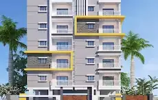
Arundhati Heights
AYODHYAINFRA · Sangareddy · RERA P01100008296
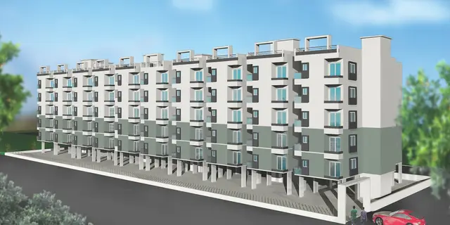
ARUNDHATI HEIGHTS is a residential apartment project in POTHREDDIPALLE, Sangareddy Mandal, Sangareddy District, developed by registered promoter AYODHYAINFRA. The site extent is 334.45 sq. m, with 1 building, one block, comprising 1 Stilt + 5 upper floors and 10 2BHK units. The project is registered under TG-RERA number P01100008296, and the promoter’s Form B undertaking states completion by 30/03/2027.
01What we found
Read from TG-RERA filings, approvals, land and registration records and court records. A court case is counted only when the court record states this project's survey number with its village, or names the project.
02Check before you pay
10 items to check before you pay, 3 high - from the title chain, court records and approvals, each with what to ask the builder or your advocate. An item may not be a problem with the project: records can be incomplete.
Project at a glance
Project identity
| Item | Project record |
|---|---|
| Registered name | ARUNDHATI HEIGHTS RERA record |
| Project type | Residential apartment project RERA record RERA filing |
| Phase / registered portion | Phase not separately identified in the supplied record; registration refers to the project |
| TG-RERA registration | P01100008296 RERA record |
| Registration validity | 25 May 2024–30 March 2027, unless extended by the Authority RERA record |
| Registered promoter | AYODHYAINFRA RERA record |
| RERA status | Registered; the supplied record does not state a later extension or other change |
Land and geographic identity
| Item | Project record |
|---|---|
| Locality / revenue village | POTHREDDIPALLE; the approval documents also spell the village Pothreddipalle / Pothireddypally RERA record RERA filing |
| Mandal | SANGAREDDY RERA record RERA filing |
| District | Sangareddy RERA record RERA filing |
| PIN | 502295 RERA record |
| Survey numbers | 158, 159, 160, 179, 180, 181, 194, 195 and 198 RERA record Land records |
| Subdivisions | No project-specific survey subdivisions are disclosed in the supplied RERA identity or approval records. Land records |
| Plot numbers | 291 and 294 RERA filing |
| Registered site extent | 334.45 sq. m in the building permit; RERA land details record total and net area as 334.45 sq. m. RERA filing |
| Boundaries | East and west: 30FT WIDE ROAD; north: PLOT NO 290 AND PLOT NO 295; south: PLOT NO 292 AND PLOT NO 293 RERA filing |
Development identity
| Item | Project record |
|---|---|
| Sanctioning authority | HMDA Approvals record |
| Principal building-permit number and date | 006904/BP/HMDA/1384/SKP/2022, approved 30 March 2024 Approvals record |
| Approved built-up area | 890.44 sq. m in the RERA land/building details; the filed plan separately labels NET BUA 888.35 and TOTAL 1068.14. These are the drawing’s separately labelled figures. RERA filing |
| Buildings / blocks | 1 building, one block RERA filing |
| Sanctioned configuration | 1 Stilt + 5 upper floors; the plan states 6 floors and building height 14.75 MT. |
| Parking levels and approved provision | Stilt/cellar is designated for parking; the plan records PROPOSED NUMBER OF PARKINGS 1. |
| Approved vs RERA-declared units | The supplied approval records do not state a total apartment count; the RERA filing records 10 units. RERA unit table |
Offering and status
| Item | Project record |
|---|---|
| RERA-filed configuration | 2BHK RERA unit table |
| RERA-filed saleable area | 106.28 sq. m per unit RERA unit table |
| Booked / available | 0 booked / 10 available, as last read from the TG-RERA portal; no as-of date is supplied, so counts are indicative. RERA unit table |
| Construction stage | No project construction-progress figure or independent site verification is supplied. RERA amenities |
| Completion dates | Promoter’s Form B undertaking: 30/03/2027. The supplied RERA registration certificate is valid to 30 March 2027; these are distinct dates/records. |
| Occupancy / completion certificate | No occupancy or completion certificate is supplied; the building permit requires an Occupancy Certificate before occupation. |
The project story
ARUNDHATI HEIGHTS is registered as a residential apartment project at Pothreddipalle, Sangareddy. The filed land identity refers to Plot Nos. 291 and 294 across Survey Nos. 158, 159, 160, 179, 180, 181, 194, 195 and 198, with a stated site extent of 334.45 sq. m. RERA record RERA filing
The HMDA building-permit record describes one residential building with a stilt and five upper floors. TG-RERA records 10 two-bedroom units, all shown as available in the portal-derived count, but that count has no stated reading date. The supplied material does not establish the current on-site construction stage or independently verify completion progress. The promoter’s Form B states a completion undertaking of 30/03/2027; this is not evidence that construction is complete or that an OC has been issued. RERA unit table
Master plan, architecture & building design
The filed plan describes one residential block on a net plot area of 334.45 sq. m. It labels 177.67 as proposed coverage area (53.12 %) and 156.78 as vacant plot area. The same plan separately records NET BUA 888.35, BUILT UP AREA 890.44, and TOTAL 1068.14; the supplied material does not define these labels further, so they should not be treated as interchangeable.
The sanctioned configuration is one stilt plus five upper floors. The plan records six floors and a building height of 14.75 MT. The plan also depicts a lift, staircase and 2.50 mt. Wide Passage. No verified floor-by-floor flat arrangement, measured apartment plan, room dimensions, or building footprint drawing measurements are supplied. Floor plans
The building permit and plan identify Plot Nos. 291 and 294 and the full survey-number set: 158, 159, 160, 179, 180, 181, 194, 195 and 198. The plan references HMDA layout number 3250/LO/ZO-SKP/HMDA/2012.
Homes, configurations & floor plans
| Configuration | Units | Booked | Available | RERA saleable area | Measured carpet area | Loading (if supplied) |
|---|---|---|---|---|---|---|
| 2BHK | 10 | 0 | 10 | 106.28 sq. m | Not measured from the supplied drawings | Not supplied |
Unit count, booking/availability and saleable area are RERA-filed/portal-derived figures; the portal count has no supplied as-of date. The drawing set contains two records, but neither is a measured apartment floor plan in the supplied extraction. Accordingly, no software-measured carpet area or room dimensions can be reported. Saleable area and carpet area are distinct measures; no project-specific breakdown of carpet, balcony/utility, or common-area loading is supplied. RERA unit table RERA unit details Floor plans
Parking & vehicle circulation
The filed building permit requires the stilt/cellar to be used exclusively for vehicle parking. The plan records PROPOSED NUMBER OF PARKINGS 1 and lists visitor parking; no separate count of resident, visitor, accessible, or two-wheeler spaces is supplied.
The approval material does not establish parking allocation to any particular apartment or exclusive ownership of a drawn bay. The plan shows roads and a 2.50 mt. Wide Passage, but the supplied record does not establish ramp configuration, separate vehicle entries/exits, pedestrian segregation, mechanical parking, or EV charging provision.
Amenities, recreation & open spaces
The RERA amenities record lists the following items and shows 0 progress for each; this is a portal-reported status, not independent site verification. RERA amenities
| Facility | Description / size | Evidence source | Declared progress / verified status |
|---|---|---|---|
| Internal Roads & Footpaths | Size not stated | RERA amenities record | 0%; not independently verified |
| Water Supply | Size/capacity not stated | RERA amenities record | 0%; not independently verified |
| Sewerage (Chamber, Lines, Septic Tank, STP) | Size/capacity not stated | RERA amenities record | 0%; not independently verified |
| Storm Water Drains | Size not stated | RERA amenities record | 0%; not independently verified |
| Green Strip/TOT LOT/Park | Size not stated | RERA amenities record | 0%; not independently verified |
| Street Lighting | Details not stated | RERA amenities record | 0%; not independently verified |
| Community Buildings | Details not stated | RERA amenities record | 0%; not independently verified |
| Treatment And Disposal Of Sewage And Sullage Water | Details not stated | RERA amenities record | 0%; not independently verified |
| Solid Waste Management And Disposal | Details not stated | RERA amenities record | 0%; not independently verified |
| Water Conservation, Rain water Harvesting | Size/capacity not stated; marked “YES” in the RERA record | RERA amenities record; building permit | 0% progress shown; not independently verified |
| Energy management | Details not stated | RERA amenities record | 0%; not independently verified |
| Fire Protection And Fire Safety Requirements | Details not stated | RERA amenities record; building permit | 0%; not independently verified |
| Electrical Meter Room, Sub-Station, Receiving Station | Details not stated | RERA amenities record; building permit | 0%; not independently verified |
| Aggregate area of recreational Open Space | Area not stated | RERA amenities record | 0%; not independently verified |
The supplied RERA amenities record does not identify a clubhouse or specific indoor or sports facilities. The drawing labels vacant plot area as 156.78; it does not, by itself, establish that this area is a delivered landscaped or recreational facility. RERA amenities
Utilities, building services & safety
The building permit requires rainwater-harvesting structures and rainwater recycling, a transformer and garbage house, and an STP. It specifies a separate underground static water storage tank of 25, 000 lts. and a separate residential terrace tank of 25,000 lts. These are approval requirements or stated provisions in the permit, not confirmation of installation or operation.
The plan labels a sump, septic tank, rainwater harvesting, distribution transformer, lift and staircase. No supplied evidence confirms utility connections, STP capacity or operational status, lift capacity, backup power, waste segregation, CCTV/access control, accessibility provisions, or completed fire-safety systems. The permit states a minimum of four fire extinguishers per floor and requires an Occupancy Certificate before occupation; the supplied record does not include an OC.
Location, access & connectivity
The registered location is POTHREDDIPALLE, Sangareddy, Sangareddy, 502295, in Sangareddy Mandal, Sangareddy District. The filed plot boundaries identify 30FT WIDE ROAD on the east and west. RERA record RERA filing
The building permit specifies a minimum approach-road width of 4.5mts. and requires the road indicated in the plan to be developed and maintained as a black-topped road before release of the occupancy certificate. The filed plan labels several roads, including 10.00MT WIDE MAINROAD, 10.00M (30'-0") WIDE ROAD, PROP. 50' WIDE ROAD, and PROPOSED 60' WDIE ROAD. The supplied evidence does not establish which of these roads directly serves the site or their present condition.
The supplied location record gives the nearest sampled Outer Ring Road interchange as approximately 19.5 km away. No other verified distances or public-transport details are supplied. Location record
Developer & development status
The registered promoter is AYODHYAINFRA, identified in the RERA record as a partnership. Its supplied address is Shanti Nagar, Pothreddipalle, Sangareddy, Sangareddy, 502295; GSTIN is 36ACEFA6206E1ZT. VENKATA KRISHNA MACHANA is identified as an authorized signatory and SURYAPETA SAI PRAKASH as a partner. The registration certificate gives the promoter’s registered-office line as Sangareddy, PIN 502001. No official contact number, email address, or website is supplied. Parties record Corporate record
The promoter’s Form B declares completion by 30/03/2027. The permit describes a single building, and the supplied record gives no phase-wise construction progress or independent construction verification. Registration validity ends 30 March 2027 unless extended; it is not a construction-progress or OC statement.
Approvals, official records & documents
| Record | What the supplied document establishes |
|---|---|
| TG-RERA registration certificate, P01100008296 | Form C certificate for ARUNDHATI HEIGHTS, naming Ayodhyainfra as promoter; validity recorded as 25/05/2024 to 30/03/2027 unless extended. |
| HMDA Building Permit Order, 006904/BP/HMDA/1384/SKP/2022, 30 March 2024 | Permit record for a residential building on Plot Nos. 291 and 294, covering the stated survey numbers and 334.45 sq. m extent; includes construction and occupation conditions. |
| Filed building plan, including HMDA layout reference 3250/LO/ZO-SKP/HMDA/2012 | Plan record for one residential block, stilt plus five upper floors, with site-area, built-up-area and parking labels. |
| Promoter Form B declaration, dated 10-05-2024 | Promoter declaration including a completion undertaking of 30/03/2027 and statements about title, encumbrances and project accounts. |
| Occupancy / completion certificate | None supplied. The building permit states that an Occupancy Certificate is compulsory before occupation. |
| HMDA layout lookup | HMDA DPMS approved-layout lookup is recorded as unavailable through the public portal; the supplied record notes that an official/HMDA-internal request is needed. This is an access limitation, not evidence of refusal. HMDA |
The project’s RERA registration and the filed permit/plan are the principal records available in this pack. No project-specific OC, completion certificate, or independent construction-progress report is included. Document index Approvals record HMDA
Project at a glance
Project identity
Registered name: ARUNDHATI HEIGHTS
Project type: Residential apartment project
Phase / registered portion: Phase not separately identified in the supplied record; registration refers to the project
TG-RERA registration: P01100008296
Registration validity: 25 May 2024–30 March 2027, unless extended by the Authority
Registered promoter: AYODHYAINFRA
RERA status: Registered; the supplied record does not state a later extension or other change
Land and geographic identity
Locality / revenue village: POTHREDDIPALLE; the approval documents also spell the village Pothreddipalle / Pothireddypally
Mandal: SANGAREDDY
District: Sangareddy
PIN: 502295
Survey numbers: 158, 159, 160, 179, 180, 181, 194, 195 and 198
Subdivisions: No project-specific survey subdivisions are disclosed in the supplied RERA identity or approval records.
Plot numbers: 291 and 294
Registered site extent: 334.45 sq. m in the building permit; RERA land details record total and net area as 334.45 sq. m.
Boundaries: East and west: 30FT WIDE ROAD; north: PLOT NO 290 AND PLOT NO 295; south: PLOT NO 292 AND PLOT NO 293
Development identity
Sanctioning authority: HMDA
Principal building-permit number and date: 006904/BP/HMDA/1384/SKP/2022, approved 30 March 2024
Approved built-up area: 890.44 sq. m in the RERA land/building details; the filed plan separately labels NET BUA 888.35 and TOTAL 1068.14. These are the drawing’s separately labelled figures.
Buildings / blocks: 1 building, one block
Sanctioned configuration: 1 Stilt + 5 upper floors; the plan states 6 floors and building height 14.75 MT.
Parking levels and approved provision: Stilt/cellar is designated for parking; the plan records PROPOSED NUMBER OF PARKINGS 1.
Approved vs RERA-declared units: The supplied approval records do not state a total apartment count; the RERA filing records 10 units.
Offering and status
RERA-filed configuration: 2BHK
RERA-filed saleable area: 106.28 sq. m per unit
Booked / available: 0 booked / 10 available, as last read from the TG-RERA portal; no as-of date is supplied, so counts are indicative.
Construction stage: No project construction-progress figure or independent site verification is supplied.
Completion dates: Promoter’s Form B undertaking: 30/03/2027. The supplied RERA registration certificate is valid to 30 March 2027; these are distinct dates/records.
Occupancy / completion certificate: No occupancy or completion certificate is supplied; the building permit requires an Occupancy Certificate before occupation.
The project story
ARUNDHATI HEIGHTS is registered as a residential apartment project at Pothreddipalle, Sangareddy. The filed land identity refers to Plot Nos. 291 and 294 across Survey Nos. 158, 159, 160, 179, 180, 181, 194, 195 and 198, with a stated site extent of 334.45 sq. m.
The HMDA building-permit record describes one residential building with a stilt and five upper floors. TG-RERA records 10 two-bedroom units, all shown as available in the portal-derived count, but that count has no stated reading date. The supplied material does not establish the current on-site construction stage or independently verify completion progress. The promoter’s Form B states a completion undertaking of 30/03/2027; this is not evidence that construction is complete or that an OC has been issued.
Master plan, architecture & building design
The filed plan describes one residential block on a net plot area of 334.45 sq. m. It labels 177.67 as proposed coverage area (53.12 %) and 156.78 as vacant plot area. The same plan separately records NET BUA 888.35, BUILT UP AREA 890.44, and TOTAL 1068.14; the supplied material does not define these labels further, so they should not be treated as interchangeable.
The sanctioned configuration is one stilt plus five upper floors. The plan records six floors and a building height of 14.75 MT. The plan also depicts a lift, staircase and 2.50 mt. Wide Passage. No verified floor-by-floor flat arrangement, measured apartment plan, room dimensions, or building footprint drawing measurements are supplied.
The building permit and plan identify Plot Nos. 291 and 294 and the full survey-number set: 158, 159, 160, 179, 180, 181, 194, 195 and 198. The plan references HMDA layout number 3250/LO/ZO-SKP/HMDA/2012.
Homes, configurations & floor plans
| Configuration | Units | Booked | Available | RERA saleable area | Measured carpet area | Loading (if supplied) |
|---|---|---|---|---|---|---|
| 2BHK | 10 | 0 | 10 | 106.28 sq. m | Not measured from the supplied drawings | Not supplied |
Unit count, booking/availability and saleable area are RERA-filed/portal-derived figures; the portal count has no supplied as-of date. The drawing set contains two records, but neither is a measured apartment floor plan in the supplied extraction. Accordingly, no software-measured carpet area or room dimensions can be reported. Saleable area and carpet area are distinct measures; no project-specific breakdown of carpet, balcony/utility, or common-area loading is supplied.
Parking & vehicle circulation
The filed building permit requires the stilt/cellar to be used exclusively for vehicle parking. The plan records PROPOSED NUMBER OF PARKINGS 1 and lists visitor parking; no separate count of resident, visitor, accessible, or two-wheeler spaces is supplied.
The approval material does not establish parking allocation to any particular apartment or exclusive ownership of a drawn bay. The plan shows roads and a 2.50 mt. Wide Passage, but the supplied record does not establish ramp configuration, separate vehicle entries/exits, pedestrian segregation, mechanical parking, or EV charging provision.
Amenities, recreation & open spaces
The RERA amenities record lists the following items and shows 0 progress for each; this is a portal-reported status, not independent site verification.
| Facility | Description / size | Evidence source | Declared progress / verified status |
|---|---|---|---|
| Internal Roads & Footpaths | Size not stated | RERA amenities record | 0%; not independently verified |
| Water Supply | Size/capacity not stated | RERA amenities record | 0%; not independently verified |
| Sewerage (Chamber, Lines, Septic Tank, STP) | Size/capacity not stated | RERA amenities record | 0%; not independently verified |
| Storm Water Drains | Size not stated | RERA amenities record | 0%; not independently verified |
| Green Strip/TOT LOT/Park | Size not stated | RERA amenities record | 0%; not independently verified |
| Street Lighting | Details not stated | RERA amenities record | 0%; not independently verified |
| Community Buildings | Details not stated | RERA amenities record | 0%; not independently verified |
| Treatment And Disposal Of Sewage And Sullage Water | Details not stated | RERA amenities record | 0%; not independently verified |
| Solid Waste Management And Disposal | Details not stated | RERA amenities record | 0%; not independently verified |
| Water Conservation, Rain water Harvesting | Size/capacity not stated; marked “YES” in the RERA record | RERA amenities record; building permit | 0% progress shown; not independently verified |
| Energy management | Details not stated | RERA amenities record | 0%; not independently verified |
| Fire Protection And Fire Safety Requirements | Details not stated | RERA amenities record; building permit | 0%; not independently verified |
| Electrical Meter Room, Sub-Station, Receiving Station | Details not stated | RERA amenities record; building permit | 0%; not independently verified |
| Aggregate area of recreational Open Space | Area not stated | RERA amenities record | 0%; not independently verified |
The supplied RERA amenities record does not identify a clubhouse or specific indoor or sports facilities. The drawing labels vacant plot area as 156.78; it does not, by itself, establish that this area is a delivered landscaped or recreational facility.
Utilities, building services & safety
The building permit requires rainwater-harvesting structures and rainwater recycling, a transformer and garbage house, and an STP. It specifies a separate underground static water storage tank of 25, 000 lts. and a separate residential terrace tank of 25,000 lts. These are approval requirements or stated provisions in the permit, not confirmation of installation or operation.
The plan labels a sump, septic tank, rainwater harvesting, distribution transformer, lift and staircase. No supplied evidence confirms utility connections, STP capacity or operational status, lift capacity, backup power, waste segregation, CCTV/access control, accessibility provisions, or completed fire-safety systems. The permit states a minimum of four fire extinguishers per floor and requires an Occupancy Certificate before occupation; the supplied record does not include an OC.
Location, access & connectivity
The registered location is POTHREDDIPALLE, Sangareddy, Sangareddy, 502295, in Sangareddy Mandal, Sangareddy District. The filed plot boundaries identify 30FT WIDE ROAD on the east and west.
The building permit specifies a minimum approach-road width of 4.5mts. and requires the road indicated in the plan to be developed and maintained as a black-topped road before release of the occupancy certificate. The filed plan labels several roads, including 10.00MT WIDE MAINROAD, 10.00M (30'-0") WIDE ROAD, PROP. 50' WIDE ROAD, and PROPOSED 60' WDIE ROAD. The supplied evidence does not establish which of these roads directly serves the site or their present condition.
The supplied location record gives the nearest sampled Outer Ring Road interchange as approximately 19.5 km away. No other verified distances or public-transport details are supplied.
Developer & development status
The registered promoter is AYODHYAINFRA, identified in the RERA record as a partnership. Its supplied address is Shanti Nagar, Pothreddipalle, Sangareddy, Sangareddy, 502295; GSTIN is 36ACEFA6206E1ZT. VENKATA KRISHNA MACHANA is identified as an authorized signatory and SURYAPETA SAI PRAKASH as a partner. The registration certificate gives the promoter’s registered-office line as Sangareddy, PIN 502001. No official contact number, email address, or website is supplied.
The promoter’s Form B declares completion by 30/03/2027. The permit describes a single building, and the supplied record gives no phase-wise construction progress or independent construction verification. Registration validity ends 30 March 2027 unless extended; it is not a construction-progress or OC statement.
Approvals, official records & documents
TG-RERA registration certificate, P01100008296: Form C certificate for ARUNDHATI HEIGHTS, naming Ayodhyainfra as promoter; validity recorded as 25/05/2024 to 30/03/2027 unless extended.
HMDA Building Permit Order, 006904/BP/HMDA/1384/SKP/2022, 30 March 2024: Permit record for a residential building on Plot Nos. 291 and 294, covering the stated survey numbers and 334.45 sq. m extent; includes construction and occupation conditions.
Filed building plan, including HMDA layout reference 3250/LO/ZO-SKP/HMDA/2012: Plan record for one residential block, stilt plus five upper floors, with site-area, built-up-area and parking labels.
Promoter Form B declaration, dated 10-05-2024: Promoter declaration including a completion undertaking of 30/03/2027 and statements about title, encumbrances and project accounts.
Occupancy / completion certificate: None supplied. The building permit states that an Occupancy Certificate is compulsory before occupation.
HMDA layout lookup: HMDA DPMS approved-layout lookup is recorded as unavailable through the public portal; the supplied record notes that an official/HMDA-internal request is needed. This is an access limitation, not evidence of refusal.
The project’s RERA registration and the filed permit/plan are the principal records available in this pack. No project-specific OC, completion certificate, or independent construction-progress report is included.
Frequently asked questions
Is ARUNDHATI HEIGHTS registered with Telangana RERA?
Yes. ARUNDHATI HEIGHTS is registered with the Telangana Real Estate Regulatory Authority as P01100008296; the registration status is New Project.
Who is the developer of ARUNDHATI HEIGHTS?
The promoter named in the RERA registration is AYODHYAINFRA.
Where is ARUNDHATI HEIGHTS located?
ARUNDHATI HEIGHTS is in POTHREDDIPALLE, SANGAREDDY, Telangana (502295).
When will ARUNDHATI HEIGHTS be completed?
The promoter's proposed date of completion filed with RERA is 30/07/2027. This is the promoter's declaration, not a guarantee.
More projects in Pothreddipalle