Ram Nagar
Bhutharaju Naraiah and Others · Nalgonda · RERA P01800002135
RAM NAGAR is a plotted development in Chandur, Chandur Mandal, Nalgonda District. It is being developed by the registered promoter Bhutharaju Naraiah And Others. The RERA filing records a total site area of 23775.28 sqmts, an affected area of 7284.34 sqmts and a net area of 16490.94 sqmts; the filed layout approvals record 81 plots, with plot sizes not disclosed. The project is registered under TG-RERA number P01800002135, and the promoter’s Form-B declaration undertakes completion by 27" January, 2023.
01What we found
Read from TG-RERA filings, approvals, land and registration records and court records. A court case is counted only when the court record states this project's survey number with its village, or names the project.
02Check before you pay
6 items to check before you pay, 2 high - from the title chain, court records and approvals, each with what to ask the builder or your advocate. An item may not be a problem with the project: records can be incomplete.
1. Project at a glance
Project identity
| Field | Project record |
|---|---|
| Registered project name | RAM NAGAR |
| Project type / status | Plotted Development; recorded as a New Project RERA record RERA filing |
| Phase / registered portion | Phase not disclosed. The registration and filed approval identify Survey No. 17; the registered portion’s precise parcel boundaries are not independently established in this Overview. |
| TG-RERA registration | P01800002135; granted under section 5. |
| Registration validity | 16/09/2020 to 27/01/2023, stated as 2 years; no extension is recorded in the supplied certificate. This is registration validity, not an occupancy certificate or proof of project completion. |
| Registered promoter | Bhutharaju Naraiah And Others |
| RERA status in supplied record | Registration certificate supplied; the registration period stated on it has ended. Current registration status is not established by the supplied evidence. |
Land and geographic identity
| Field | Project record |
|---|---|
| Locality / revenue village | Chandur / Chandur; approval records also describe the site as Chandur Municipality. |
| Mandal / district / PIN | Chandur / Nalgonda / 508255 |
| Project survey number(s) | Survey No. 17; no project subdivision is identified in the registration certificate or approval extracts. |
| RERA-filed site area | Total area 23775.28 sqmts; affected in road widening/FTL of tanks/nala widening 7284.34 sqmts; net area 16490.94 sqmts. RERA filing |
| Approval-record land / layout area | The DTCP Technical Layout Pattern extract states Ac. 6-00 Cents extent and Ac. 5.875 Cents layout area; the Municipality extract records Ac. 06-00 and layout area 5.875 cents. |
| Boundaries in RERA filing | East: Others Land; West: 40 FEET WIDE ROAD; North: 40 FEET WIDE ROAD; South: Others Land. RERA filing |
Development identity
| Field | Project record |
|---|---|
| Sanctioning authorities | Director of Town and Country Planning (DTCP) and Chandur Municipality, as identified in the filed approval extracts. |
| Principal layout approvals | DTCP TLP No. 28/2020/H, approved 18-01-2020; Chandur Municipality layout sanction 4513/2019/H, dated 02.02.2020, proceedings G1/204/TP/MCC/2019. |
| Approved development | Plotted layout: 81 plots. The filed layout extracts state a layout area of Ac. 5.875 Cents, 10% open space and 30.63% roads. |
| Approved built-up area | RERA filing lists 23775.28 sqmts as “Approved Built up Area”; this is a filed figure and is not a plot-by-plot building area schedule. RERA filing |
| Buildings / floors / parking levels | Not disclosed in the supplied approval extracts. The project is a plotted layout; no sanctioned residential building floor configuration or parking-level schedule is supplied. |
| RERA-declared plot count | 81 plots in the filed layout approval extracts. Plot-size bands and plot-wise inventory are not supplied here. |
Offering and status
| Field | Project record |
|---|---|
| Offered product | Plots in a plotted development; individual plot sizes and saleable-size range are not disclosed in the supplied data. RERA record |
| Booked / available counts | Not disclosed. |
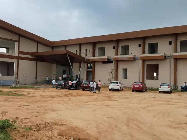
| Construction / development stage | The RERA filing records 80% completeness; the measurement date and whether this is promoter-reported or independently certified are not supplied. It is not independent site verification. RERA record |
| Completion date | Promoter’s Form-B declaration undertakes completion by 27" January, 2023; the RERA certificate validity also ends 27/01/2023. No revised completion date is supplied. |
| Occupancy / completion certificate | No occupancy or completion certificate is identified in the supplied project evidence. The project is recorded as plotted development; the status of completion certification is not established here. |
2. The project story
RAM NAGAR is registered with TG-RERA as a plotted development in Chandur, Nalgonda District, under registration number P01800002135. The filed layout documents describe 81 plots in Survey No. 17 and identify roads and open space as layout components. The supplied records do not disclose plot-wise dimensions, booked inventory, or the precise configuration of the plots on the ground.
The filing reports 80% completeness, but the source date and basis for that percentage are not provided; it should therefore be read as a recorded progress figure, not a current or independently verified site assessment. The promoter’s Form-B declaration gives 27" January, 2023 as the completion undertaking. The supplied evidence does not establish subsequent completion or an occupancy/completion certificate. RERA record
3. Master plan, architecture & building design
This is a plotted layout, not an apartment or tower scheme in the supplied approval records. The DTCP Technical Layout Pattern extract records 81 plots, a layout area of Ac. 5.875 Cents, 10% open space (Ac. 0.588 Cents) and 30.63 % roads (Ac. 1.80 Cents). The Municipality layout-sanction extract also records 81 plots and the 10% open-space and 30.63% road figures.
The RERA filing lists a total site area of 23775.28 sqmts, an affected area of 7284.34 sqmts, and a net area of 16490.94 sqmts; it separately lists 23775.28 sqmts as approved built-up area. These are filed figures, not a verified plot-area schedule or a building floor-area schedule. RERA filing RERA filing
The supplied records do not include readable layout drawings or a plot arrangement plan, so plot dimensions, internal road geometry, utility-land allocation, landscaping design and plot-by-plot land-use distribution cannot be described from the available evidence. The approval extract lists avenue plantation and rainwater-harvesting pits among layout conditions or provisions. Floor plans
4. Homes, configurations & floor plans
The registered offering is plots, not flats. A plot-size schedule, plot-wise saleable areas, and booked or available inventory are not disclosed in the supplied data. The filed layout approval records 81 plots.
Two drawings are listed, but neither has been measured; both are pending scan review. No software-measured carpet-area or room-dimension data is available. Apartment carpet-area and loading comparisons are therefore not applicable to the supplied plotted-layout evidence. Floor plans
5. Parking & vehicle circulation
The RERA-filed layout approval records a roads area of 30.63 %, but the supplied evidence does not provide road widths by segment, vehicle entry/exit details, driveway or pedestrian-circulation plans, or a sanctioned parking-space count.
A third-party listing describes parking as “Open Parking,” but no TG-RERA-filed parking count or plot-specific parking allocation is supplied. That listing does not establish a legally documented parking entitlement for any plot. Promoter website
6. Amenities, recreation & open spaces
The RERA-filed amenities data records the following items. Each has a recorded progress value of 0; the evidence does not explain whether this denotes no progress, missing progress reporting, or another status. No facility is independently verified as complete. RERA amenities
| Description / size | Layout approval states 10% open space; DTCP extract gives Ac. 0.588 Cents. |
|---|---|
| Evidence source | Sanction extract; RERA amenities |
| Declared progress / verified status | Progress 0 in amenities record; delivery not independently verified. RERA amenities |
| Description / size | No dimensions supplied. RERA amenities |
|---|---|
| Evidence source | RERA amenities; layout approval |
| Declared progress / verified status | Progress 0; completion not independently verified. RERA amenities |
| Description / size | No size or quantity supplied. RERA amenities |
|---|---|
| Evidence source | RERA amenities |
| Declared progress / verified status | Progress 0; completion not independently verified. RERA amenities |
| Description / size | No size, quantity or description supplied. RERA amenities |
|---|---|
| Evidence source | RERA amenities |
| Declared progress / verified status | Progress 0; completion not independently verified. RERA amenities |
| Description / size | No specification supplied. RERA amenities |
|---|---|
| Evidence source | RERA amenities; layout approval lists street lighting and electricity facilities. |
| Declared progress / verified status | Progress 0; completion not independently verified. RERA amenities |
| Description / size | No space or equipment details supplied. Promoter website |
|---|---|
| Evidence source | Third-party listing only |
| Declared progress / verified status | No progress or delivery evidence supplied. |
| Description / size | No size or equipment details supplied. Promoter website |
|---|---|
| Evidence source | Third-party listing only |
| Declared progress / verified status | No progress or delivery evidence supplied. |
7. Utilities, building services & safety
The RERA amenities record lists water supply, sewerage, storm-water drains, treatment and disposal of sewage and sullage water, solid-waste management and disposal, water conservation/rainwater harvesting, energy management, fire-protection and fire-safety requirements, and an electrical meter room/sub-station/receiving station. These are recorded as project provisions; detailed designs, capacities, completion status and statutory clearances are not supplied. RERA amenities
The DTCP layout extract also lists rainwater-harvesting pits, street lighting and electricity facilities, a sewerage-disposal system, and protected water supply among the layout provisions. It does not provide system capacities or establish that these works have been completed.
No detailed evidence is supplied for water source or storage, treatment capacity, drainage outfall, electrical load or backup, fire equipment or clearances, security systems, accessibility features, or project-level waste facilities beyond the listed RERA amenities. A third-party listing mentions CCTV, security and power backup, but the supplied project-filed documents do not substantiate those specifications. Promoter website Document index
8. Location, access & connectivity
The RERA record identifies the project at Chandur, Chandur Mandal, Nalgonda District, PIN 508255, in Survey No. 17. The filed boundaries identify 40 FEET WIDE ROAD on the west and north sides; the east and south boundaries are described as Others Land. RERA filing
No verified public-transport route, nearby landmark distance or project approach-road description is supplied. A third-party listing names Nalgonda as a nearby landmark and gives a general list of neighborhood facilities, without measured distances. Those details are not treated here as verified project connectivity. Promoter website
9. Developer & development status
The registered promoter is Bhutharaju Naraiah And Others. The project filing describes the organization type as “Others” and its description as “Partnership”; the formal legal-entity identity and corporate registration details are not established in the supplied evidence. The RERA certificate lists the promoter’s office as Village: Bangarigadda, Mandal: Chandur, District: Nalgonda, PIN 508255. RERA filing
A Form-B affidavit dated 5th February, 2020, made by Sri. Butaraju Narayana, declares a completion undertaking of 27" January, 2023 and states that 70% of amounts realized would be deposited in a separate scheduled-bank account. These are promoter declarations in the filed document.
The RERA filing reports 80% completeness, but supplies no measurement date or independent verification basis. No revised completion date, current works schedule, or occupancy/completion certificate is provided. RERA record Document index
10. Approvals, official records & documents
| Identifier / date | P01800002135; issued 16/09/2020; valid through 27/01/2023 |
|---|---|
| Scope and evidence | Form C records RAM NAGAR, promoter Bhutharaju Naraiah And Others, Survey No. 17, Chandur, Nalgonda. |
| Identifier / date | TLP No. 28/2020/H; approved 18-01-2020; file DTCP-HT3/OTH/100/2019-HYD Sec-DTCP |
|---|---|
| Scope and evidence | Filed layout approval extract for Survey No. 17, Chandur Municipality. |
| Identifier / date | 4513/2019/H, dated 02.02.2020; proceedings G1/204/TP/MCC/2019 |
|---|---|
| Scope and evidence | Filed extract records sanction for a layout in Survey No. 17 and 81 plots. It states roads and open spaces were handed over to the Municipality through a registered gift deed. |
| Identifier / date | Dated 5th February, 2020 |
|---|---|
| Scope and evidence | Promoter declaration concerning title basis, encumbrances, project obligations and proposed completion. |
| Identifier / date | Two drawings listed; both scans pending review |
|---|---|
| Scope and evidence | No drawing-derived measurements available. Floor plans |
| Identifier / date | Not identified in supplied evidence |
|---|---|
| Scope and evidence | Current certificate status and scope are not established. Document index |
1. Project at a glance
Project identity
Registered project name: RAM NAGAR
Project type / status: Plotted Development; recorded as a New Project
Phase / registered portion: Phase not disclosed. The registration and filed approval identify Survey No. 17; the registered portion’s precise parcel boundaries are not independently established in this Overview.
TG-RERA registration: P01800002135; granted under section 5.
Registration validity: 16/09/2020 to 27/01/2023, stated as 2 years; no extension is recorded in the supplied certificate. This is registration validity, not an occupancy certificate or proof of project completion.
Registered promoter: Bhutharaju Naraiah And Others
RERA status in supplied record: Registration certificate supplied; the registration period stated on it has ended. Current registration status is not established by the supplied evidence.
Land and geographic identity
Locality / revenue village: Chandur / Chandur; approval records also describe the site as Chandur Municipality.
Mandal / district / PIN: Chandur / Nalgonda / 508255
Project survey number(s): Survey No. 17; no project subdivision is identified in the registration certificate or approval extracts.
RERA-filed site area: Total area 23775.28 sqmts; affected in road widening/FTL of tanks/nala widening 7284.34 sqmts; net area 16490.94 sqmts.
Approval-record land / layout area: The DTCP Technical Layout Pattern extract states Ac. 6-00 Cents extent and Ac. 5.875 Cents layout area; the Municipality extract records Ac. 06-00 and layout area 5.875 cents.
Boundaries in RERA filing: East: Others Land; West: 40 FEET WIDE ROAD; North: 40 FEET WIDE ROAD; South: Others Land.
Development identity
Sanctioning authorities: Director of Town and Country Planning (DTCP) and Chandur Municipality, as identified in the filed approval extracts.
Principal layout approvals: DTCP TLP No. 28/2020/H, approved 18-01-2020; Chandur Municipality layout sanction 4513/2019/H, dated 02.02.2020, proceedings G1/204/TP/MCC/2019.
Approved development: Plotted layout: 81 plots. The filed layout extracts state a layout area of Ac. 5.875 Cents, 10% open space and 30.63% roads.
Approved built-up area: RERA filing lists 23775.28 sqmts as “Approved Built up Area”; this is a filed figure and is not a plot-by-plot building area schedule.
Buildings / floors / parking levels: Not disclosed in the supplied approval extracts. The project is a plotted layout; no sanctioned residential building floor configuration or parking-level schedule is supplied.
RERA-declared plot count: 81 plots in the filed layout approval extracts. Plot-size bands and plot-wise inventory are not supplied here.
Offering and status
Offered product: Plots in a plotted development; individual plot sizes and saleable-size range are not disclosed in the supplied data.
Booked / available counts: Not disclosed.
Construction / development stage: The RERA filing records 80% completeness; the measurement date and whether this is promoter-reported or independently certified are not supplied. It is not independent site verification.
Completion date: Promoter’s Form-B declaration undertakes completion by 27" January, 2023; the RERA certificate validity also ends 27/01/2023. No revised completion date is supplied.
Occupancy / completion certificate: No occupancy or completion certificate is identified in the supplied project evidence. The project is recorded as plotted development; the status of completion certification is not established here.
2. The project story
RAM NAGAR is registered with TG-RERA as a plotted development in Chandur, Nalgonda District, under registration number P01800002135. The filed layout documents describe 81 plots in Survey No. 17 and identify roads and open space as layout components. The supplied records do not disclose plot-wise dimensions, booked inventory, or the precise configuration of the plots on the ground.
The filing reports 80% completeness, but the source date and basis for that percentage are not provided; it should therefore be read as a recorded progress figure, not a current or independently verified site assessment. The promoter’s Form-B declaration gives 27" January, 2023 as the completion undertaking. The supplied evidence does not establish subsequent completion or an occupancy/completion certificate.
3. Master plan, architecture & building design
This is a plotted layout, not an apartment or tower scheme in the supplied approval records. The DTCP Technical Layout Pattern extract records 81 plots, a layout area of Ac. 5.875 Cents, 10% open space (Ac. 0.588 Cents) and 30.63 % roads (Ac. 1.80 Cents). The Municipality layout-sanction extract also records 81 plots and the 10% open-space and 30.63% road figures.
The RERA filing lists a total site area of 23775.28 sqmts, an affected area of 7284.34 sqmts, and a net area of 16490.94 sqmts; it separately lists 23775.28 sqmts as approved built-up area. These are filed figures, not a verified plot-area schedule or a building floor-area schedule.
The supplied records do not include readable layout drawings or a plot arrangement plan, so plot dimensions, internal road geometry, utility-land allocation, landscaping design and plot-by-plot land-use distribution cannot be described from the available evidence. The approval extract lists avenue plantation and rainwater-harvesting pits among layout conditions or provisions.
4. Homes, configurations & floor plans
The registered offering is plots, not flats. A plot-size schedule, plot-wise saleable areas, and booked or available inventory are not disclosed in the supplied data. The filed layout approval records 81 plots.
Two drawings are listed, but neither has been measured; both are pending scan review. No software-measured carpet-area or room-dimension data is available. Apartment carpet-area and loading comparisons are therefore not applicable to the supplied plotted-layout evidence.
5. Parking & vehicle circulation
The RERA-filed layout approval records a roads area of 30.63 %, but the supplied evidence does not provide road widths by segment, vehicle entry/exit details, driveway or pedestrian-circulation plans, or a sanctioned parking-space count.
A third-party listing describes parking as “Open Parking,” but no TG-RERA-filed parking count or plot-specific parking allocation is supplied. That listing does not establish a legally documented parking entitlement for any plot.
6. Amenities, recreation & open spaces
The RERA-filed amenities data records the following items. Each has a recorded progress value of 0; the evidence does not explain whether this denotes no progress, missing progress reporting, or another status. No facility is independently verified as complete.
| Facility | Description / size | Evidence source | Declared progress / verified status |
|---|---|---|---|
| Open space / recreational open space | Layout approval states 10% open space; DTCP extract gives Ac. 0.588 Cents. | Sanction extract; RERA amenities | Progress 0 in amenities record; delivery not independently verified. |
| Internal roads and footpaths | No dimensions supplied. | RERA amenities; layout approval | Progress 0; completion not independently verified. |
| Green strip / tot lot / park | No size or quantity supplied. | RERA amenities | Progress 0; completion not independently verified. |
| Community buildings | No size, quantity or description supplied. | RERA amenities | Progress 0; completion not independently verified. |
| Street lighting | No specification supplied. | RERA amenities; layout approval lists street lighting and electricity facilities. | Progress 0; completion not independently verified. |
| Indoor games | No space or equipment details supplied. | Third-party listing only | No progress or delivery evidence supplied. |
| Children’s play area / park | No size or equipment details supplied. | Third-party listing only | No progress or delivery evidence supplied. |
7. Utilities, building services & safety
The RERA amenities record lists water supply, sewerage, storm-water drains, treatment and disposal of sewage and sullage water, solid-waste management and disposal, water conservation/rainwater harvesting, energy management, fire-protection and fire-safety requirements, and an electrical meter room/sub-station/receiving station. These are recorded as project provisions; detailed designs, capacities, completion status and statutory clearances are not supplied.
The DTCP layout extract also lists rainwater-harvesting pits, street lighting and electricity facilities, a sewerage-disposal system, and protected water supply among the layout provisions. It does not provide system capacities or establish that these works have been completed.
No detailed evidence is supplied for water source or storage, treatment capacity, drainage outfall, electrical load or backup, fire equipment or clearances, security systems, accessibility features, or project-level waste facilities beyond the listed RERA amenities. A third-party listing mentions CCTV, security and power backup, but the supplied project-filed documents do not substantiate those specifications.
8. Location, access & connectivity
The RERA record identifies the project at Chandur, Chandur Mandal, Nalgonda District, PIN 508255, in Survey No. 17. The filed boundaries identify 40 FEET WIDE ROAD on the west and north sides; the east and south boundaries are described as Others Land.
No verified public-transport route, nearby landmark distance or project approach-road description is supplied. A third-party listing names Nalgonda as a nearby landmark and gives a general list of neighborhood facilities, without measured distances. Those details are not treated here as verified project connectivity.
9. Developer & development status
The registered promoter is Bhutharaju Naraiah And Others. The project filing describes the organization type as “Others” and its description as “Partnership”; the formal legal-entity identity and corporate registration details are not established in the supplied evidence. The RERA certificate lists the promoter’s office as Village: Bangarigadda, Mandal: Chandur, District: Nalgonda, PIN 508255.
A Form-B affidavit dated 5th February, 2020, made by Sri. Butaraju Narayana, declares a completion undertaking of 27" January, 2023 and states that 70% of amounts realized would be deposited in a separate scheduled-bank account. These are promoter declarations in the filed document.
The RERA filing reports 80% completeness, but supplies no measurement date or independent verification basis. No revised completion date, current works schedule, or occupancy/completion certificate is provided.
10. Approvals, official records & documents
| Identifier / date | P01800002135; issued 16/09/2020; valid through 27/01/2023 |
|---|---|
| Scope and evidence | Form C records RAM NAGAR, promoter Bhutharaju Naraiah And Others, Survey No. 17, Chandur, Nalgonda. |
| Identifier / date | TLP No. 28/2020/H; approved 18-01-2020; file DTCP-HT3/OTH/100/2019-HYD Sec-DTCP |
|---|---|
| Scope and evidence | Filed layout approval extract for Survey No. 17, Chandur Municipality. |
| Identifier / date | 4513/2019/H, dated 02.02.2020; proceedings G1/204/TP/MCC/2019 |
|---|---|
| Scope and evidence | Filed extract records sanction for a layout in Survey No. 17 and 81 plots. It states roads and open spaces were handed over to the Municipality through a registered gift deed. |
| Identifier / date | Dated 5th February, 2020 |
|---|---|
| Scope and evidence | Promoter declaration concerning title basis, encumbrances, project obligations and proposed completion. |
| Identifier / date | Two drawings listed; both scans pending review |
|---|---|
| Scope and evidence | No drawing-derived measurements available. |
| Identifier / date | Not identified in supplied evidence |
|---|---|
| Scope and evidence | Current certificate status and scope are not established. |
Frequently asked questions
Is RAM NAGAR registered with Telangana RERA?
Yes. RAM NAGAR is registered with the Telangana Real Estate Regulatory Authority as P01800002135; the registration status is New Project.
Who is the developer of RAM NAGAR?
The promoter named in the RERA registration is Bhutharaju Naraiah and Others.
Where is RAM NAGAR located?
RAM NAGAR is in Chandur, Nalgonda, Telangana (508255).
When will RAM NAGAR be completed?
The promoter's proposed date of completion filed with RERA is 27/01/2023. This is the promoter's declaration, not a guarantee.
More projects in Chandur